|
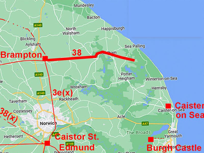
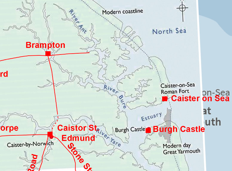
The Roman Road from Brampton to SmallburghMargary Number: 38Distance: 6.5 milesThere was no doubt about the existence of the road - just its destination. Brampton was a a major pottery production centre so a connection with the sea for transport would have been highly desirable and it seems likely that Smallburgh at that time was at the head of an estuary. The alternative is that this road had Caister-on-Sea as its destination but I have so far been unable to locate any evidence for the road continuing on to there. English Heritage's Roman coastline map and the wide field Lidar image (see later for both) would indicate there was not a dry land route to Caister in Roman times. Norfolk HER: 2796 (regarded as part of the Fen Causeway) |
Historic Counties: Norfolk Current Counties: Norfolk HER: Norfolk
|
|
|
|
|
|
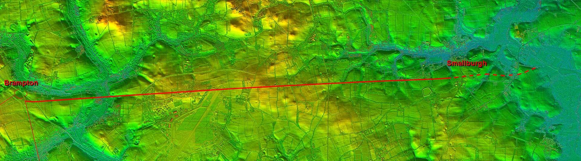
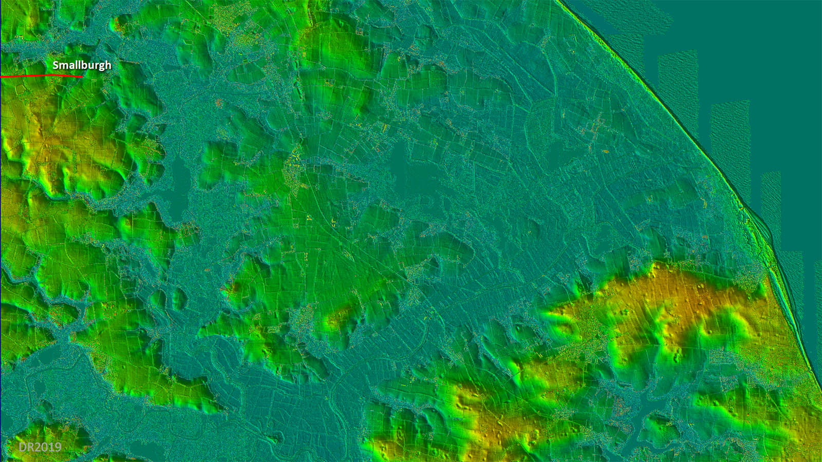
Lidar Image - full route This Lidar image perhaps explains the logic behind this road - was it a connection to a sea estuary in Roman times? The name Anchor Street is perhaps a clue.
|
Click for larger view
|
 |
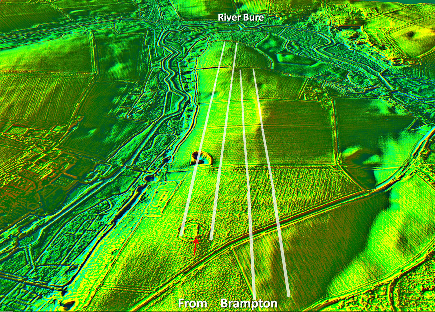
Oblique 3D Lidar Image - Brampton Options The evidence for the line of the Roman road is intermittant with two options visible. The feature martked with a red arrow does look like a surviving short length of agger but the right hand (southern) option does have more lidar evidence. 2024 Update: Aerial Archaeology Mapping adds more information and does show features on both lines but the northern line looks favourite.. |
Click for larger view |
 |
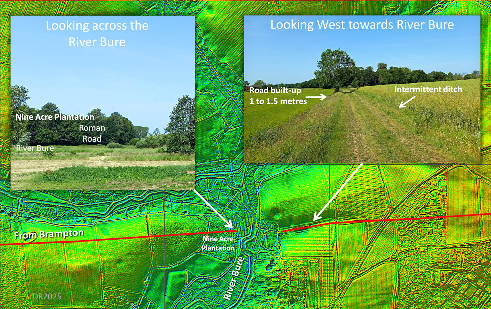
River Bure Crossing - Lamas No sign of a causeway across the marsh but on the east bank is a straight footpath with all the indications of it being a well engineered road. In places - near the big tree - it is built up on its southern side around 1.5 metres. The north side has a ditch but this has been re-dug in place. Out of keeping with the other farm tracks here and as it aligns reasonably well with traces further east there can be little doubt that this is indeed the Roman road. Images: DR |
Click for larger view |
 |
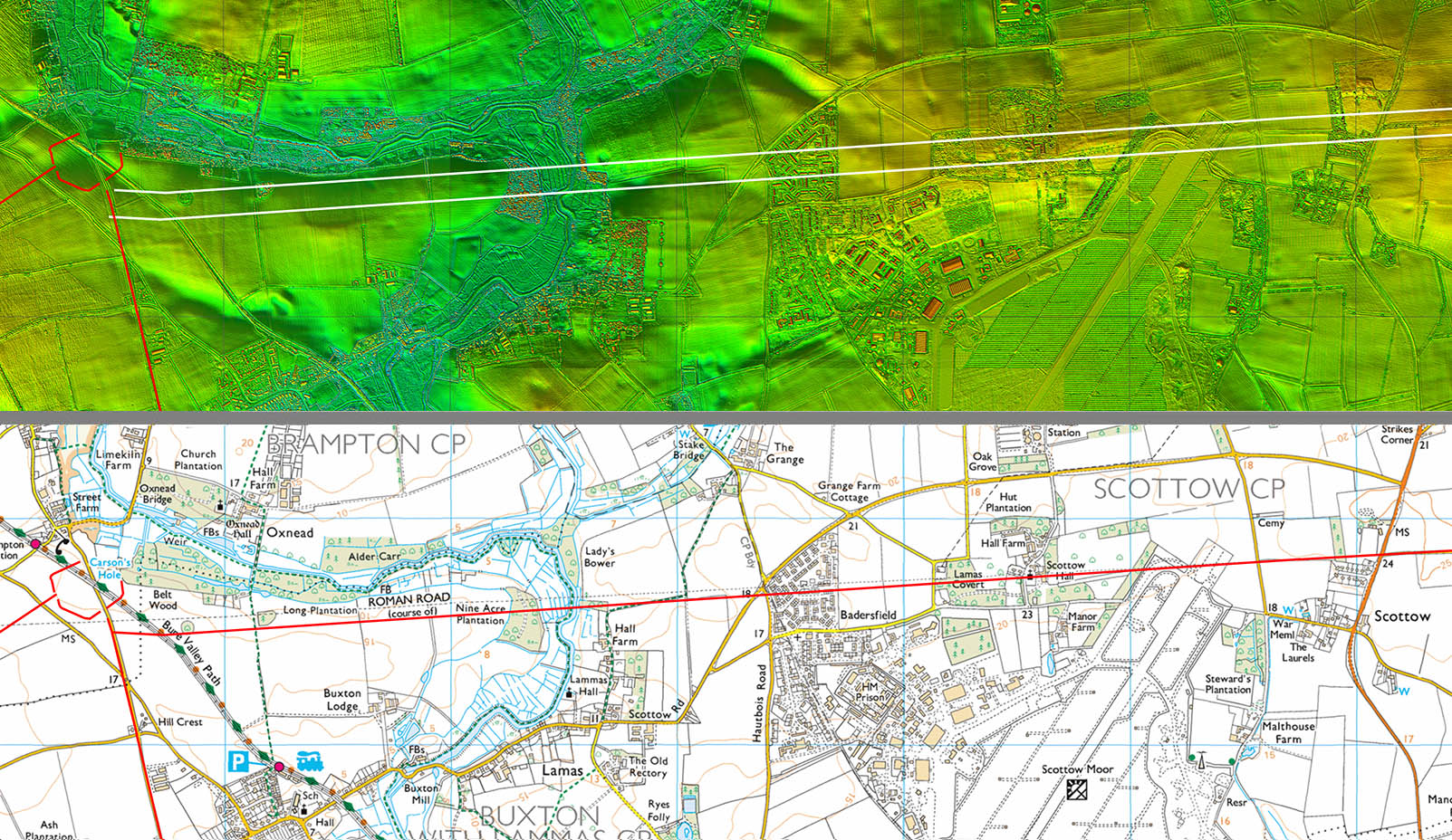
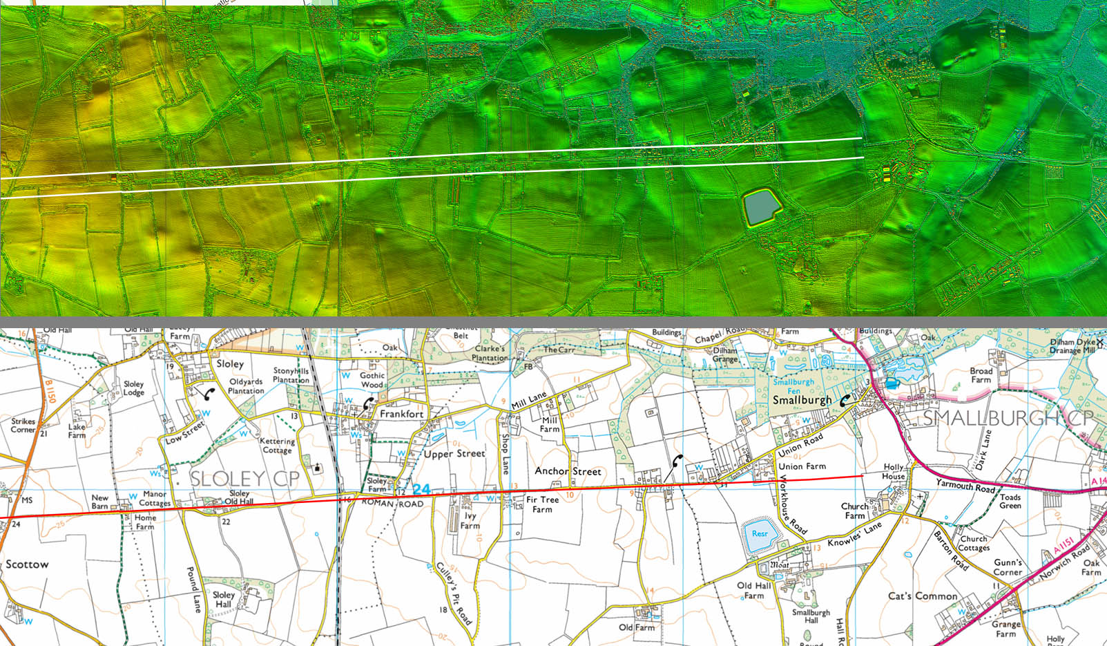
Lidar Image and Route Map 1 - Brampton to Scottow Lidar indicates that the route to the River Bure and Scottow is almost certainly further south than previously believed. This new alignment does actually also follow higher ground as far as the River Bure - a common Roman trait and a sensible course to have chosen. |
Click for larger view |
 |
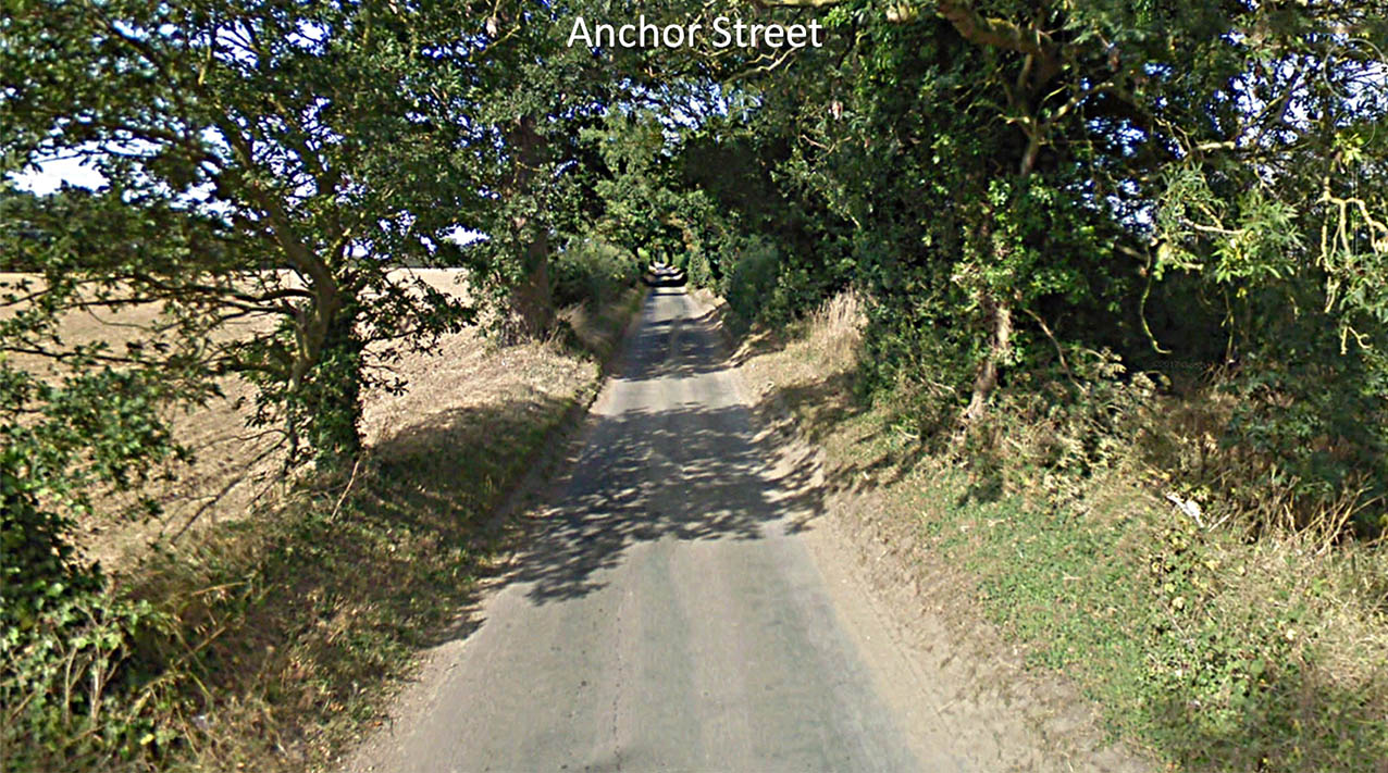
Anchor Street Anchor Street today is relatively narrow compared to what it must have been in Roman times. The name is perhaps suggestive the road went to a harbour. |
Click for larger view |
 |
Lidar Image and Map 2 - Scottow to Smallburgh This stretch is mostly overlaid by the modern Anchor Street but the lidar data peters out beyond Smallburgh. |
Click for larger view |
 |
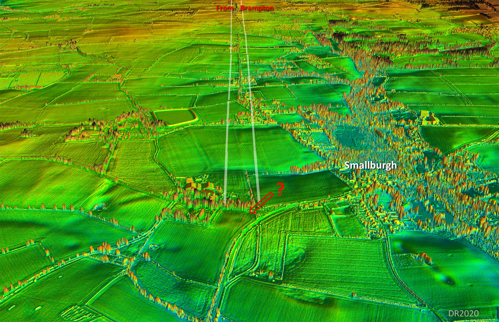
Oblique 3D Lidar Image - Smallburgh The 3D lidar image doesn't really solve the puzzle of it destination. The name Smallburgh is perhaps a clue - could there have been a small fort/fortlet here? The road does seem to aiming towards the feature marked with an arrow, north of the church. It is a local high spot and looks to have the remains a square buildling/bank(?). There is nothing listed in the Norfolk HER for this spot.
|
Click for larger view |
 |
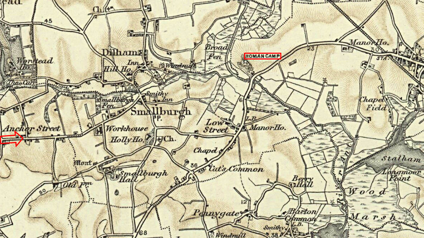
OS 1-inch First Edition Map c.1898 The old OS maps show a Roman Camp across Wayford Bridge. However, this has disappeared off modern maps and HER 7446 states no Roman features have been found there but it is perhaps how Smallburgh got its name rather than a Roman fort/port existing here. |
Click for larger view |
 |
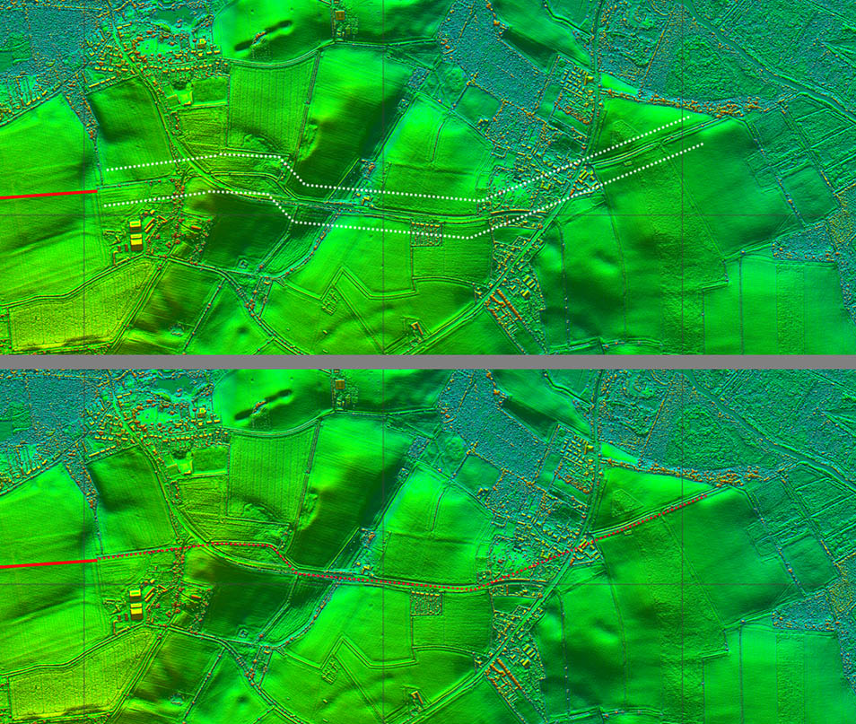
Lidar Images - Possible Destination There are further signs of the agger continuing and this probably is the most likely continuation onwards of the road. The name Low Street (see above map) does lend some support for this. A Roman harbour would be nothing more than a safe beaching site so there could be nothing surviving to indicate its presence. |
Click for larger view |
 |
English Heritage Roman Coastline Map - road network overlaid This English Heritage map of the Roman coastline has had our Roman roads overlaid. This would indicate that a harbour at Smallburgh was the most logical destination. An over-land route onwards to Caister on Sea would have been impractical - see below also. |
Click for larger view |
 |
Lidar Image - Smallburgh to the Coast When you look at the wider picture then there is surely no doubt that somewhere near Smallburgh was a Roman harbour/port. Could rising sea levels make this a worrying future possibility too? The small "island" at the bottom is St Benet's Abbey. |
Click for larger view |
 |
|
|
|
Last update: January 2024 |
© David Ratledge |