
|
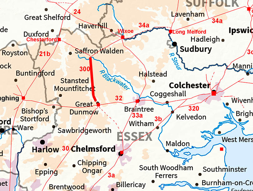
The Roman Road from Radwinter to Great DunmowMargary Number: 300Distance: 10 miles A road perhaps best explained by being a joint route from the Roman settlements/towns of Great Chesterford and Wixoe to that at Great Dunmow. Another typically direct route.
|
Historic Counties: Essex Current Counties: Essex HER: Essex
|
|
|
|
|
|
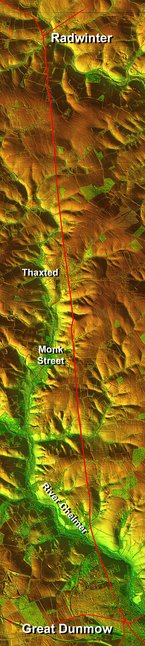
Lidar Image - Full Route Sensible route keeping out of the river valleys and passing through Thaxted and the aptly named Monk Street. Only approaching Great Dunmow does the road abandon the long alignment from Radwinter. |
Click for larger view
|
 |
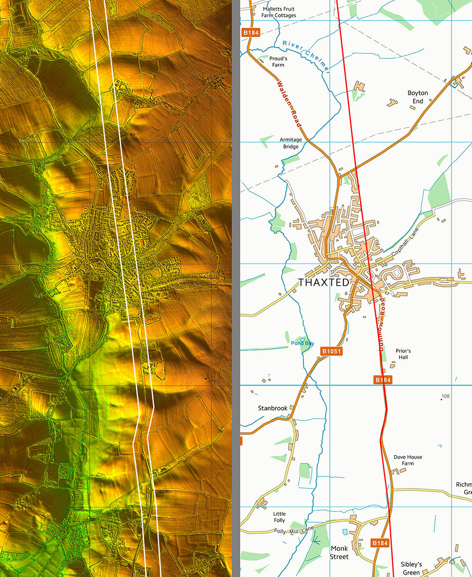
Lidar Image and Route Map 1 The route is very clear in the Lidar imagery all the way to Thaxted. |
Click for larger view |
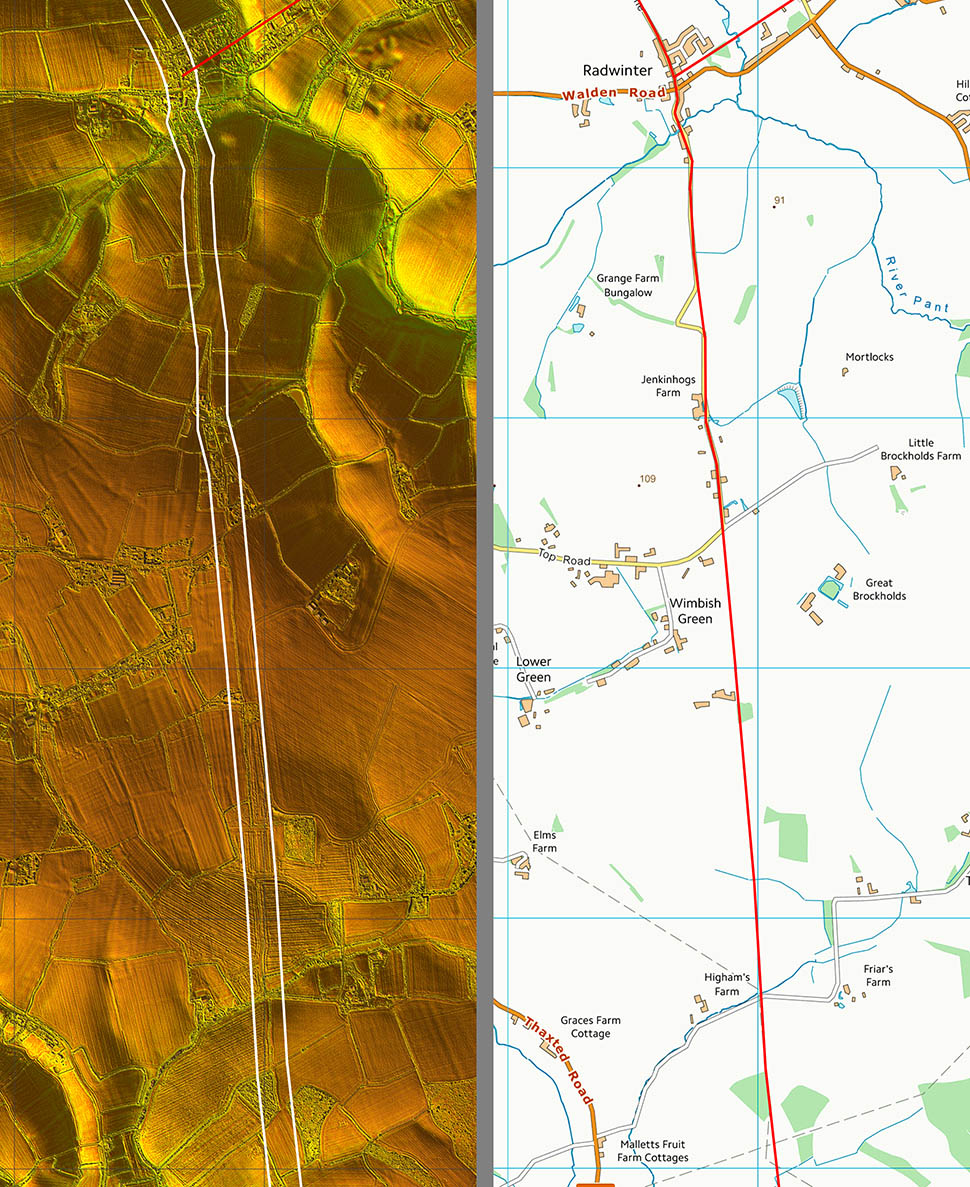 |
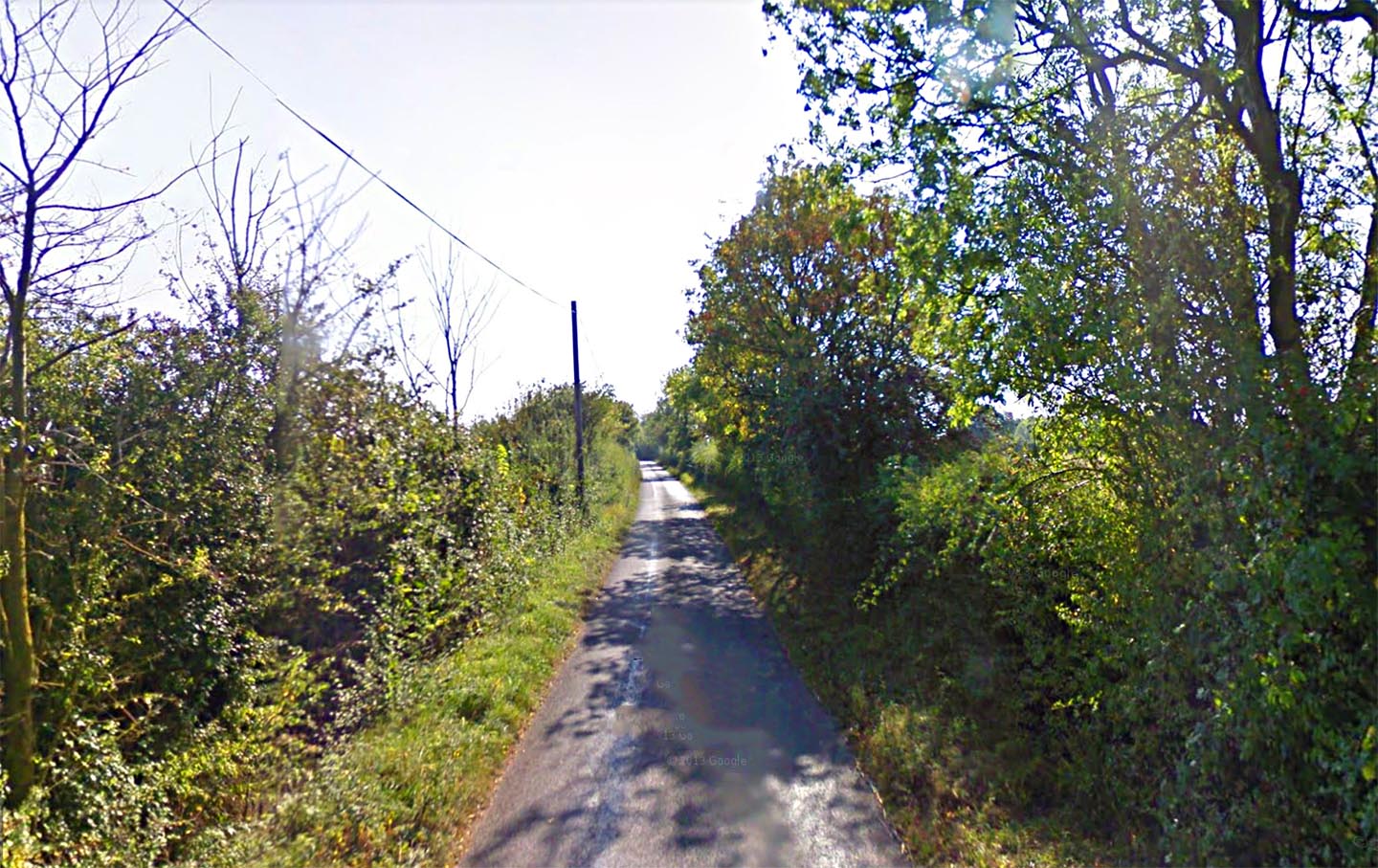
Roman Road - South of Radwinter The Roman line is mostly overlaid by the modern lane aptly named "Roman Road". Today it is quite narrow and only its straightness gives away its Roman origin. |
Click for larger view |
 |
Lidar Image and Route Map 2 Across Thaxted I have had to interpolate but this is almost certainly the route the road would have followed. There is a slight dog-leg just before Monk Street. |
Click for larger view |
 |
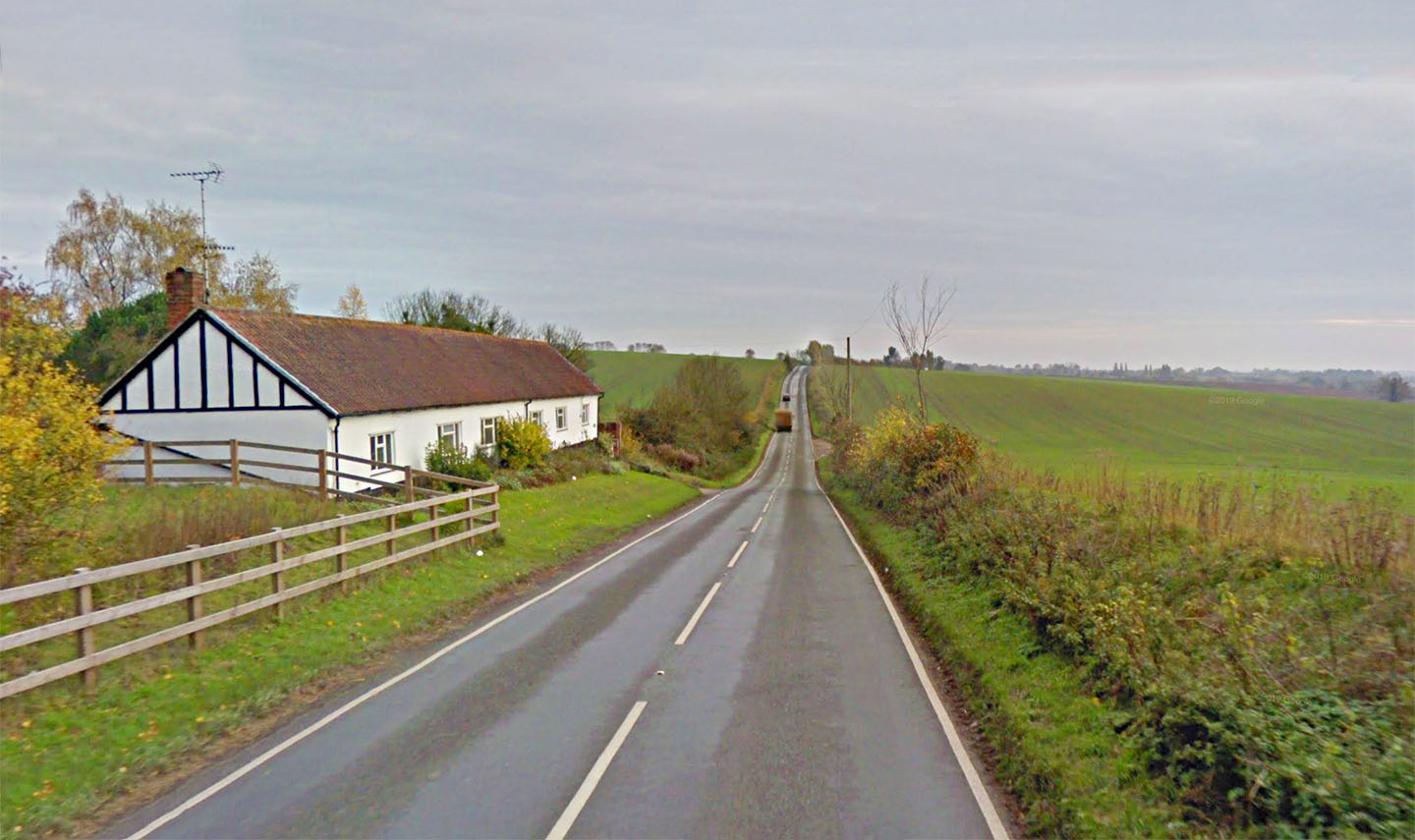
Dunmow Road - South of Thaxted One of the most obvious of Roman roads! This is about half a mile south of Thaxted on the B184 looking south.. |
Click for larger view |
 |
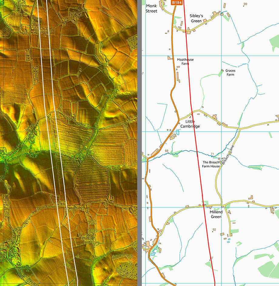
Lidar Image and Route Map 3 Again sufficient clues to confirm the route including a cutting just north of Little Cambridge. |
Click for larger view |
 |
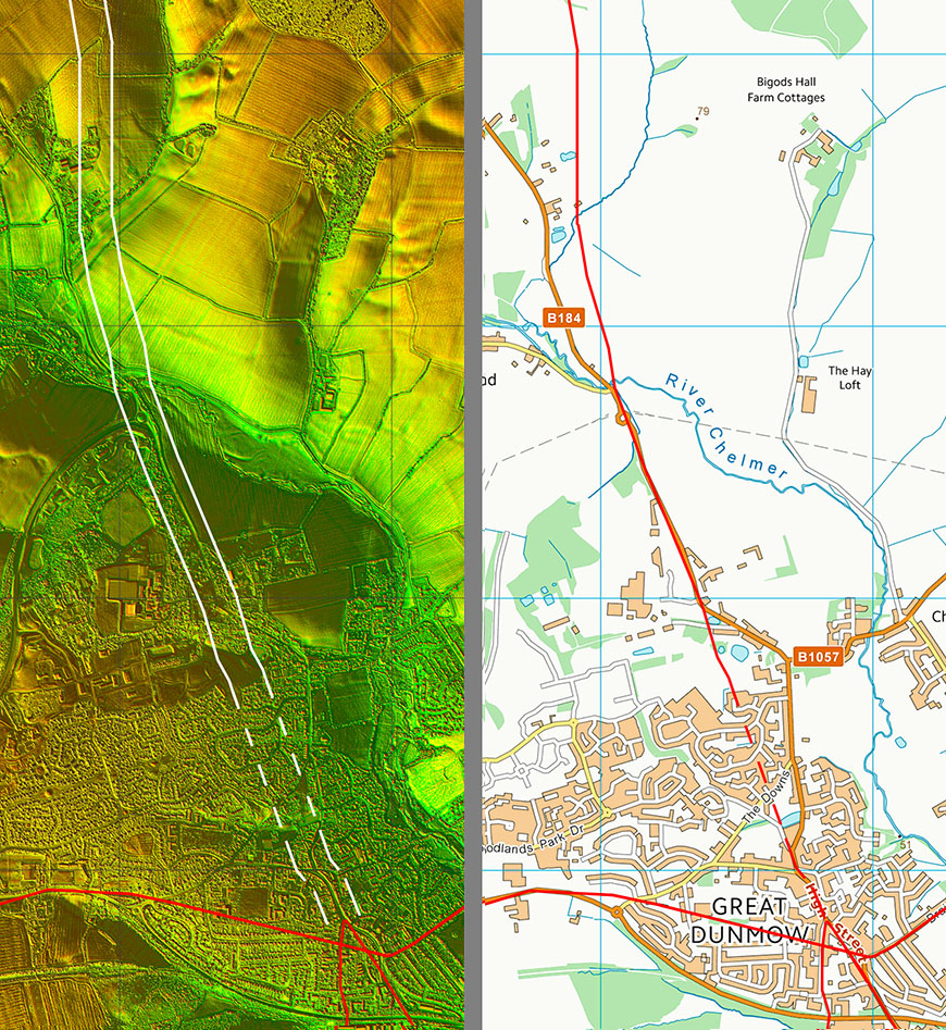
Lidar Image and Route Map 4 Just north of the River Chelmer there appears to be a fine surviving length of agger. |
Click for larger view |
 |
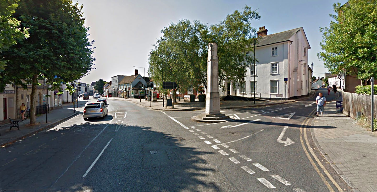
Great Dunmow - High Street The Roman line goes straight on here to the junction with Stane Street - roughly in the direction of the obelisk.
|
Click for larger view |
 |
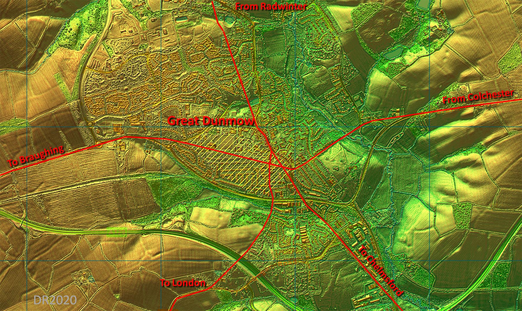
Lidar Image - Great Dunmow Roman Settlement The Roman settlement area appears to have been mainly to the west of the road junction. It is likely that Stane Street predated the other later roads which then avoided the already settled area. The Settlement area is shaded in yellow and is taken from Wickenden although the road to London I have shown in a different location based on Lidar and old mapping.. Ref: Excavations at Great Dunmow, Essex: a Romano-British small town in the Trinovantian Civitas, N.P. Wickenden, EAA 41 (1988)
|
Click for larger view |
 |
|
|
|
Last update: July 2020 |
© David Ratledge |