
|
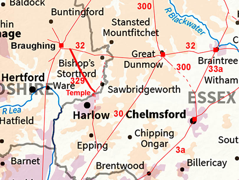
The Roman Road from Harlow to Stane Street (for Braughing)Margary Number: 329Distance: 8 miles (to Stane Street) A road recorded by Ivan Margary although he was unable to trace it over its full length but (correctly) suspected Harlow must be its southern destination. We now know Harlow was indeed that destination. It was a Roman settlement of some importance with high status buildings and industrial workings plus, of course, the famous temple.
|
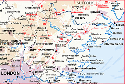
Historic Counties: Essex, Hertfordshire Current Counties: Essex, Hertfordshire HER: Essex, Hertfordshire
|
|
|
|
|
|
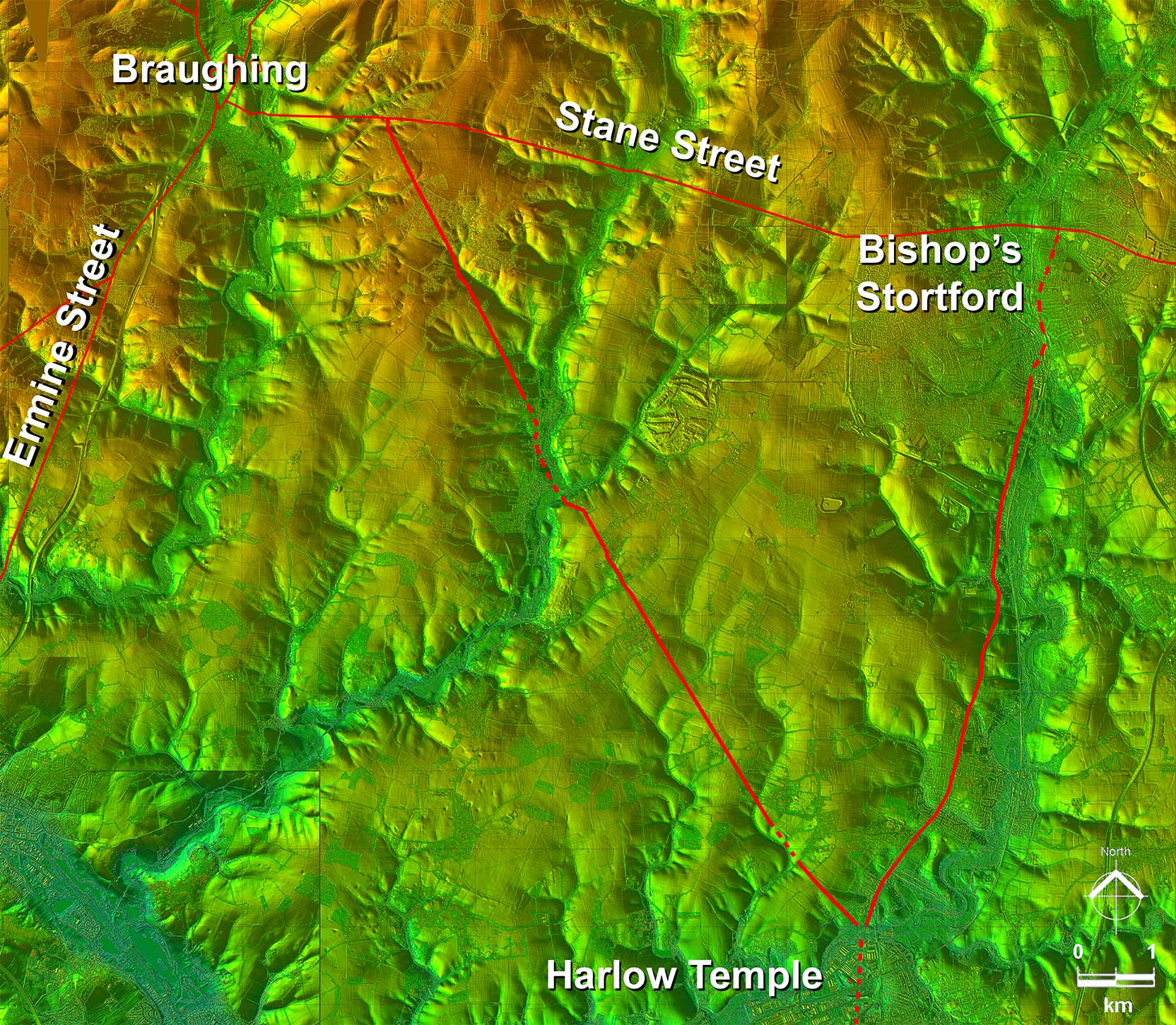
Lidar Image - Full Route Once across the River Stort a very direct alignment to a point on Stane Street about 2 km east of Braughing. We shall see later that the short "offset" at Hadham was due to the River Ash being on line. |
Click for larger view
|
 |
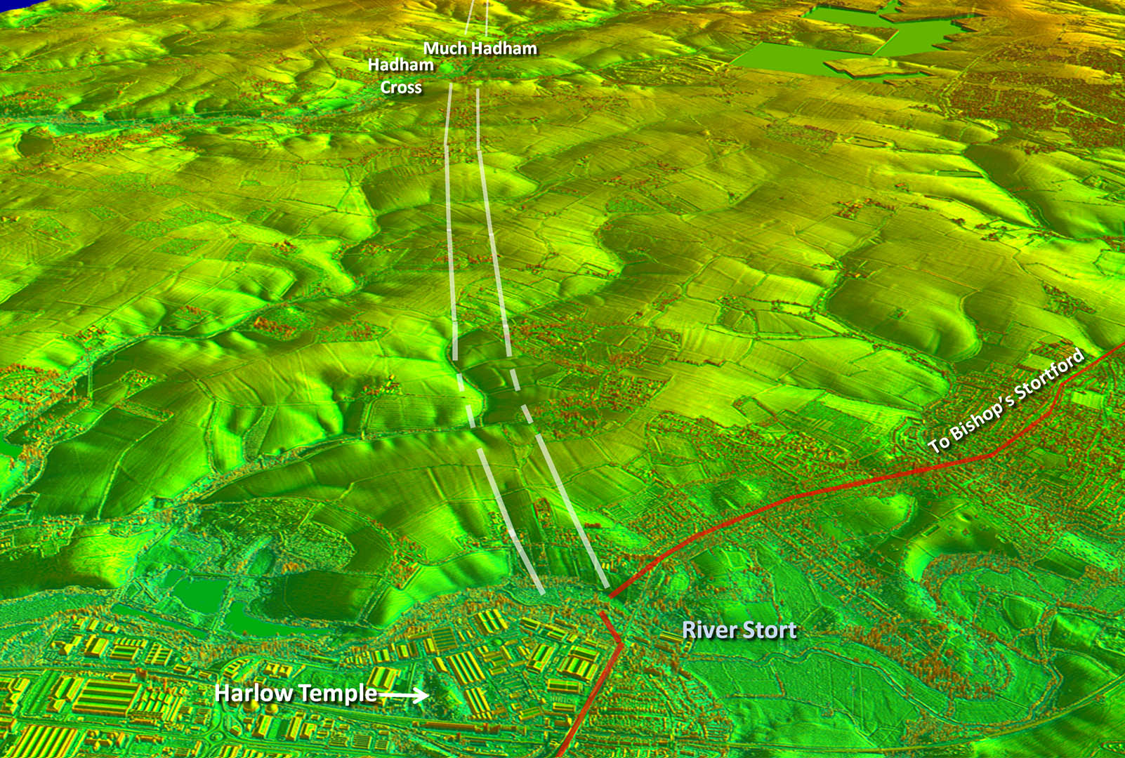
Oblique 3D Lidar Image - Harlow looking towards Hadham The initial wiggles were obviously to negotiate a couple of little valleys. The road to Bishop's Stortford and this road would have shared a common bridge over the River Stort. |
Click for larger view |
 |
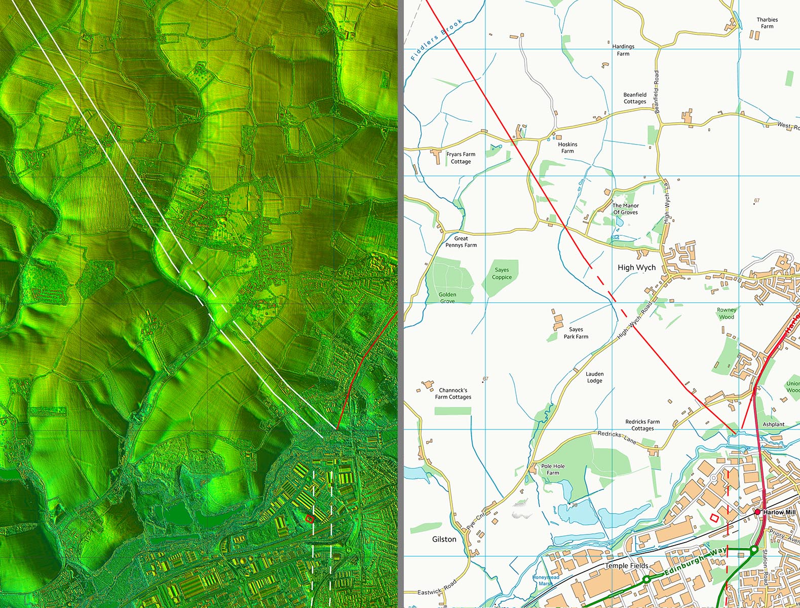
Lidar Image and Route Map 1 The main alignment, beyond the initial wiggles, appears to be aiming just to the right of the temple site but it was most likely the bridge site that determined the line. |
Click for larger view |
 |
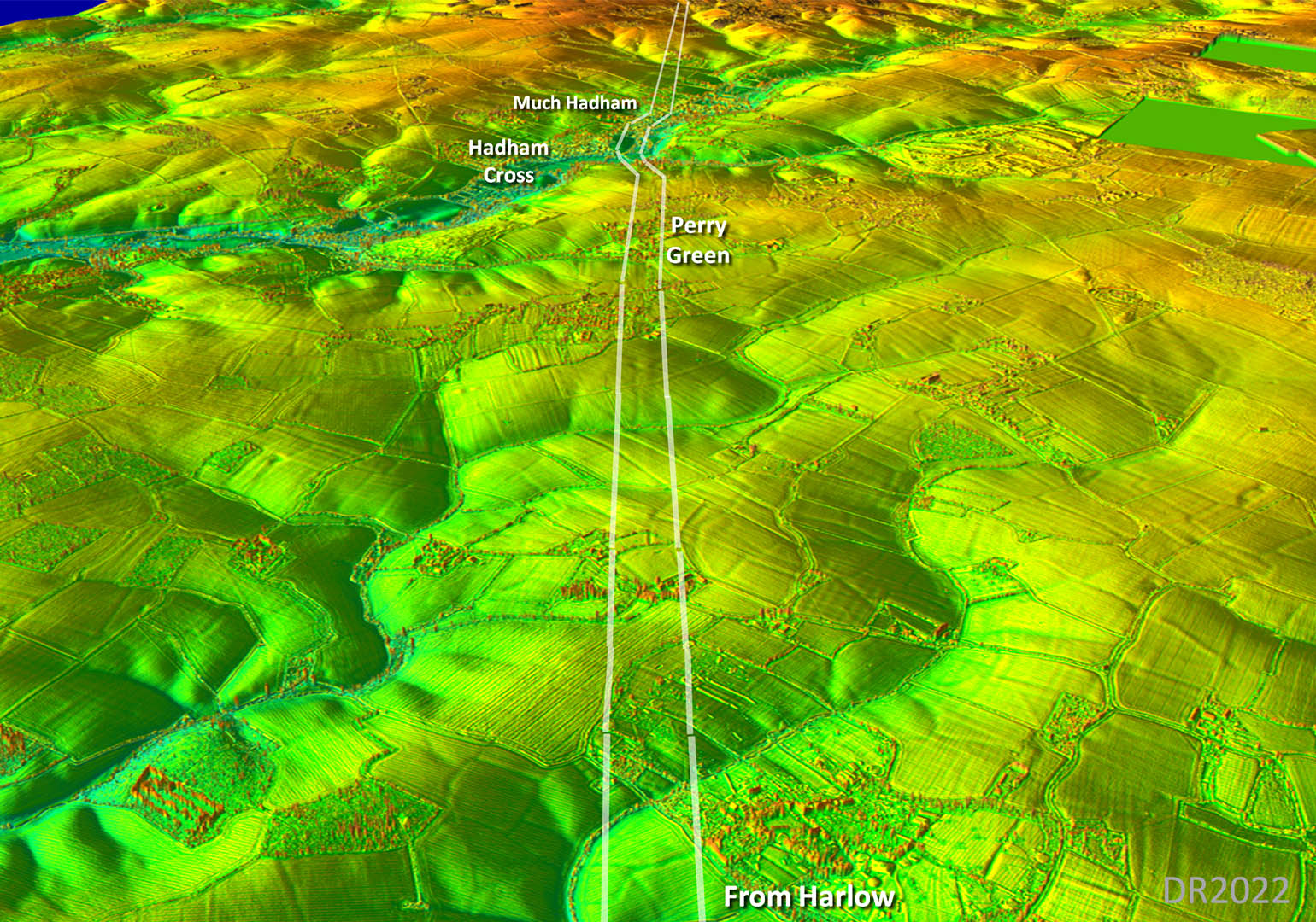
Oblique 3D Lidar Image - Approaching Perry Green Its faint but enough clues and all in a line to determine the Roman alignment with certainty.. |
Click for larger view |
 |
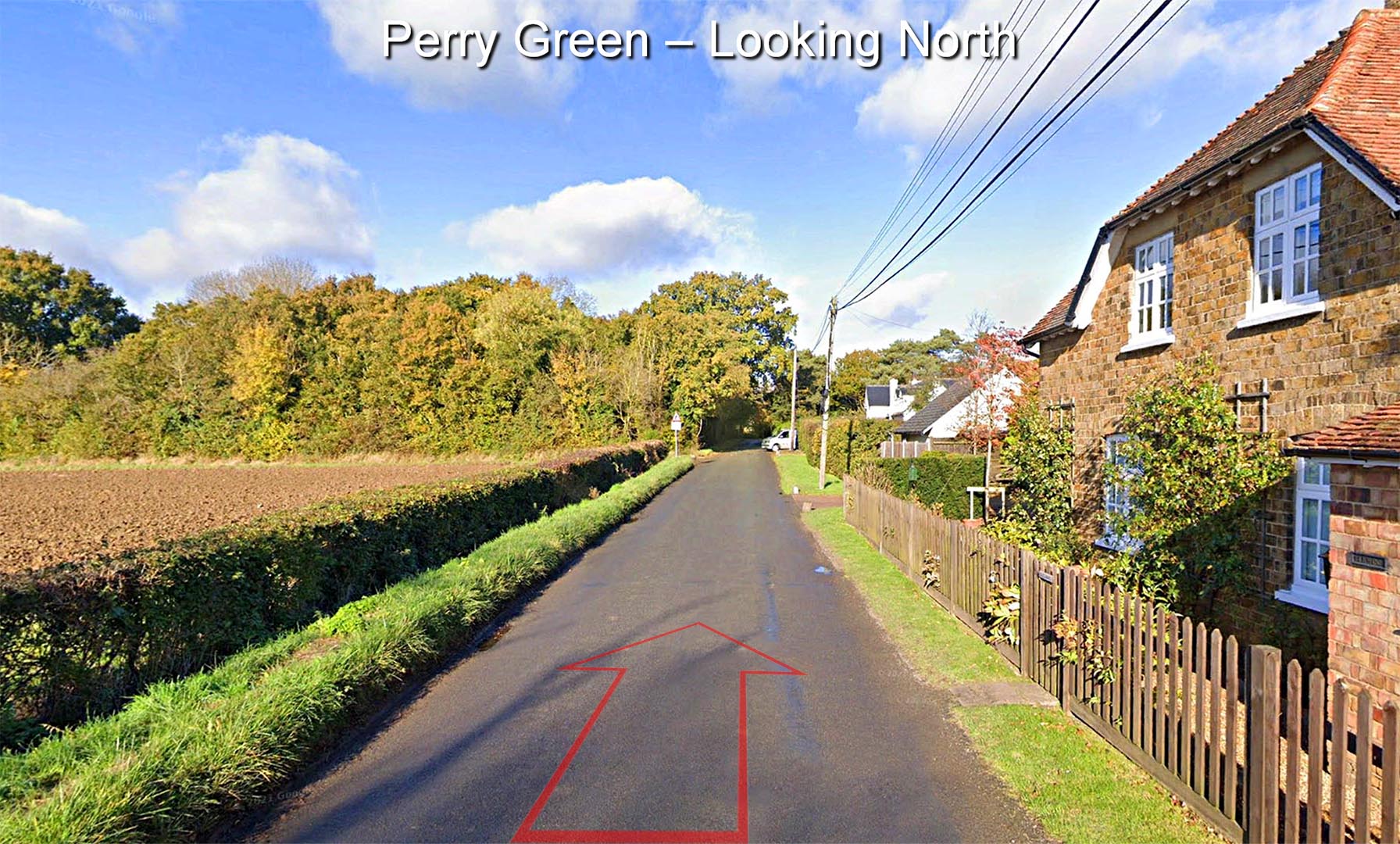
Perry Green Margary had lost the line of the road at Much Hadham but noted the modern lane at Perry Green continued the alignment from Stane Street. He was correct and lidar has confirmed his suggestion. The modern road is clearly built on top of the Roman agger, well above the ground to the left. The west ditch on the left side.
|
Click for larger view |
 |
Oblique 3D Lidar Image - Much Hadham Margary could not trace the road across Much Hadham but suspected Daneswood valley could be the road. There are just enough clues to confirm this across Much Hadham and the arrangement of a "sidestep" to a short parallel section is a common Roman solution where a river (Ash) would be in the way. |
Click for larger view |
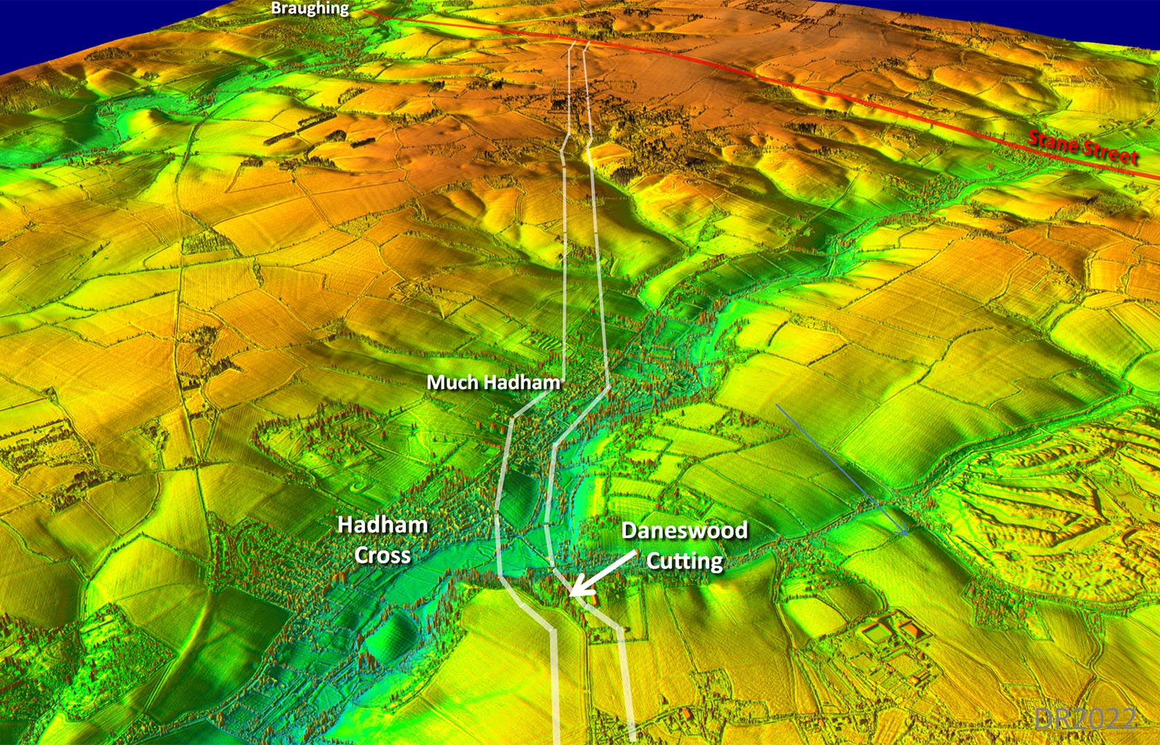 |
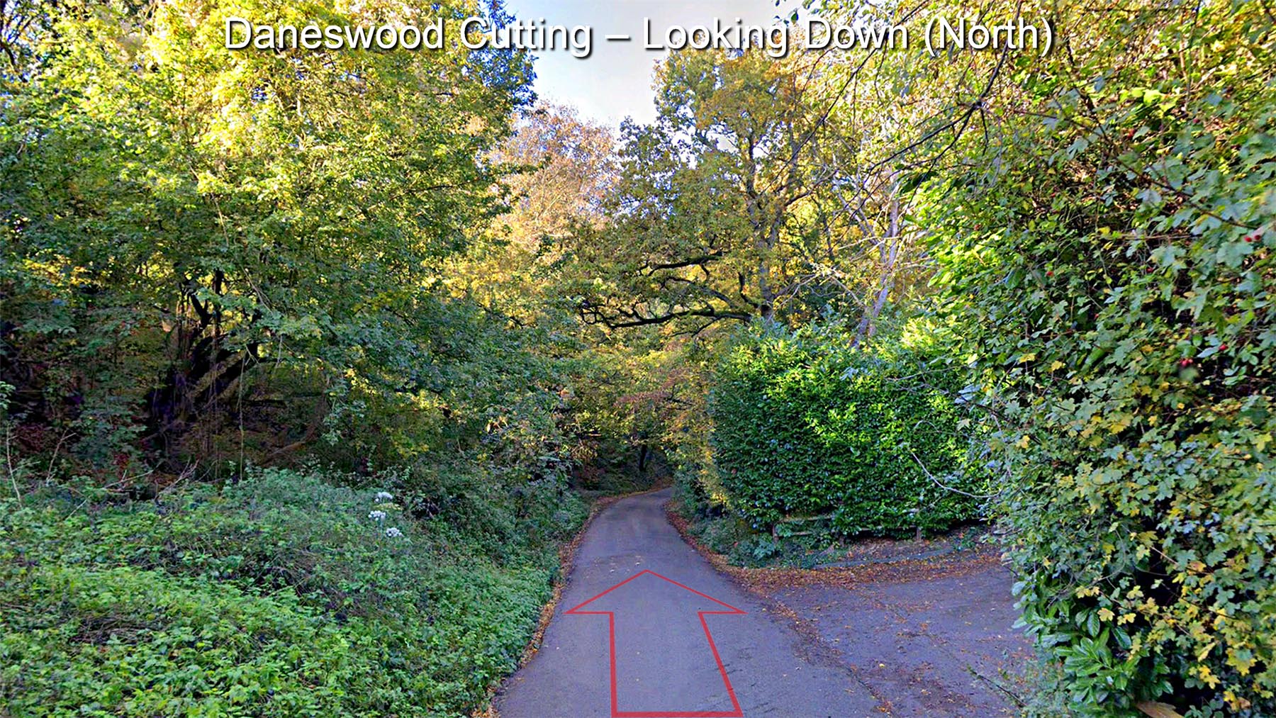
Daneswood Cutting 1 Margary had lost the line at Much Hadham but suggested this cutting could represent the line onwards - he was working north to south. He referred to it as a natural valley. It probably was but looks (see next image) to have been further excavated to form a cutting for a road. You would assume it was the Romans who did this. As we now known cuttings were a common feature on many of their roads. We are about half way down and looking north in this view. |
Click for larger view |
 |
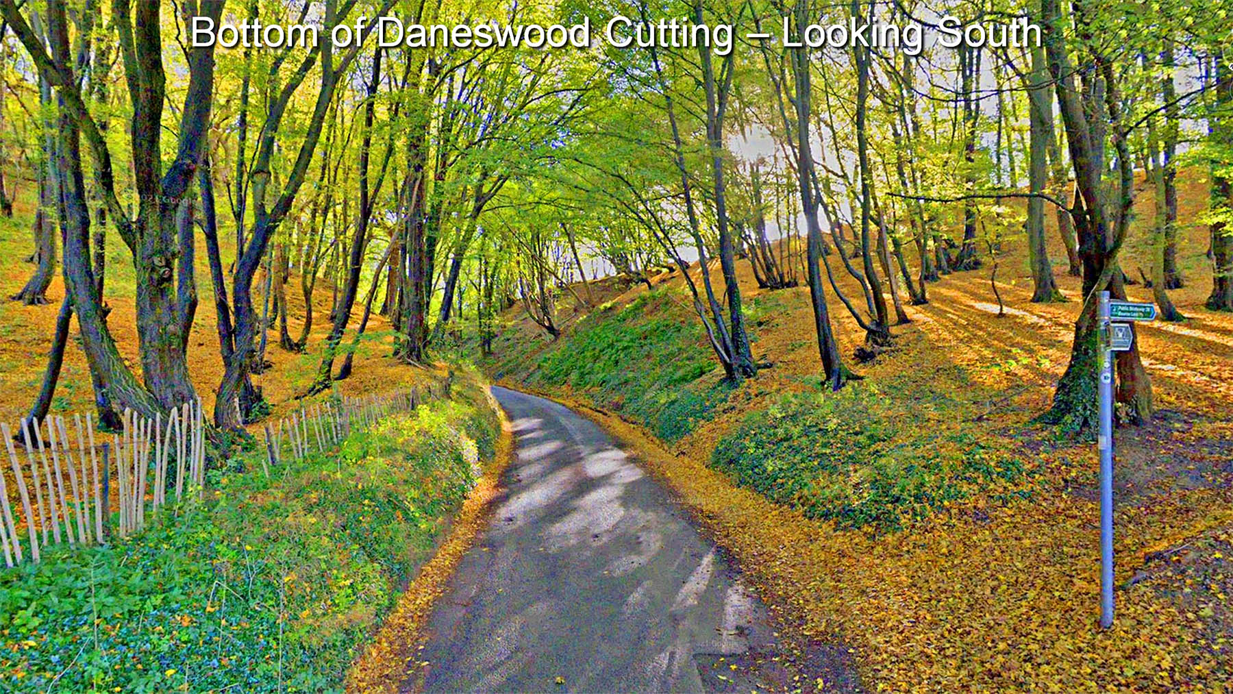
Daneswood Cutting 2 We are at the bottom of the cutting looking upwards. Note (most obvious near middle on the right bank) how the natural slope changes into a man-made regular steeper gradient down to the road. The Romans have utilised a natural valley and formed a road-wide cutting within it and achieved a steady descent/climb. |
Click for larger view |
 |
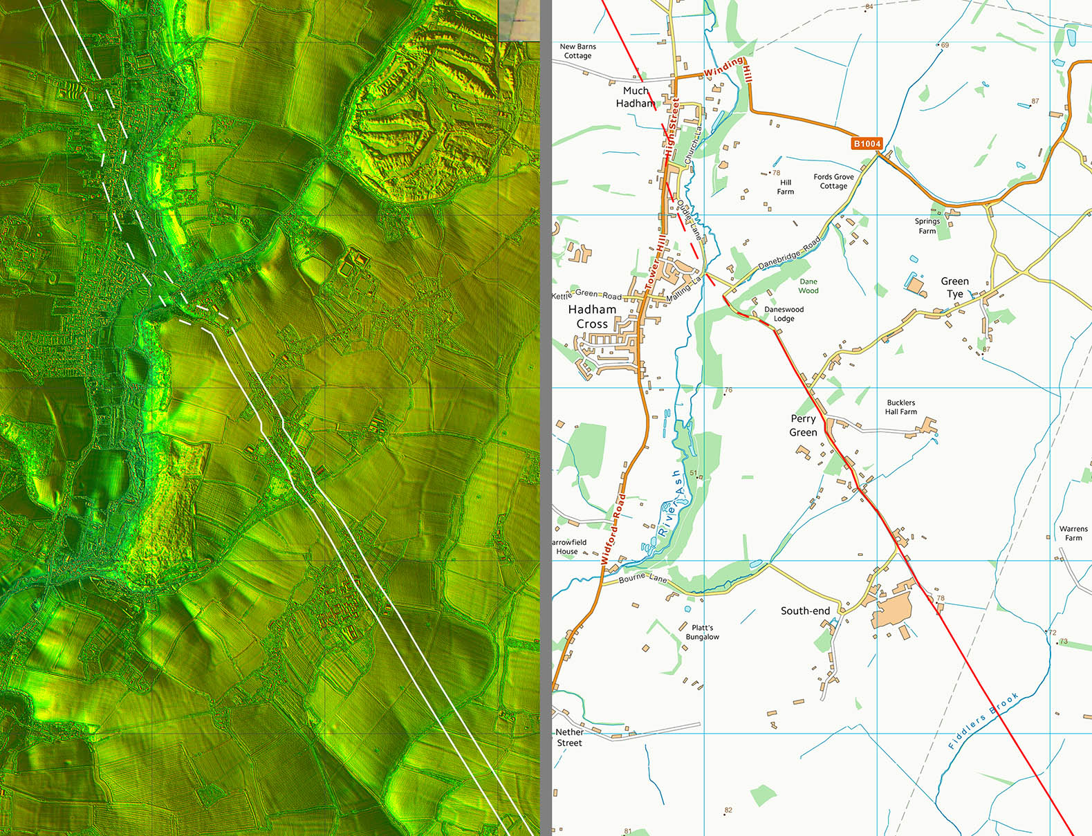
Lidar Image and Route Map 2 Typical Roman setting out with a some small wiggles for the valleys at Penny Green and the parallel sidestep at Much Hadham. |
Click for larger view |
 |
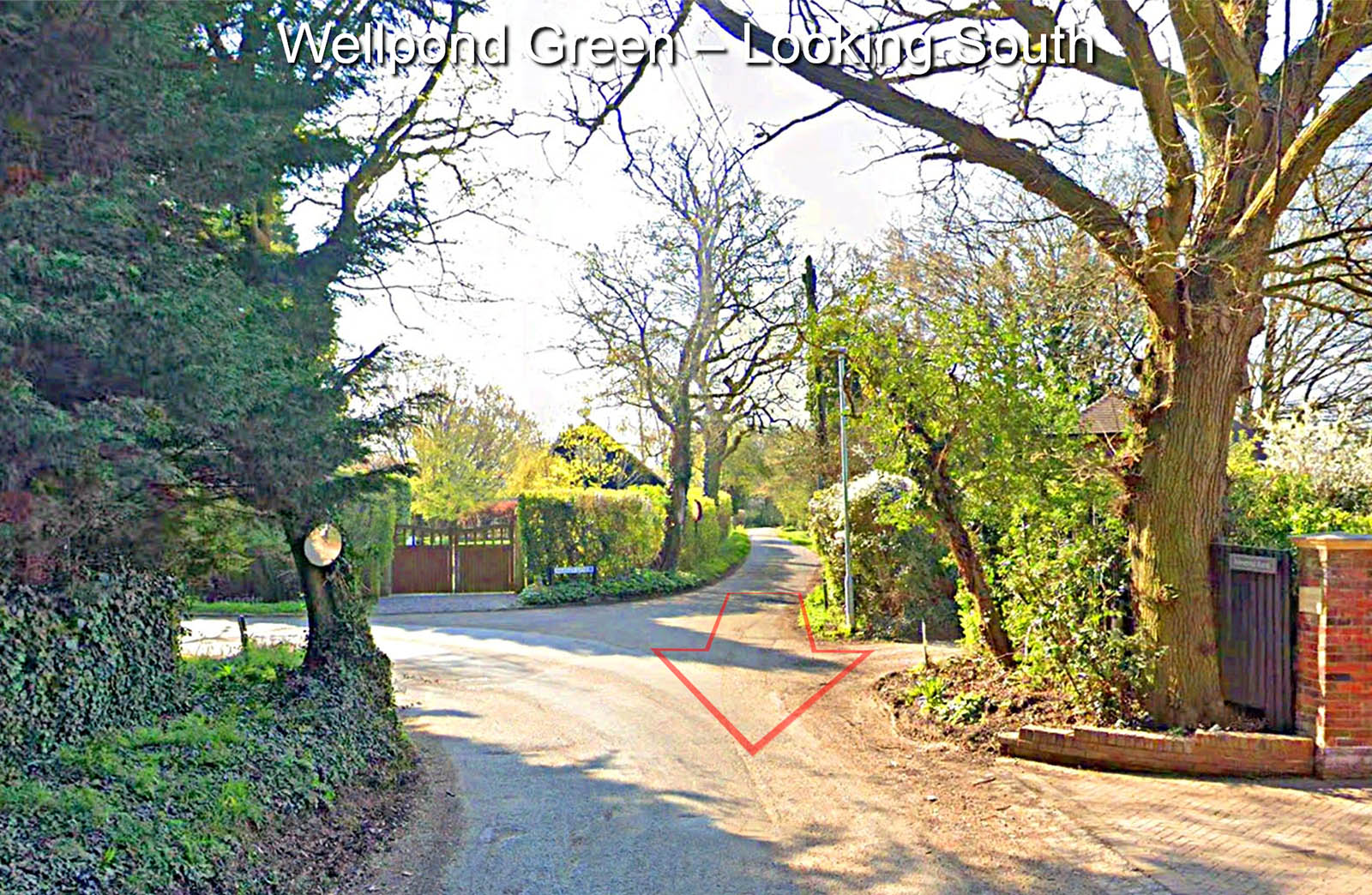
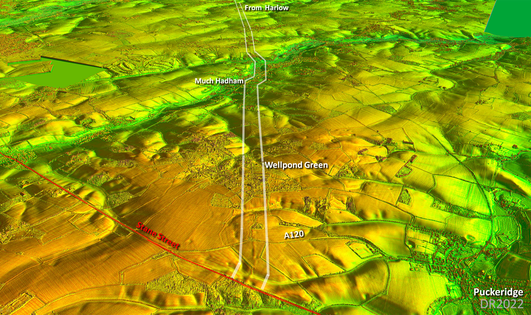
Wellpond Green The country lane through the pretty village of Wellpond Green marks the line of our Roman road. Here we are looking back towards Harlow. |
Click for larger view |
 |
Oblique 3D Lidar Image - Looking back from Stane Street The agger is very clear on the far (south) side of the A120. It can also be seen that the Romans chose to turn the road so as to form a right-angled junction with Stane Street. |
Click for larger view |
 |
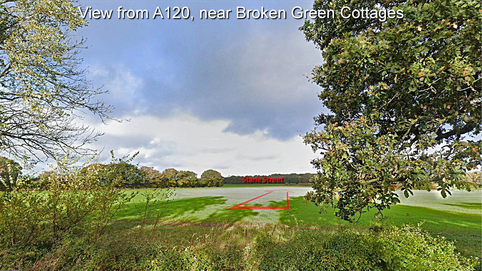
View towards Stane Street from A120 The line of the road is between the two large trees at Broken Green and heads to the corner of the field where it will turn slightly for its junction with Stane Street. |
Click for larger view |
 |
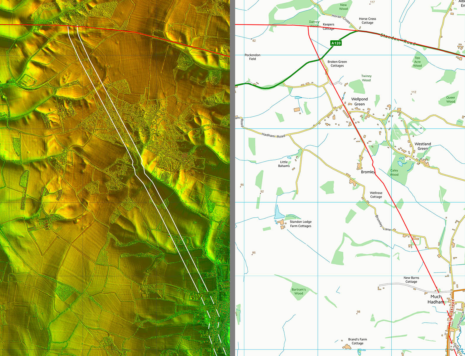
Lidar Image and Route Map 3 It was Roman common practice to compromise between directness and economy of construction. So when it was possible to join an existing Roman road for its final section to its destination it would often do so. This arrangement also confirms that Stane Street was the earlier road. |
Click for larger view |
 |
|
|
|
Last update: March 2024 |
© David Ratledge |