
|
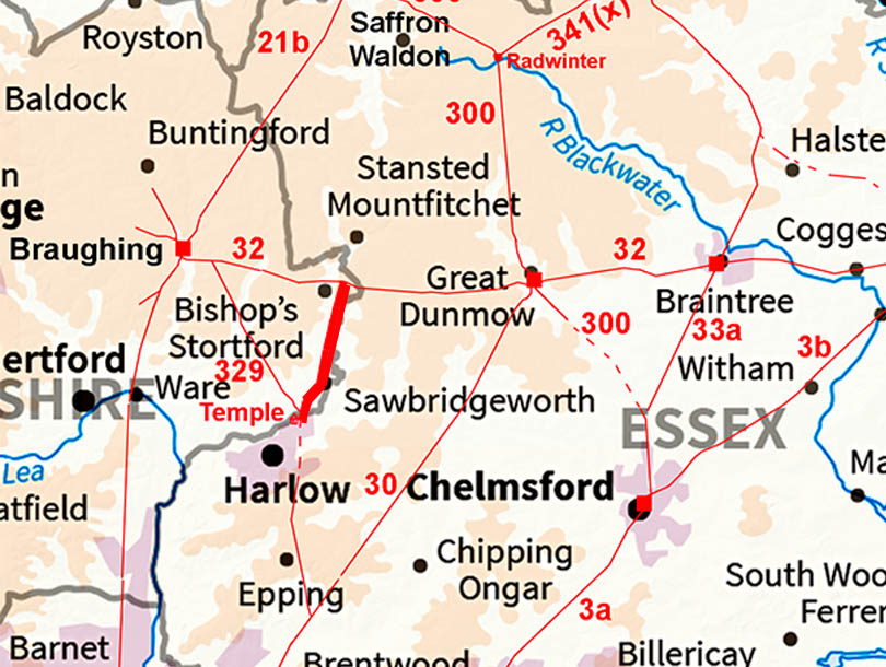
The Roman Road from Harlow to Bishop's Stortford (Probable)Margary Number: 328xDistance: 6.5 miles A very logical Roman road but without much real evidence. The agger on the north bank of the River Stort at the Harlow end plus the name "Thorley Street" are just about it. So perhaps should be in the "probable" category. If it is Roman then virtually its full length is overlaid by modern roads - mostly the A1184 and London Road Bishop's Stortford was Roman settlement was on Stane Street, The known area is located to the east of where Stane Street crossed the River Stort. During the 1950’s, rebuilding uncovered remains of Romano-British houses having gravel floors and timber-slots, with associated livestock ditches and storage pits. Large quantities of pottery recovered ranged from the mid-first to fourth centuries. Recently, rescue excavations by Oxford Archaeology at Grange Paddocks leisure centre (2022) found the Stane Street road, a possible temple, coins, and pottery plus burials. Note : the majority of the the route is in Herfordshire. |
Historic Counties: Essex, Hertfordshire Current Counties: Essex, Hertfordshire HER: Essex, Hertfordshire
|
|
|
|
|
|
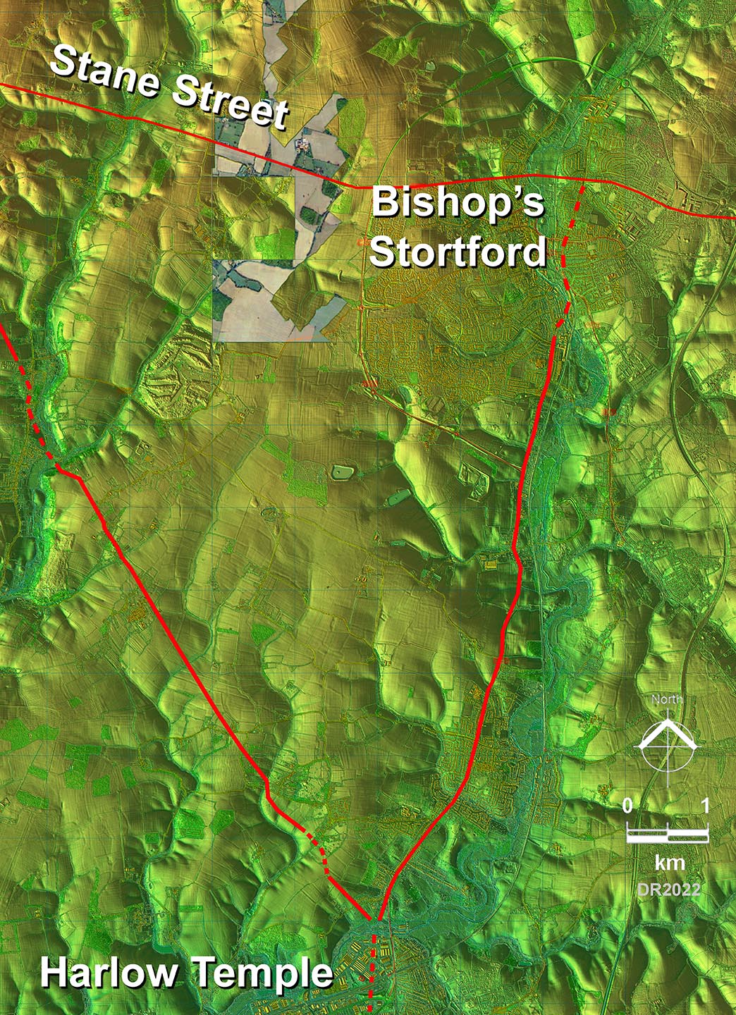
Lidar Image - Full Route The route is reasonably direct crossing the River Sort and then following the west bank to Bishop's Stortford where is possibly crossed back over to the east bank and headed up London Road to Stane Street. |
Click for larger view
|
 |
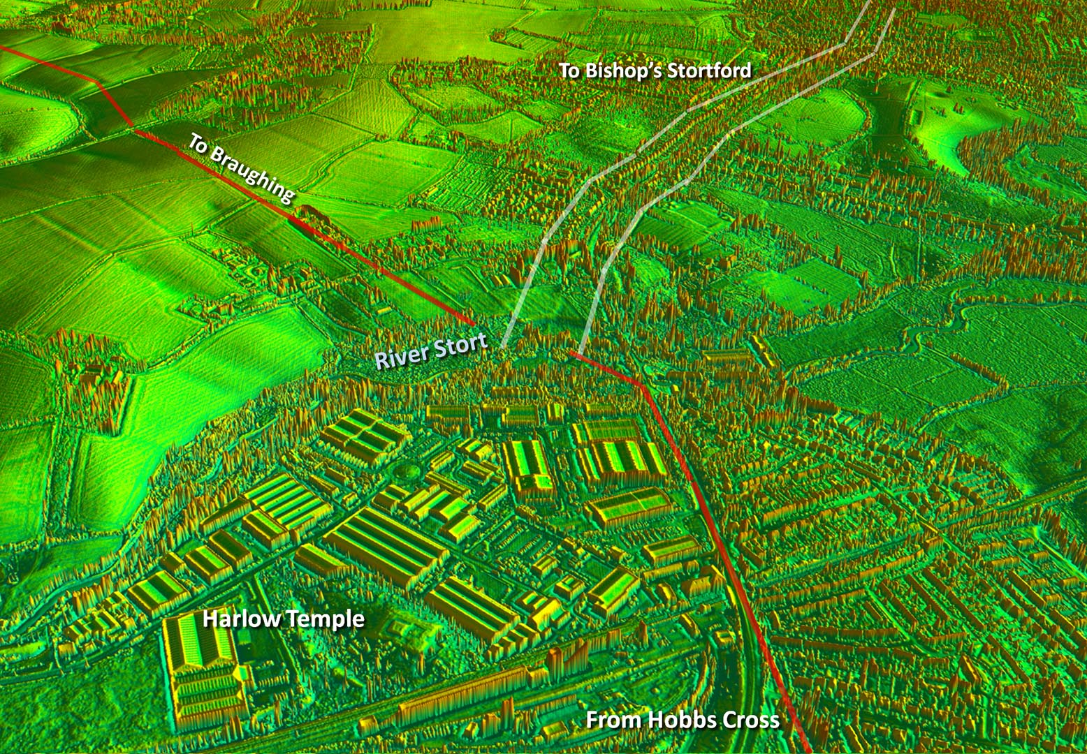
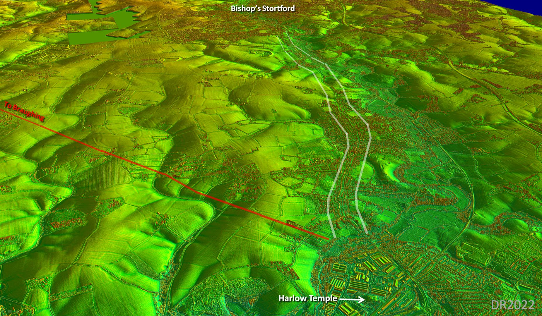
Oblique 3D Lidar Image - Harlow River Stort Crossing This is just about the only visible evidence for a Roman road to Bishop's Stortford. The fact that the road from Braughing seems to have joined it for a crossing of the River Stort is additional support for its existence. The river will have no doubt shifted over the centuries so the actual crossing point is probably lost but should have been where the two roads intersect. |
Click for larger view |
 |
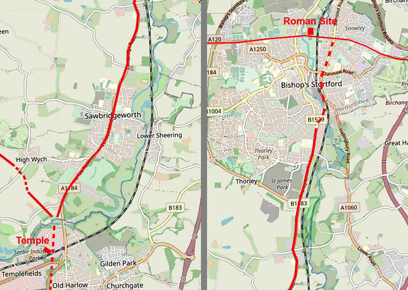
Route Map I could have shown the full length as a dashed line rather than just the last section in Bishop's Stortford.. That last section is perhaps less secure as it would have required a bridge over the River Stort whereas continuing via the west bank would have not needed another bridge as it could have used the Stane Street one. Base map: copyright Openstreetmap Contributors |
Click for larger view |
 |
Oblique 3D Lidar Image - Route to Bishop's Stortford The view shows the benefit of following the west bank of the river - it produced a much shorter route. |
Click for larger view |
 |
|
|
|
Last update: July 2022 |
© David Ratledge |