
|
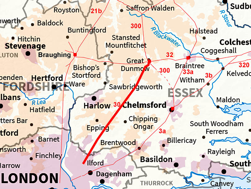
The Roman Road from Great Dunmow to LondonMargary Number: 30Distance: 35 miles A very direct Roman road that we will follow to the Greater London boundary but its destination was of course Londinium.
|
Historic Counties: Essex Current Counties: Essex HER: Essex
|
|
|
|
|
|
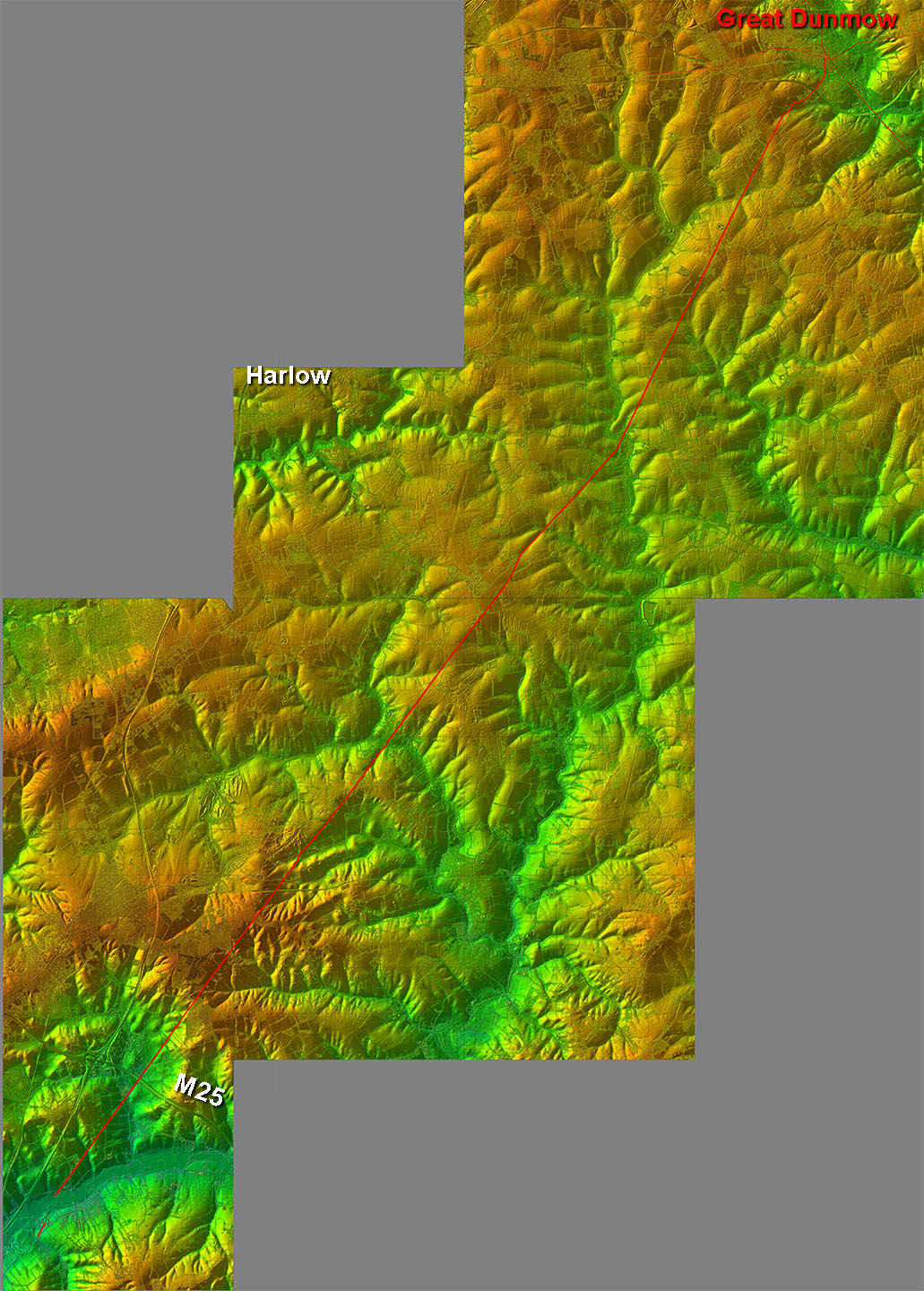
Lidar Image - Full Route No major obstacles to prevent the Roman adopting a straight alignment. |
Click for larger view
|
 |
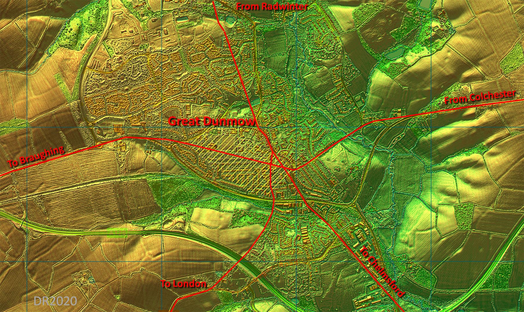
Lidar Image - Great Dunmow Roman Settlement The Settlement area is shaded in yellow and is taken from Wickenden. However our road to London I have shown in a different location based on Lidar and old mapping. It is a more logical route too. Ref: Excavations at Great Dunmow, Essex: a Romano-British small town in the Trinovantian Civitas, N.P. Wickenden, EAA 41 (1988)
|
Click for larger view |
 |
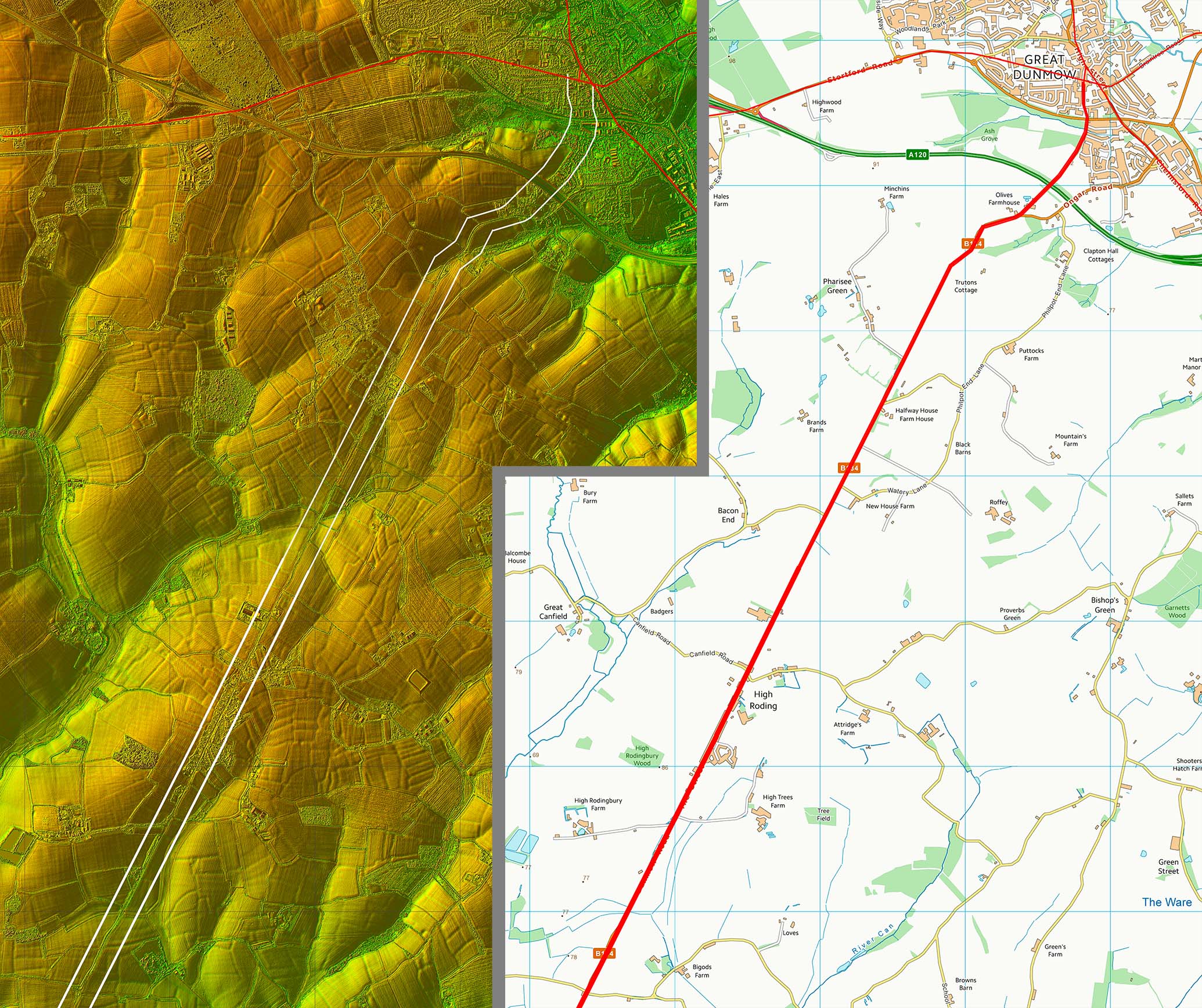
Lidar Image and Route Map 1 A mile south of Great Dunmow that straight alignment begins. |
Click for larger view |
 |
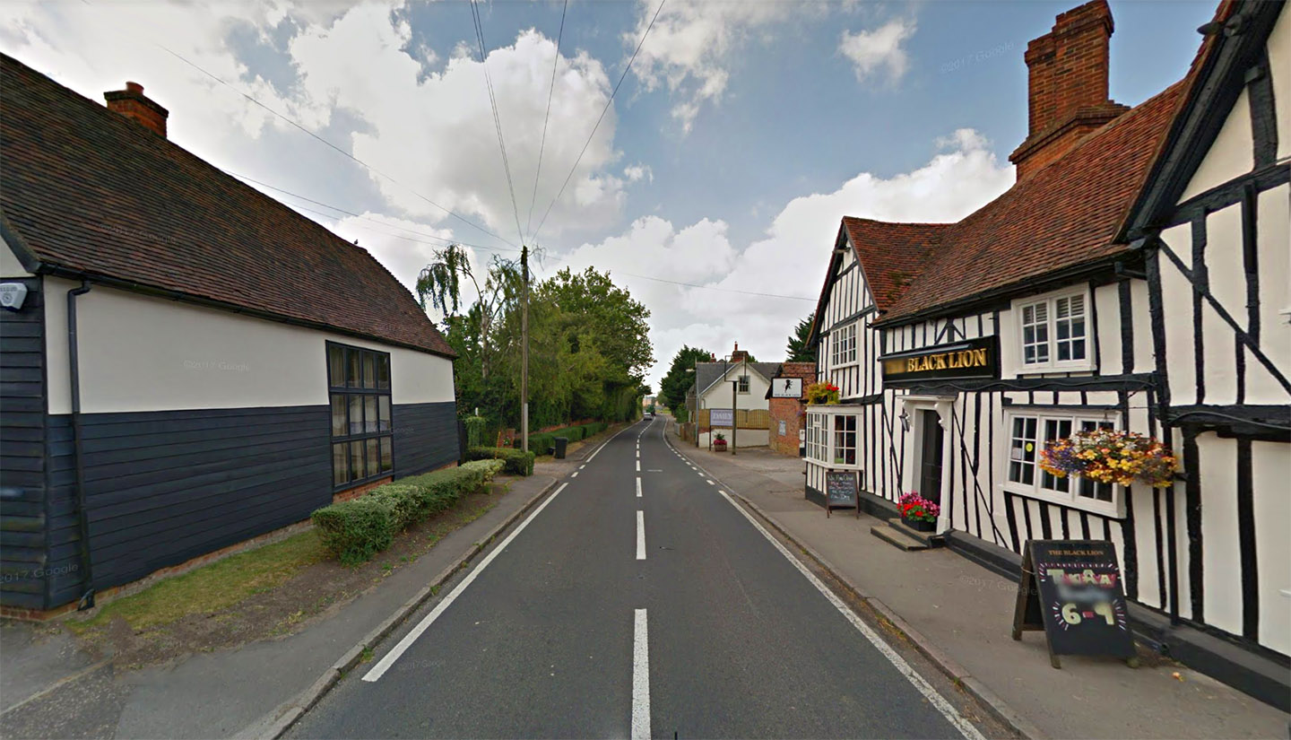
High Roding Nice and straight through High Roding giving the game away that this is a Roman Road. |
Click for larger view |
 |
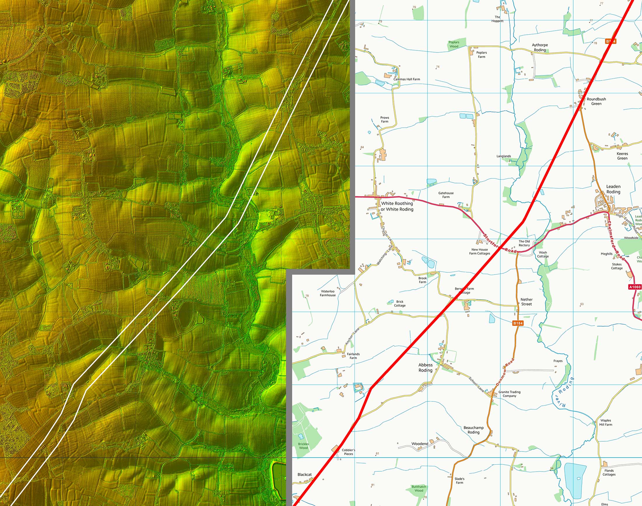
Lidar Image and Route Map 2 Passing through the Rodings it makes a subtle change of direction. |
Click for larger view |
 |
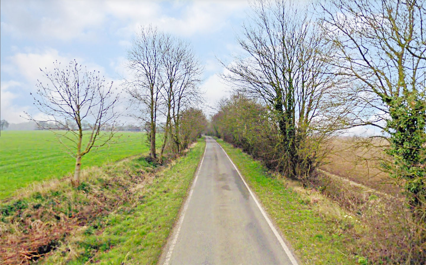
Approaching Black Cat The road to London is now just a narrow country lane. The agger is wider though giving a clue to its Roman origins. We are between Cobbler's pieces and Black Cat here. |
Click for larger view |
 |
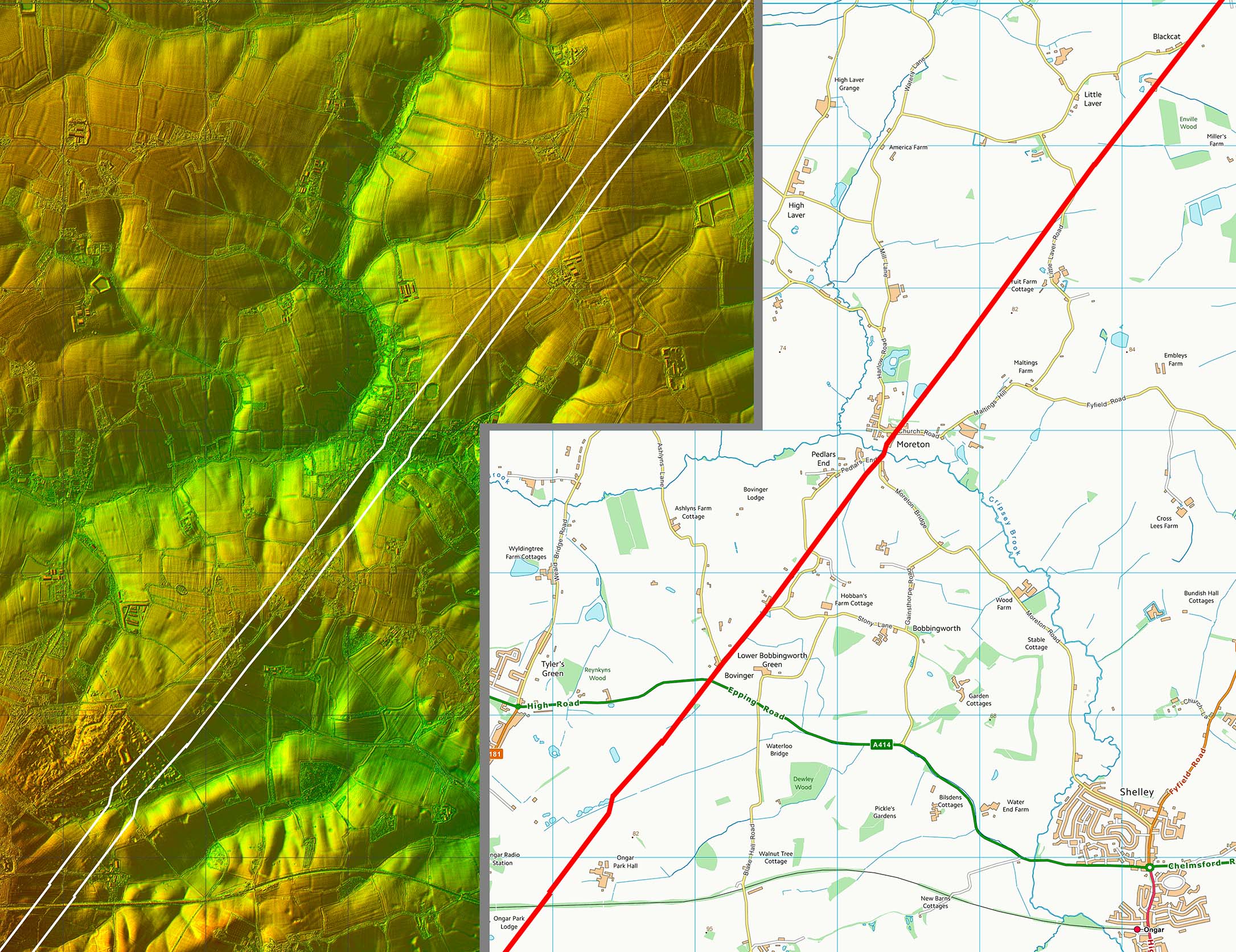
Lidar Image and Route Map 3 At Moreton there is a little dog-leg for the river crossing and another a few miles further on. |
Click for larger view |
 |
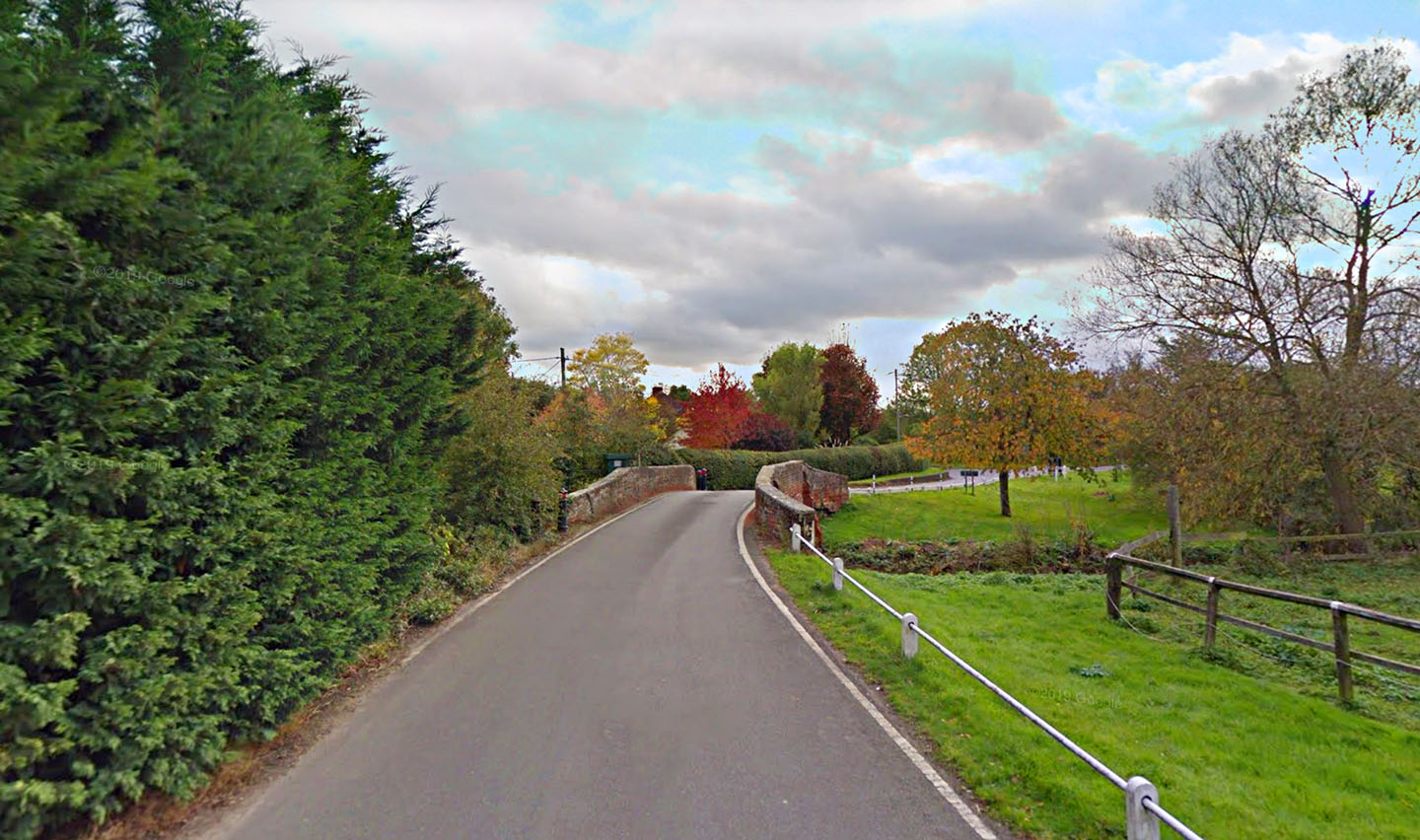
Moreton Bridge The Roman bridge site and the modern bridge most likely coincide just south of Moreton over the Cripsey Brook. |
Click for larger view |
 |
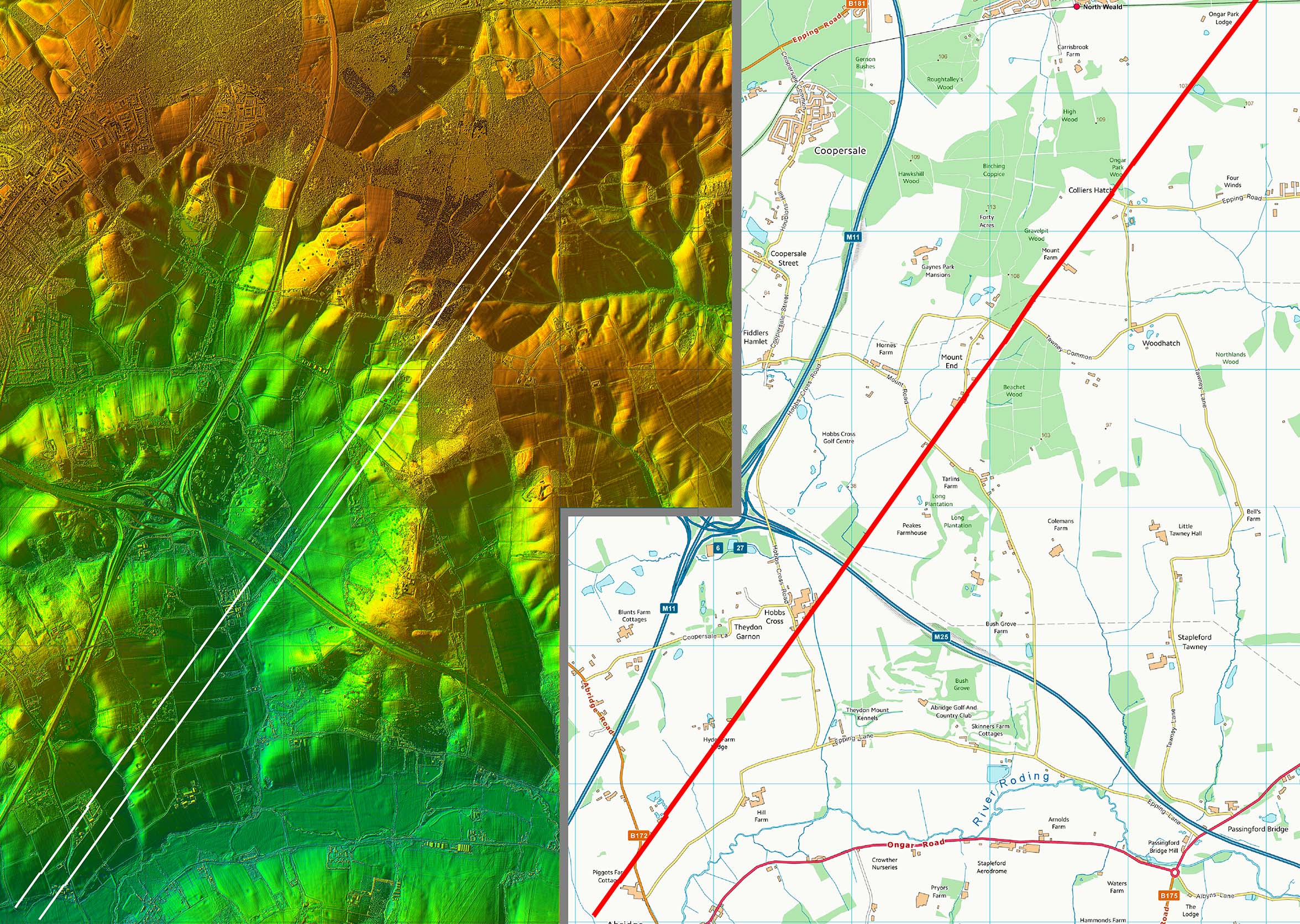
Lidar Image and Route Map 4 The straight alignment continues on across the M25 and we leave it at the River Roding. |
Click for larger view |
 |
|
|
|
Last update: July 2020 |
© David Ratledge |