
|
The Roman Road from Colchester to GosbecksMargary Number: 320Distance: 7.5 miles Some doubt as to whether this road exists. Margary listed it as his no. 320, Kemble/Going (1996) included it on their map, the Ordnance Survey list it as "Roman Road" at Easthorpe and the Colchester HER has a suspected stretch recorded near the Roman River. It does look so obvious and logical, plus it would have connected the important Gosbecks site into the road network. It is therefore included here. Gosbecks lies to the south-west of Colchester is believed to the pre-Roman tribal capital of south eastern Britain. A feature is the number of defensive ditches or dykes - presumably against the Roman invasion. However, It continued to be important in Roman times with a temple and theatre of its own. It was connected into the Roman road system by Margary 320 but also had another (local) road in from Colchester - see map1. Today Gosbecks Archaeological Park covers 65 hectares, and is mainly flat grassland and farmland. It has been described as one of Britain's premier Iron Age and Roman monuments and, with adjacent sites, was designated as a Scheduled Ancient Monument in 1988.
|
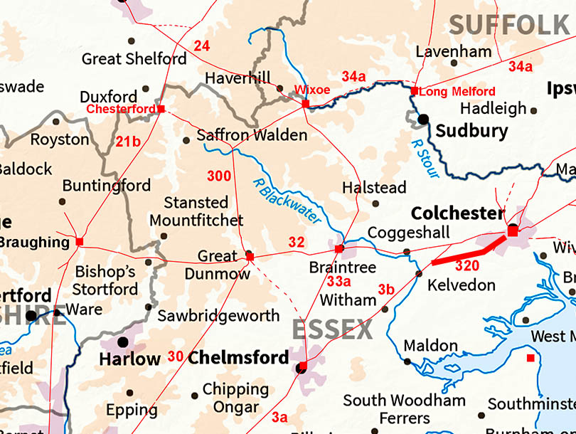
Historic Counties: Essex Current Counties: Essex HER: Essex & Colchester
|
|
|
|
|
|
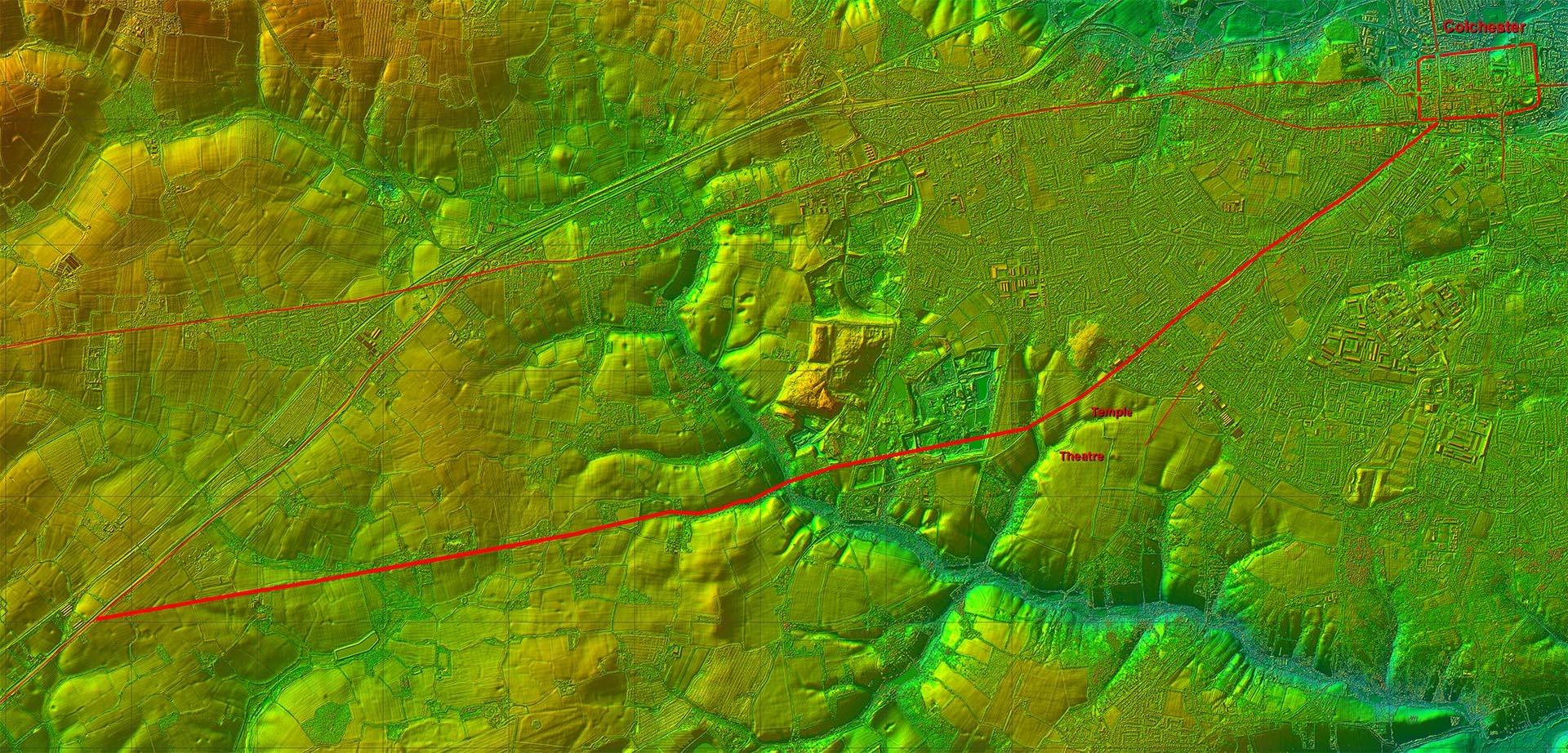
Lidar Image - Full Route Assuming this road exists then the Gosbecks Romano-British site was connected into the road system both to the south (Chelmsford and London) and Colchester. The sites of the Temple and Theatre are labeled. |
Click for larger view
|
 |
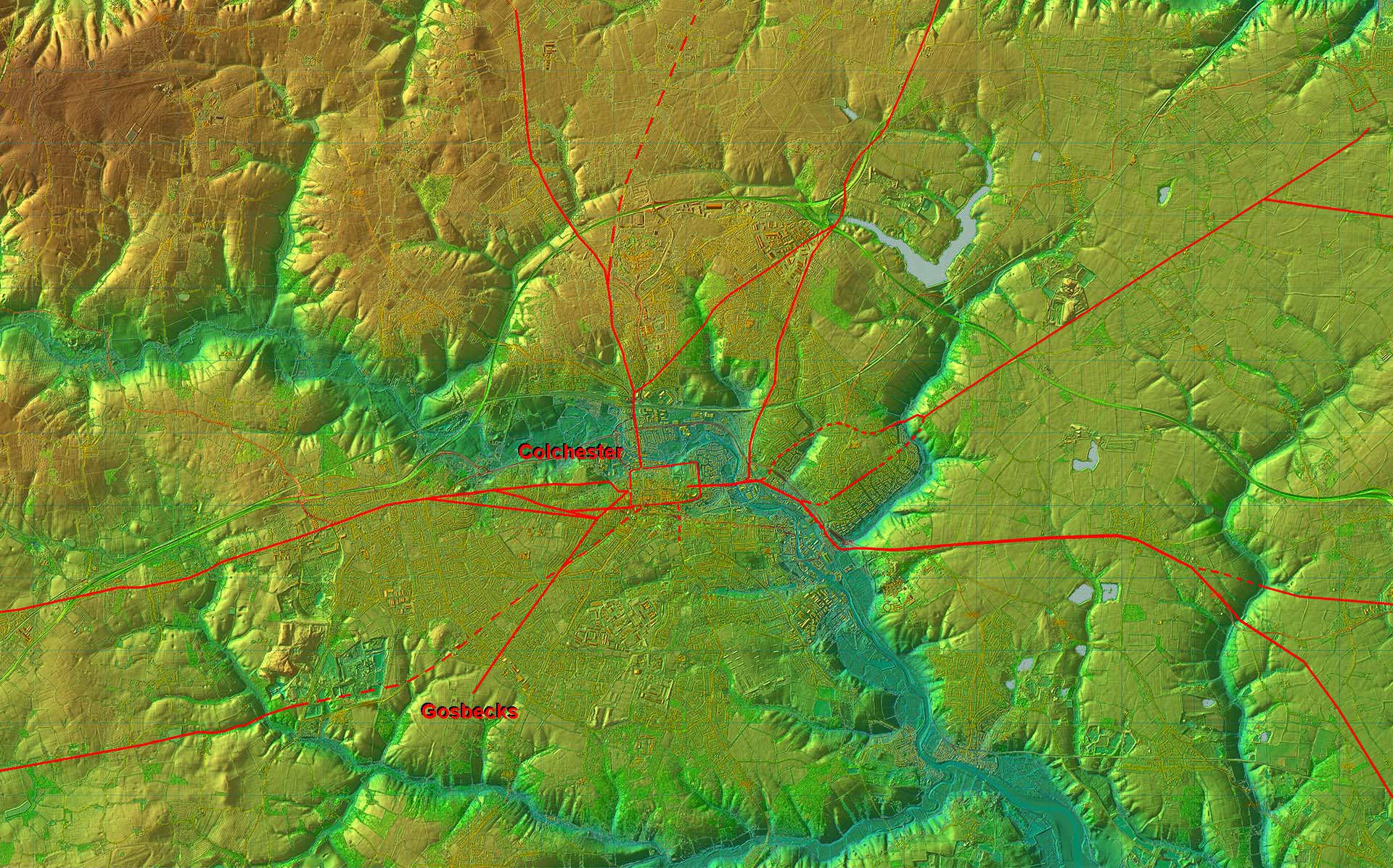
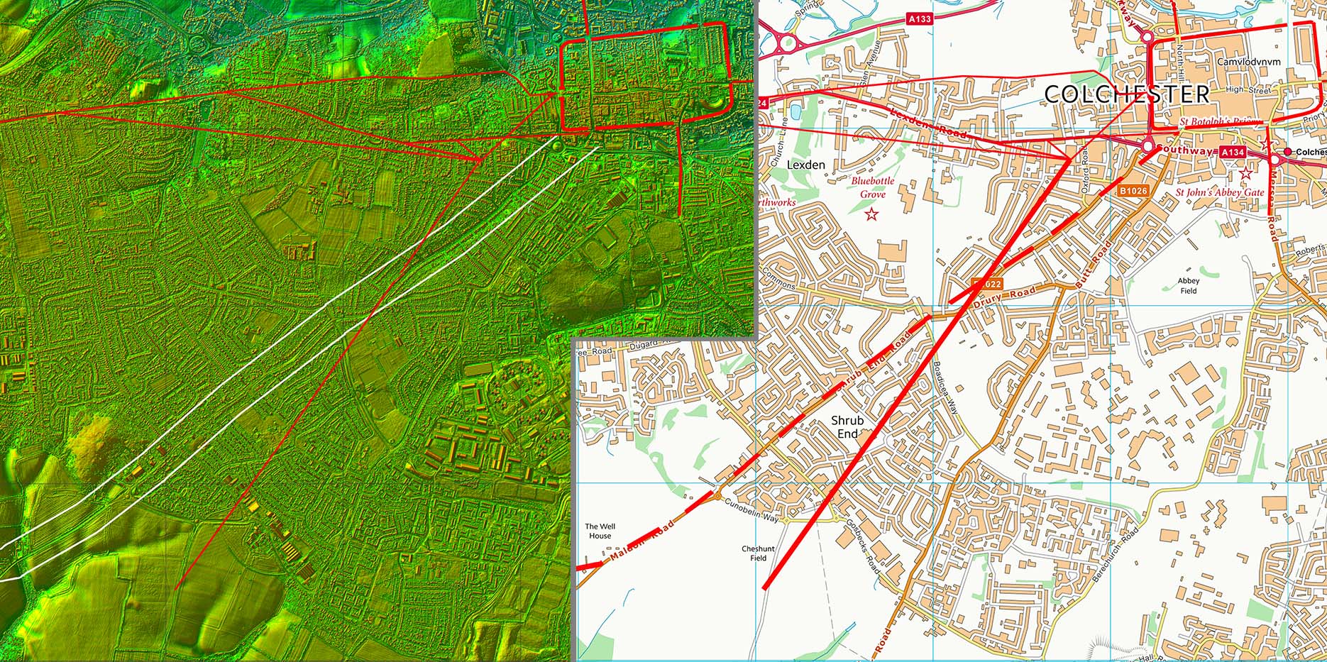
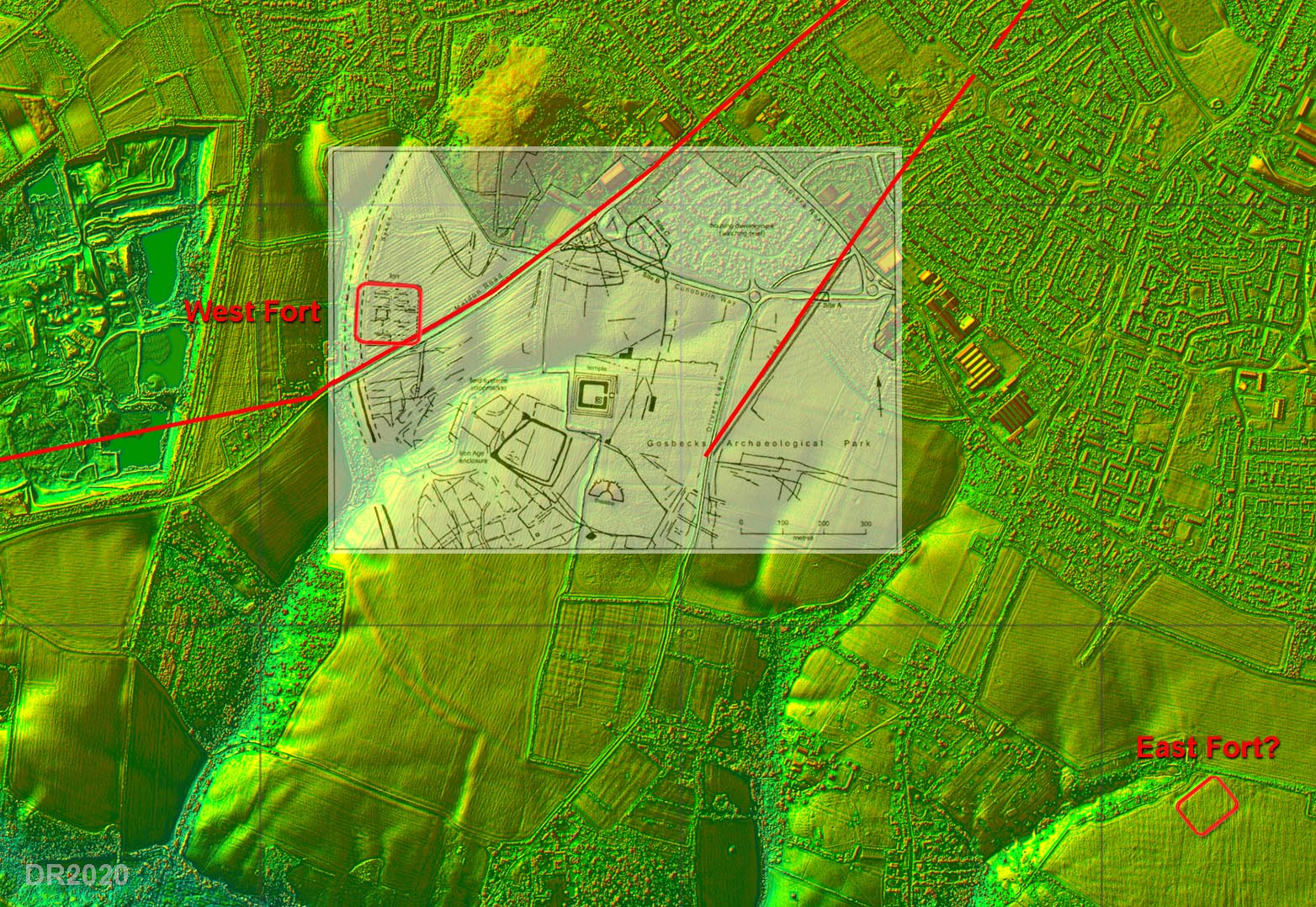
Roman Roads around Colchester - Lidar Image The location of the Gosbecks site is probably explained by this Lidar image. It is positioned centrally and on the high ground of an "island" bounded by the River Colne to the north and east plus the Roman River to the south. The only easy approach is from the west and this is where the famous defensive ditches were positioned. For the Roman city, a location on the banks of the River Colne must have been more important.. |
Click for larger view |
 |
Lidar Image and Route Map 1 Margary 320 was probably marked by Maldon Road, B1022 as it is aligned on the soth gate of the city but there is also a second road into the site from Colchester. |
Click for larger view |
 |
Gosbecks Site The site predates Roman Colchester but clearly continued on into the Roman era with a Temple and Theatre. It would appear to have been bounded by two Roman forts - one on the west and one on the east. The forts were likely to be very short lived as this was generally the case in East anglia. The inset plan is by Colchester Archaeological Trust (from CAT Report 127). It is derived from a magnetometry survey carried out by Dr Tim Dennis. If you visit the Archaeological Park, the sites of the Romano-British temple and Roman theatre marked on the grass with white lines. Note: the Trusts map is a bit unclear as to whether the road from Colchester continues beyond the site. |
Click for larger view |
 |
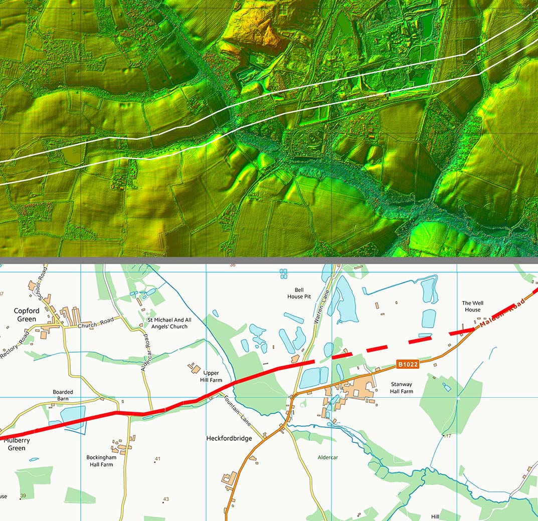
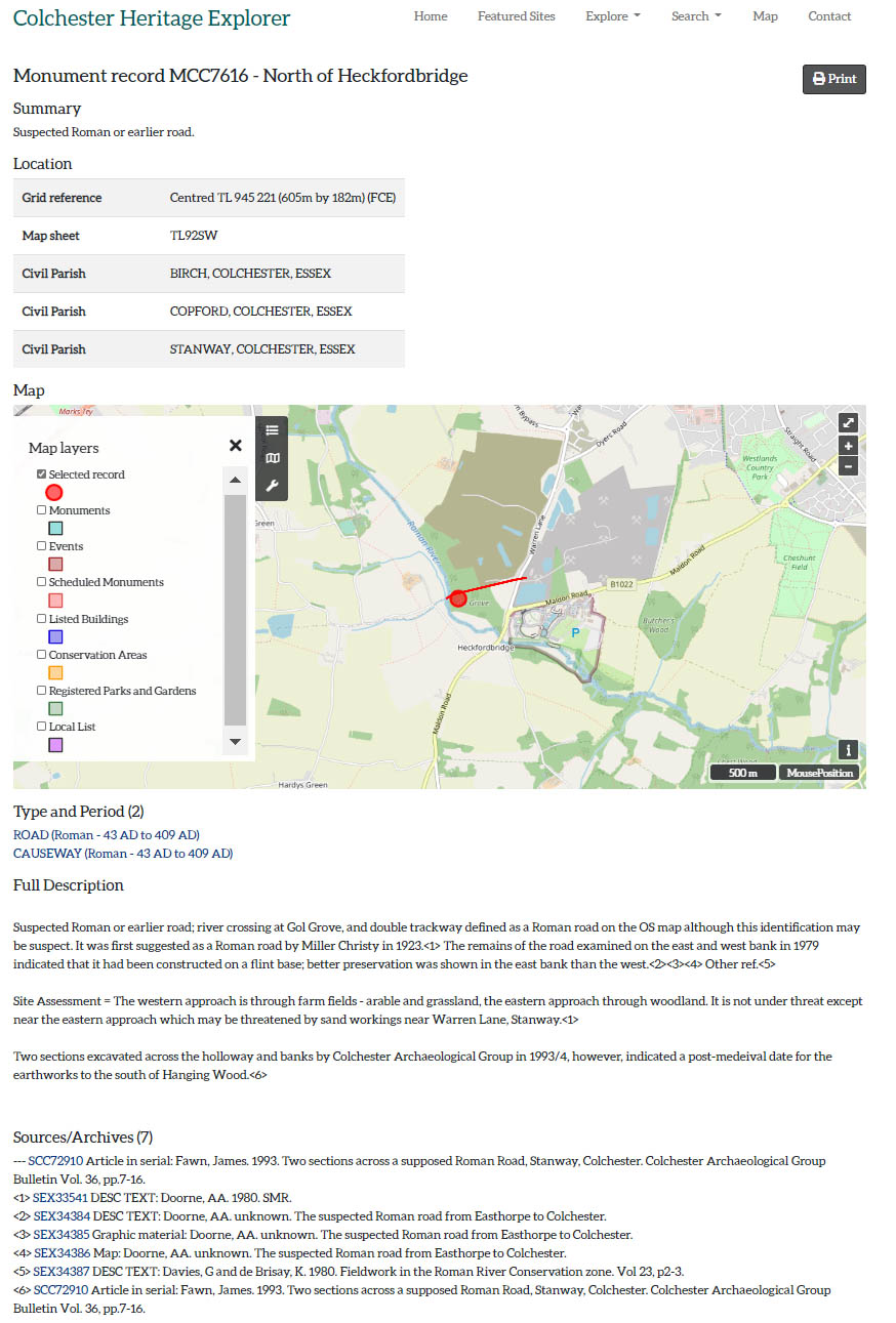
Lidar Image and Route Map 2 Beyond the Gosbecks site Margary 320 turns more westerly but is lost in the quarries. Evidence resumes at Roman River - an apt name if ever there was one. The route shown is perhaps supported by an entry in the Colchester HER and Lidar does show this too it appears more a hollow-way than an agger. |
Click for larger view |
 |
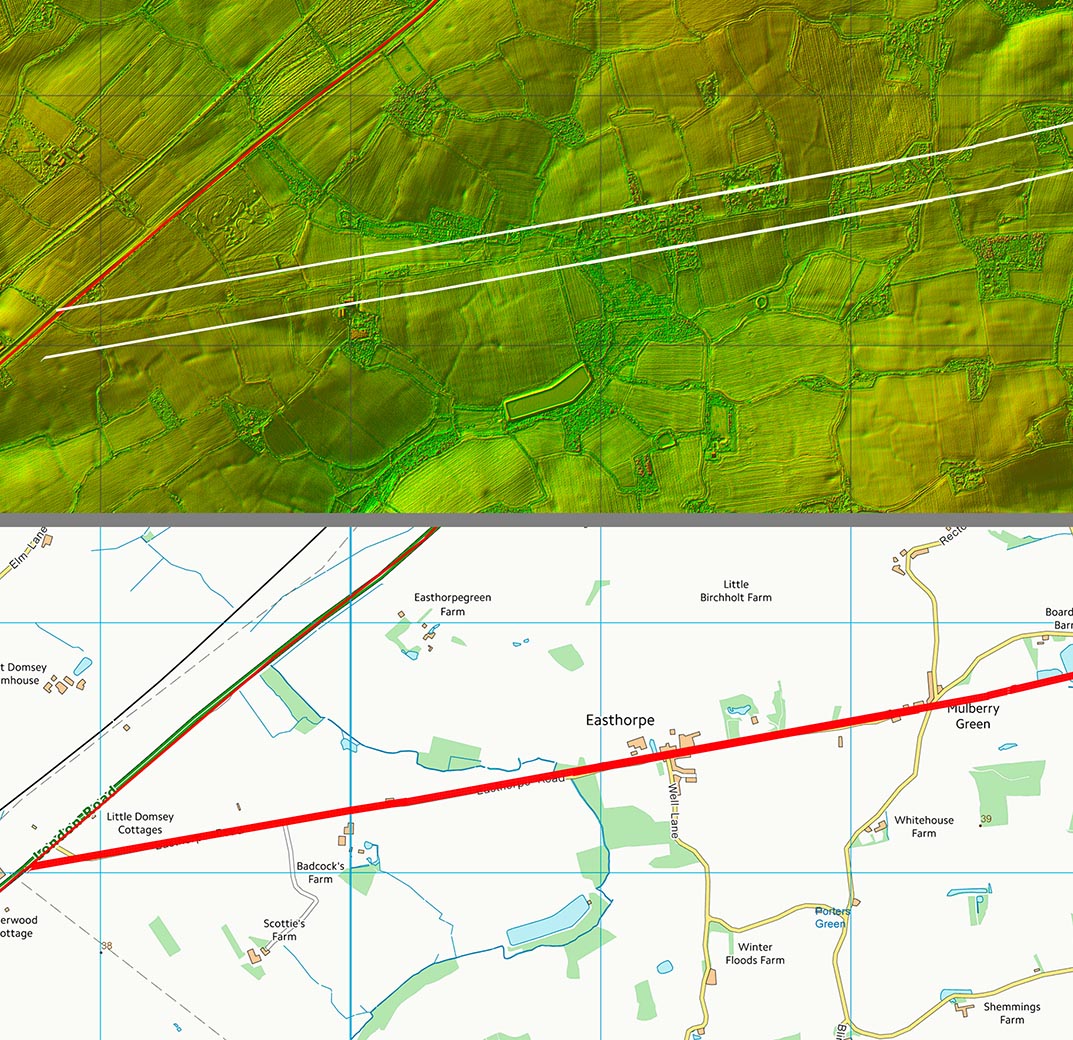
Lidar Image and Route Map 3 The last stretch follows Easthorpe Road before joining up with the main Colchester to Chelmsford Roman road.
Conclusion Margary 320 looks logical but in reality it really needs some confirmatory excavations |
Click for larger view |
 |
|
|
|
Last update: July 2020 |
© David Ratledge |