|
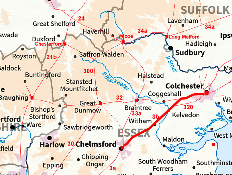
The Roman Road from Colchester to ChelmsfordMargary Number: 3bDistance: 20 miles Clearly the most important of Colchester's Roman roads emanating for the famous and impressive Balkerne Gate. There are perhaps two routes immediately west of the gate which would join up for the first alignment to Marks Tey. Here it changes direction for Chelmsford. The road passes through Kelvedon which believed to be the Roman settlement of Canonium.
|
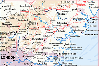
Historic Counties: Essex Current Counties: Essex HER: Essex
|
|
|
|
|
|
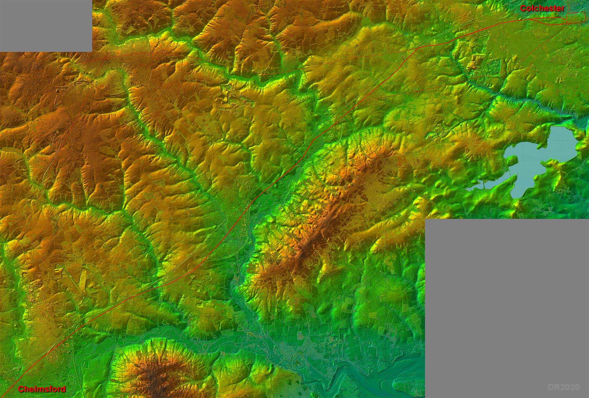
Lidar Image - Full Route The route of the road would suggest that the Roman road to Braintree was there first. Our road appears to branch off this at Marks Tey and only then takes aim for Chelmsford. |
Click for larger view
|
 |
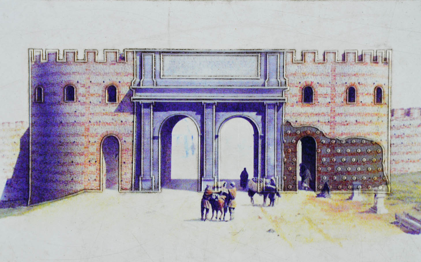
Colchester - Balkerne Gate Reconstruction drawing of the Balkerne Gate. Creative Commons Image - a 1st-century Roman gateway in Camulodunum, it is the largest surviving gateway in Roman Britain, Colchester, Great Britain (22915487469).jpg" by Carole Raddato from FRANKFURT, Germany is licensed under CC BY-SA 2.0. To view a copy of this license, visit https://creativecommons.org/licenses/by-sa/2.0 |
Click for larger view |
 |
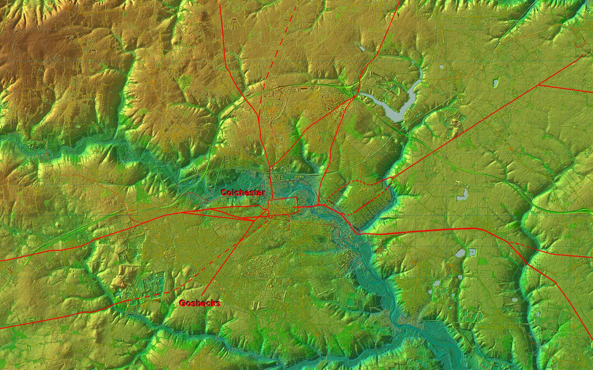
Roman Roads around Colchester - Lidar Image We can get some idea of just how important Colchester was in Roman times - routes from all directions converge on the city. |
Click for larger view |
 |
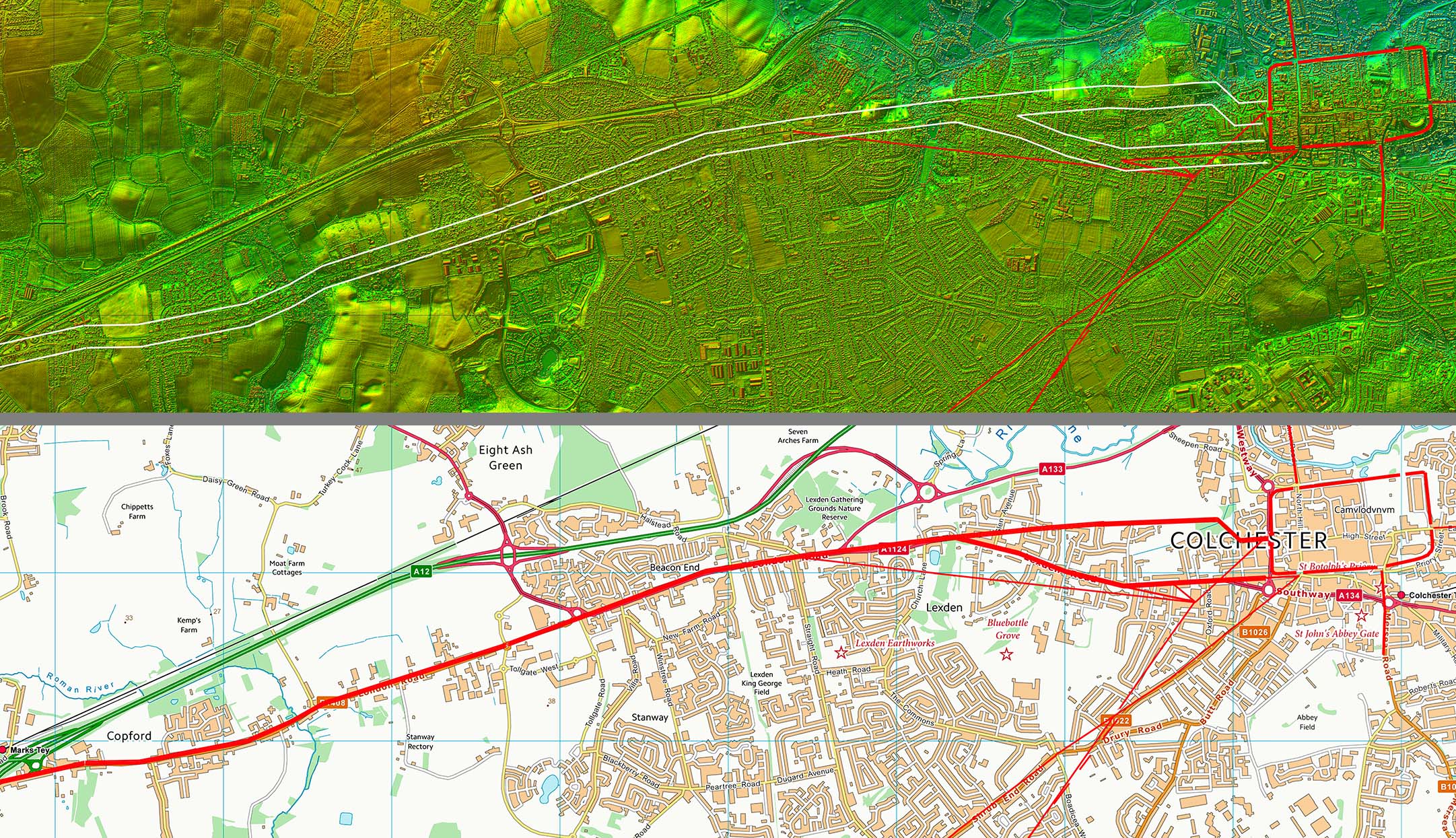
Lidar Image and Route Map 1 This is the common route as far as Marks Tey. The initial route was probably twinned as far as Lexden. |
Click for larger view |
 |
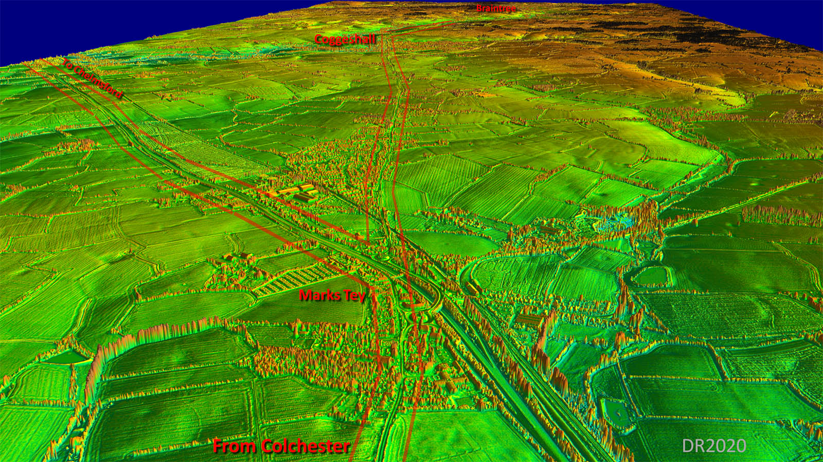
Oblique 3D Lidar Image - Marks Tey At Marks Tey is the important junction for Chelmsford to the left and Braintree straight on. This arrangement would seem to implay that the Braintree road was the earlier. |
Click for larger view |
 |
Lidar Image and Route Map 2 Our main alignment starts at Marks Tey. This arrangement would suggest that the first road to Colchester was from the Braintree direction ie Stane Street. |
Click for larger view |
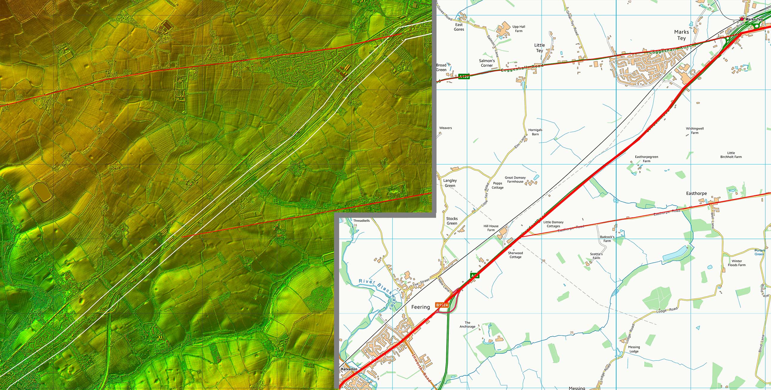 |
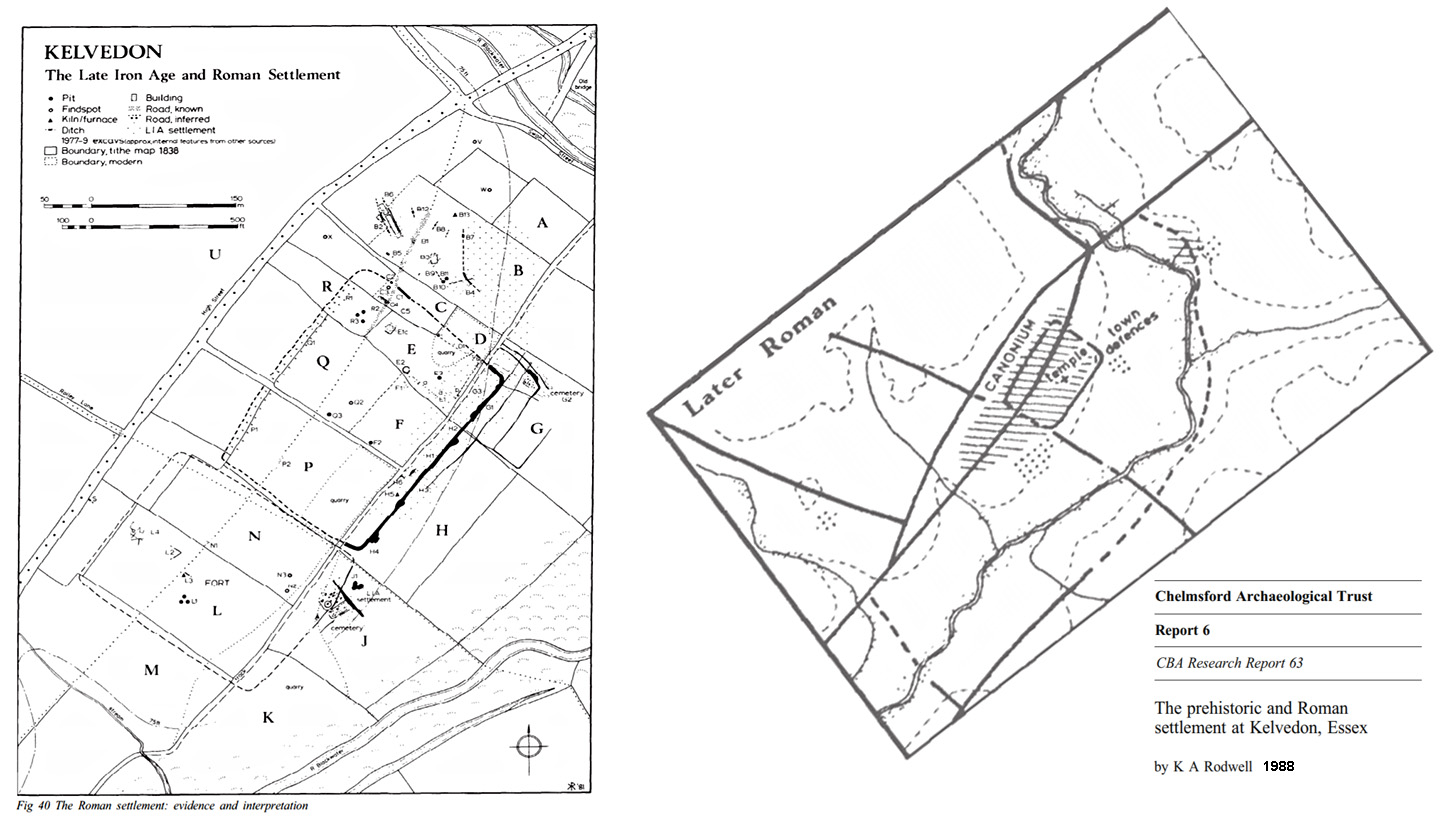
Kelvedon - K A Rodwell, 1988 The road passes through Kelvedon which was an important Roman settlement, almost certainly Canonium. The road arrangement (right) is taken from CBA Research Report 63, The prehistoric and Roman settlement at Kelvedon, Essex by K A Rodwell, poblished by the Chelmsford Archaeological Trust and the Council for British Archaeology. Rodwell shows the through route bypassing the settlement, which is served by its own road. |
Click for larger view |
 |
Lidar Image and Route Map 3 Our road now passes through Kelvedon which believed to be the Roman settlement of Canonium. There have been significant Roman finds there including a probable Mansio. However, the presence of an early fort is somewhat less certain. |
Click for larger view |
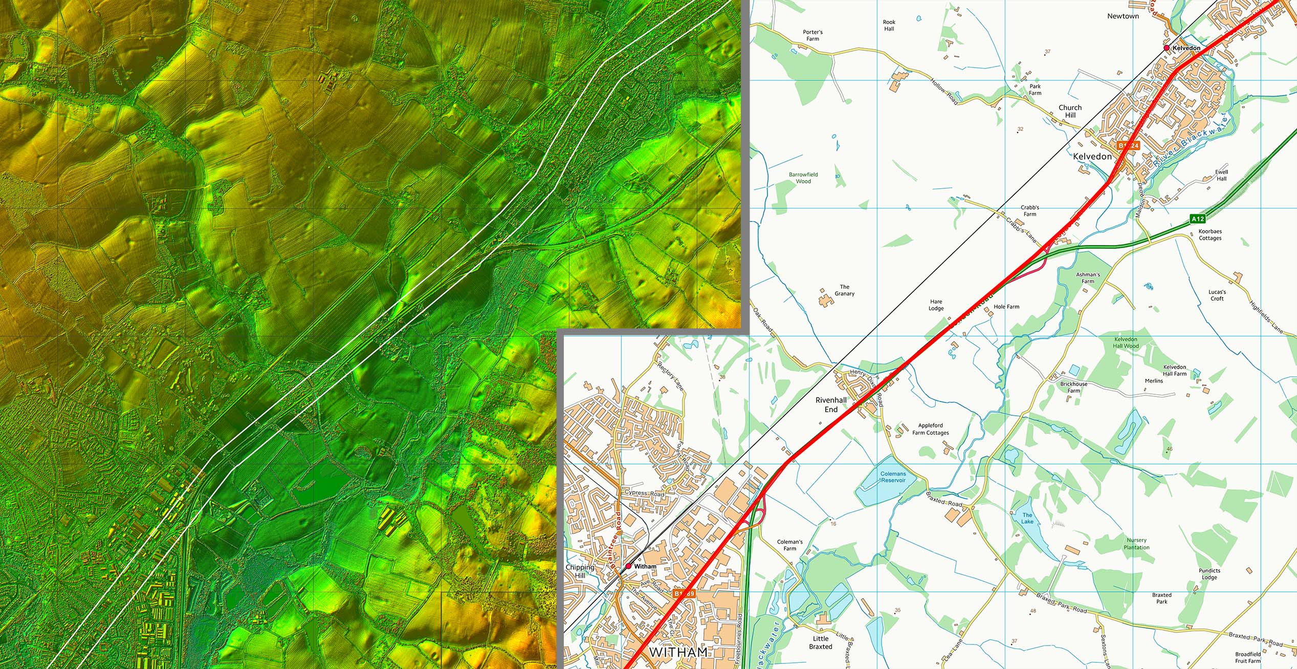 |
Lidar Image and Route Map 4 Between Witham and Hatfield there was change of direction on a high point (46m AOD). |
Click for larger view |
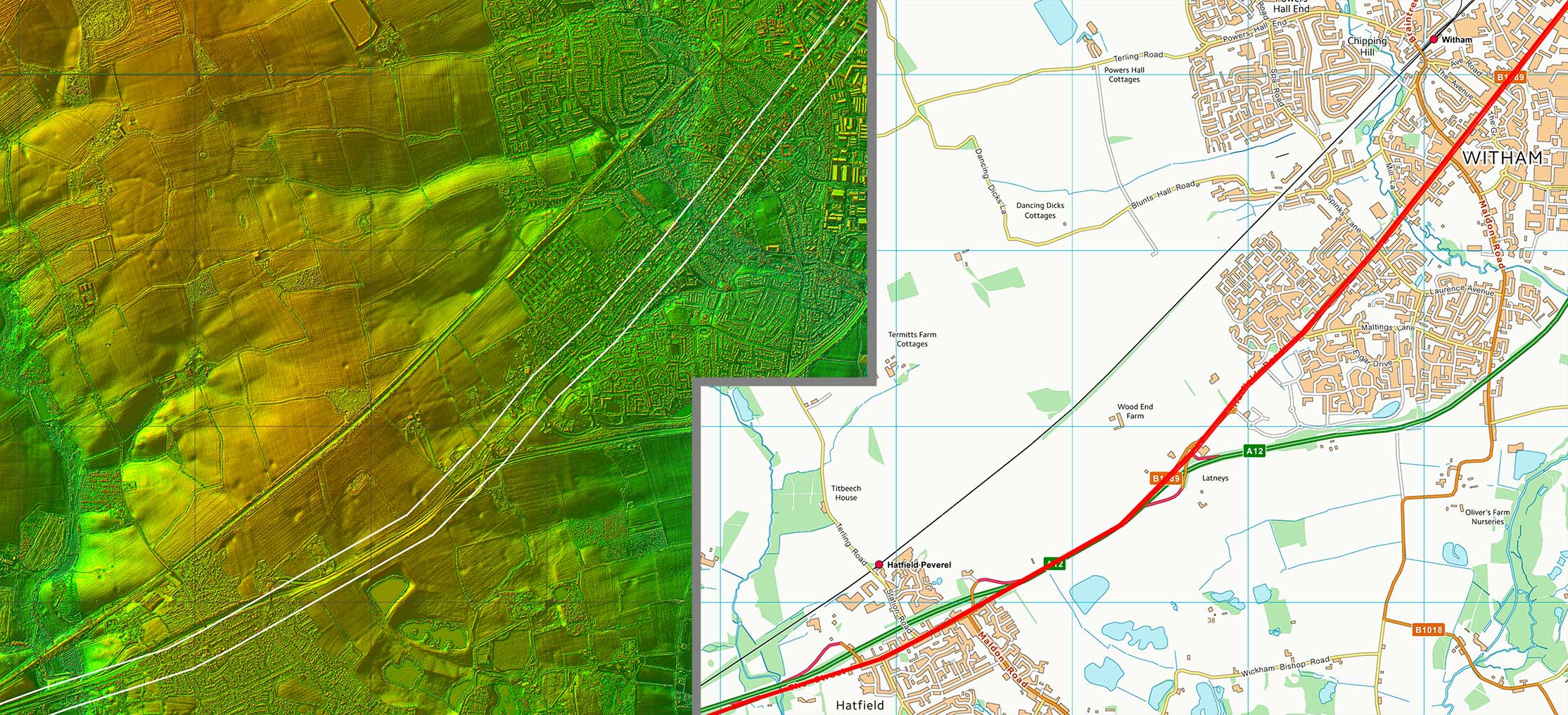 |
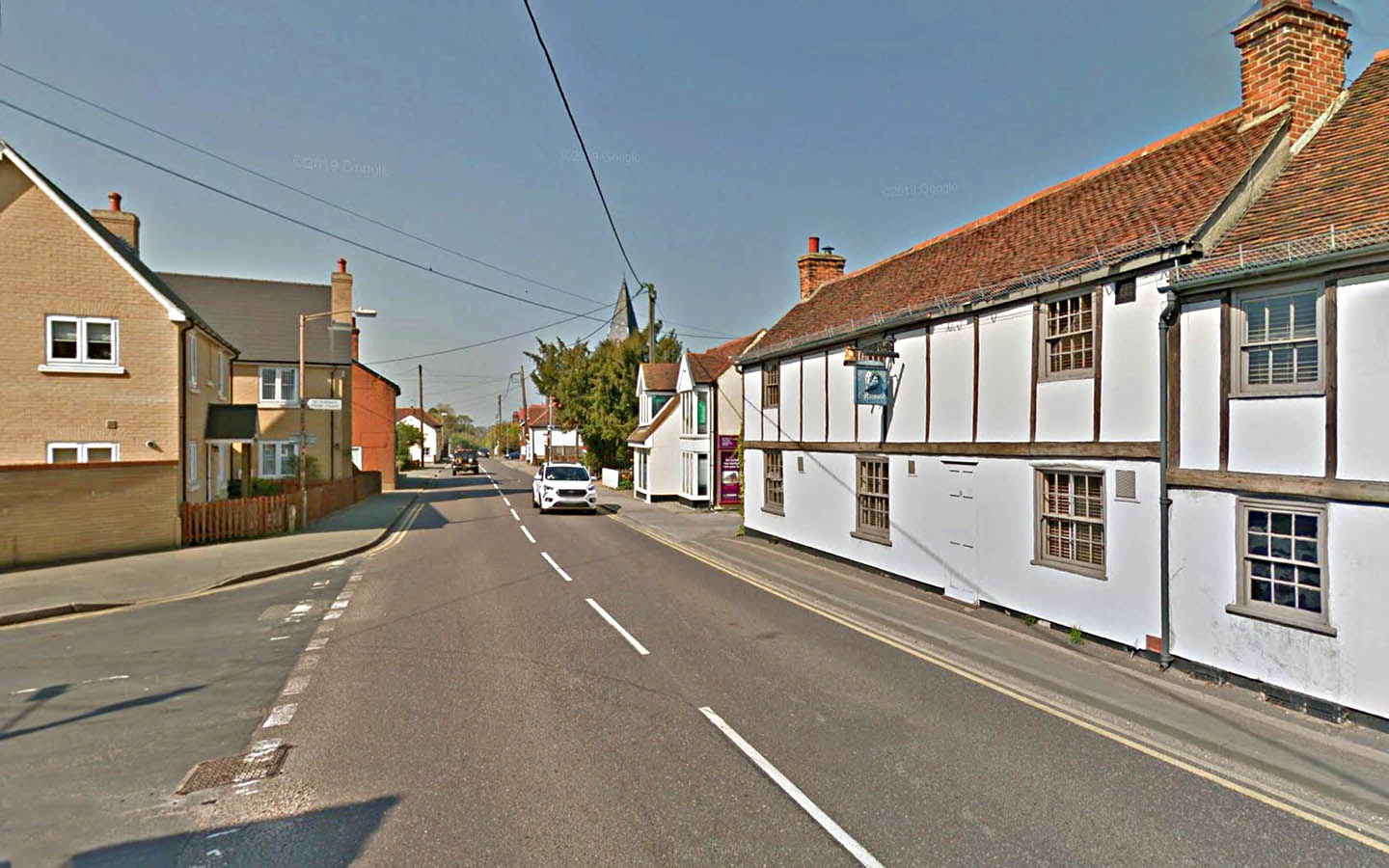
The Street, Hatfield Peverel Aptly named The Street as our road passes the Swan in Hatfield Peverel. |
Click for larger view |
 |
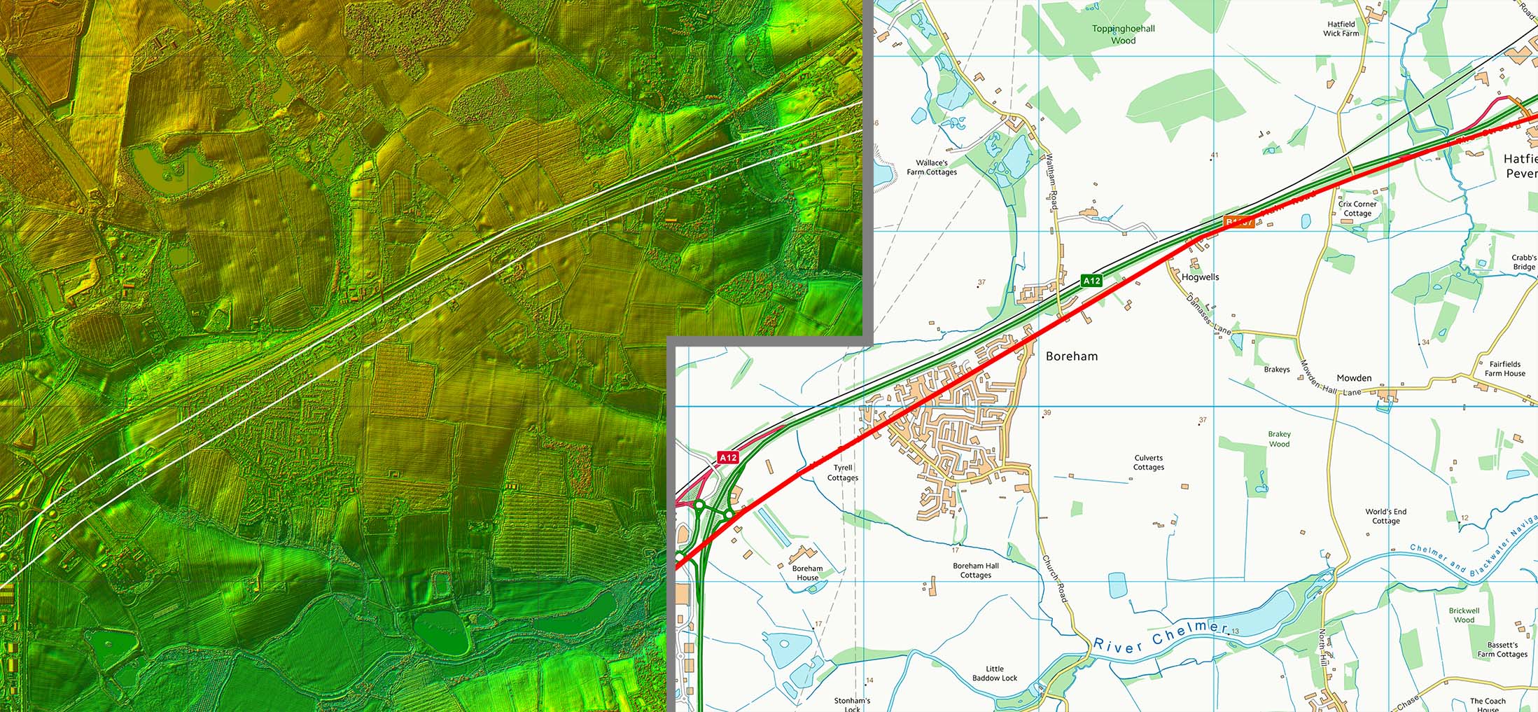
Lidar Image and Route Map 5 Straight-on through Boreham now thankfully bypassed |
Click for larger view |
 |
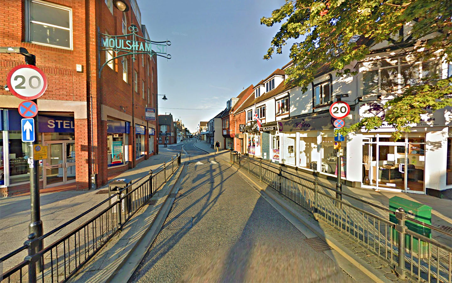
Moulsham Street, Chelmsford We enter the Roman town of Caesaromagus here at the start of Moulsham Street. No grand gate survives or even a blue plaque to mark the spot. |
Click for larger view |
 |
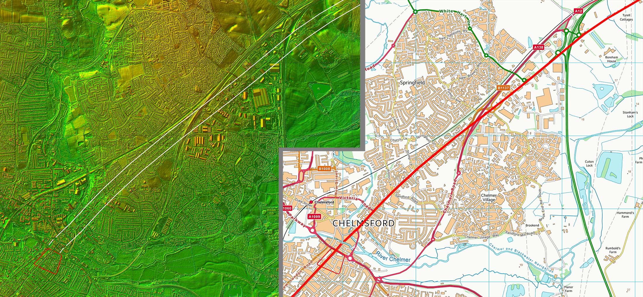
Lidar Image and Route Map 6 Chelmsford's Roman fort was built in AD 60 and a civilian town grew up around it. Its Roman name was Caesaromagus (Caesar's market), although the reason for it being given the great honour of bearing the Imperial prefix is now unclear. Did Caesar get this far in his aborted invasion?. The remains of a mansio lie beneath the streets of modern Moulsham, and the ruins of an octagonal temple are located beneath the Odeon roundabout (source wiki). |
Click for larger view |
 |
|
|
|
Last update: July 2020 |
© David Ratledge |