
|
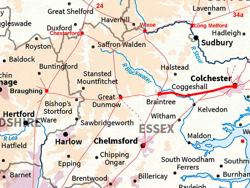
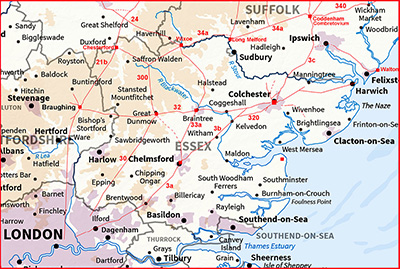
Stane Street - Colchester to BraintreeMargary Number: 32Distance: 14.75 miles Essex has its own Stane Street. This one runs from Colchester via Braintree and Great Dunmow to Braughing in Herfordshire. As this is the main route in and out of Colchester it would appear to be the earliest road to Colchester. There was a minor Roman settlement at Coggeshall.
|
Historic Counties: Essex Current Counties: Essex HER: Essex
|
|
|
|
|
|
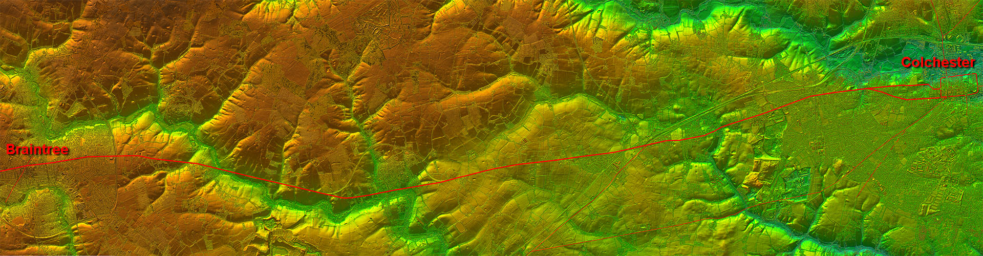
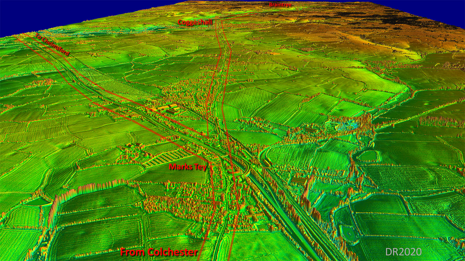
Lidar Image - Full Route The first alignment was on Coggeshall, or just past it, where it makes a turn for the cross roads and settlement in Braintree. |
Click for larger view
|
 |
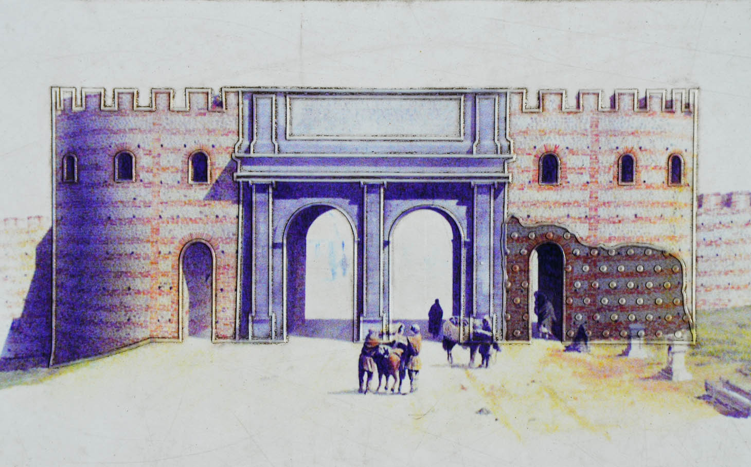
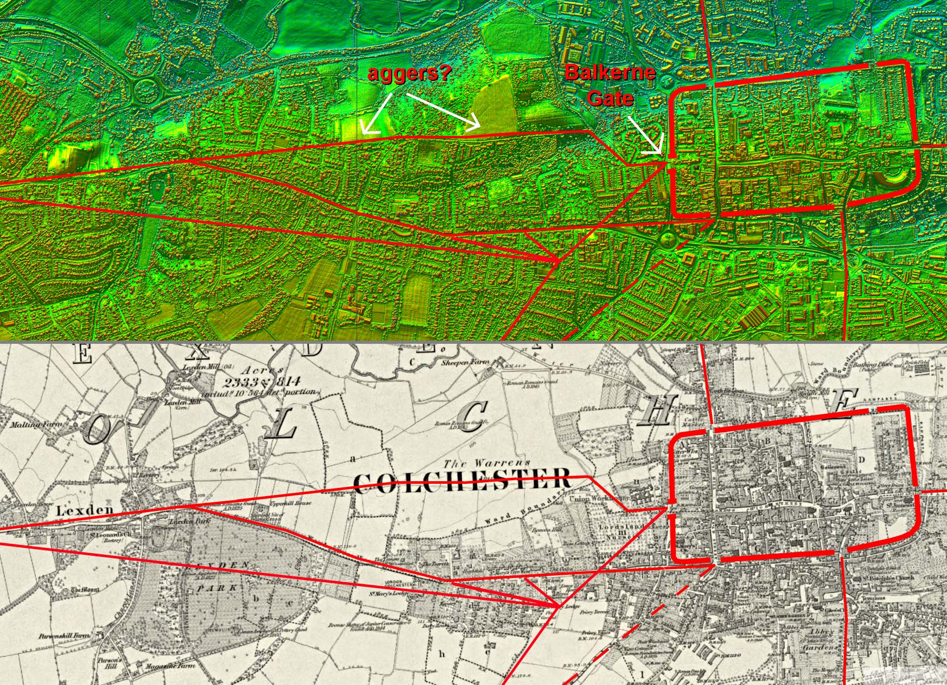
Colchester - Balkerne Gate Obviously meant to impress.The gateway originally had four arches, 2 for the main road and 2 separate arched footways on either side. The surviving gateway which we can see today is the south-side arched footway; however, the remains of a guard tower are also visible. The gate consisted of two broad carriageways, each 17 ft (5.2 m) wide, flanked by two footways, each about 6 ft (1.8 m) wide. The whole gate projects 30 ft (9.1 m) in front of the town wall, and the total extent of the frontage is 107 ft (33 m). Reconstruction drawing of the Balkerne Gate Creative Commons Image: a 1st-century Roman gateway in Camulodunum, it is the largest surviving gateway in Roman Britain, Colchester, Great Britain (22915487469).jpg" by Carole Raddato from FRANKFURT, Germany is licensed under CC BY-SA 2.0. To view a copy of this license, visit https://creativecommons.org/licenses/by-sa/2.0 |
Click for larger view |
 |
Balkern Gate Routes - Lidar & OS First Edition Map The Balkerne was obviously the main entrance and yet none of the main roads seem to be aimed directly at it. The road system west of the city is extremely complex and this map is based on those recorded in the Colchester HER plus some that look likely. That meeting point south-west of the city is very strange. |
Click for larger view |
 |
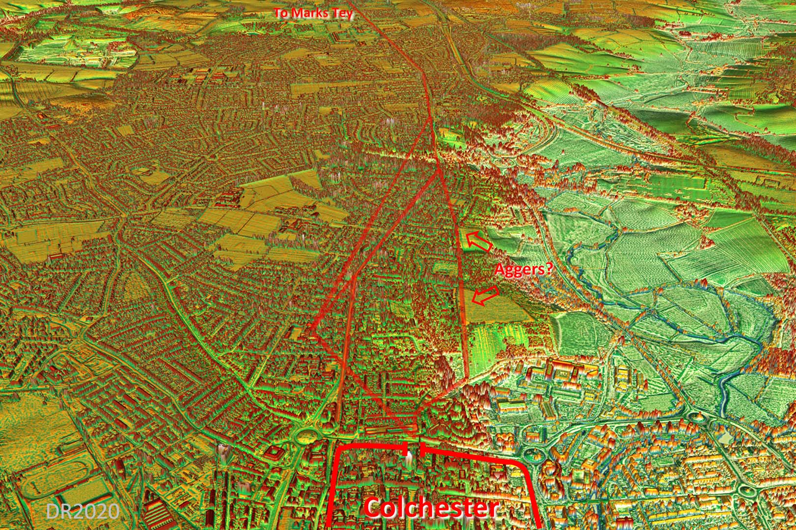
Oblique 3D Lidar- Colchester looking West Untangling which of the complex pattern of roads was the main road(s) west is no easy matter!.Directly west of the Balkerne Gate is a little valley which would appear the road(s) avoided. The original(?) direct road would most lilely ahve kept to the high ground. If the road predated the Balkerne Gate then perhaps it was aligned on an earlier gate's location. When the prestigious Balkern Gate was constructed the road needed a dog-leg to reach it. |
Click for larger view |
 |
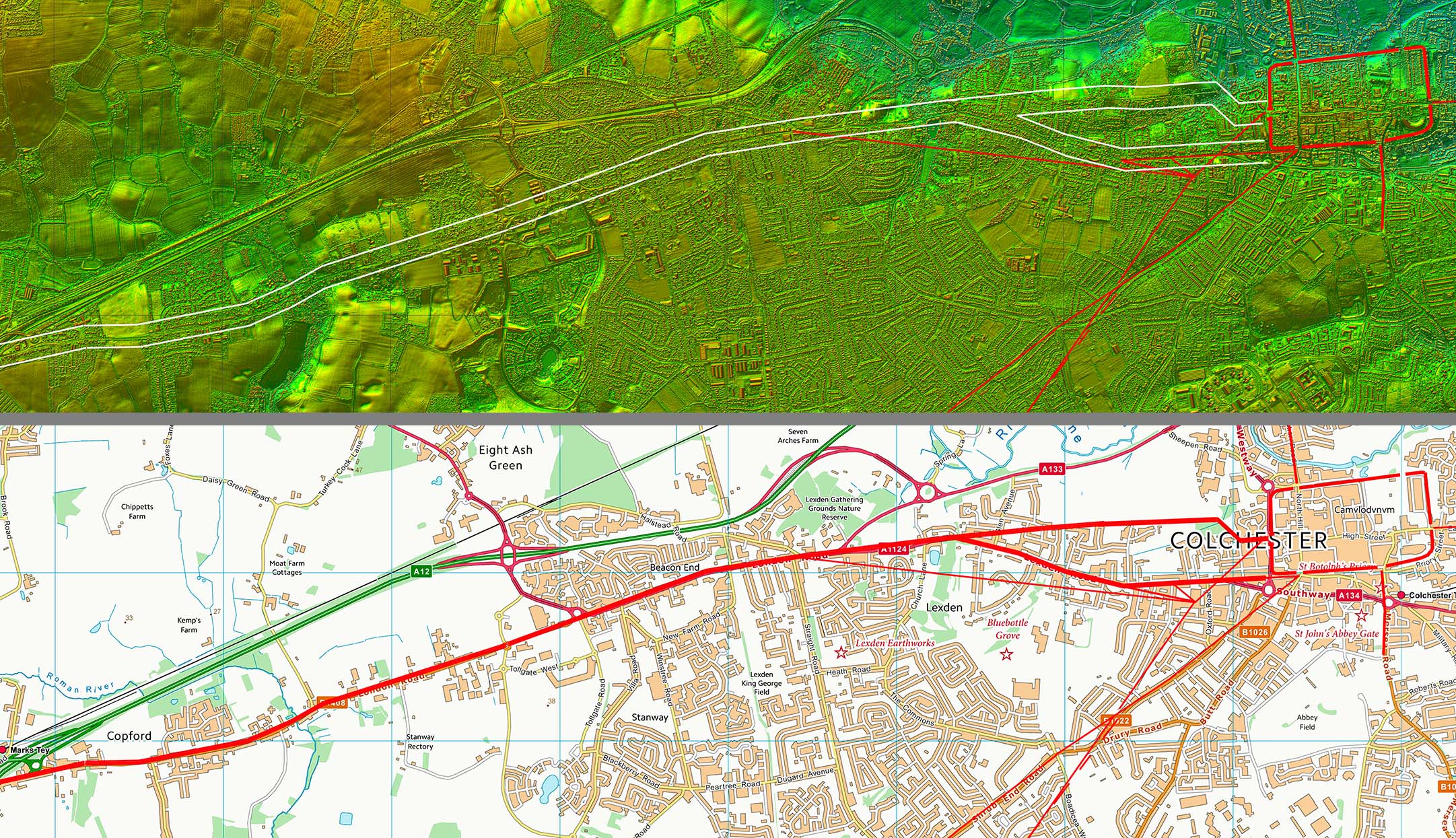
Lidar Image and Route Map 1 This is the common route as far as Marks Tey. The initial route at the Colchester end was probably twinned as far as Lexden. |
Click for larger view |
 |
Oblique 3D Lidar Image - Marks Tey At Marks Tey is the important junction for Chelmsford to the left and Braintree straight on. This arrangement would seem to implay that the Braintree road was the earlier. |
Click for larger view |
 |
Lidar Image and Route Map 2 From Marks Tey the alignment continues to just beyond Coggeshall. |
Click for larger view |
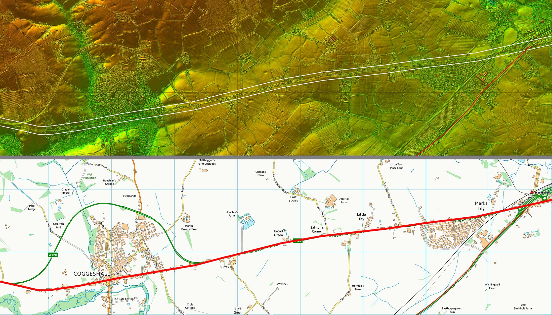 |
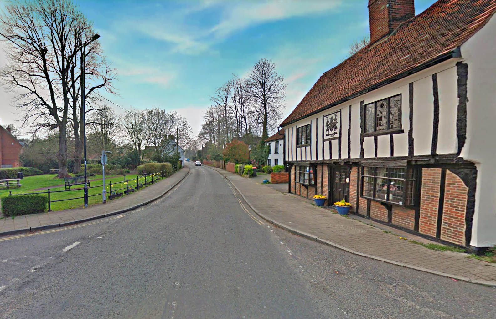
Coggeshall - West Street Our road runs through the centre of Coggeshall and out via West Street. There was a small Roman settlement at Coggeshall. The Cottage date is 1560. Image: Google |
Click for larger view |
 |
Lidar Image and Route Map 3 A final slight change of alignment around Ballaglas Cottage. |
Click for larger view |
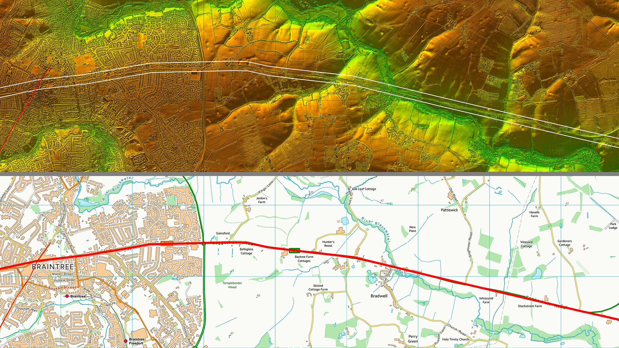 |
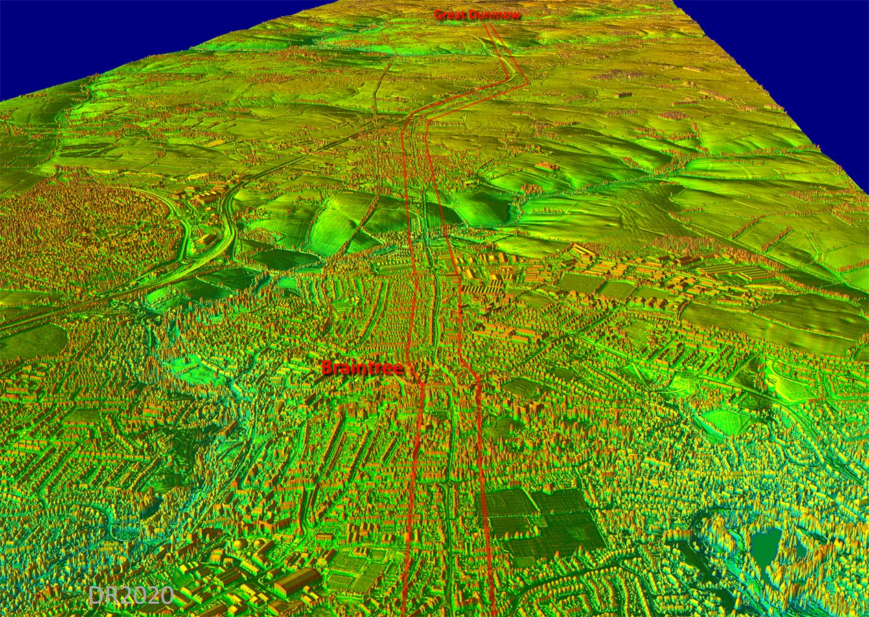
Oblique 3D Lidar Iamge - Braintree Braintree was an important Roman crossroads and settlement. |
Click for larger view |
 |
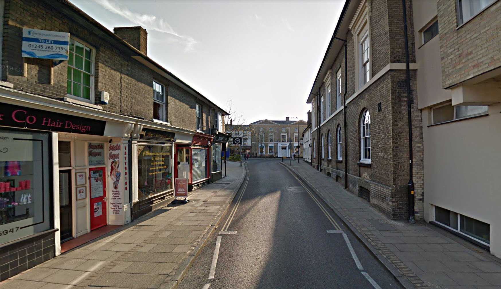
Coggeshall Street - Braintree The Roman road enters Braintree via Coggeshall Street. Today the route ahead is blocked but the Roman line went straight on here. |
Click for larger view |
 |
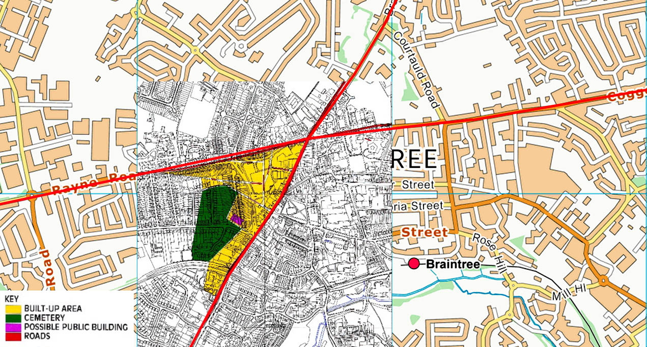
Braintree Historic Town Map (Roman Period) The Roman period plan from the Essex Historic Towns Survey overlaid on a modern map. The cemetery location is a little odd - they were almost invariably located alongside roads. |
Click for larger view |
 |
|
|
|
Last update: October 2020 |
© David Ratledge |