
|
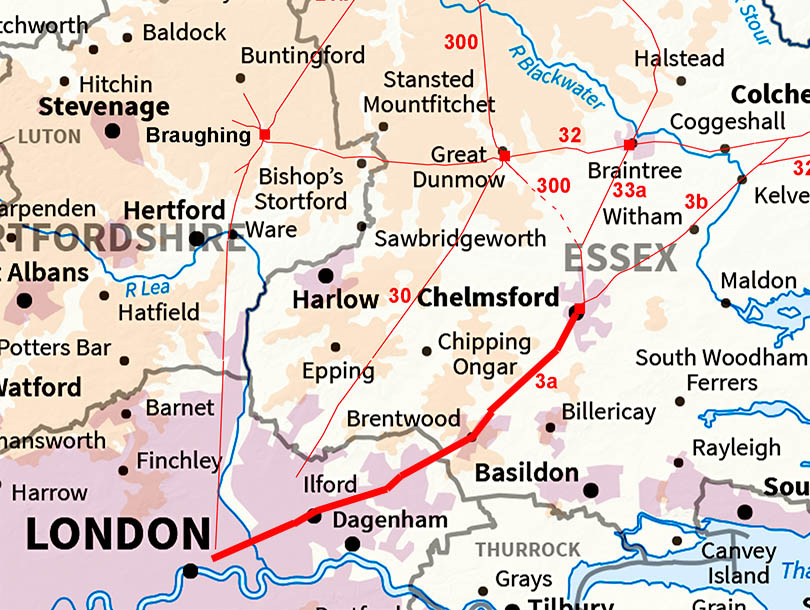
The Roman Road from Chelmsford to LondonMargary Number: 3aDistance: 31 miles Margary refers to this as "The Great Road" and as it linked Colchester and Caistor St Edmund to London it is perhaps a justified description. Both the Antonine Itineraries V and IX follow this road. We will follow it as far as the M25 just beyond Brentwood, the current Essex county boundary. Several sections are marked as Roman Road on current OS maps.
|
Historic Counties: Essex Current Counties: Essex & Greater London HER: Essex & Greater London
|
|
|
|
|
|
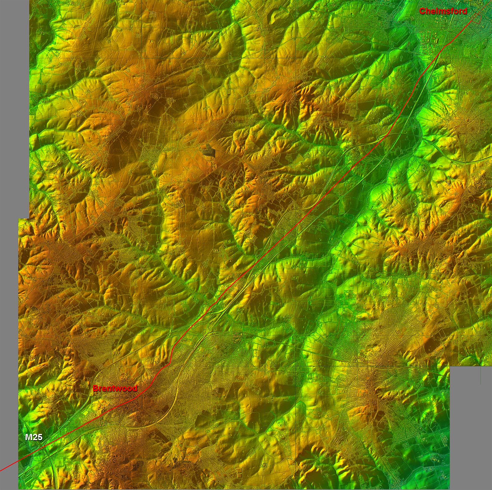
Lidar Image - Full Route The Essex section is ostensibly 4 main alignments although there are the usual adjustments here and there. The first half keeps out of the Wid valley and the second half heads for the high ground at Brentwood. |
Click for larger view
|
 |
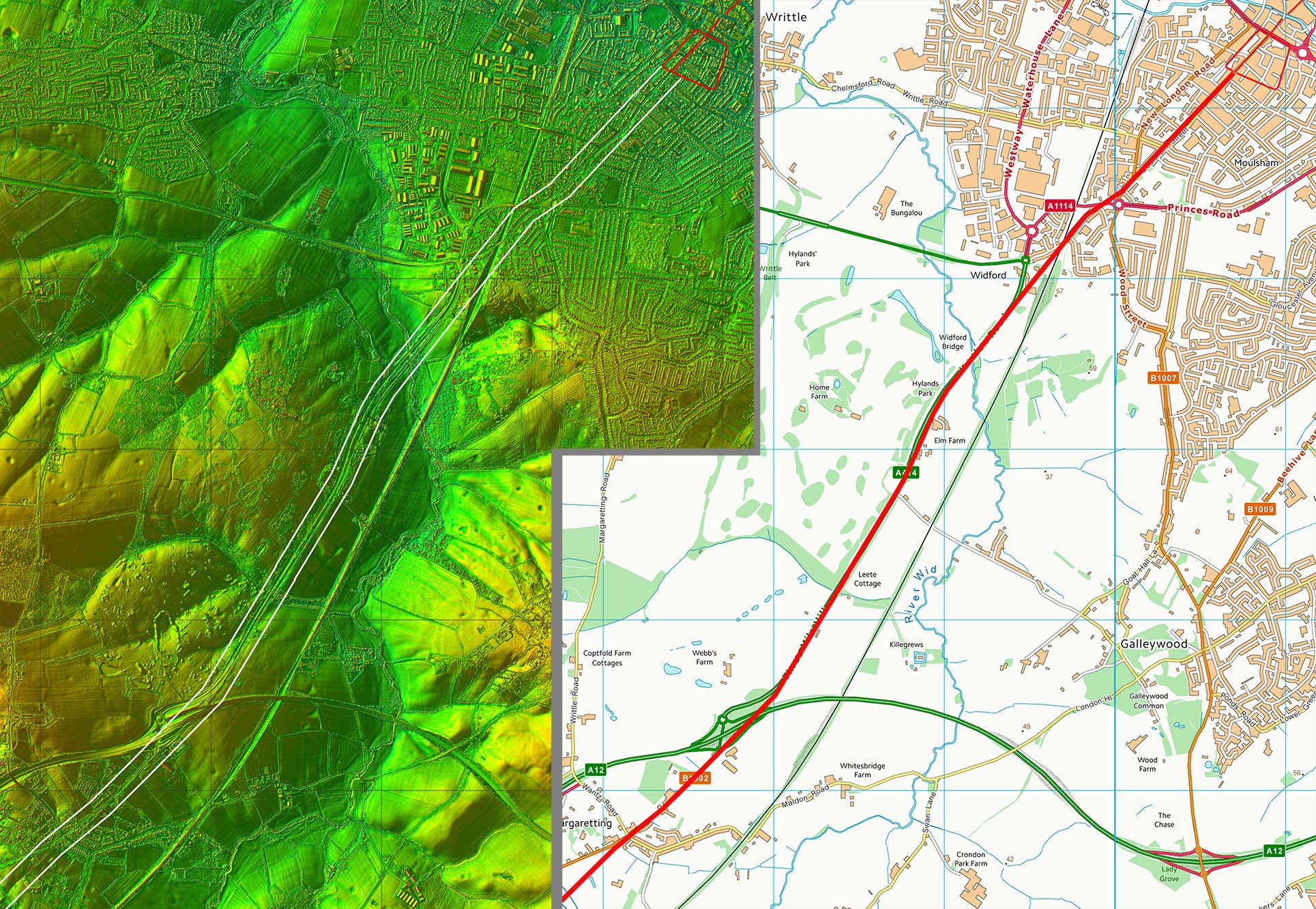
Lidar Image and Route Map 1 Our route from the Roman settlement in Chelmsford is along Moulsham Street and Widford Road. For such an important road there would have been abridge over the River Wid - the name Widford would derive from long after the Roman bridge had gone. |
Click for larger view |
 |
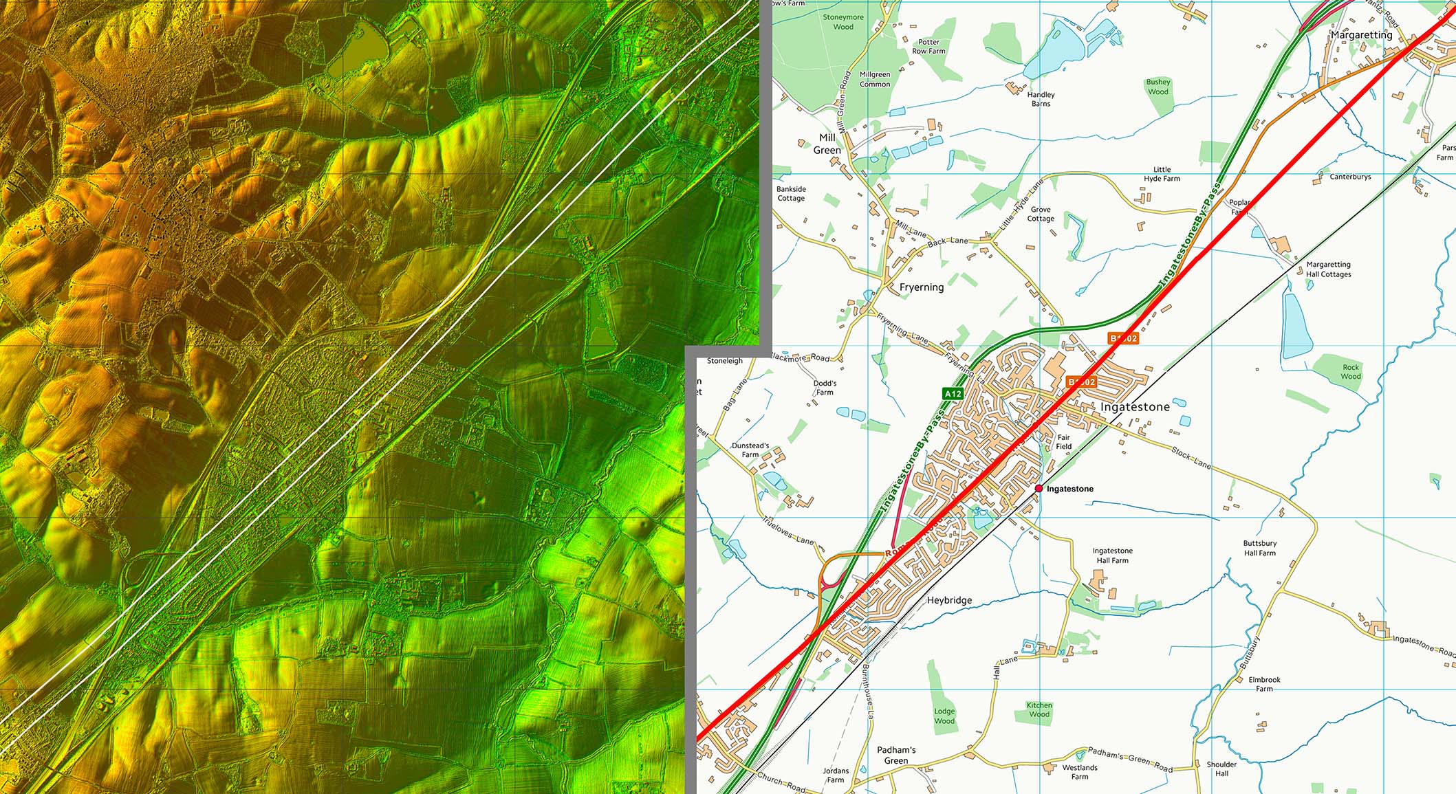
Lidar Image and Route Map 2 South of Margaretting I have shown the Roman line taking a direct line away from the old Main Road (B1002) heading to Ingatestone. There is some Lidar evidence for this - see below. |
Click for larger view |
 |
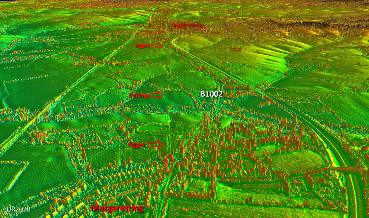
Oblique 3D Lidar Image - Margaretting The Roman alignment would surely have continued straight on and there is some evidence to support this. On balance I would think this was the most likely course here. |
Click for larger view |
 |
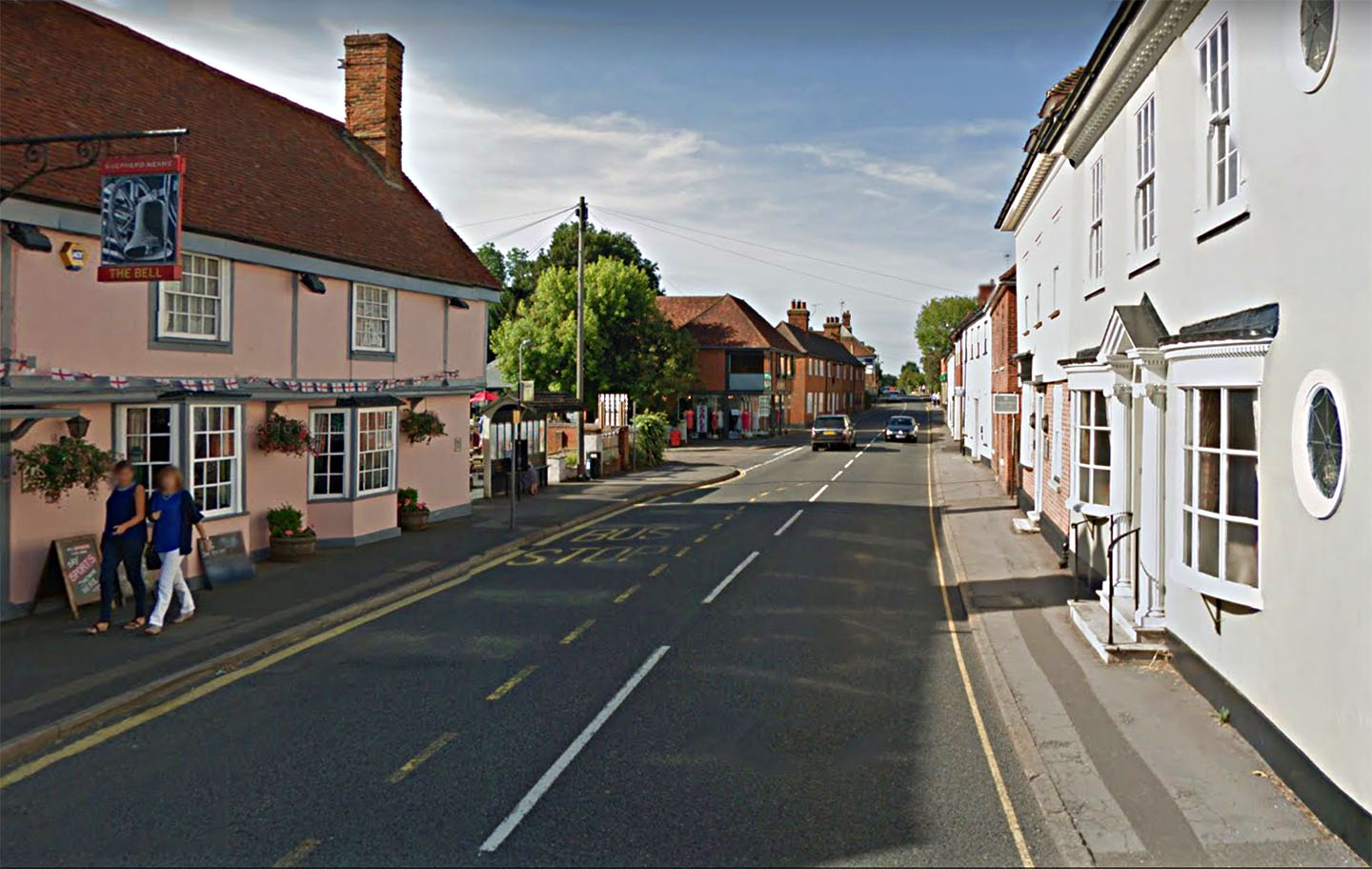
Ingatestone, B1002 Our road runs straight through Ingatestone, here passing the Bell Inn. |
Click for larger view |
 |
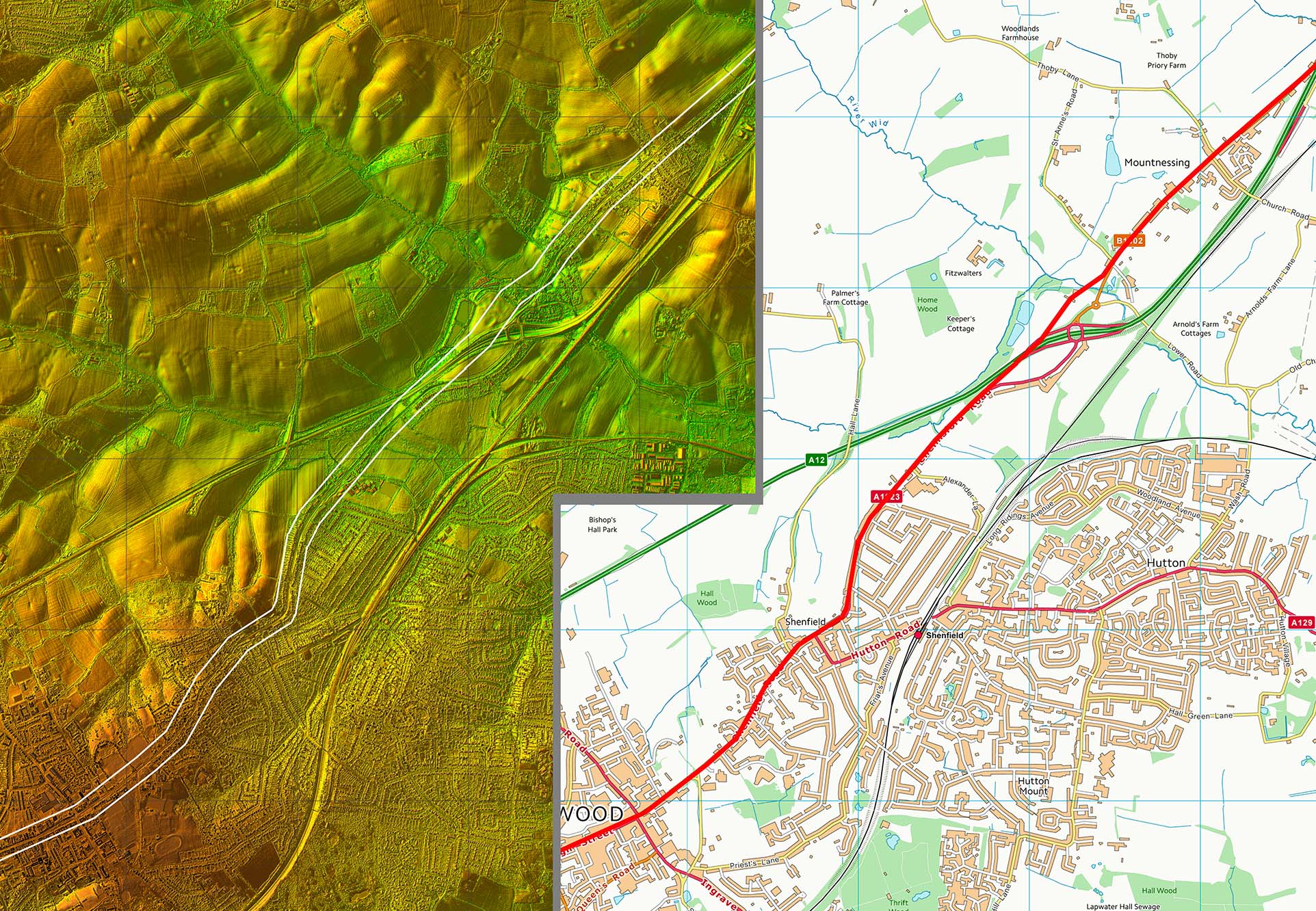
Lidar Image and Route Map 3 Heading into Brentwood then our road does appear to have deviated considerably from its usual straight alignment. Lidar does show the hilly terrain so this was probably the reason. |
Click for larger view |
 |
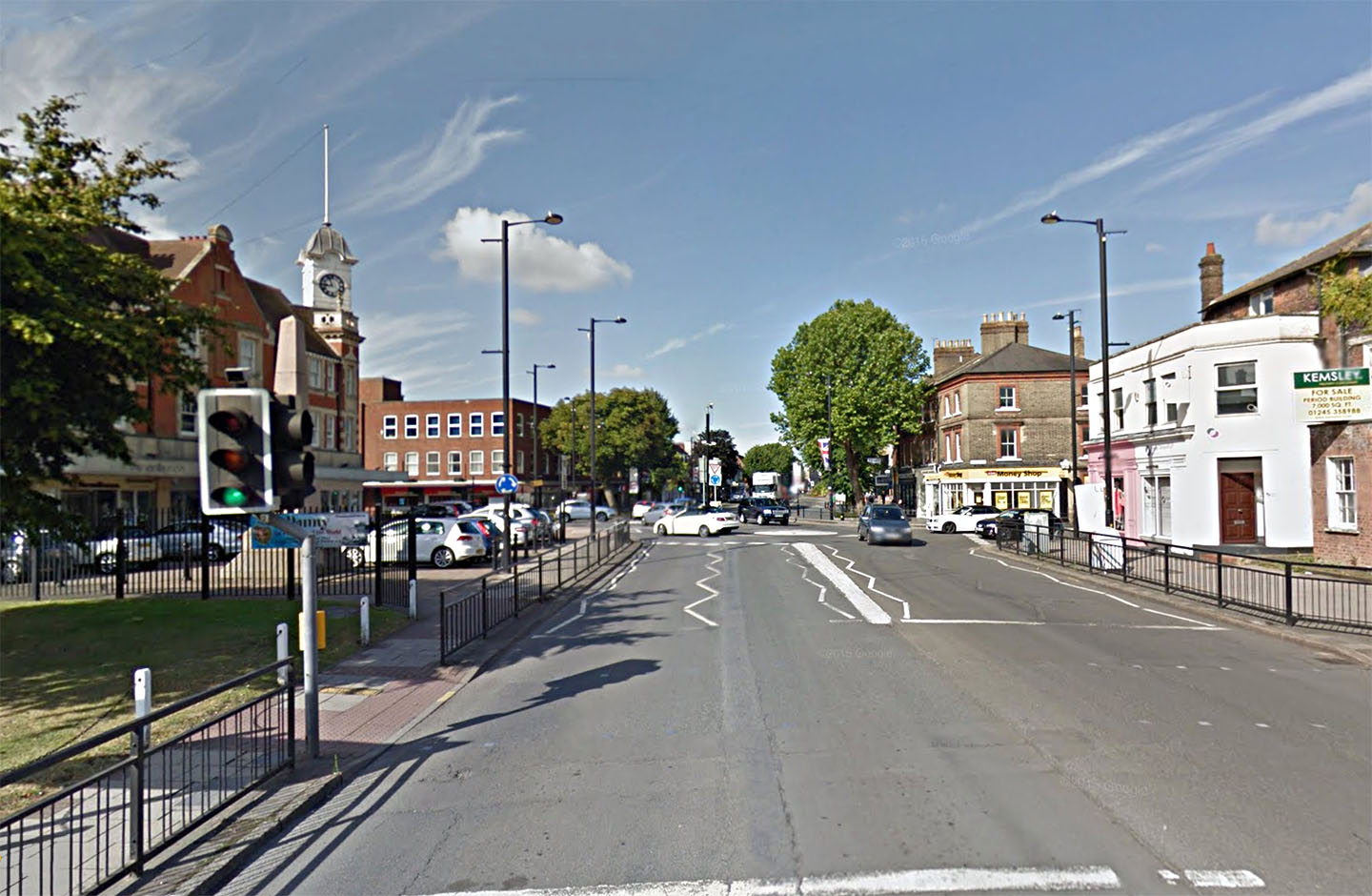
Brentwood The Roman line was through the middle of Brentwood. |
Click for larger view |
 |
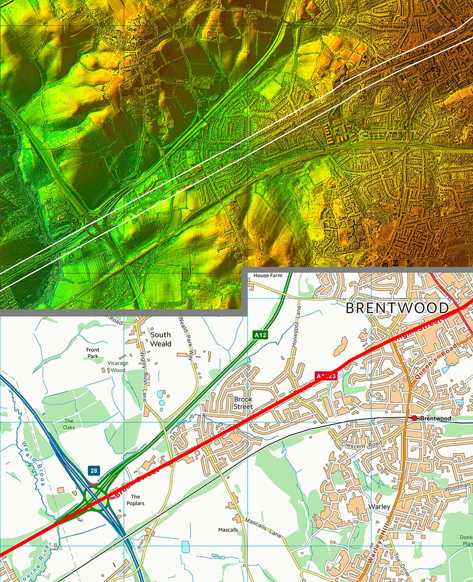
Lidar Image and Route Map 4 From the centre of Brentwood normality resumes and a very straight alignment takes our road over the county boundary. |
Click for larger view |
 |
|
|
|
Last update: July 2020 |
© David Ratledge |