|
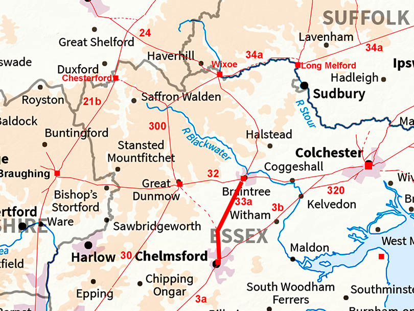
The Roman Road from Braintree to ChelmsfordMargary Number: 33aDistance: 11.2 miles The alignment north of Braintree is continued south as far as Little Waltham where it turns south to keep to the west side of the River Chelmer valley. |
Historic Counties: Essex Current Counties: Essex HER: Essex
|
|
|
|
|
|
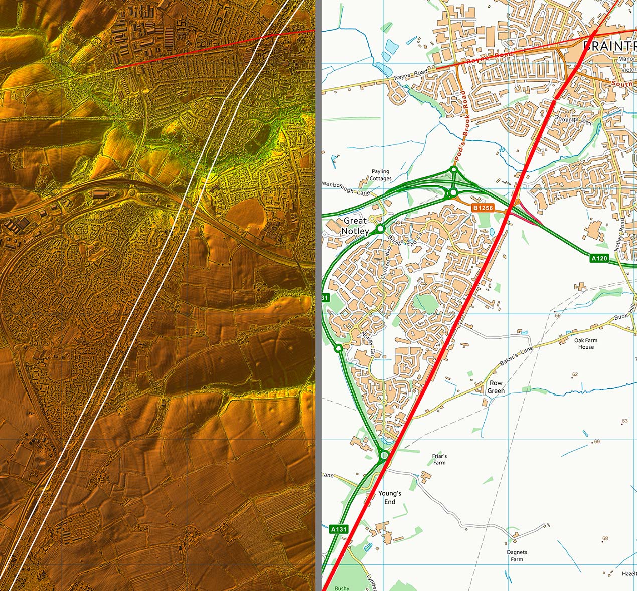
Lidar Image - Full Route The alignment would possibly make most sense it it were joining an existing road from Great Dunmow to Chelmsford. However, that road is proving elusive. |
Click for larger view
|
 |
London Road, Braintree We head out of Briantree down London Road - leaving no doubt as to the ultimate destination of our Roman road although we will follow it just to Chelmsford. |
Click for larger view |
 |
Lidar Image and Route Map 1 Virtually straight apart from a little wobble to negotiate the River Brain valley. |
Click for larger view |
 |
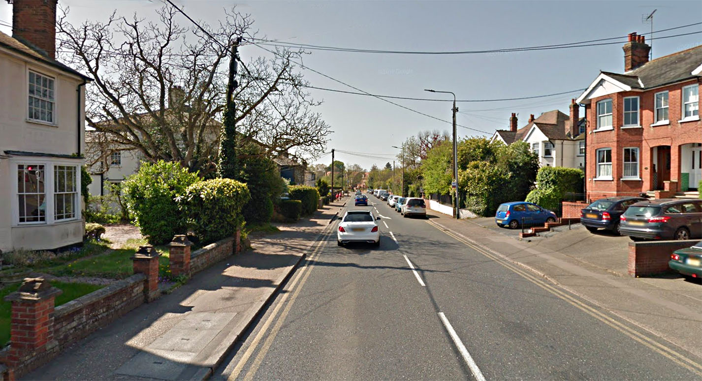
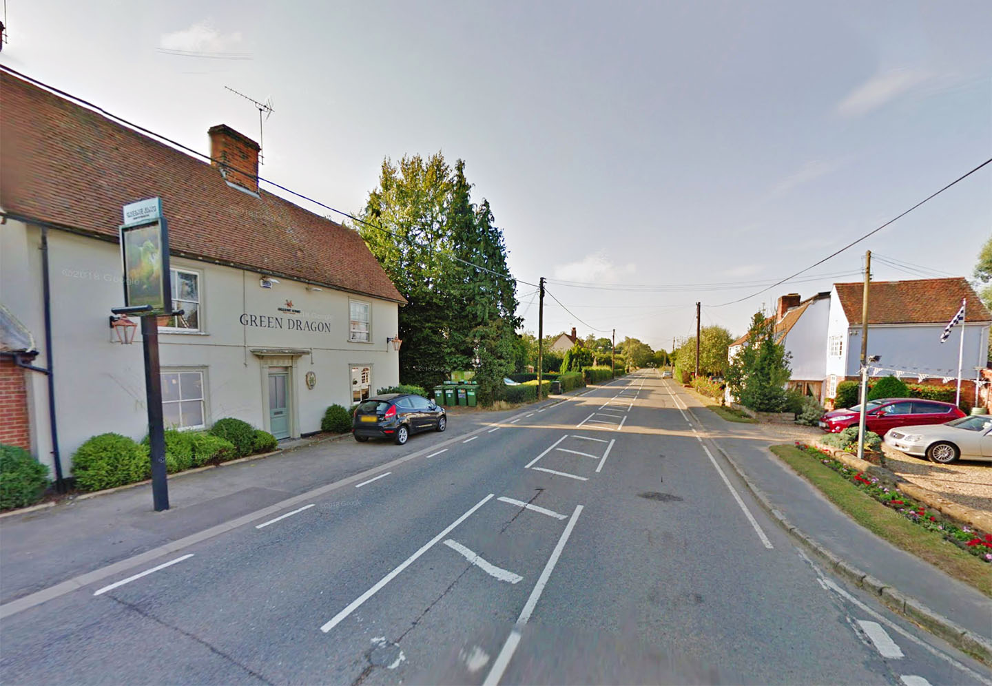
London Road, Great Notley Just south of Great Notley at Youngs Ends we continue down London Road this time passing the Green Dragon. Plenty of refreshments on this Roman road. |
Click for larger view |
 |
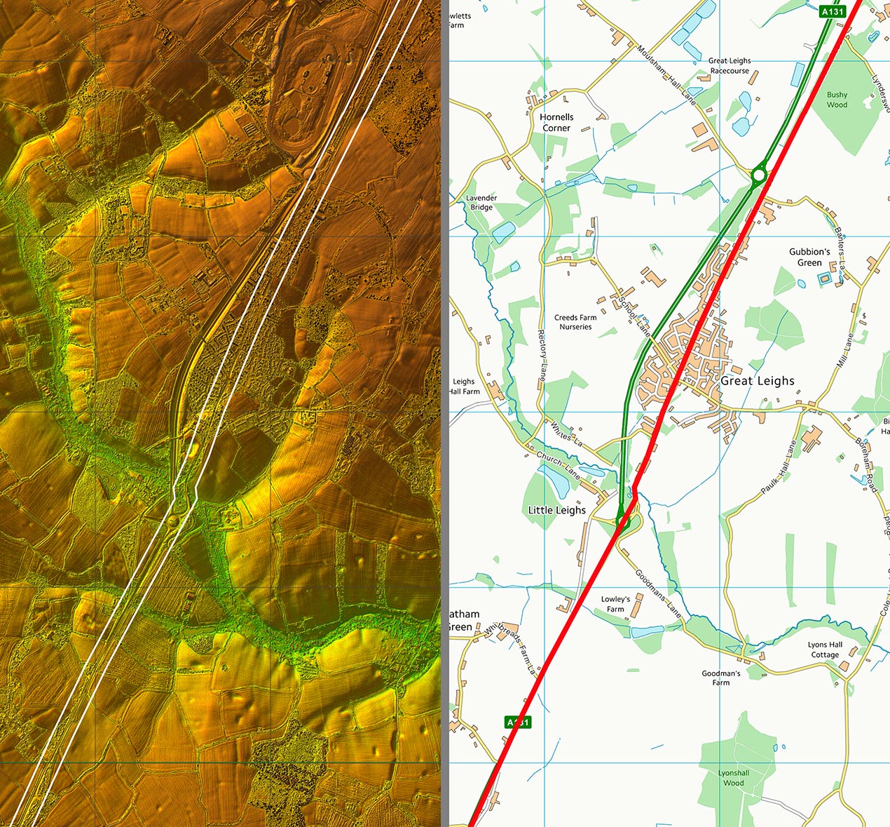
Lidar Image and Route Map 2 The old road through Great Leights mark the Roman line and probably a slight bend crossing the river at Deres Bridge. |
Click for larger view |
 |
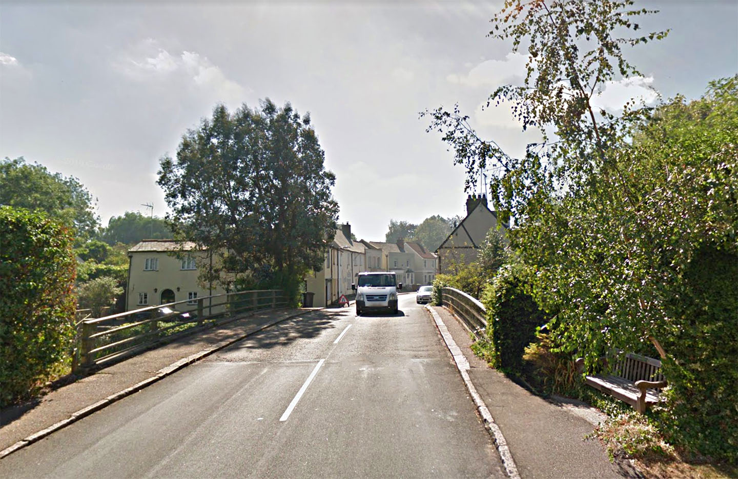
River Chelmer Bridge, The Street, Little Waltham The Roman bridge was probably at or perhaps slightly downstream of the modern bridge in Litlle Waltham.
|
Click for larger view |
 |
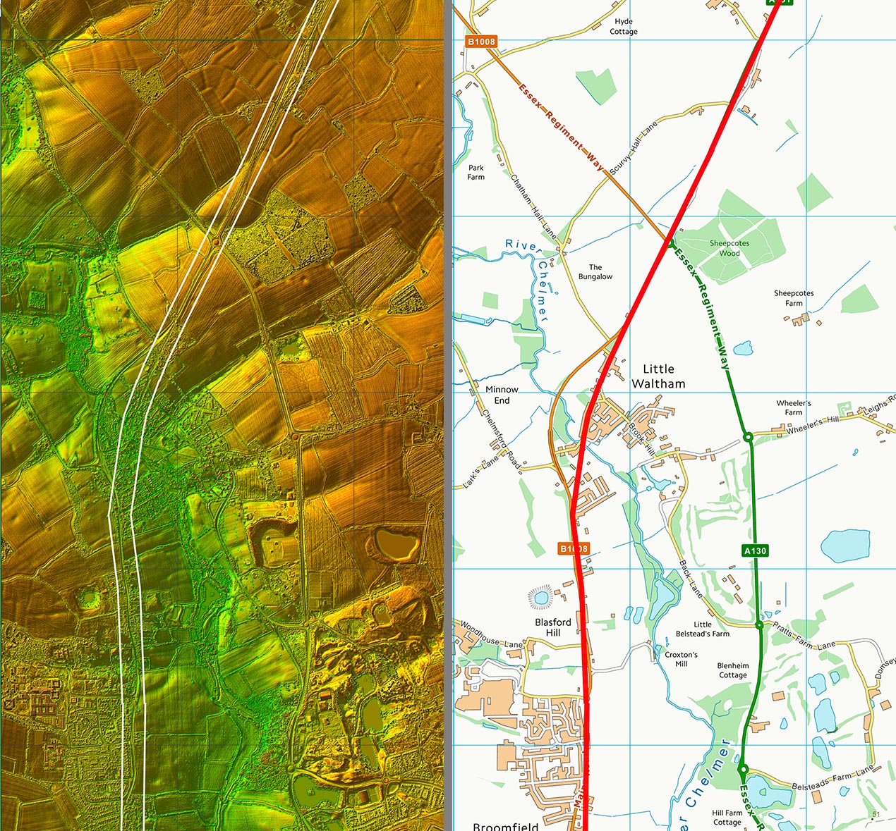
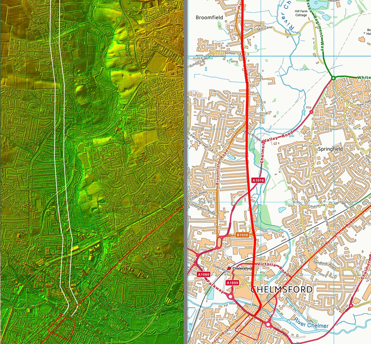
Lidar Image and Route Map 3 The change of direction at Little Waltham is where you expect the road from Great Dunmow to come in but I so far have not been able to locate it. |
Click for larger view |
 |
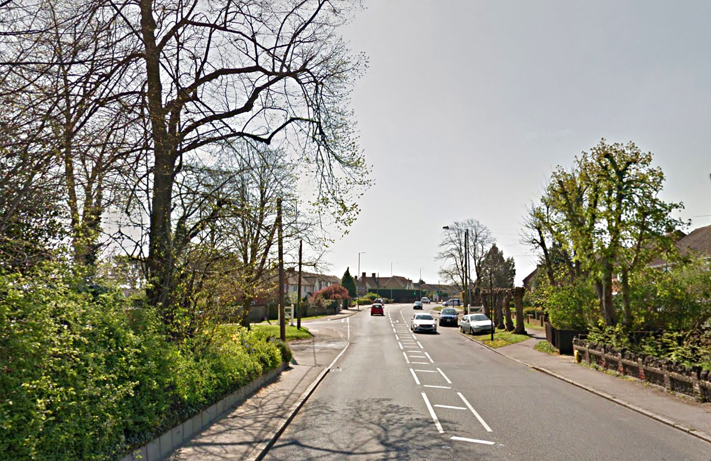
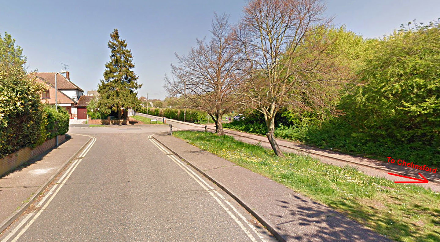
Main Road, Chelmsford Coming down Main Road towards Chelmsford this is where the modern road swings to the right but the Roman line was straight on - see next iamge. |
Click for larger view |
 |
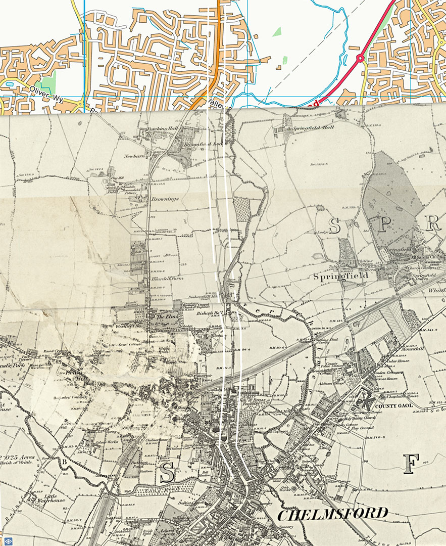
OS First Edition Map - Route into Chelmsford Rather than follwoing the modern road what I went with was the straight continuation from Broomfield of old field boundaries. Slight issue where the river bend now is but that could be river movement over the centuries. Bends get bigger. I have come across several times where they aim for the tightest spot on a river bend without needing to divert off line. So on balance I went for the usual Roman trait of continuing in a straight line. |
Click for larger view |
 |
First avenue - Footpath on Roman line At the bottom of First Avenue is this footpath (right) which preserves the probable Roman alignment heading for Chelmsford. |
Click for larger view |
 |
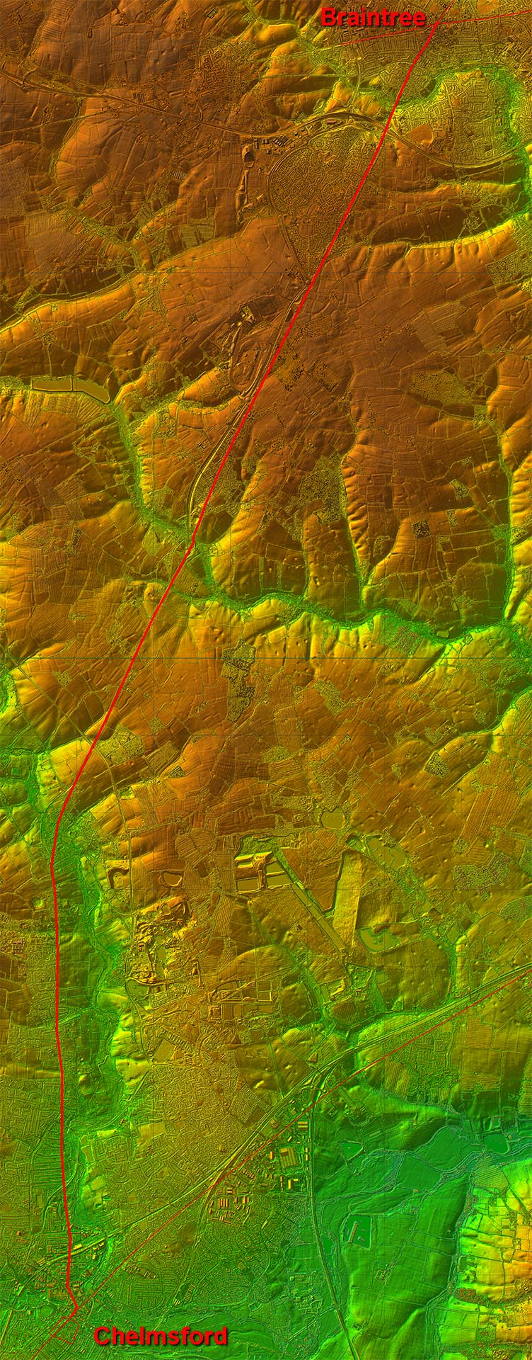
Lidar Image and Route Map 4 The road keeps away from the low land adjacent to the River Chelmer until it get close to Chelmsford. Its course is then marked a footpath at the ends of the First to Seventh Avenues. This is today very close to the river but movements over the centuries probably means it was further away in Roman times. |
Click for larger view |
 |
|
|
|
Last update: April 2024 |
© David Ratledge |