 |
The Roman Road from Kirkby Thore to Brougham, Margary 82This was for long thought to be a simple road with a change of direction at the River Eden crossing. As we shall see it turned out to be the very opposite! What Lidar revealed was a Roman spaghetti junction and a "new" road almost certainly heading straight on for Old Penrith.
The Margary 82 number has been retained for this road although it could be argued that the Stainmore Road is actually represented by the road to Old Penrith. The road to Brougham has the appearance of a branch road off the direct road but, without dating evidence, this is just a best guess.
|
3D Lidar Image looking towards Temple Sowerby. Passing Kirkby Thore all straight forward so far. |
Click for larger view |
 |
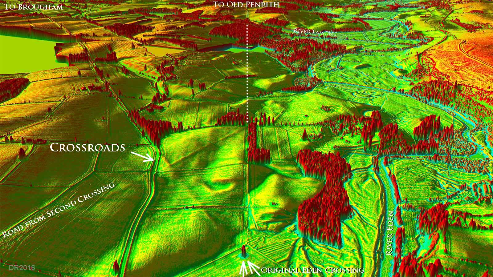
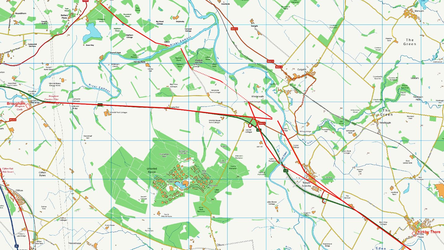
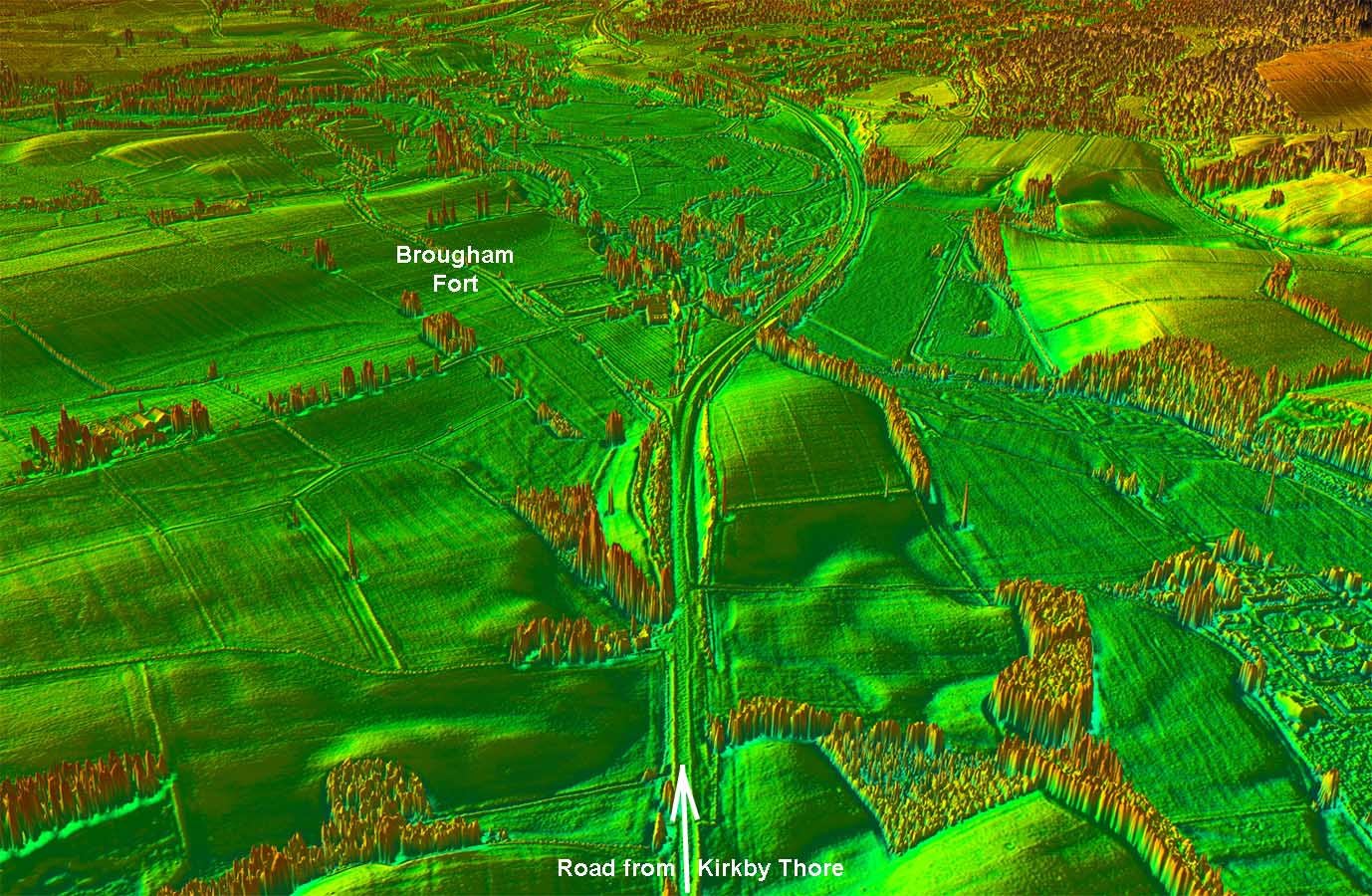
3D Lidar Image - River Eden This was the Lidar image that revealed the complexity of what was supposed to be a single road. I was also looking for a possible branch to Old Penrith but how could a branch road end up as a crossroad junction? Not only was there a crossroads but further examination and site visits confirmed there was a triangular (hypotenuse) road bypassing the crossroads. The latter was clearly aligned on Old Penrith. |
Click for larger view |
 |
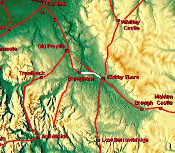
Route Map This road and the Road to Old Penrith are inexorably linked and the various routes cannot be un-picked without considering the chronology of both roads - see below. |
Click for larger view |
 |
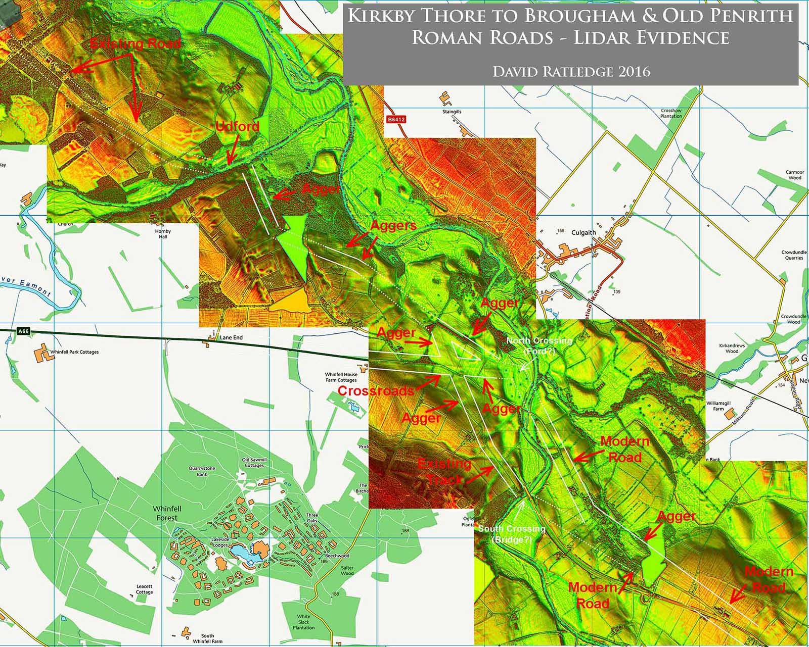
Lidar Image - Eden Crossings The various clues and Lidar evidence are marked up with captions. Unfortunately reproduction here is somewhat below optimum but hopefully gives an indication of what is visible. |
Click for larger view |
 |
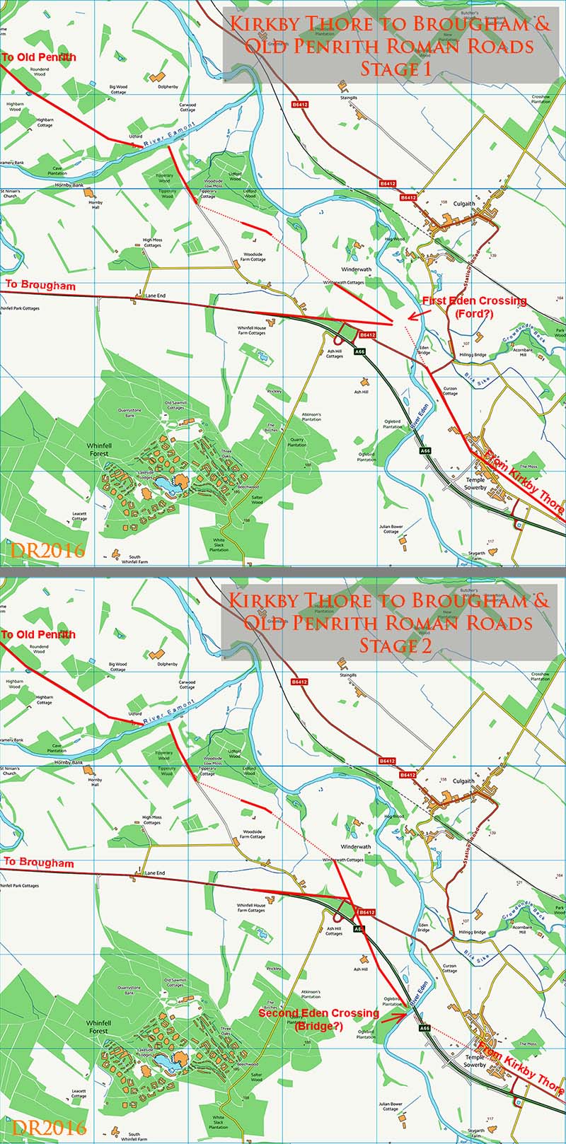
Eden Crossings: Maps showing chronology of the site. • There were obviously two Roman crossings of the River Eden. • The northern crossing: this is located in an open stretch of the river valley providing a natural fording point. This openness is no doubt why the river has changed course here and no longer flows past the Roman crossing point. • Both the road to Brougham and the (new) road to Old Penrith are clearly set-out and aligned with the northern crossing showing it must have been the original. • The southern crossing: the river is very constrained here between banks and there is a substantial sandstone outcrop. Putting my bridge engineer hat on, then this is a perfect bridge site with a rock solid foundation. Undoubtedly the best spot in the vicinity for a bridge. • I also spotted that there are two routes through Temple Sowerby - the alignment of the houses made me suspicious and lidar confirms it. There is the existing modern road plus another slightly more to the north-east. This is a more logical and direct route to the northern crossing. • The route of the Old Penrith road from the northern crossing using the triangular bypass road links up in a direct line with 2 pieces of lidar evidence and heads undoubtedly to the Udford on the River Eamont. • Beyond the River Eamont this alignment continues up Udford road - this has all the hallmarks of a Roman road. I cannot understand why this has not been considered as Roman before - it is a dead ringer. • As referred to above the southern crossing in best understood as the later bridging point. • The route and direction of the Roman road from the southern crossing up to the Brougham road and onto the Old Penrith road now makes perfect sense. It is the shortest route to join up with the already constructed roads from the earlier northern crossing (ford?). It is exactly where you would build a linking road. • When the southern crossing comes into use then the roads east of the crossroads and the triangular bypass road become redundant. So the crossroads was never actually a crossroads! • What cannot be determined is which destination was first - Brougham or Old Penrith. However the general direction of the Stainmore road passing Kirkby Thore is certainly more aligned with Old Penrith than Brougham.. |
Click for larger view |
 |
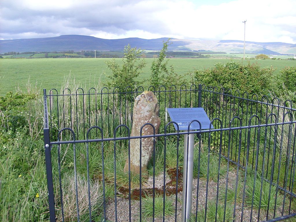
The Kirkby Thore/Temple Sowerby Milestone - it is actually half way between the two. Thanks to the new bypass, the milestone is now safe and easy to visit. Image: Mike Garratt |
Click for larger view |
 |
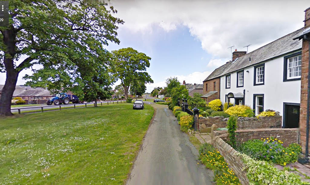
Temple Sowerby - line of original Roman road This is the Roman line to the northern crossing of the River Eden through Temple Sowerby village. It was superceded when the southern crossing came into use. The tractor is on the old A66 road. |
Click for larger view |
 |
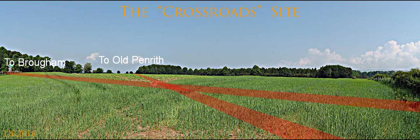
The Crossroads - ground level view. Virtually nothing visible so I have marked up the roads. Winter might be a better time to see what remains. |
Click for larger view |
 |
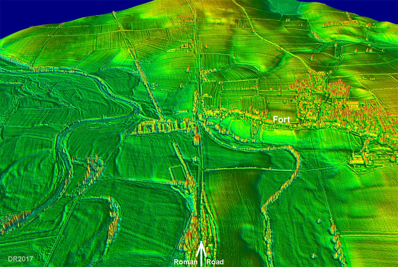
3D Lidar Image - approach to Brougham Fort Where the modern A66 curves off, the Roman road continues straight on to the fort. |
Click for larger view |
 |
|
|
|
Return to Cumbria Roman Roads homepage Last update January 2018 |
© David Ratledge |