 |
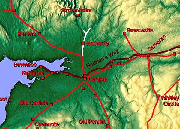
The Roman Road from Sandysike to Netherby and beyond, Margary 868Netherby has turned out not to be a Roman cul-de-sac but part of probably two "new" routes into Scotland. For details of the road from Carlisle to Sandysike, where the road to Birrens branches off, see road Margary 7f.
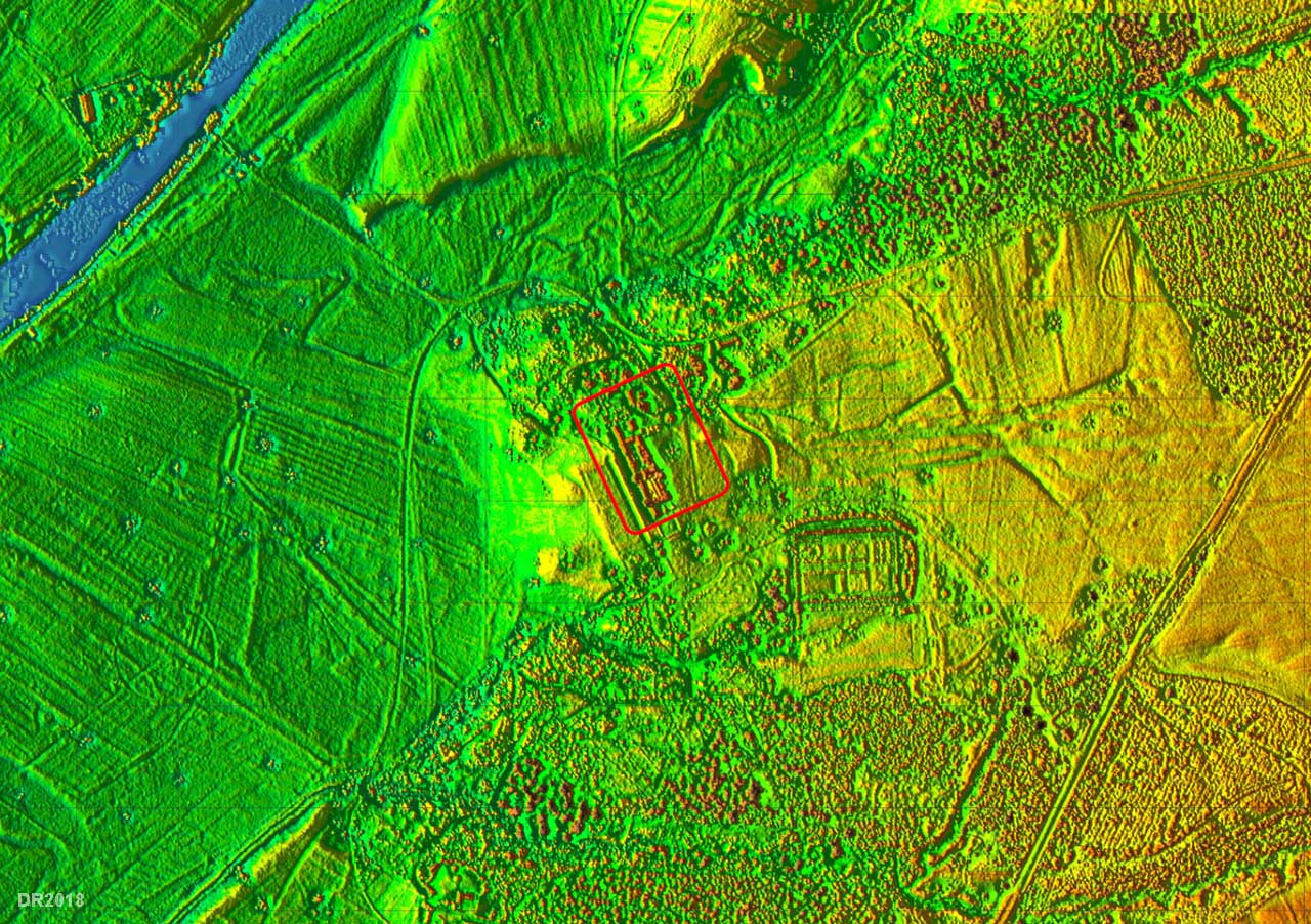
Often previously shown dotted and only as far as Netherby, Lidar has produced convincing evidence both south and north of Netherby. I was asked if the Lidar software could pin down the location of Netherby fort - in short it couldn't or least I couldn't. Netherby House seems to have removed all traces. Luckily the roads have survived. STOP PRESS 2018 - The location of the fort has almost certainly been pinned down by Gerry Martin (Gerry Martin Associates Ltd., Archaeological Survey: Netherby Hall, Netherby, Longtown, 2016). Barrack blocks were excavated and comparing these to a standard Roman fort layout enabled a reasonable location for the fort to be postulated. See later.
|
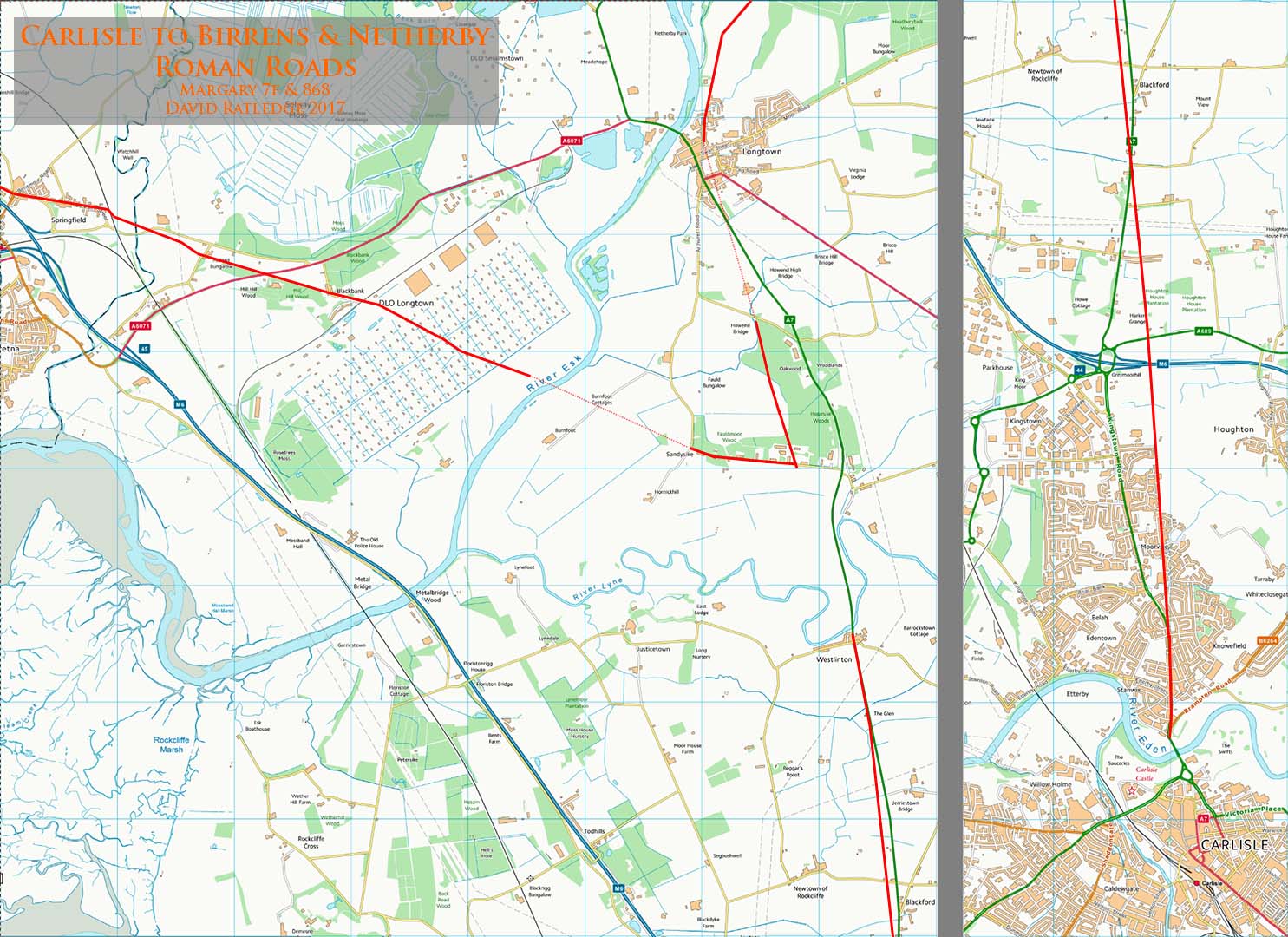
Map of Margary 7f and 868 Our road starts at the Sandysike junction and heads towards Longtown before a turn to the north-east for Netherby. You could argue that the Birrens road is the branch and Netherby the original route. |
Click for larger view |
 |
Lidar Image - Sandysike Junction The agger for the road to Netherby is reasonably clear although off the top of this image (north) there is no trace into Longtown so a question of joining the dots. |
Click for larger view |
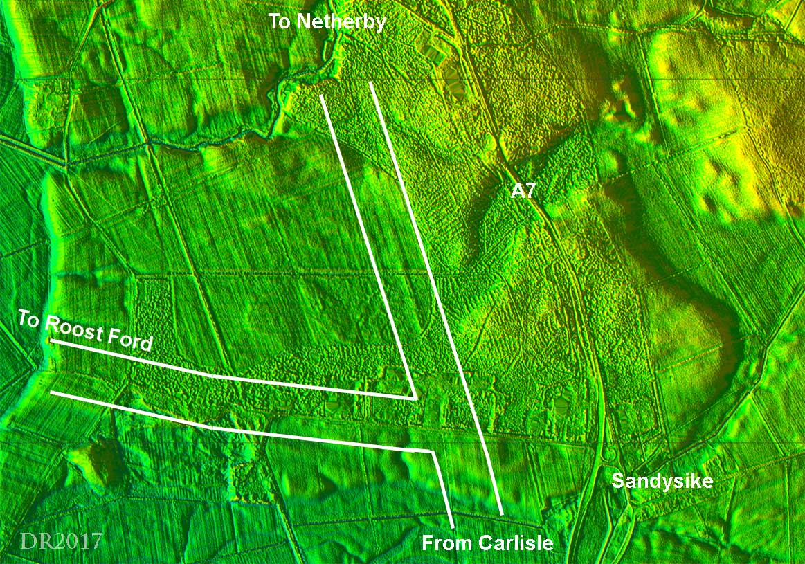 |
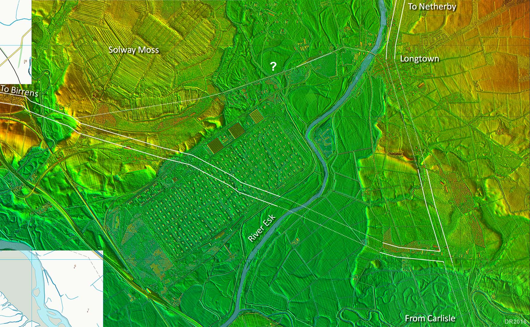
Lidar Image - Sandysike & Longtown Options The Roost ford is a bit odd - the Romans would surely have had a bridge for such an important route north. In which case the ford could have been superseded by a bridge and Longtown would seem to be the best candidate for a stable bridging point. It also fits well with the direction of the road from Carlisle which seems to be directed towards it. The roads are a bit interpolated here as evidence is patchy but I think must be reasonably close. There is an alternative route down to Roost ford north of Sandysike but I prefer the Sandysike Road option. The best candidate for a Netherby to Birrens link is the A6071. To me this could have replaced the Roost ford. |
Click for larger view |
 |
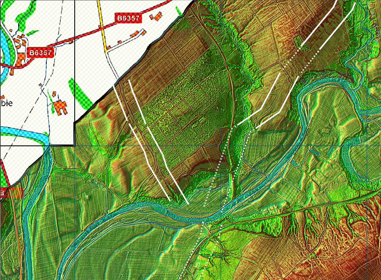
Lidar Image - approach to Netherby Very obvious, very straight and very Roman. |
Click for larger view |
 |
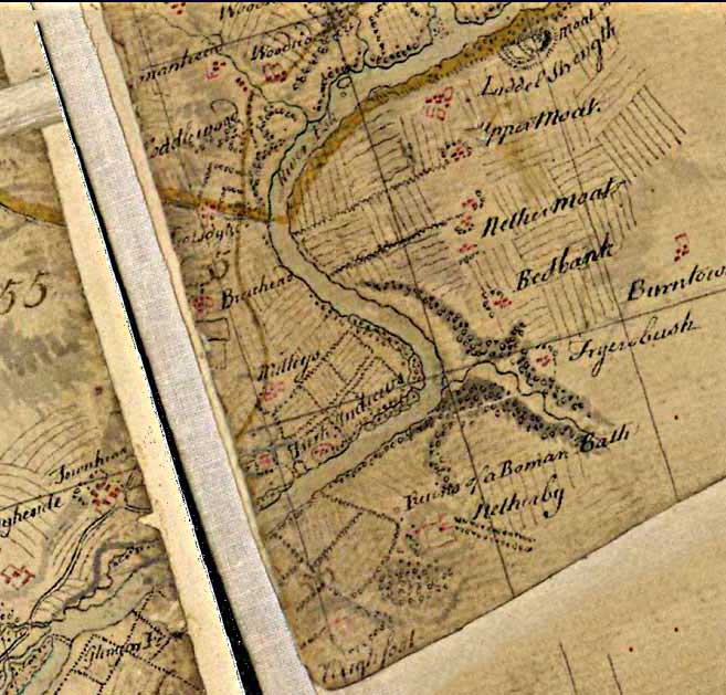
Roy's Map of Netherby (Roy's Military Survey 1752-55) He does not show the location of the fort but does record a "Roman Bath". Also visible at the top is Liddel Strength Motte and Bailey. The map has been rotated to place north at the top.
|
Click for larger view |
 |
Lidar Image - fort site at Netherby according to Gerry Martin The puzzle of exactly where the fort site lay has now been solved. Gerry Martin "...discovered, through excavation, three contiburnium (barrack blocks) in the stable courtyard". By comparing these to a standard Roman fort layout the position of the fort could be postulated with reasonable confidence. Thanks are due to Gerry Martin for bringing this to my attention. Ref: Gerry Martin Associates Ltd., Archaeological Survey: Netherby Hall, Netherby, Longtown, 2016 |
Click for larger view |
 |
Lidar & Map - Roman roads north of Netherby |
Click for larger view |
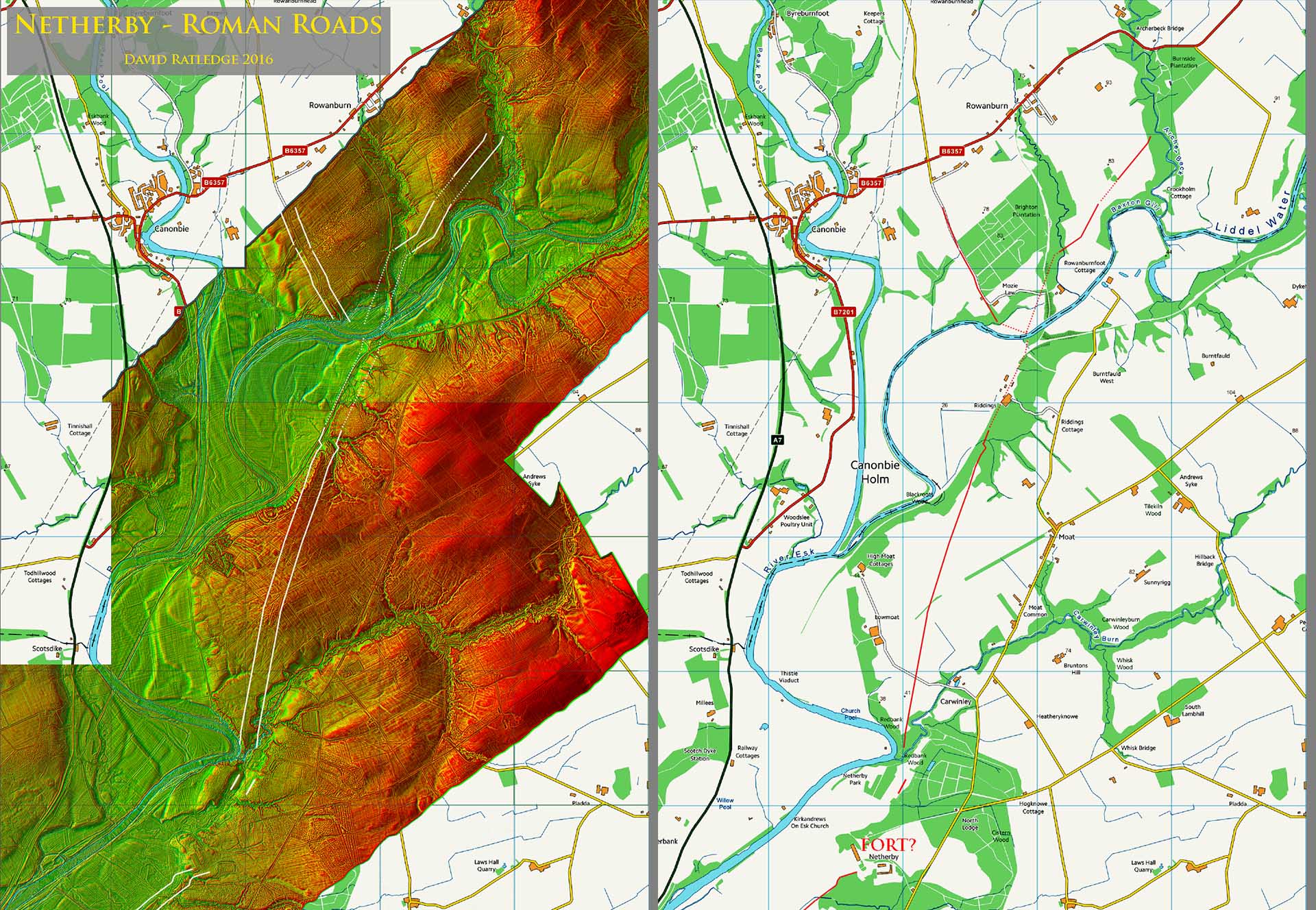 |
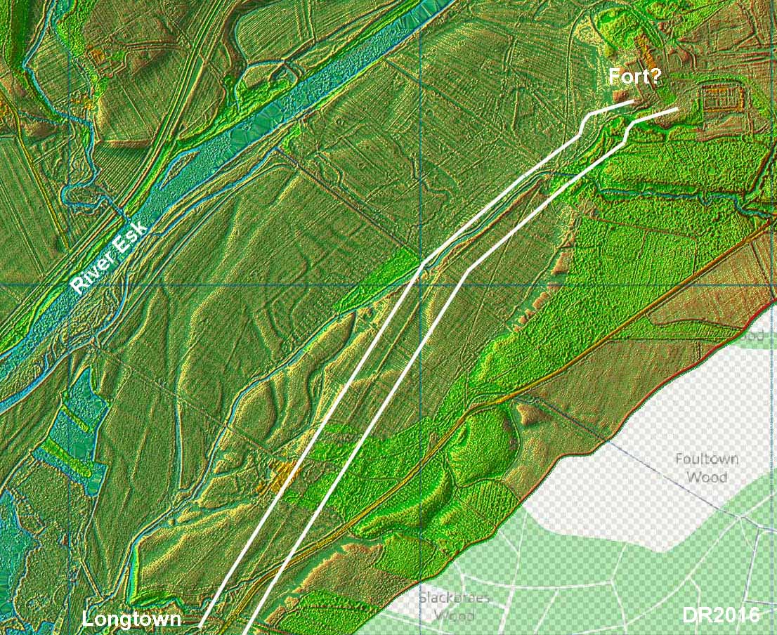
Lidar Image - detail north of Netherby This was the section that suddenly revealed that Netherby was not a dead end but lay on a road into Scotland. |
Click for larger view |
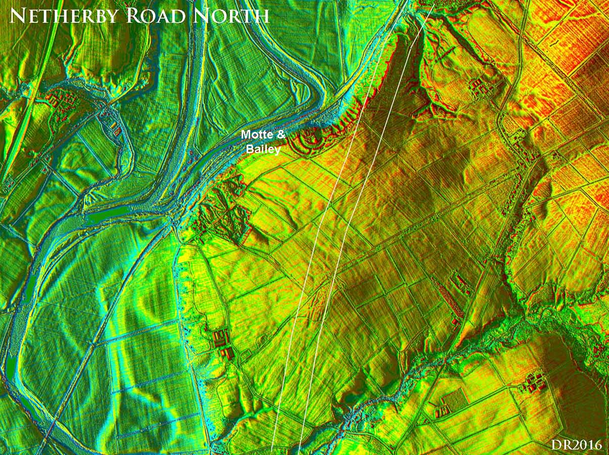 |
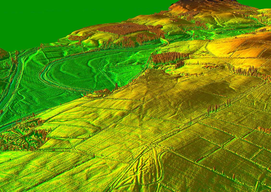
3D Lidar View - Redbank The Roman road is clear over Redbank passing the (later) Motte and Bailey and heading for a crossing of Liddel Water west of the old railway viaduct. |
Click for larger view |
 |
Lidar Image - North of Liddel Water One road is clearly heading up Eskdale to Broomholm Roman Fort (south of Langholm) and the second up Liddesdale for............... ? The modern B6357 probably covers much of this road at least initially. Destination then Bonchester Bridge is an interesting name but that is just my guess! |
Click for larger view |
 |
|
NEW - 3D Lidar video fly-over of the road from Longtown to Liddesdale |
|
|
|
Return to Cumbria Roman Roads homepage Last update September 2018 |
© David Ratledge |