 |
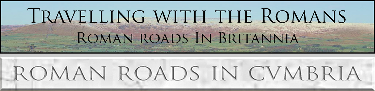
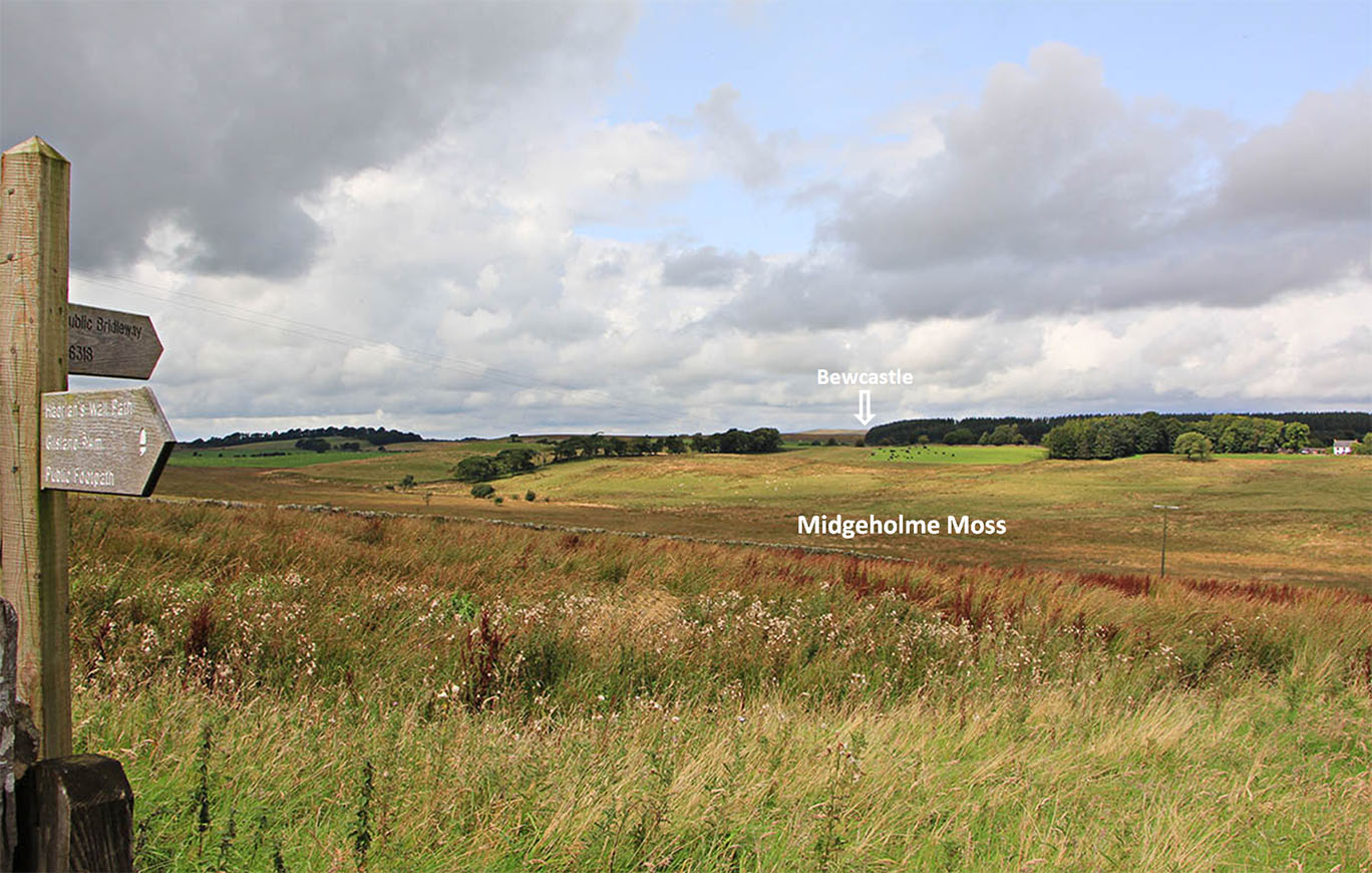
The Roman Road from Birdoswald to Bewcastle, Margary 865A short 6 mile road linking Birdoswald to the outpost at Bewcastle. A quote from Margary set me thinking: "no trace has been found in the first 1/2 mile". The first half mile was supposed run in a straight line from the north gate of Birdoswald fort across Midgeholme Moss - a large boggy area that actually provides protection to the fort but is no help to road builders. Lidar was only available for half way across the moss but it too showed no evidence for a direct road. It is likely the moss was open water in Roman times as it shows clear signs of having been drained. This road was originally traced by Mr. Maughan c. 1850s and examined by Haverfield in 1896/7. Haverfield's comments are particularly relevant: "For the first half mile north of Birdoswald the road has vanished in soft ground: it was apparently invisible in Mr. Maughan's time, and certainly could not be found by us." The explanation was obvious. The Roman road engineers didn't go through the bog - they followed dry land around the edge of it - very sensible. Once clear of this obstacle they returned to the main alignment for Bewcastle, a typical Roman strategy.
Bewcastle is perhaps a Roman cul-de-sac. I could find no evidence for a road heading further on but the Lidar coverage is incomplete there so perhaps needs reassessing when the Series 2 Lidar is completed Note this road should not be referred to as Maiden Way as it sometimes still is today. That name applies to Kirkby Thore to Carvoran via Whitley Castle only and as long ago as 1929, Collingwood explained why it should not be applied to this road - basically they are two separate roads. NEW 2020: 3D Lidar video from Birdoswald to Bewcastle - see at the bottom
|
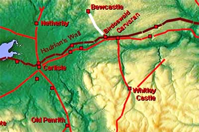
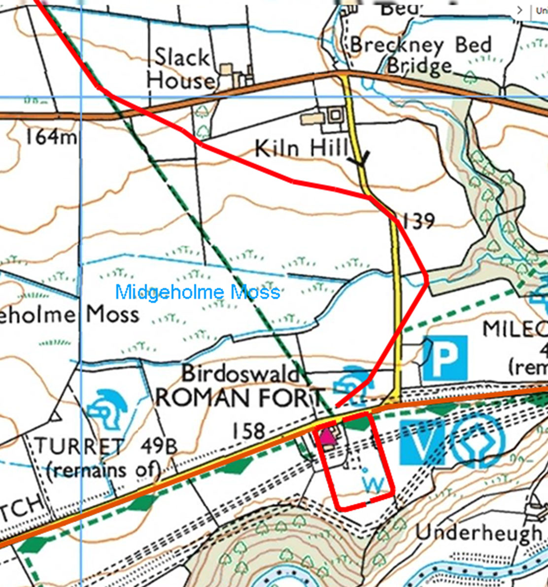
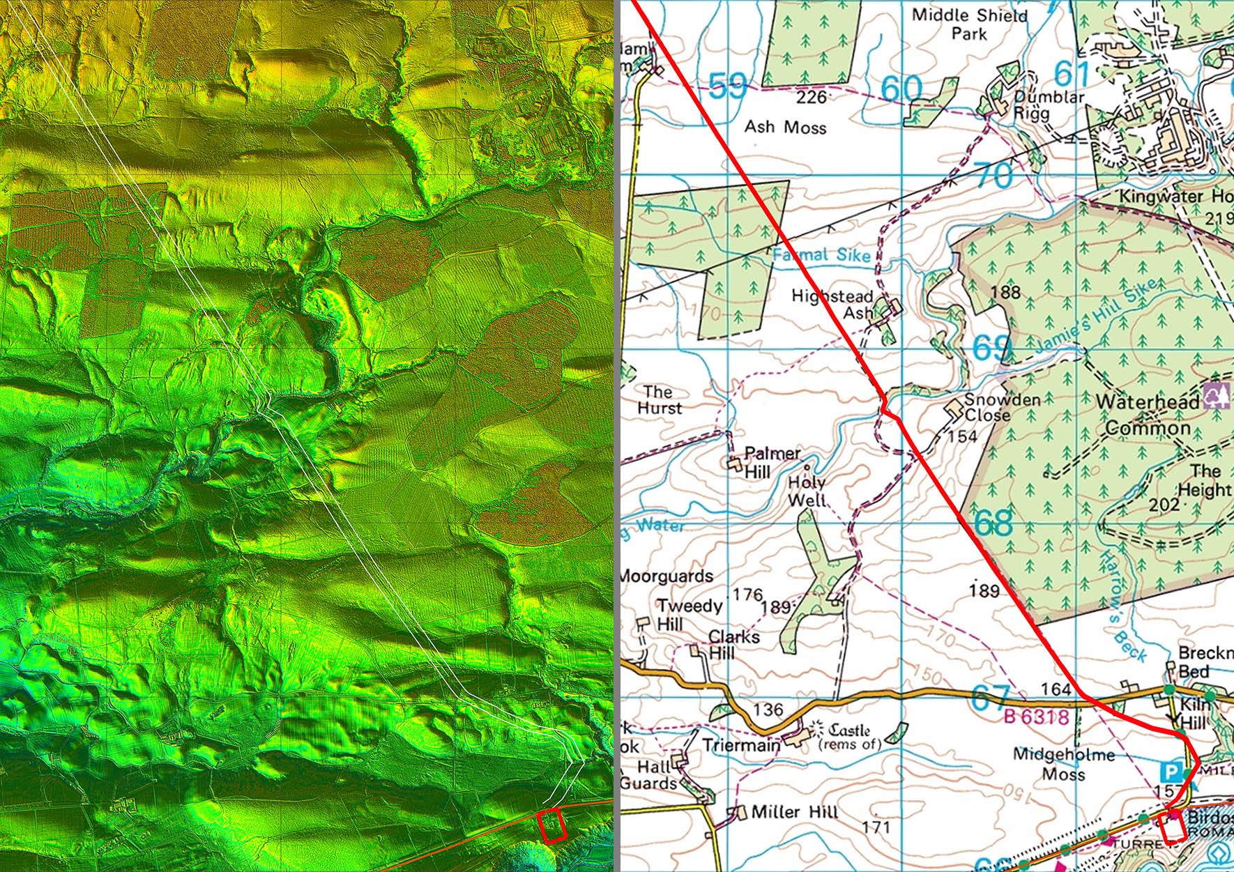
Full Route Lidar Logical arrangement with a long alignment to Collin Bank where it then makes a change of direction for the drop down to Bewcastle. Note although the main straight is set out from Birdoswald north gate the actual road only adopts this alignment after it has circumnavigated Midgeholme Moss, north of the B6381 - see below.
|
Click for larger view |
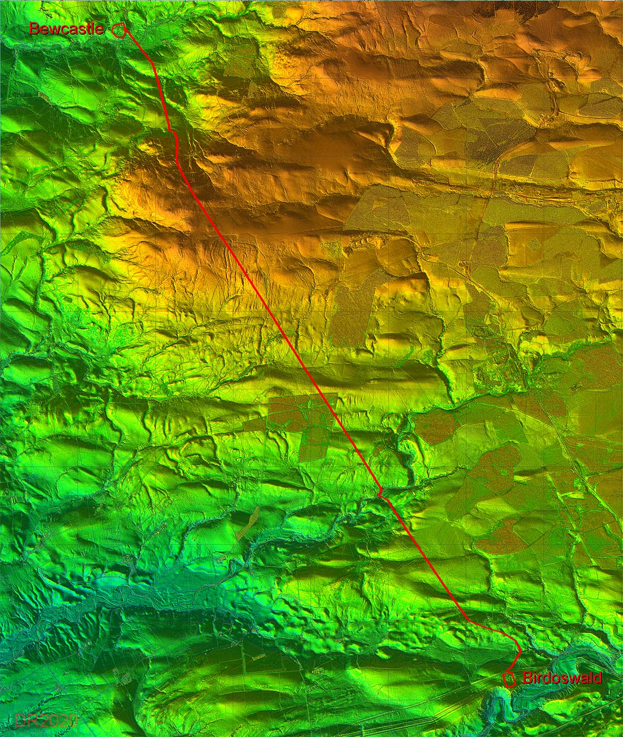 |
Full Route Map Simple arrangement of one long alignment followed by two short straights to get to the east gate of Bewcastle fort. There was also a slight adjustment in the main alignment at NY6057 6768 - see later. There are a couple of intermediate dog-legs to negotiate the valley of King Water and the slopes at Collin Bank.. |
Click for larger view |
 |
Oblique 3D Lidar Image - Birdoswald to Bewcastle That slight adjustment to the main alignment is evident in this view from Birdoswald towards Bewcastle. It took place on a local high spot at NY6057 6768 and was probably the best spot to set-out the road.
|
Click for larger view |
 |
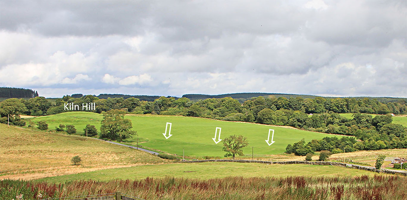
View from Birdoswald Fort north gate. Midgeholme Moss is straight ahead in valley bottom. I would suspect it is a shadow of its former self and was probably even open water in Roman times. There is clear evidence of modern drainage ditches to dry it out. A route via Kiln Hill makes much more sense...... Image DR |
Click for larger view |
 |
Oblique 3D Lidar Image - Route around Midgeholme Moss First clue: visible is in the Lidar image is a very clear terrace-way leading away from the gate in the above picture heading, not for Bewcastle, but in the direction of modern car park i.e. north-east. Second clue: a cutting/terrace heading down to the beck to the east of the modern bridge. This is actually clearer on the ground. Third clue: a very pronounced agger/cutting heading north-north-west from the beck up to the dog-leg in the modern road.. Fourth clue: the modern road chicanes to the left (west) derived no doubt from the Roman road which was now heading back for the main Bewcastle alignment. Fifth clue: a straight stretch of agger heading towards the B6381. Sixth clue: the dog-leg of the road rejoining the alignment north of the B6381. This dog-leg is very clear on the ground too - the road never went straight to Birdoswald - see later. |
Click for larger view |
 |
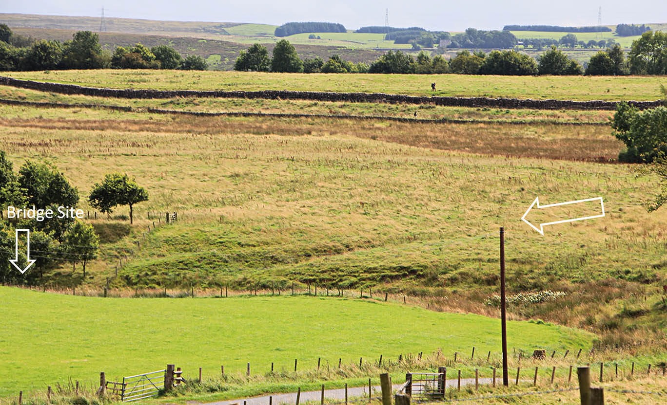
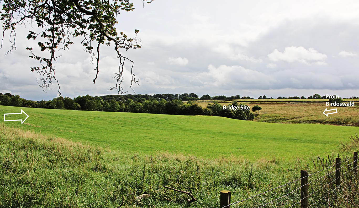
Route Map - Midgeholme bypass At first I thought the modern bridge was the Roman route but the evidence for the road east (downstream) of the modern bridge is convincing. Map: Bing |
Click for larger view |
 |
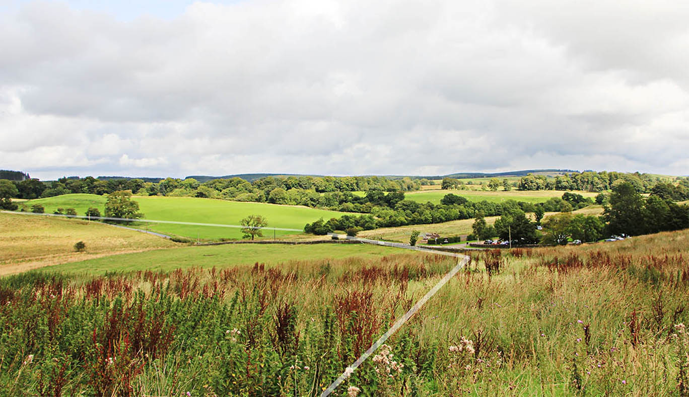
View from Birdoswald - actual route We are looking down the terrace in the direction of the car park. Summer growth means not the best time to view it on the ground. This terrace, so obvious in the Lidar data, turns before the car park to head down a cutting to the beck downstream of the modern bridge. Image DR |
Click for larger view |
 |
Terrace/Cutting approaching the stream from Midgeholme Moss. Very clear and obvious descent. The actual bridge site would have been below those trees. Image DR |
Click for larger view |
 |
Ascent from stream towards Kiln Hill At first I thought the ridge feature was the road agger but on closer inspection the road is clearly this side of the bank. The road is more of a terrace here with excavated material forming the bank. Image DR |
Click for larger view |
 |
Road ascending from Bridge Site This is a big bank - much more obvious in reality than in photographs. The road is this side of it. Image: DR |
Click for larger view |
 |
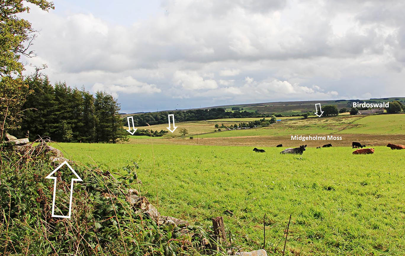
View back from B6381 The left arrow points towards the dog-leg in the modern road where it coincides with the Roman road. Such a modern road is known as "captured" road - when a modern road diverts to make use of part of a Roman road. Absolutely no evidence for a road across Midgeholme Moss. Image: DR |
Click for larger view |
 |
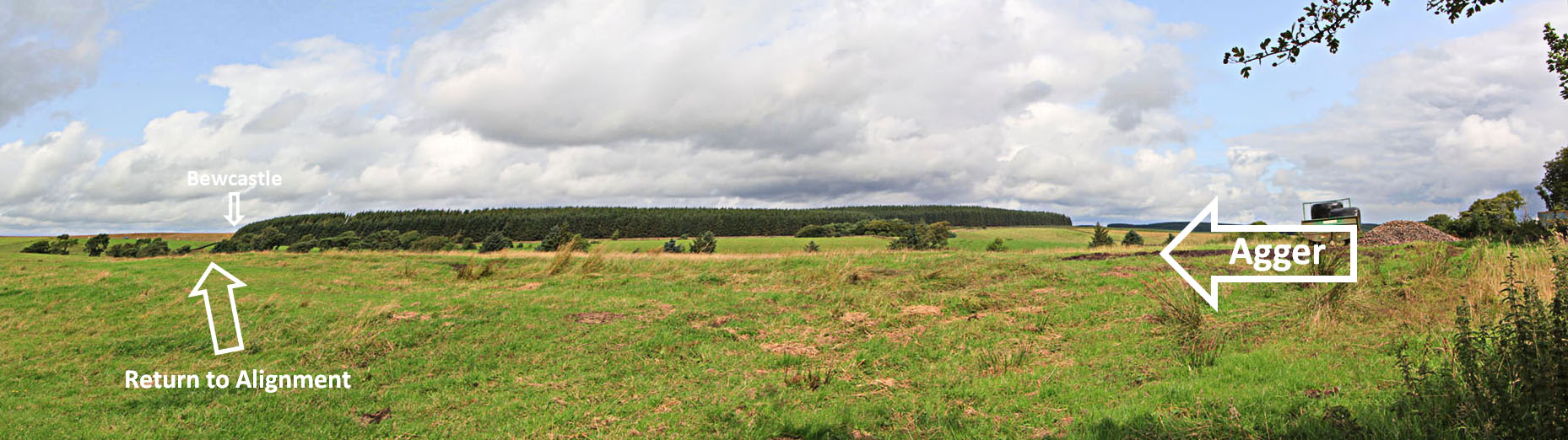
Return to Main Alignment - north of B6381 The agger coming in from the Kiln Hill route is very pronounced. It is so obvious it can be viewed from the B6318 (top). Why was this never seen before? The Roman road never went to Midgeholme Moss. Modern lidar confirms this (bottom) but in reality no confirmation should have been required. Even today the agger is still around 2 feet high. Image: DR |
Click for larger view |
 |
Lidar Image - Crossing King Water Having regained the main alignment, the route passes over a crest alongside Waterhead Common before descending towards King Water, near Snowden Close farm. The current (2014) English Heritage Hadrian’s Wall Map shows a deviation off the alignment well before King Water.Careful study of the LiDAR imagery here, under a variety of illumination angles, indicates that this is perhaps a water course caused by runoff, initially from the west ditch of the agger, leaving the road and finding its own (sinuous) ways down the slope. Nearer to King water the map line again deviates off to the west, this time down a field boundary. Again Lidar does not support this. The new series 2 LiDAR data indicates that the road carried straight on at both spots and made just a single shorter dog-leg to the west for the river crossing, adjacent to Slittery Ford . The Roman crossing point would appear to have been to the east of the modern concrete bridge at around NY59907 68643. On the north bank there is a modern track which has disturbed the Roman line. The latter appears to be just to the south of the modern track before they merge together near the bend at the top of the slope |
Click for larger view |
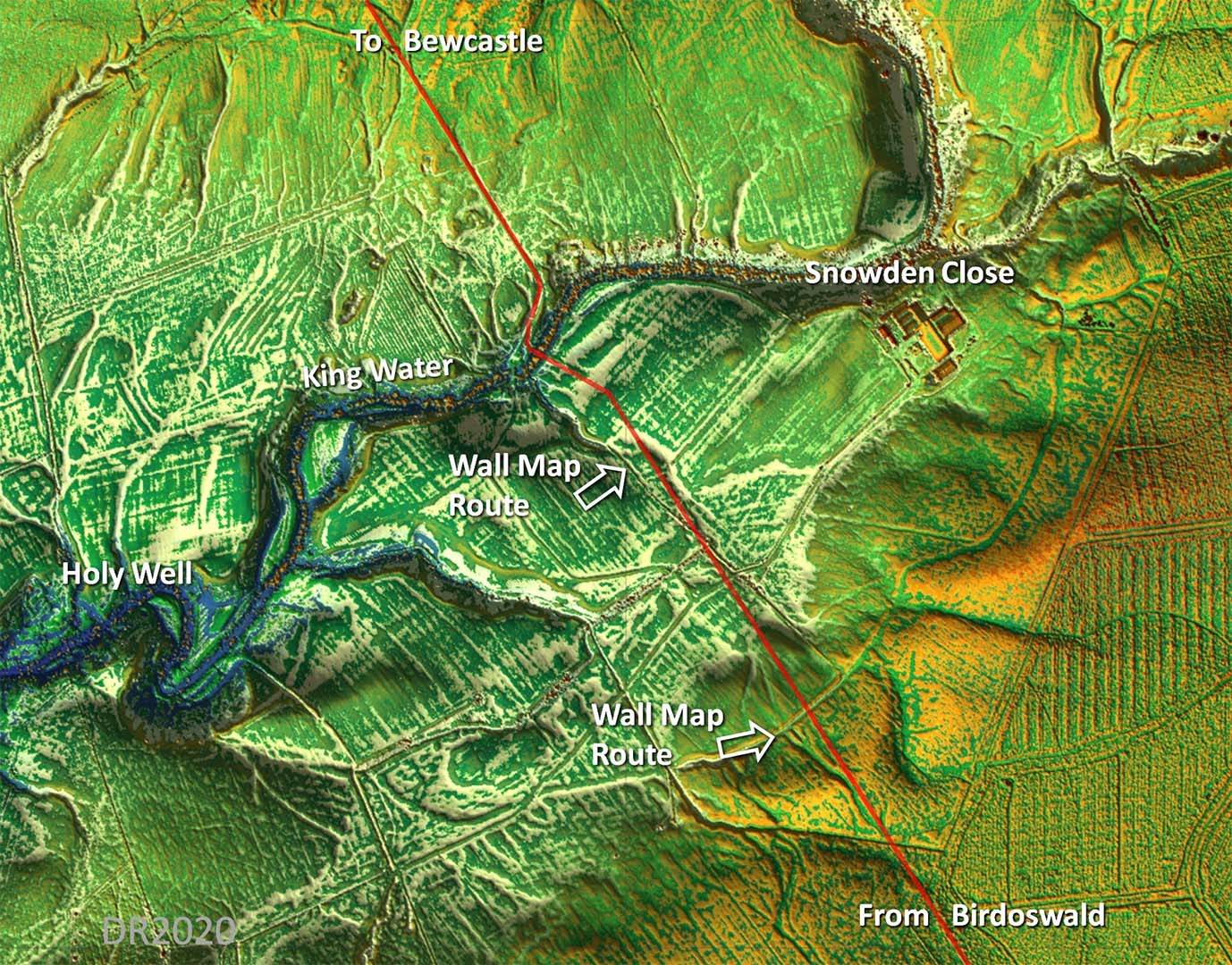 |
Route Map 1 The dog leg at Jamie's Hill Sike/King Water appears to have survived in excellent condition - otherwise a pretty straight alignment apart from the circumnavigation of Midgeholme Moss and the little dog-leg at King Water. |
Click for larger view |
 |
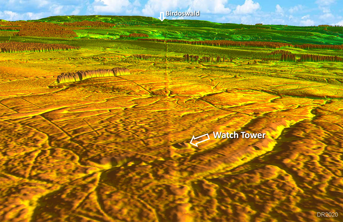
Watch Tower/Signal Station Alongside the road near Gillalees Beacon is a Roman Watch Tower or Signal Station. It has a clear view of Birdoswald but cannot see Bewcastle. However, it can see Baron's Pike signal tower (east of bewcastle) so presumably that is how it operated. |
Click for larger view |
 |
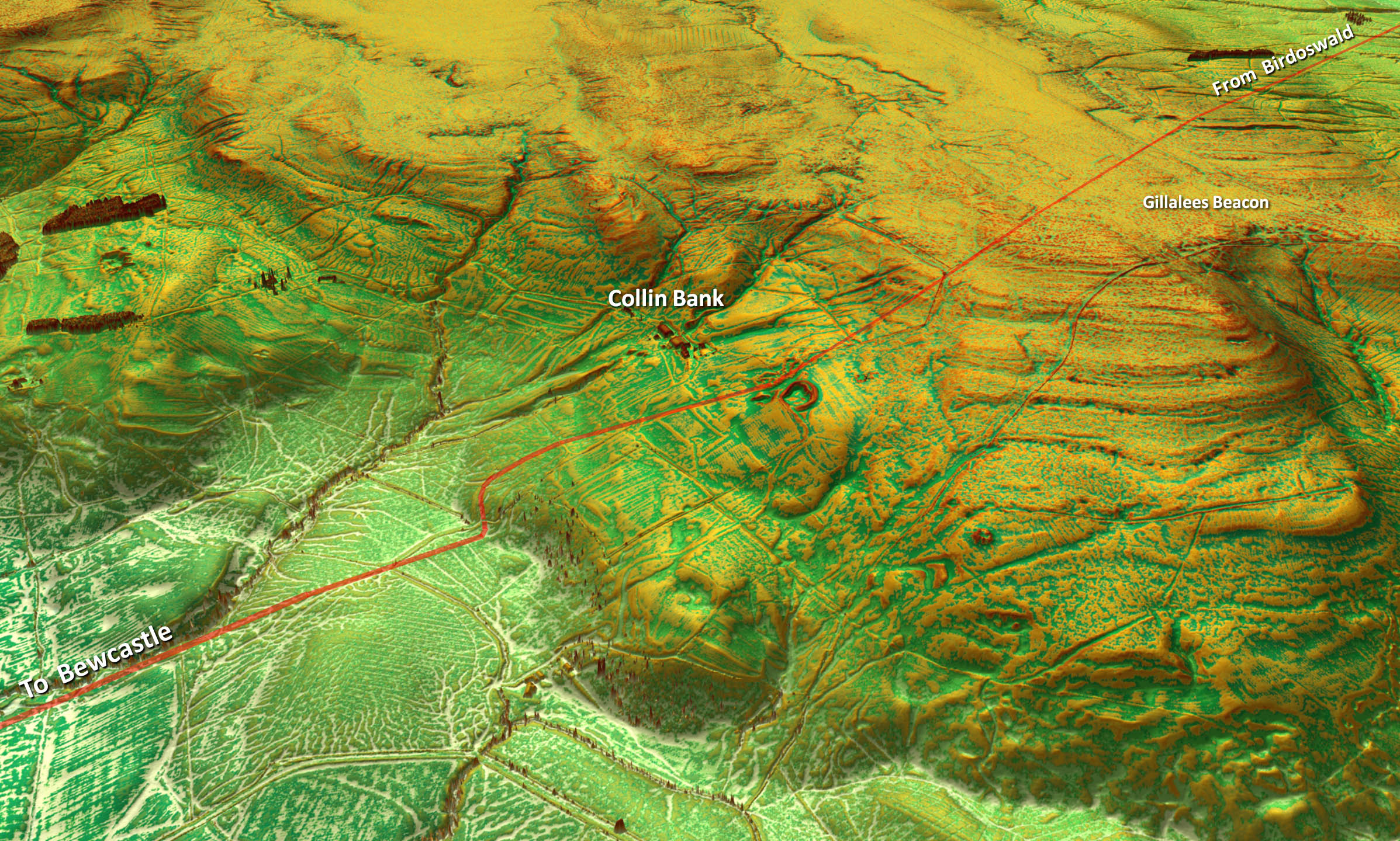
Route Map 2 The route at Collin Bank is very disturbed but what I have shown is more than likely correct. The area there is very strange and it is hard to understand what has caused all the disturbance. The final dog-leg approaching Bewcastle takes us around the temporary marching camp (see below)and so was probably there before the road was constructed. |
Click for larger view |
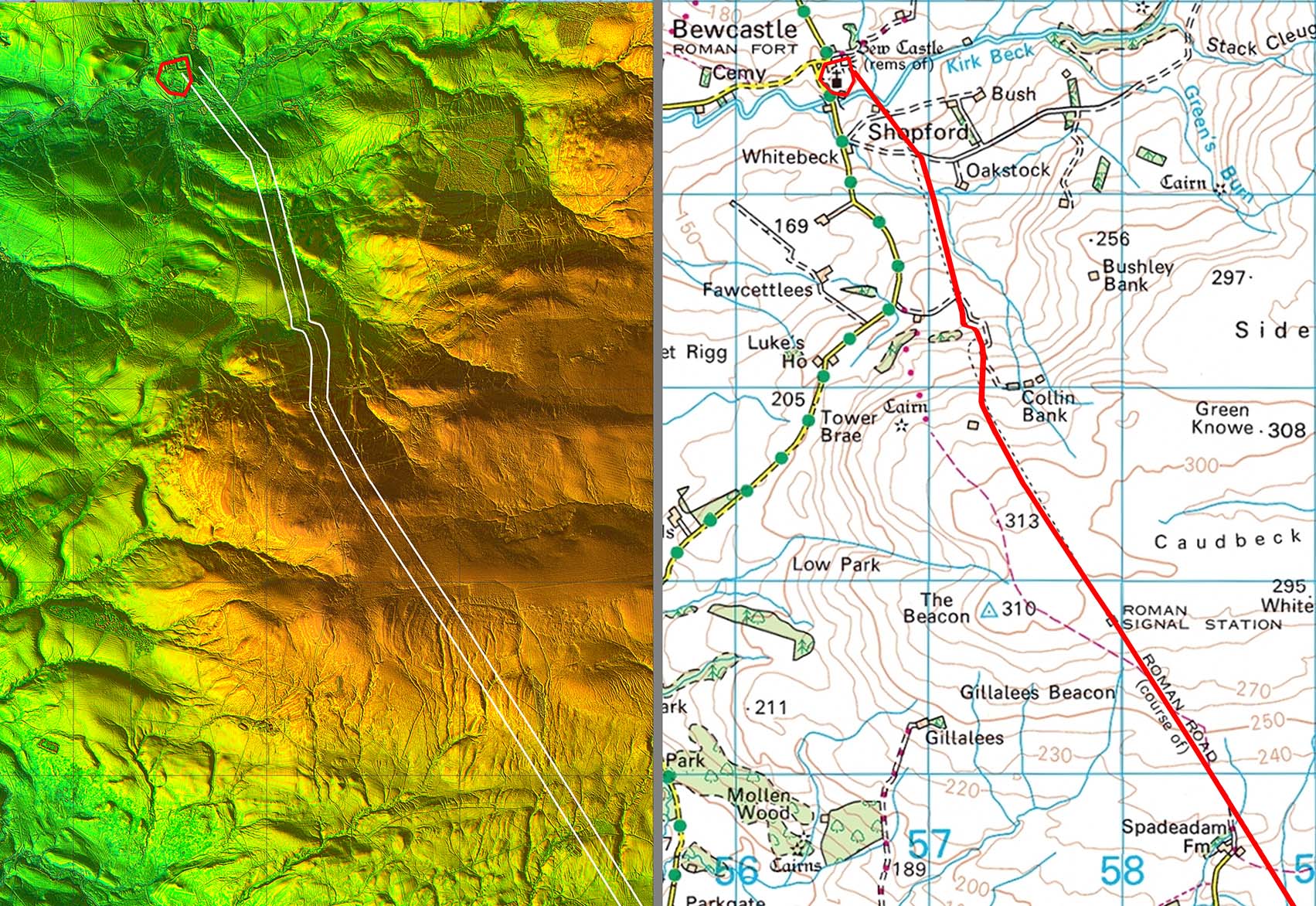 |
3D Lidar Image - Descent down Collin Bank This was clearly the most practical route down from the Gillalees Beacon to the fort site. The Ordnance Survey route is incorrect here.
|
Click for larger view |
 |
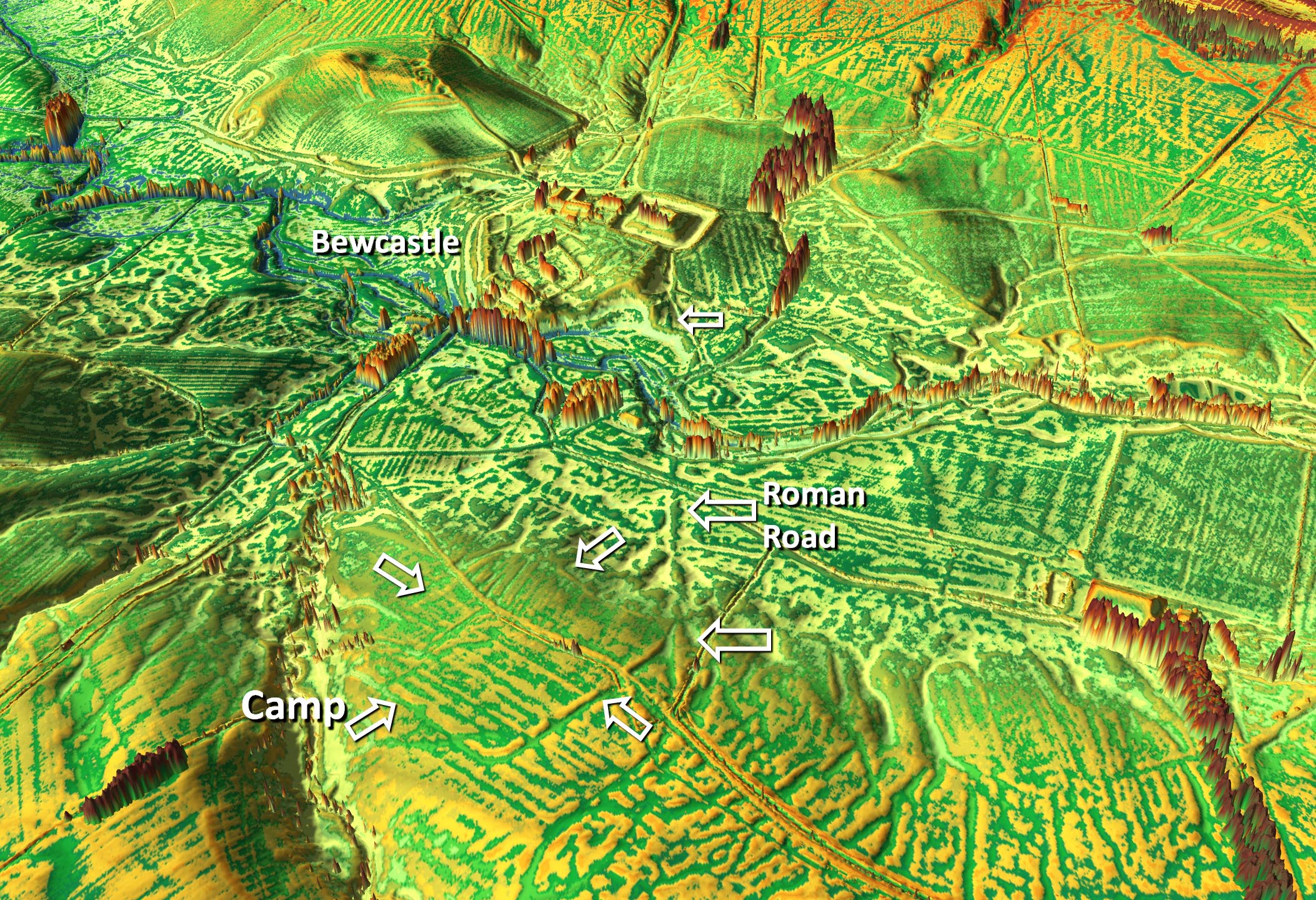
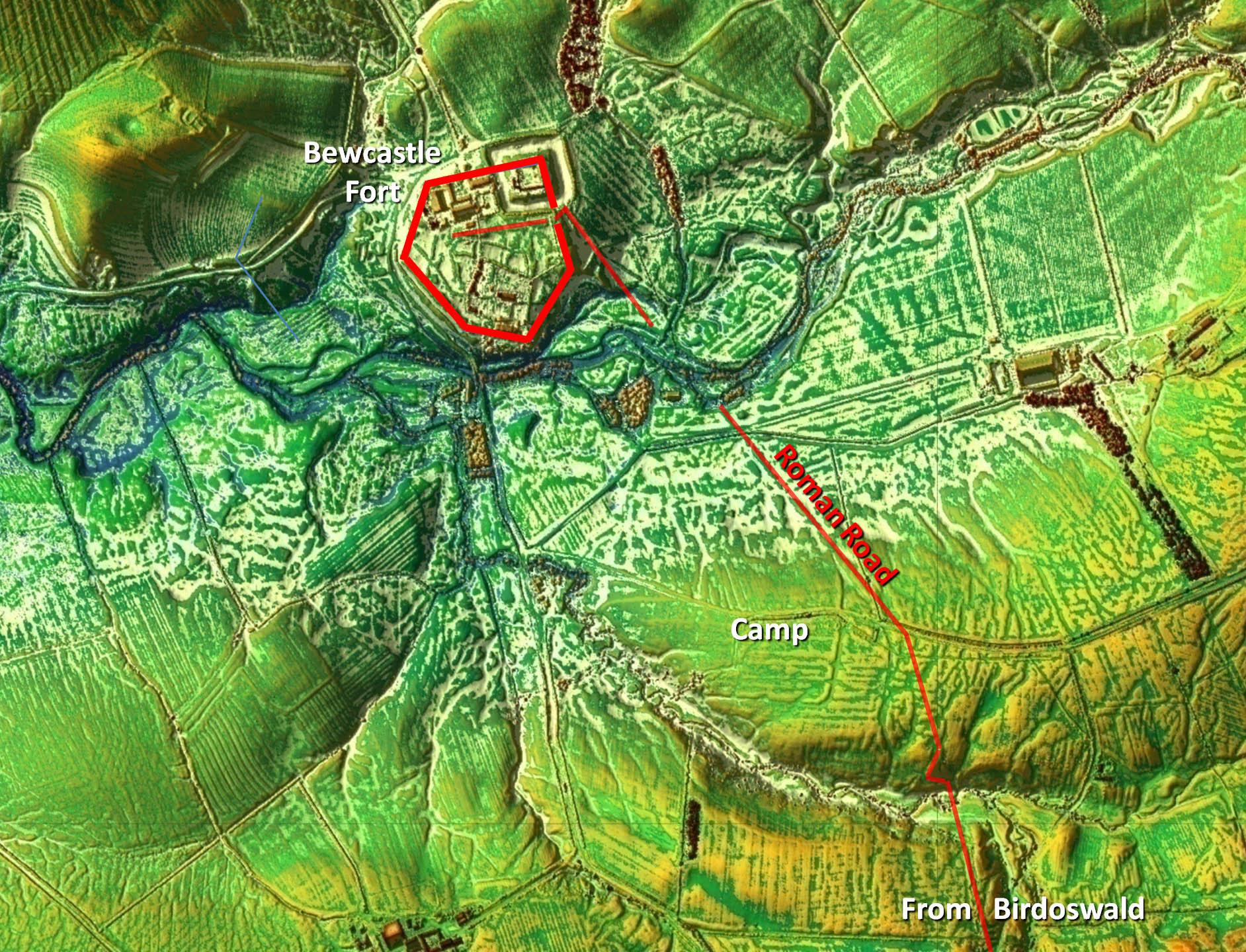
3D Lidar Image - Temporary Marching Camp Discovered by Bryn Gethin, this marching camp is so obvious it is actually visible on aerial photography but for some reason escaped detection until the advent of Lidar. Several entrances are visible. Note how the road skirts its east corner almost certainly indicating they were contemporary but with the camp the earlier.
|
Click for larger view |
 |
Lidar Image - Bewcastle Fort The fort comprises a very odd hexagon shape and appears to be a religious site as its probable name, Fanum Cocidii, means "shrine of Cocidus". The road arrives at the east gate of the fort. Today the site is remote from civilisation but must have still been important long after the Romans departed, witness Bewcastle Cross and the Norman castle built into the north-east corner of the Roman fort. There is a local society - Bewcastle Heritage Society. |
Click for larger view |
 |
NE3D Lidar video from Birdoswald to Bewcastle
|
|
|
|
Return to Cumbria Roman Roads homepage Last update June 2020 |
© David Ratledge |