 |
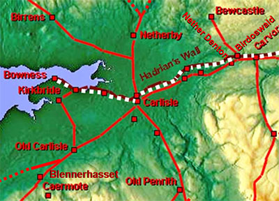
The Military Way, Margary 86It is one of those roads you know should be there but actually locating it is another matter. Believed to have run behind Hadrian's Wall for the full length but evidence for that is far from conclusive especially in Cumbria. Still we do have some certain lengths but a lot more missing lengths. Perhaps, or probably, it never was completed.
|
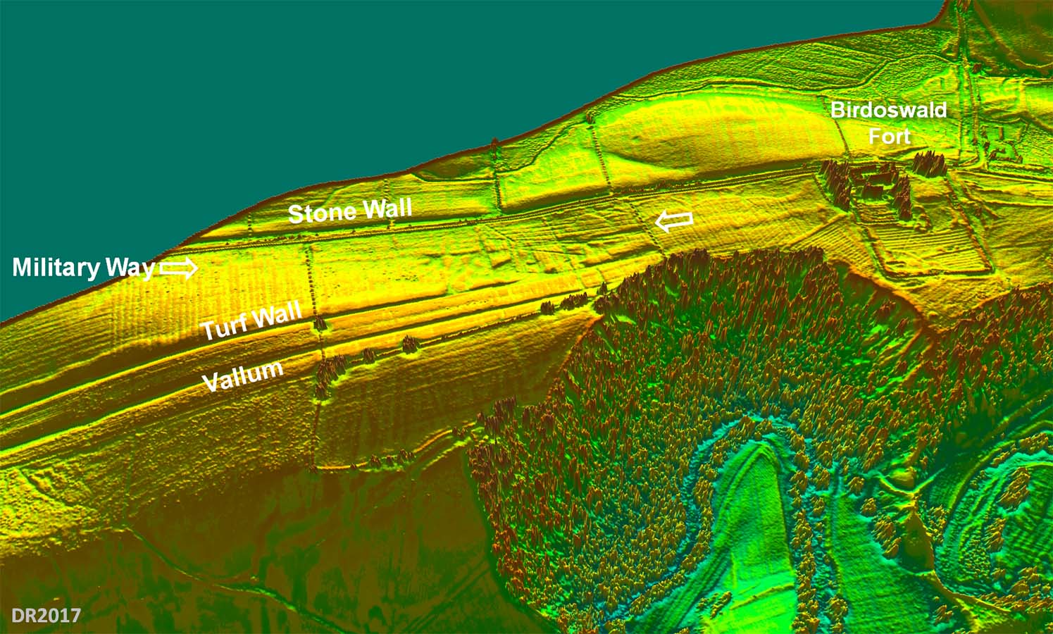
3D Lidar Image - West of Birdoswald This looking northwards towards Hadrian's Wall with Birdoswald fort on the right. The Military Way here is probably a good as any surviving in Cumbria. This spot is complicated by having the Turf Wall as well. |
Click for larger view |
 |
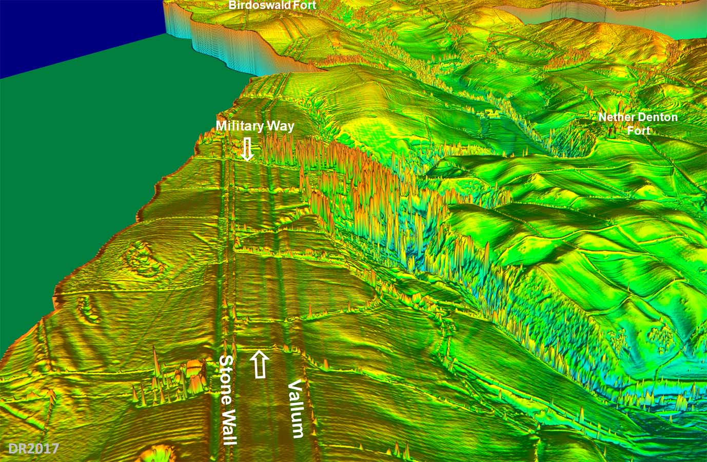
3D Lidar Image - North of Nether Denton Further west than the above image and another length of road is visable. |
Click for larger view |
 |
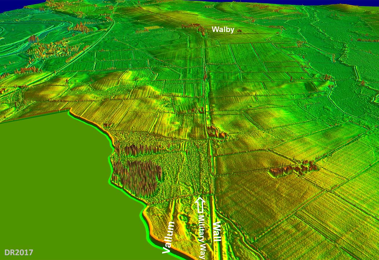
3D Lidar Image - Approaching Walby Looking west towards Walby then again a clear piece of road is visible, albeit not a very long length. |
Click for larger view |
 |
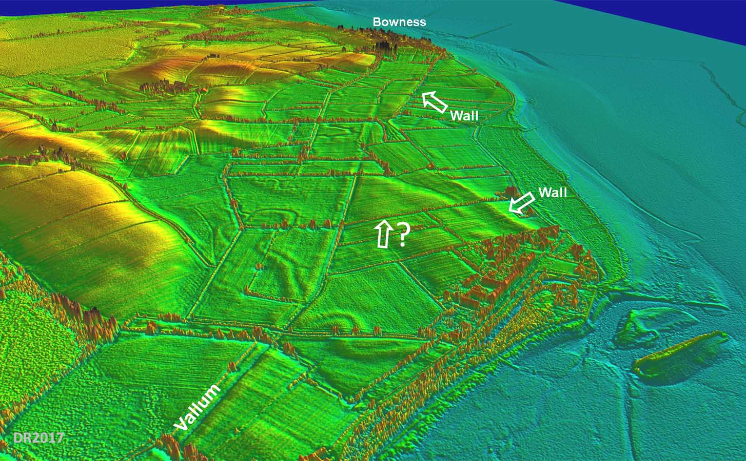
3D Lidar Image - Approaching Bowness The latest Wall Map (2014) shows a very short length where the arrow is pointing. There is nothing in Lidar supporting this. Typically west of Carlisle I could find no trace. |
Click for larger view |
 |
|
|
|
Return to Cumbria Roman Roads homepage Last update January 2018 |
© David Ratledge |