 |
The Western Stanegate Roman Road, Margary 85The forts of Burgh 1 and Kirkbride pre-date Hadrian's Wall and are considered contemporary with the Stanegate forts east of Carlisle. The proposal for a western road extension of the Stanegate serving them has often been suggested. In truth they would have needed road connections. Professor Barri Jones was probably at the forefront of researching this and in addition to recording a short length of road at Finglandrigg also proposed a linear palisade. However, he appears to have thought the road went via Burgh by Sands but we now know it took a much more direct course. Lidar coverage for the whole route has now been released and this confirms the route of the road virtually all the way to Kikbride. Burgh1 and Burgh-by-Sands link road is described at the bottom. NEW - Video flyover - see link at bottom
Reference Professor G.D.A. Jones & D.J. Woolliscroft, Hadrian's Wall from the Air, 2001 Despite references to a road on Finglandrigg he concentrates more on running ditches and watch towers. Somewhat frustratingly lacking in detail for us.
|
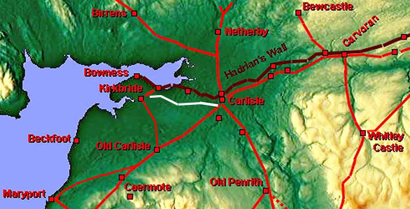
Western Stanegate Forts - location Map A very simple road design keeping to the drier ground and requiring probably just a single built up causeway across the marshy area crossing Grass Dike, approaching Finglandrigg |
Click for larger view |
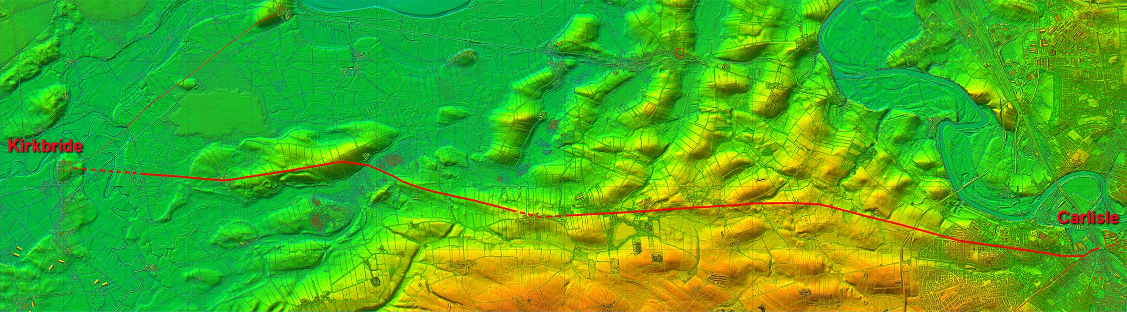 |
Oblique 3D Lidar View - looking West from Carlisle The section heading west beyond the suburbs of Carlisle is very clear in this 3D lidar view looking straight along its alignment. The vallum and the wall are also clear to the right on this image. Remember the Western Stanegate, Burgh 1 and Kirkbride pre-date Hadrian's Wall and it forts.
|
Click for larger view |
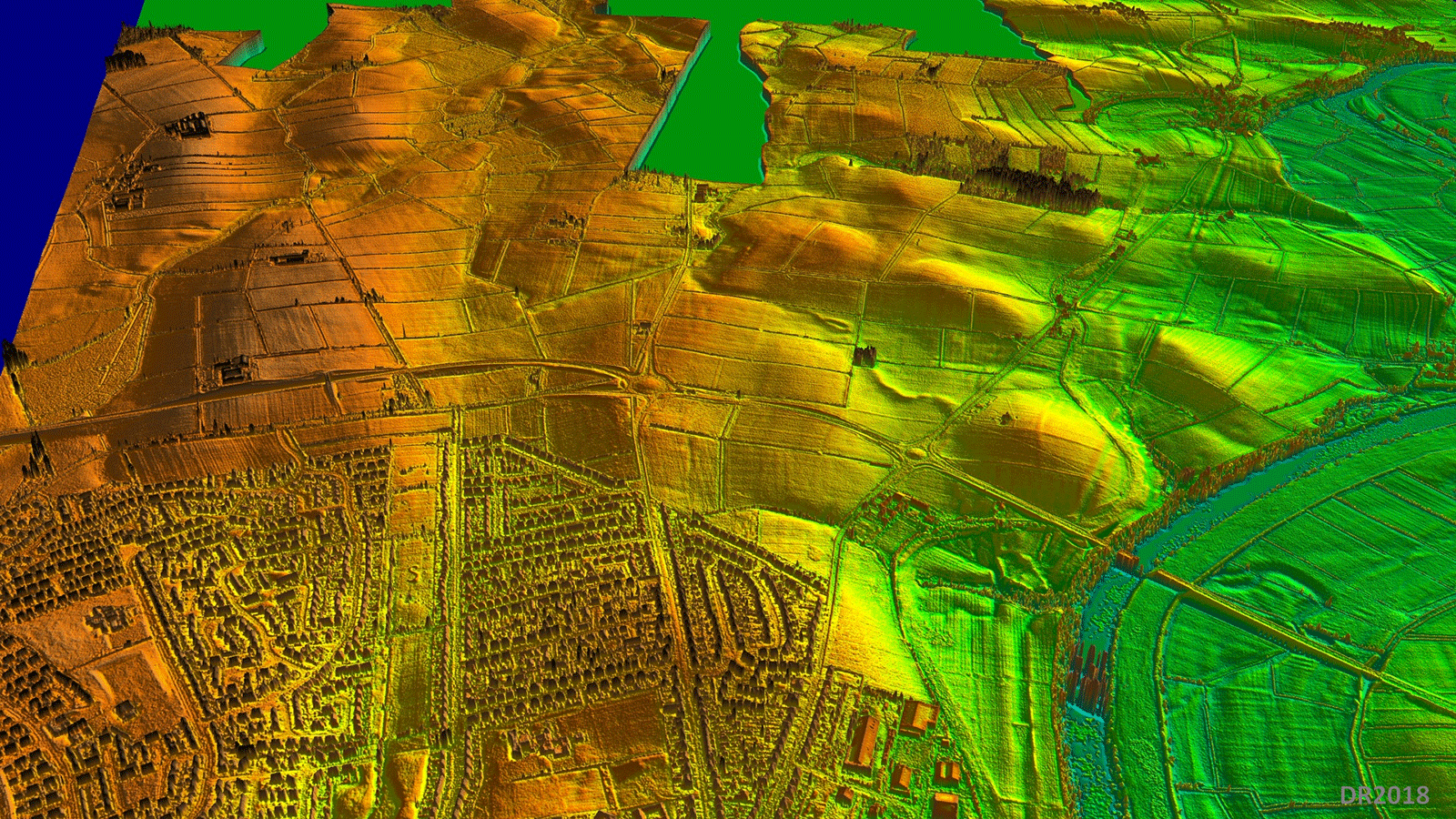 |
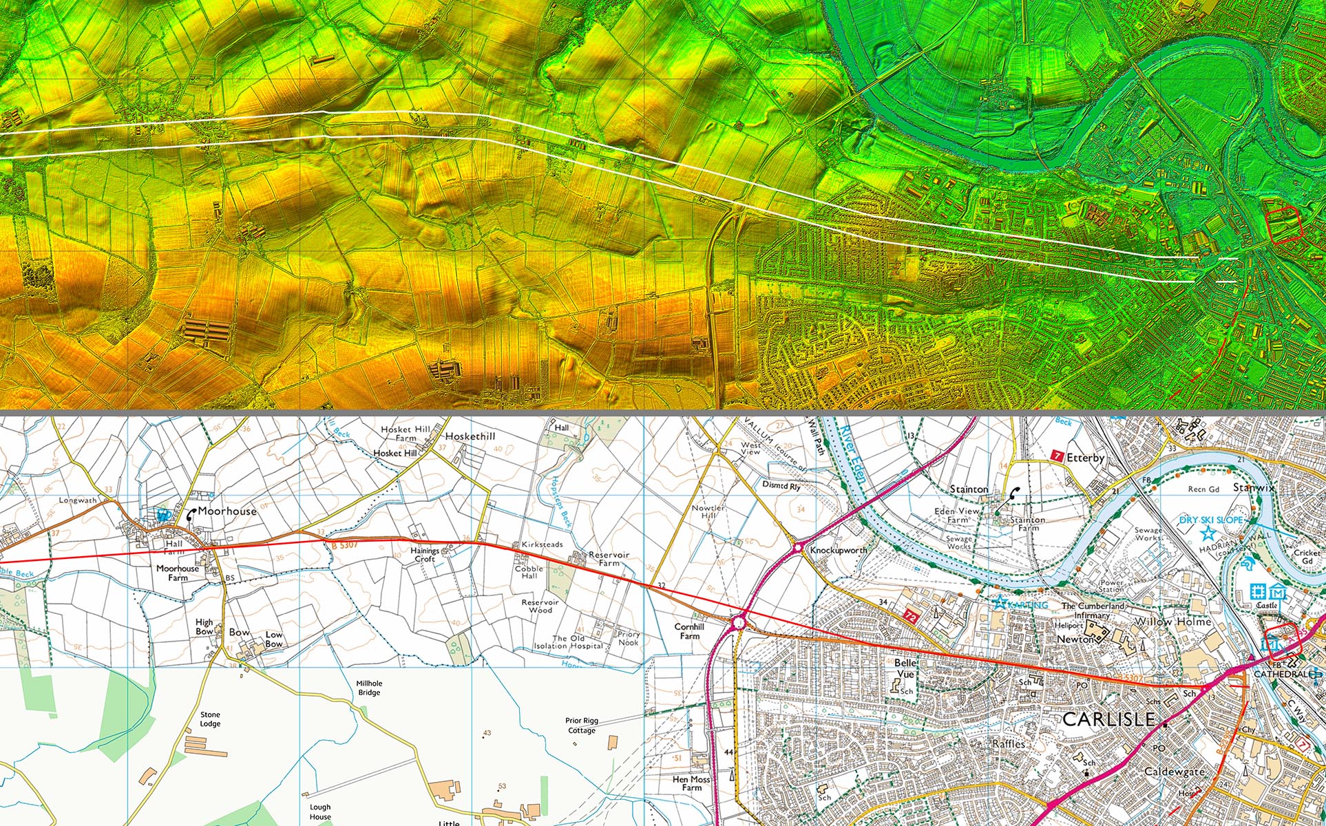
Lidar Image and Route Map 1 The first visible section is cut by Carlisle Westerly Bypass (Carlisle Northern Development Route), A689, but it is clearly visible either side of it. During construction the Roman road was not detected but of course they did not know its route then and thought it would be where the roundabout now is.
|
Click for larger view |
 |
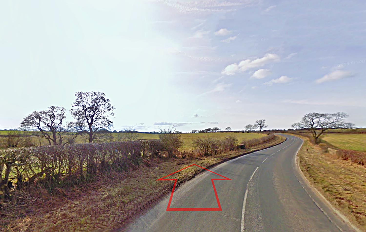
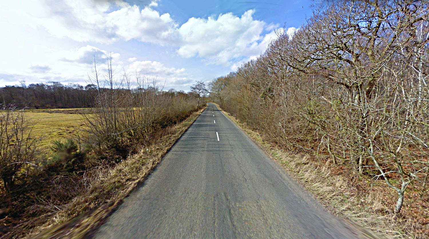
Approaching Moorhouse The B5307 swings off line crossing Greathill Beck, the bridge of which is just visible. The Roman alignment carries straight on. Image; Google |
Click for larger view |
 |
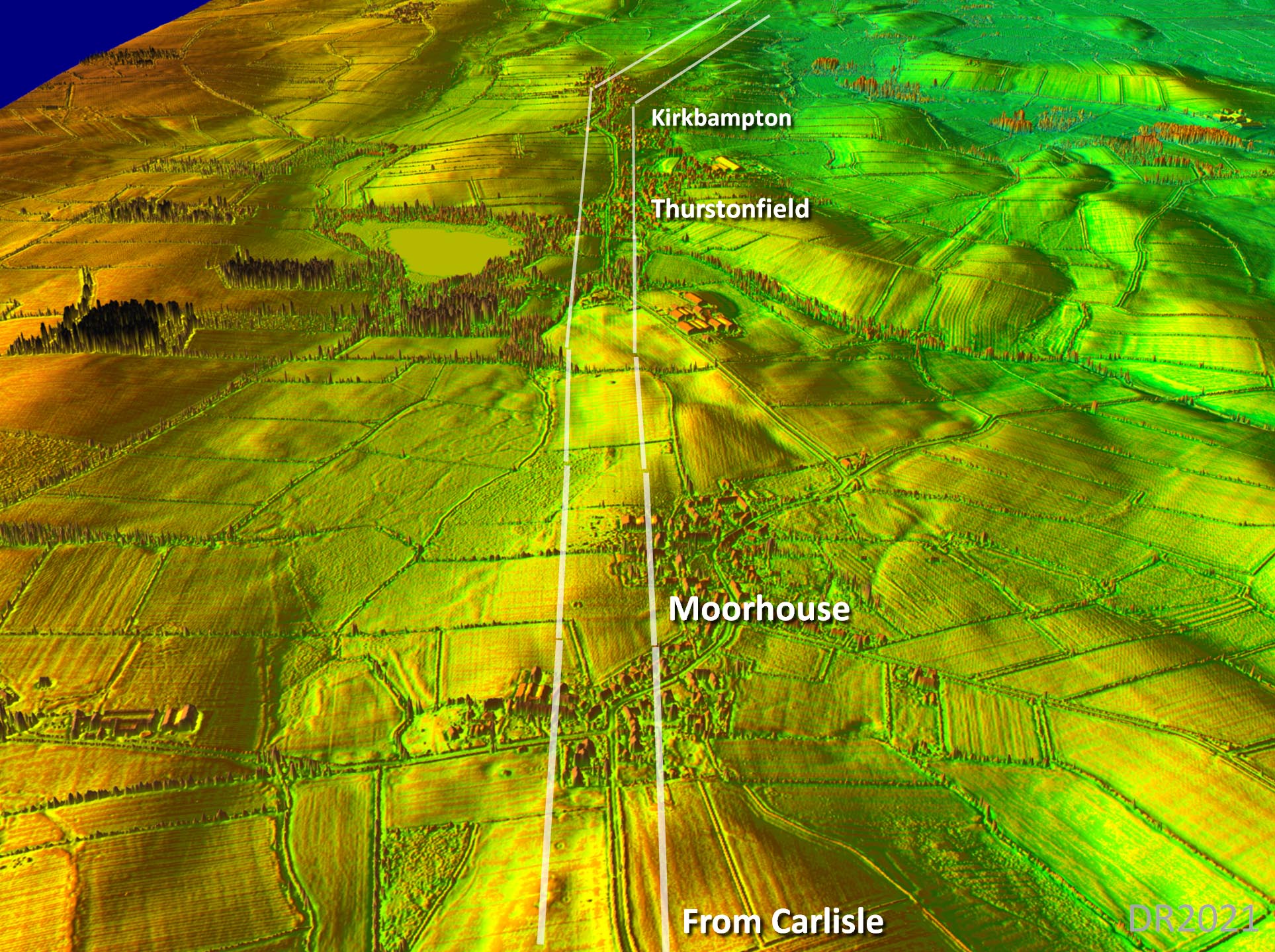
Oblique 3D Lidar View - Moorhouse This is the view that confirmed the Roman line was heading for Kikbride. Burgh is off to the right in this view so the road was continuing on beyond a link to Burgh and can only therefore be heading for Kirkbride. |
Click for larger view |
 |
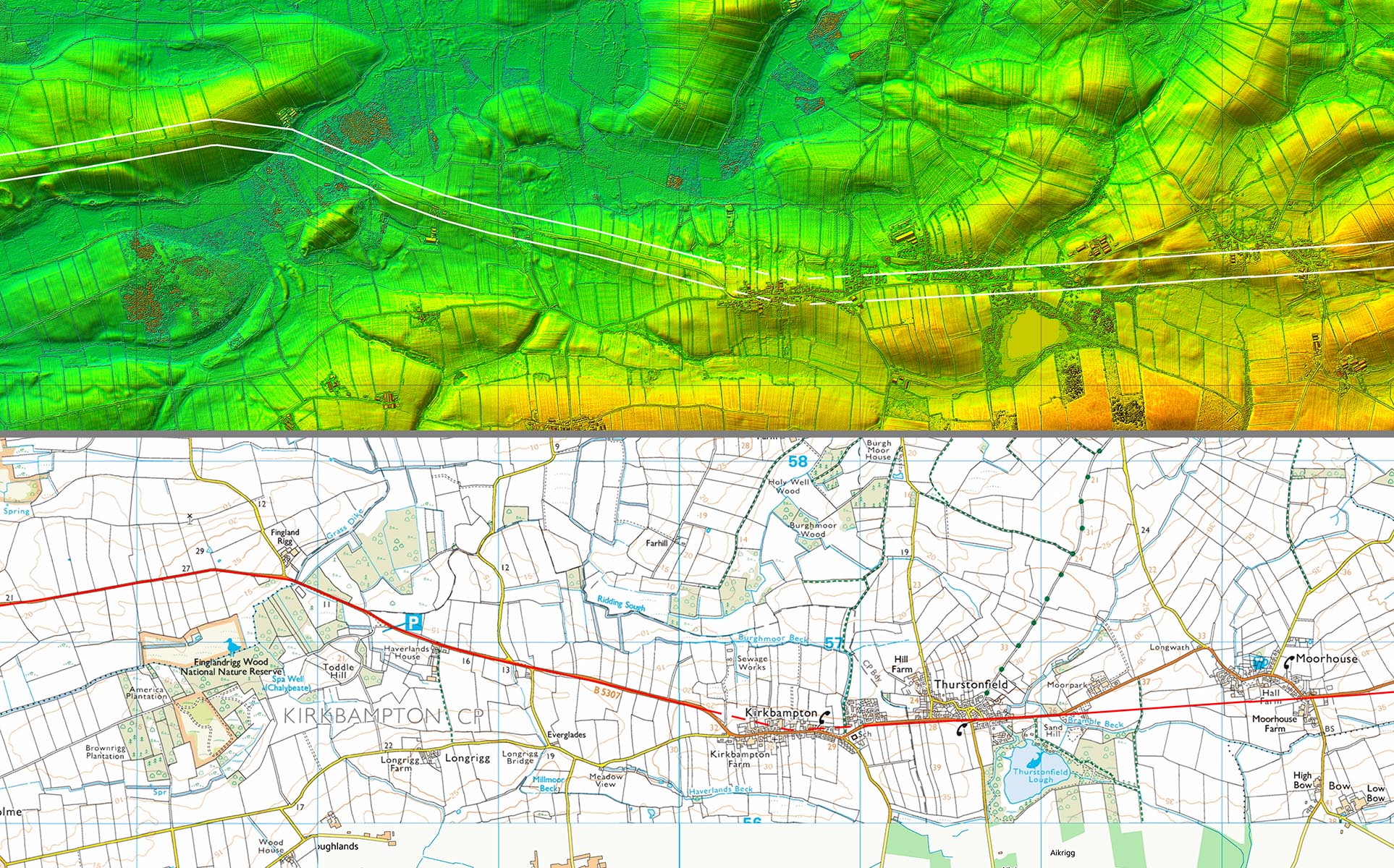
Lidar Image and Route Map 2 The Roman line between Moorhouse and Thurstonfield is direct and is clearly visible in the fields south of the modern road. It was spotting this length that confirmed this as the western Stanegate. |
Click for larger view |
 |
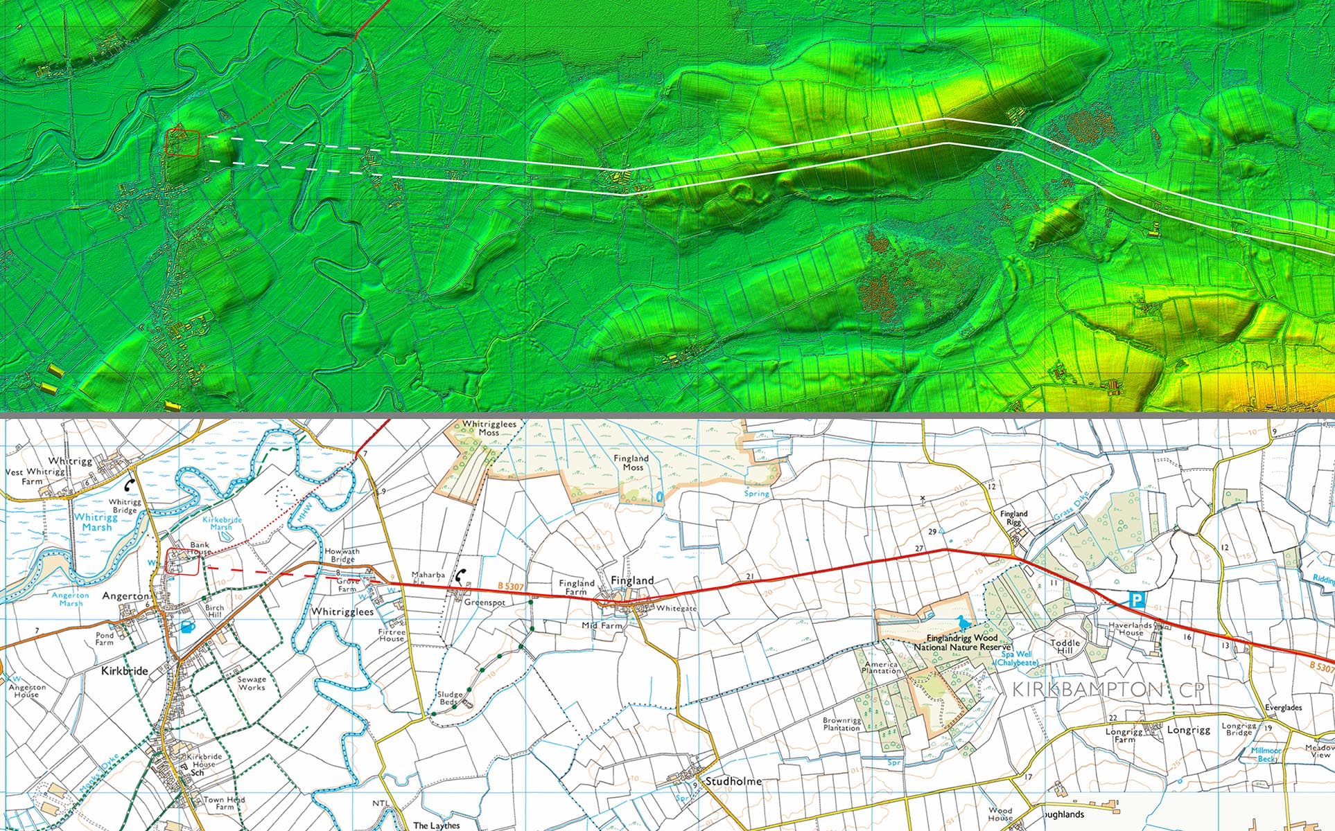
Crossing Grass Dike To get to the dry ground of Finglandrigg the road has to cross the marshy area of Grass Dike. The road is on a built-up agger the size of which is evident from the ditch on the left hand side. Image; Google |
Click for larger view |
 |
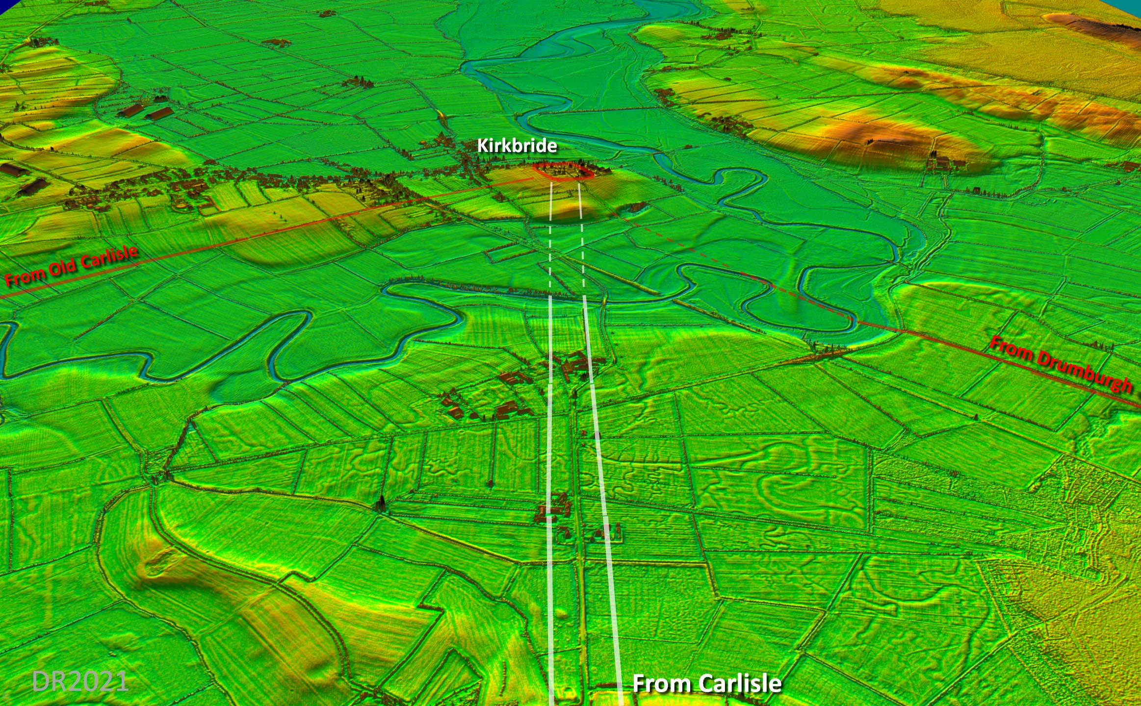
Oblique 3D Lidar View - Approach to Kirkbride The straight modern road is clearly the Roman line and it heads straight for Kikbride fort exactly where a road was recorded leaving the fort. The two other roads to Kirkbride are also shown but the Drumburgh one must be a later road as it dates to Hadrian's Wall era. Kirkbride was possibly the Roman site of Briga. The name is recorded in the Vindolanda tablests and Kirkbride is contemporary with Vindolanda. |
Click for larger view |
 |
Lidar Image and Route Map 3 Much of the modern road overlies the Roman line but we can be confident that it does represent the Roman course. The final stretch across the marsh has left no trace but the last certain length is aligned on the fort and matches precisely where Professor Barri Jones recorded the road leaving the fort. So it all fits together. |
Click for larger view |
 |
Link Road to Burgh1 and Burgh-by-Sands Burgh Fort 1 was an early site and would therefore have surely needed a connecting road. The existing modern road from Moorhouse to Burgh would appear to represent the probable Roman line. In this form the Western Stanegate would have lasted for around 50 years before a huge change to the frontier was to take place with the arrival of Hadrian’s Wall. West of Carlisle new forts were established at Burgh by Sands, Drumburgh and Bowness. Burgh by Sands would have easily been connected into the existing road system by a short extension from Burgh 1. This has been confirmed by excavation (thanks to Paul Hickman for notifying me) - details below |
Click for larger view |
 |
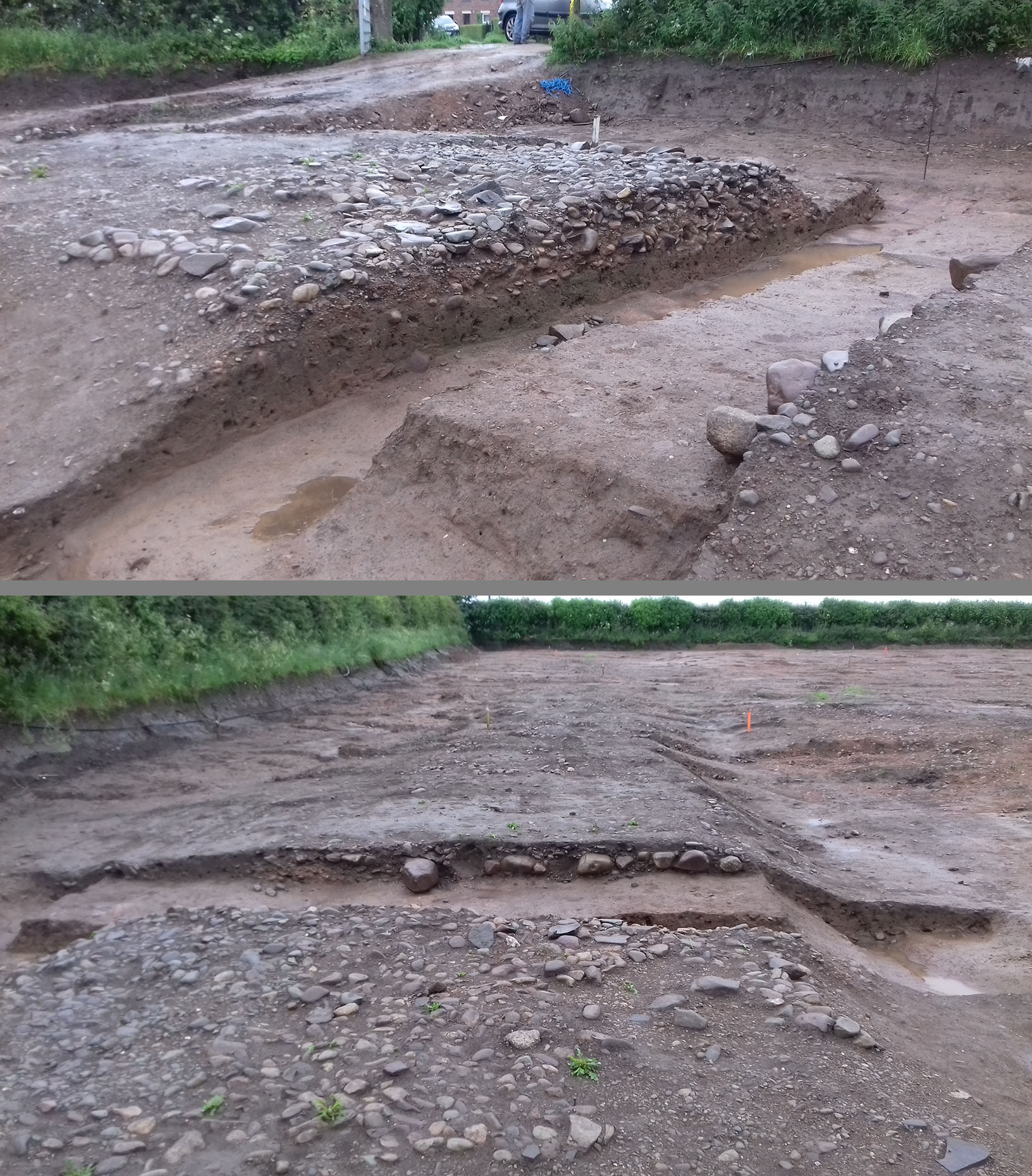
Excavation of Link Road to Burgh1 and Burgh-by-Sands - June 2019 Thanks to Paul Hickman for these photos showing the excavated road to the west of Amberfied Road approaching Burgh-by-Sands - see above map for location. The upper picture reveals the full contruction depth and also indicates it has survived almost in pristine condition. In the lower picture looking south the roadside hedge can be seen on the left. More detials to follow.....
|
Click for larger view |
 |
|
NEW - 3D Lidar video flyover from Carlisle to Kirkbride and on to Bowness |
|
|
|
Return to Cumbria Roman Roads homepage Last update November 2021 |
© David Ratledge |