|
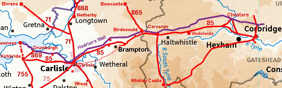
The Stanegate Roman Road, Corbridge to Throp via Vindolanda & Carvoran, Margary 85This describes the Northumberland section of the Stanegate road. Several years ago I was asked by John Poulter if I could use lidar to help in locating the Stanegate west of Corbridge. We only had series 1 lidar then but that was enough to believe we had solved the mystery. The later release of more complete series 2 lidar confirmed what we had found. However, the findings were embargoed for around 2 years but this is now lifted so the story can at last be told. The route no doubt began as a fast cross-country road linking the two strategic border sites of Corbridge and Carlisle, either side of the Pennines. Following the abandonment of the campaign to conquer what is now Scotland, it was adapted and probably the route adjusted here and there when it became a frontier. It was strengthened with a fort system that appears to repeat in a pattern of large - small - large - small etc.. Note that a small fort at Crosby would be expected but one has not been found (yet). Note the Stanegate preceded Hadrian's Wall by about 50 years.
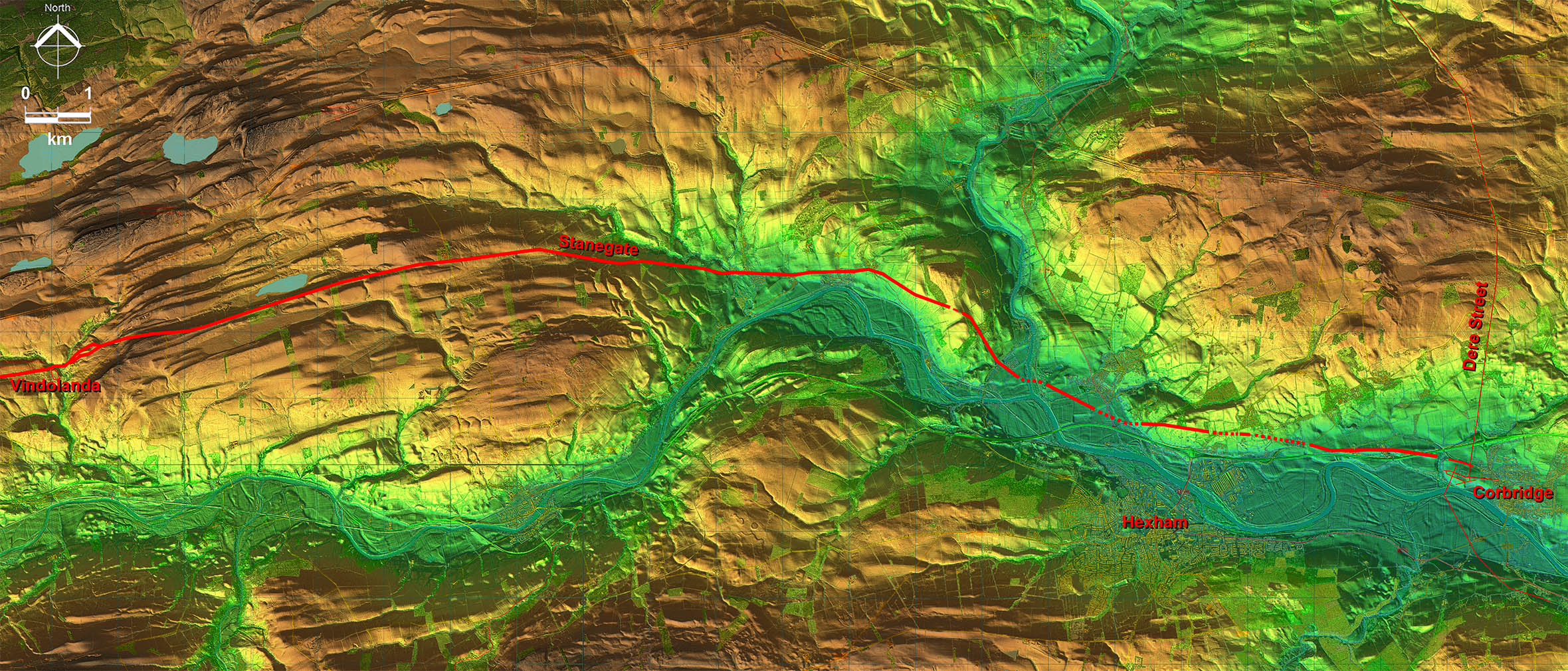
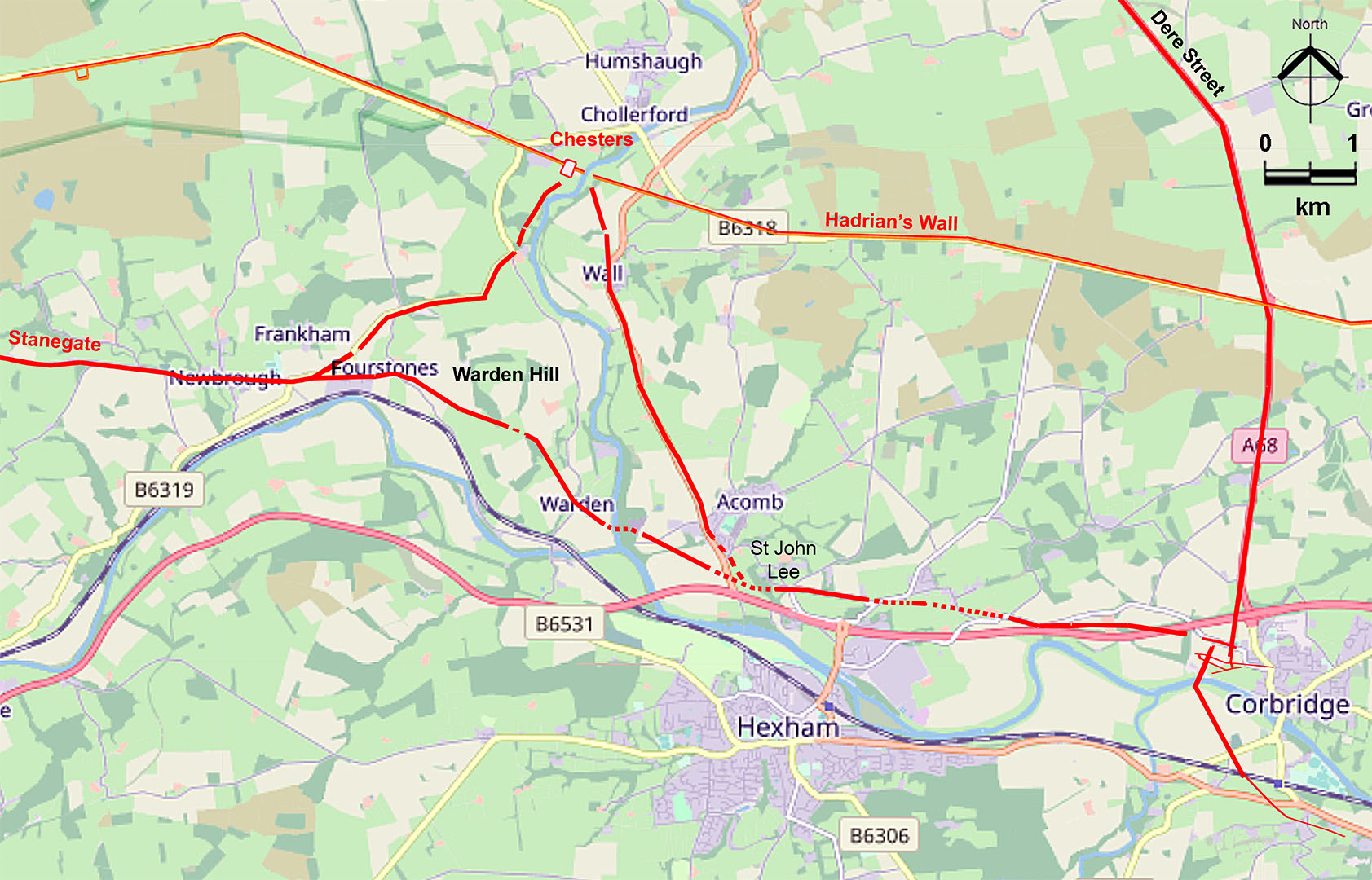
However, the route of the Stanegate from Corbridge to Fourstones was lost. Hadrian's Wall Map showed the road from Fourstones heading to the north of Warden Hill where it disappeared. Its real location can now be revealed.
Video flyover from Vindolanda to Corbridge
|
Lidar Image - Corbridge to Vindolanda A direct line would have necessitated crossing the South Tyne and River Tyne twice whereas a route via Fourstones involved just a single crossing of the North Tyne - sensible road surveying typical of the Romans. Remember this road was created around 50 years before Hadrian's Wall came into existence and the goal was undoubtedly the most practical route linking Corbridge and Carlisle. |
Click for larger view |
 |
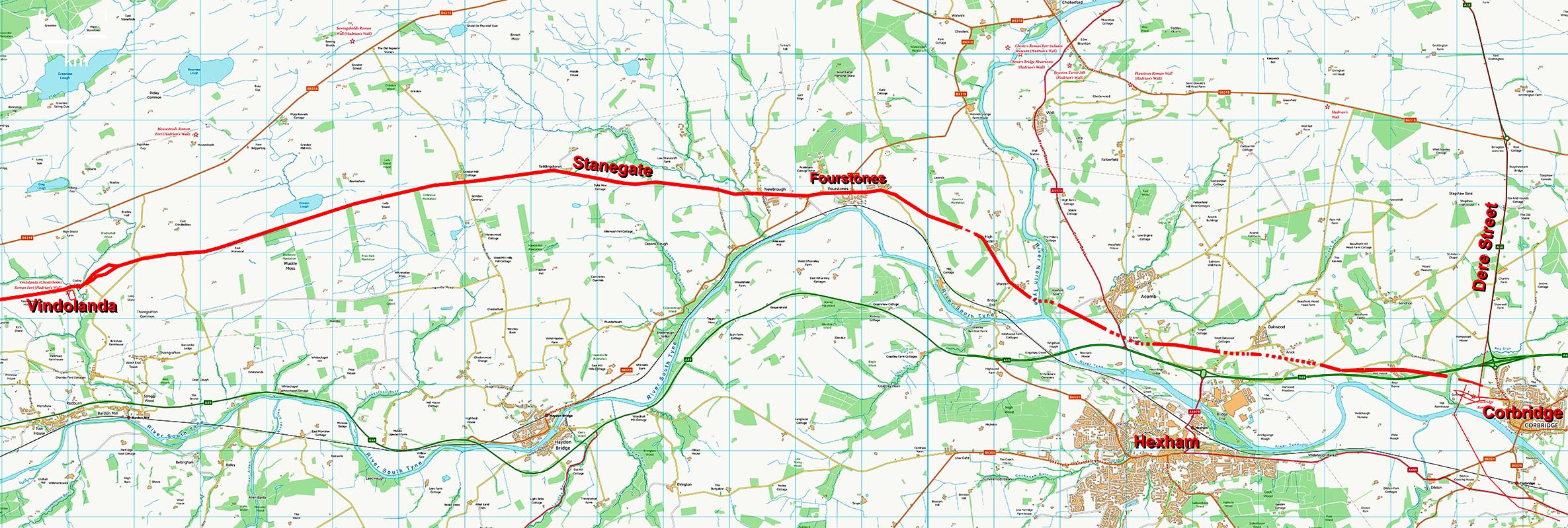
Route Map - Corbridge to Vindolanda Modern map equivalent to the above.
|
Click for larger view |
 |
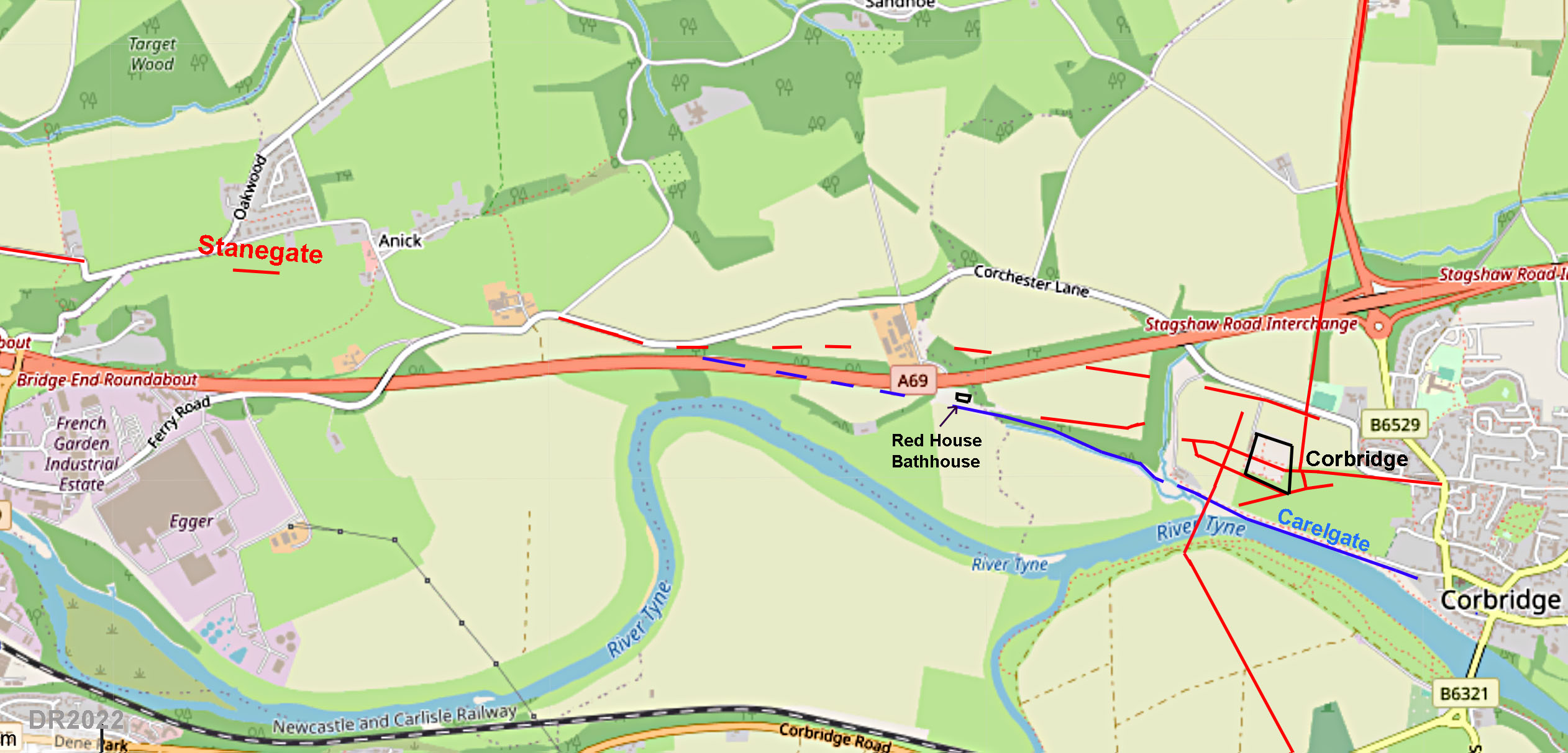
Corbridge Road Plan The Stanegate was probably set out when the early Red House Fort and Bathhouse was extant so the medieval road known as Carelgate (or part of it) was possibly the original Stanegate route - the alignment west of Red House would tend to support this. This appears to have been bypassed by a later more northerly route when the site moved further east to Corbridge. It is however very confusing with several local roads.
|
Click for larger view |
 |
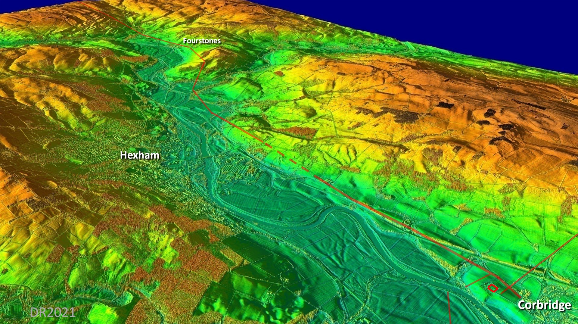
Oblique 3D Lidar - Corbridge towards Fourstones The route of the Stanegate to Fourstones was lost but in reality it followed a typically direct and practical route to Fourstones where it could turn and aim directly to Carlisle via Vindolanda.
|
Click for larger view |
 |
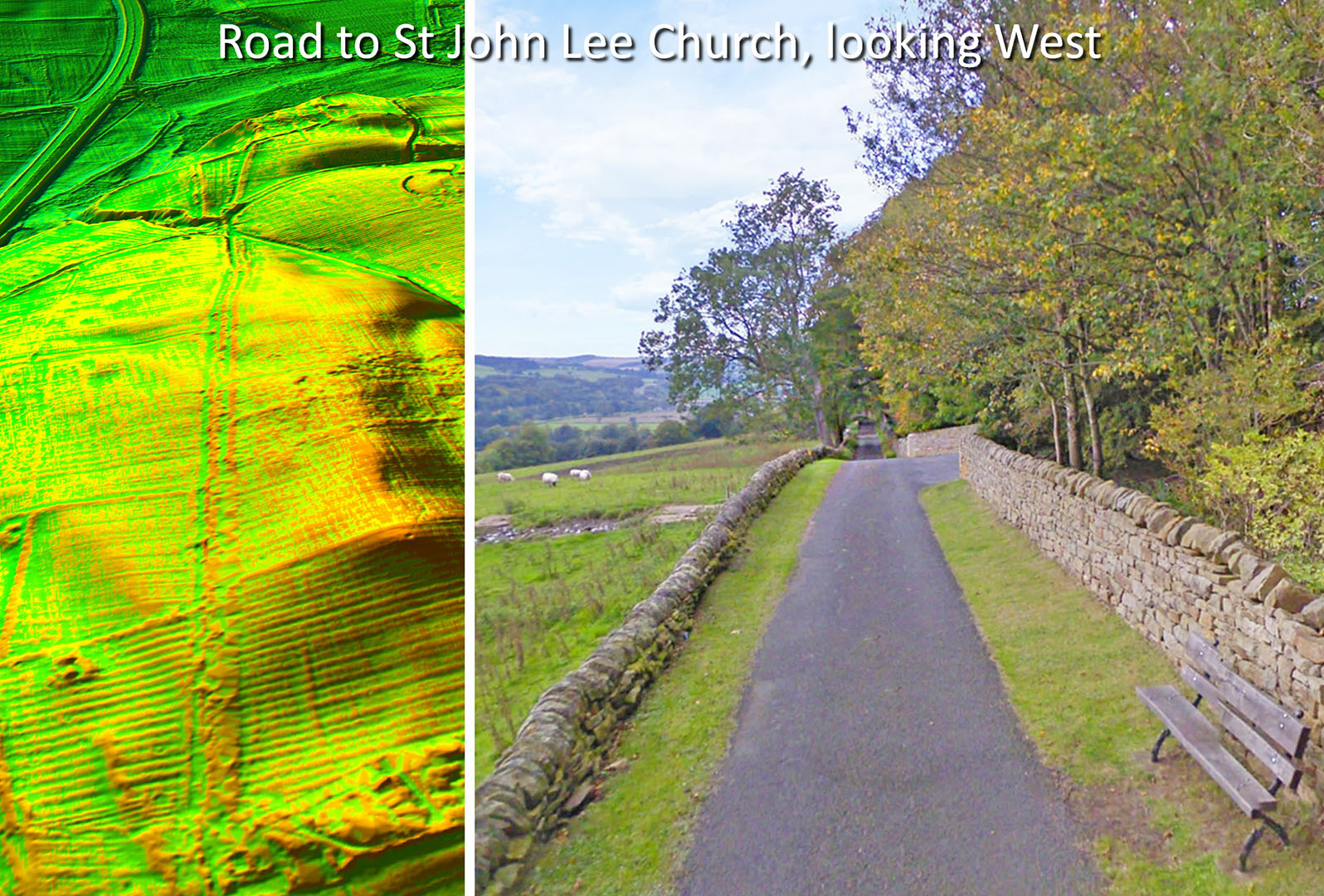
Unnamed Lane, Acomb - looking west It was this lane (right) that John Poulter suggested could well be the Stanegate. Here we are passing the entrance to Target House. Its straightness rather than its modern width is the big clue. However, the DTM Lidar view (left) clearly shows an original road width twice as wide as the modern lane. It can only be the Stanegate!
|
Click for larger view |
 |
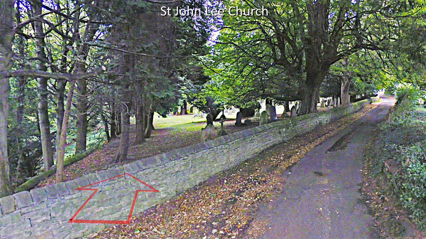
Unnamed Lane, St John Lee Church - looking west The straight unnamed lane swings off to the north at St John Lee Church. The Roman line carries straight on as indicated by the arrow.
|
Click for larger view |
 |
Lidar Image, Route Map - Acomb This straight lane at St John Lee was first suggested to me by John Poulter and Lidar extends this both ways indicating that it is indeed the Stanegate route. The North Tyne crossing point can be inferred with high confidence. Whether it was a bridge or ford (Howford) would need local research but I would guess a road as important as the Stanegate then it would have been a bridge..
|
Click for larger view |
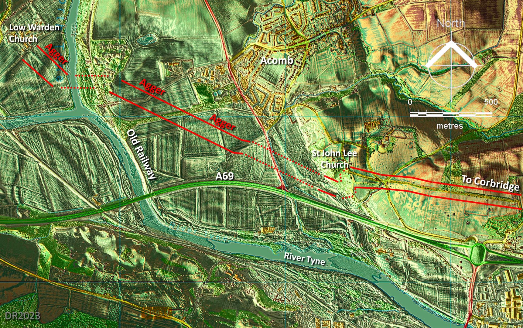 |
3D Lidar Image, Acomb - looking East It all fits together very logically. Notice how the lane to St John Lee Church is aligned on Corbridge.
|
Click for larger view |
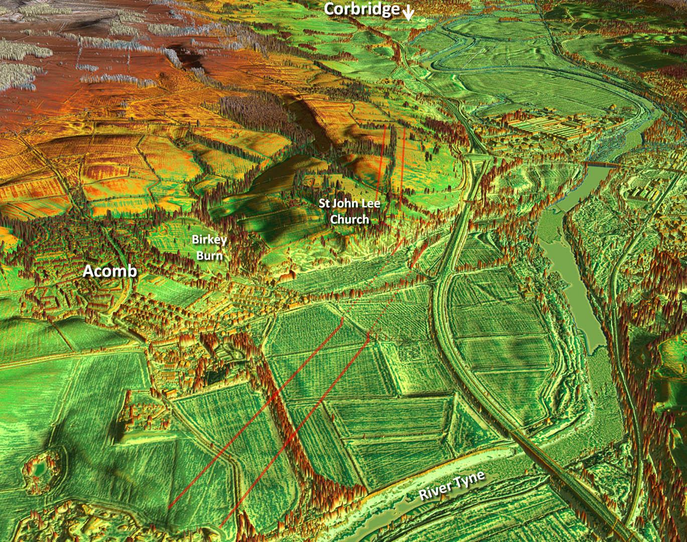 |
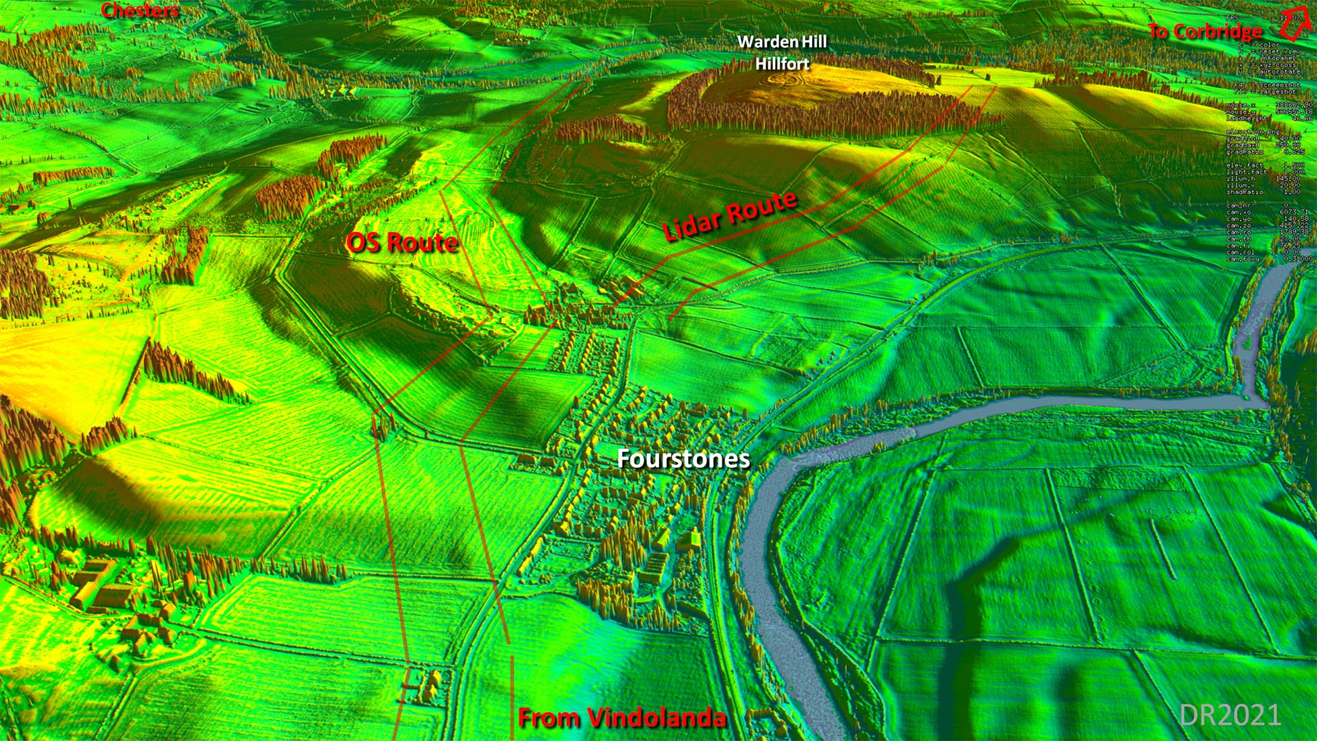
Oblique 3D Lidar - Acomb and the Tyne Crossing It was this view that confirmed the route went via High Warden. Neither the OS route north of Warden Hill nor a low route to the North Tyne crossing point from Fourstones are commensurate with the clear Lidar evidence visible here. There can no longer be any doubt as to the route the road took. |
Click for larger view |
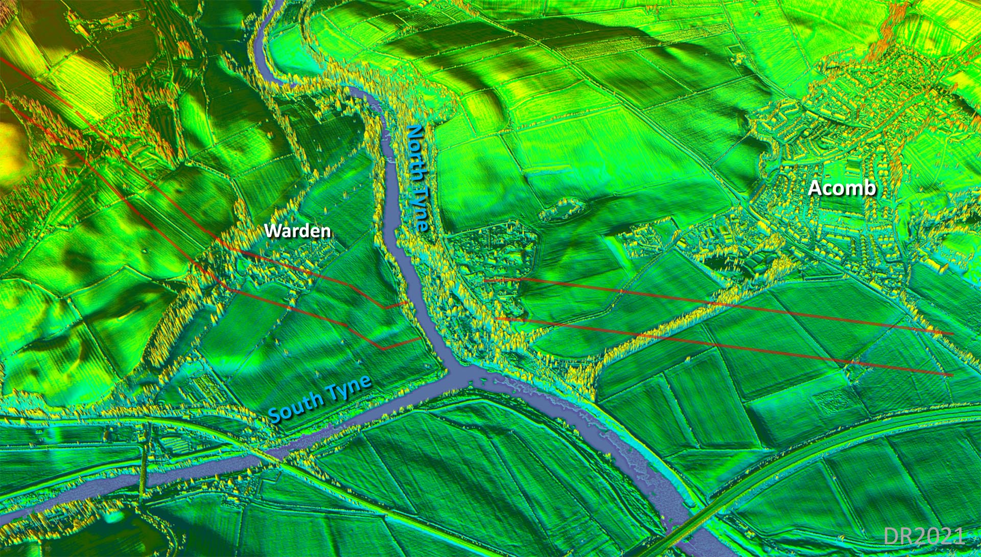 |
Lidar Image - Route across Warden Hill to Fourstones Seeing this convinced me that at last we had found the route of the Stanegate from Fourstones to St John Lee. The evidence clear over virtually the full length. It is typical Roman engineering - directness without excessive climbing. An excellent compromise. The North Tyne crossing point is reasonably certainly located too and I would guess it would be a bridge for a road as important as the Stanegate.
|
Click for larger view |
 |
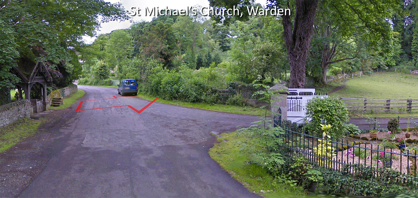
St Michael's Church, Warden The road passes through St Michael's Church graveyard, crosses this minor road and then strarts climbing up to Higher Warden. The wall/hedge (right above middle) marks its course. There is a Motte & Bailey here. Now we know where the road is its location alongside the Roman road makes perfect sense. There is a very similar arrangement at Netherby (Cumbria) with Roman road, river and motte all adjacent. |
Click for larger view |
 |
Traditional OS Route This is the route depicted on modern OS maps including the Hadrian's Wall Map. Coming from the Vindolanda direction it is very logical to Fourstones but the route depicted then illogically heads north-east around the north of Warden Hill before coming to an abrupt end. Not only that it is not a sensible line to achieve that but dog-legs unnecessarily and has to go over a hillock where a more direct option was clearly available. There had to be a simple explanation! Note there were excavations carried on this line north Warden Hill and they did find a road but its Roman authenticity is now doubtful in the light of a much more likely direct route. Mapping: Openstreetmap |
Click for larger view |
 |
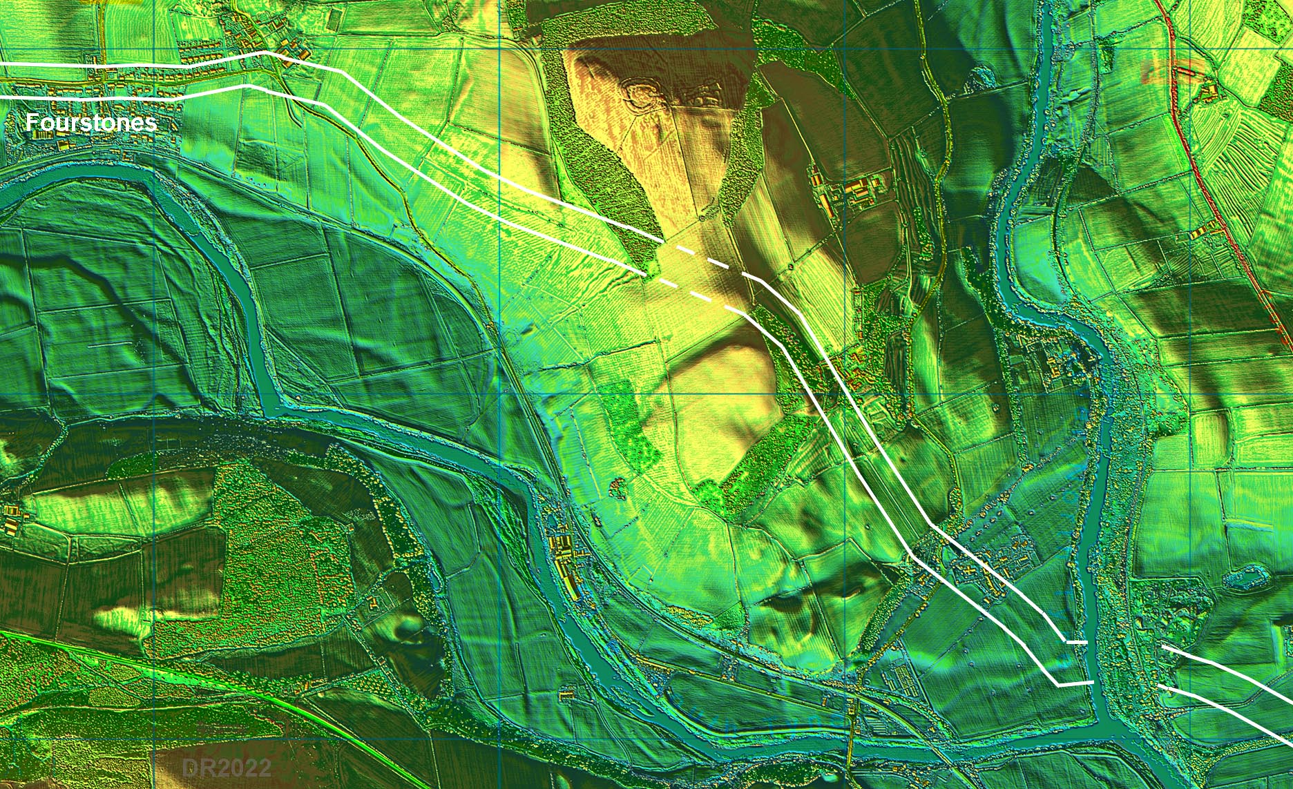
Oblique 3D Lidar - Fourstones looking East This view I think shows how illogical the supposed OS route around the north side of Warden Hill was. For a start - why turn off the alignment before Fourstones and turn left (north-east). It isn't even straight when it could have been. It is a dogleg route and as a consequence has to cross a ridge. A straighter and easier option was plainly possible. As we shall later there was a turn off to the north-east at this spot but not go around Warden Hill - it was a link to Chesters - visible top left. It was not the Stanegate, which can be seen heading to the right (south of Warden Hill fort) towards Corbridge. The following sequence should make it all clear.
|
Click for larger view |
 |
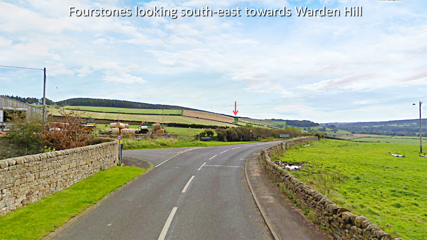
Fourstones looking south-east over Warden Hill We are looking back from Fourstones towards Corbridge from where the Roman road leaves the modern road. The Roman road can be seen climbing up across the slope of Warden Hill. How was it missed? With hindsight it is of course blindingly obvious.
|
Click for larger view |
 |
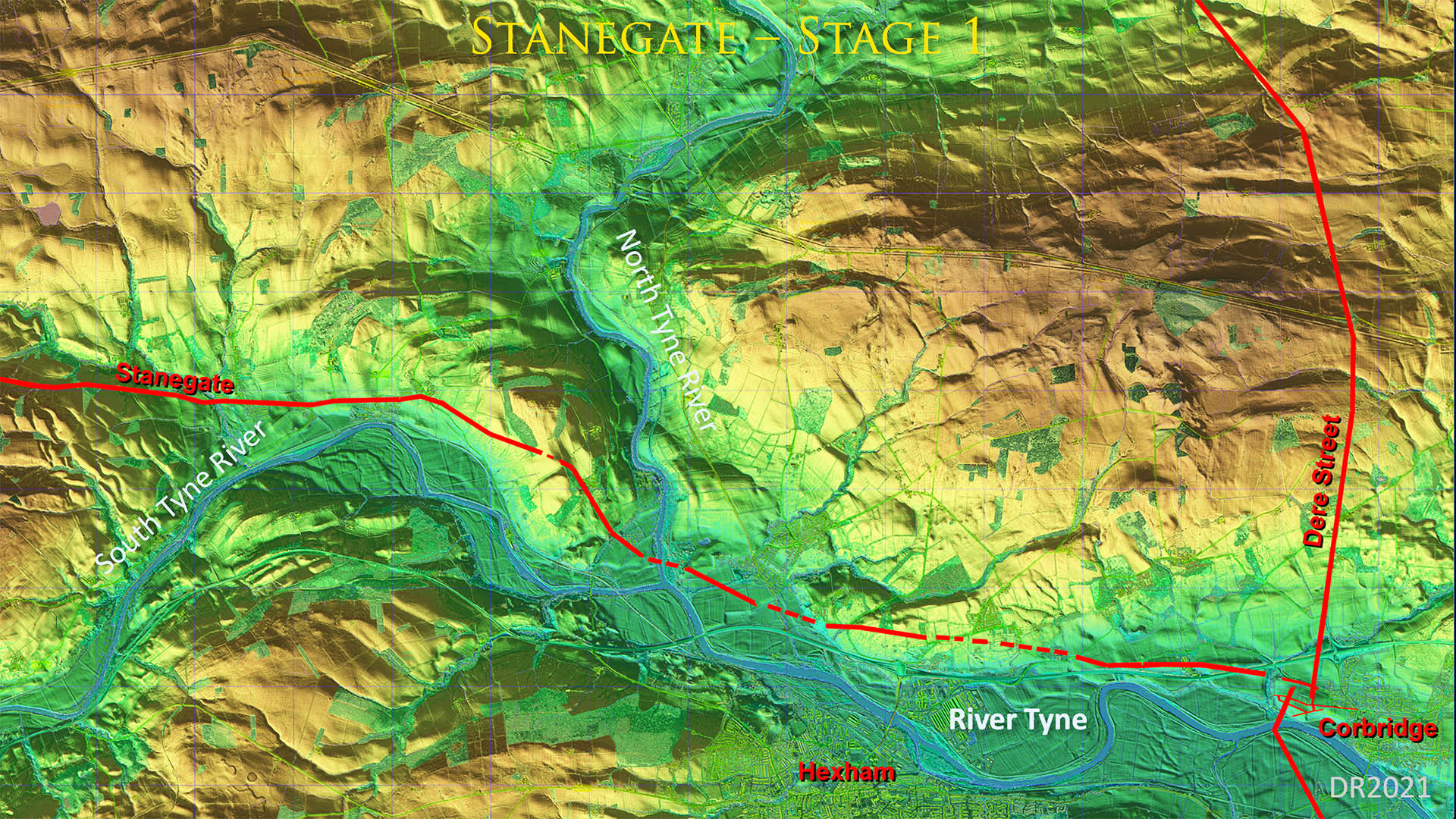
Fourstones to Corbridge - Stanegate Stage 1 Stanegate on its own - before Hadrian's Wall and Cheters fort. A very logically laid out road heading around the south Tyne at Fourstones. It is the shortest practical route. |
Click for larger view |
 |
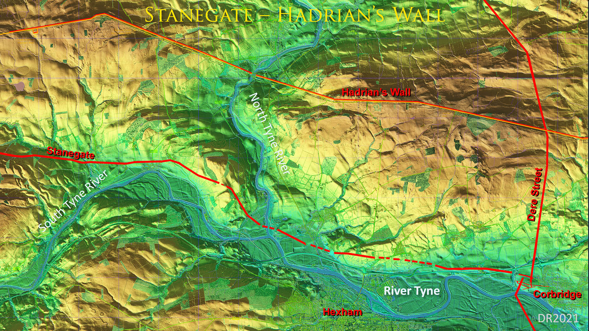
Fourstones to Corbridge - Stanegate Stage 1 + Hadrian's Wall Initially Hadrian's Wall did not have wall forts - they were an after thought. So the link roads up the Wall were most likely to come later. |
Click for larger view |
 |
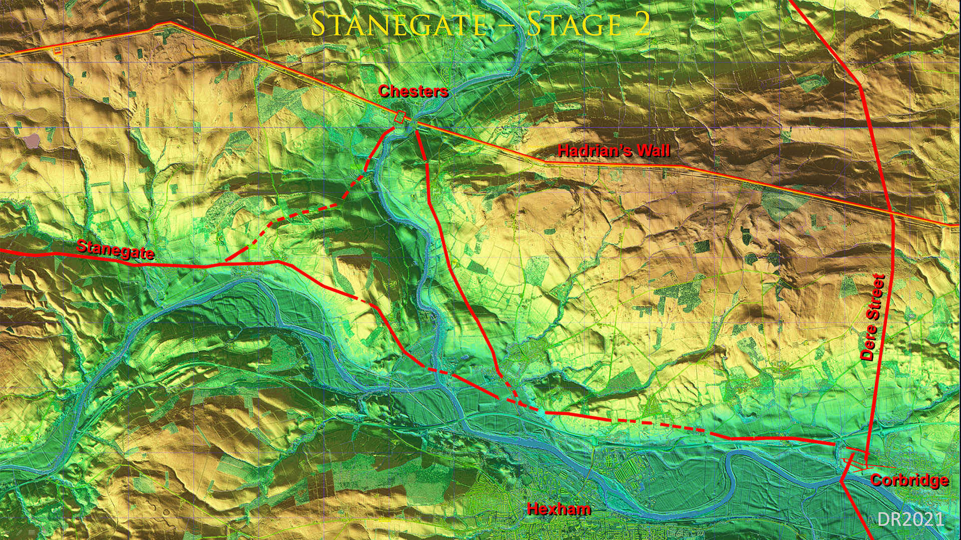
Fourstones to Corbridge - Stanegate Stage 2 + Chesters Fort When Chester Fort was added to the Wall then there would have been need for it to be connected to the Stanegate. Two link roads appear to have been provided. The beginning of the westerly one was known from geophys heading south-south-west at Chesters. The dogleg at Fourstones thought to be the Stanegate heading north of Warden Hill now makes sense. It was not the Stanegate but the link road to Chesters. |
Click for larger view |
 |
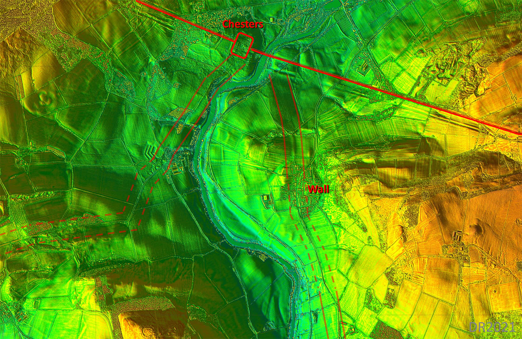
Lidar Image - Chesters Link Roads The westerly road was known- or at least the Chesters end of it - from geophys work around Chester fort. The route to Fourstones was not a simple straight line but sensibly went around small hillocks there, The easterly road is clear approaching the North Tyne bridge at Chesters. There is also a section visible further south where the modern road wanders off line (bottom edge of this image). |
Click for larger view |
 |
Map - Final Arrangement at Corbridge So once Hadrian's Wall and Chester fort arrived then this was the final arrangement of the roads. A very logical and practical solution. Mapping: Openstreetmap |
Click for larger view |
 |
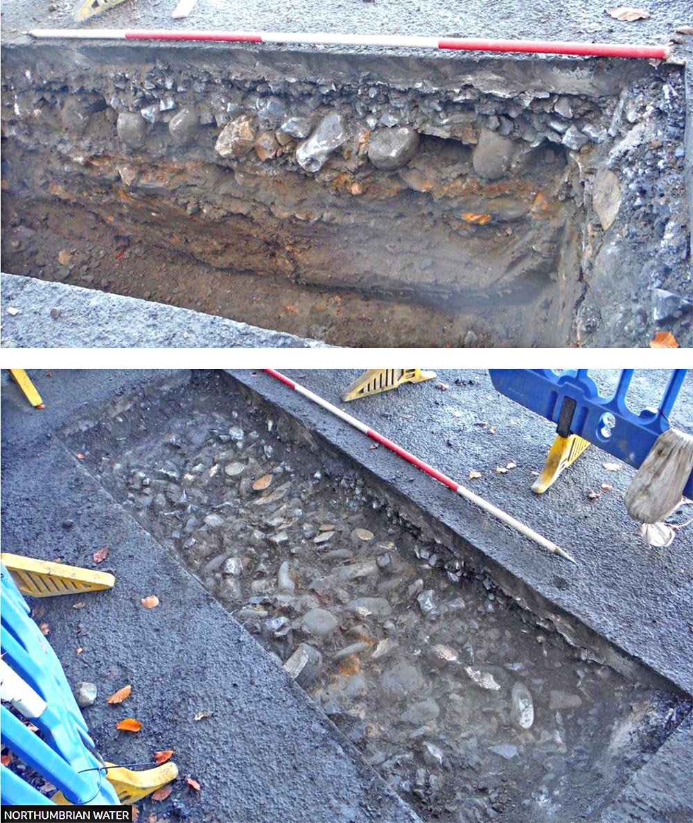
Settlingstones - Road revealed in Water Main Excavation 2020 The remains were discovered by Northumbrian Water in December 2020, when they undertook improvement works on the line of he Stanegate road in Settlingstones. Philippa Hunter, from Archaeological Research Services Ltd, which worked on the site, was quoted as saying "While monitoring the excavation pit, our archaeologist identified a deposit of compacted cobbles thought to be the remains of the Roman road's foundations." Images: Northumberland Water |
Click for larger view |
 |
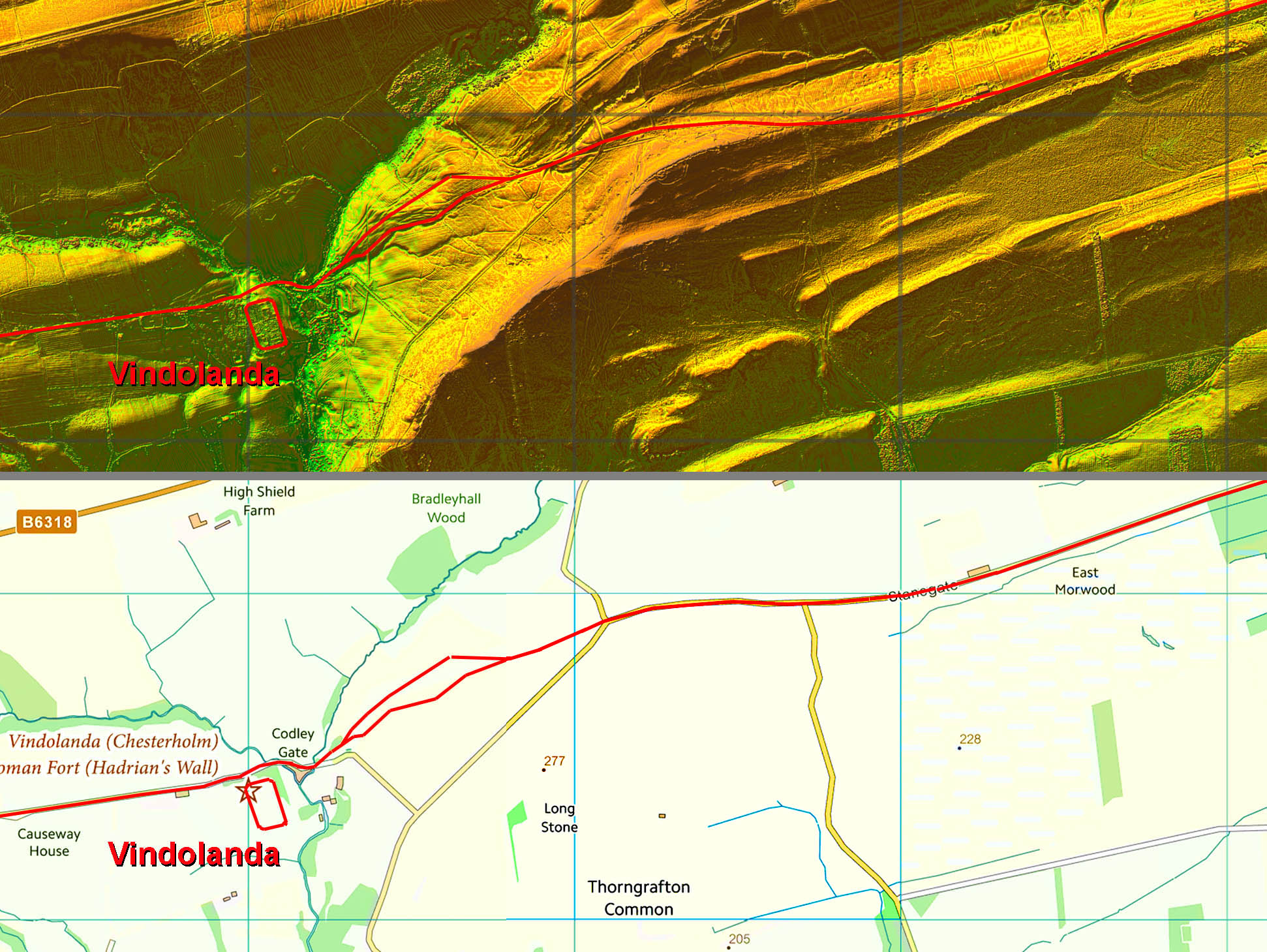
Lidar Image & Route Map - Vindolanda The "dual carriageway" east of Vindolanda is not unique. It just means within the lifetime of the Stanegate it was re-routed for some reason. Perhaps from too marshy ground or too steep a gradient. Just think how often we upgrade roads. |
Click for larger view |
 |
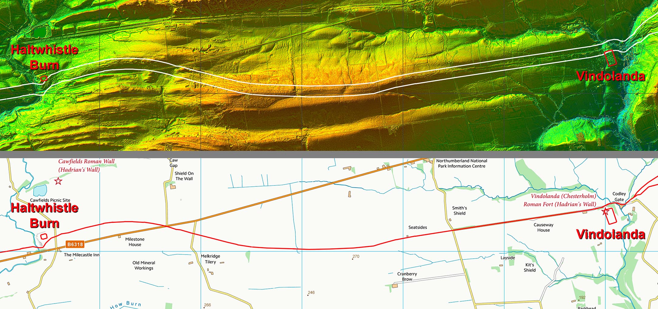
Lidar Image & Route Map - Vindolanda to Haltwhistle Burn If you have visited Vindolanda then you will have driven down the Stanegate to get into the carpark. The section of the Stanegate passing Vindolanda is unique in that there are/were 4 milestones in succession. This would tend to suggest that the Stanegate did have milestones every mile along its length otherwise why put just 4 together?. |
Click for larger view |
 |
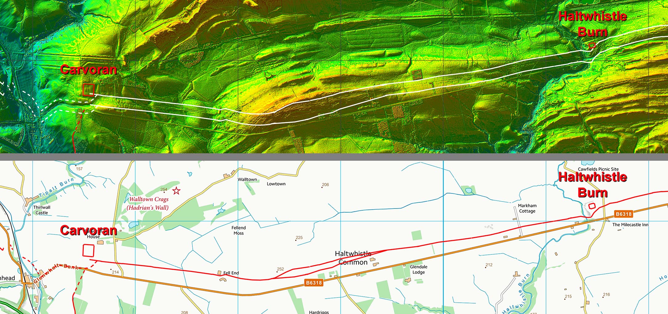
Lidar Image & Route Map - Haltwhistle Burn to Carvoran There appears to be another "dual carriageway" across Haltwhistle Common where perhaps again the road was re-positioned sometime its lifetime.
|
Click for larger view |
 |
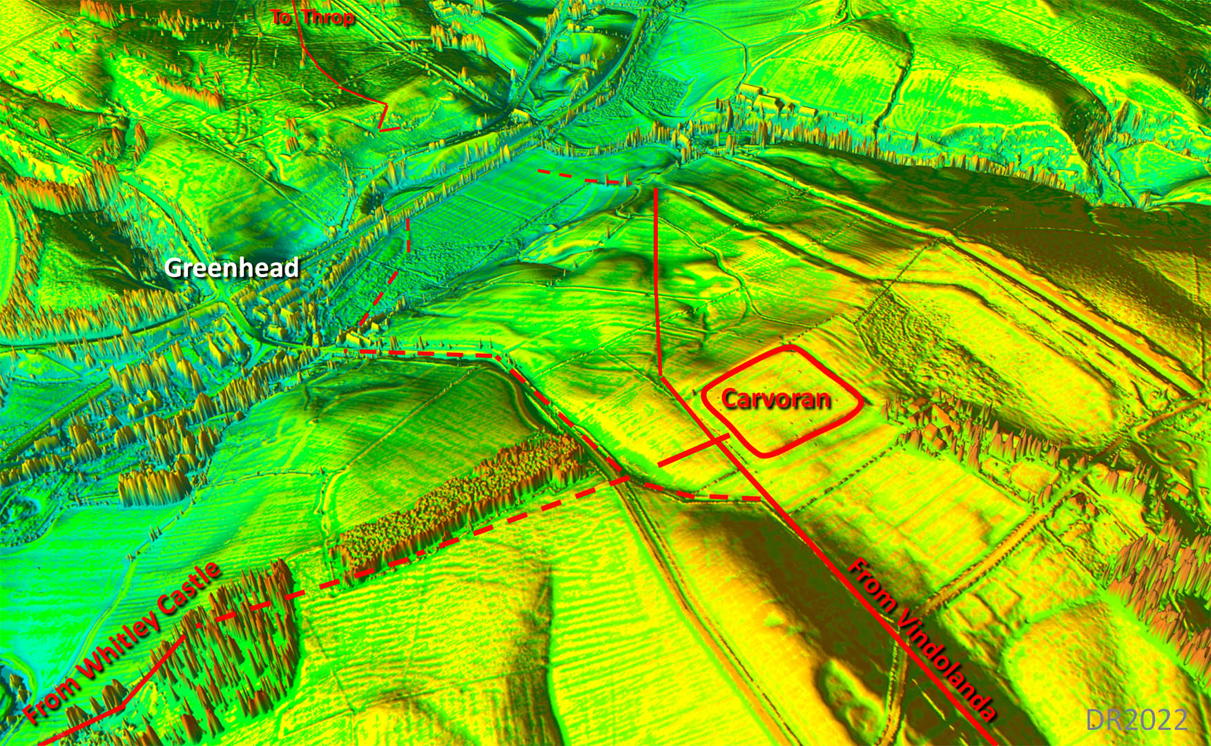
Oblique 3D Lidar Image - Carvoran There are two options for the descent and crossing of Tipalt Burn at Greenhead. The solid route down towards the vallum (which of course was not there originally) is probably the more likely but west of the burn it is not so obvious.
|
Click for larger view |
 |
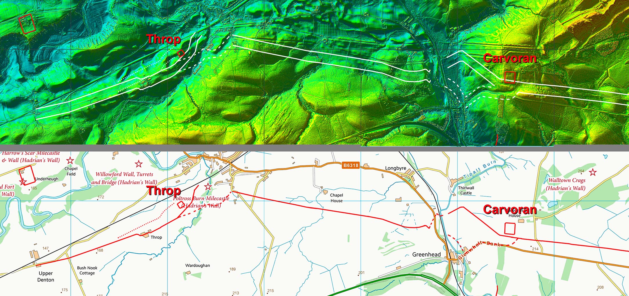
Lidar Image & Route Map - Carvoran to Throp The crossing of Poltross Burn is confusing. The indications are the vallum was probably built over part of the original Stanegate, which then had to be moved. This would explain the odd alignments there as well.
|
Click for larger view |
 |
See our separate section on the Cumbrian section of the Stanegate. |
|
|
|
Return to Cumbria Roman Roads homepage Last update: September 2022 |
© David Ratledge |