 |
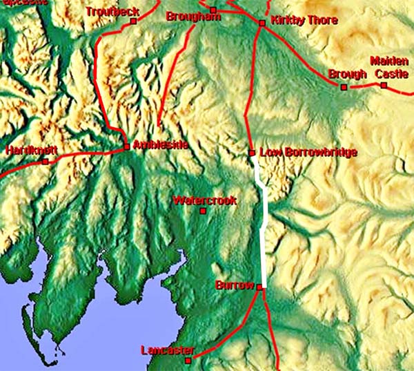
The Roman Road from Burrow to Low Borrowbridge, Margary 7cThe Roman road from Burrow in Lunesdale to Low Borrowbridge is well attested apart from a small section to the west of Sedbergh. Here, across the valley of the River Rawthey, its course was uncertain. Lidar has now provided some clear indications as to its probable course (see later). 2020 Update: We now know there was also a Roman road on the west bank of the River Lune from Middleton to Low Borrowbridge. See Margary 7ca for details.
The road keeps to the east bank of the River Lune before finally crossing the Lune at Low Borrowbridge
|
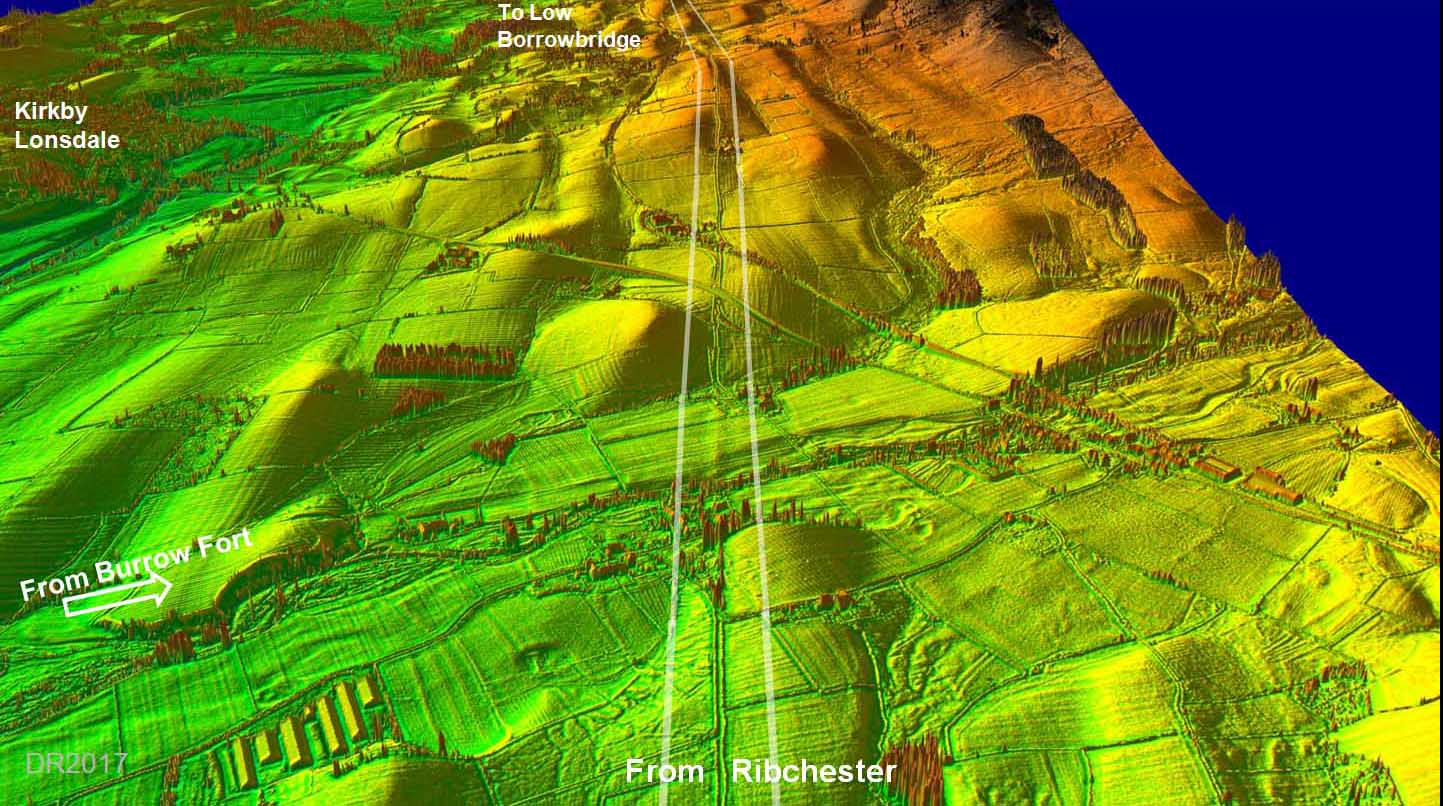
3D Lidar Image - passing Burrow Fort link road The Roman road passes almost 1 mile to the east of Burrow fort. |
Click for larger view |
 |
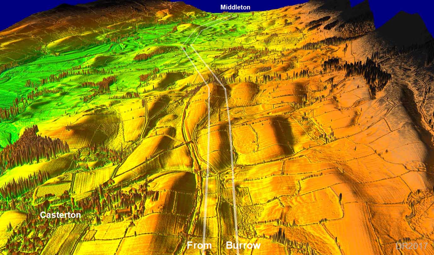
3D Lidar Image - Casterton Now that's a name that has Roman implications! But sadly I cannot find anything Roman to explain the derivation of the name Casterton - apart from the Roman road. This is where the road was excavated in the 1950s, near the middle of this image, see below. |
Click for larger view |
 |
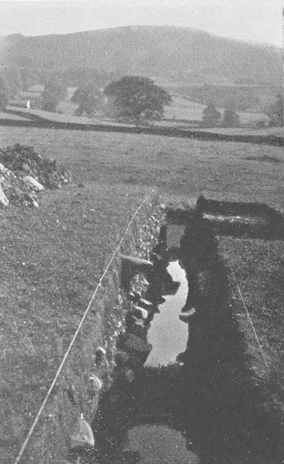
Casterton Excavation 1958 by Jane M Ewbank Location was north of Casterton and south of Bent Lane, Grid Ref SD 626805 For full details of the excavation including a second photo and a cross-section see C&WAAS Transactions 1960 Pp 28-31 Image by Mrs E M Maples |
 |
|
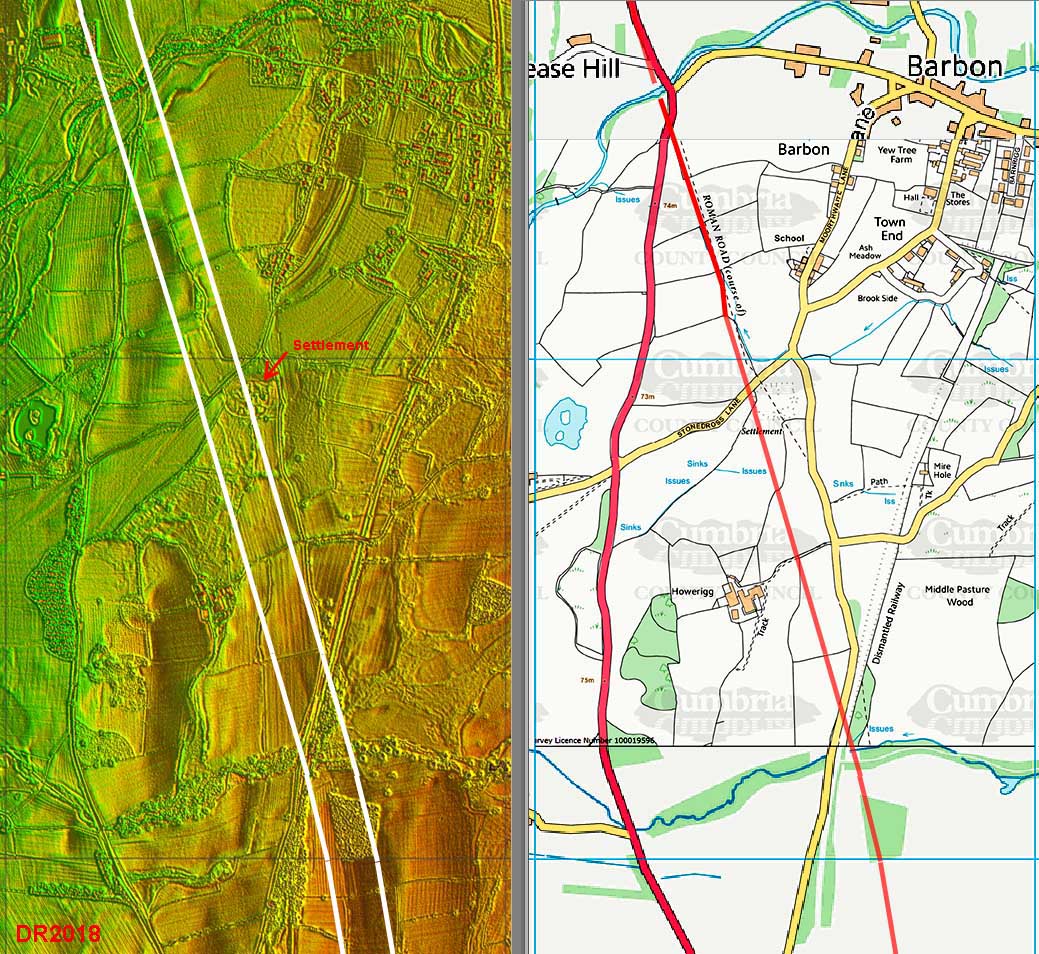
Lidar Image & Map - Barbon The line of the Roman road is also incorrect on the OS maps passing Barbon and they even have the road going through the middle of Howerigg Settlement, which it clearly does not. The road respects the settlement and passes its west side. |
Click for larger view |
 |
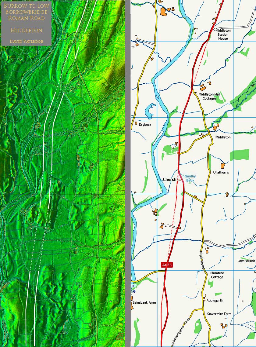
Lidar Image & Map The modern road and the Roman line deviate quite often in this section. The Sedbergh Turnpike Trust made several upgrades to the road and this resulted in these differences. The Middleton milestone location is now in the churchyard of the church shown on the map - safe parking available. |
Click for larger view |
 |
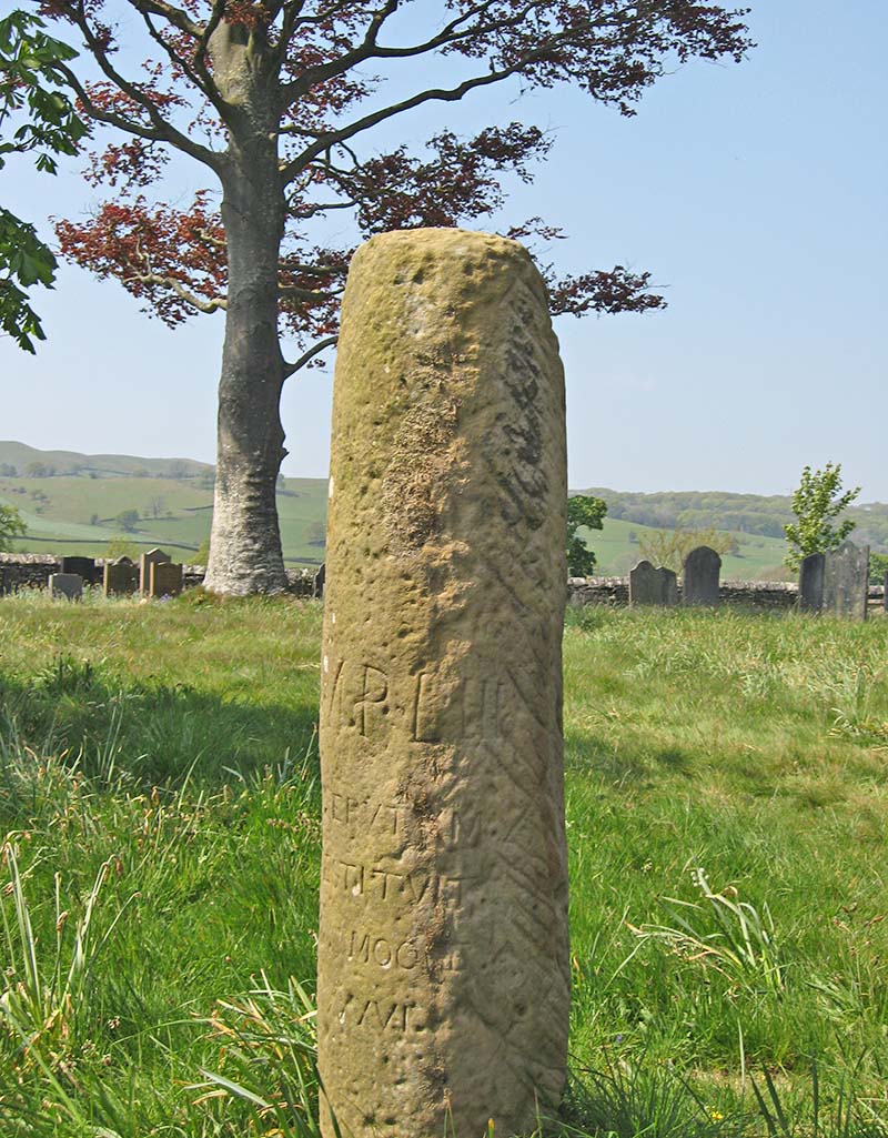
Middleton Milestone This famous milestone has now been re-re-erected by the Yorkshire Dales National Park inside the churchyard of Middleton Church. It used to be in the field south of the church and Lidar has shown that position (a Victorian re-erection) was actually alongside the road. The new location in the churchyard is not on line. The milestone records a distance of 53 MP (miles). This taken to refer to Carlisle. However, we now know this road heads for Kirkby Thore (not Brougham) which doesn't invalidate the distance to Carlisle as we now know there was short direct Roman road from Kirkby Thore to Old Penrith. However, an equally valid alternative, would be Carvoran by the Maiden Way. Even so Carlisle seems more likely. |
Click for larger view |
 |
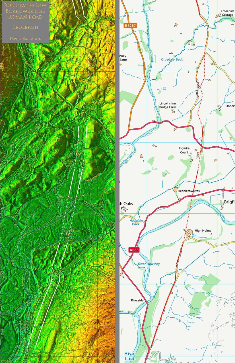
Lidar Image & Map - Sedbergh area This was the missing link - from Middleton to Howgill Lane. The first evidence visible is west of Jordan Lane centred on SD6341 9013. Here Jordan Lane was obviously moved off the Roman line to accommodate the building of the railway. North of the River Rawthey, east of Hebblethwaites, a length of agger is visible (SD6370 9146), which matches the Jordan Lane alignment. The final stretch visible is north of the A684 and extends the previous alignment before making a slight turn to the north. It is centred on SD6380 9215. |
Click for larger view |
 |
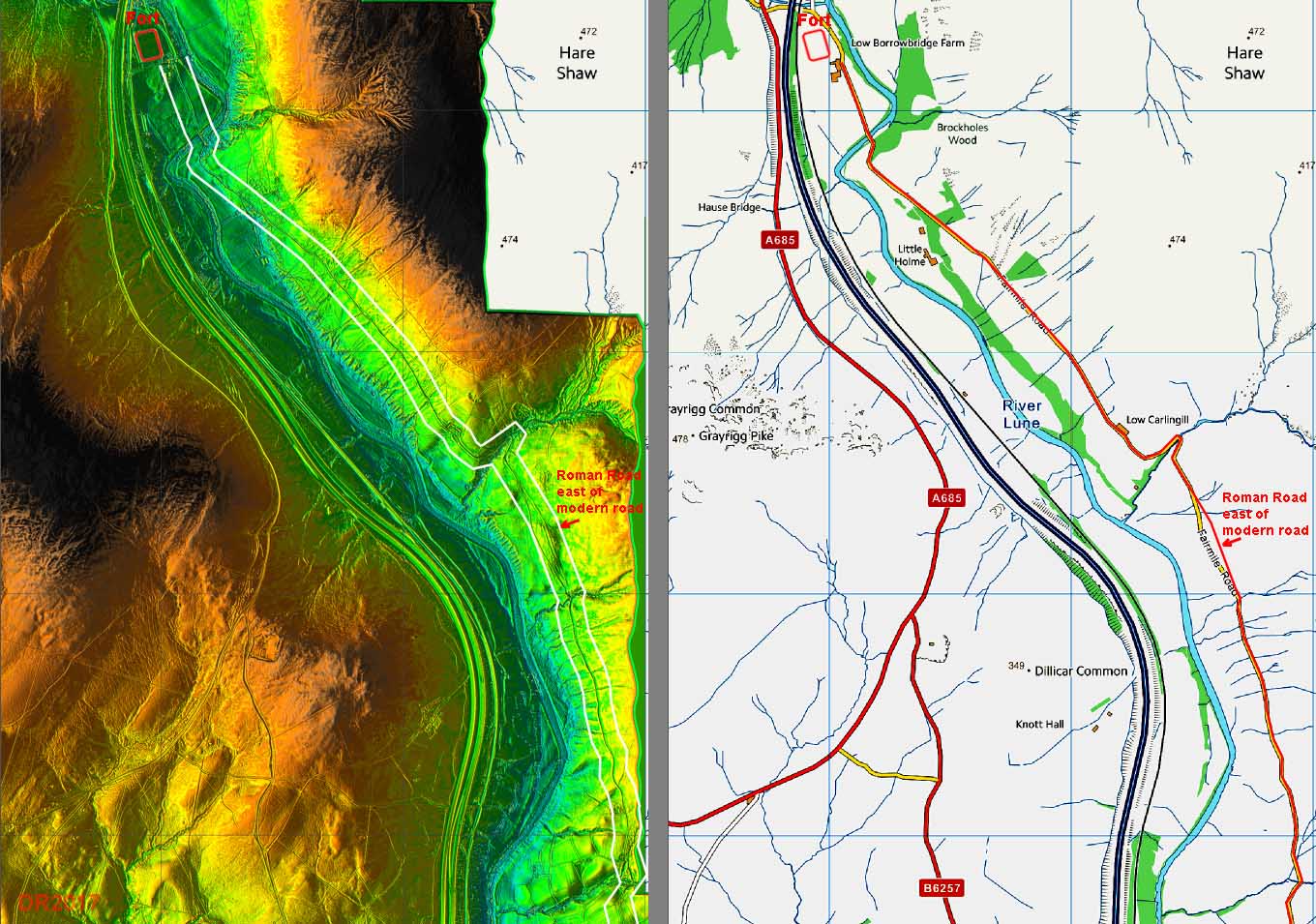
3D Lidar Image - approaching Low Borrowbridge The modern minor roads Howgill Lane and Fairmile Road overlie the Roman road except in just a few instances. The longest divergence is just south of Carlingill and provides the best opportunity to see the Roman agger - see below. |
Click for larger view |
 |
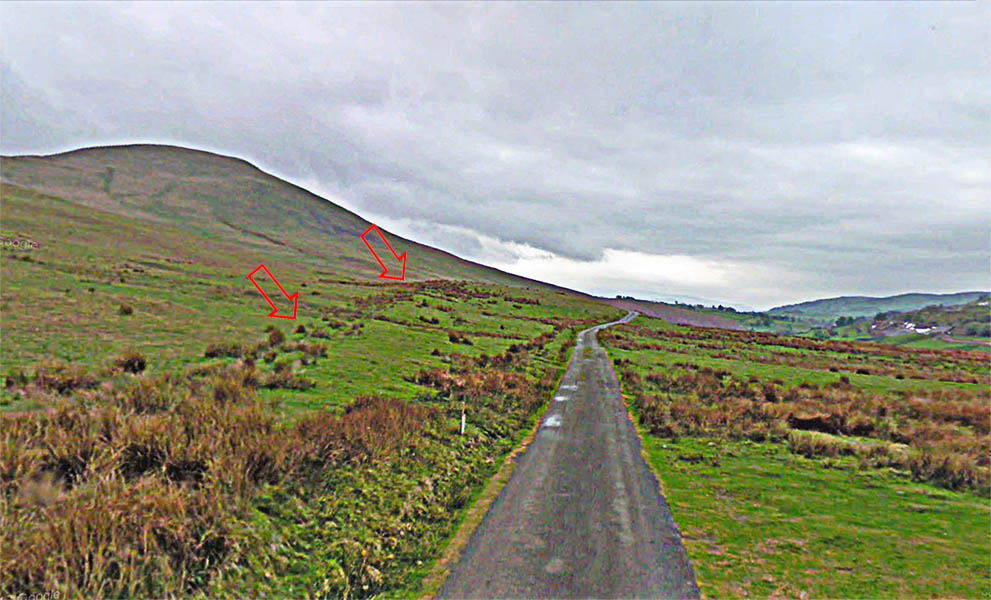
Roman Agger - Fairmile Road looking south The Roman line is east of the modern road and somewhat higher (left in image). This is just south of Carlingill Bridge at Gibbet Hill. |
Click for larger view |
 |
Lidar Image & Map - Carlingill to Low Borrowbridge Who says Roman roads are straight! Here the road has very sensibly adapted to the contours. |
Click for larger view |
 |
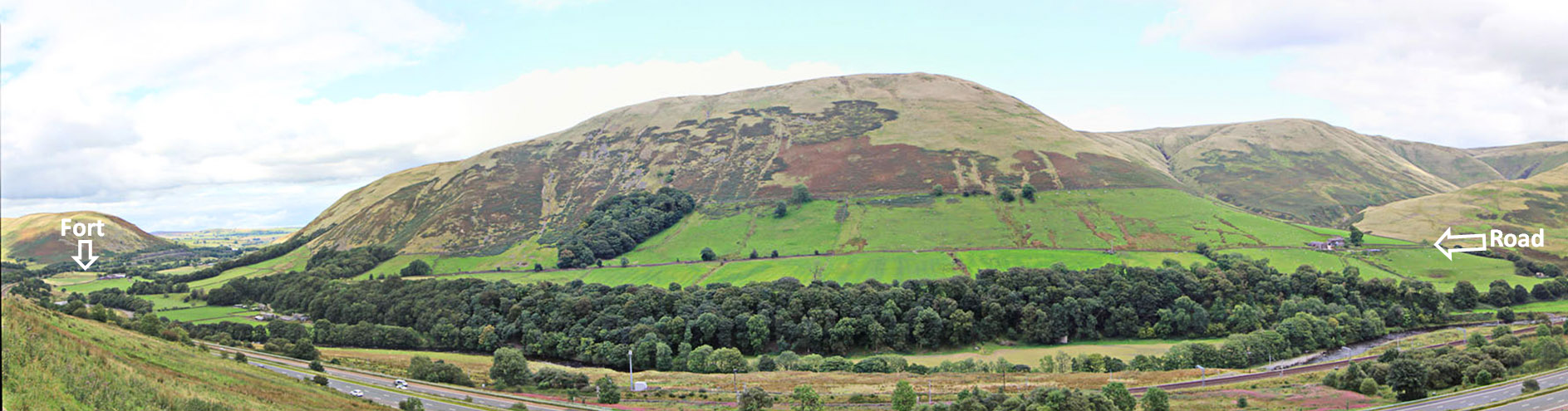
Lune Gorge Panorama This is the view travellers on the M6 are familiar with - the Roman road running across the fell on the far side of the valley. Taken from the A685. |
Click for larger view |
 |
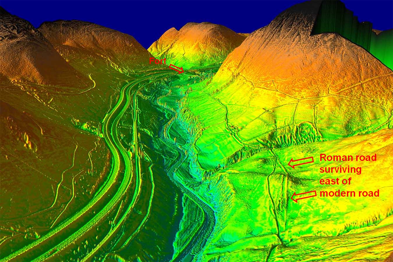
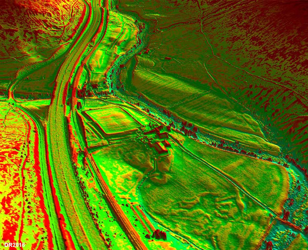
3D Lidar Image - Fort and Vicus? Fairly extreme Lidar processing to bring out detail south of the fort. Our road passes the fort outside it east gate. For more details of Low Borrowbridge Roman visit Lunesdale Archaeology Society |
Click for larger view |
 |
|
NEW - 3D Lidar video fly-over through the gorge passing Low Borrowbridge fort |
|
|
|
Return to Cumbria Roman Roads homepage Last update January 2018 |
© David Ratledge |