
|
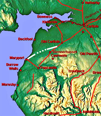
The Roman Road from Old Carlisle to Maryport, Margary 754More accurately a branch off the road from Old Carlisle to Papcastle at High Waverbridge to Maryport. Richard Bellhouse was probably the biggest protagonist for this road having several attempts at finding the route. Unfortunately the only map he produced of the (east end of the) line in 1956 turned out to be incorrect. He corrected it later in 1960 but didn't produce a new map (both his articles in C&WAAS). Margary followed the erroneous map so the description in the latter's famous book is wrong. The Lidar coverage has been complted (2020) and we can now have high confidence in the whole route.
|
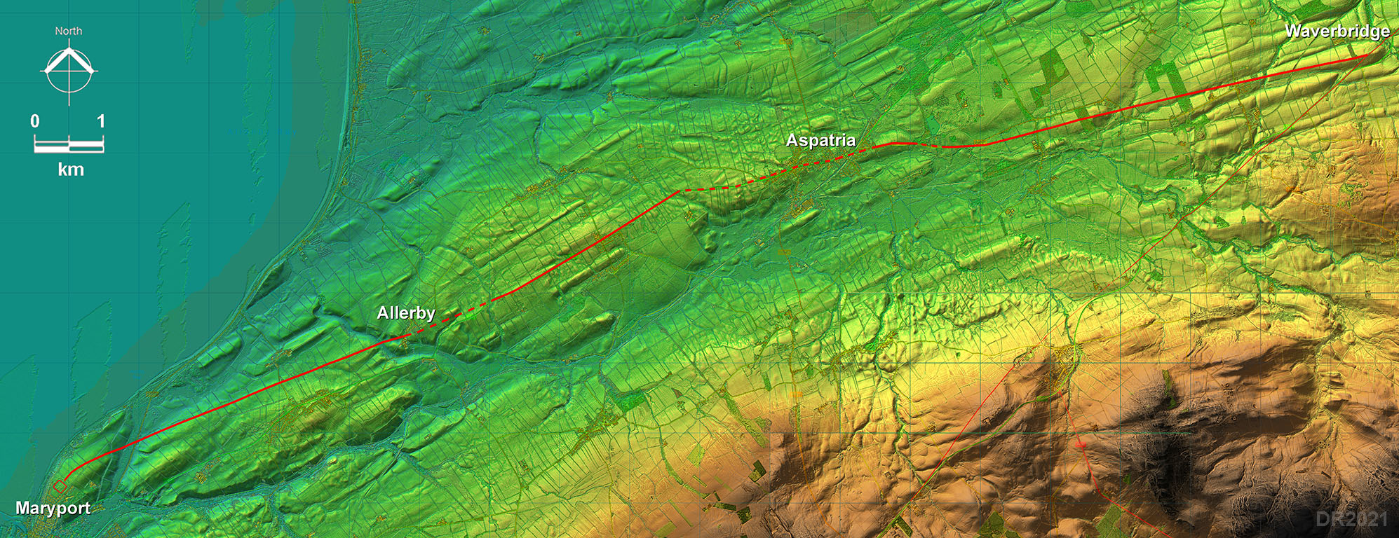
Lidar Iamge - Full Route Very logical route keeping out of the River Ellen valley. |
Click for larger view |
 |
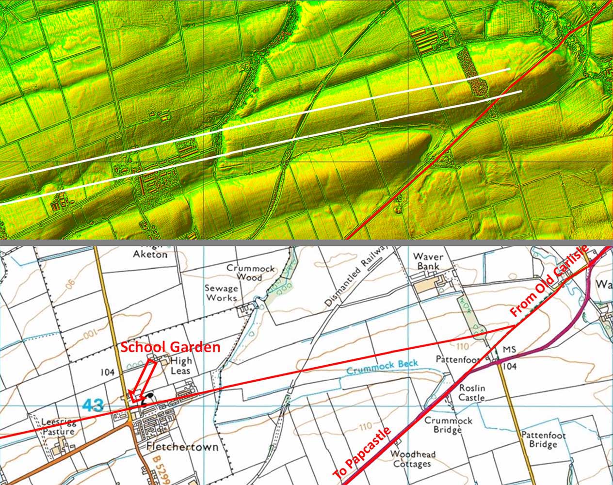
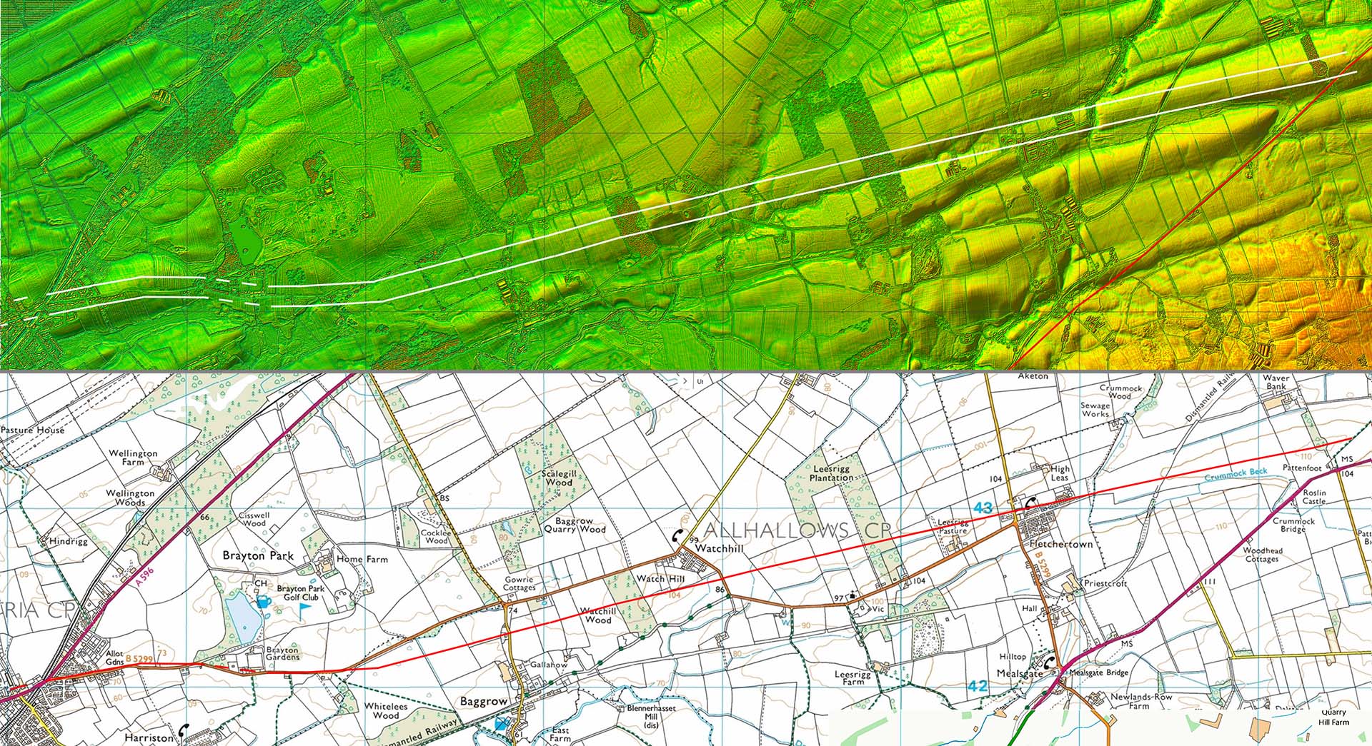
Lidar image and Route - Junction The road branches off the Old Carlisle to Papcastle road at High Waverbridge. Lidar shows it well. Bellhouse's initial route was further north along the Parish boundary. He was later to be made aware of tthe stone monument with plaque marking the line of the road in the school garden of Fletchertown National School (1866). What was recorded in the garden was "a cobbled surface which was interpreted as a Roman road, with flanking road-side ditches". Lidar confirms they were right. This error by Bellhouse caused him to extrapolate his alignment too far to the south. Having subsequently learnt about the Fletchertown excavation he did not revise his line. |
Click for larger view |
 |
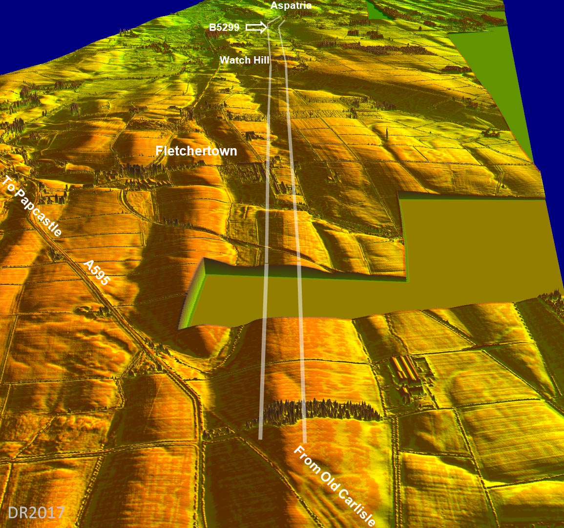
Oblique Lidar image looking towards Aspatria The straight first alignment of the road is obvious in 3D as is its alignment with the B5299 into Aspatria. There can be little doubt that this was the actual route of the Roman road.
|
Click for larger view |
 |
Lidar image and Route Map 1 This is the extent of the Lidar coverage at the east end of the road. It is clearly set out from the hill near the junction to Watch Hill and onwards. The alignment merges in with the modern road approaching Aspatria. This is sensible as going via Aspatria keeps to high ground away from the River Ellen.. Bellhouse thought the route went close by the Sewage Works, near the railway, but this was based on his projecting forward his erroneous alignment. His route head for low ground by the River Ellen and his evidence he found there was also very circumspect. King Street through Aspatria fits the true alignment and, as we shall see, this fits with evidence coming in the other direction. |
Click for larger view |
 |
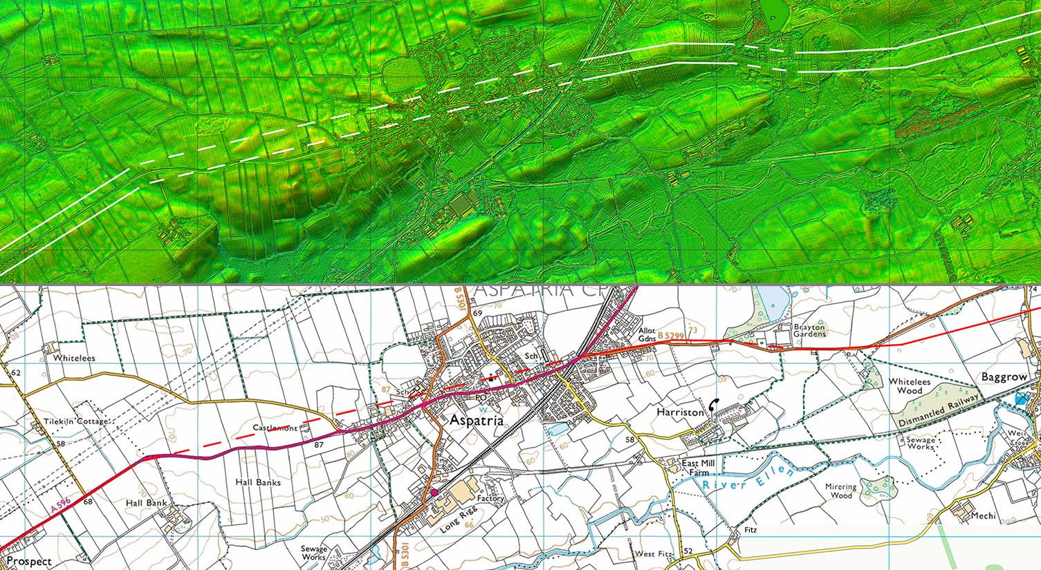
Lidar, Aerial and Route Map 2 - Aspatria Across Aspatria with the modern development we are forced to interpolate. What is shown is probably pretty close to reality. |
Click for larger view |
 |
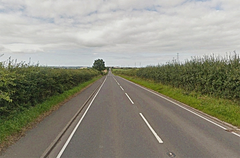
A596, Nr. Prospect - looking towards Maryport The A596 through the village of Prospect is typically Roman for around 1.5 miles. |
Click for larger view |
 |
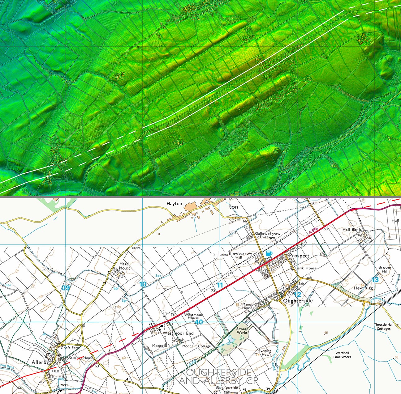
Lidar and Route Map 3 - Prospect It seems amazing no one thought the straight road through Prospect was Roman. It is a classic dead straight ridge route. |
Click for larger view |
 |
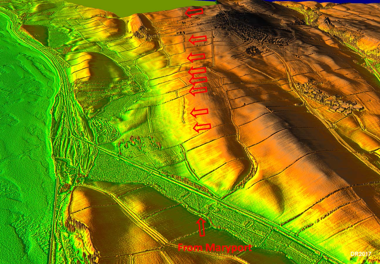
3D Lidar Image - looking back towards Allerby from Maryport. The clues are subtle but when they all line up through several fields then the line of the road can regarded as certain.
|
Click for larger view |
 |
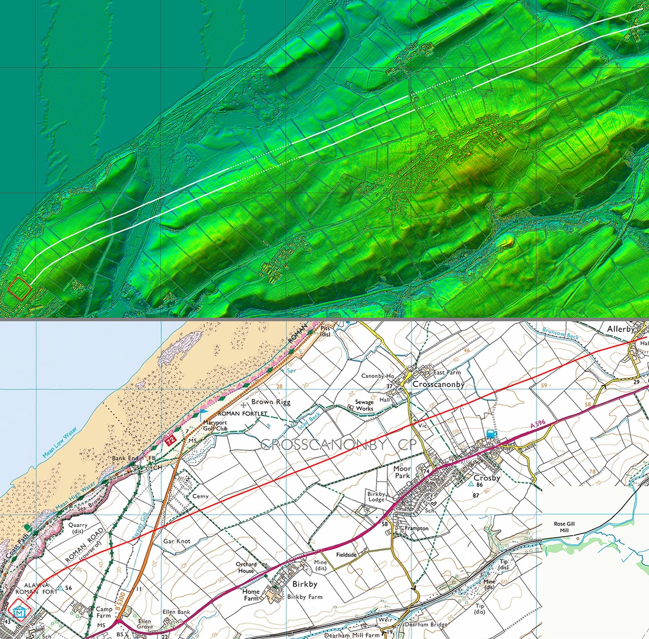
Lidar and Route Map 4 - Maryport Traces are faint but there are so many of them that line up then the route is not in doubt. It lines up with where the geophys of the fort area revealed the road. |
Click for larger view |
 |
|
|
|
Return to Cumbria Roman Roads homepage Last update: January 2021 |
© David Ratledge |