 |
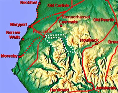
Papcastle to Keswick, Margary 753Logically it would be expected that the Romans had a link road from Papcastle towards Keswick to join up with the Ambleside to Old Penrith road, Margary 741, in the vicinity of Keswick. Keswick has always been suspected as a missing fort site and, as we shall see later, perhaps we at last have a clue as to its location.
At least 3 options for the route going via:- 1. Whinlatter and Lorton Vale - suggested many times but evidence is proving very elusive. This is actually the route Margary designates as 753. 2. West of Bassenthwaite Lake - route favoured by the late Hugh Toller and there is some supporting Lidar evidence. 3. East of Bassenthwaite Lake - on the face of it an odd suggestion but this was normal route from Keswick to Cockermouth until recent times. .
|
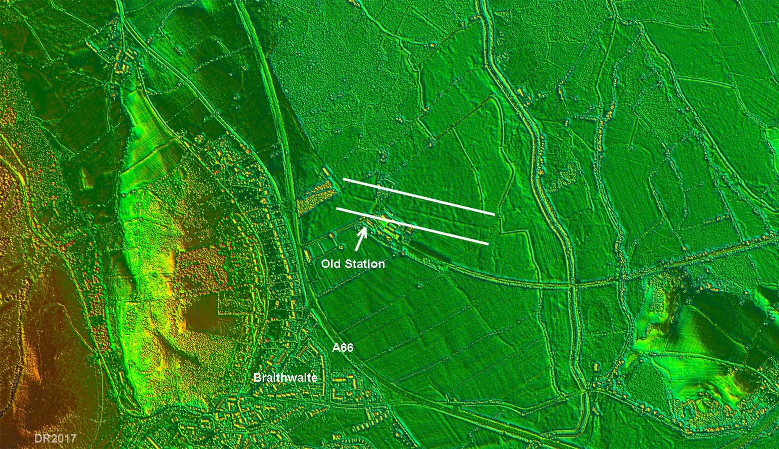
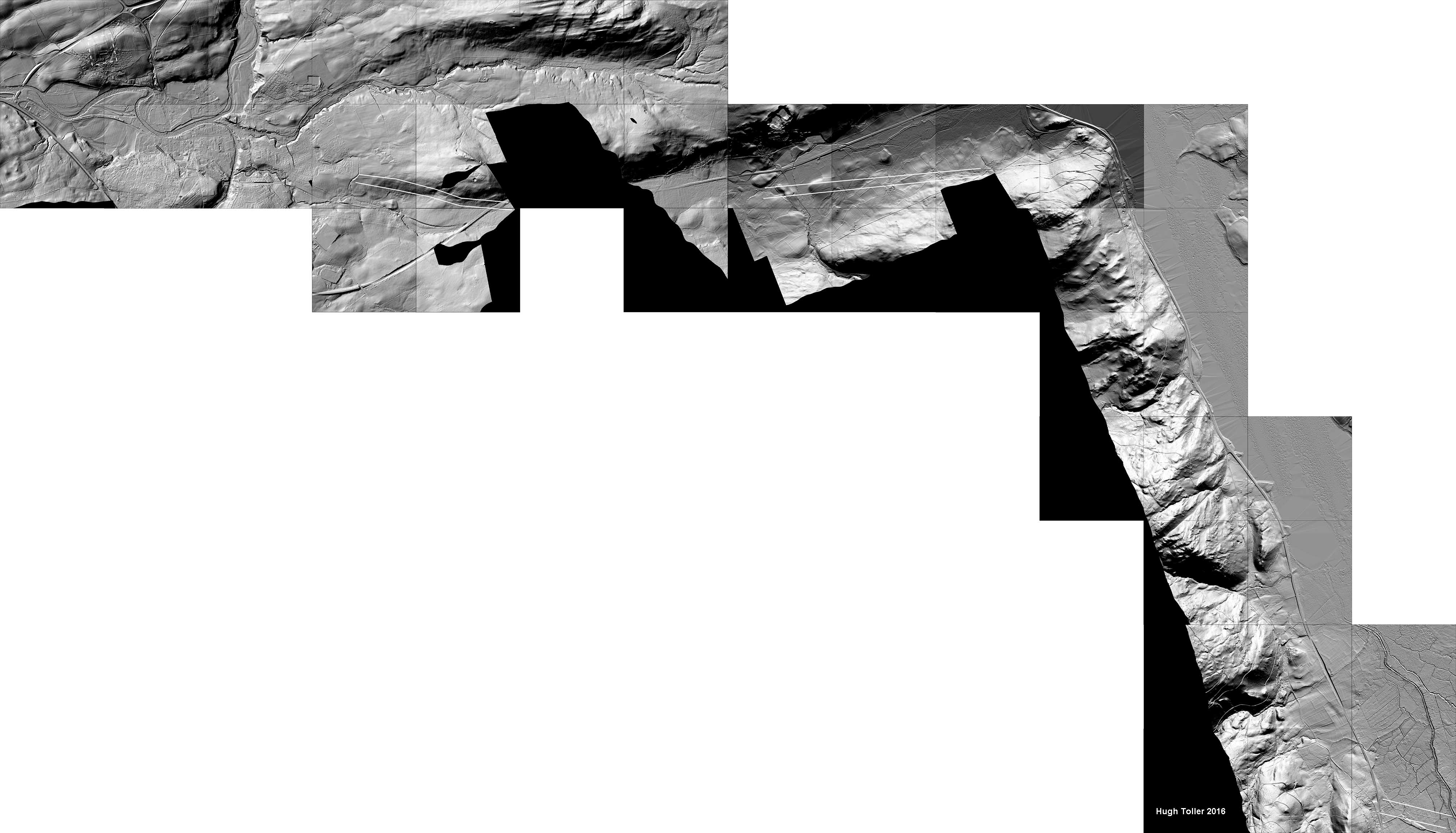
Lidar Image - agger at Braithwaite This is the agger discovered by Richard Bellhouse near Braithwaite Station (CWAAS 1954). If it is the Roman road then this would point to either routes 1 or 2 being the best candidates for a route to Papcastle. |
Click for larger view |
 |
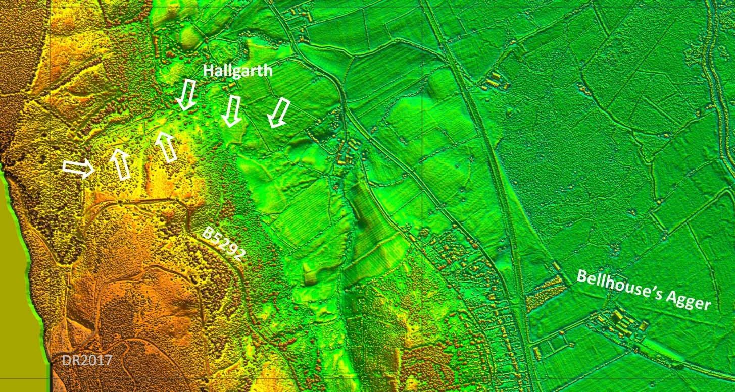
1. Whinlatter and Lorton ValeThe Lorton Vale route was suggested by Bellhouse in CWAAS, 1954. This route was investigated more recently by the Lorton History Society. Their results were published in CWAAS 2007 and a copy is available online. The group had been unsuccessful in finding the road at the western end of the dale turned their attention to an old road at the eastern end of Whinlatter pass near Hallgarth. What they found does show in Lidar data and it can be extended eastwards joining to the existing road in Braithwaite. It appears to be the old road through Whinlatter predating the modern road (B5292), which is based on a turnpike. With nothing further west and the rather faint un-Roman like features here then option 1 must be regarded as still to be proven. |
Click for larger view |
 |
2. West of Bassenthwaite LakeLidar image by Hugh Toller. This is the route Hugh Toller was working on just before his untimely death. The route goes east along the Embleton valley before turning at Castle How to head down the west side of Bassenthwaite to join Bellhouse's agger at Braithwaite old station.
|
Click for larger view |
 |
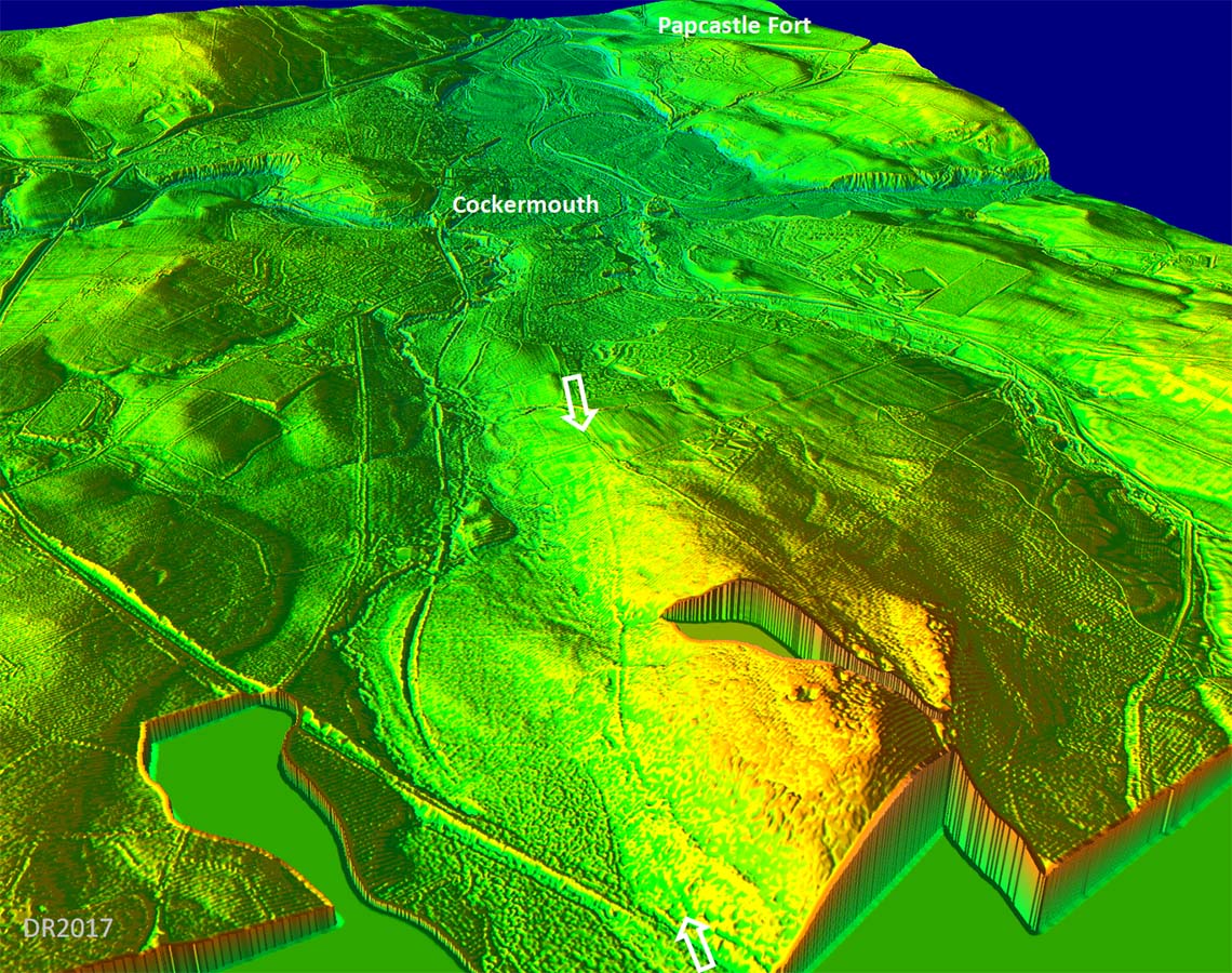
3D Lidar Image - looking west towards Papcastle This is what Hugh spotted and does look like a possible road heading east from Cockermouth down the Embleton valley. |
Click for larger view |
 |
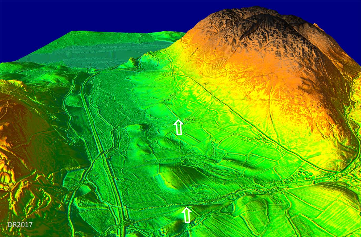
3D-Lidar Image - looking past Sale Fell to Bassenthwaite Lake A short trace further eastwards on approximately the same alignment as above. Heading down the west side of Bassenthwaite to join up with Bellhouse's agger there is little scope for finding any evidence there today with the old road, the A66 and the former railway all now amalgamated. So this is probably another route best regarded as unproven but is perhaps the best option for Margary 753. |
Click for larger view |
 |
3. East of Bassenthwaite LakeThere are some indications of a road diverging from the A591 and heading for the east side of Bassenthwaite Lake. This might seem a strange route to Cockermouth/Papcastle but before the turnpike era this was apparently the normal route - see Ogilby c.1675 (ref Hindle). To get to Papcastle the River Derwent would have to be crossed at the north end of Bassenthwaite and presumably then via the old road passing Higham Hall, which is generally very straight. An alternative or second destination for a road this side of the lake would be to Caermote Fort. |
Click for larger view |
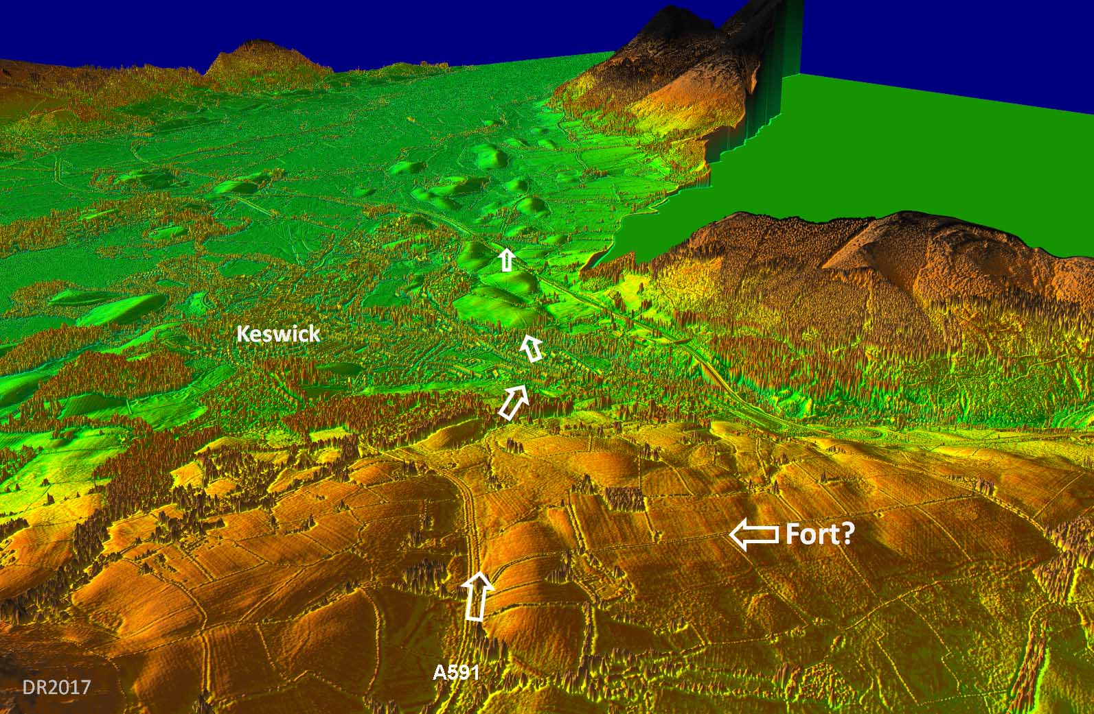 |
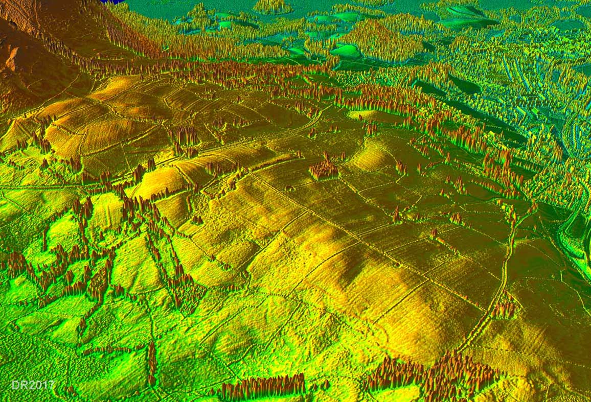
The Missing Keswick Fort? A view looking west across the possible fort on Castlerigg - see also image above. Discovered as part of a geophys survey of Castlerigg Circle, this feature was interpreted as a temporary marching camp. On the basis of the above image and this one it looks a little too substantial for just a temporary camp. Perhaps it is the missing Keswick fort?
|
Click for larger view |
 |
|
NEW - 3D Lidar video fly-over circling Castlerigg and the fort(?). |
|
|
|
Return to Cumbria Roman Roads homepage Last update January 2018 |
© David Ratledge |