 |
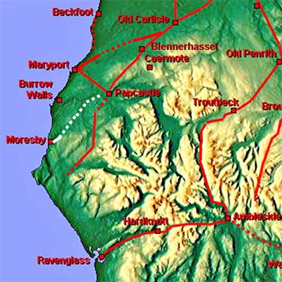
Papcastle to Moresby, Margary 752There must have been a road to Moresby Fort but which way did it go? Bellhouse thought the road to Moresby would have branched off the Papcastle to Ravenglass road (M75s) near Dean and then headed over High Moor via Colingate. Martin Allan in his Roman Route across the Northern Lake District also favoured High Moor & Colingate as a route but he was attempting to find a route to Keswick. What neither could do was find a route down from High Moor to Moresby. Lidar shows no route either. However, there is much simpler and much more obvious route.
|
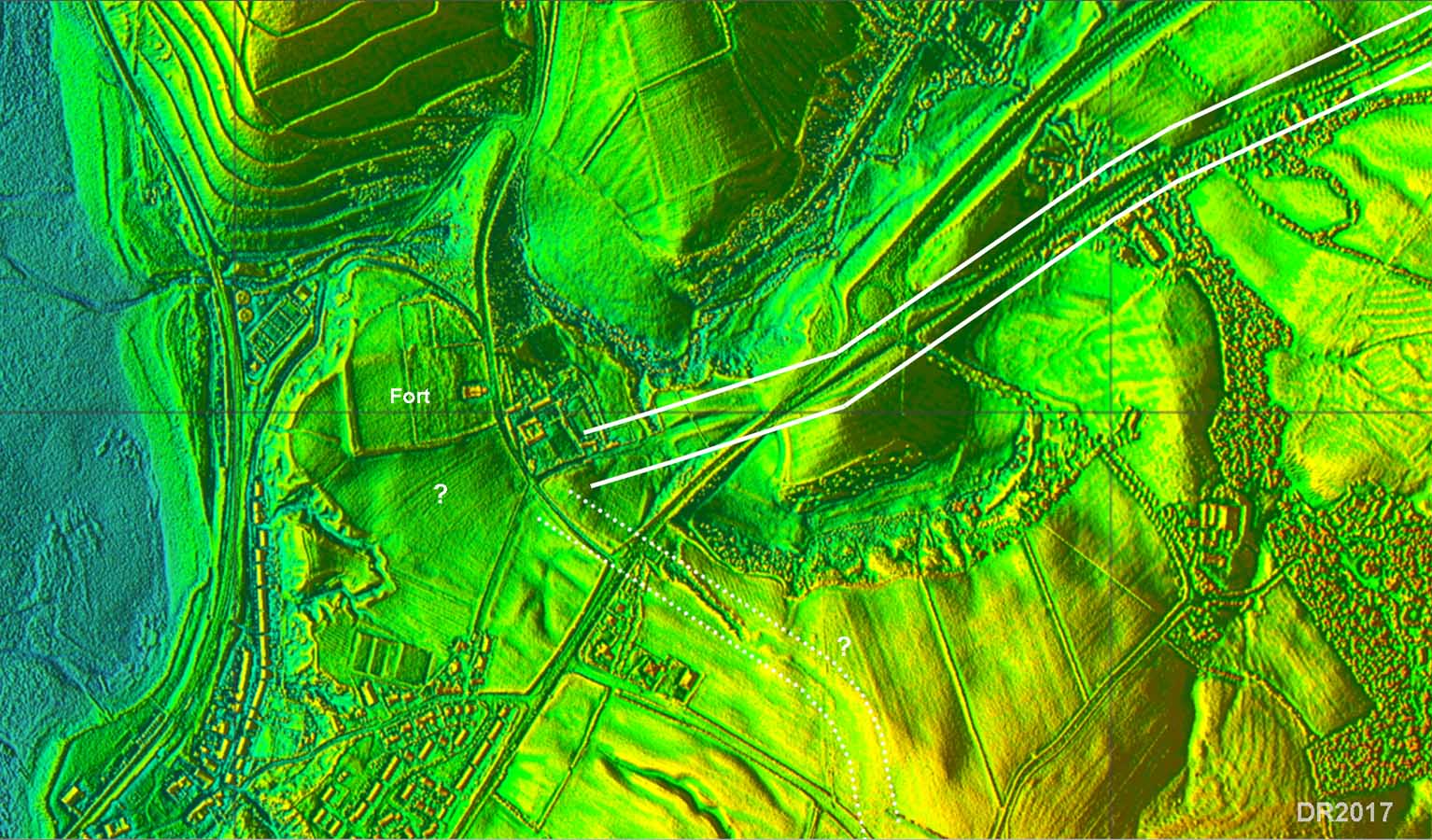
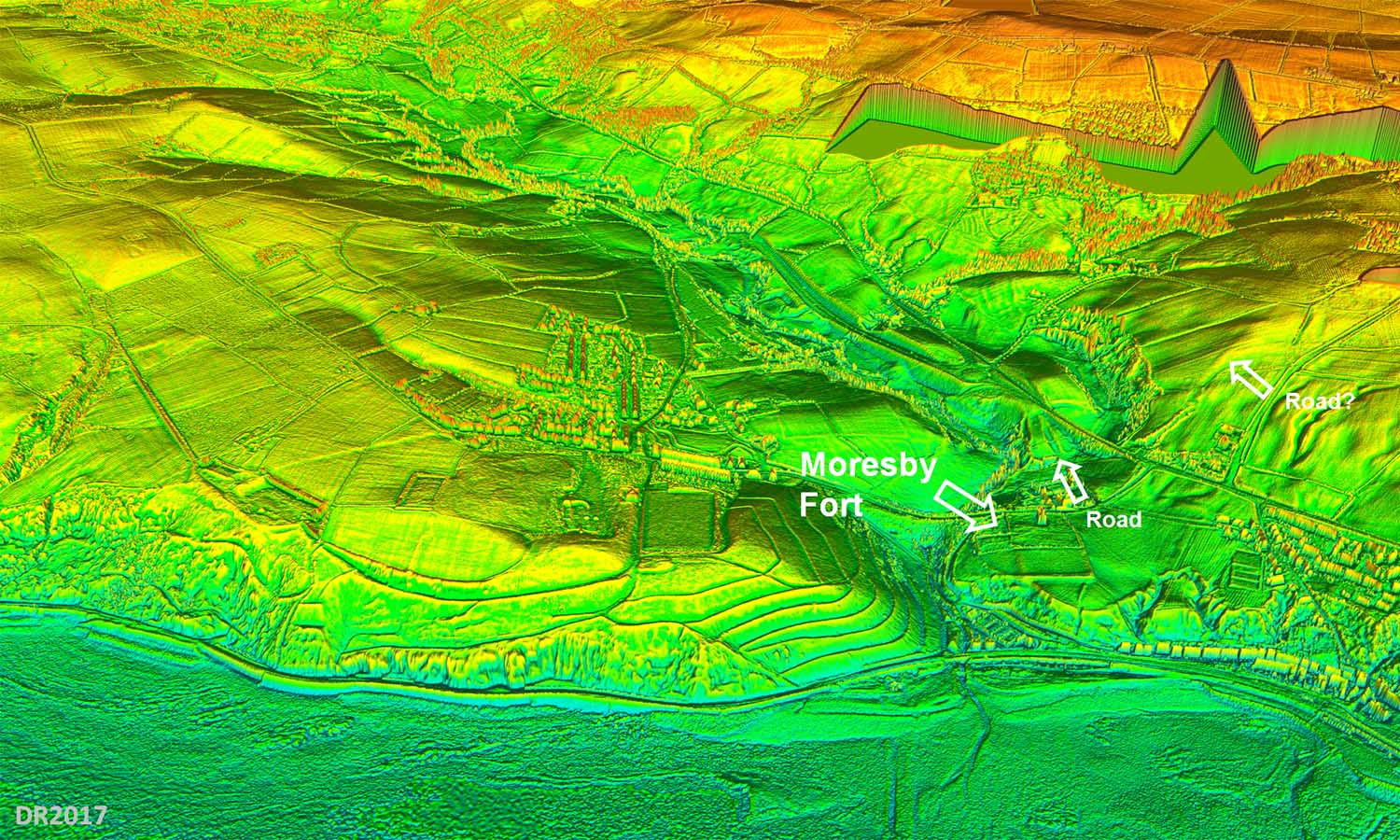
Lidar Image - Moresby There is a very clear road coming into the fort - it appears as a agger and cutting. It merges with the modern road but when Distington Bypass was under construction a section there was excavated/inspected by Bellhouse - ref Allan's book above. It is recorded at NX985210 which is bit vague but is now probably under the road. But what is visible on Lidar and what Bellhouse saw would fit together. However, rather than indicating a route over High Moor this clearly lines in with the original main road through Distington - see map below. The road/cutting actually aligns south of the fort and there is a suspicion of a platform there. Also a possibility is another road heading south or south-east - perhaps a road to Egremont? |
Click for larger view |
 |
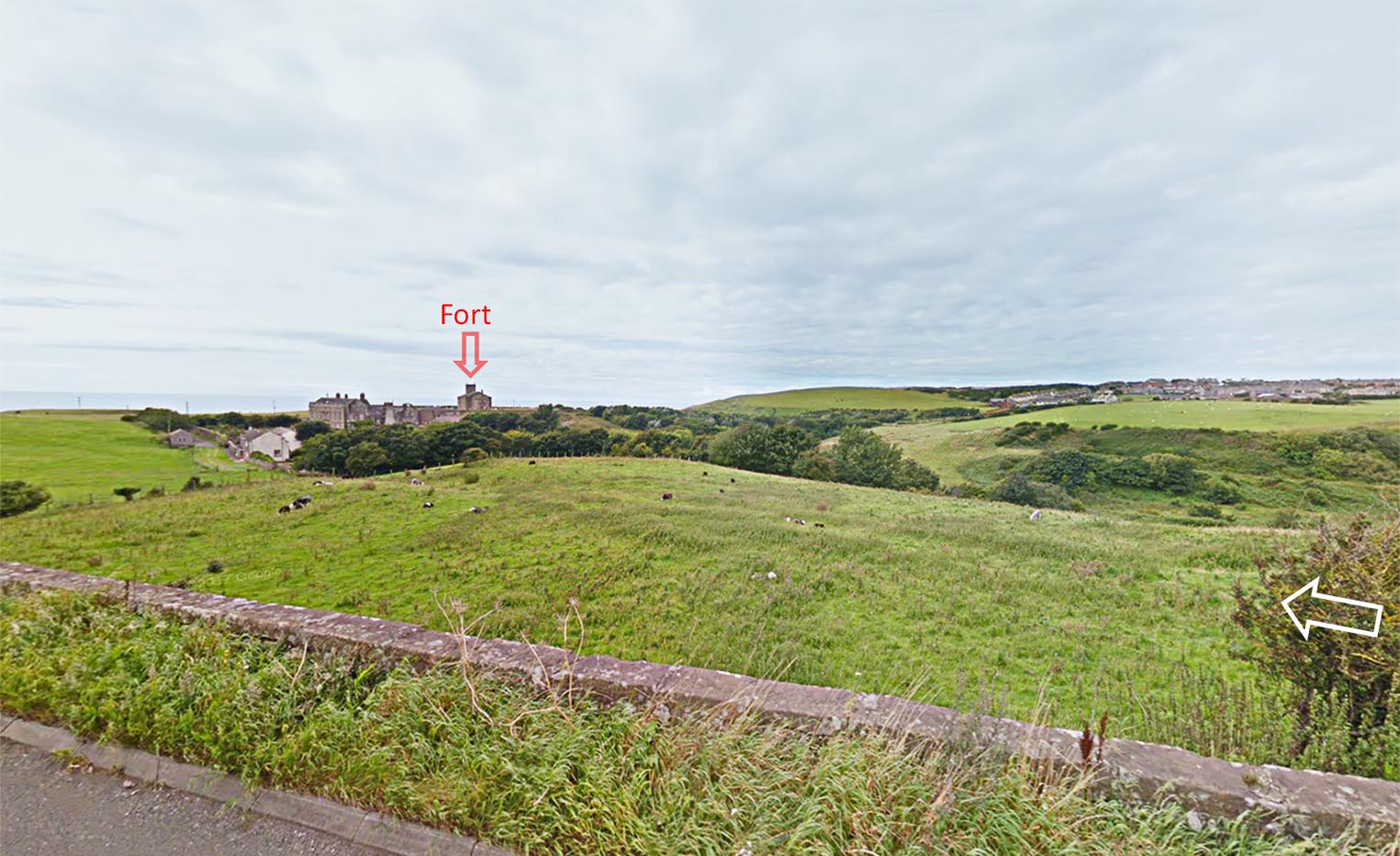
Agger and Cutting - approaching Moresby Wow - how could you miss this? To the right of here the new bypass has removed all traces but what is left is certain enough to confirm this as the road in from Papcastle. As can be seen it doesn't actually align on the fort but this arrangement occurs elsewhere e.g. Ravenglass. |
Click for larger view |
 |
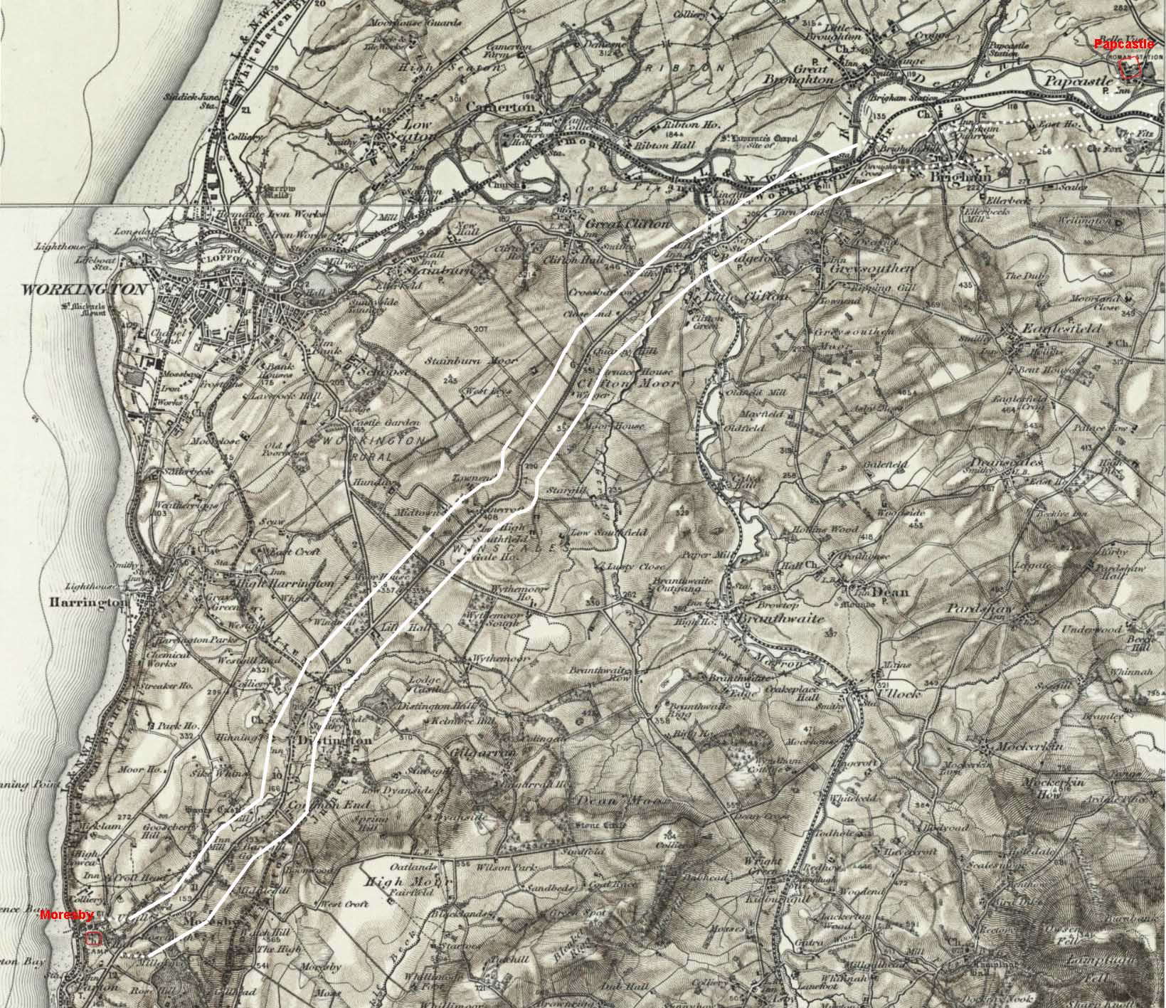
OS 1-inch Map First Edition Most of the old road to Cockermouth/Papcastle is laid out in straights. It is clearly represents the missing road from Papcastle to Moresby. There was no need to link across to the Papcastle to Ravenglass road at all. This is a much simpler and direct route |
Click for larger view |
 |
3D Lidar Image - Moresby Fort The old road to Papcastle can be seen heading off to the top left. |
Click for larger view |
 |
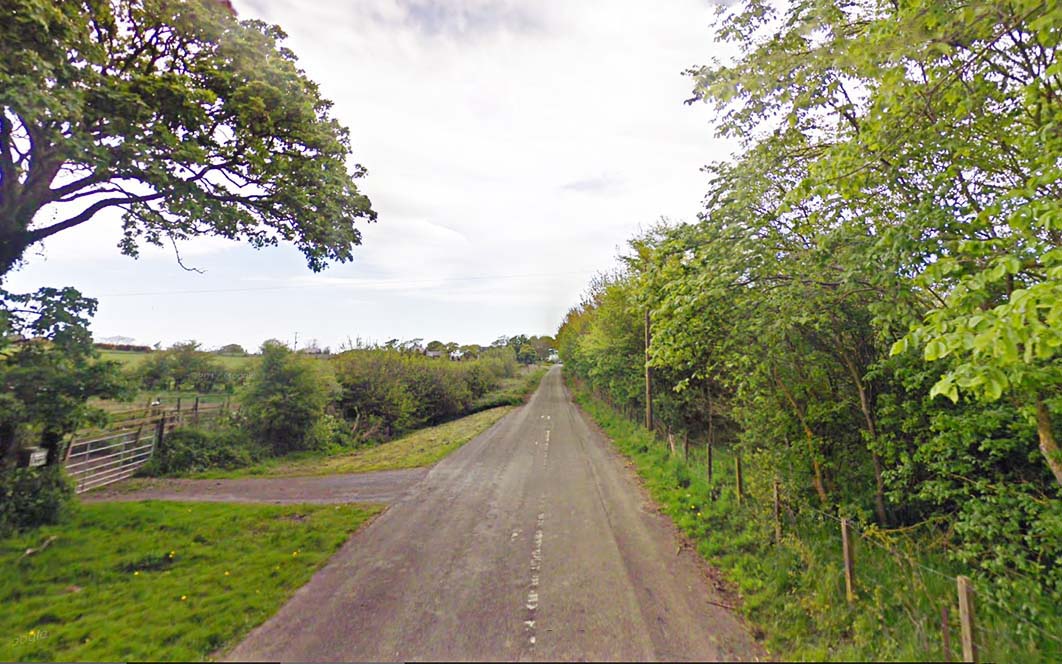
Old Road - Winscales Road, Little Clifton Near the Melbreak Hotel a section of the old road has survived, north of the A595. It is straight, it is wide and it is built up with a ditch on the south (left) side. Doesn't prove anything really but it could be Roman. |
Click for larger view |
 |
|
|
|
Return to Cumbria Roman Roads homepage Last update January 2018 |
© David Ratledge |