 |
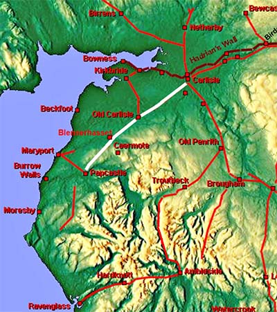
The Roman Road from Carlisle to Papcastle, Margary 75Carlisle was linked to the forts of Old Carlisle and Papcastle in west Cumbria by a very direct road that ran in a south-westerly direction. Unfortunately for us the road is largely covered by the A595 so we will concentrate on where old and modern roads diverge, such as at Thursby and Bothel. The definitive work on this road is by Richard Bellhouse recorded in C&WAAS (1956). We will fill in some of the gaps he was unable to find.
|
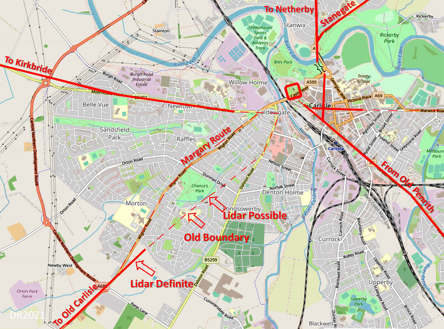
Carlisle - Road Map It has always been assumed the road initially followed Wigton Road (ref. Margary). However, LiDAR has shown this almost certainly was not the case. The Roman line is more direct and suggests the beginnings of Dalston Road mark the course before the main alignment proper began. Where the River Caldew was crossed is somewhat vague. The roads in central Carlisle derived from Hogg, McCarthy and Breeze. Hogg researched where the bridge was likely to be, McCarthy produced the definitive text on Roman Carlisle and David Breeze produced a map! Mapping: Openstreetmap |
Click for larger view |
 |
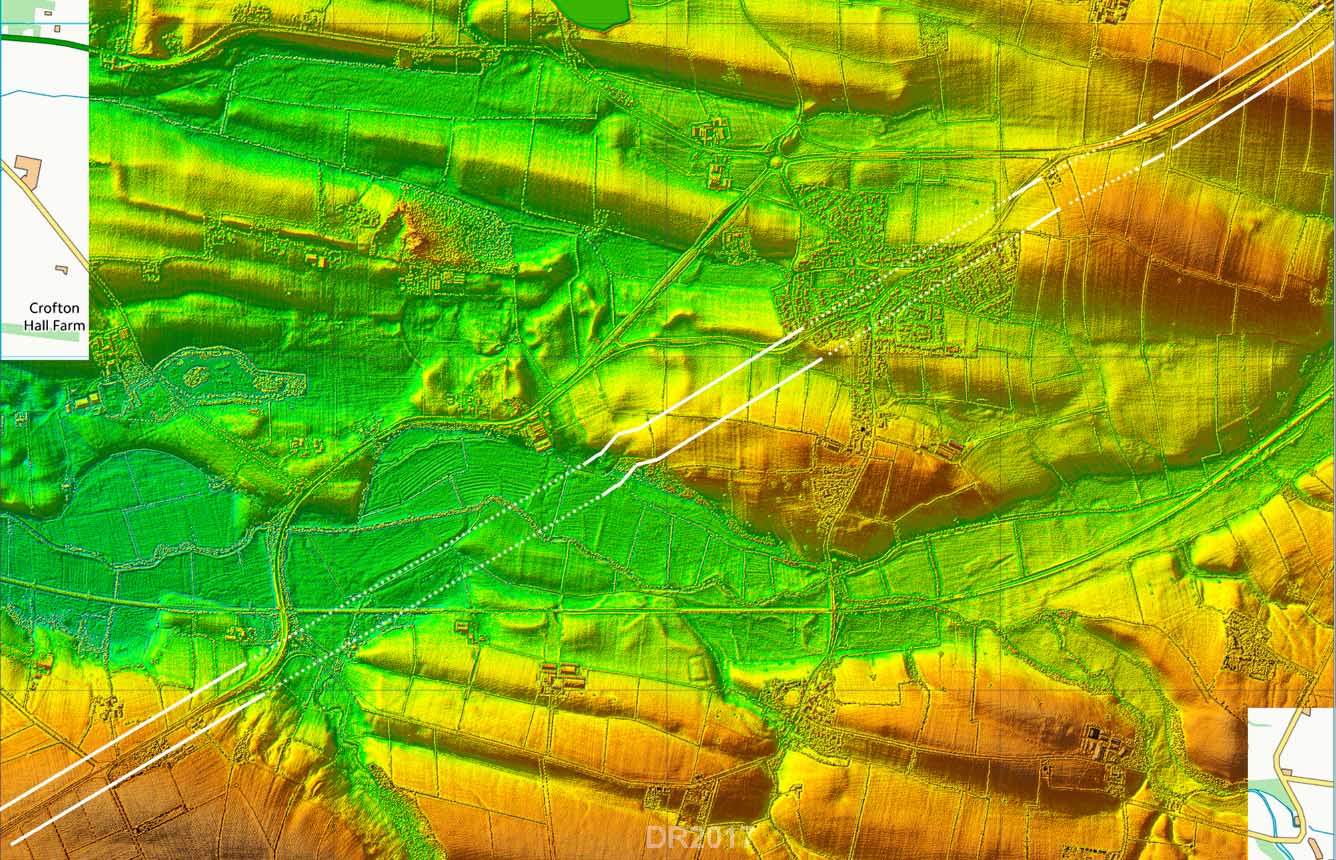
Route Map - Thursby Bellhouse was able to guess much of the line as it would obviously have not deviated from a straight line by much. The only definite piece he could see on the ground was the little cutting by which the road got down to the Wampool river bottoms. We can extend that back with Lidar to Thursby village and there is also a faint trace north-east of the village too. |
Click for larger view |
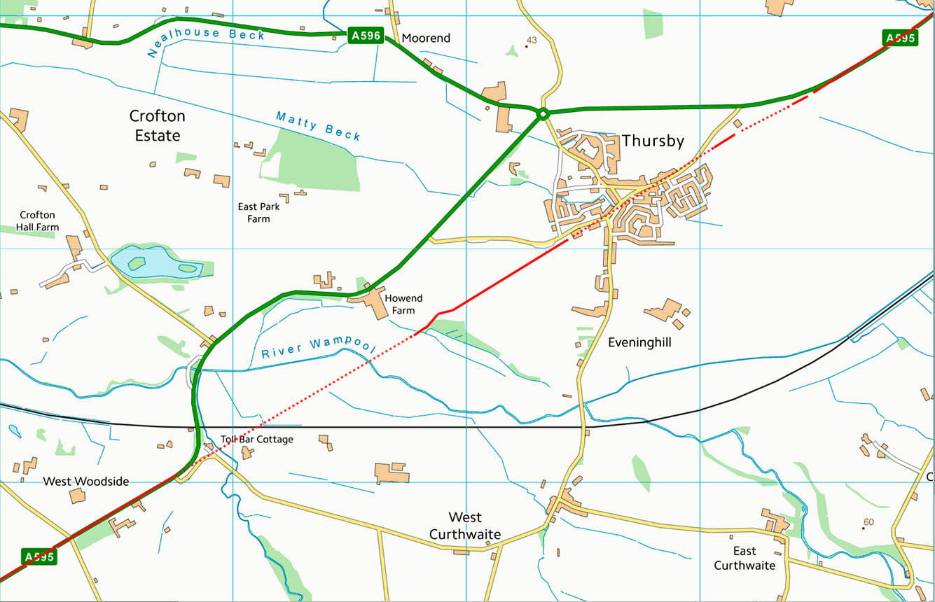 |
Lidar Image - Thursby Beyond the Wampool, Bellhouse thought the straight ditch feature (Bellhouse calls it a "slack"), could be a ditch of the road although there was no trace of an agger. I have not shown it solid as it is slightly off line but I think he was probably correct and this was perhaps the west ditch of the road. |
Click for larger view |
 |
Old Carlisle - Route map and Lidar Image Fortunately the modern road has avoided the Roman remains and skirted around the vicus. The Roman road is lined by vicus buildings as it passes the fort. |
Click for larger view |
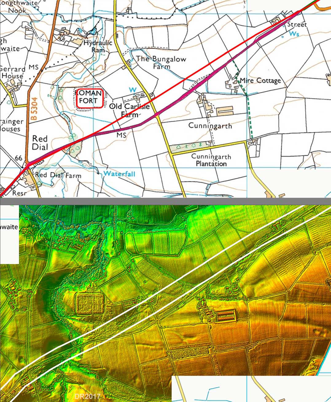 |
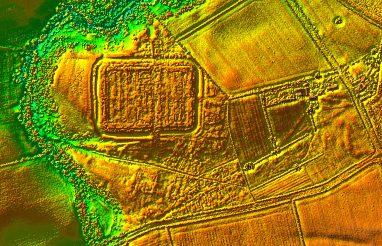
Lidar Image - Old Carlisle Fort & Vicus Incredible amount of detail visible indicating much of the Old Carlisle site must have survived well. The fort grid pattern is also clear as is the famous Mansio - the square building south of the fort. This is angled with respect to the fort and the main road but seems to be aligned with a branch road to the fort. For an interpretation of what is visible see Hadrian's Wall from the Air by GBD Jones and DJ Wooliscroft. |
Click for larger view |
 |
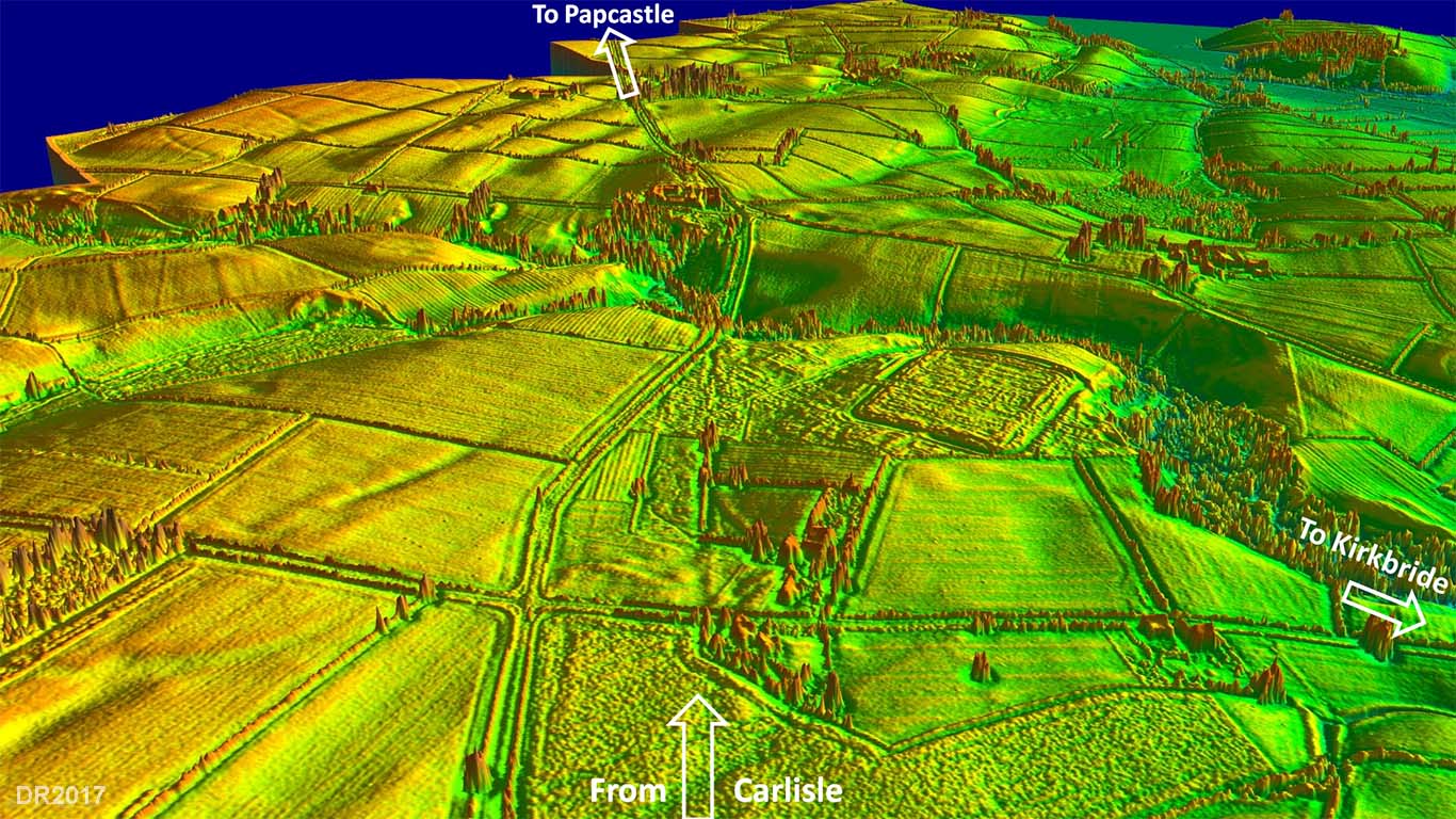
3D Lidar Image - looking towards Papcastle The road to Kirkbride also shows well in the view. |
Click for larger view |
 |
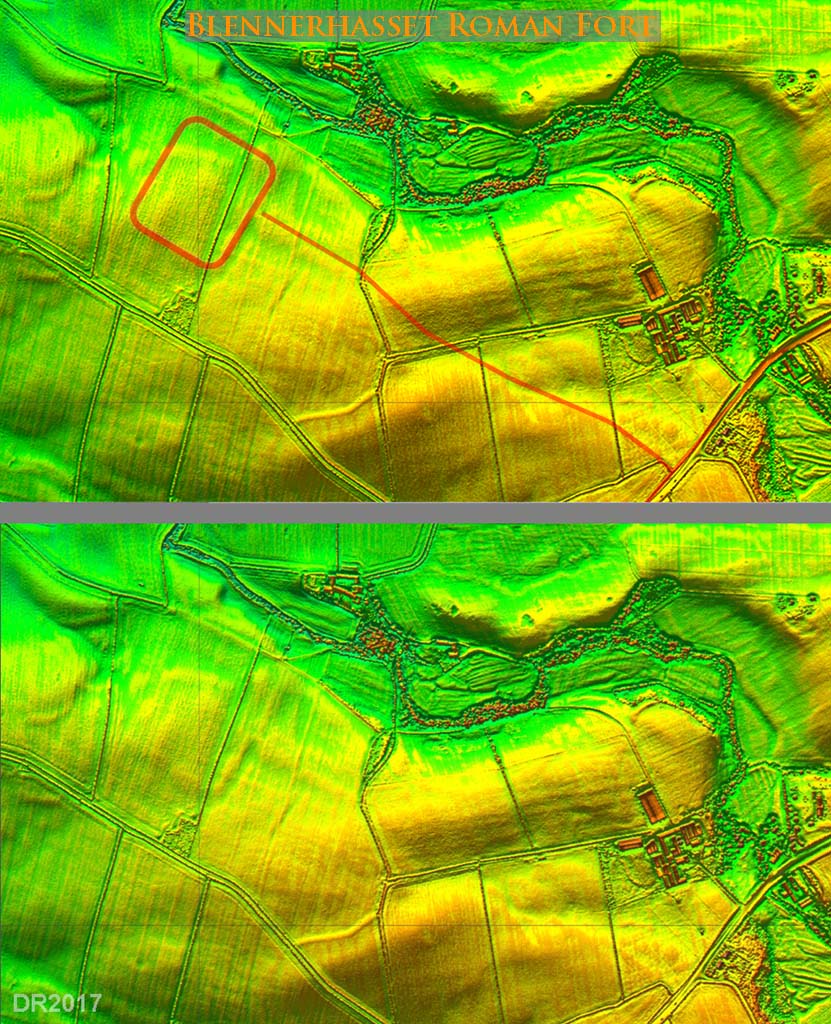
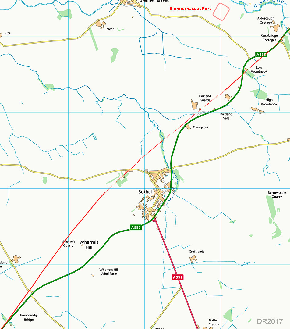
Blennerhasset Roman Fort - Lidar images One of Cumbria's very earliest forts - probably dating to the conquest. At the time of Bellhouse's report it was unknown and it would be aerial photography in the 1980s that revealed the fort's triple ditches. Lidar shows the fort faintly but the south-eastern and south-western ramparts are clear, each with their own entrance. Also visible is the link road to the main Carlisle to Papcastle Roman road. For the location of the fort see the map below. Note: English Heritage has the fort somewhat misaligned in their records. |
Click for larger view |
 |
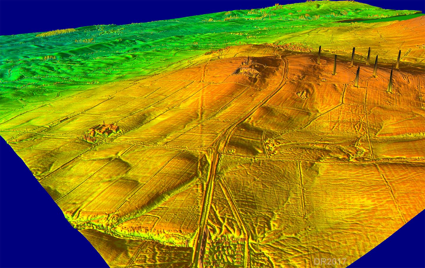
Bothel - Route map This is by far the longest stretch away from the A595. Bellhouse struggled here but did find part the road on Wharrels Hill although one of his grid coordinates must be wrong. We are now able to complete the route.
|
Click for larger view |
 |
Lidar Image - Bothel North of Bothel there is just enough evidence to complete the route, admittedly by joining the dots. The Wharrels Hill length is surprisingly clear and has survived well. Bellhouse traced part of it from NY172386 to NY169384 but with Lidar we can extend this north to the quarry and south to the A595 at Threapland. |
Click for larger view |
 |
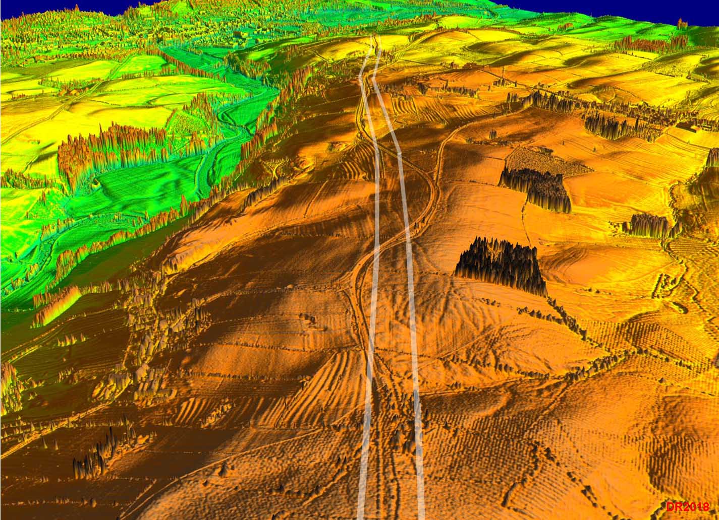
3D Lidar Image - Wharrels Hill Fabulous stretch of road agger looking north from Threapland Gill. Must be one of the best surviving aggers in the County. |
Click for larger view |
 |
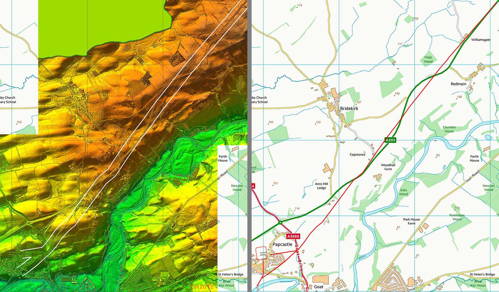
3D Lidar Image - Approaching Papcastle Looking aheand now and Papcastle lies in the distance. The modern road wobbles about either side the Roman line. |
Click for larger view |
 |
Lidar Image & Map- Approaching Papcastle The Roman line is much more direct than the current modern A595. |
Click for larger view |
 |
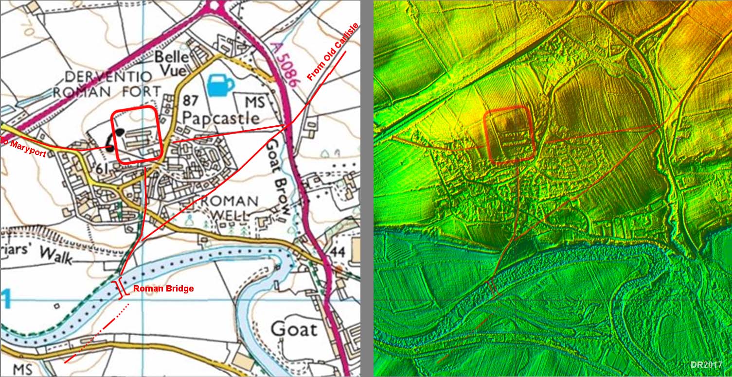
Papcastle - Road Map and Lidar Image The Roman road map is derived from Roman Papcastle by Eric Apperley, modified slightly in accordance with what is visible on the Lidar image. |
Click for larger view |
 |
|
|
|
Return to Cumbria Roman Roads homepage Last update: June 2021 |
© David Ratledge |