 |
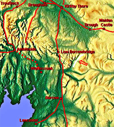
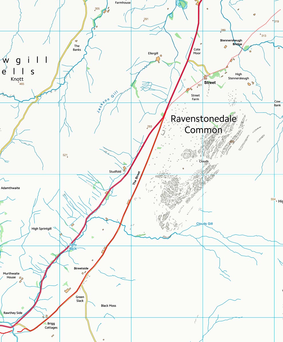
The Roman Road from Sedbergh to Kirkby Stephen, Margary 731Included by Margary but there is some doubt as to whether this truly is a Roman Road. Arguments for its inclusion are the several "street" names along it and it does have many characteristic Roman features. Those street names are, from south to north: Street Road (across Fell End), Streetside (farm), Street (the hamlet) with The Street and Street Farm. Bluecaster too has Roman connotations. Those Roman characteristics: cleverly engineered and direct across Bluecaster side with a classic dog-legged descent and ascent at the River Rawthey, direct and well engineered along Fell End too. Arguments against it are the failures to connect it up to (Church) Brough fort at the north end and the main north-south road at the Sedbergh end. Other arguments for it is that it provides the complementary link via the Stainmore pass that Margary 820 does on the east side of the Pennines (ref. Mike Bishop). Adding to this is that Brough appears, on the basis of numerous lead sealings, to have been a distribution point. This makes no sense if it lies on a single road - it would need to be at a road hub. This road could provide one of those links. Complicating matters for us were the actions of the Sedbergh Turnpike Trust who modified, upgraded and bypassed several sections of the local roads here that were formally ancient routes.
Because this is a somewhat disputed Roman road I have included more images than normal so you can make up your own mind! Recent Archaeological Survey: In June 2010, Ed Dennison Archaeological Services (EDAS) Ltd were commissioned by Robert White, Senior Conservation Archaeologist for the Yorkshire Dales National Park Authority (YDNPA), to undertake a detailed topographical survey prior to, and a subsequent watching brief during, drainage works carried out along the line of a probable minor Roman road alignment on Bluecaster Side, near Sedbergh, Cumbria (NGR SD 7032 9670 centred). The area of survey measured 610m long by c.20m wide, centred on the line of the probable Roman road, from a point 250m north-east of Bluecaster Side as far as Near Gill (between NGRs SD 7024 9652 and SD 7060 9700). See Link
|
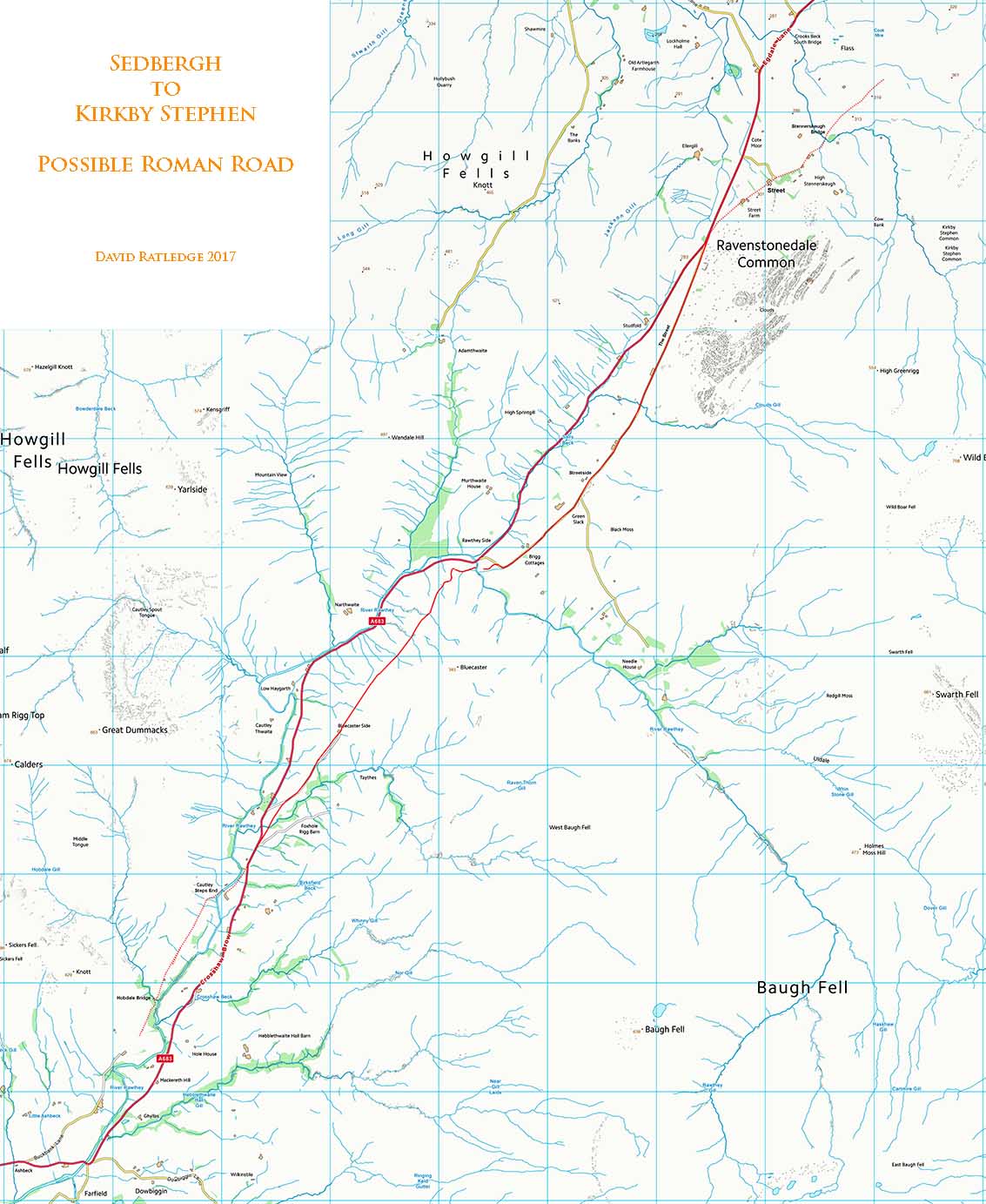
Route Map - Sedbergh to Stennerskeugh This is about as much that can be traced - or least as much I have been able to locate. It might seem strange crossing the River Rawthey at Steps End but it does cut the corner off and reduce the distance rather keeping east of the Rawthey in the Sedbergh area. |
Click for larger view |
 |
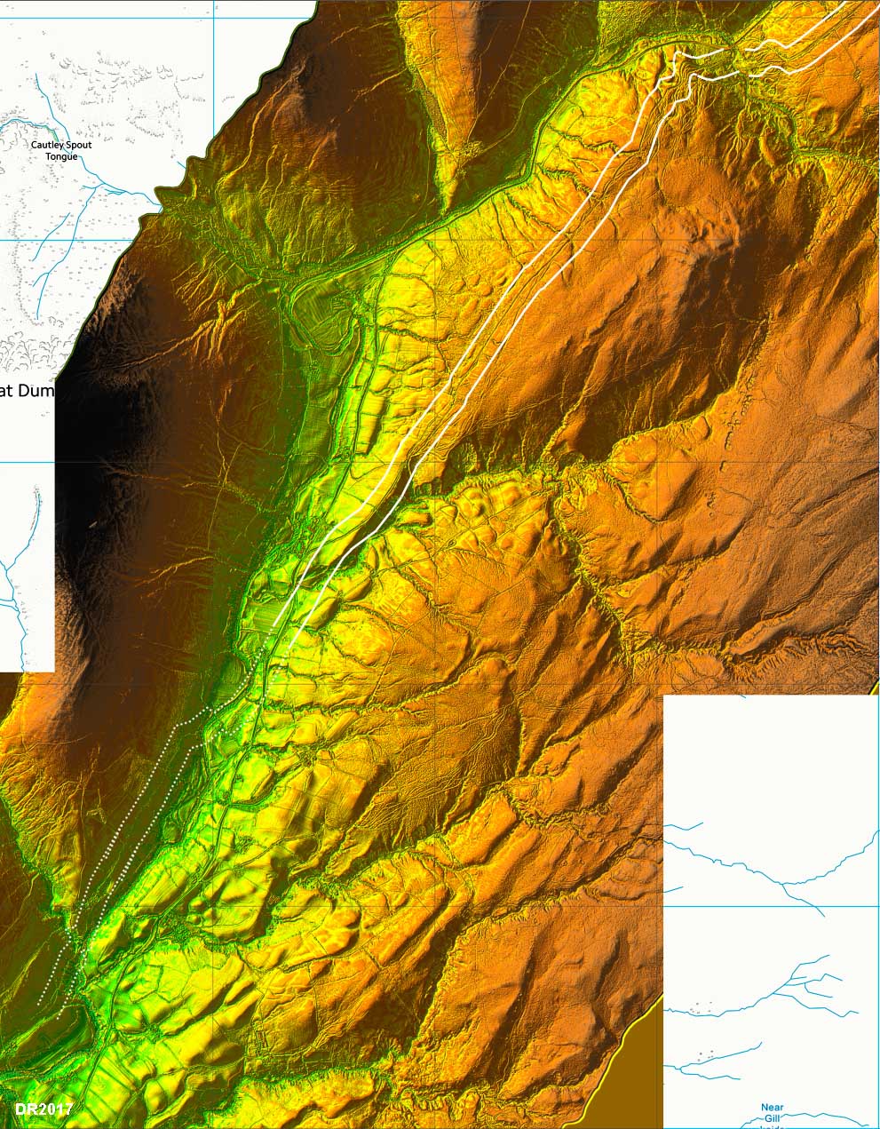
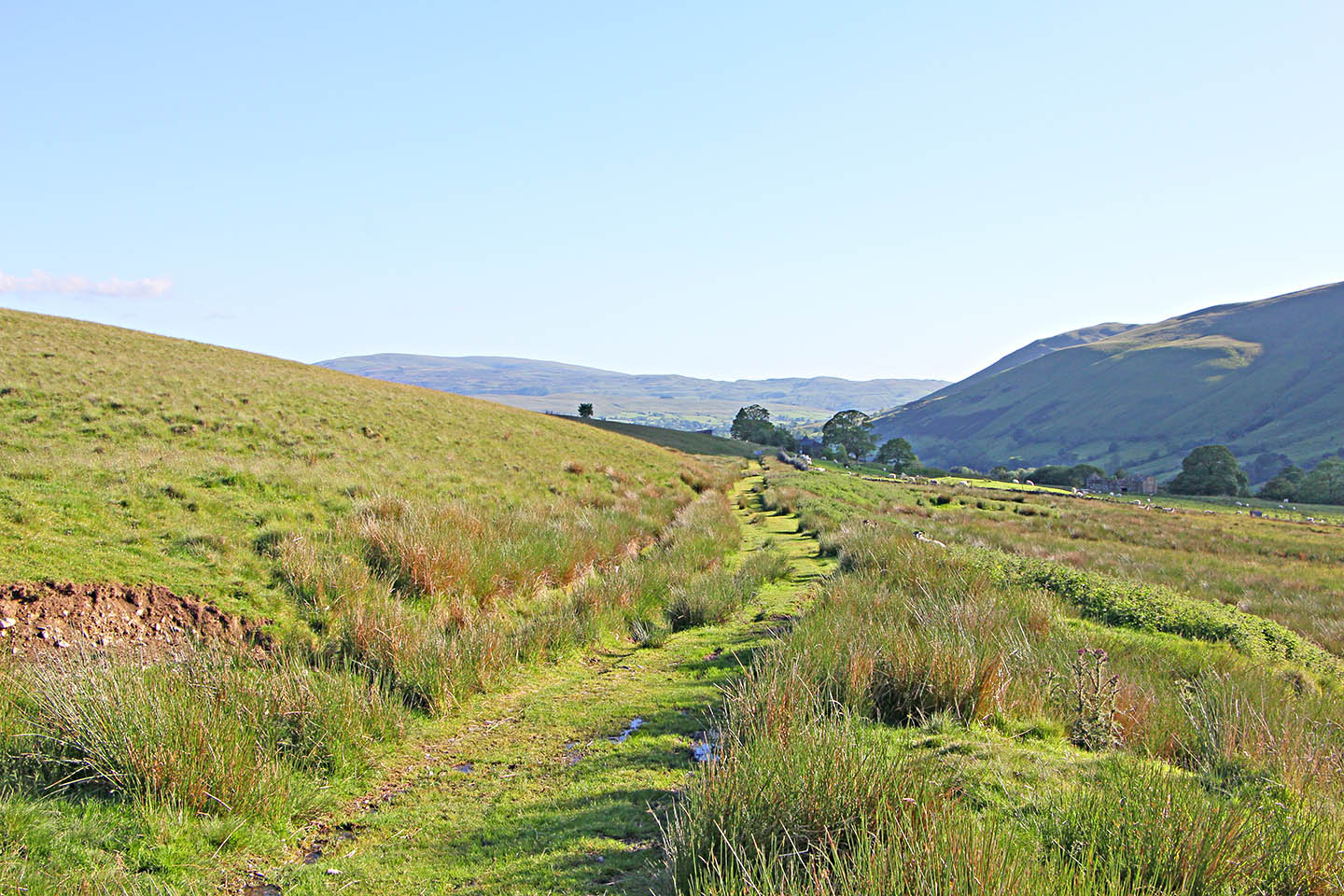
Lidar Image - Hobdale to Rawthey Bridge I have started at Hobdale as west of there routes are very subjective. Beyond Hobdale and across Bluecaster there is a walkable road. |
Click for larger view |
 |
Route Map - Hobdale to Rawthey Bridge The walk across Bluecaster is recommended. The road has been damaged in places but is still well preserved in others. I could find no explanation for the "Bluecaster" name. See the reference above for a recent professional excavation and evaluation of part of this stretch. |
Click for larger view |
 |
Terraceway - opposite Cautley Vicarage This is between Hobdale Bridge and Steps End. Because of the steeply sloping hillside the road is cut into the hillside and built up on its lower side. |
Click for larger view |
 |
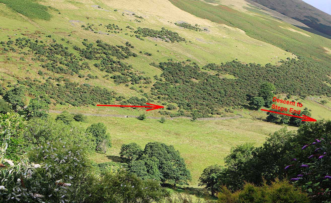
Cautley Terraceway and incline down to Steps End The incline down to Steps End is no longer accessible - several years ago it was possible to walk it but on my last visit it was fenced off. The lower part of the incline has land-slipped away. To get around the fenced off descent then continue on across the fellside before doubling back on the public right of way to Steps End. |
Click for larger view |
 |
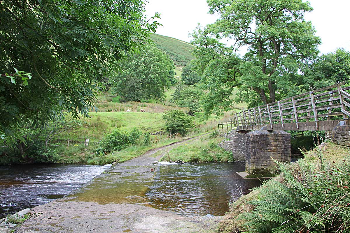
Steps End Ford The incline down is on the far bank coming in from the left but it is now fenced off.
|
Click for larger view |
 |
Agger approaching Ecker Secker Beck This was probably the route to Bluecaster until the Bluecaster road was bypassed c1819-20 - see later. This view is from the A683 road which crosses the beck downstream of this spot. The hawthorn trees mark the agger which is much more obvious in winter. |
Click for larger view |
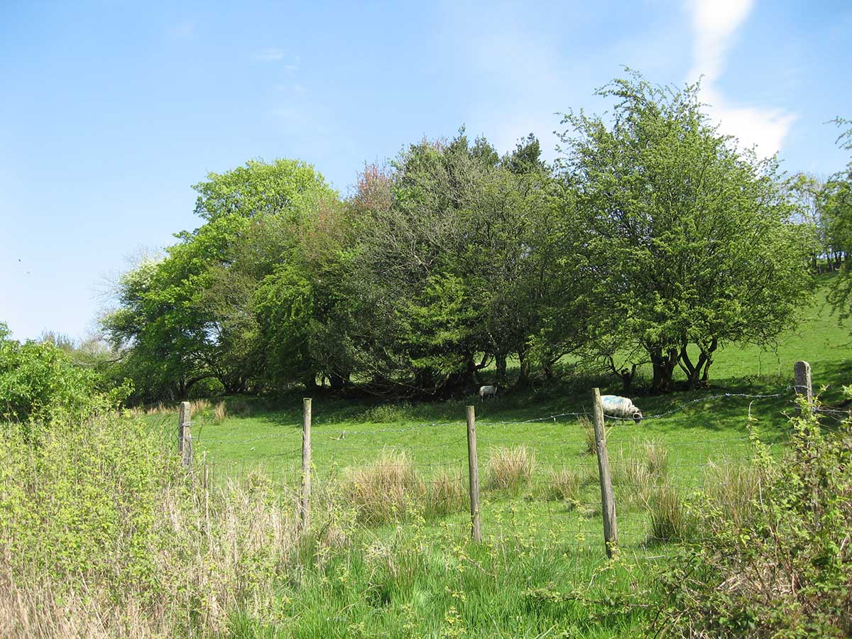 |
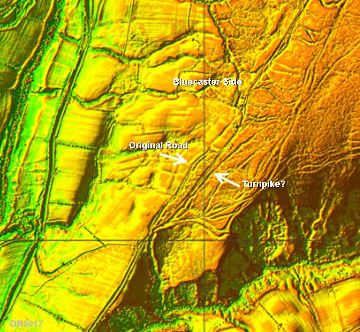
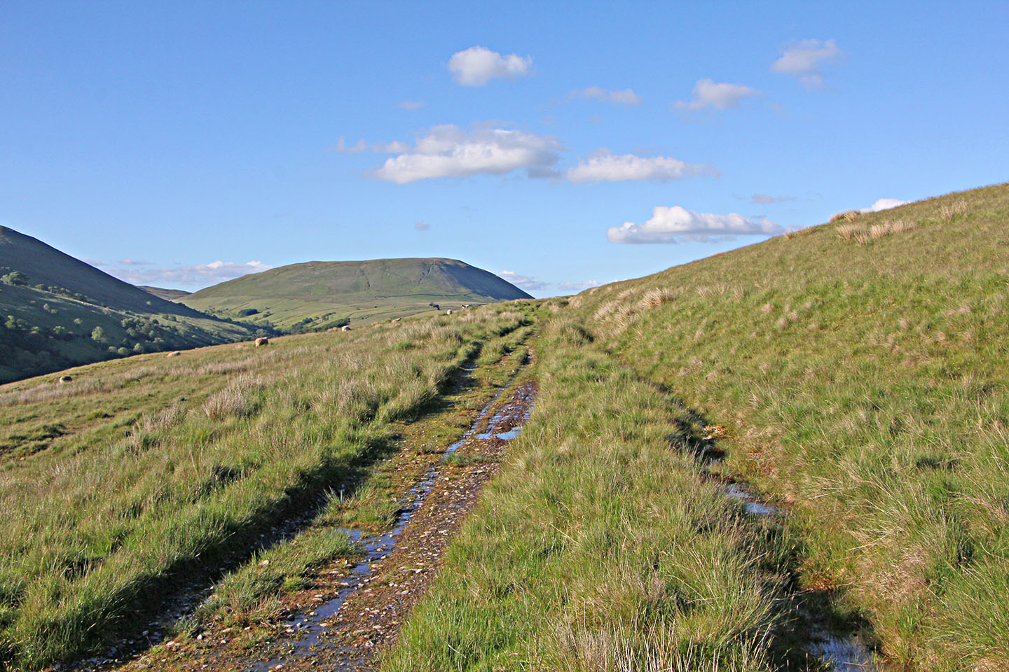
Bluecaster Side - divergence of tracks 1 This is perhaps the most significant clue as to whether the road is Roman or not. The road across Bluecaster side was obviously an ancient route that was adopted under the 1761 Turnpike Act. So in looking at Bluecaster side it is hard to differentiate what was original and what was a turnpike upgrade. But just here the ancient and turnpike roads diverge - the modern and Turnpike road swings to the right (to the east) here. The original line is straight on - see the Lidar image later. |
Click for larger view |
 |
Bluecaster Side - divergence of tracks 2 The reverse view to the one above. The original (Roman?) route is severely water damaged - no wonder it is bypassed. The old route follows the wall and passes the front of Bluecaster Side (cottage) before merging in with the turnpike route. |
Click for larger view |
 |
Lidar Image - Bluecaster Side The modern road and the Turnpike road diverge off the ancient line approaching Bluecaster Side. The original un-improved road still exists to the west. The latter is a more direct line and does have Roman characteristics but is much disturbed. No wonder they bypassed it. The route across Bluecaster was the first to be replaced c.1819-20. The low route went via the Cross Keys and is still in use today albeit it has needed extensive repairs due to its proximity to the River Rawthey. |
Click for larger view |
 |
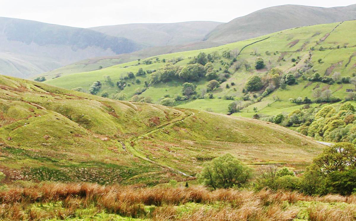
Bluecaster Side About a mile from Bluecaster Side looking back (south-west). |
Click for larger view |
 |
Bluecaster Side Reverse view from above looking ahead. The ditch on the right hand side is obvious. On sidelong ground there is no need for a ditch on the low side. |
Click for larger view |
 |
Descent to Rawthey Bridge Fabulous curving dog-leg descent to Rawthey Bridge (old). The old bridge was upstream of the modern one and the west abutment is still discernable. The road across Bluecaster has suffered from motorised scramble bikes and I believe the National Park are trying to address this problem - hopefully sooner rather than later. |
Click for larger view |
 |
Lidar Image - Rawthey Bridge to Stennerskeugh Gap in the Lidar coverage but it is of no consequence as the route is not in doubt here |
Click for larger view |
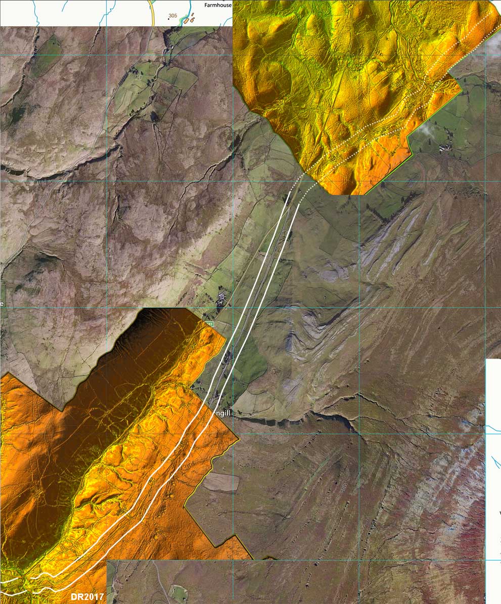 |
Route Map - Rawthey Bridge to Stennerskeugh The turn to Street and Stennerskeugh is probably marked by the wall boundary on the east side of the road just before the open common land. the wall diverges to the east almost certainly marking the original line. |
Click for larger view |
 |
Ascent from Rawthey Bridge This cutting marks the route up from Rawthey Bridge onto Fell End. Beautifully engineered but it must have been too steep for traffic in the early 1800s as it was bypassed c. 1834 - see below. |
Click for larger view |
 |
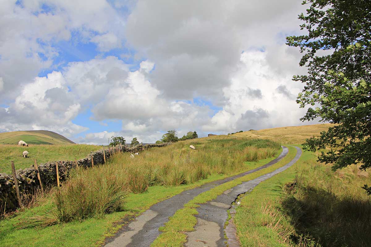
Fell End - The Street (road) at Clouds Gill Bridge This is looking back to Rawthey Bridge. All along Fell End the road (The Street) is cambered with a ditch on the high side and usually banked up on the low side. The Fell End stretch was turnpiked in 1765 and these early turnpikes generally adopted existing roads and repaired/upgraded them. It was replaced as a result of the 1826 Turnpike Act but the actual works do not seem to have been completed until around 1834. The new lower line had easier gradients and avoided the steep climb up from Rawthey Bridge. The modern A683 road follows the lower road. . |
Click for larger view |
 |
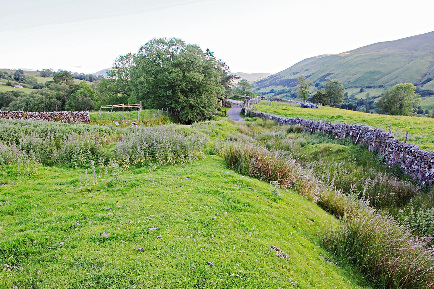
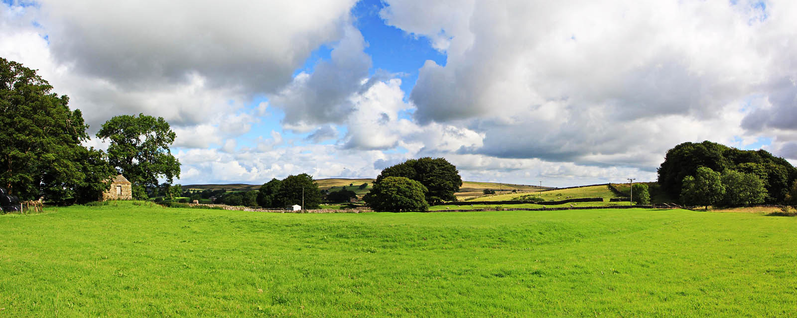
Street Hamlet - looking back from Stennerskeugh to Street (house) This stretch was never turnpiked despite being proposed as part of the 1826 Act. So what we see is still much as original. Judging by the width between walls it was probably used as a drove road. Quite where the Roman line was - if that is what it was - is difficult to determine but perhaps a line near the right-hand wall makes most sense. The straight line across the field does not look like a road agger.
|
Click for larger view |
 |
Lidar Image - the possible camps at Street and Stennerskeugh These camps have been suspected for several years having been spotted by balloonists amongst others! Difficult to say one way or another. If they are Roman then the case for the road becomes a bit more certain. |
Click for larger view |
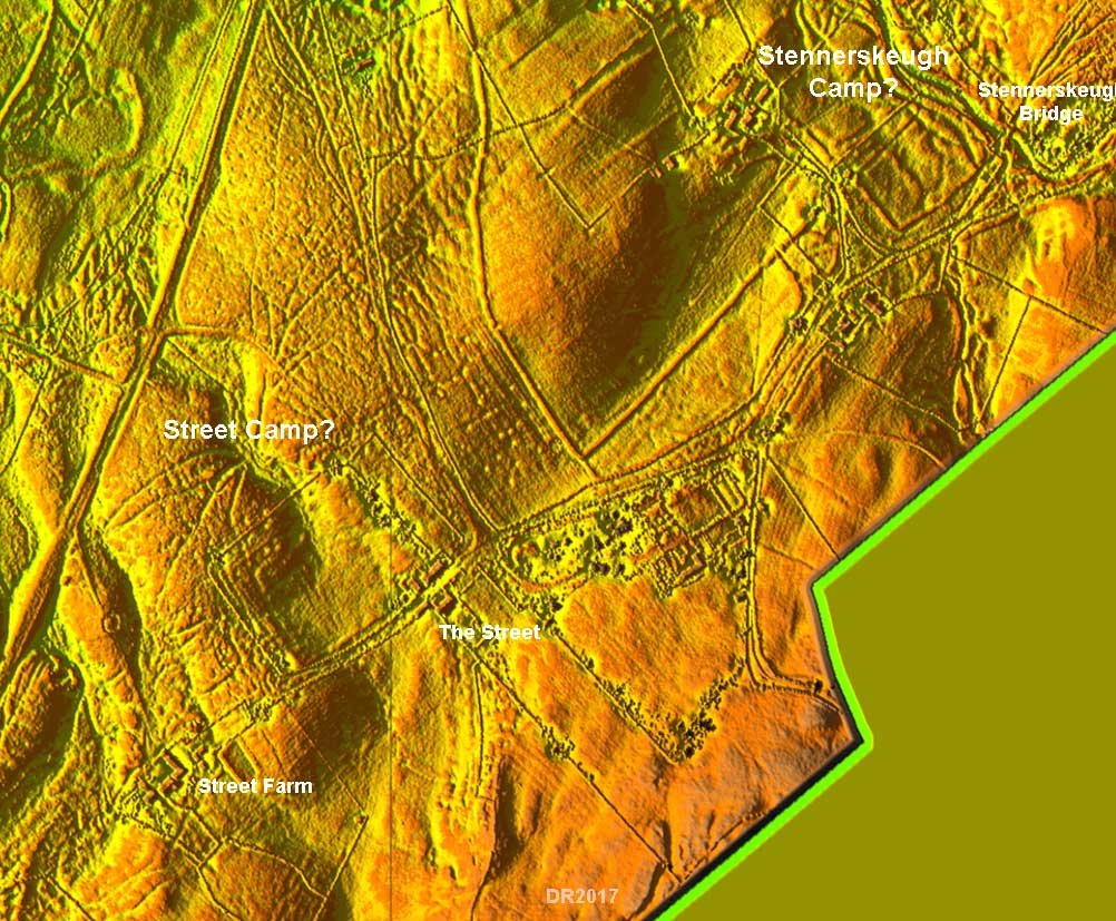 |
Stennerskeugh Camp(?) This is the smaller camp near Stennerskeugh Bridge and the curving south-west corner is very clear. Just worried that if this was a drove road then this would have been a good spot for overnight pens. |
Click for larger view |
 |
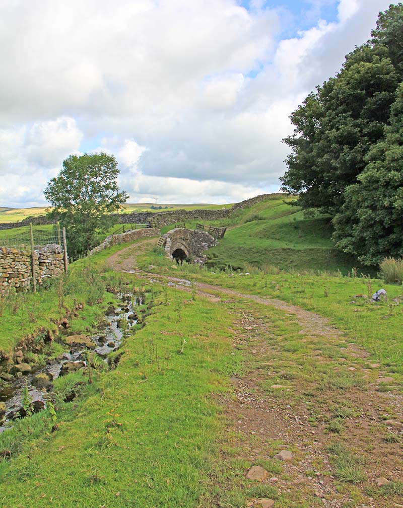
Stennerskeugh Bridge Beautiful bridge in the middle of nowhere leading to nowhere! The track heads on beyond over moorland towards Kirkby Stephen but the Lidar coverage runs out. A clue to route it took can be gleaned from the Turnpike Act of 1826 even though the proposed works were never carried out for this stretch. The proposed route described was via "Low Stennerskeugh to Wharton Dykes and thence through Warton Park to Kirkby Stephen". |
Click for larger view |
 |
Tracing the route from Stennerskeugh to Church Brough has proved problematical. The description of the route in the Turnpike act would suggest it would pass through the centre of Kirkby Stephen so modern roads could mask it. The same could be true to Brough. More work needed. |
|
|
|
Return to Cumbria Roman Roads homepage Last update June 2019 |
© David Ratledge |