|
Possible Roman RoadsThere is never a shortage of suggested Roman roads - the author Dutton alone suggested numerous ones! However, we look at 4 possibles selected largely on the frequency that that they are put forward. There are of course several others that we considered but so far no convincing evidence has been forthcoming - at least to our eyes. This doesn't mean the searching has stopped! |
Historic Counties: Cheshire Current Counties: Cheshire HER: Cheshire
|
|
|
Weaverham The legend of a Roman road running under the chancel of Weaverham Church seems to be down to Kirk in 1876. The road is assumed to be heading for a crossing of the River Weaver at Saltersford. The latter would appear to have been destroyed by Barnton Cut but Saltersford Locks preserve to name and approximate location. However, Lidar is unable to provide any support for just such a road. |
Click for larger view |
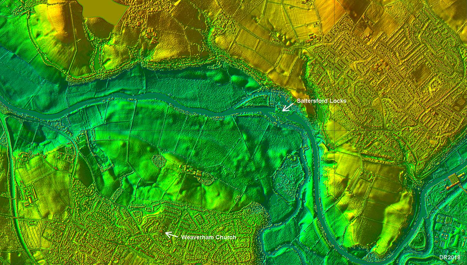 |
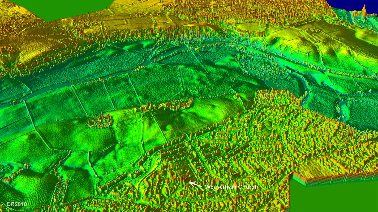
Oblique 3D Lidar View - Weaverham Here we are looking over the church in the direction of Saltersford. Again nothing suggestive of a possible Roman road is visible. For more information follow this link. |
Click for larger view |
 |
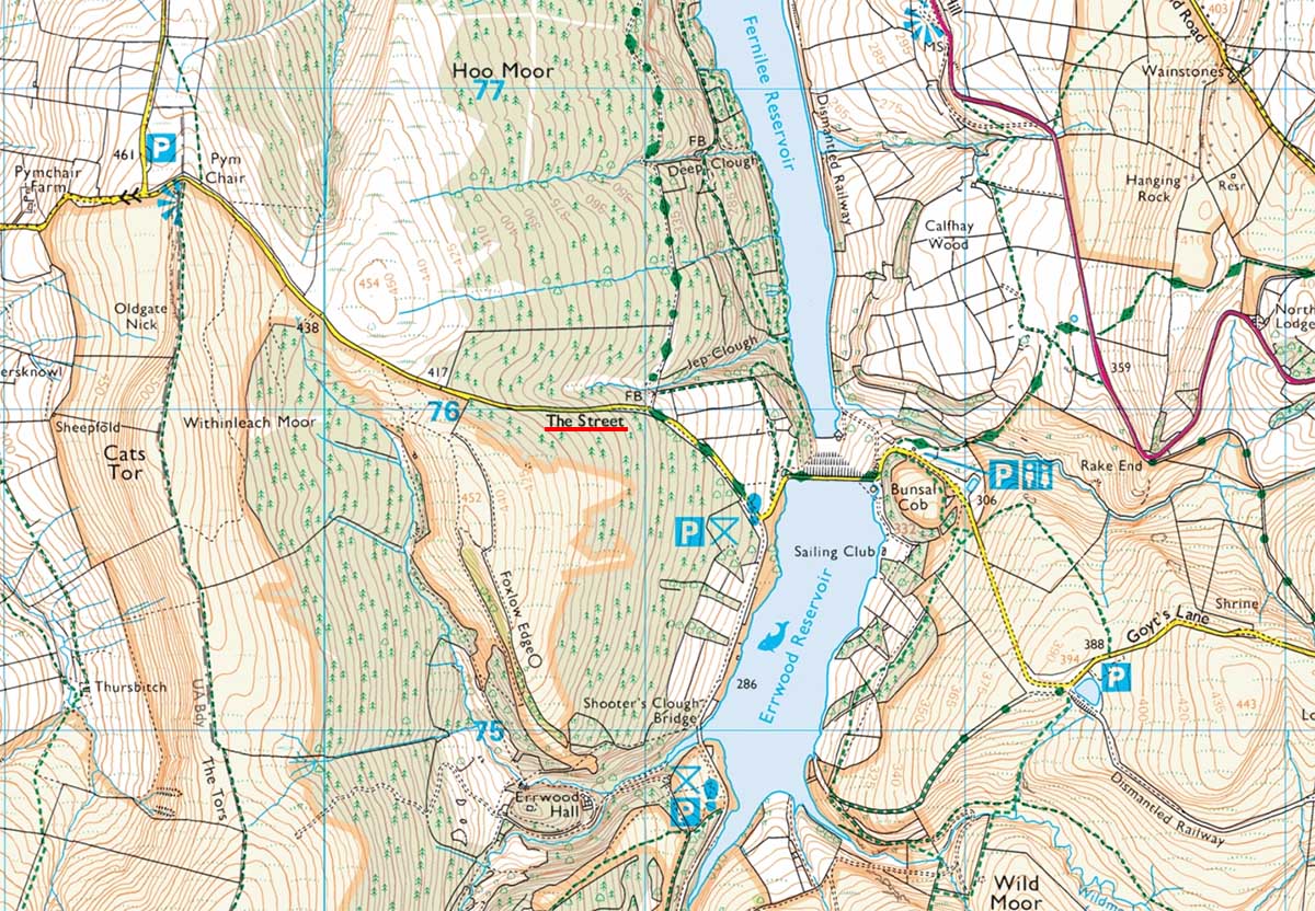
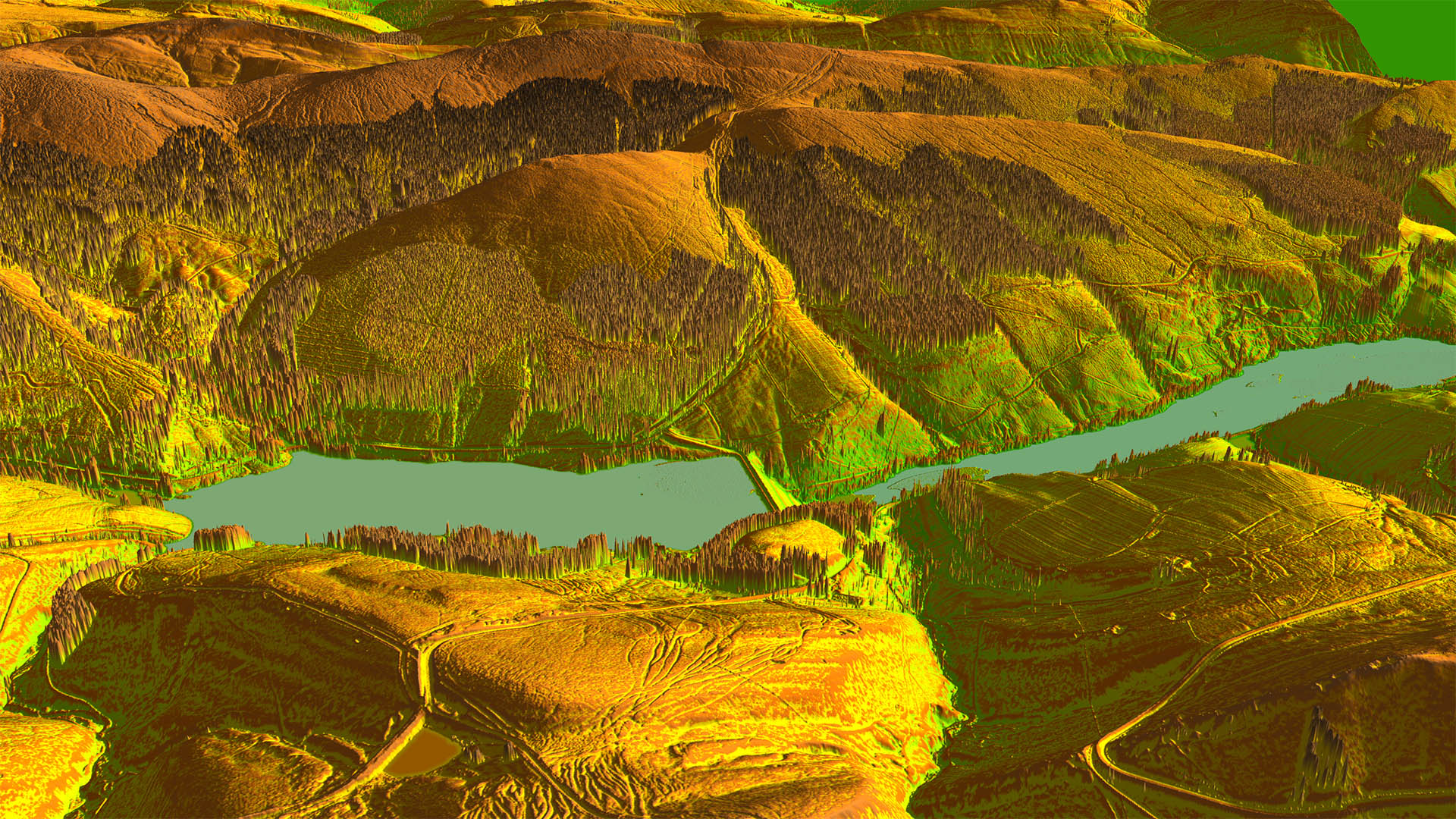
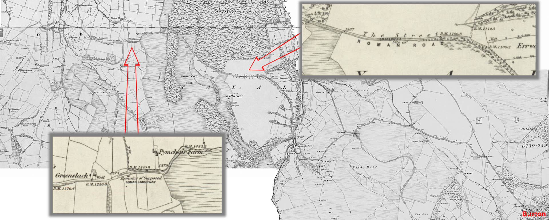
The Street A road from Chester to Buxton would seem logical and probably the leading contender for this The Street. It is close to the border between Cheshire and Derbyshire, to the west of Buxton. The Street is now in Derbyshire and the so-called Roman Causeway at Pymchair in Cheshire. Connecting this possible road westwards is the problem - so far nothing convincing has emerged. Watkin imagined it turning more to the north and heading for Stockport but again real evidence is lacking. |
Click for larger view |
 |
Oblique Lidar View across the Goyt Valley The equivalent Lidar view to above looking west. The road does have some Roman characteristics but not totatlly convincing for me. Those braided tracks this side of the reservoir are a shorter course than modern road but are certainly not Roman
|
Click for larger view |
 |
OS First Edition 6-inch Map The Ordnance Survey first edition map (Cheshire series - it was in Cheshire then) is quite definite. It labels The Street as "Roman Road" and it also shows at Pymchair a "Supposed" Roman Causeway. The latter is recorded in the Cheshire HER but no comments either supportive or dismissive are given - see link.
|
Click for larger view |
 |
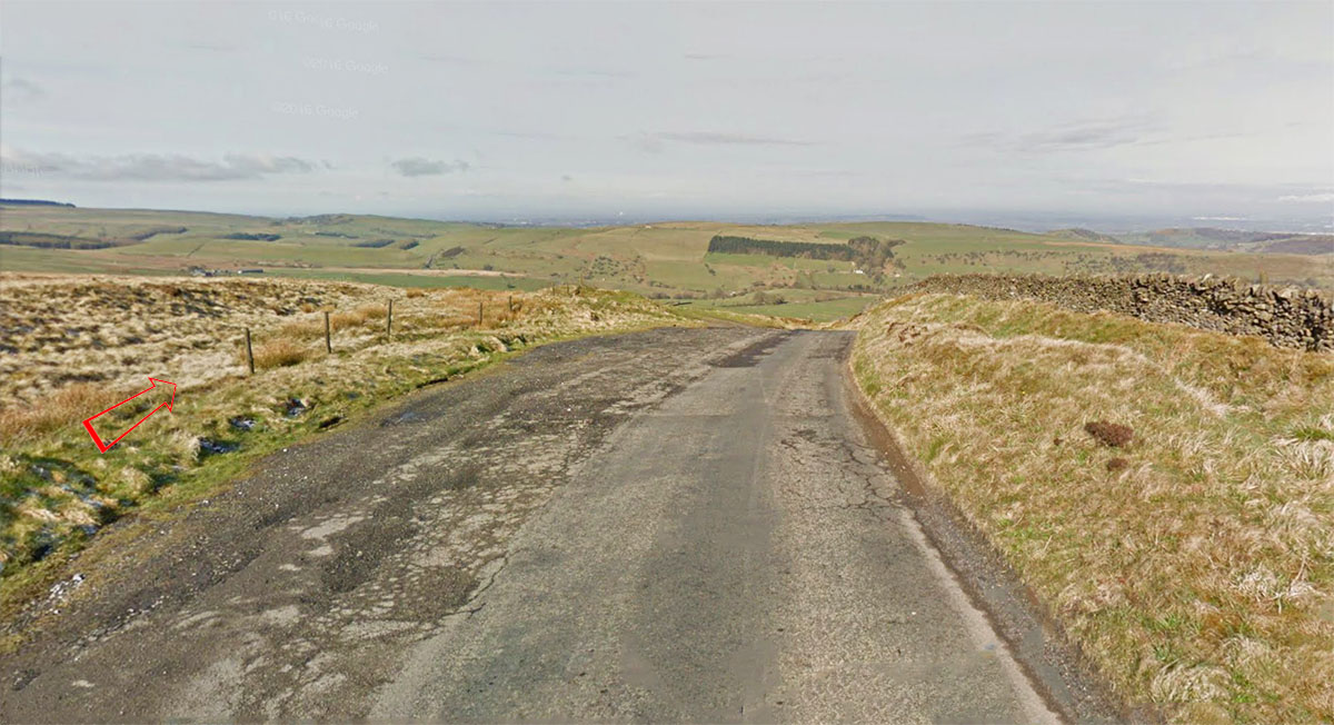
Pymchair looking West This is the "Supposed Roman Causeway". It appears to be an older course of the road but is it old enough to be Roman?
|
Click for larger view |
 |
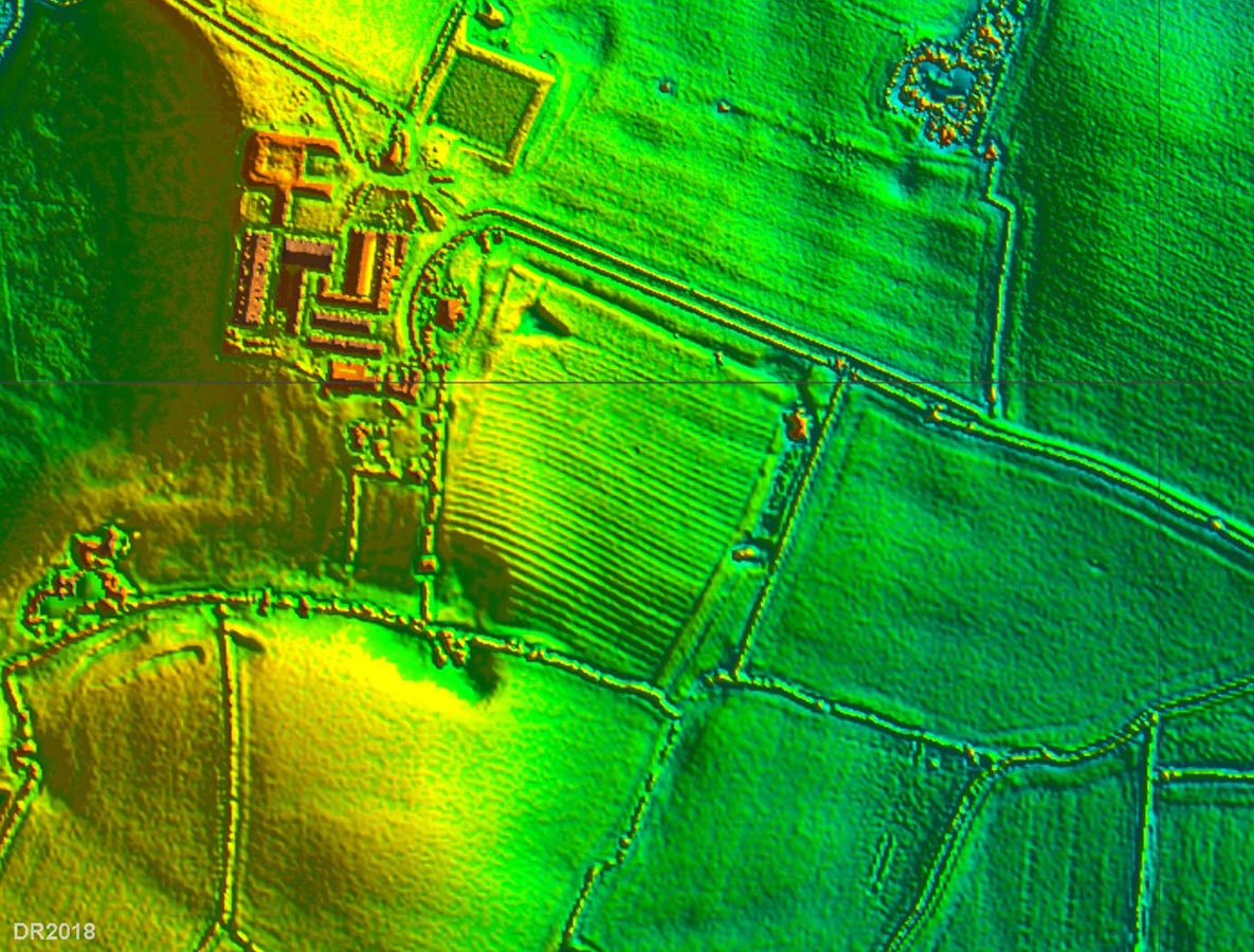
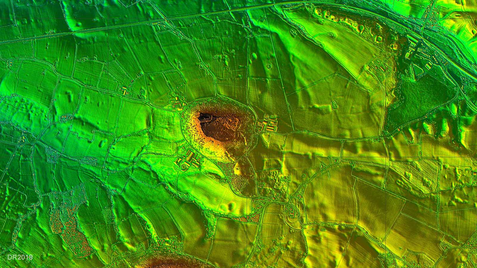
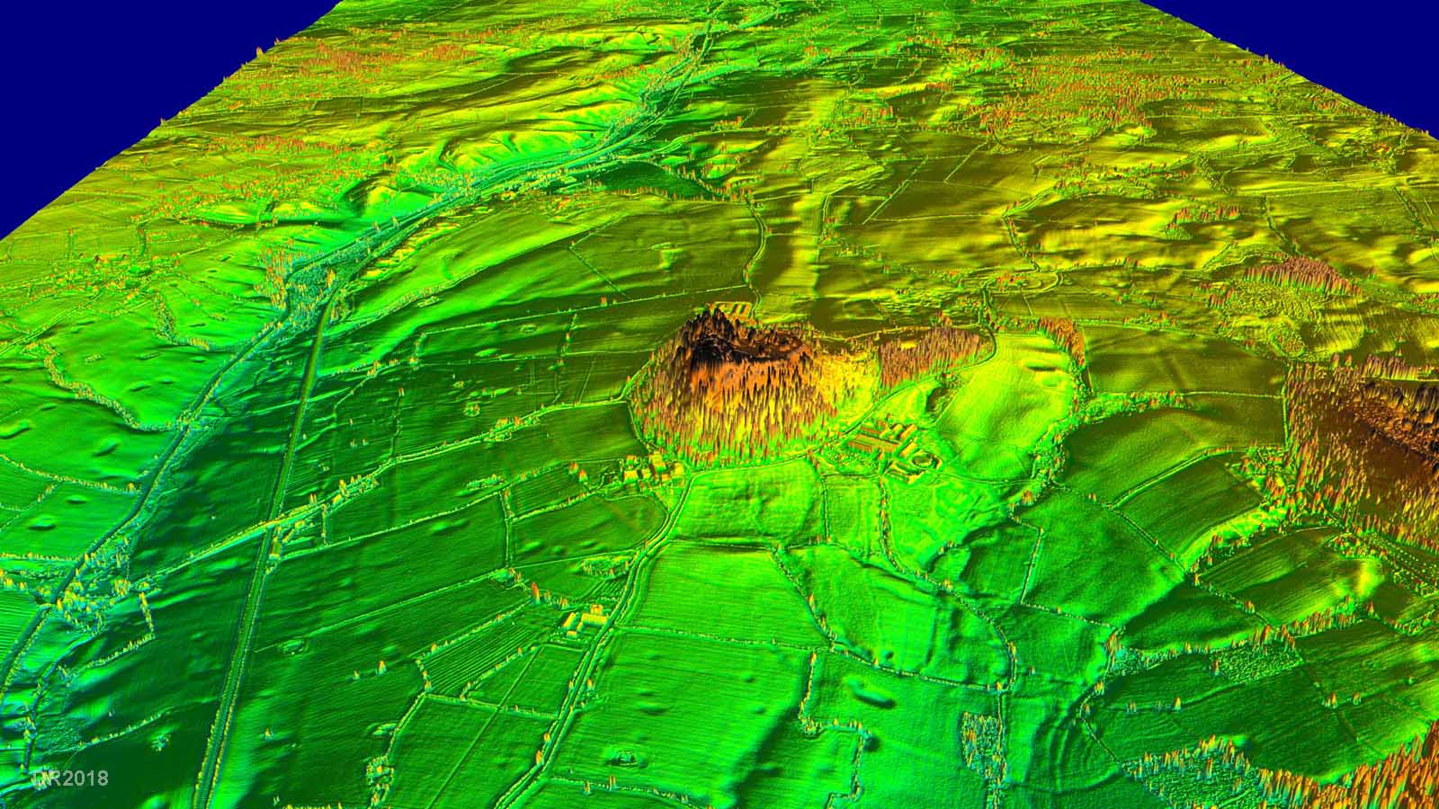
Congleton, Astbury This supposed Roman camp at Bent Farm, Asbury, Congleton is listed as an ancient monument by Historic England. The Cheshire HER is a little more circumspect in its authenticity - see link. What interests us here is the suggestion of roads from both the west and east entrances of the camp. The location of the site is credited to a local historian Cartlidge. Excavations took place in 1967 & 1970. In addition geophys over part of the site was carried out in 1976. No dating evidence was forthcoming. So what does Lidar show? Well the visible enclosure does have a ditch and rampart but fails to satisfy Historic England's requirement that Roman camps must have rounded corners - what is visible are square ones. What about the supposed roads? Well the west side is masked by farm buildings and on the east side nothing is visible. Spreading the search wider then again no roads have been spotted.
|
Click for larger view |
 |
Beeston A road from Chester passing Beeston Castle was suggested by Dutton heading, he thought, for Chesterton. Watkin recorded a road from Boughton (Chester) towards the south-east which would fit with Pepper Street, Christleton but beyond this then clues run out. Dutton carried out an excavation near Beeston and recorded a Roman road 10 metres wide. The only relevant record we could find in the Cheshire HER for the Beeston area was not as suggestive. In the Lidar image there are some traces of an older road just to the south of the track to the west of Beeston Castle but the course is meandering and untypical of a Roman alignment. |
Click for larger view |
 |
Oblique 3D Lidar View - looking East Again nothing convincing - just that meandering older road mentioned above. Tracing the Lidar back to Pepper Street then again nothing shows. |
Click for larger view |
 |
|
|
|
Last update: Sept 2023 |
© David Ratledge & Neil Buckley |