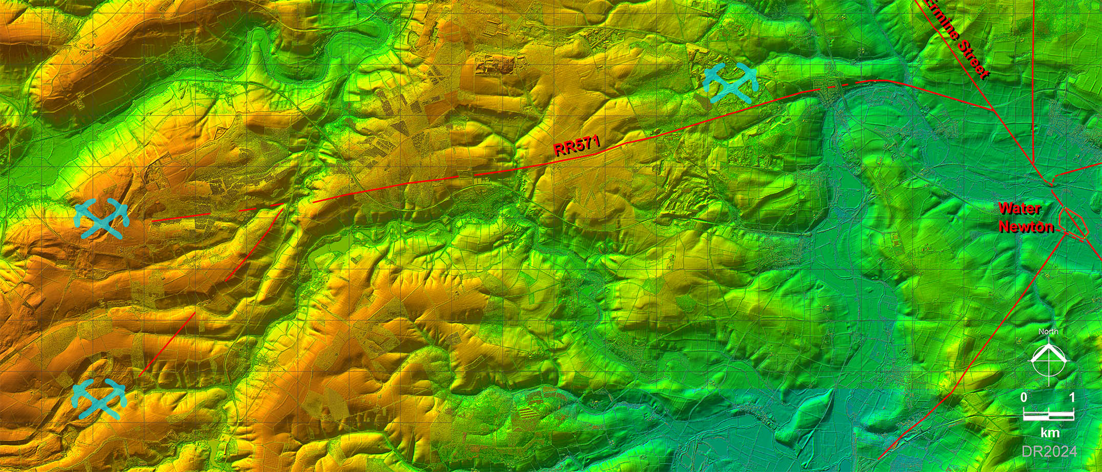
Lidar Image - Full Route Water Newton to Laxton
A direct route to Laxton ironstone quarries would have require another River Nene bridge. So the surveyor sensibly took the road around the bend in the river at Wansford and then took a straight course for the rest of the road to Laxton.
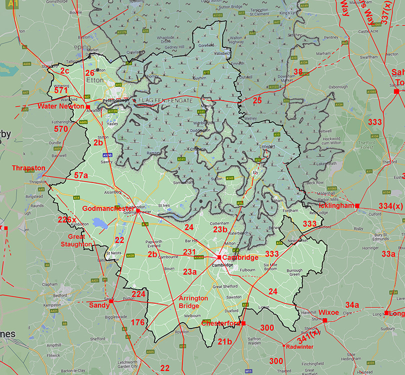
The quarry symbols are from the OS Roman Britain map - corrected as that map is not the most accurate. There are other quarries visible but presumably no evidence to link them to the Romans. |
|
 |
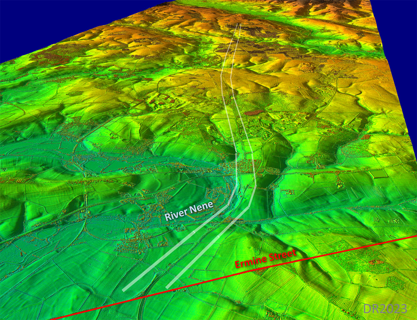
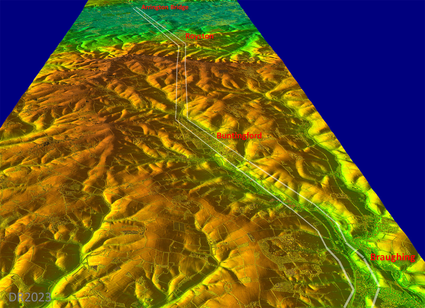
Oblique 3D Lidar Image - Ermine Street towards Laxton
The route around the bend in the River Nene is obvious in this oblique view. From then onwards a straight(ish) alignment was followed. |
Click for larger view |
 |
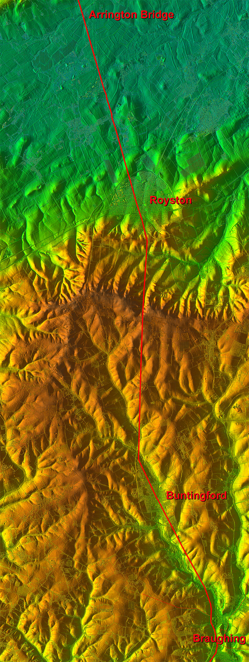
Lidar Image and Route Map 1
Clearly getting around the bend in the River Nene was the critical factor in this the first section of the road. A more direct road from Water Newton was possible but would have needed another bridge. |
Click for larger view |
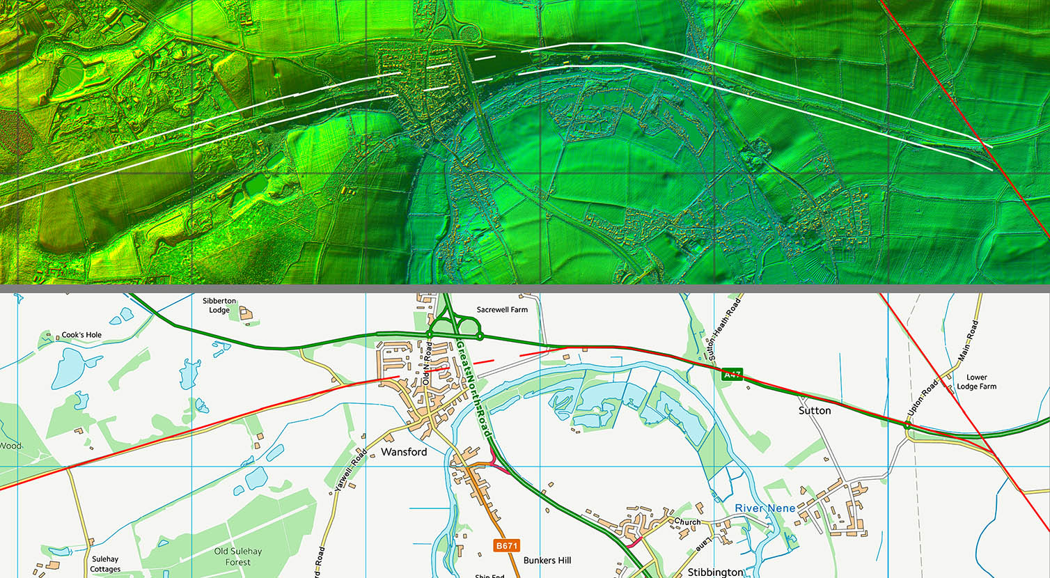 |
Ordnance Survey First Edition - Wansford
Not a lot to go on across Wansford hence the dashed line. The Roman surveyor though appears to have attempted to keep the road as close to the river bend as possible so what I have shown seems likely to pretty close. |
Click for larger view |
 |
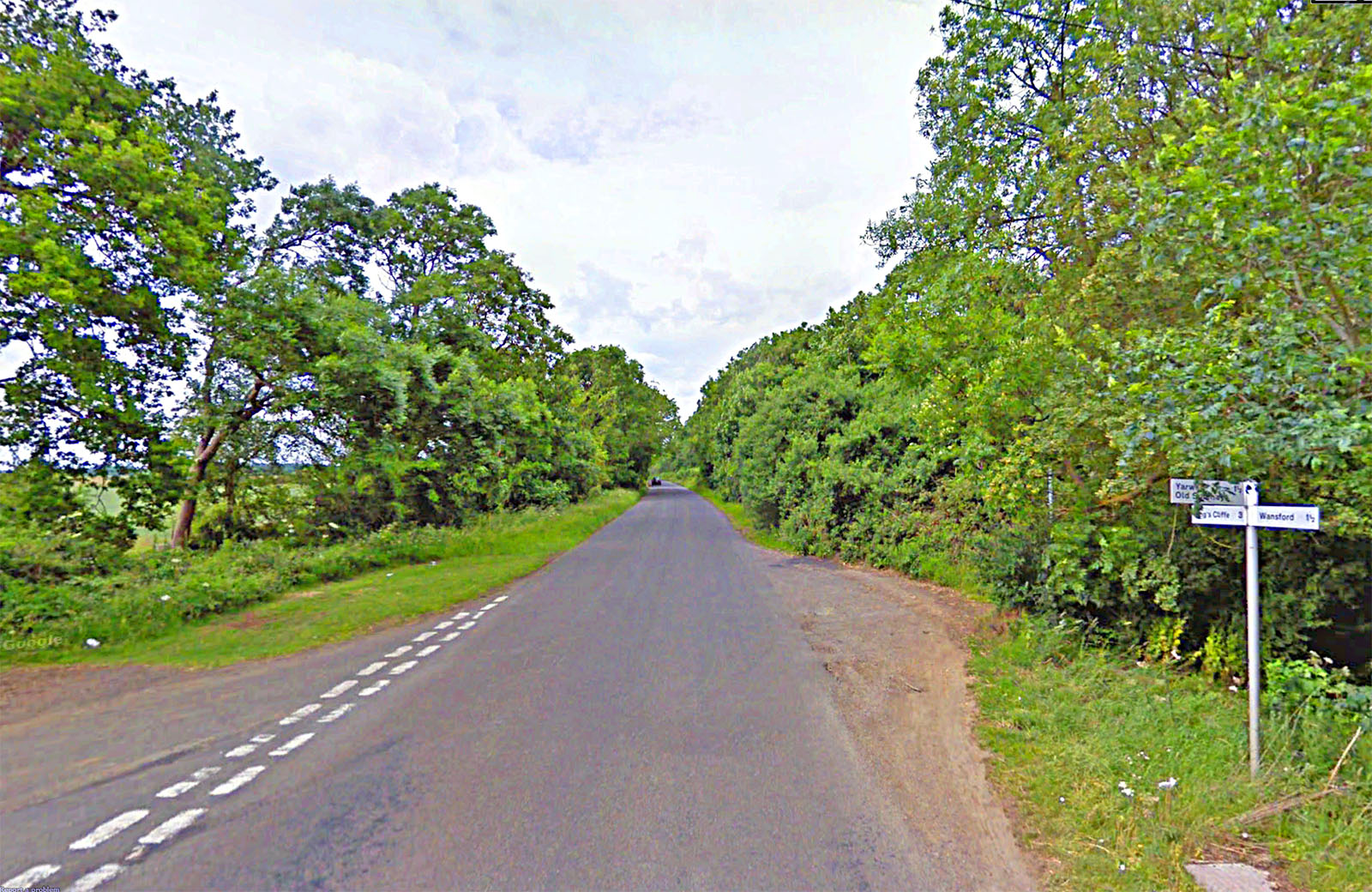
Between Wansford and King's Cliffe
About a mile from Wansford on the King's Cliffe road there is the suggestive name of Leadgate (Farm). Gate means road but why lead and not iron? |
Click for larger view |
 |
>
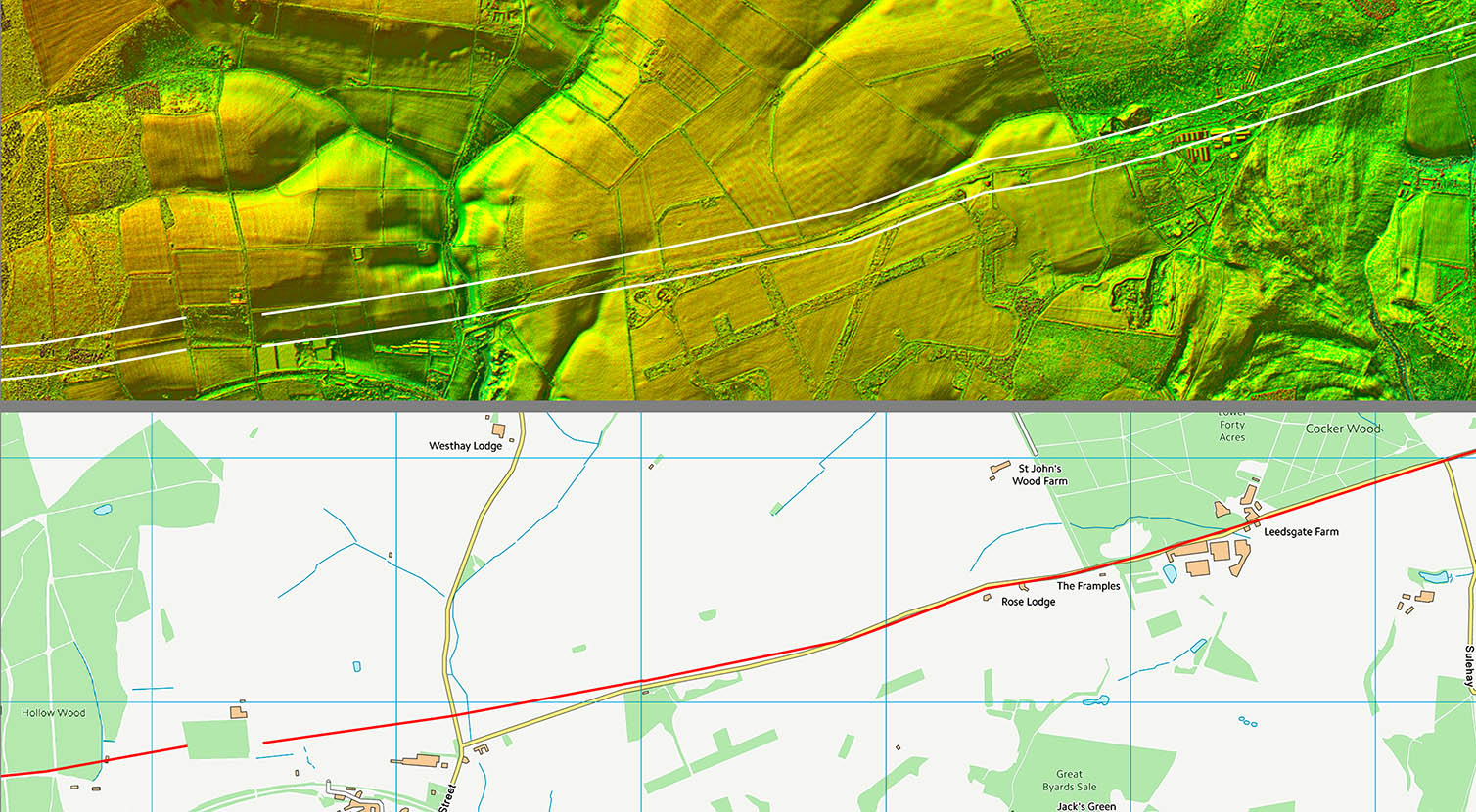
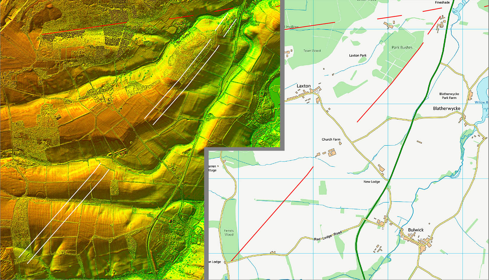
Lidar Image and Route Map 2
The straight(ish) alignment all the way to Laxton now begins. There is the suspicion of a little zig-zag to negotiate the little valley before King's Cliffe where traditionally route was thought to end. |
Click for larger view |
 |
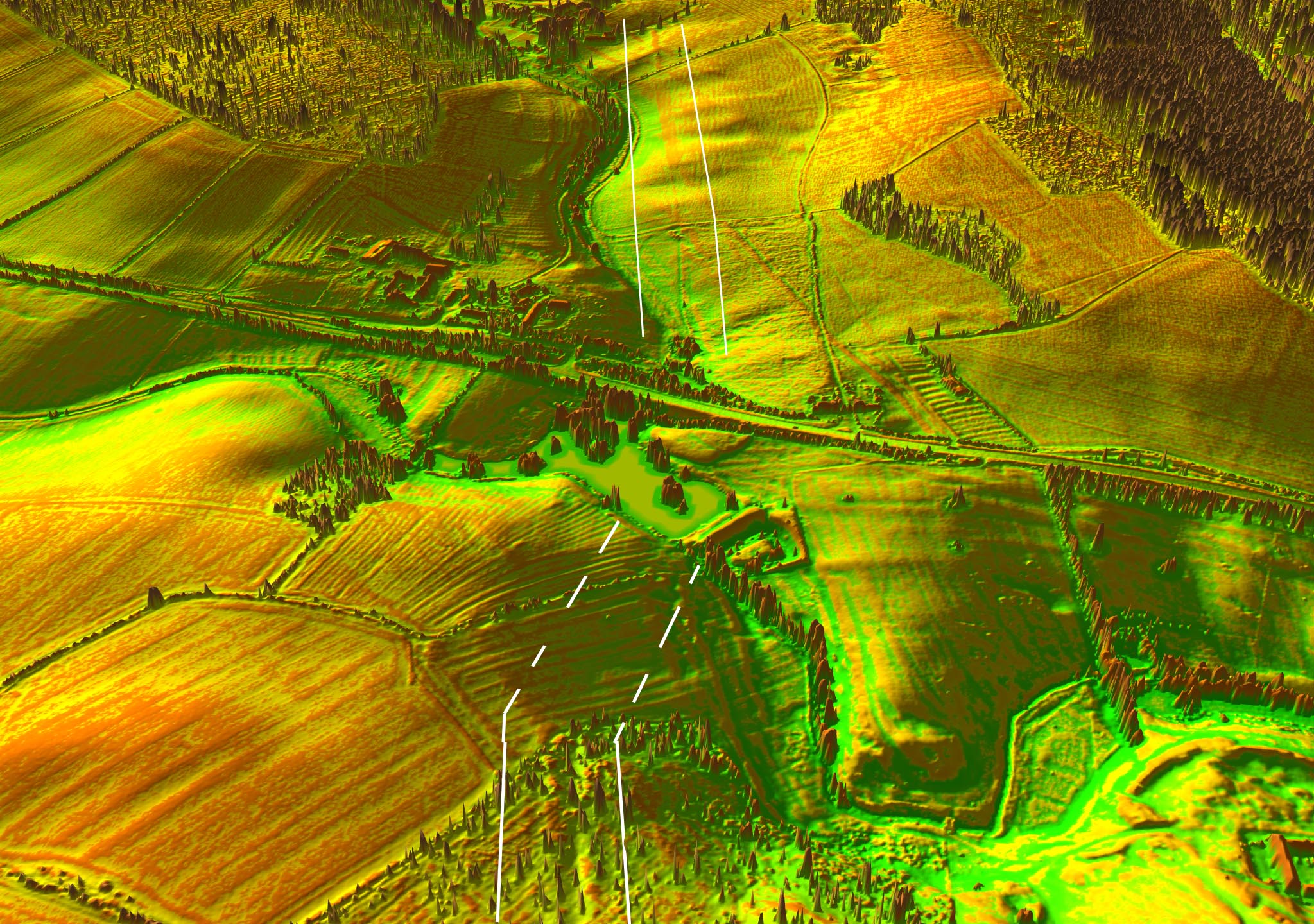
Oblique 3D Lidar Image - Crossing the A47
A lake interrupts the evidence as we approach the A43 and Laxton Hall. There is some faint evidence that the straight alignment continues and this seems reasonable. However, there does appear to be a possibility of the junction being staggered as an agger like feature is also visible angling right. |
Click for larger view |
 |
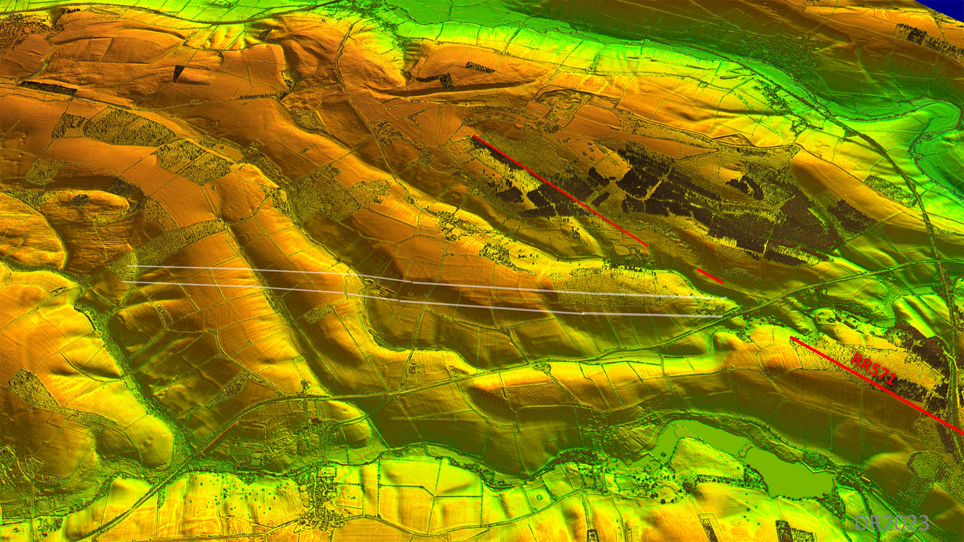
Lidar Image and Route Map 3
I think there is just about enough evidence that the straight alignment carried to the Laxton ironstone quarries.
The road down towards Corby branched off here - see below. |
Click for larger view |
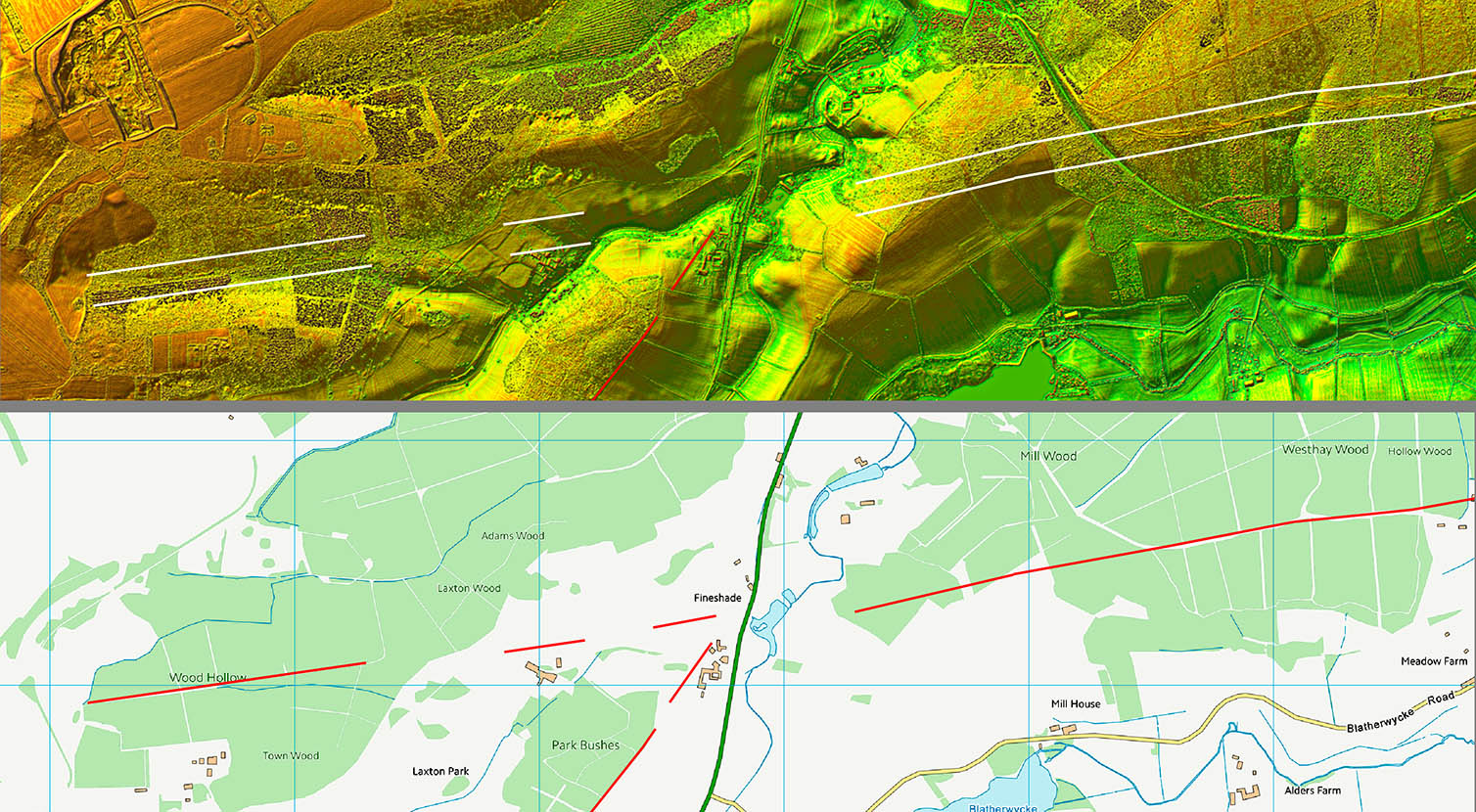 |
Lidar Image and Route Map 4 - Branch(?) Road towards Corby
I was unaware that Wayne Kirk had beaten me to spotting this road. Wayne also suggested the road continued northwards (i.e. a crossroads not a branch) to presumably Great Chesterton. As we are deep into Northamptonshire now I will leave that to him. |
Click for larger view |
 |
Lidar Image and Route Map 4 - Branch(?) Road towards Corby
Very obvious and clear Lidar evidence all the way to more ironstone workings. The assumption is that it continued on through Corby but little to see now with all the quarrying disturbance. |
Click for larger view |
 |