title

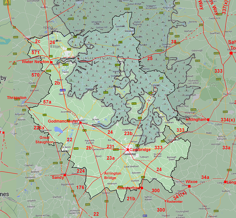
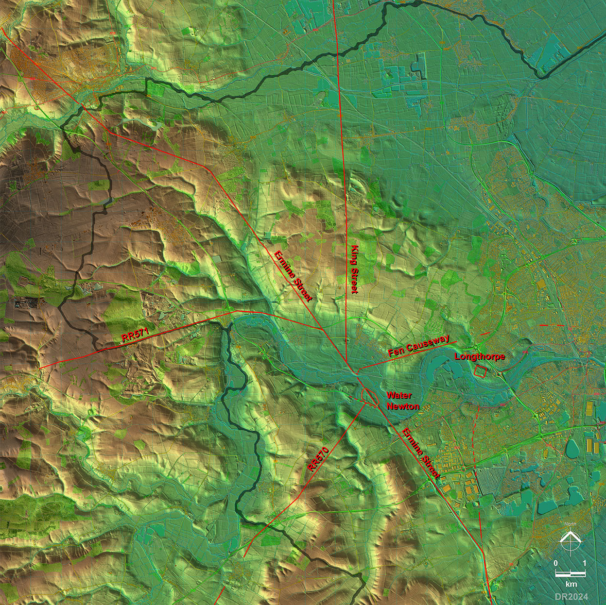
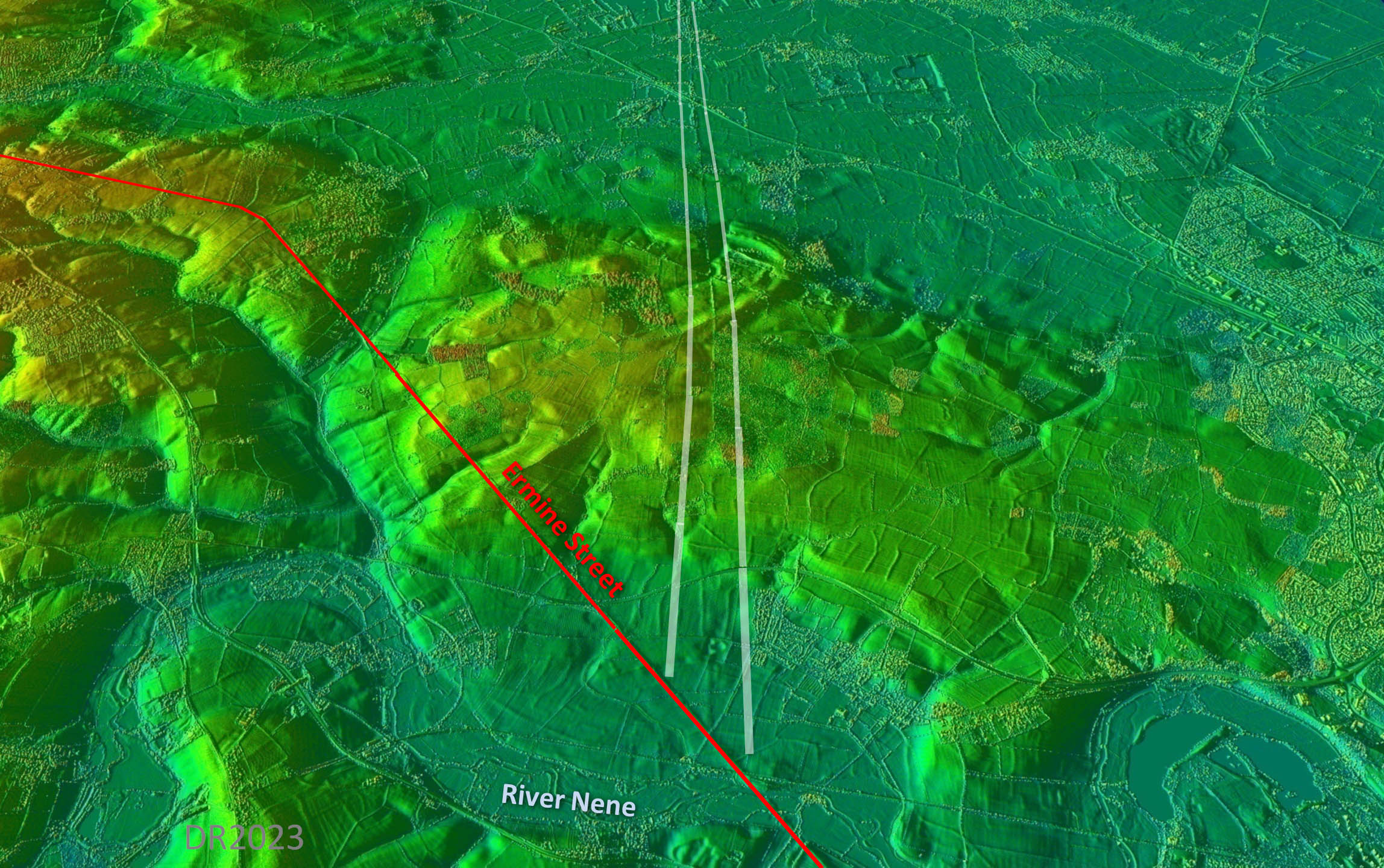
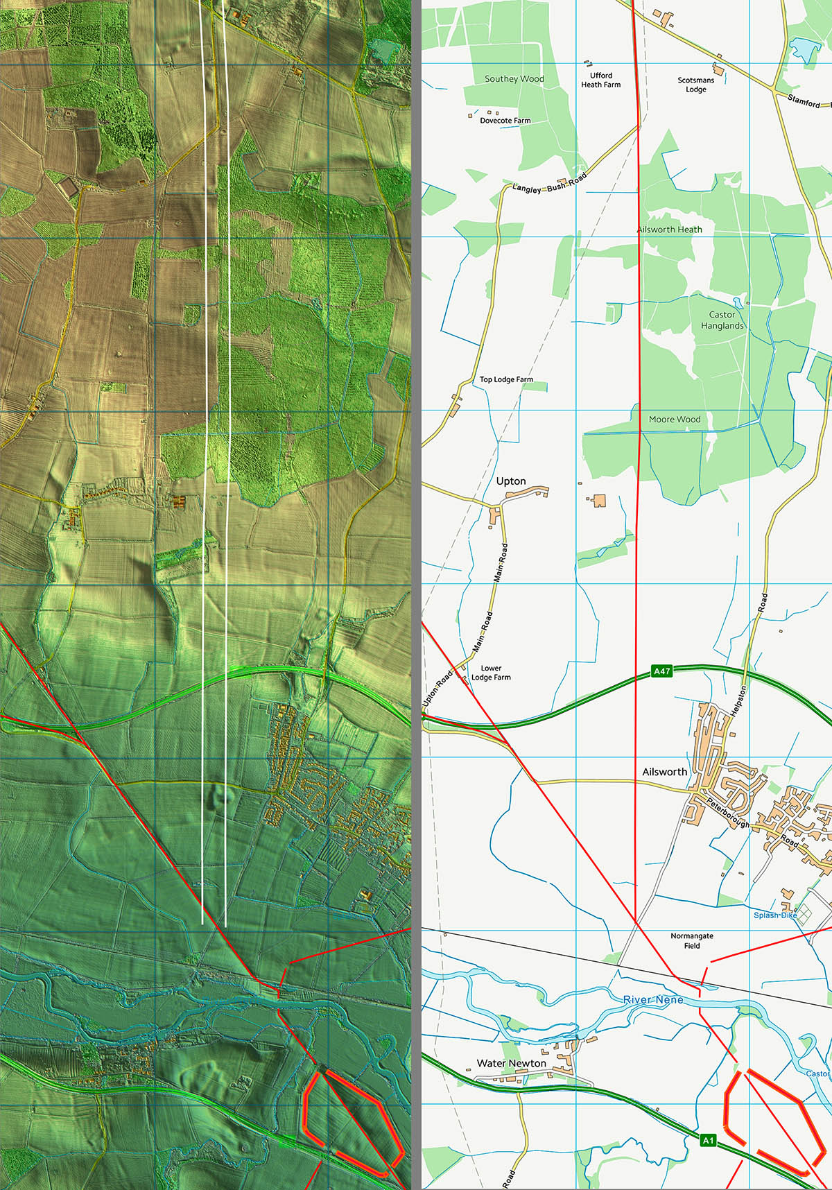
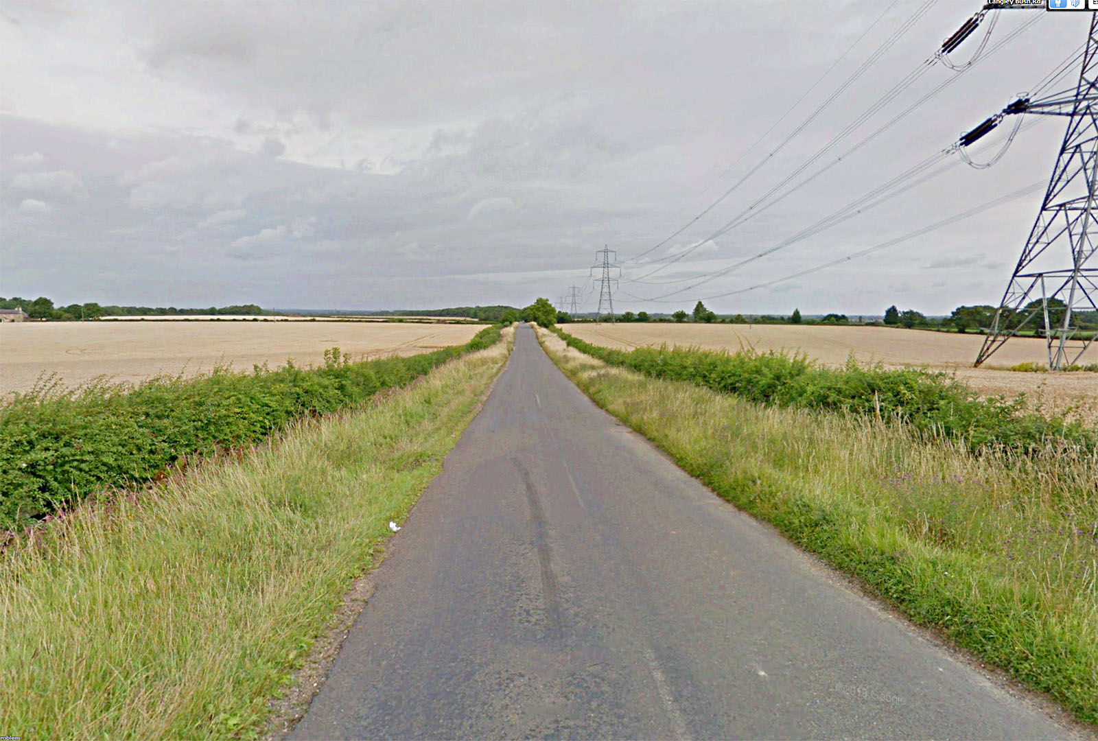
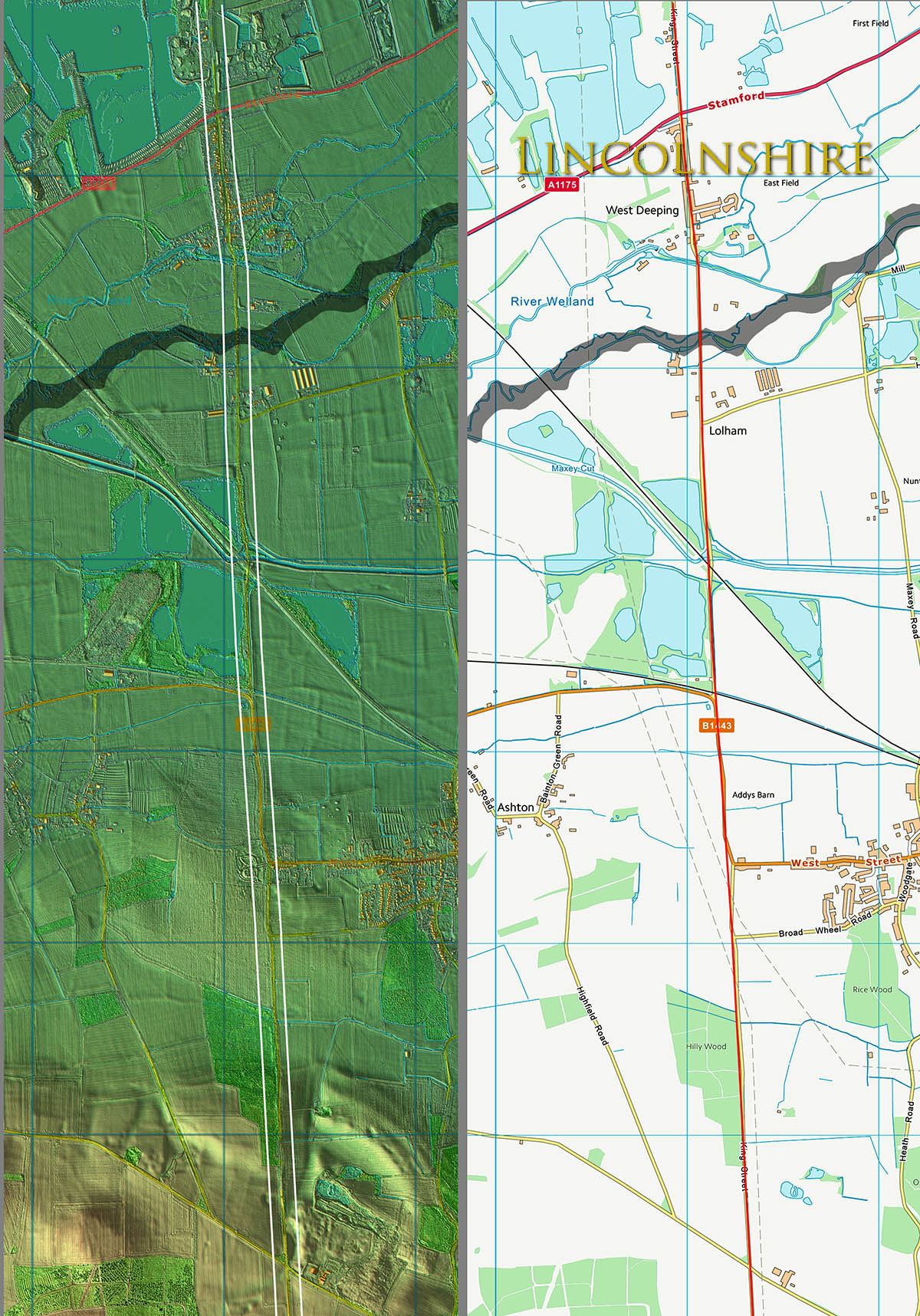
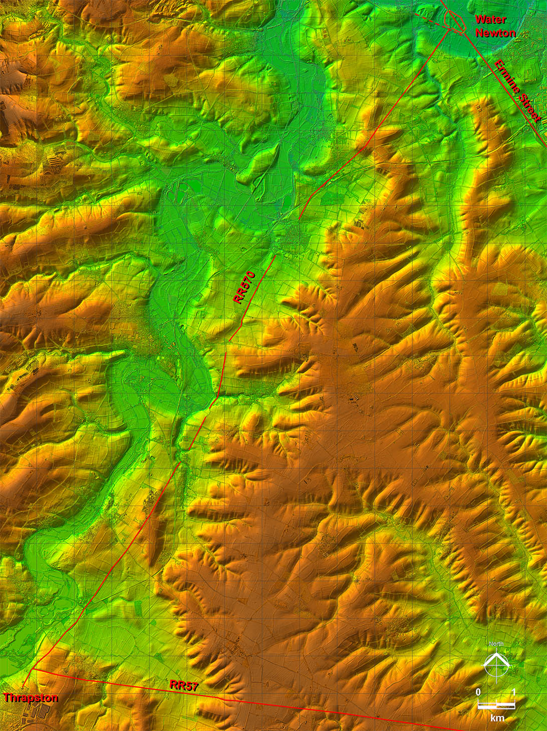
King Street Roman Road from Water Newton North

Margary Number: 26b

Distance: 7 miles (to County Boundary)

This branch off Ermine Street provided a slighly shorter route to Lincoln. However, it is across the edge of the Fens so perhaps was not as suitable in wet spells. The edge of the Fens though was probably such an important resource that it justified its own road. It was though inland of the Car Dyke, which probably provided some flood protection.


Historic Counties: Northamptonshire & Bedfordshire

Current Counties:Cambridgeshire & Bedfordshire

HER: Peterborough & Bedfordshire


location

mini map


Lidar Image - Roads around Water Newton including King Street

That River Nene (Roman) bridge acted as of focal point for several Roman roads including King Street. King Street in Cambridgeshire was generally around 10 metres AOD.

Click for larger view


water newton

Oblique 3D Lidar Image - Water Newton towards Lincolnshire

Obviously a later branch off Ermine Street and perhaps oddly for a Roman road heads straight into the Fens and low ground. It does represent a slighly shorter route to Lincoln though.

Click for larger view
3D lidar

Lidar Image and Route Map 1

Once across the River Nene bridge then this road could branch off Ermine Street and head almost due north.

Click for larger view
map1

Langdyke Bush

From Langdyke Bush northwards moderm roads now overly the Roman line all the way to the county boundary. Here the modern road is narrow compared to the width of the (Roman) agger over the ditches. Lang (long) Dyke was very much an appropriate name.

Click for larger view
langdyke bush

Lidar Image and Route Map 2

The straight alignment continues into Lincolnshire and we leave the road heading towards Bourne and ultimately Lincoln.

Click for larger view
map2

Back to Cambridgeshire homepage

Last update: Jan 2024

© David Ratledge