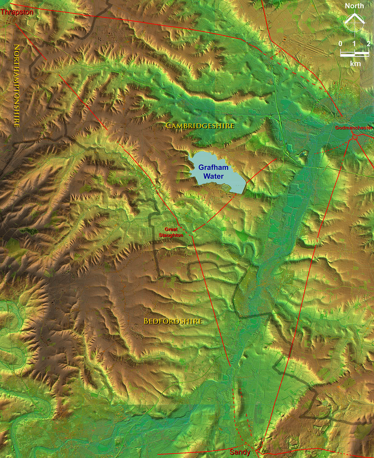
This road starts in Bedfordshire and ends in Northamptonshire but half of its length is in Cambridgeshire.
I was looking for RR173d proposed by the Viatores but found nothing convincing. However I did spot this road all the way from Sandy to Thrapston.
There appears to have been a possible settlement at Staughton at approximately the half-way point. This was confirmed in September 2024 when Historic England published geophys revealing a small "town" - see below..
Video Flyover available - see at the bottom of this page
Lidar Image - Route from Sandy to Thrapston via Cambridgeshire
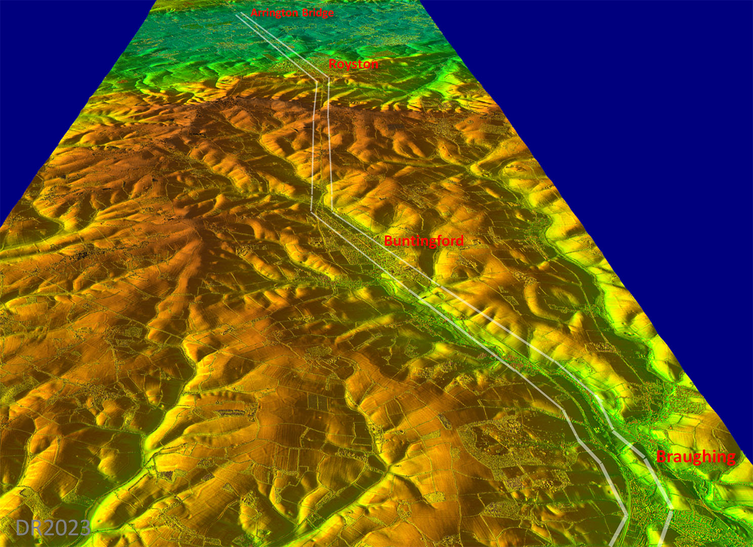
Not exactly direct but does make sensible use of high ground.
Click for larger view
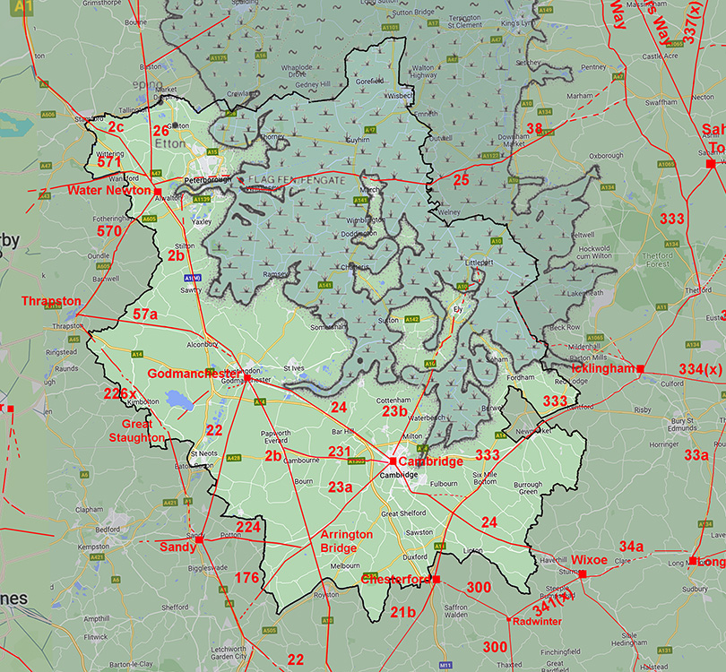
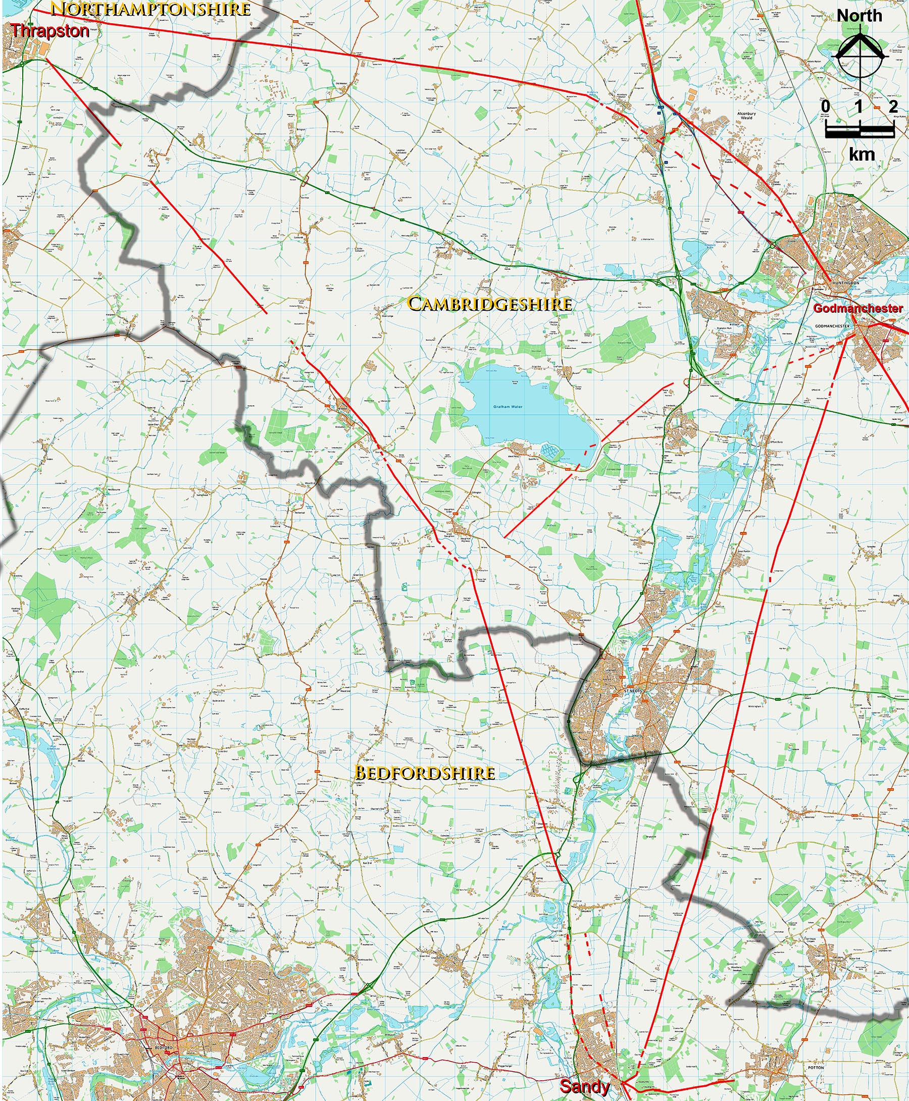
Route Map - Sandy to Thrapston
OS Opendata map equivalent to the above plus county boundaries.
Click for larger view
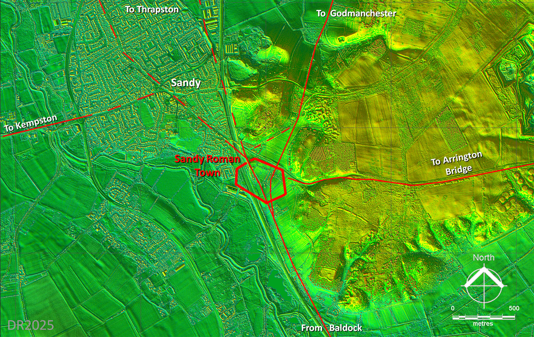
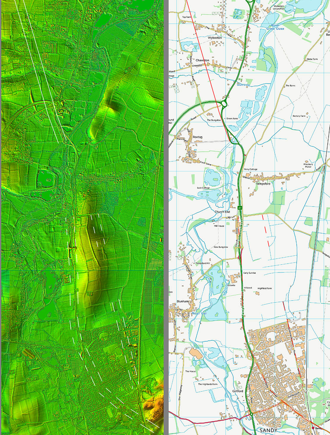
Lidar Image - Roman Roads around Sandy
We now know Sandy (Bedfordshire) was an important Roman road junction with at least 5 roads meeting there. I didn't trace the one heading west any further as the evidence seemed to disappear after 5km.
Click for larger view
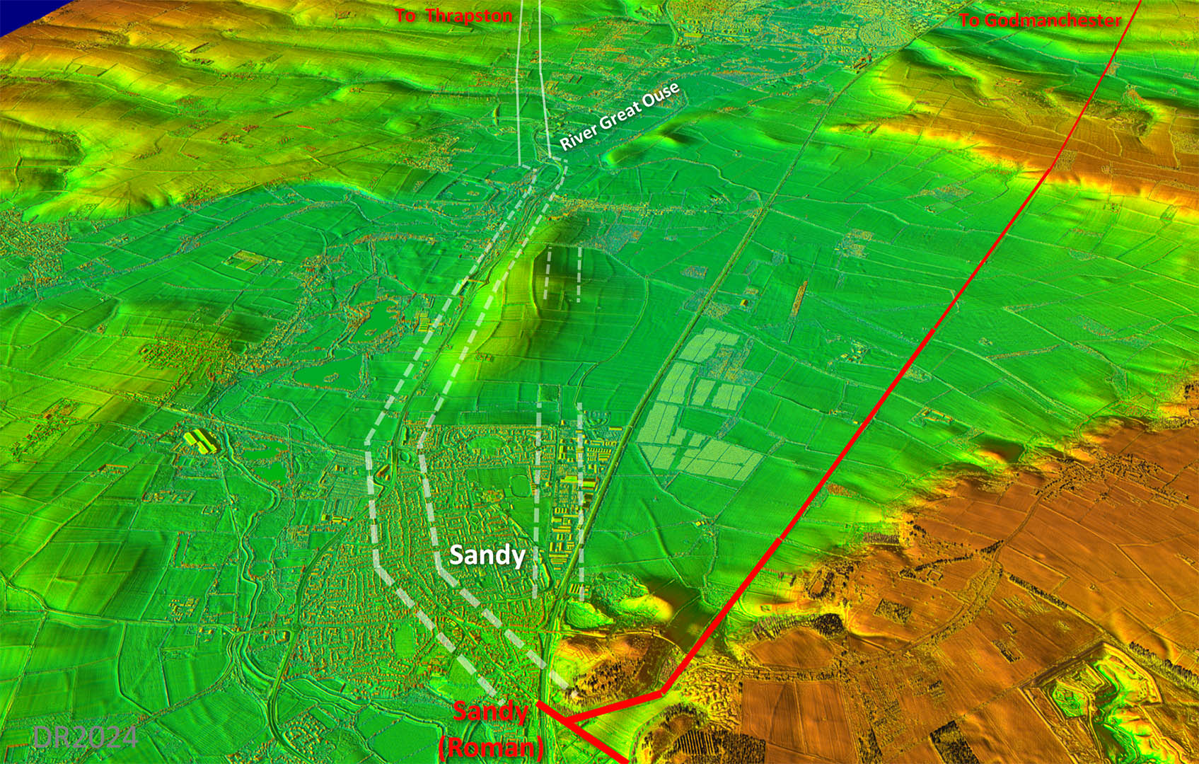
Oblique 3D Lidar Image - Sandy to the Great Ouse
Two options as far as the River Great Ouse. Most likely is the route following the current road. The Ordnance Survey First Edition mapping shows this as a series of straight alignments. The alternative is a direct route to the right (east) of the small hillock. Some evidence for this but is it enough?
Click for larger view
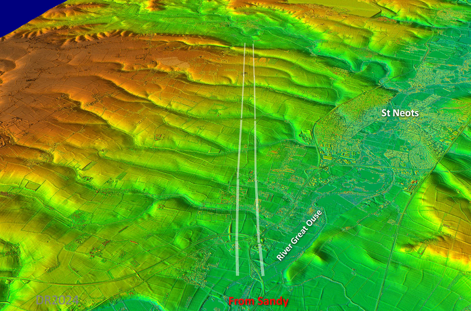
Oblique 3D Lidar Image - Great Ouse onward
Evidence is definite in the Lidar imagery.
Click for larger view
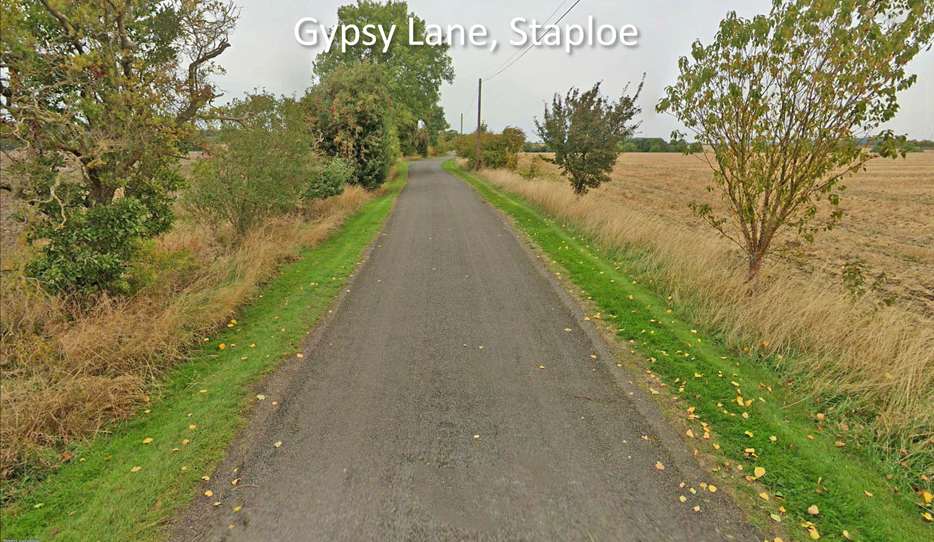
Gypsy Lane
Modern road sits on a built-up agger with side ditches.
Click for larger view
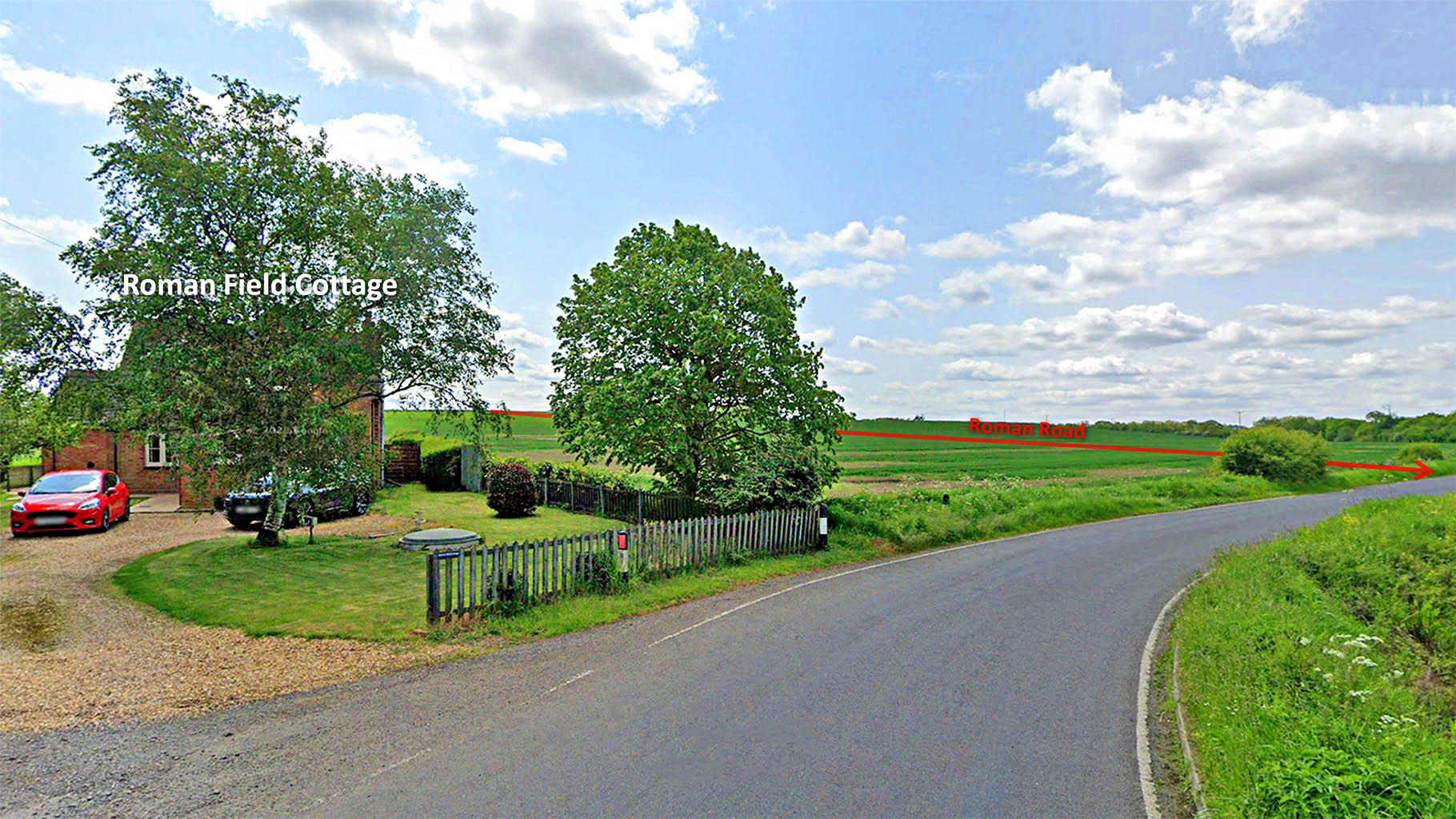
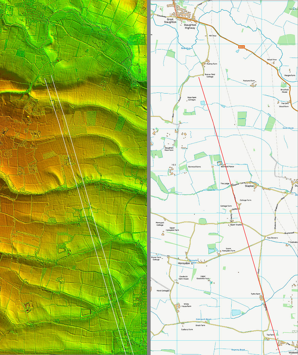
Roman Field Cottage
The field contains Roman buildings taken to be a villa, marked as Roman Buildings on the map below. The Roman road was unknown so the name must only refer to the villa. Nevertheless the Roman road ran through the field.
Click for larger view
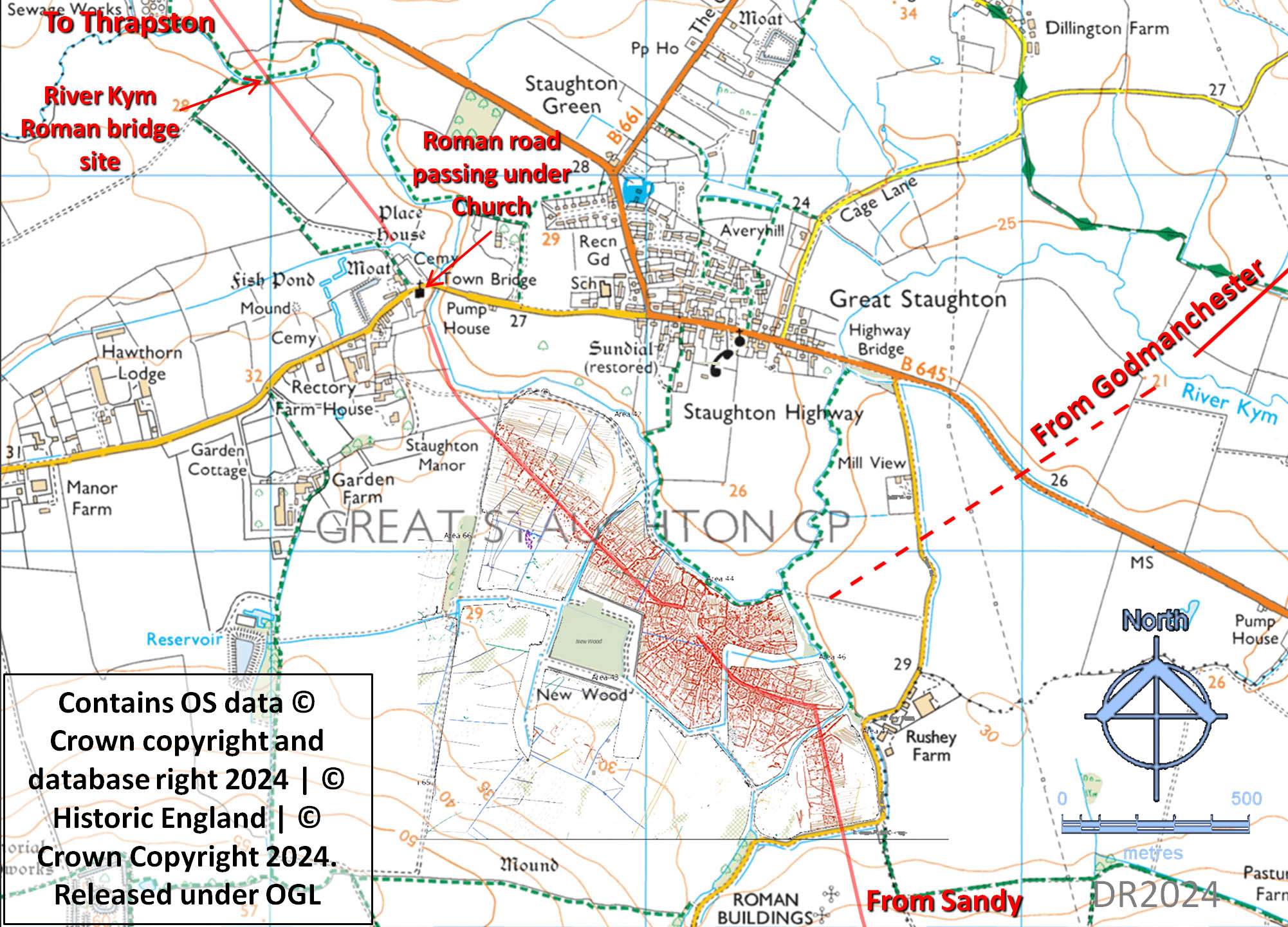
Great Staughton - Historic England Geophys on Bing MappingUpdated September 2024
This is what I wrote last year (and published): "Something odd happened at Staughton. It would appear there was most likely a small settlement there and the road had to pick its way through it. Hence no straight alignments.." How right that turned out to be when Historic England published in September 2024 their extensive geophys results for Great Staughton. This confirmed a Roman settlement, which they described as a "town".
So yes a very odd route but totally explained by the road adapting to the settlement. The road clearly must have passed under the church and the its crossing of the River Kym coincides with a modern footbridge - see below. The route of the road in from Godmanchester is somewhat uncertain but what is shown is probably close to reality.
Click for larger view
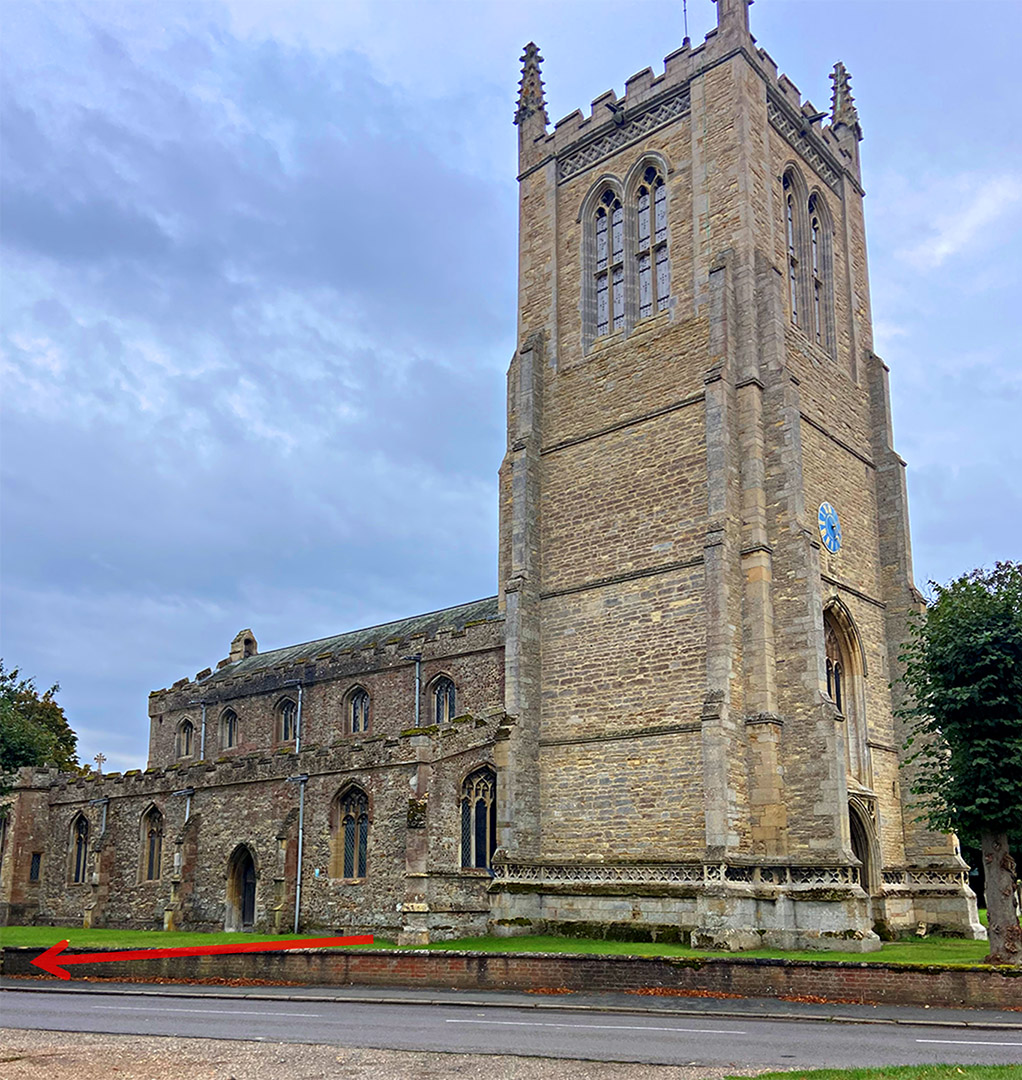
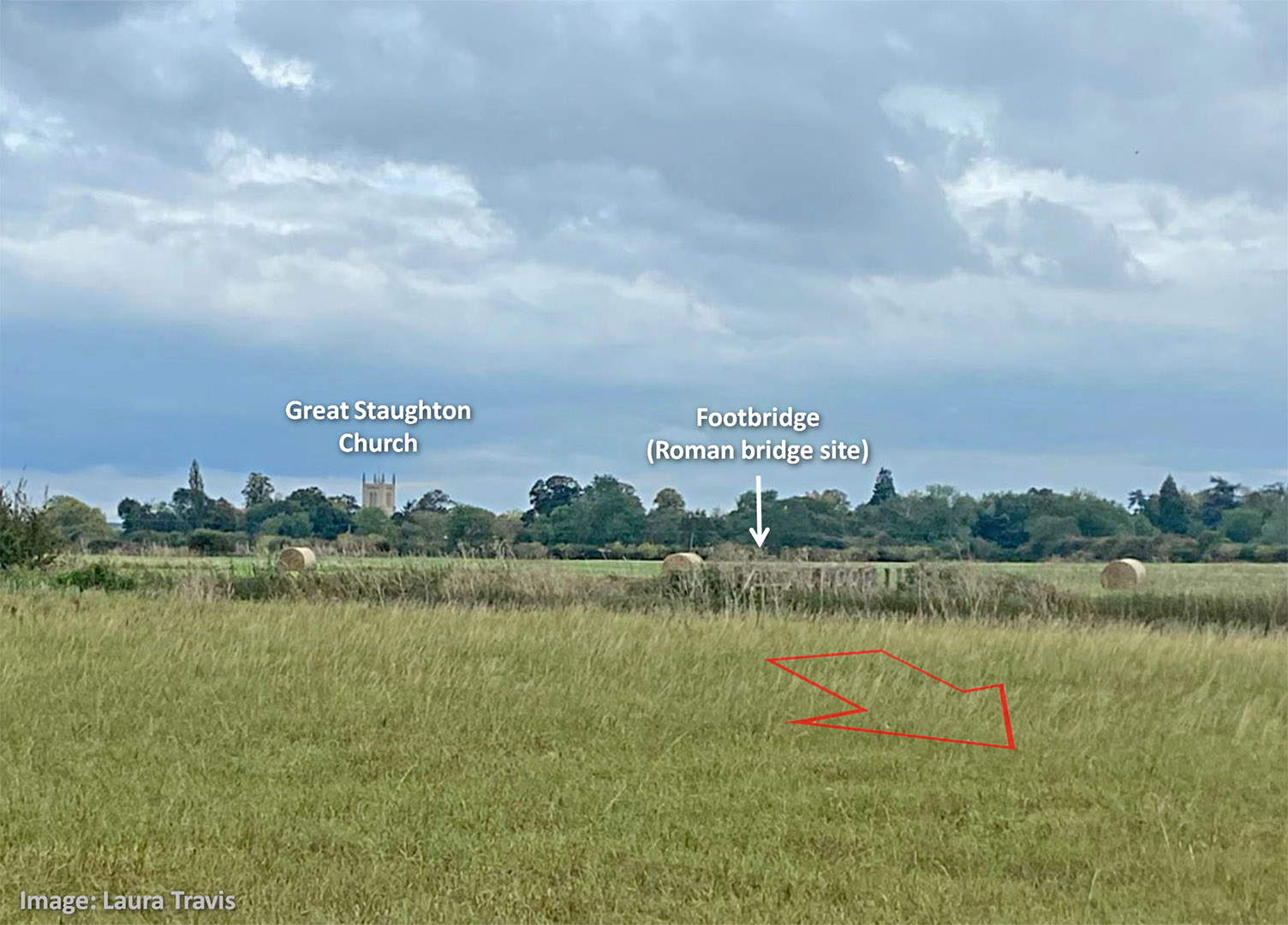
Great Staughton Church - Approximate Course of the Road
The road clearly passed under Great Staughton Church - projecting the lines either side makes this certain. Exactly where then it is harder to be sure but the red arrow indicates the likely spot.
It is not unusual for churches to be built on Roman roads - I have come across at least 3 others. Plenty of good foundation stones available.
Image: Laura Travis
Click for larger view
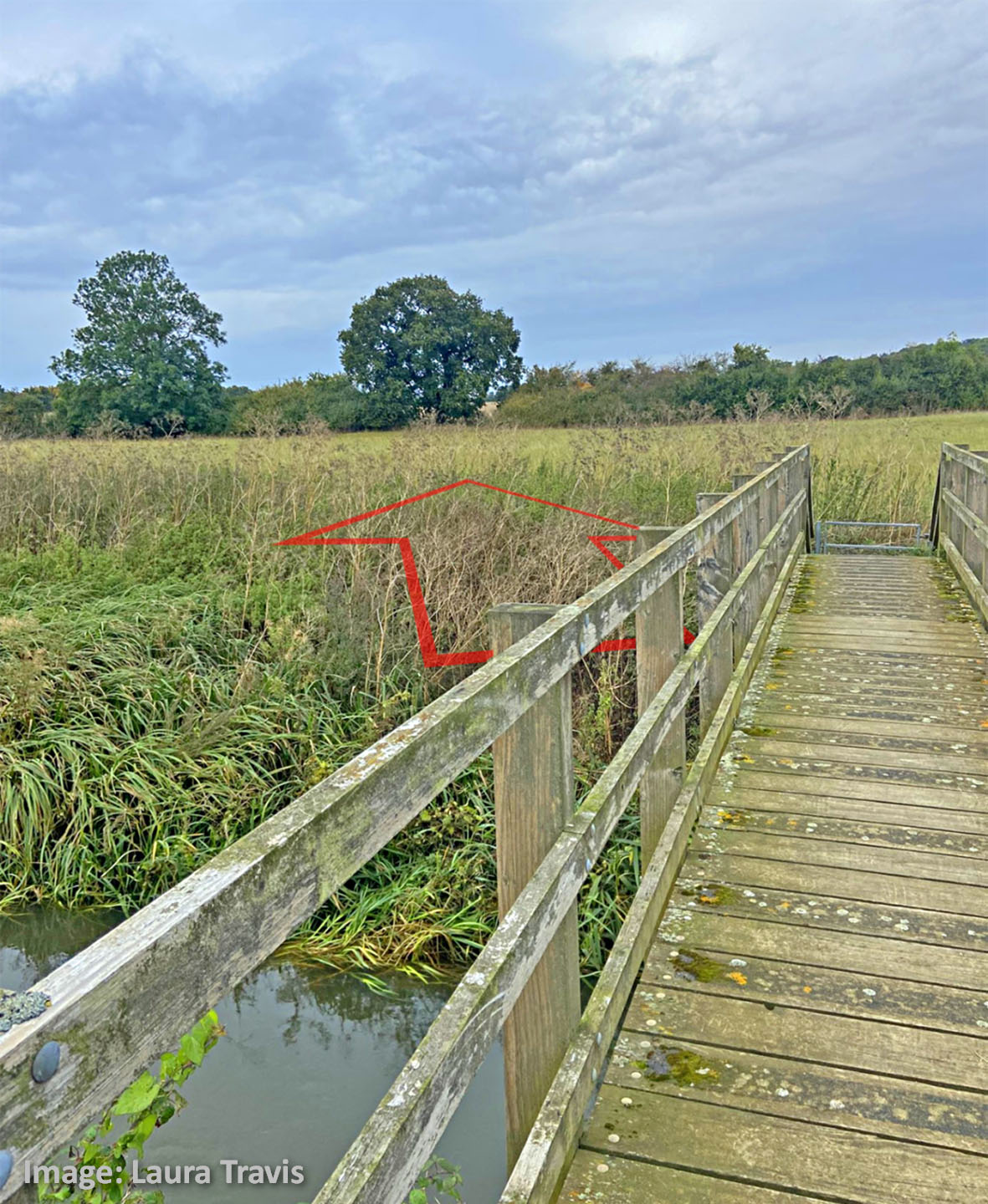
Great Staughton - Roman Bridge Site-1
The road had to cross the River Kym but this was north-west of the modern village and today coincides with a modern footbridge. This cannot be a coincidence with the modern bridge obviously making use of the old Roman crossing point. Undoubtedly this would have been a bridge - the Romans had the technology. My guess would be the footbridge sits on top of the remnants of the Roman abutments. Thanks are due to local resident Laura Travis for bringing the footbridge to my attention.
In this view we are looking back towards the village with the Roman road coming from the church and crossing the river where the footbridge now is. There is a public footpath over the footbridge.
Image: Laura Travis
Click for larger view
Great Staughton - Roman Bridge Site-2
We are stood on the footbridge looking ahead to Kimbolton and eventually Thrapston. The arrow indicates the approximate direction of the road.
Image: Laura Travis
Click for larger view
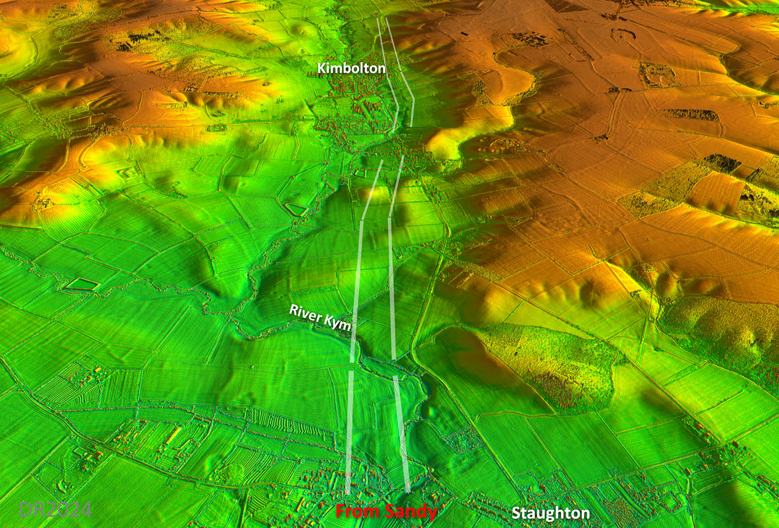
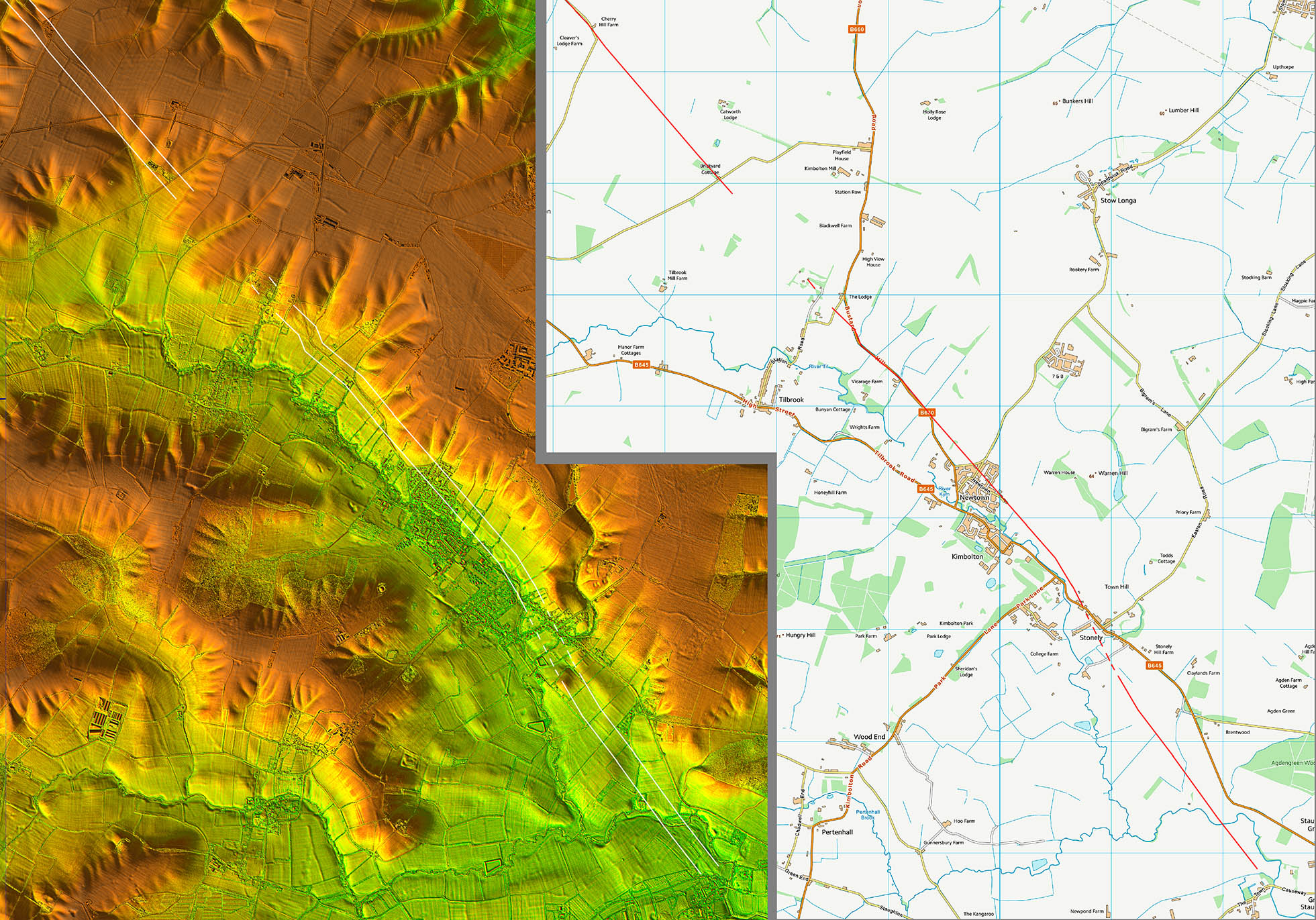
Oblique 3D Lidar Image - Kimbolton
Normality returns and another clear section running towards and passing through Kimbolton
Click for larger view
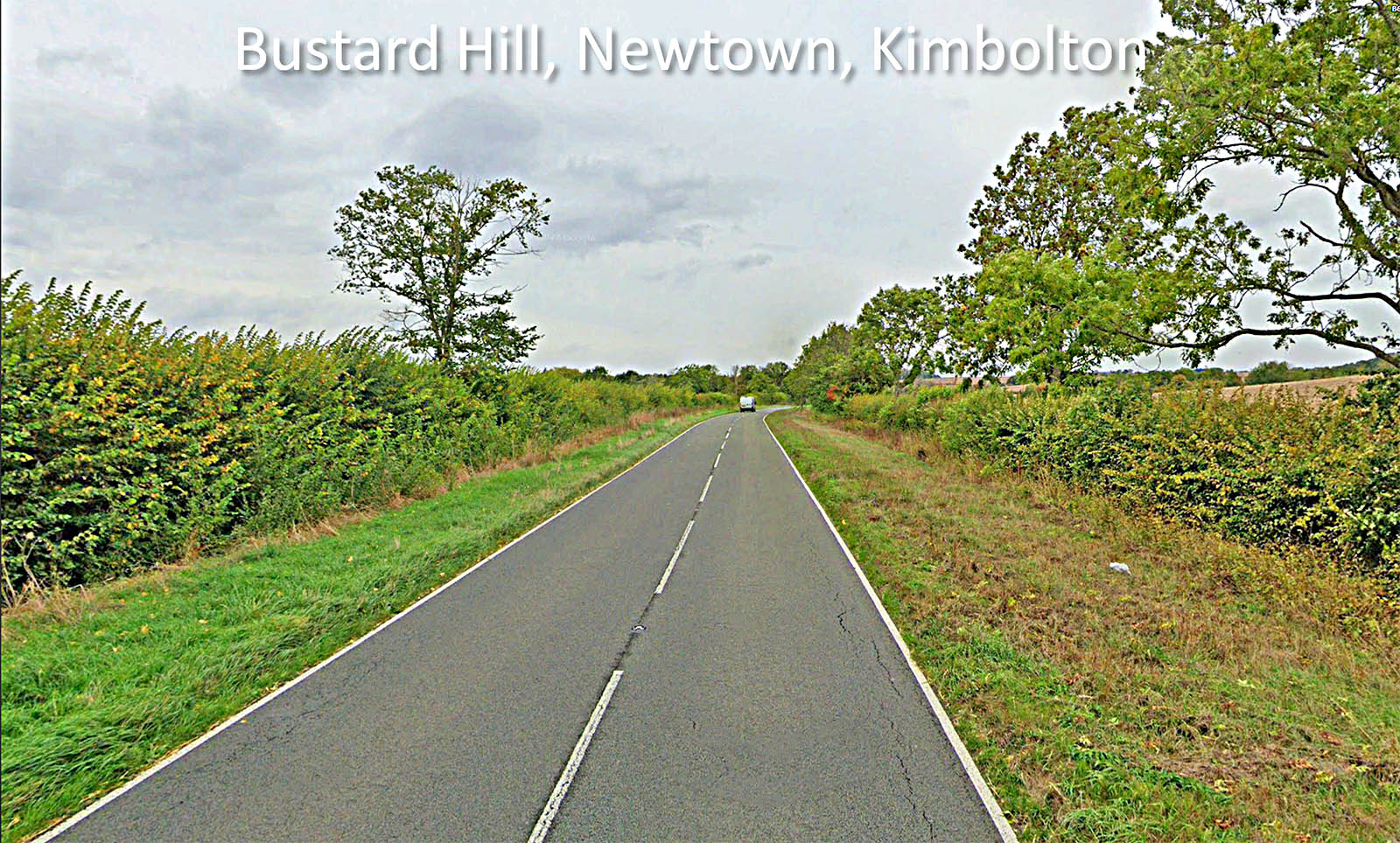
Bustard Hill, Newtown, Kimbolton
This section of the road up Bustard Hall coincides with the Roman line. It has a huge width between the hedges so I guess it became a drove road?
Click for larger view
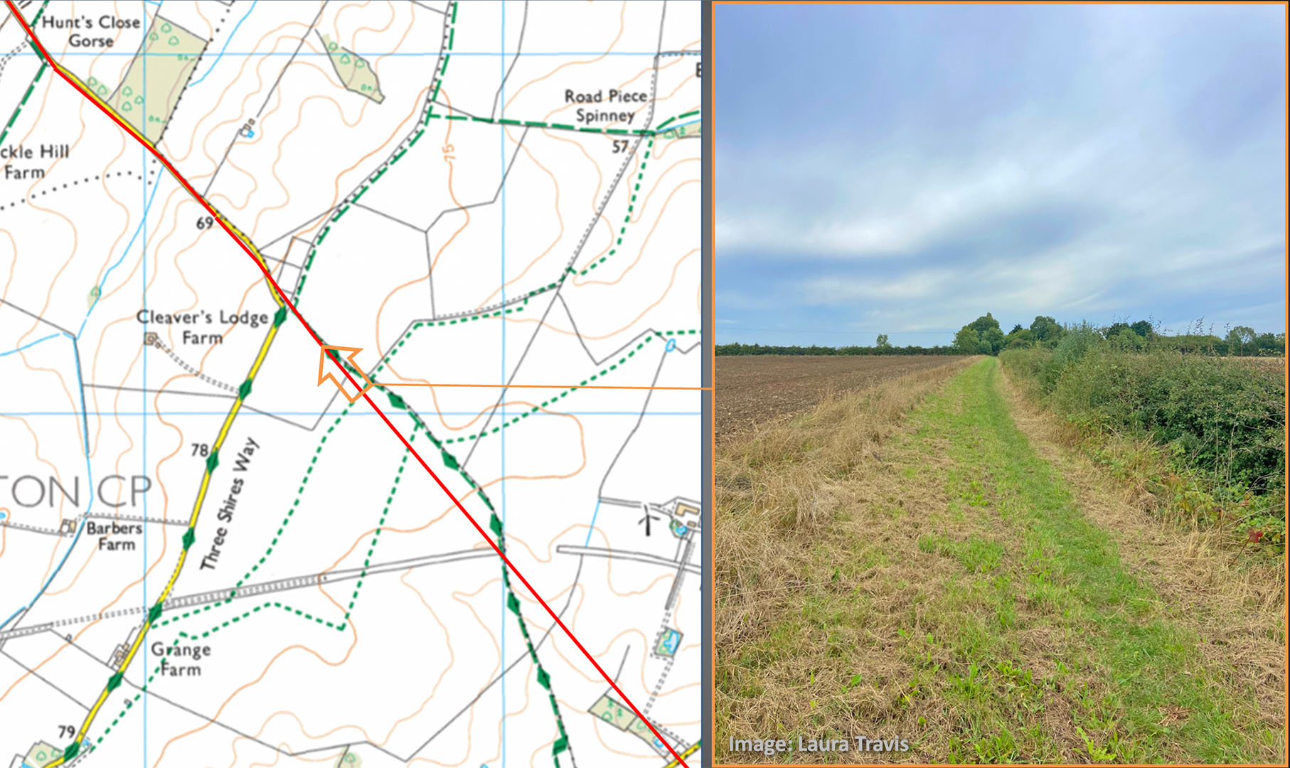
Roman Road at Covington - Map and Image
We are looking towards Cleaver's Lodge Farm along the line of the road now a public footpath. This is where behind us the modern footpath swings off line. This spot is visible in the 3D lidar view below.
Image: Laura Travis
Click for larger view
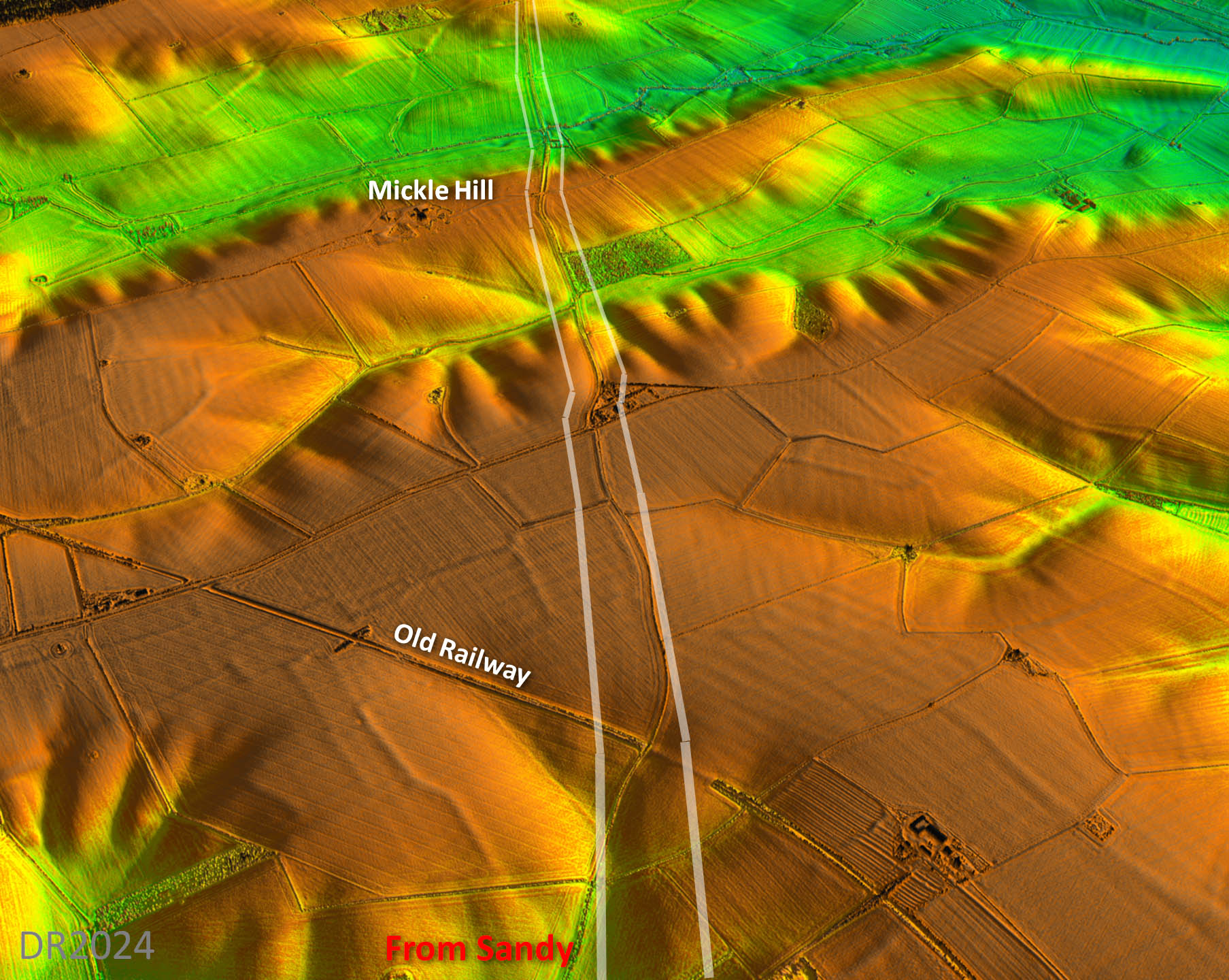
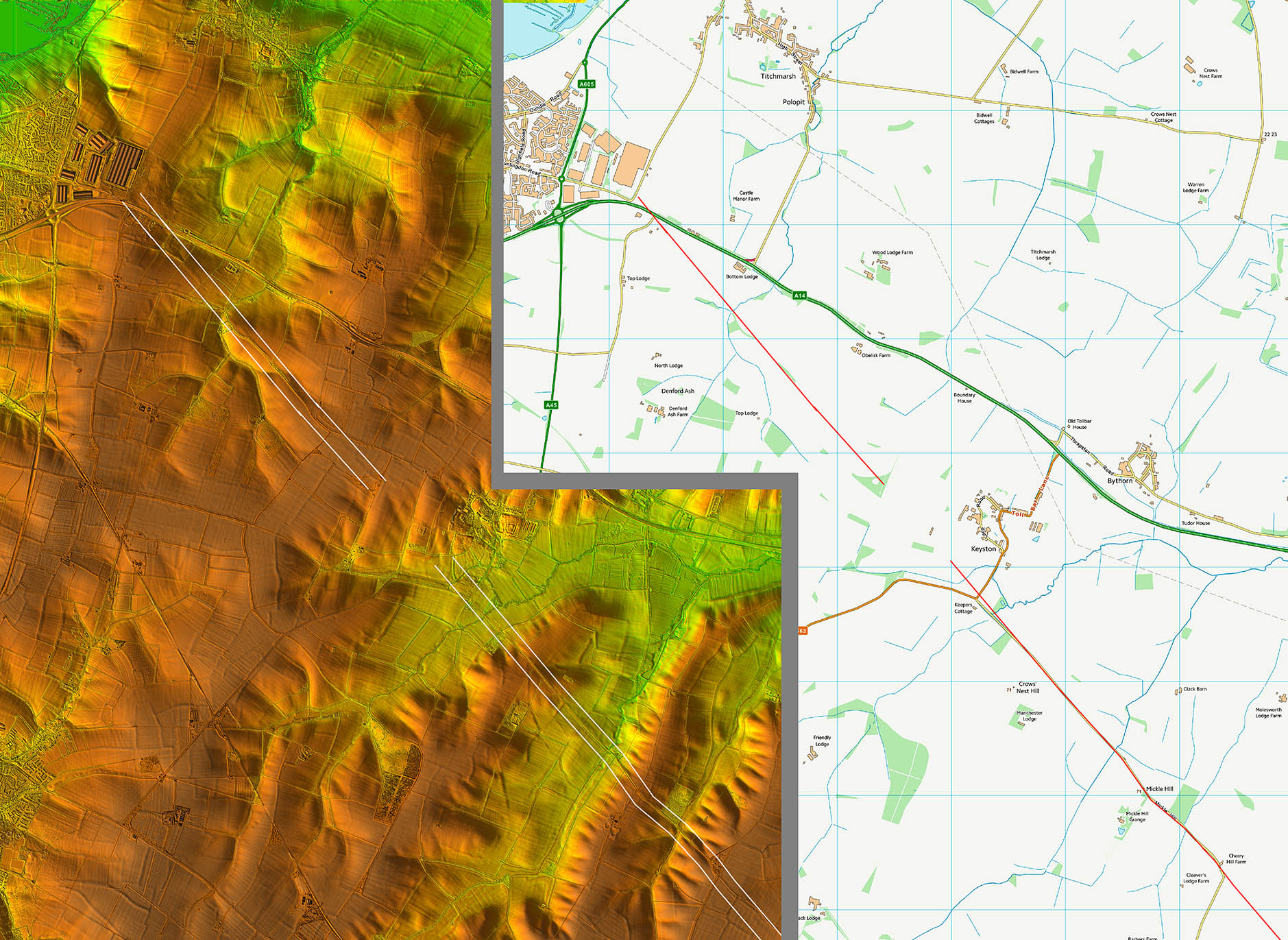
Oblique 3D Lidar Image - Mickle Hill
Faint but not in doubt. A few anglings to manage the slopes but that is normal - overall it is straight.
Click for larger view
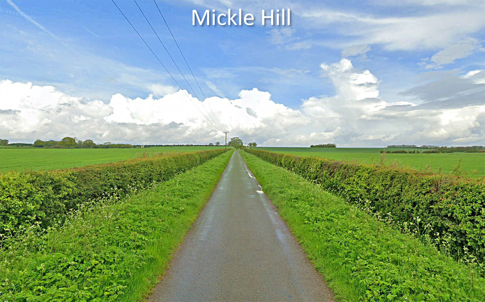
Mickle Hill
Tiny modern road sat on top of a wide Roman agger just beyond Mickle Hill. Cannot understand why no one before didn't think this must be Roman. Still in Cambridgeshire here - but not for long.
Image: Google
Click for larger view
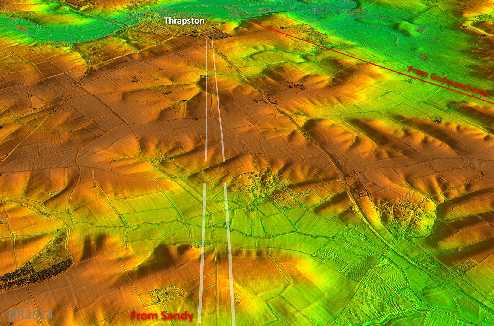
Oblique 3D Lidar Image - approaching Thrapston
Final alignment into Thrapston where modern developments mask the final section.
Click for larger view
Lidar Image and Route Map 1
Click for larger view
Lidar Image and Route Map 2
Click for larger view
Lidar Image and Route Map 3
Click for larger view
Lidar Image and Route Map 4
Click for larger view
NEW 3D Lidar video from Sandy to Thrapston via Great Staughton