title

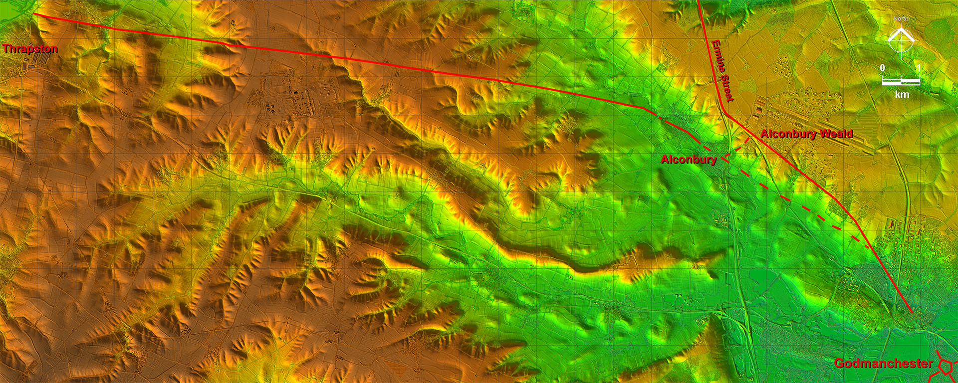
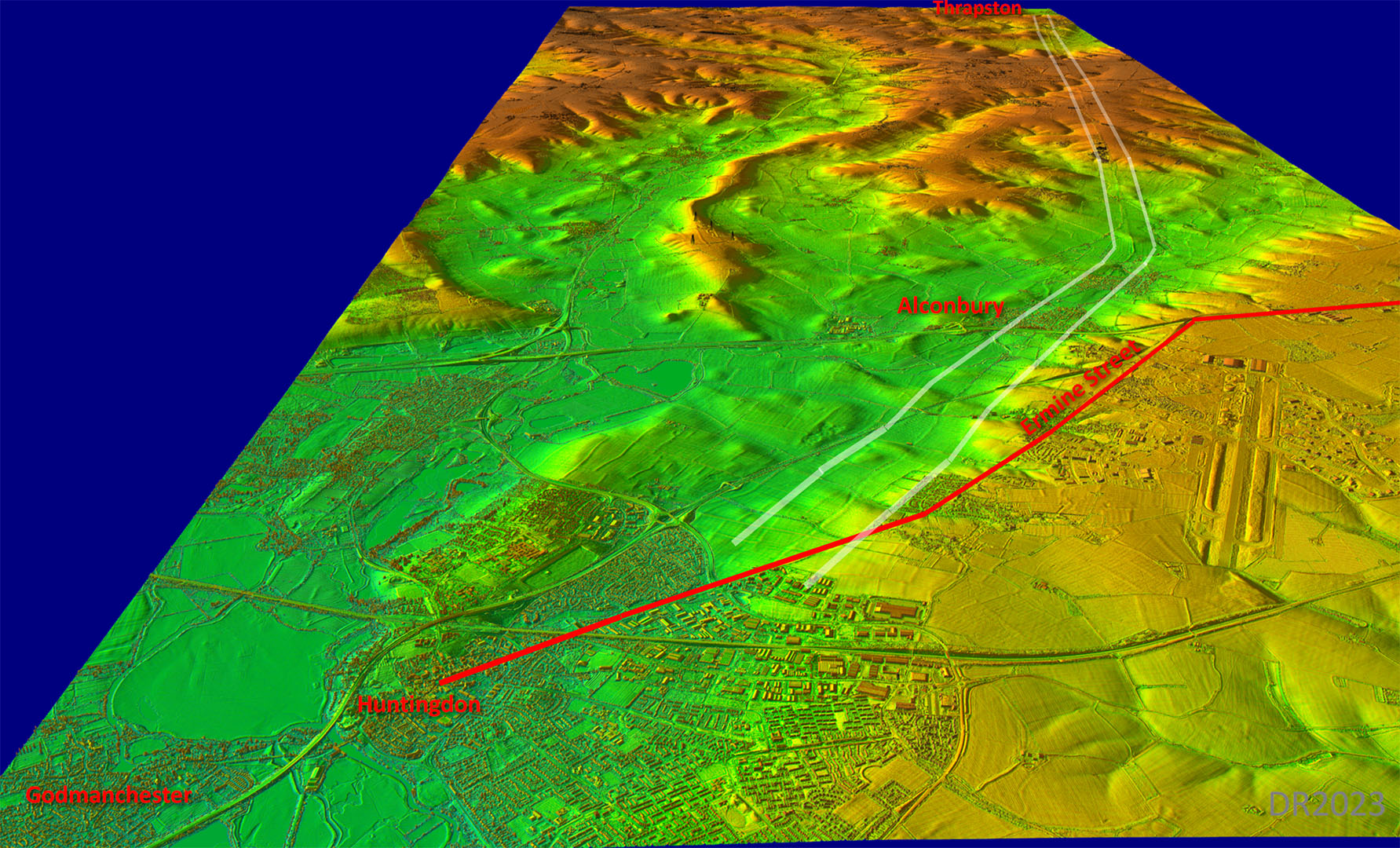
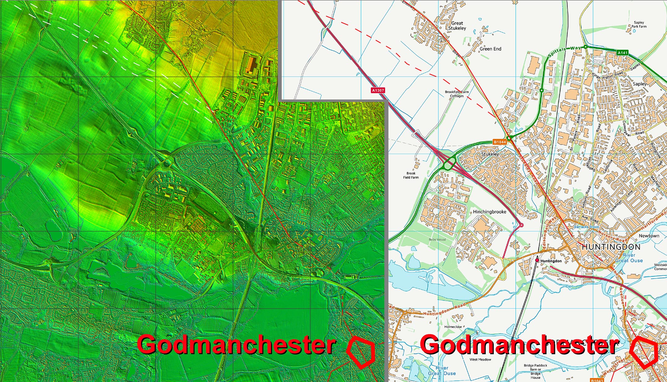
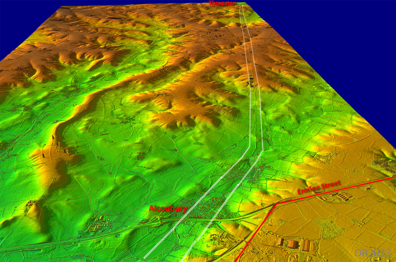
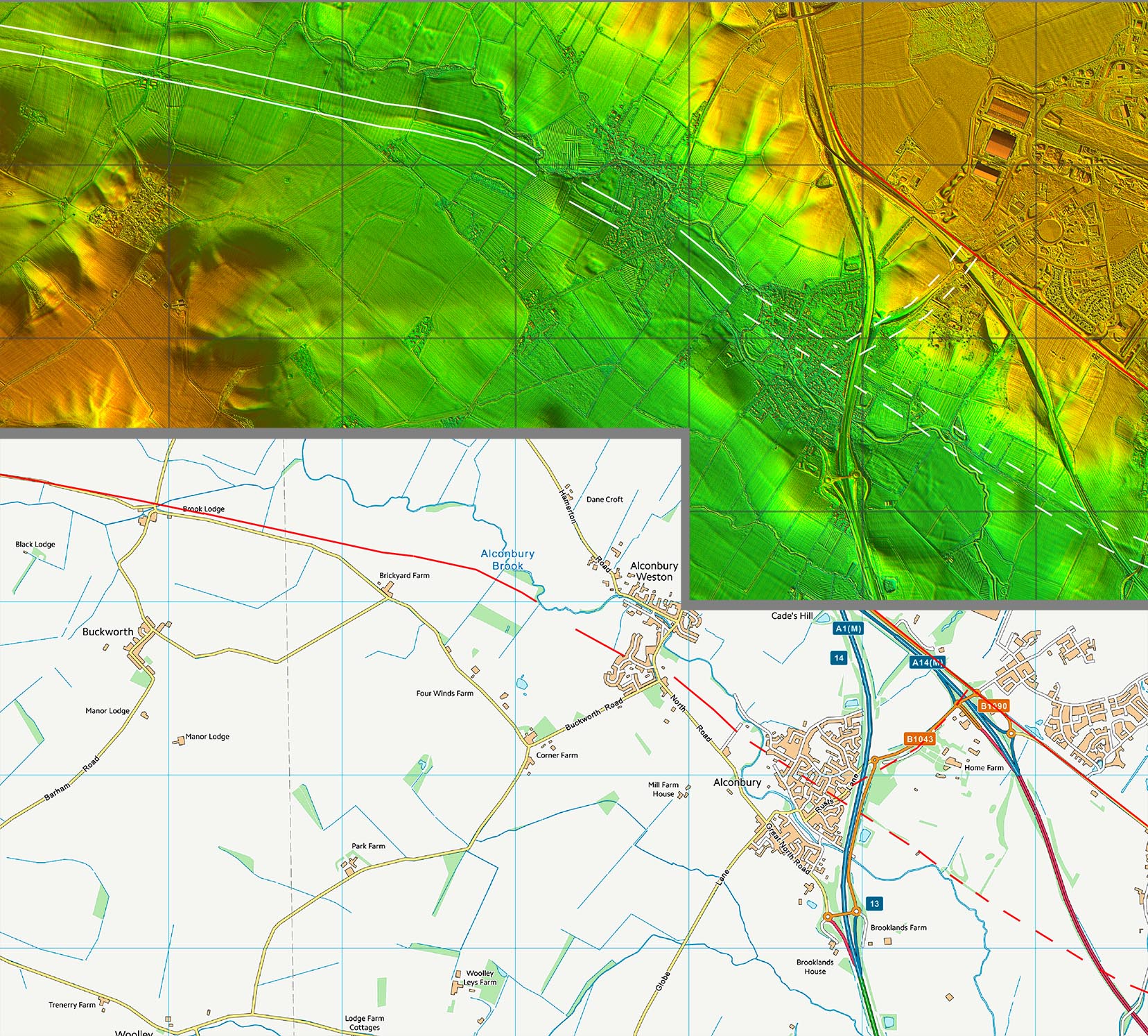
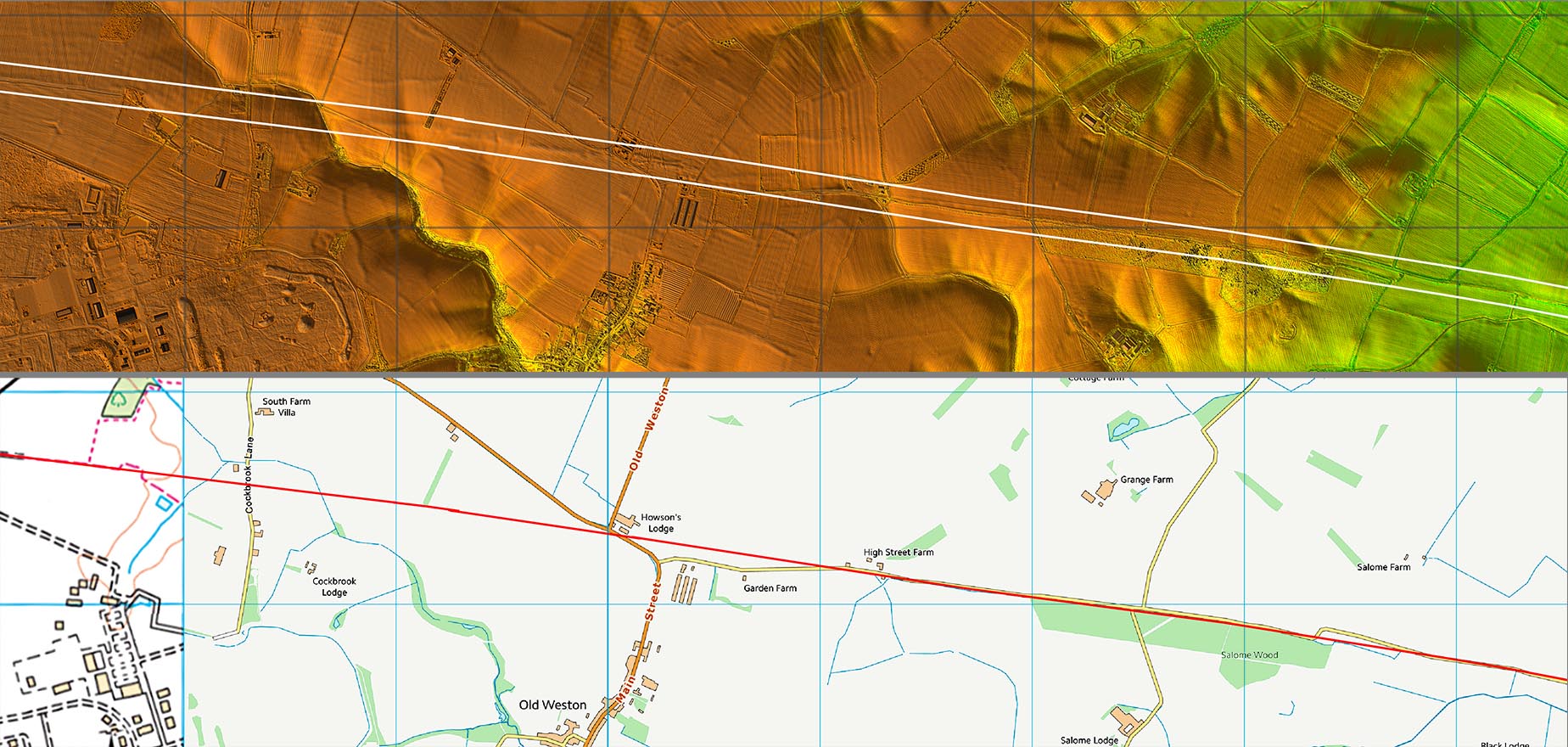
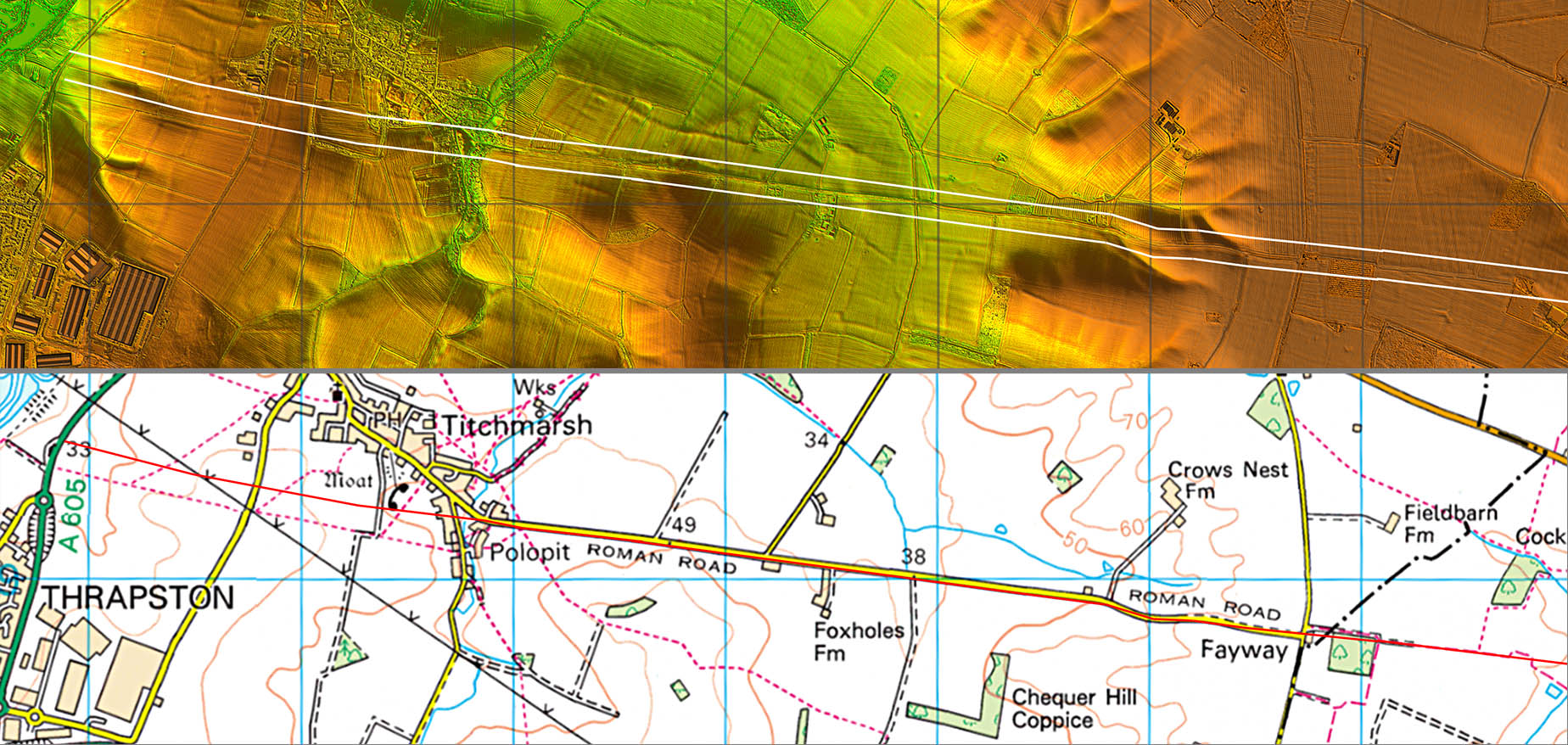
The Roman Road from Godmanchester to Thrapston

Margary Number: 57a

Distance: 17 miles

One of the most puzzling of Roman roads in Cambridge - well at least at its beginning. Ermine Street was clearly the earlier road with this road branching off it at the northern edge of Huntingdon. RR 57a then follows an almost parallel course to Alconbury. This is a lower course so was perhaps to avoid climbing up to the higher ground of Alconbury Weald.but it still seems unnecessary and very strange.

Beyond Alconbury normality returns and we begin a very long typically straight alignment to Ticthmarsh, near Thrapston.


Historic Counties: Huntingdonshire & Northamptonshire

Current Counties:Cambridgeshire & Northamptonshire

HER: Cambridgeshire & Northamptonshire


location

mini map


Lidar Image - Full Route

A have shown the route to Alconbury dashed. There is certainly an old road there but perhaps it is a bit more wobbly than a typically straight Roman road. There was probably a link up to Alconbury Weald and the Roman industrial area there


Click for larger view

fullroute

Oblique 3D Lidar Image

The low level route to Alconbury is clear but as I said perhaps a bit less straight than is normal.

After the turn beyond Alconbury typical long straight alignments return.

Click for larger view
3D route

Lidar Image and Route Map 1

The branch off Ermine Street is very prominent as is the agger continuing on. Just that worry about it not consisting of straight alignments.

Click for larger view
routemap1

Oblique 3D Lidar Image

The main turn is clear and the road did not connect to Ermine Street until the probable link at Alconbury.

Click for larger view
3D alconbury

Lidar Image and Route Map 2

A link to Alconbury Weald is logical but evidence is a bit limited with the modern road probably derived from a Roman predecessor.

Click for larger view
routemap2

Lidar Image and Route Map 3

Normal service has resumed with typically long straight alignments

Click for larger view
routemap3

Approaching Titchmarsh

Typical Roman alignment and the ditch is clear on the left (south) side.

Click for larger view
titchmarsh

Lidar Image and Route Map 4

At Thrapston Roman road 570 from Water Newton met this road and there was a small settlement.

The evidence for RR57a continuing further west towards Leicester is somewhat sketchy and needs more work.

Click for larger view
routemap4

Back to Cambridgeshire homepage

Last update: Jan 2024

© David Ratledge