|
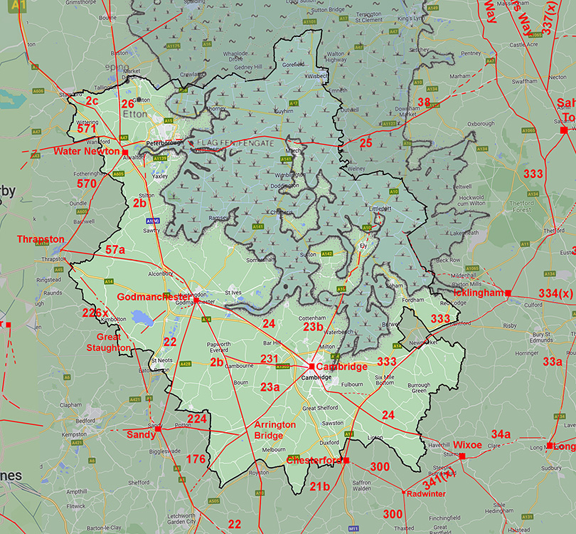
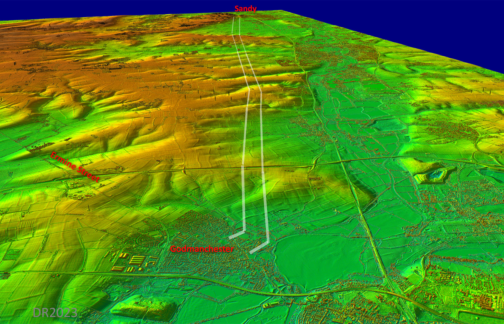
The Roman Road from Godmanchester to SandyMargary Number:22Distance: 15 miles Sandy we now know was a walled Roman town and a connection down the Ouse valley was an easy connection to make. The route was generally well attested but at Offord the route shown on modern mapping would appear to be off the real line. Lidar shows it clearly on a slightly different but more direct course. The approach into Sandy made use of a natural valley around a hillfort, known as Caesar's Camp.
|
Historic Counties: Huntingdonshire & Bedfordshire Current Counties:Cambridgeshire & Befordshire HER: Cambridgeshire & Bedfordhsire
|
|
|
|
|
|
Lidar Image - Full Route Very direct route keeping to the east side of the Ouse Valley. |
Click for larger view |
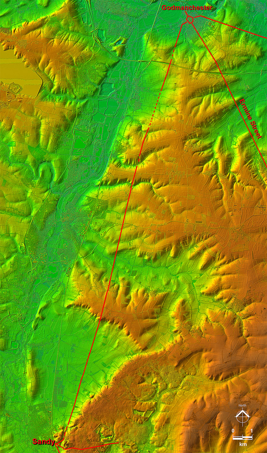 |
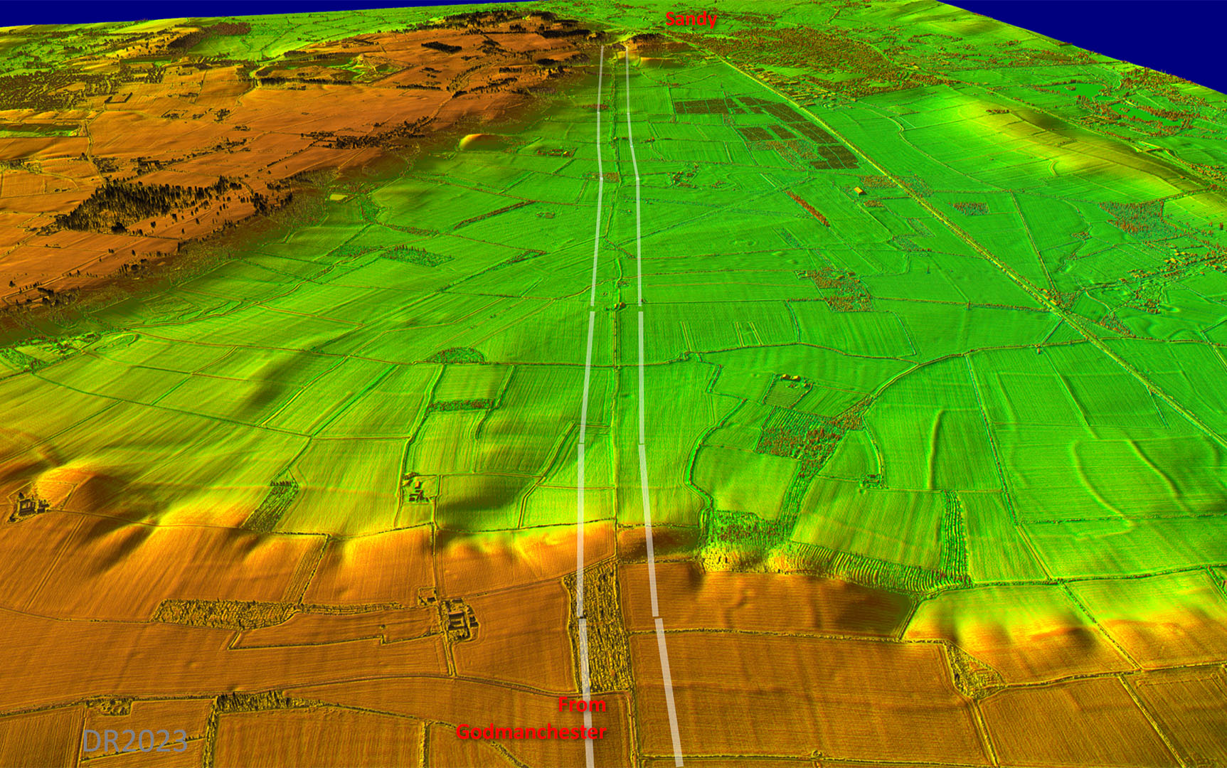
Oblique 3D Lidar Image The road was not aligned on the Godmanchester settlement and aimed somewhat to its west. Perhaps this was directed at the original river crossing point? |
Click for larger view |
 |
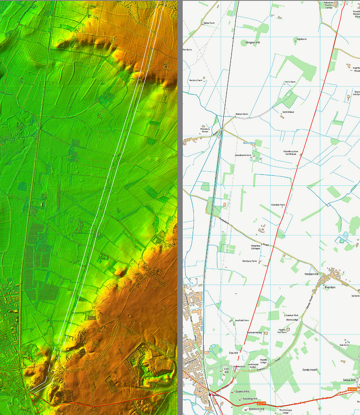
Lidar Image and Route Map 1 Passing Offord then the OS appears incorrect - see below for more detail and the Lidar evidence. |
Click for larger view |
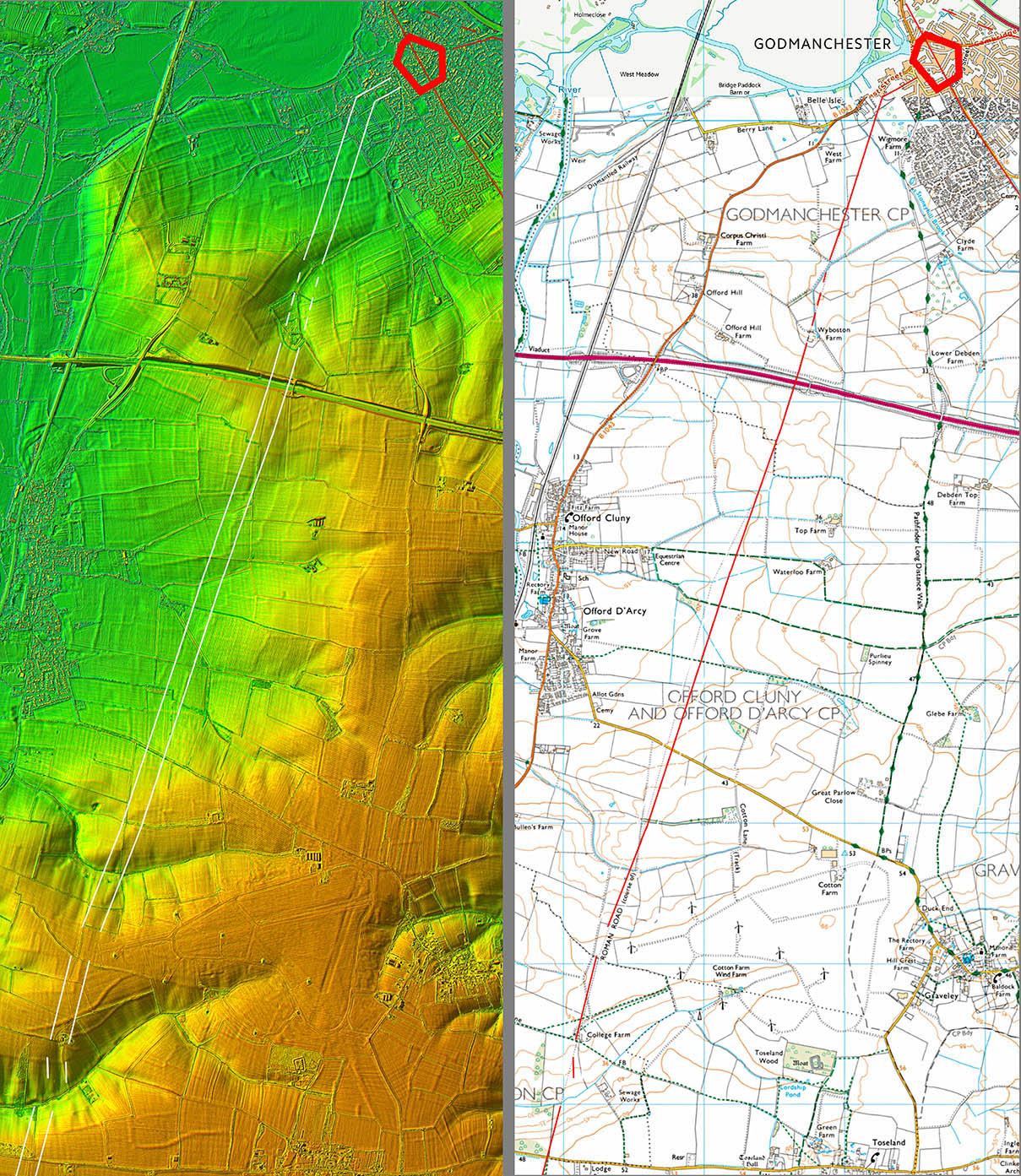 |
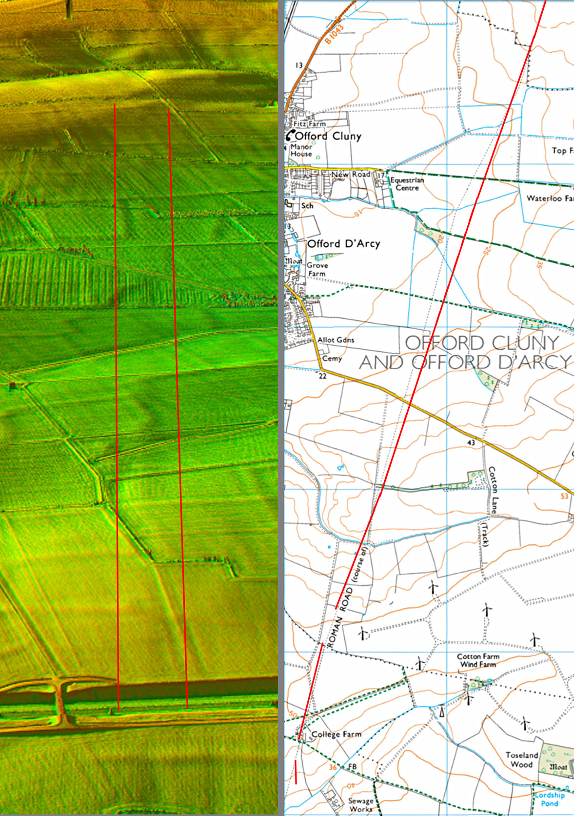
Oblique 3D Lidar Image & Corrected Route at Offord The Lidar evidence is faint but cleat that the OS depicted line is incorrect and much straight alignment was followed east of the Offords. Mapping: Bing OS |
Click for larger view |
 |
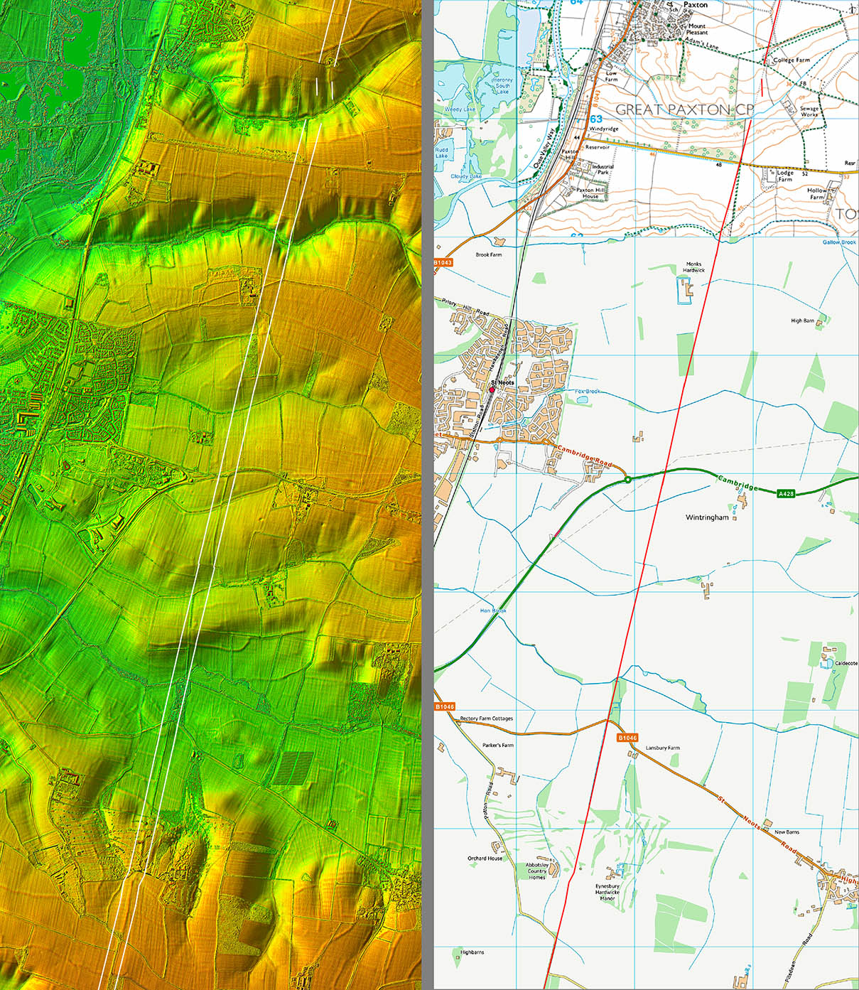
Lidar Image and Route Map 2 Obvious in Lidar but perhaps surprising that modern roads generally have ignored it. Near Abbotsley (bottom of map) then a modern road does swing on to it but then only for a short stretch - see below |
Click for larger view |
 |
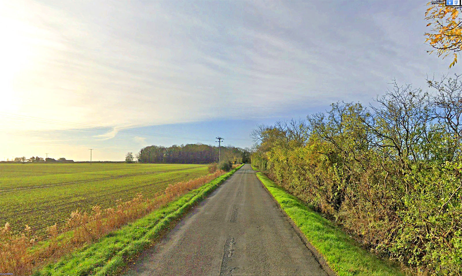
Gypsy Corner, Near Abbotsley Classic Roman agger well raised above ground level. |
Click for larger view |
 |
Lidar Image and Route Map 3 Several excellent lengths of surviving aggers all the way to Sandy. Today public footpaths make this stretch fully accessible. The road skirts around the hillfort there known as Caesar's Camp. For details of Sandy Roman Town see AOC Archaeology Group
|
Click for larger view |
 |
Oblique 3D Lidar Image - approaching Sandy Clever alignment heading straight for that natural valley approaching Sandy.This would no doubt have been sighted from the high ground in the foreground. |
Click for larger view |
 |
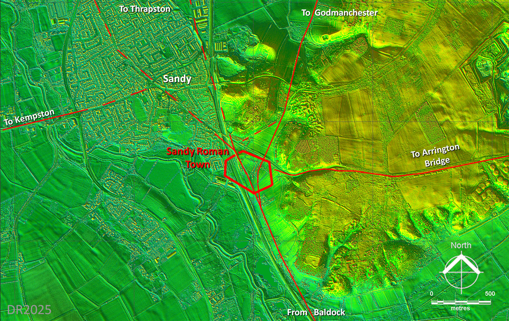
Lidar Image - Roman Roads around Sandy We now know Sandy (Bedfordshire) was an important Roman road junction with at least 5 roads meeting there. I didn't trace the one heading west any further as the evidence seemed to disappear after 5km. |
Click for larger view |
 |
|
|
|
Last update: Jan 2024 |
© David Ratledge |