|
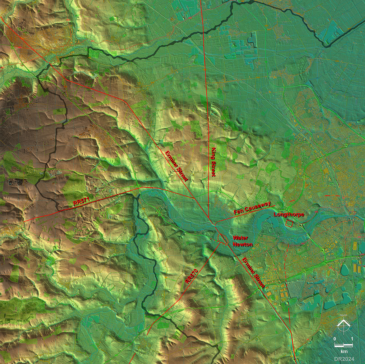
Ermine Street Roman Road from Water Newton to Stamford (Lincs.)Margary Number: 2cDistance: 9 miles (to Stamford) The major road in eastern England running from London to Lincoln and York. Also probably one of the earliest Roman roads in the country. The road first crossed the Rive Nene, the bridge giving the town its name, and then heads more inland to Stamford before it will eventually turn more northerly towards Lincoln. It leaves Cambridgeshire at Stamford.
|
Historic Counties: Northamptonshire & Lincolnshire Current Counties:Cambridgeshire & Lincolnshire HER: Peterborough & Lincolnshire
|
|
|
|
|
|
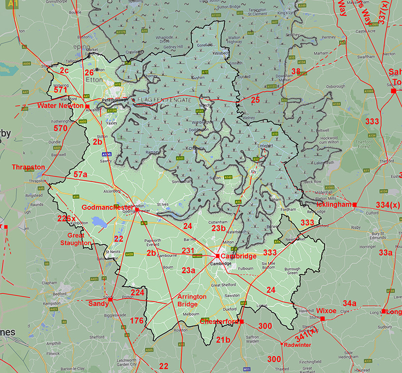
Lidar Image - Roman Roads around Water Newton Obvious from this map is just how important Water Newton became as a Roman road hub. Durobrivae means "Walled Town by the Bridge(s)" and it was no doubt the bridging point of the river that meant several roads were concentrated here, all to make use of the bridge. |
Click for larger view |
 |
Water Newton Milestones Two Roman milestones have been found just outside the north side of the fort. Milestone 1: Florianus, dated 276. Inscription RIB2235. Translation: For the Emperor Caesar Marcus Annius Florianus Pius Felix Invictus Augustus, one mile. The distance of 1 mile is puzzling as it was not found 1 mile from Durobrivae. Milestone 2: Victorinus, dated 268-70. Inscription RIB2238. Translation: For the Emperor Caesar Marcus Piaonius Victorinus Pius Felix Augustus, pontifex maximus, in his [. .] year of tribunician power. Acknowledgement: The texts of RIB and the TEI XML from which they are derived are published under a Creative Commons Attribution 4.0 International License |
 |
|
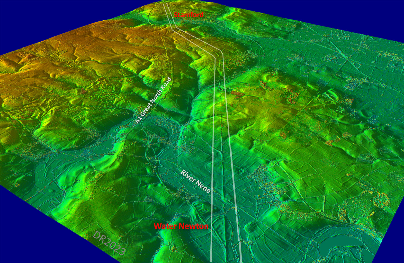
Oblique 3D Lidar Image - Water Newton to Stamford The logic of the route is clear in this oblique view. The Roman surveyor kept the road to the high ground on the right (east) side of the valley of the White Water Brook.. The modern A1, on the other hand, keeps to the west side. |
Click for larger view |
 |
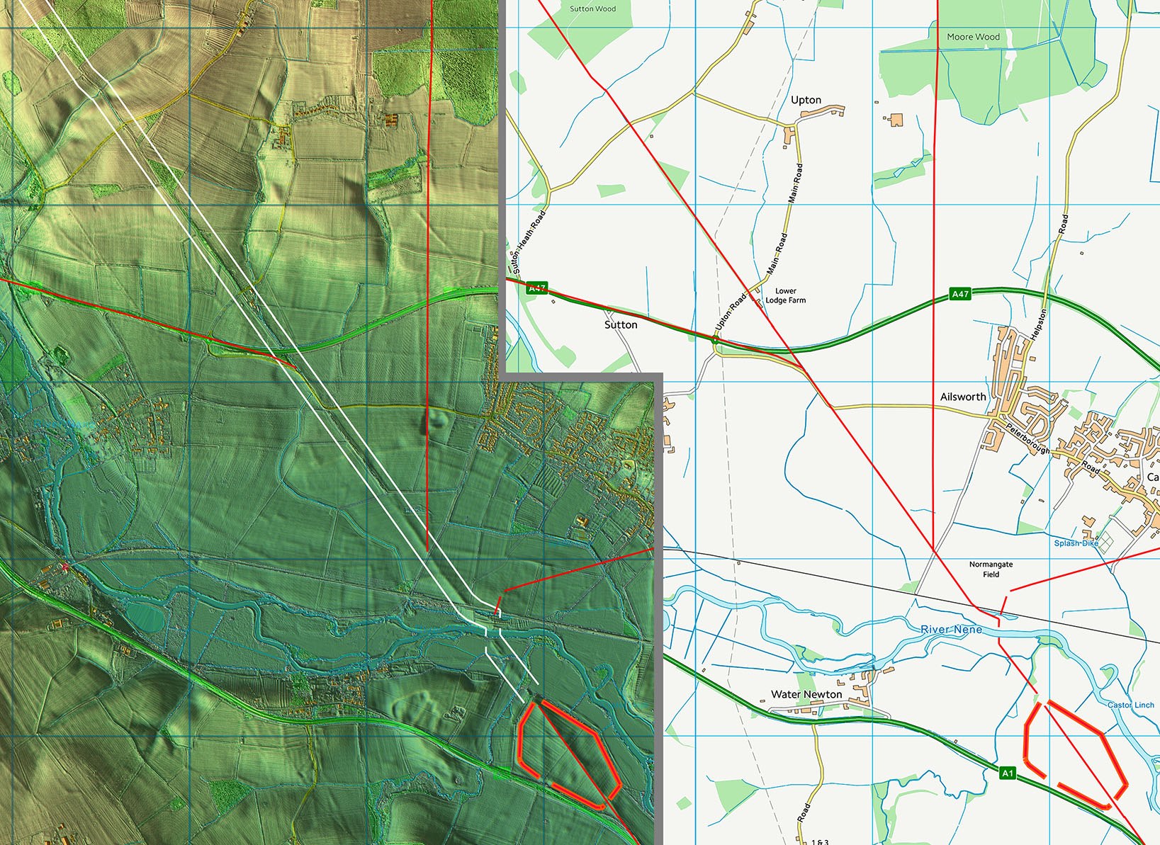
Lidar Image and Route Map 11 The agger of the road is massive even after 2000 years! Showing what an important Roman road this was. It is likely the huge agger would have been the result of many resurfacings in the Roman era, which would increase its thickness considerably. |
Click for larger view |
 |
Lidar Image and Route Map 12 After negotiating Southorpe bottoms the road makes a change of direction near Barnack for Stamford. |
Click for larger view |
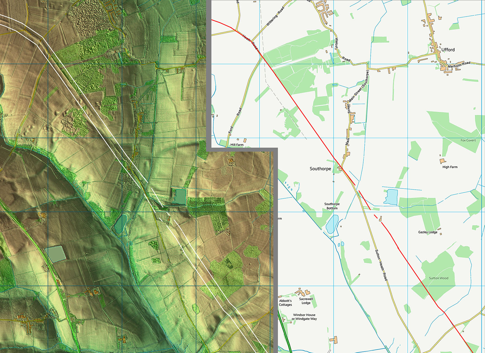 |
Near Barnack - Change of Alignment This is where the first change of direction north of Durobrivae occurred. |
Click for larger view |
 |
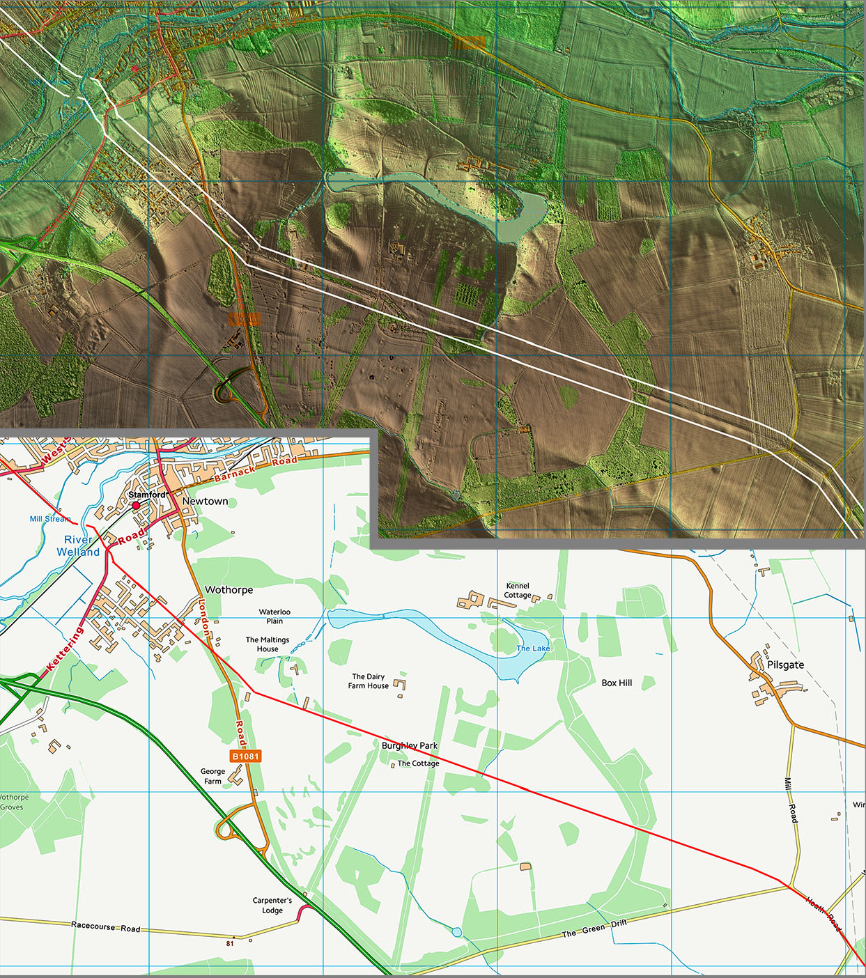
Lidar Image and Route Map 13 Having made the change of direction the road is still clear crossing Burghley Park before making another turn just before the B1080. This one was for its descent down to cross the River Welland. Don't be fooled by the Stamford "ford" name - the Romans would have had a bridge. It was after the Roman bridge was gone that Stamford and its later ford would have got its name. |
Click for larger view |
 |
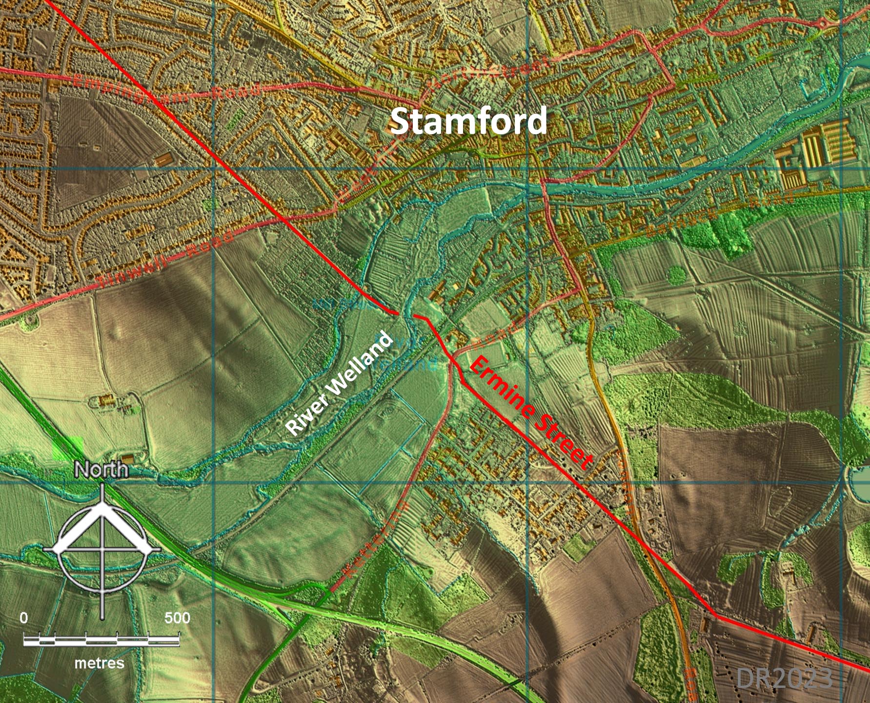
Lidar Image - Stamford The modern bridge and road through Stamford is not the line of Ermine Street, which was further west. The River Welland is the current county boundary. |
Click for larger view |
 |
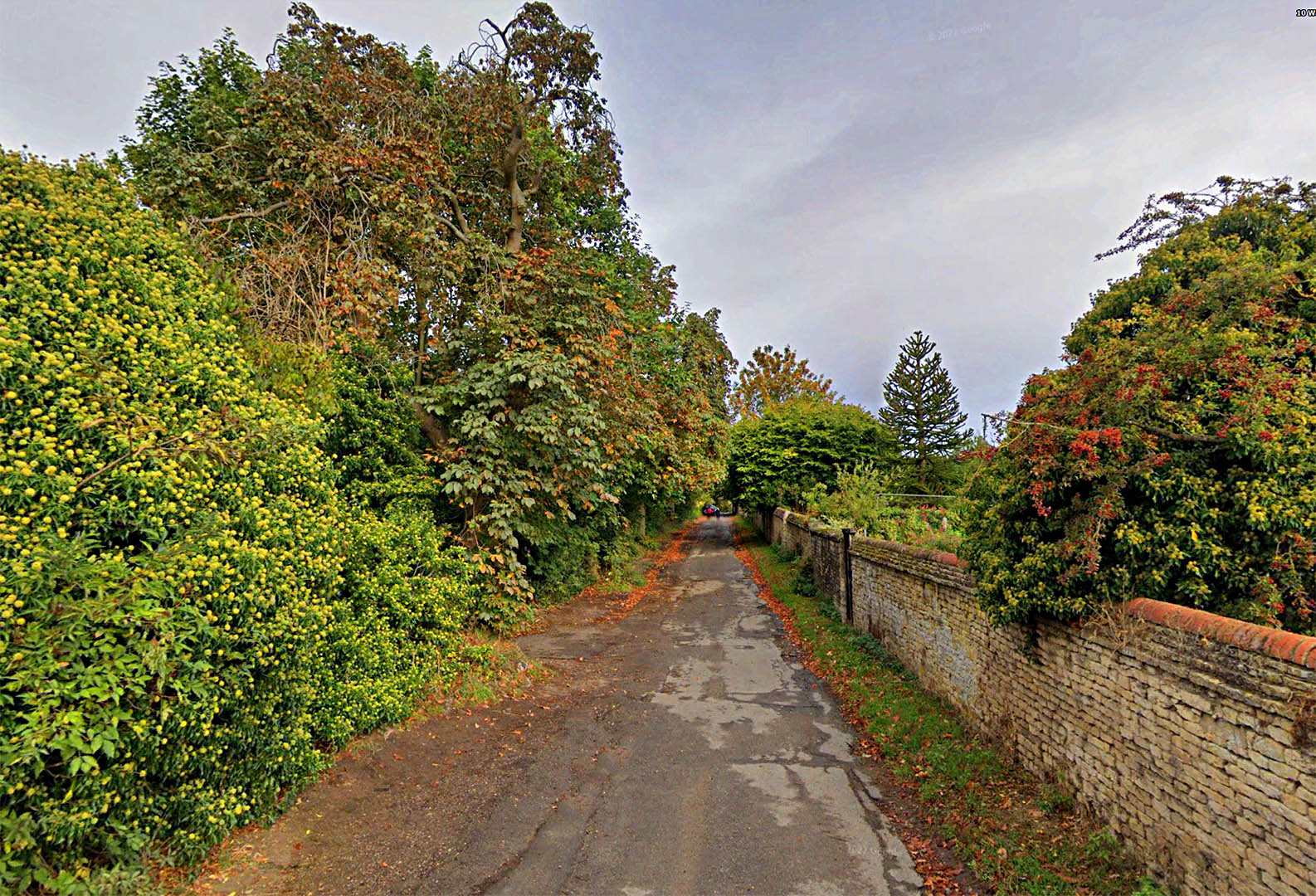
Water Furlong, Stamford We have crossed the River Welland and we have left Cambridgeshire. We are now in the county of Lincolnshire. Ermine Street is a bit more quiet and forgotten here. |
Click for larger view |
 |
|
Last update: Jan 2024 |
© David Ratledge |