|
Ermine Street Roman Road from Godmanchester to Water NewtonMargary Number: 2bDistance: 20 miles The major road in eastern England running from London to Lincoln and York. Also probably one of the earliest Roman roads in the country. In this section we cross the Great Ouse river and head northwards to the walled town of Roman Durobrivae.
|
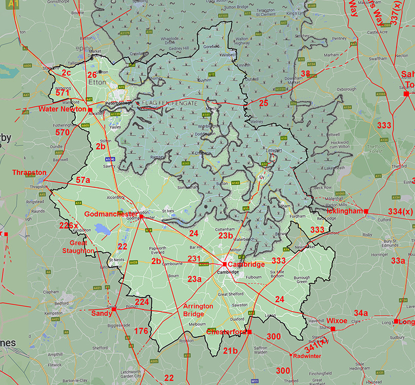
Historic Counties: Huntingdonshire Current Counties:Cambridgeshire HER: Cambridgeshire & Peterborough
|
|
|
|
|
|
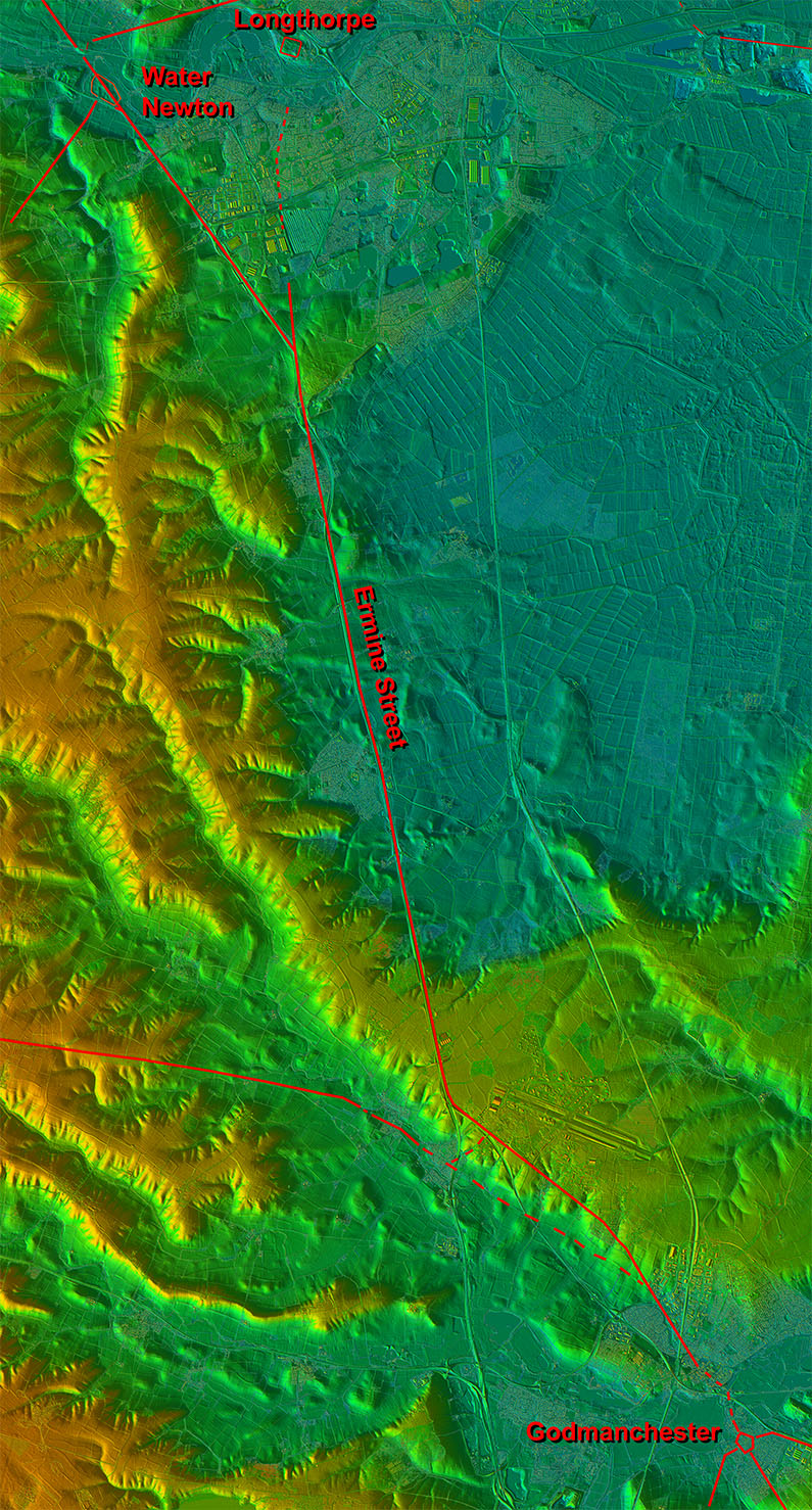
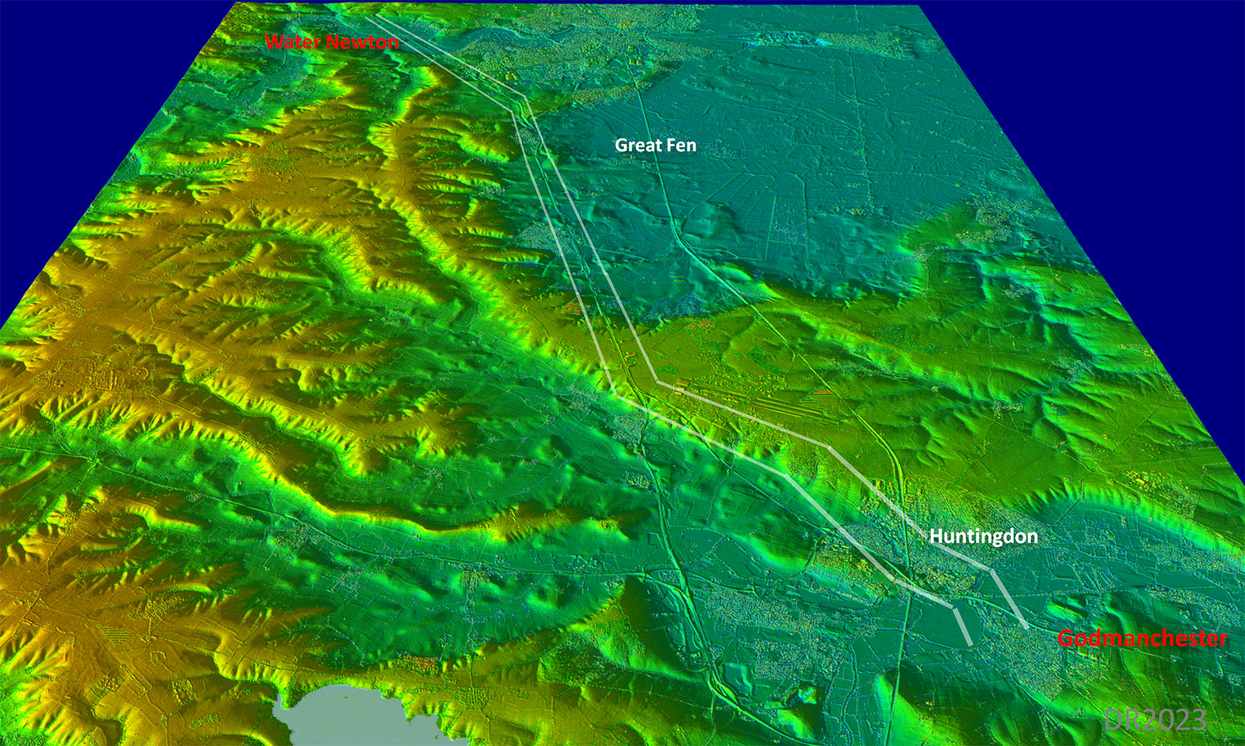
Lidar Image - Route from Godmanchester to Water Newton Why did the Roman surveyor not take the road via that curving ridge of high (and dry) ground? The only explanation I can think of is Ermine Street originally aimed for Longthorpe Fort. In that case the course chosen would make perfect sense. |
Click for larger view |
 |
Oblique 3D Lidar Image - Godmanchester to Water Newton In this view it would appear that the route ran as close to the Great Fen as possible as a direct route to Longthorpe(?) would have had to cross through that Fen and was therefore impracticable. |
Click for larger view |
 |
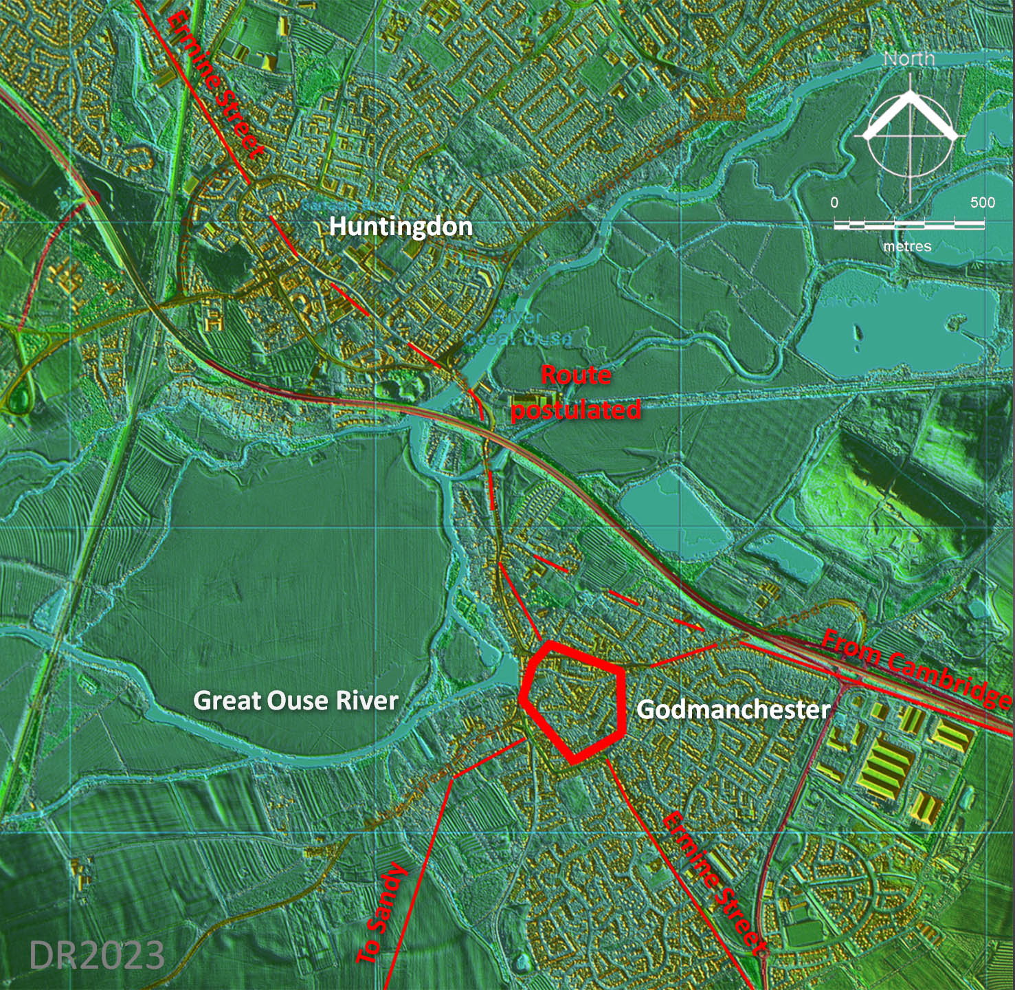
Lidar Plan - Godmanchester Across the Great Ouse flood plain and through Huntingdon then the route shown dashed is suggested as probably the most likely. The (old) Great Ouse Bridge is most likely on or very close to where the Roman bridge would have been. |
Click for larger view |
 |
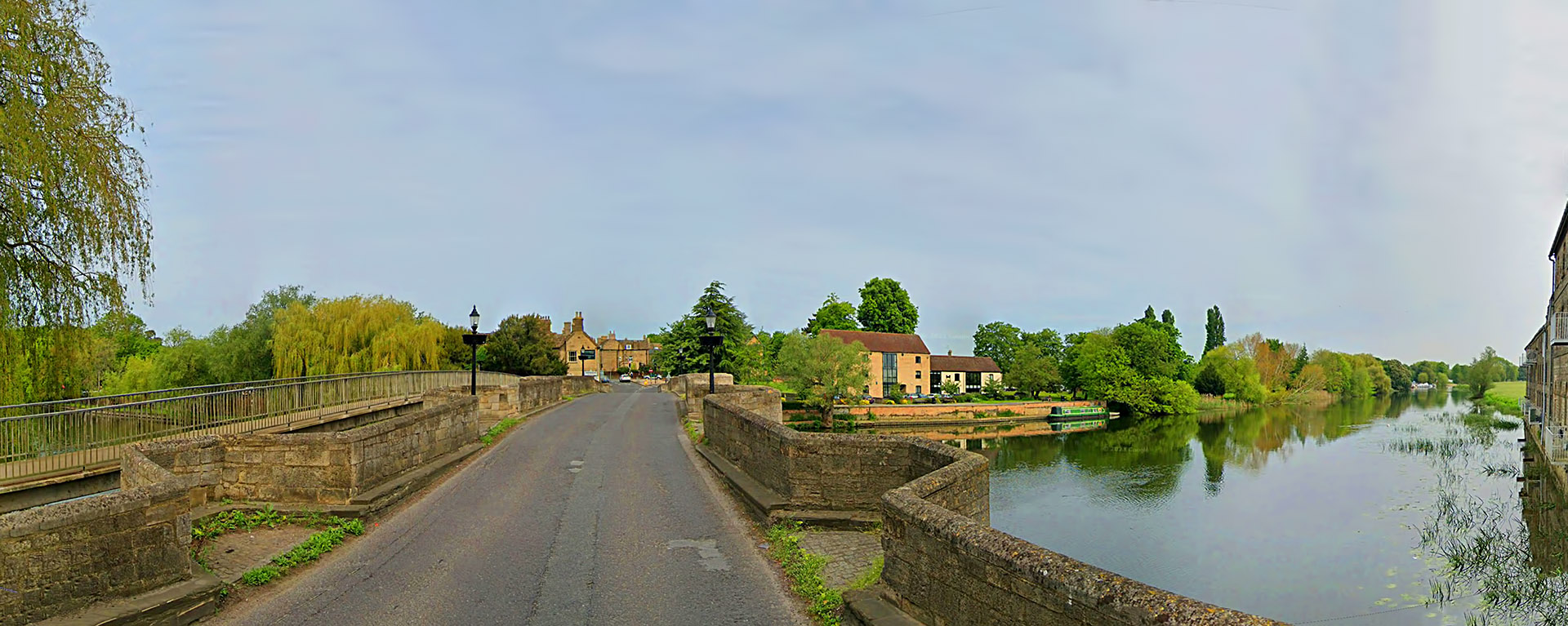
The Old Great Ouse River Bridge The Old Bridge probably marks the spot where the Romans too chose to bridge the river. Large bridges like the current one represented no difficulty in construction for the Romans. Forget fords - a road as important as Ermine Street would have had a bridge. |
Click for larger view |
 |
Lidar Image and Route Map 7 The crossing point of the Great Ouse River into Huntingdon is somewhat subjective but likely. Alconbury Weald became a Roman site of some importance but recent excavations have revealed that it was very late in the Roman period so very much later than Ermine Street. |
Click for larger view |
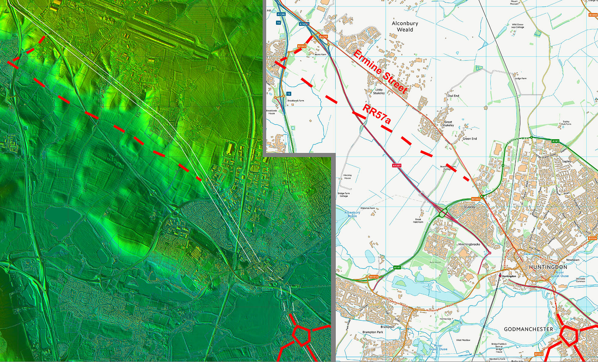 |
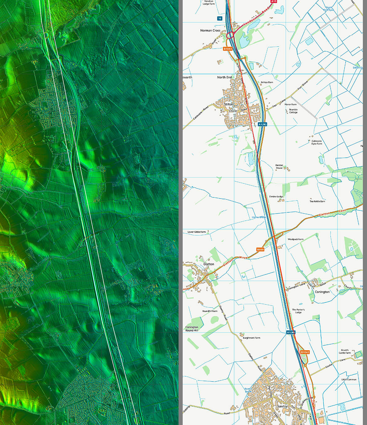
Lidar Image and Route Map 8 The change of direction here begins an alignment which appears to been aiming for Longthorpe Roman fort. |
Click for larger view |
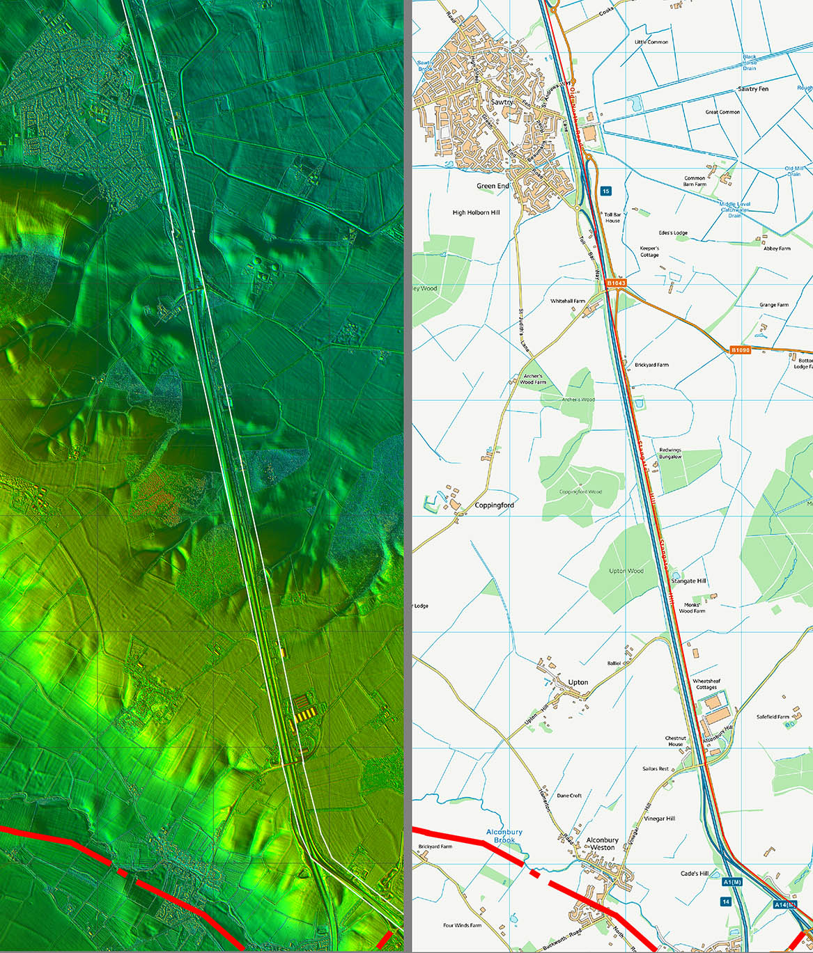 |
Lidar Image and Route Map 9 Two different village locations, Sawtry (bottom) and Stilton (top). Sawtry developed off Ermine Street whereas Stilton straddled it. If desirous of a peaceful life then a location off the Roman line would have been safer and quieter. On line would have been riskier but better for business. |
Click for larger view |
 |
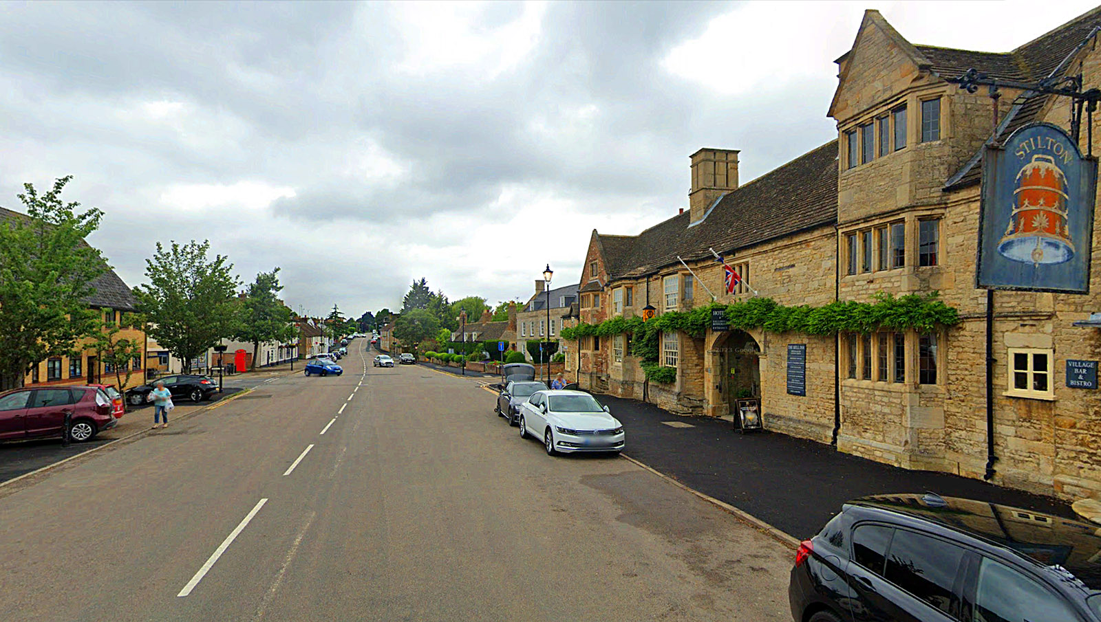
Former Bell Inn, Stilton The Old Great North Road on top of the even older Ermine Street. The huge width gives a clue to this road's continuing importance down the centuries - well at least until it was bypassed. Stilton had 14 coaching inns of which the Bell was probably the most prestigious. |
Click for larger view |
 |
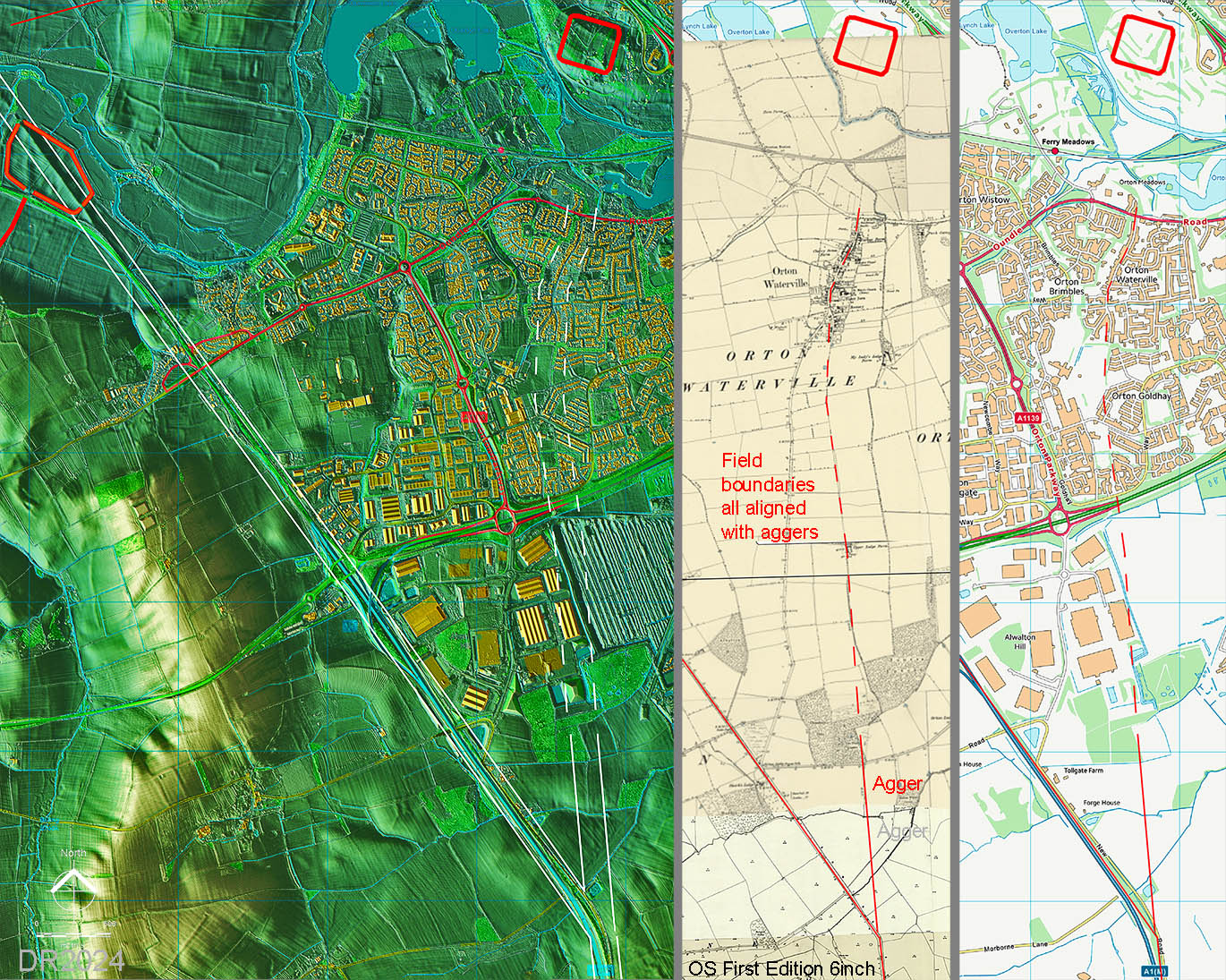
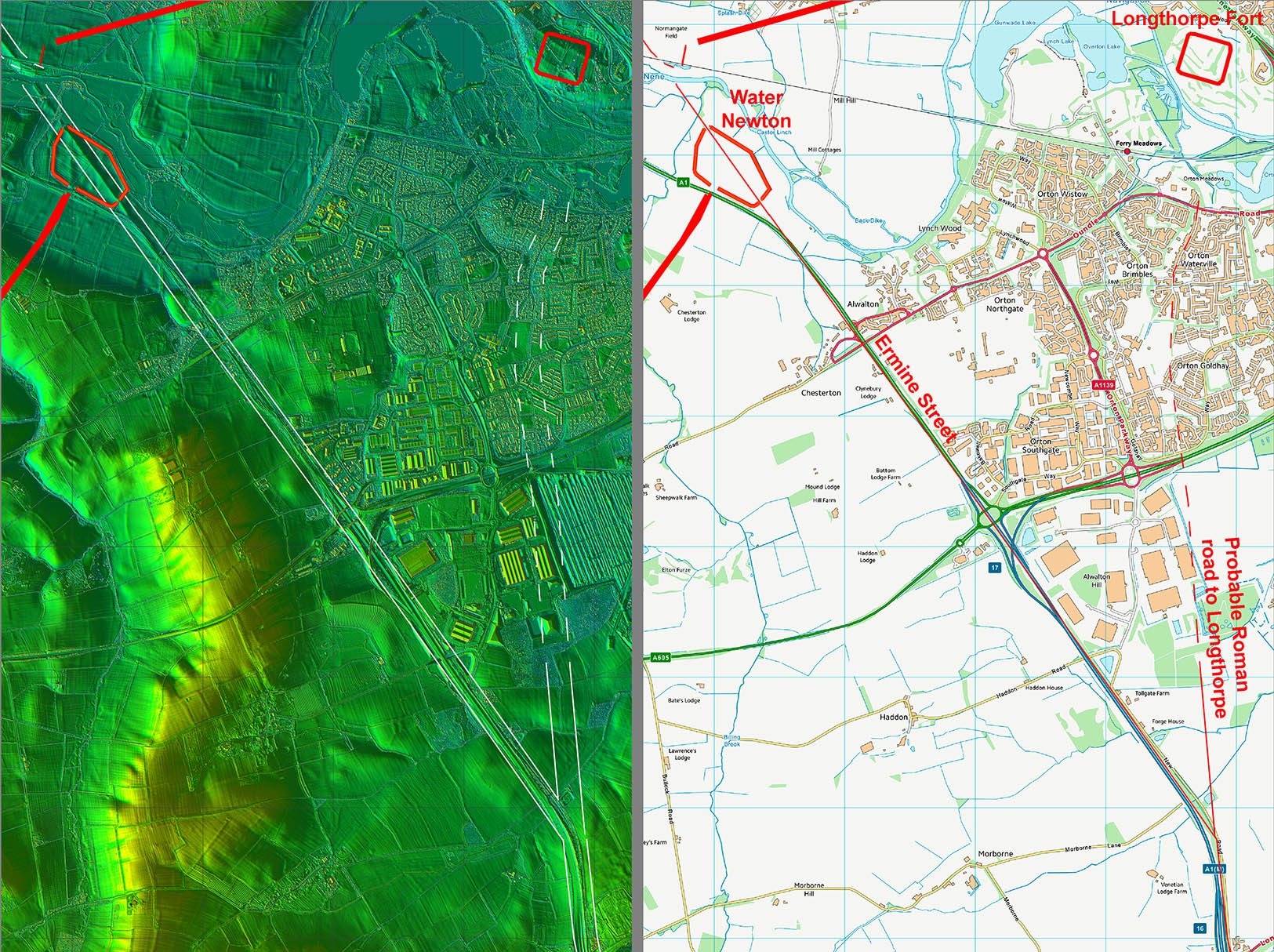
Longthorpe Link Road (original Ermine Street?) - Lidar, First Edition and modern mapping. The alignment of Ermine Street coming from the south makes most sense if it were targeting Longthorpe Fort rather than Water Newton. The evidence for the road carrying on towards Longthorpe is strong, at least initially, before modern developments wipe out all trace. However, the alignment of the aggers visible does match with 150 year old field boundaries, which would continue the line almost as far as the River Nene. Perhaps the Nene was forded and when bridges were required then Water Newton became the new course for Ermine Street. Speculation yes but similar road evolution has been observed elsewhere (River Lune in Cumbria). |
Click for larger view |
 |
Lidar Image and Route Map 10 Ermine Street actually goes straight through the middle of Durobrivae (Water Newton) so perhaps the site grew from a roadside minor settlement into a defended town.. The current Great North road diverges west from Ermine street just before Durobrivae - a diversion no doubt caused when the Roman bridge over the River Nene collapsed. |
Click for larger view |
 |
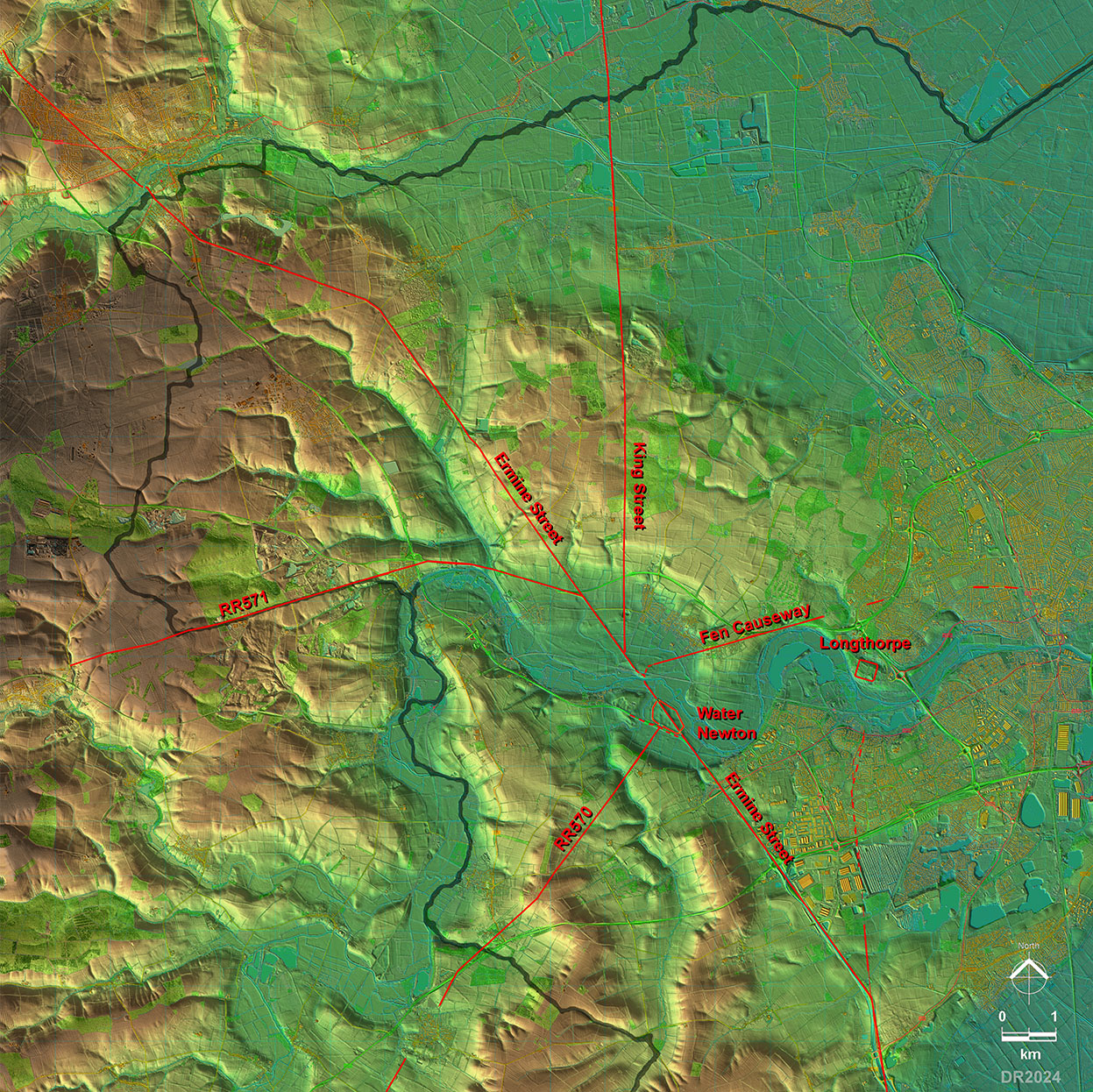
Lidar Image - Roman Roads around Water Newton Obvious from this map is just how important Water Newton became as a Roman road.hub. Durobrivae means "Walled Town by the Bridge(s)" and it was no doubt the bridging point of the river that meant several roads were concentrated here. |
Click for larger view |
 |
|
Last update: Jan 2024 |
© David Ratledge |