|
Ermine Street Roman Road from Arrington Bridge to GodmanchesterMargary Number: 2bDistance: 15 miles The major road in eastern England running from London to Lincoln and York. Also probably one of the earliest in the country. This section is largely covered by the modern A10 except where bypasses have been constructed. We continue our journey northwards from the Roman crossroads and settlement at Arrington Bridge to the RIver Great Ouse bridging point at Godmanchester. |
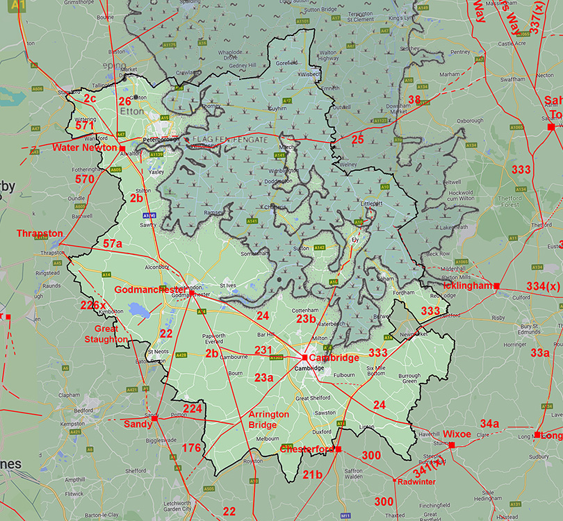
Historic Counties:Cambridgeshire & Huntingdonshire Current Counties:Cambridgeshire HER: Cambridgeshire
|
|
|
|
|
|
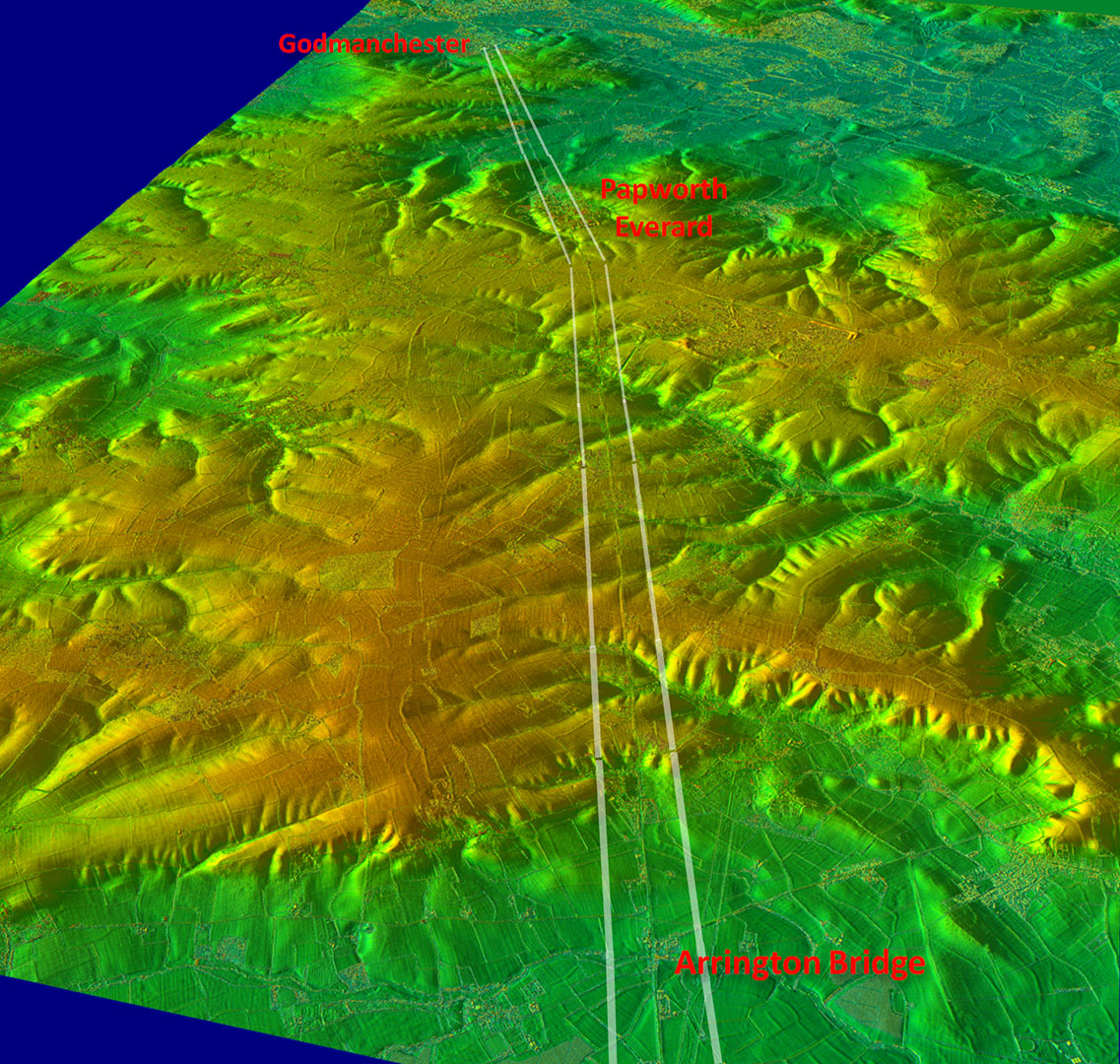
Lidar Image - Route from Arrington Bridge to Godmanchester Just the slightest of deviations from a single straight alignment. This occurred about a mile south of Papworth at Caxton Gibbet at a height of around 66 metres. |
Click for larger view |
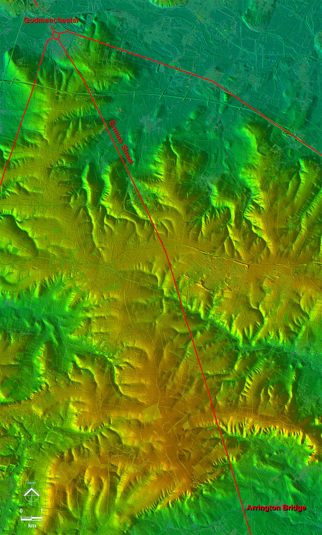 |
Oblique 3D Lidar Image - Arrington Bridge to Godmanchester That small change in alignment south of Papworth is exaggerated in this oblique image. If the Roman surveyor had moved the road a little to the west (left) he could have kept to high ground and avoided the Bourn Valley but obviously chose not to. |
Click for larger view |
 |
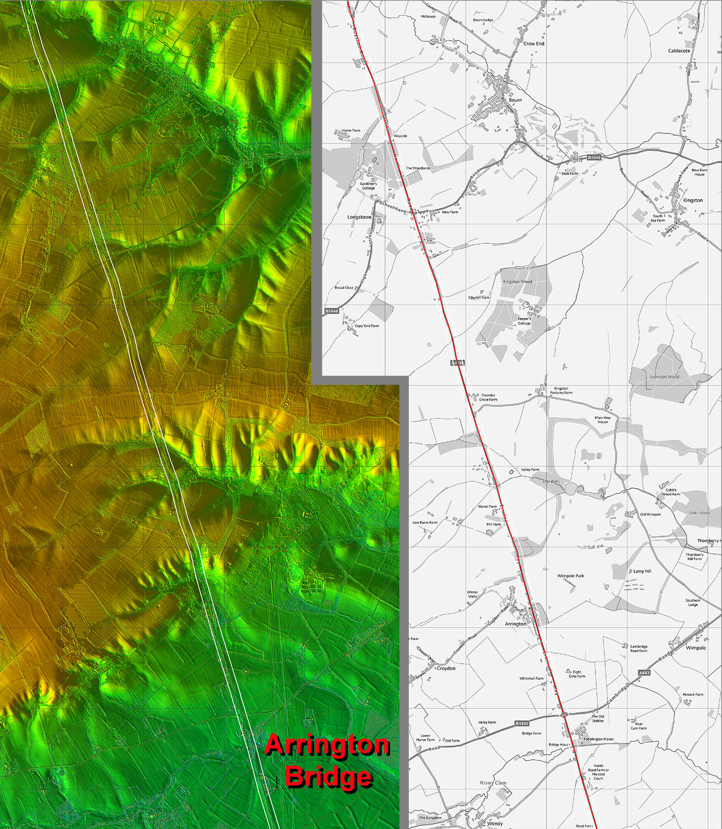
Lidar Image and Route Map 4 This is the first straight alignment to the Bourn Valley. |
Click for larger view |
 |
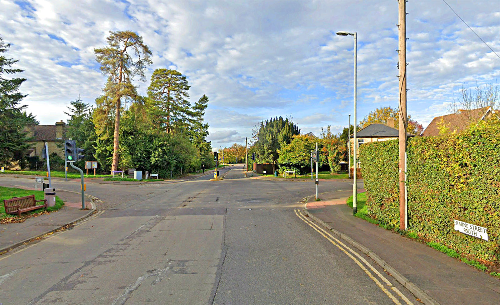
Papworth Everard, Ermine Street South A quiet day in Papworth! Across the junction the road name changes to Ermine Street North. |
Click for larger view |
 |
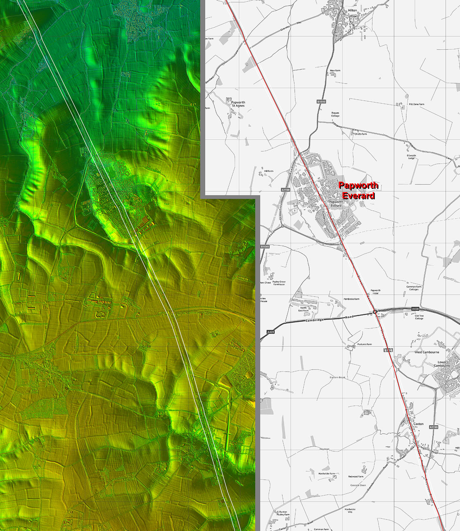
Lidar Image and Route Map 5 The change of direction - just a minor adjustment - was obviously to target the crossing of the Great Ouse River. |
Click for larger view |
 |
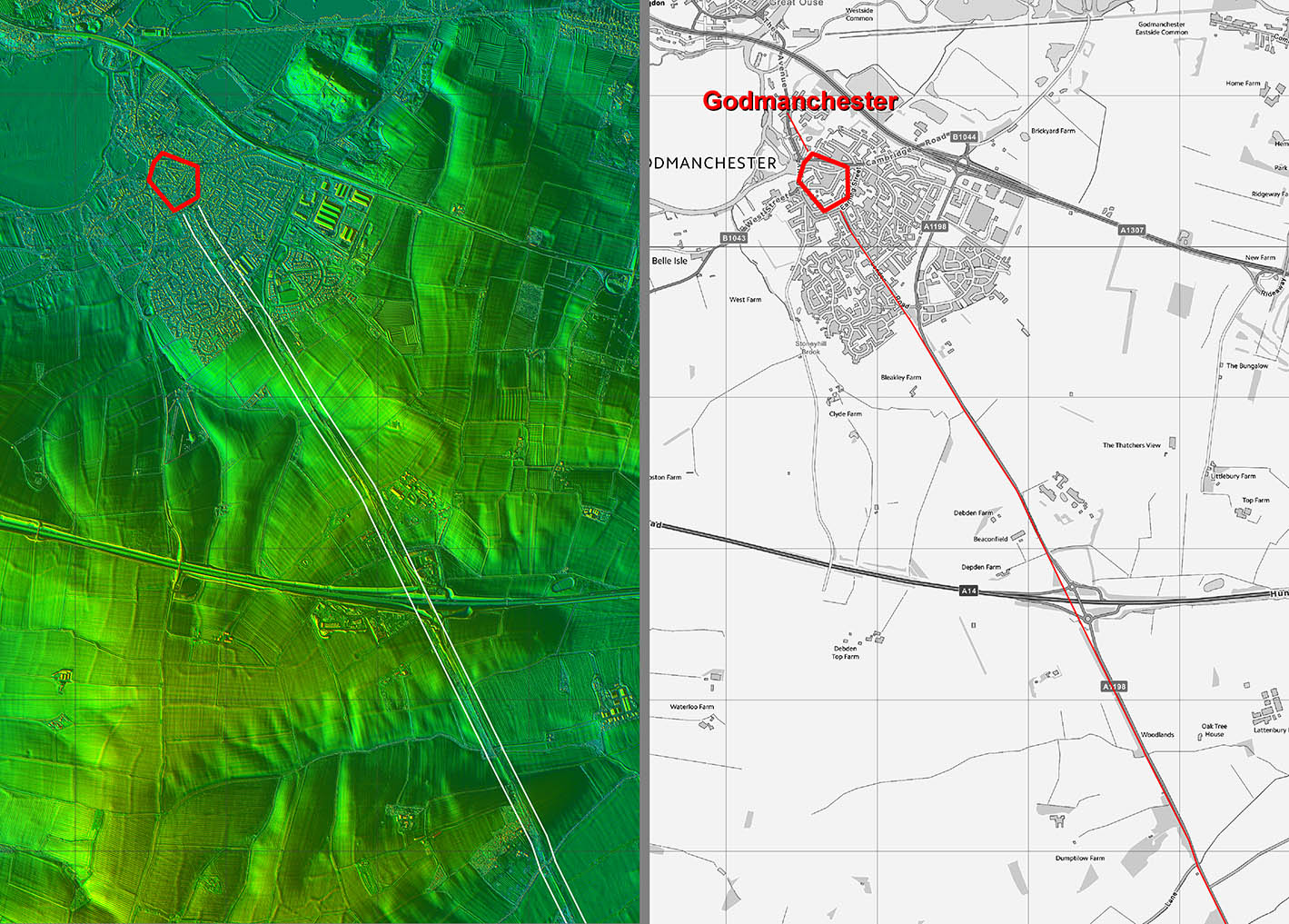
Lidar Image and Route Map 6 From Papworth Everard it was a simple alignment on to the Roman town at Godmanchester. Ermine Street went through the middle of the Roman town. |
Click for larger view |
 |
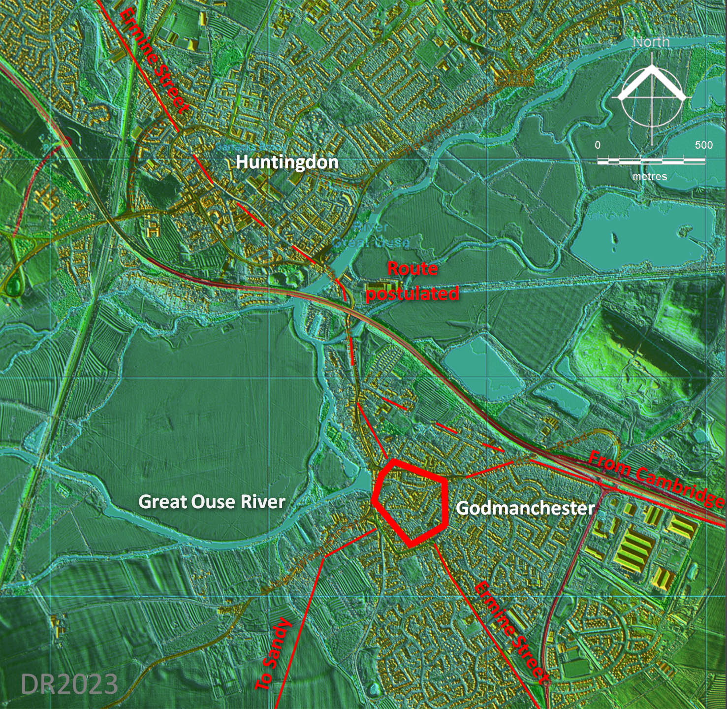
Lidar Plan - Godmanchester Three Roman roads from the south converged on the bridging point. Across the Great Ouse flood plain and through Huntingdon then the suggested route is shown dashed but it is probably the most likely course. |
Click for larger view |
 |
|
Last update: Jan 2024 |
© David Ratledge |