|
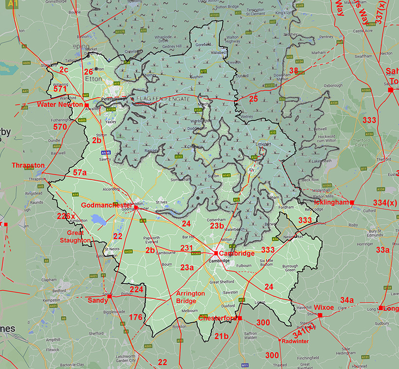
Ermine Street Roman Road from Braughing to Arrington BridgeMargary Number: 2bDistance: 16 miles The major road in eastern England running from London to Lincoln and York. Also probably one of the earliest in the country. The name Ermine Street dates back to at least the 10th century. It is believed to derive from the Earningas, an Anglo-Saxon group from around Arrington Village (Reference Albone). This section is largely covered by the modern A10 except where bypasses have been constructed. There was a Roman town at Braughing near the former railway Station and a presumably earlier fort on the eastern side of the River Rib. Ermine Street doesn't actually cross into Braughing (parish). The fort is strangely positioned adjacent to the Roman road to Great Chesterford (21b) rather than Ermine Street. In fact it has a poor view of Ermine Street. Note Braughing is pronounced 'braff-in' - this did catch me out when giving a local talk!
|
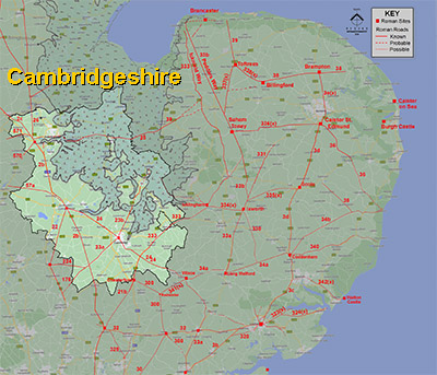
Historic Counties: Hertfordshire & Cambridgeshire Current Counties:Hertfordshire & Cambridgeshire HER: Hertfordshire & Cambridgeshire
|
|
|
|
|
|
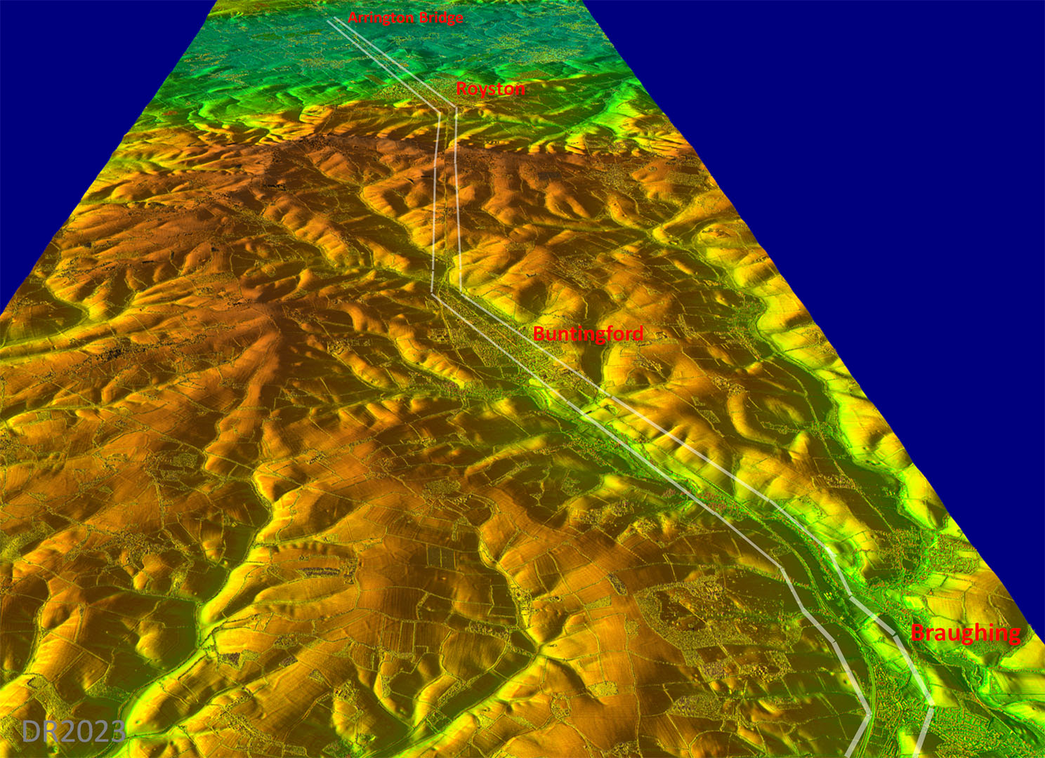
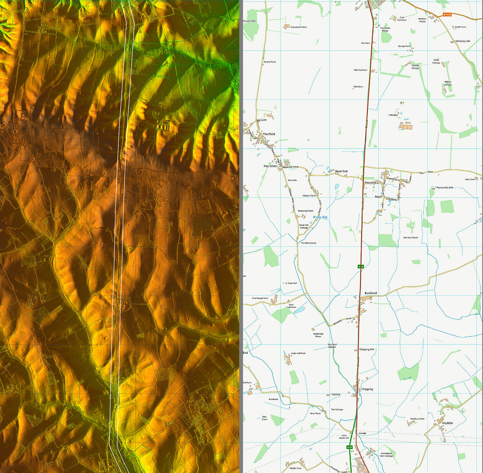
Lidar Image - Route from Braughing to Arrington Bridge The route initially follows the River Rib valley passing through Buntingford but then turns off towards Royston where another change of direction occurred, this time towards Arrington Bridge |
Click for larger view
|
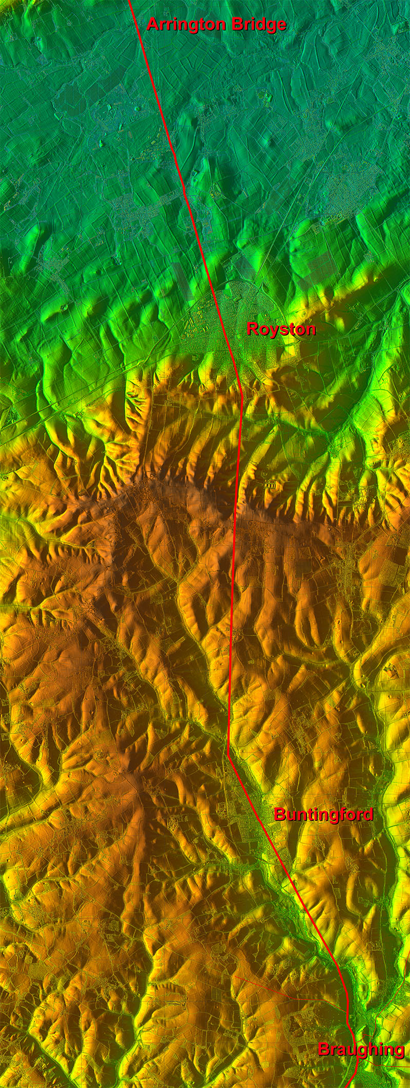 |
Oblique 3D Lidar Image - Braughing to Arrington Bridge The Rib valley route is obvious in this oblique view. If it had followed the valley further north then a higher crossing of the hills would have resulted. So a good compromise between directness and climbing. |
Click for larger view |
 |
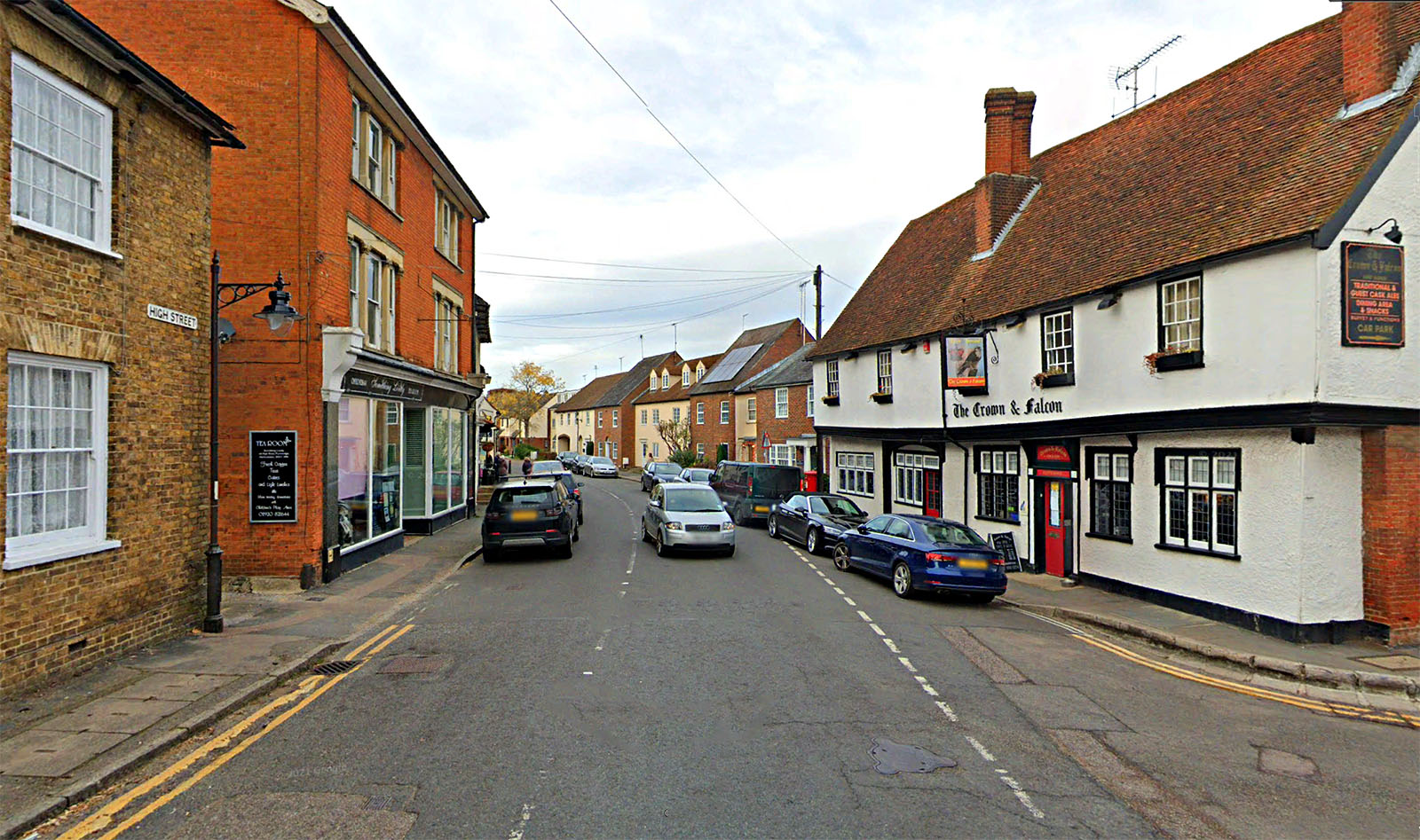
High Street, Puckeridge As mentioned above, Ermine Street does not enter Braughing Parish but passes through the village of Puckeridge. There High Street indicates the approximate Roman route but the old Crown and Falcon pub, I would suggest, is most likely aligned with and alongside the original Roman alignment, so slightly angled to the modern road.. |
Click for larger view |
 |
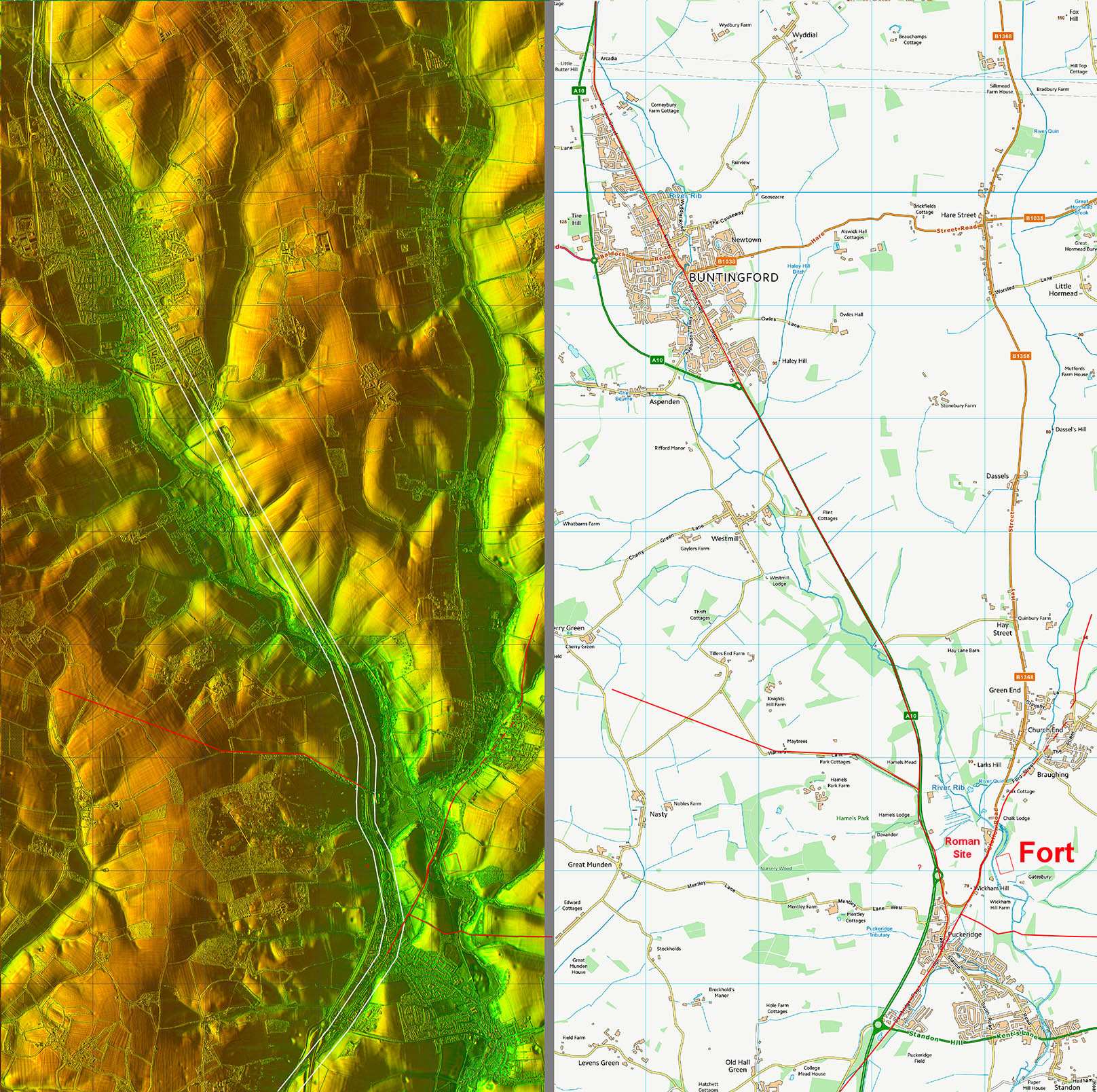
Lidar Image and Route Map 1 Not a lot of Roman evidence as the A10 masks the Roman line. |
Click for larger view |
 |
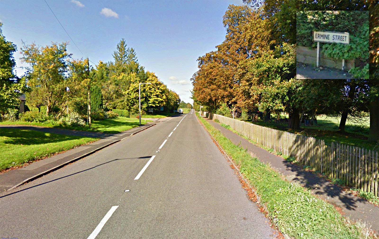
Ermine Street, Buntingford Leaving Buntingford then the road retains the name Ermine Street. |
Click for larger view |
 |
Lidar Image and Route Map 2 Again the A10 covers up the Roman road. |
Click for larger view |
 |
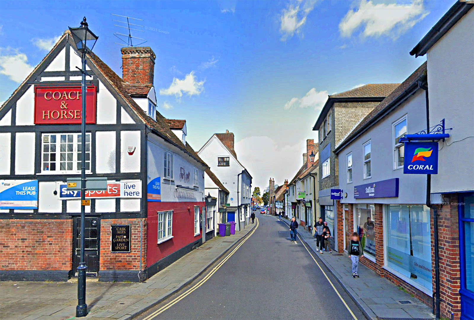
Kneesworth Street, Royston The pub name gives it away that this road continued in use long after the Romans had departed. Beyond Royston the road name changes to Old North Road - a very apt name being almost 2000 years old. |
Click for larger view |
 |
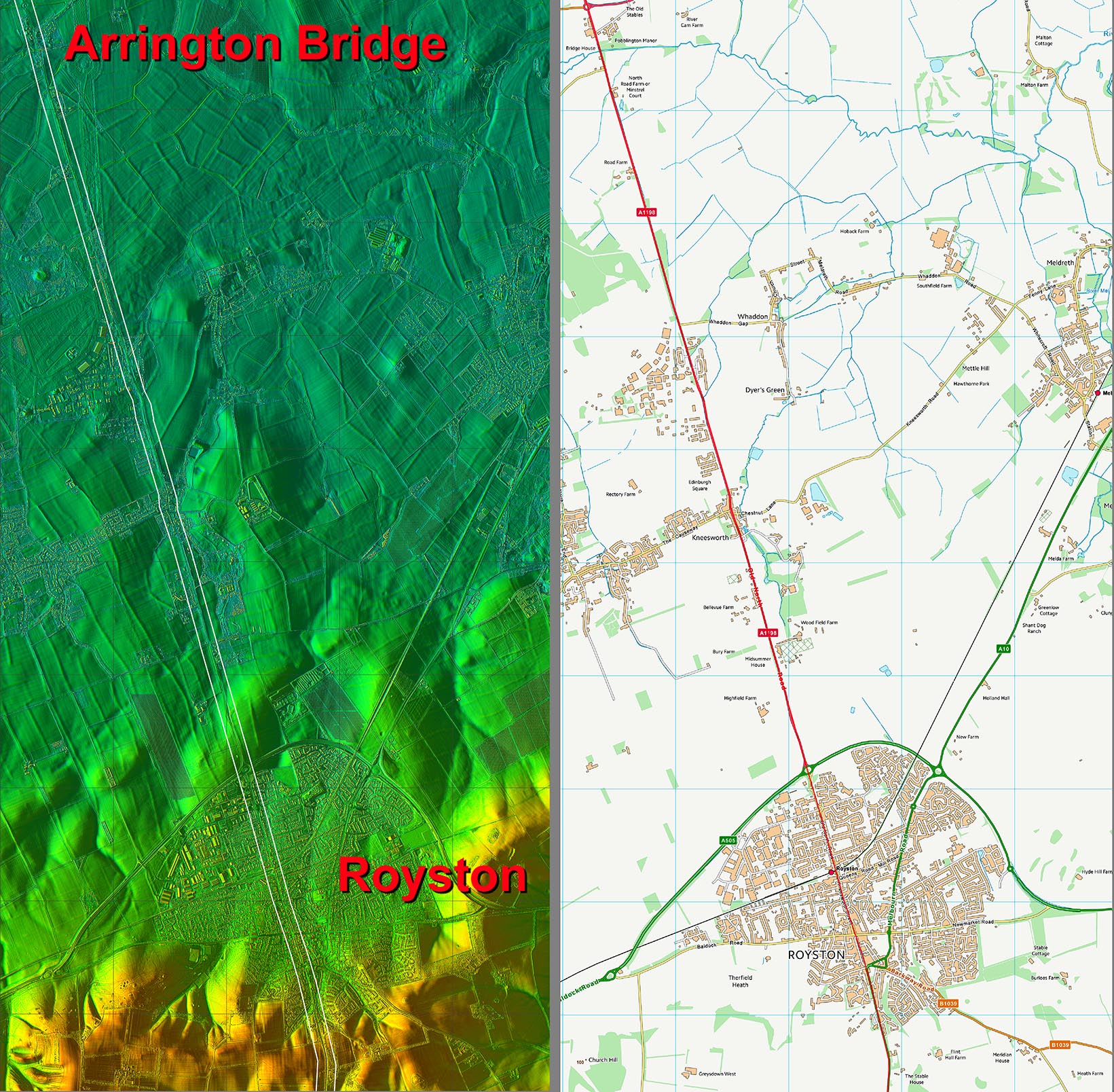
Lidar Image and Route Map3 Virtually straight now all the way to the Roman settlement at Arrington Bridge. |
Click for larger view |
 |
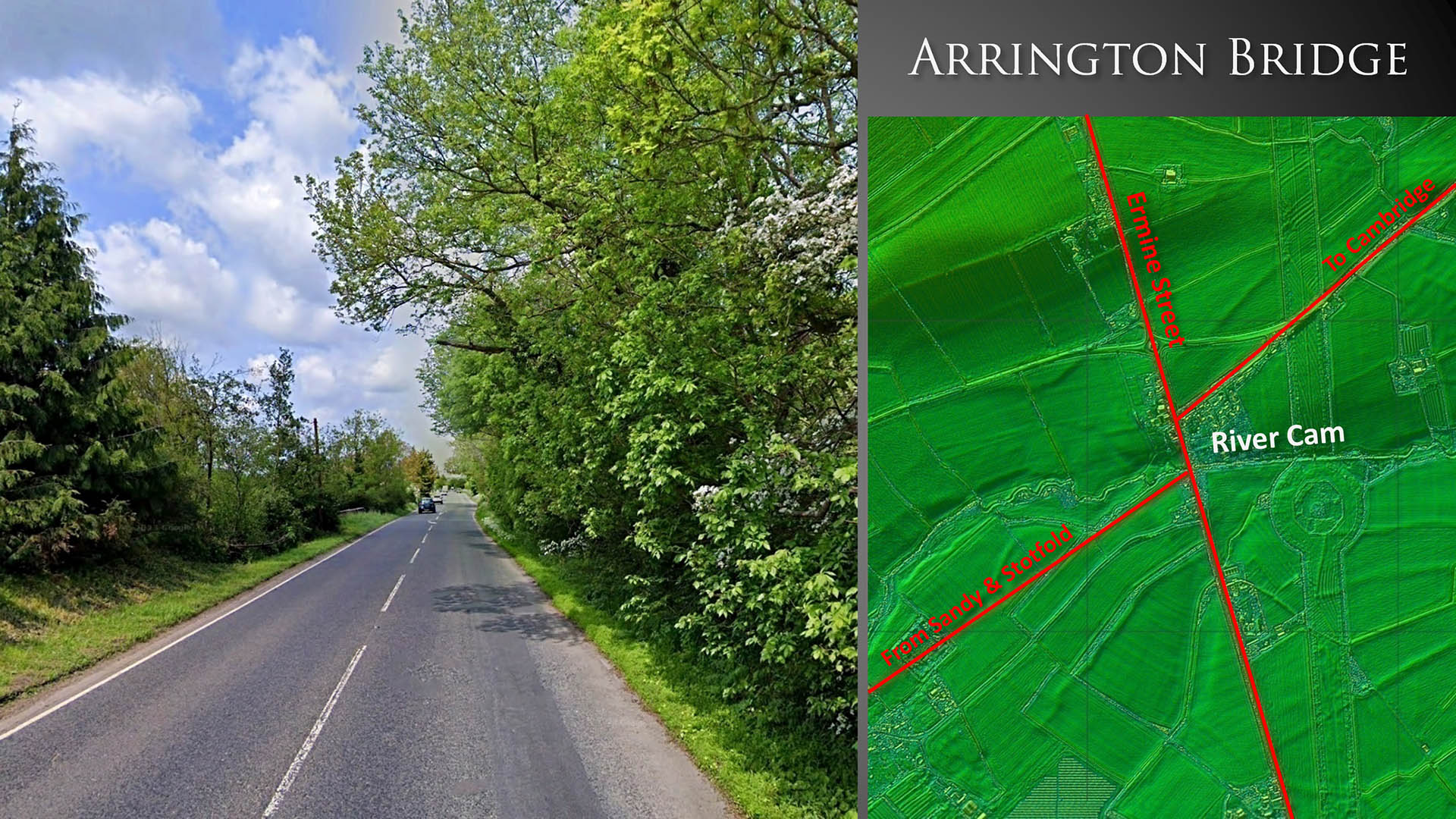
Arrington Bridge Arrington Bridge was an important road junction with roads from Cambridge, Sandy and Stotfold all met and shared a common bridge over the River Cam. As well as being a cross-roads this site is halfway between Braughing and Godmanchester to a Roman site or staging post would be expected here. Just such a site along both sides of the A14 at Arrington Bridge has been known for some years. It was discovered and investigated by very limited trial trenching by Roland Parker in 1972, who interpreted the site as a posting station.This was later confirmed when the new roundabout was constructed revealing evidence for a roadside settlement. Reference: Excavation of a Roman Site near W Cambs., 1989, Wendy Horton, Gavin Lucas & Gerald A. Wait, Cambridge Antiquarian Society.
|
Click for larger view |
 |
|
Last update: Jan 2024 |
© David Ratledge |