|
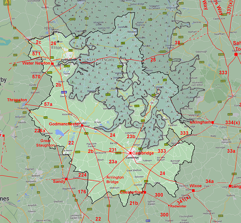
The Roman Road from Cambridge to GodmanchesterMargary Number: 24Distance: 14 miles The so-called Via Devana although the name is a fanciful 18th century creation and a direct route to Chester (Deva) is stretching credibility somewhat. Today Roman evidence has just about been wiped out by multiple upgrades to the A14 trunk road. Ostensibly two main alignments with its main change of direction at Fenstanton although there was a slight deviation at Bar Hill.. Roman Roads, 22, 2b (Ermine Street) and 24 (Via Devana) were all heading for the crossing point of the Great Ouse River.
|
Historic Counties: Cambridgeshire& Huntingdonshire Current Counties:Cambridgeshire HER: Cambridgeshire
|
|
|
|
|
|
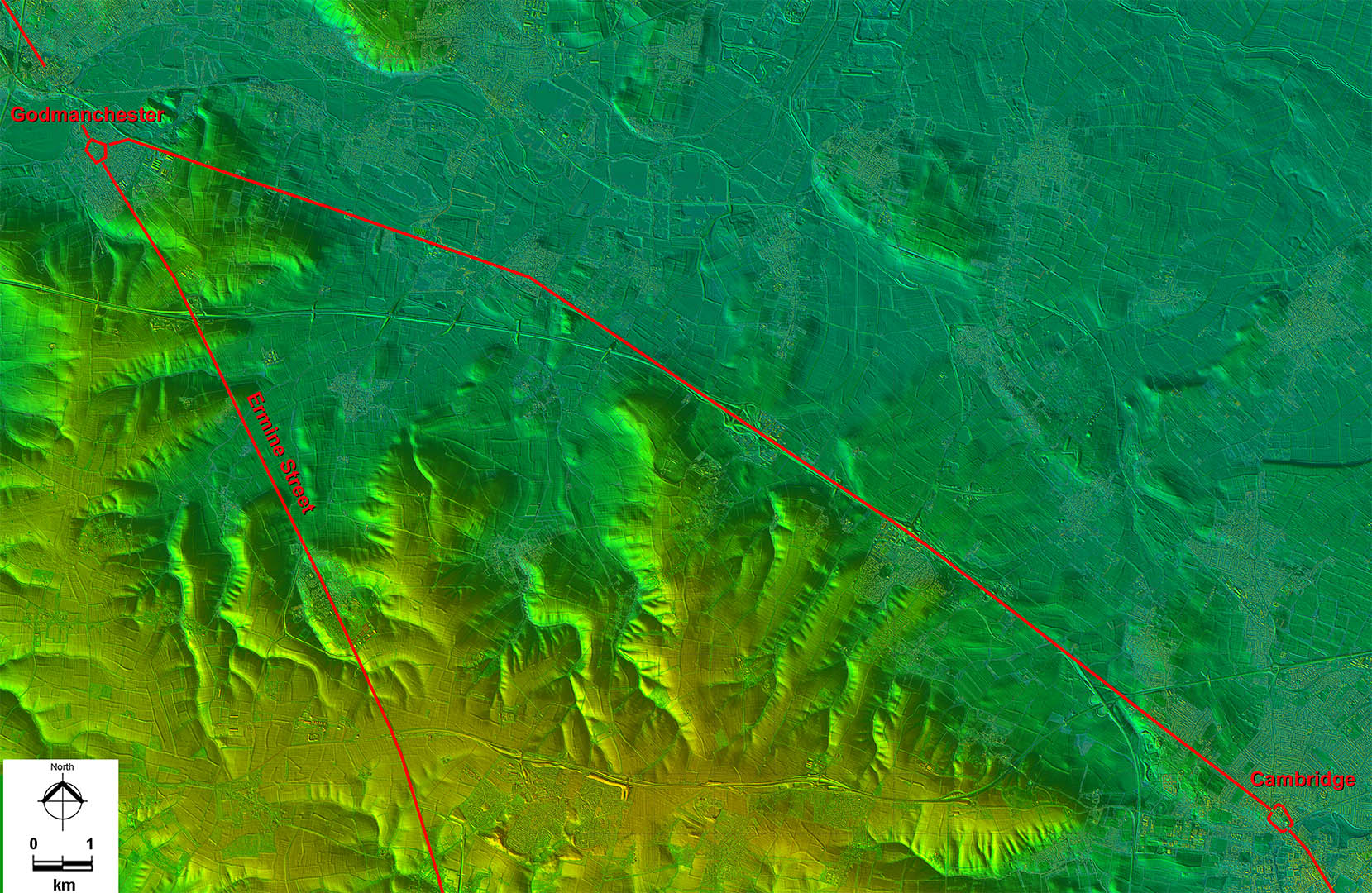
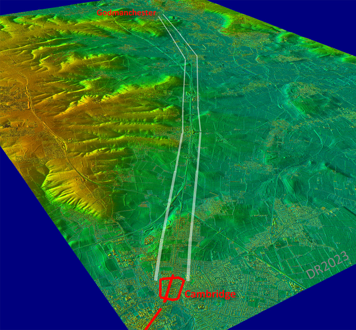
Lidar Image - Full Route The route clearly targeting joining Ermine Street at Godmanchester for northward connections. This would probably have been the lowest bridging point of the Great Ouse River. |
Click for larger view
|
 |
Oblique 3D Lidar Image That fractional change of direction at Bar Hill is evident in this oblique view. The course was perhaps selected by the Roman surveyor to skirt around the high ground. |
Click for larger view |
 |
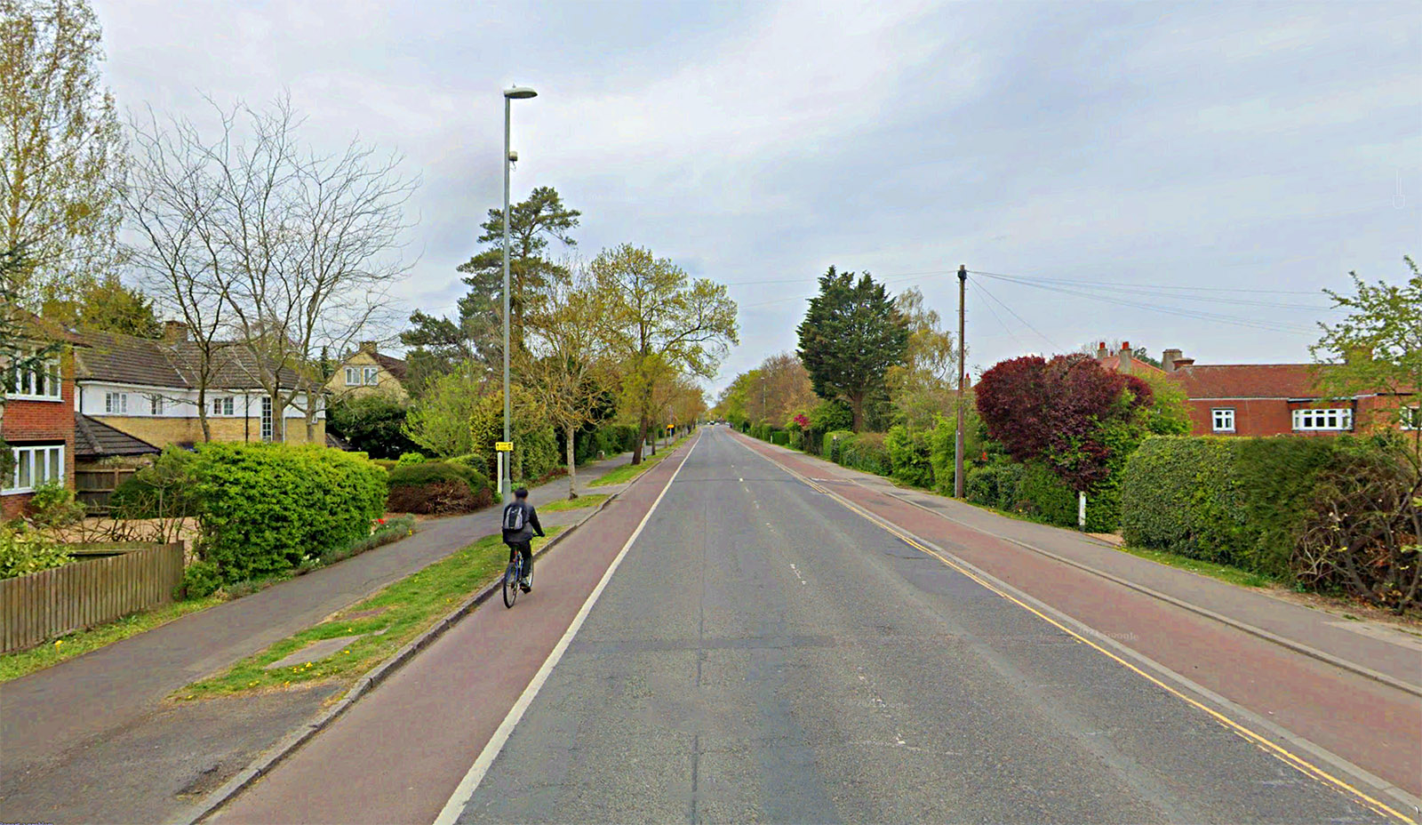
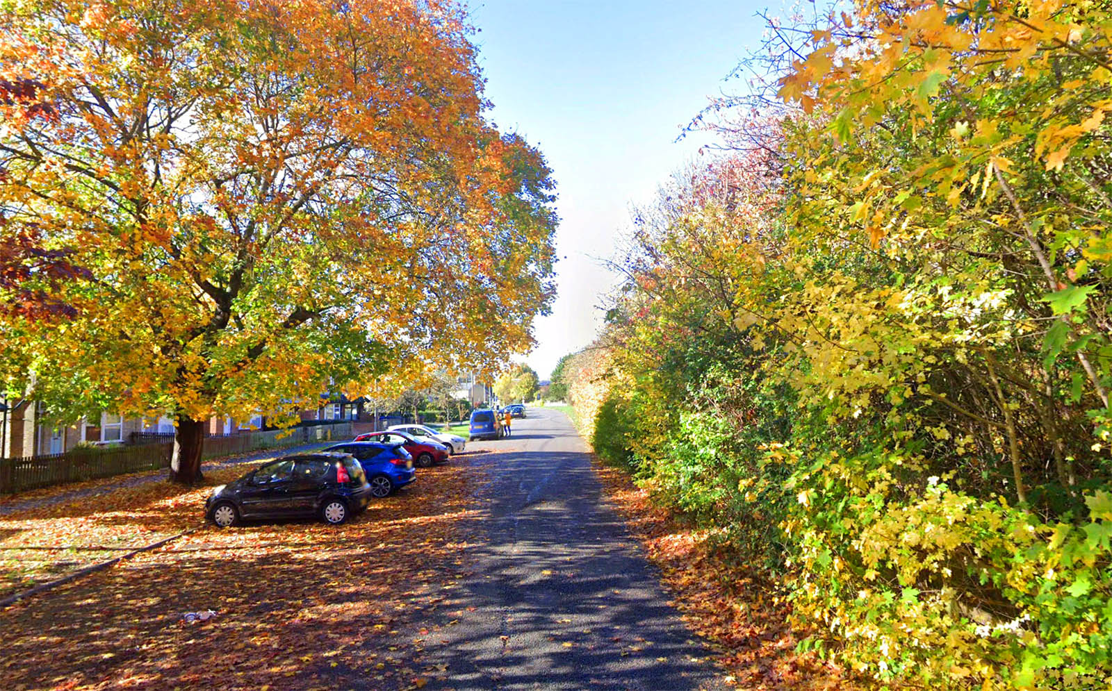
Leaving Cambridge - Former A14 now A1307 Not usually this quiet! Along this stretch is Ridgeway Village - a name obviously derived from the road. |
Click for larger view |
 |
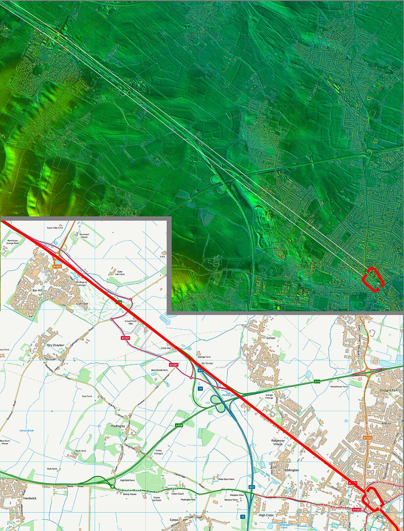
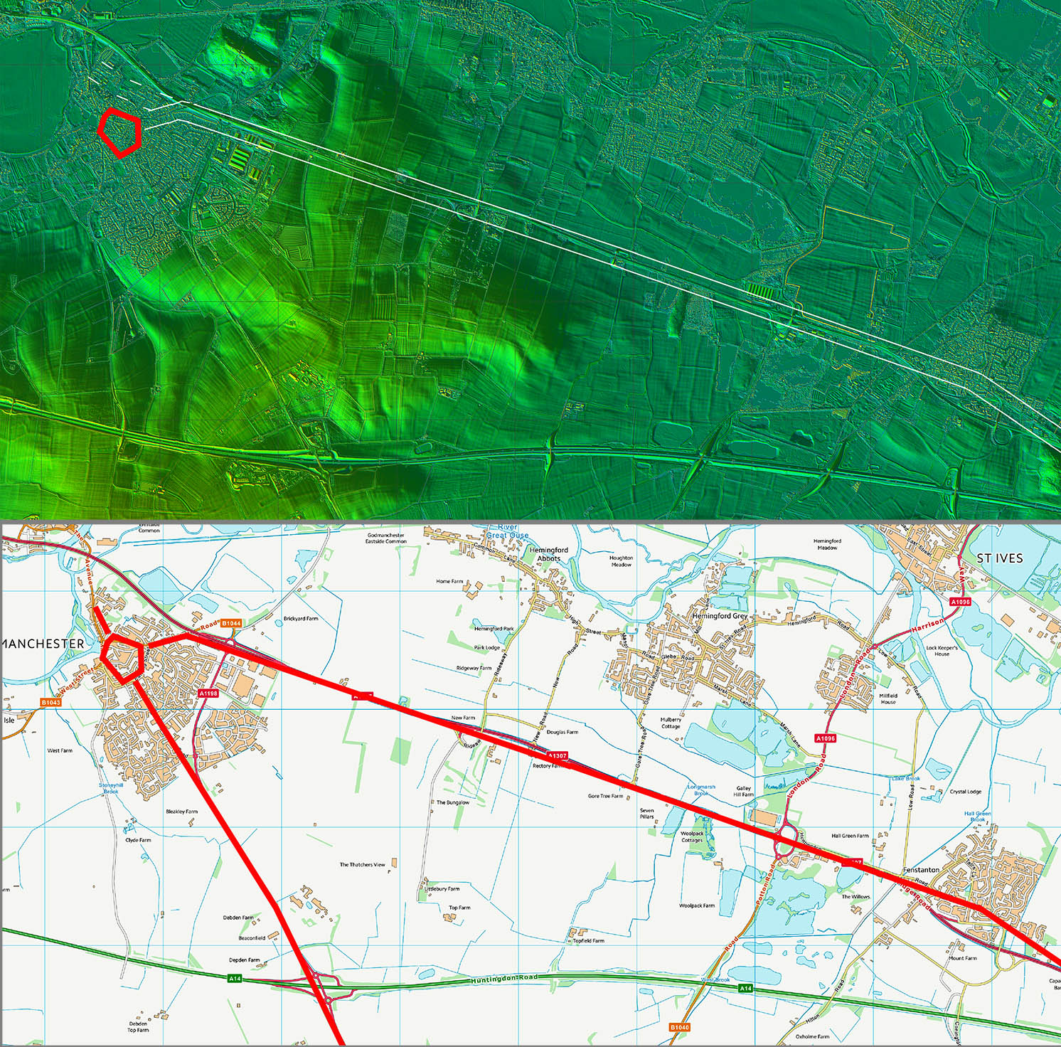
Lidar Image and Route Map 1 First alignment from Cambridge was on Bar Hill. |
Click for larger view |
 |
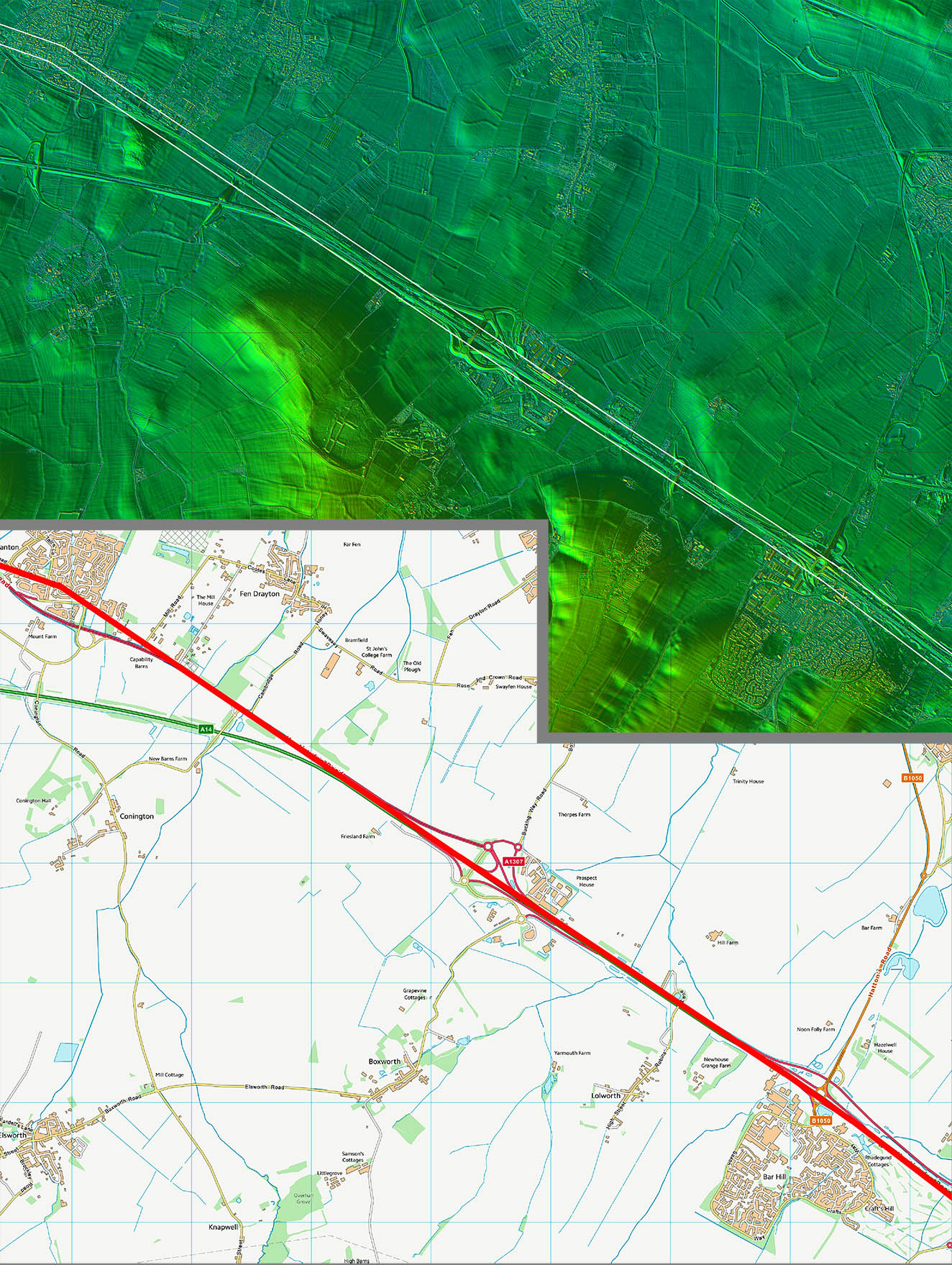
Lidar Image and Route Map 2 Typical Roman alignment between Bar Hill and Fenstanton. |
Click for larger view |
 |
Old Road Huntingdon This short cul-de-sac is the remains of the old road to Godmanchester, now bypassed. |
Click for larger view |
 |
Lidar Image and Route Map 3 The alignment was adjusted at Fenstanton and aimed not for the Roman town at Godmanchester but clearly the bridge site for the crossing of the Great Ouse.. |
Click for larger view |
 |
|
|
|
Last update: Jan 2024 |
© David Ratledge |