|
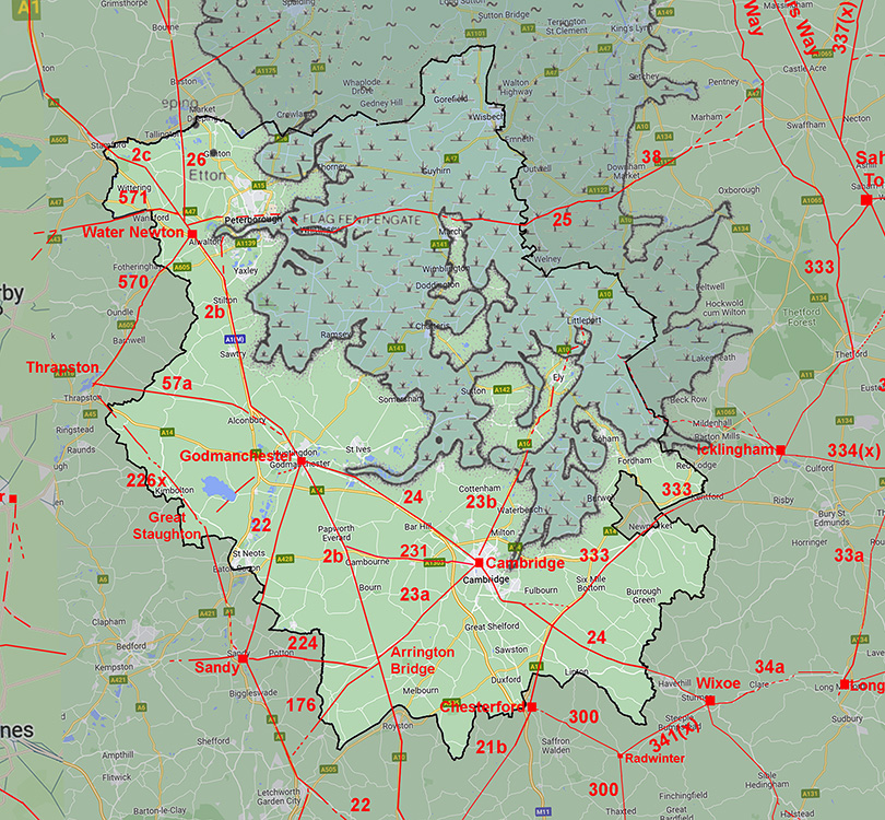
Akeman Street Roman Road from Cambridge to Ely and (probably) LittleportMargary Number: 23bDistance: 20 miles (to Littleport) Confusingly there are two Akeman Street Roman roads - this one is in Cambridgeshire. Cambridgeshire Akeman Street runs from Arrington Bridge, Wimpole on Ermine Street heading northeast to Cambridge and on via Ely to the Fens. This web page covers the section from Cambridge to Ely and probably onwards to Littleport. There was a Roman settlement at Littleport with high status buildings. It was located alongside the old course of the River Cam. Its connection further on to Denver is long suggested but there is no surviving visible evidence supporting this. Instead the old River Cam would have provided onward waterborne communications.
|
Historic Counties: Cambridgeshire Current Counties:Cambridgeshire HER: Cambridgeshire
|
|
|
|
|
|
Lidar Image - Full Route The route as far as Ely is fairly certain but the course on to Littleport a little speculative. The latter seems logical as that could, as its name suggests, have been a port (in Roman times) out to sea. A road connection on to Denver appears unlikely as from Littleport north there is no high ground or a suitable rodden to keep a dry line. |
Click for larger view
|
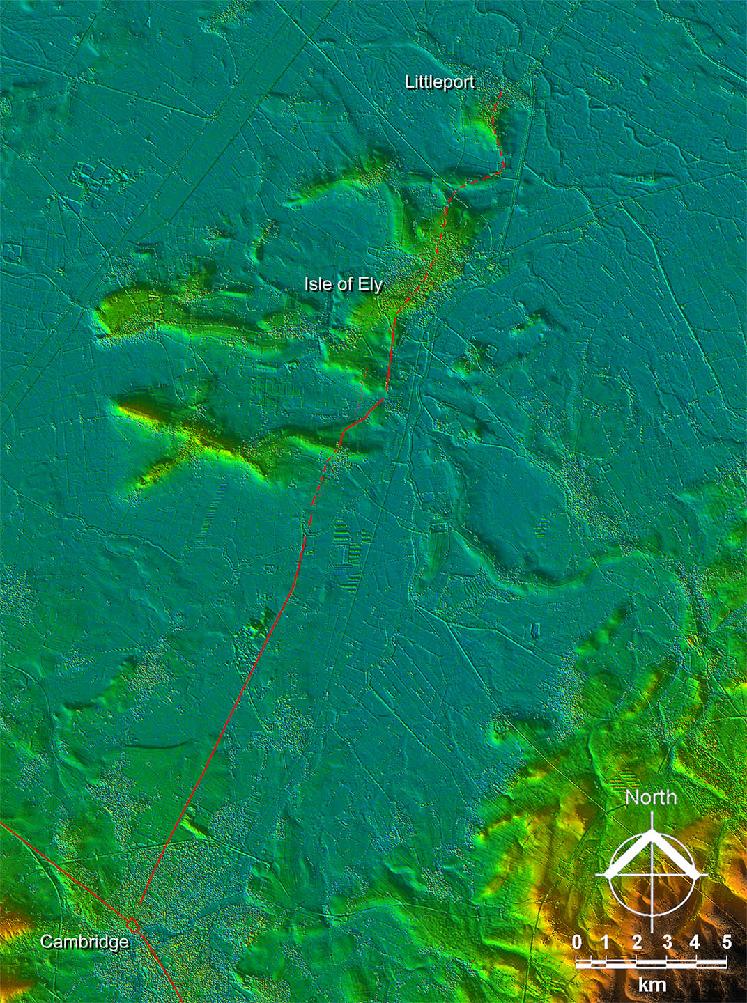 |
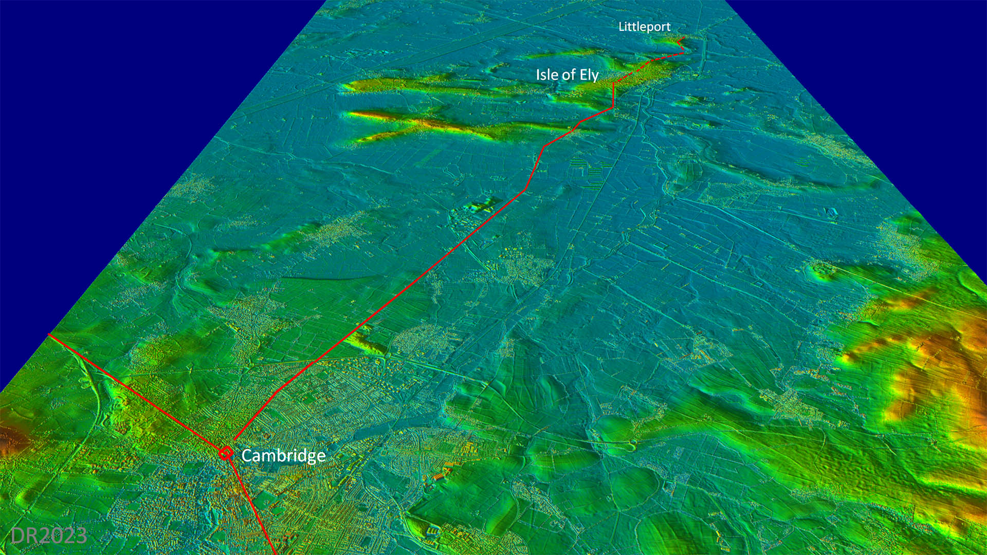
Oblique 3D Lidar Image - looking north Very much island hopping and sticking to high ground wherever possible. Ely of course was known as Isle of Ely and you can see why. The Roman Lark Canal heads to a very nearby location (Prickwillow) so perhaps there was a Roman port at Littleport.
|
Click for larger view |
 |
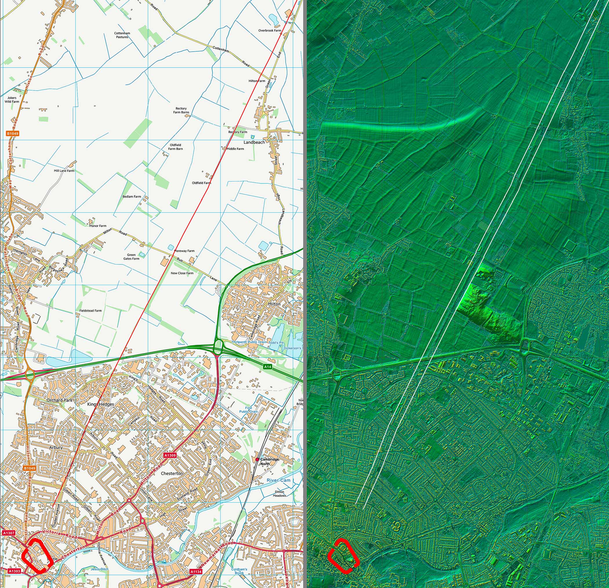
Lidar Image and Route Map 1 Probably left the north-east gate of Cambridge Roman town although the first section is not recorded. |
Click for larger view |
 |
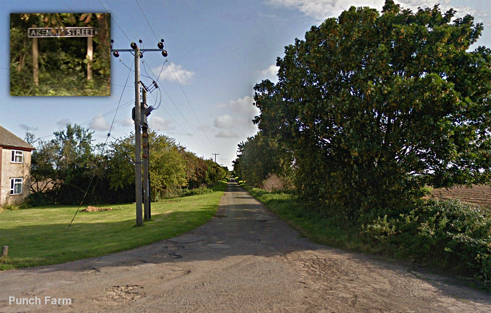
Akeman Street passing Punch Farm, Landbeach Unmistakebly Roman! Wide and straight passing Punch Farm and the name plate with Akeman Street on it confirms it. |
Click for larger view |
 |
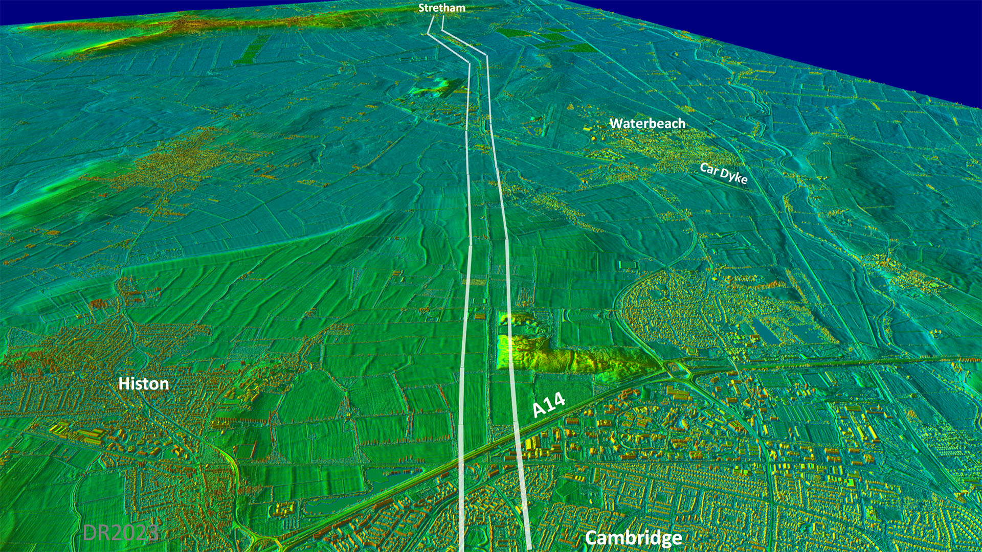
Oblique 3D Lidar Image - Passing Waterbeach Very obvious and very direct once the road has left Cambridge. Passing Waterbeach the road would have crossed the Car Dyke.
|
Click for larger view |
 |
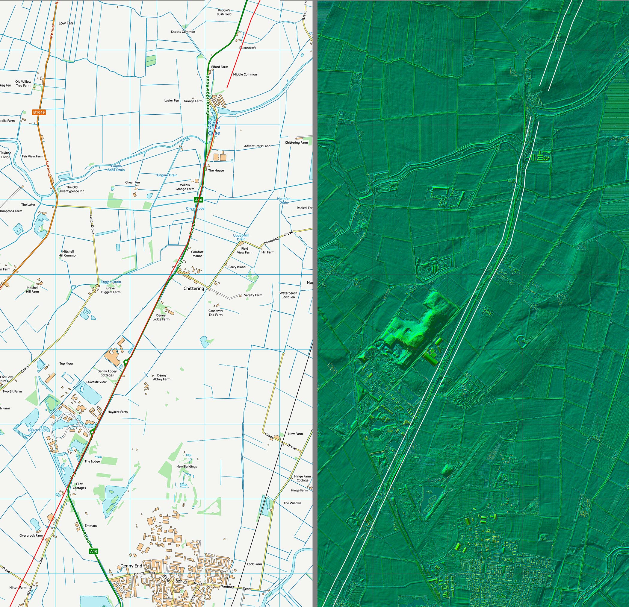
Lidar Image and Route Map 2 The old River Great Ouse was the primary obstacle on this stretch and the Roman line was probably more direct than the modern A10. |
Click for larger view |
 |
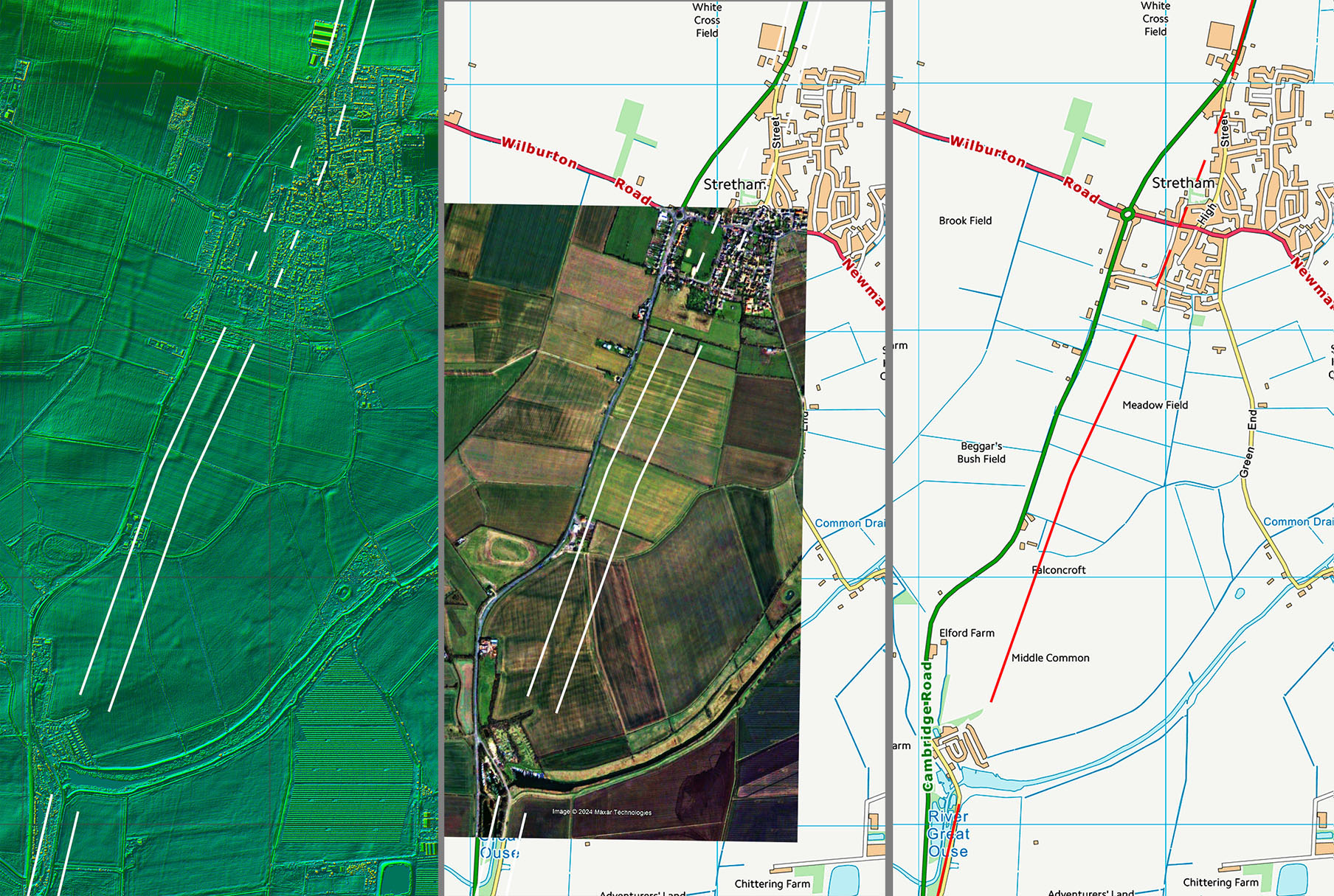
Approach to Stretham- Lidar and historic aerial photographs The Roman line is in the fields east of the A10 approaching Stretham The old road to Sretham Bridge Ferry on the River Great Ouse marks the line and aerial photos and lidar show the line to Stretham village. Aerial photo - montage of GoogleEarth historicc aerials. |
Click for larger view |
 |
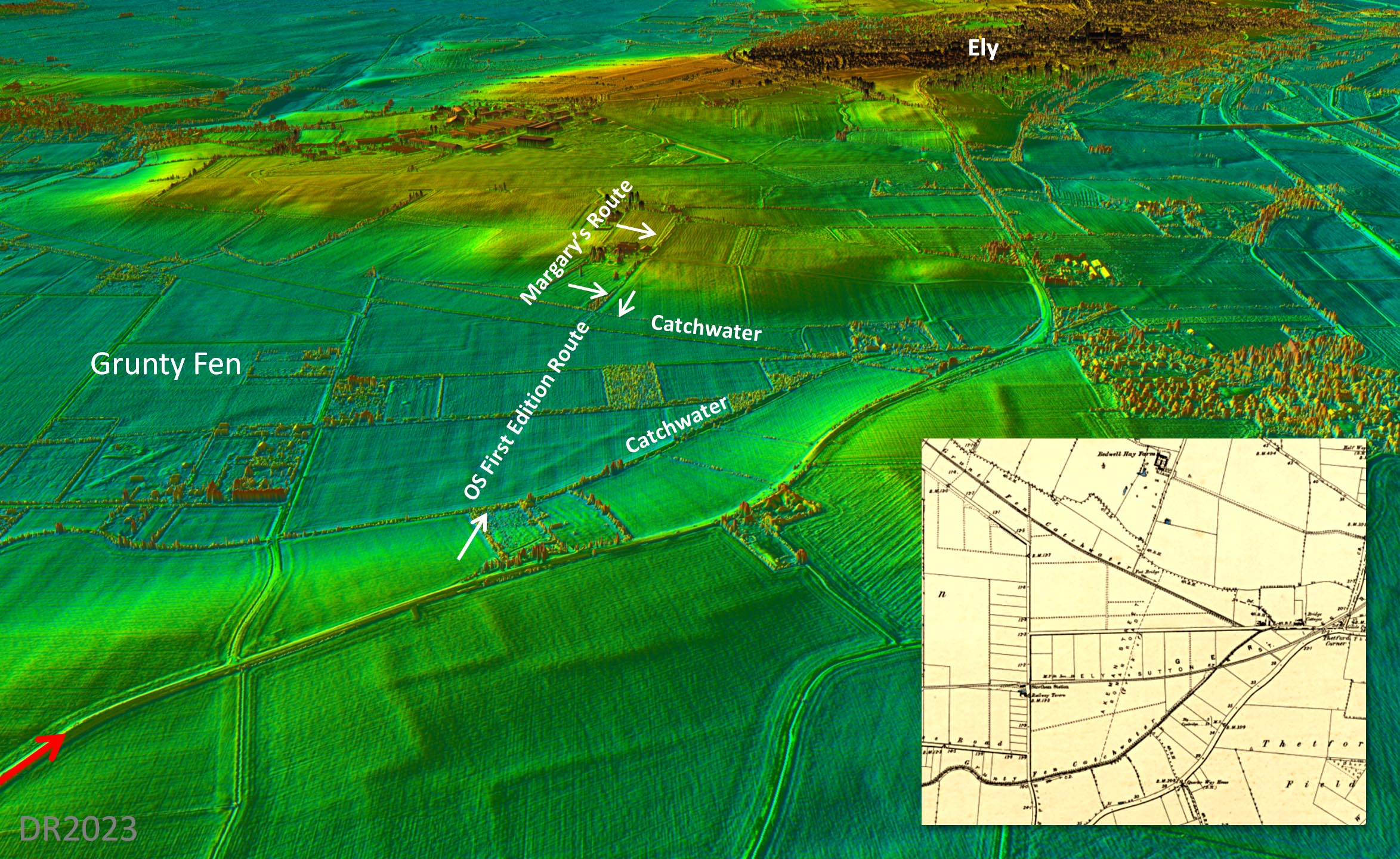
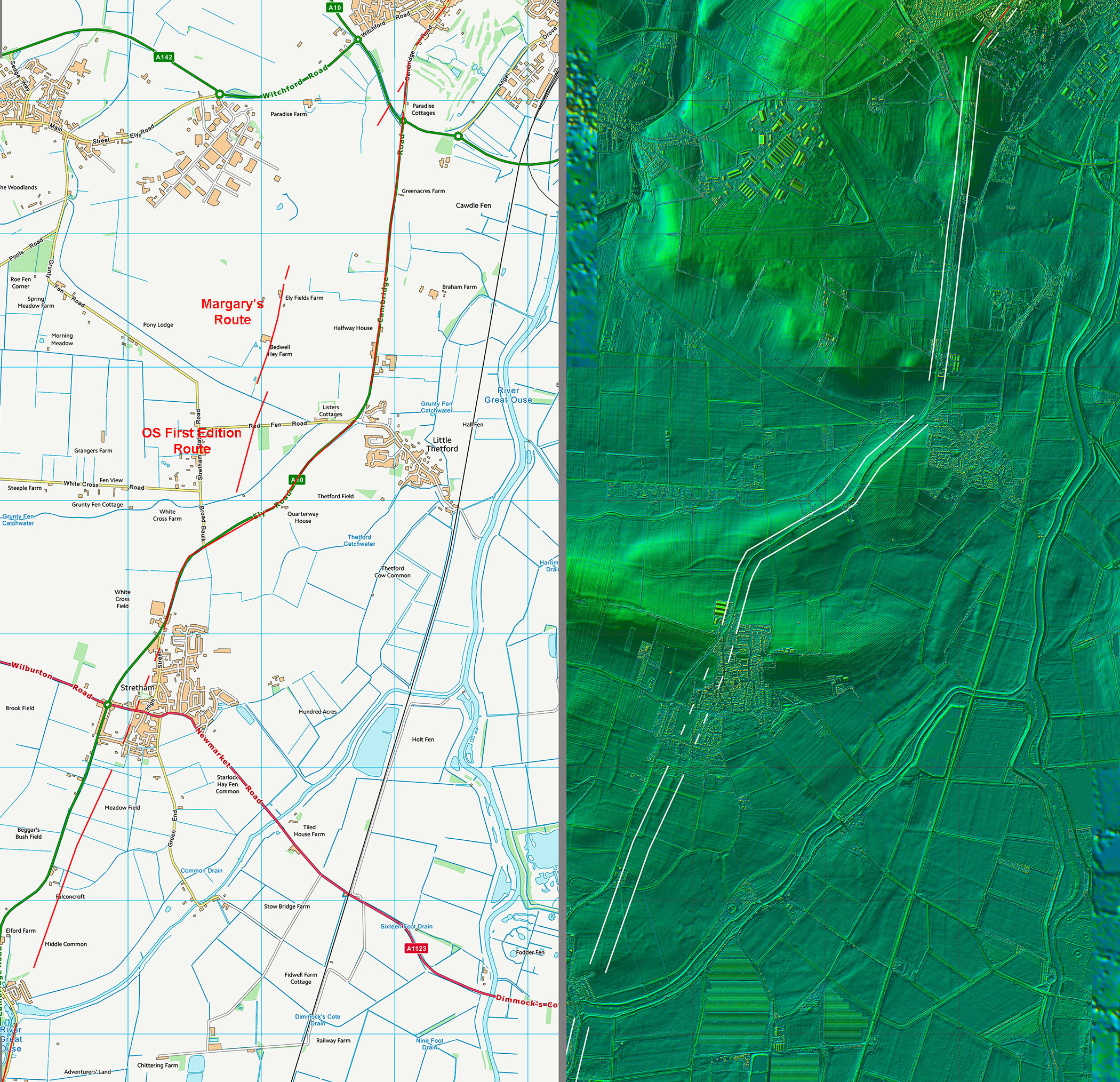
Oblique Lidar Image & OS First Edition Map - Grunty Fen Both the OS route and Margary's route cross Grundy Fen whereas the modern road follows higher ground. Grundy Fen has clearly been drained in more modern times with catchwater cutoff drains north and south. Before these drains then the Fen would surely have been too wet for the Romans. The catchwater drains wouldn't have been cut unless they were needed. In addition the OS and Margary routes don't align further casting doubt on any route taking that course. The route followed by the modern A10 is surely more likely to be the Roman line. Longer yes but certainly drier.. |
Click for larger view |
 |
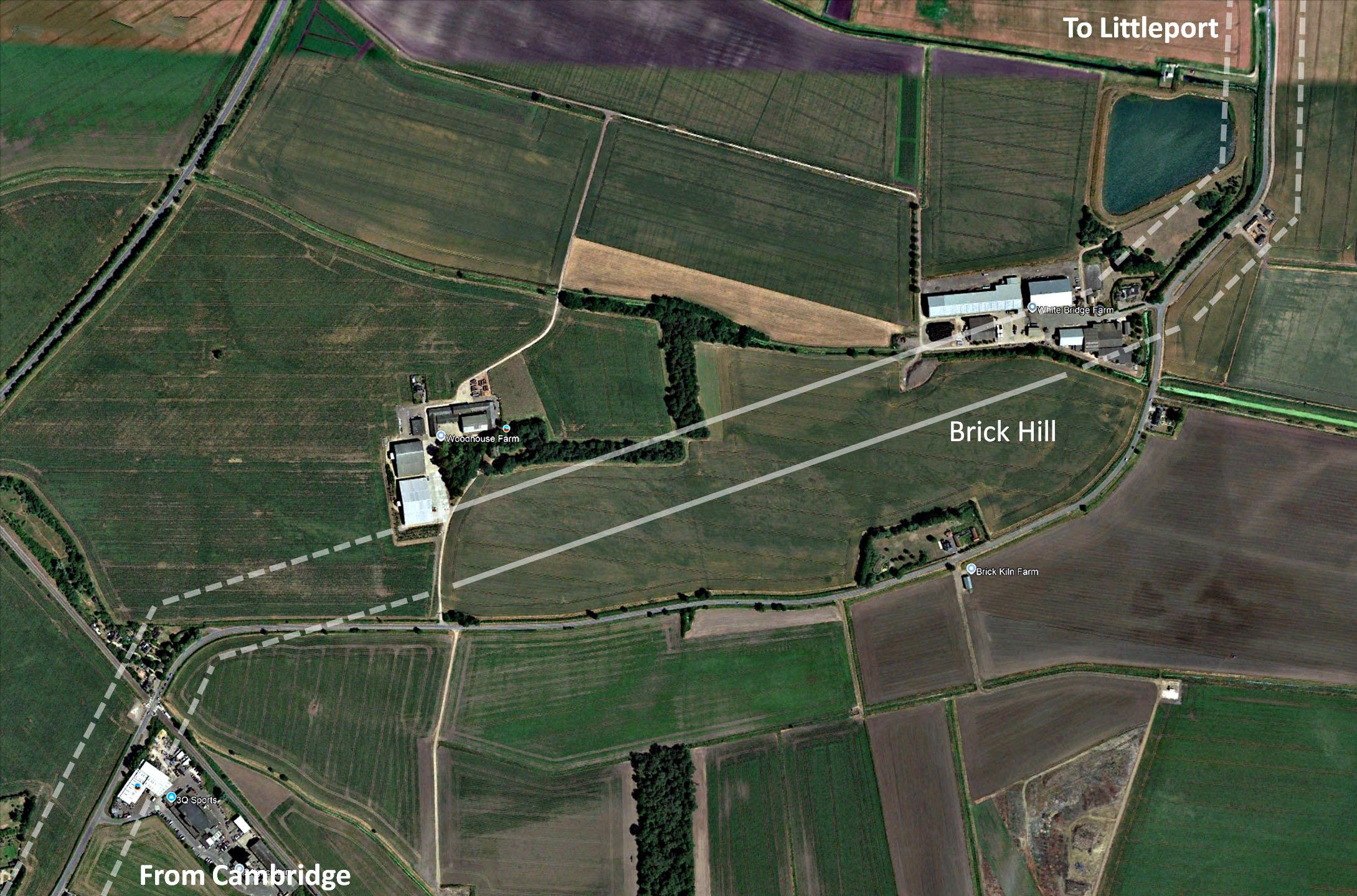
North of Ely - Brick Hill North of Ely to Littleport then the course of the road has little option but to follow an indirect route, bascially "island hopping". This route is mostly covered by the modern road, Ely Road, but at Brick Hill there is some faint evidence on historical aerial photographs that the Roman line could well have been more direct. Image: GoogleEarth historical aerial photograph |
Click for larger view |
 |
Lidar Image and Route Map 3 This is the plan view of the above. The A10 must be favourite.. |
Click for larger view |
 |
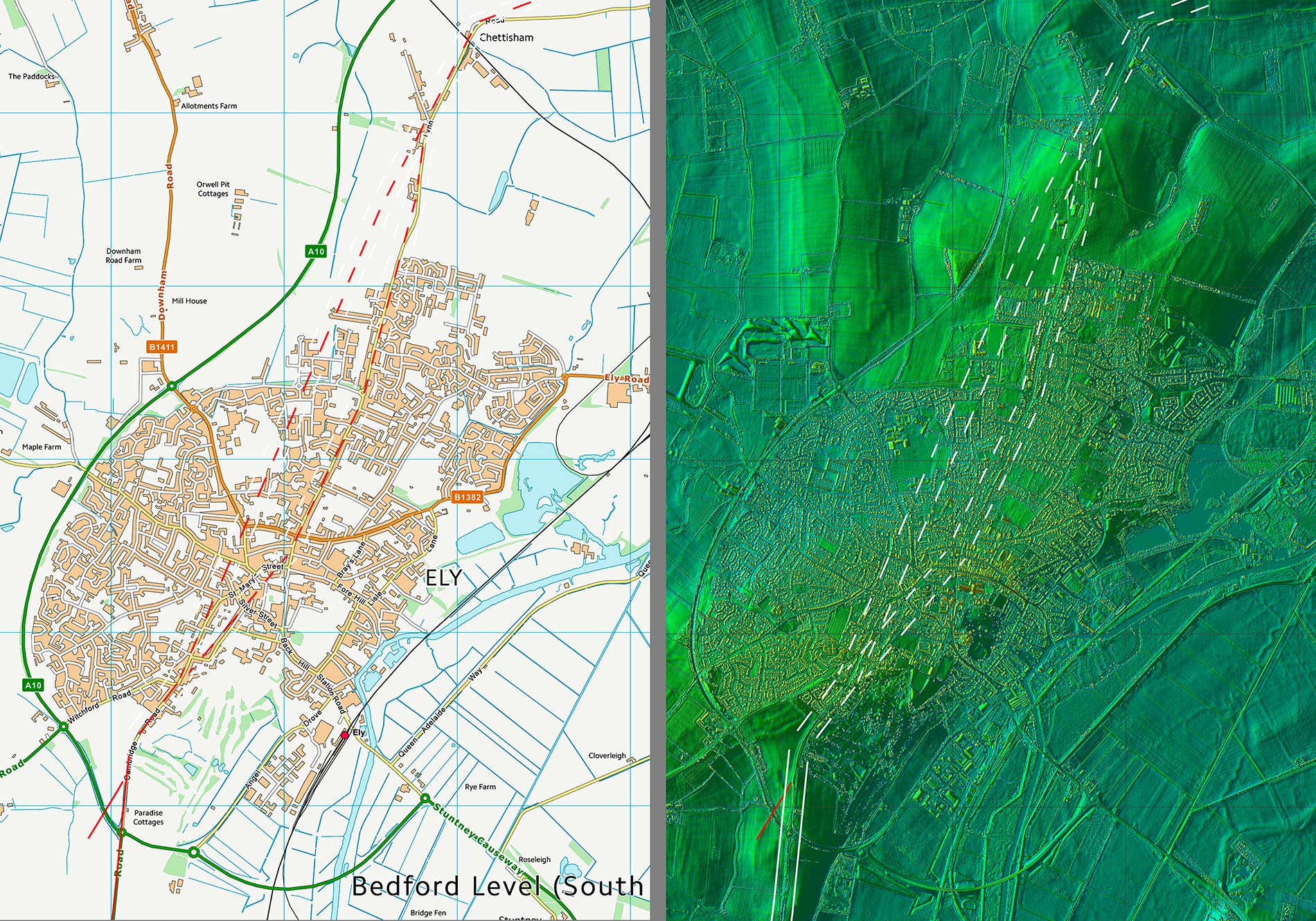
Lidar Image and Route Map 4 - Ely Two options across Ely. The one followed by the modern road is on higher ground so is perhaps the more likely. |
Click for larger view |
 |
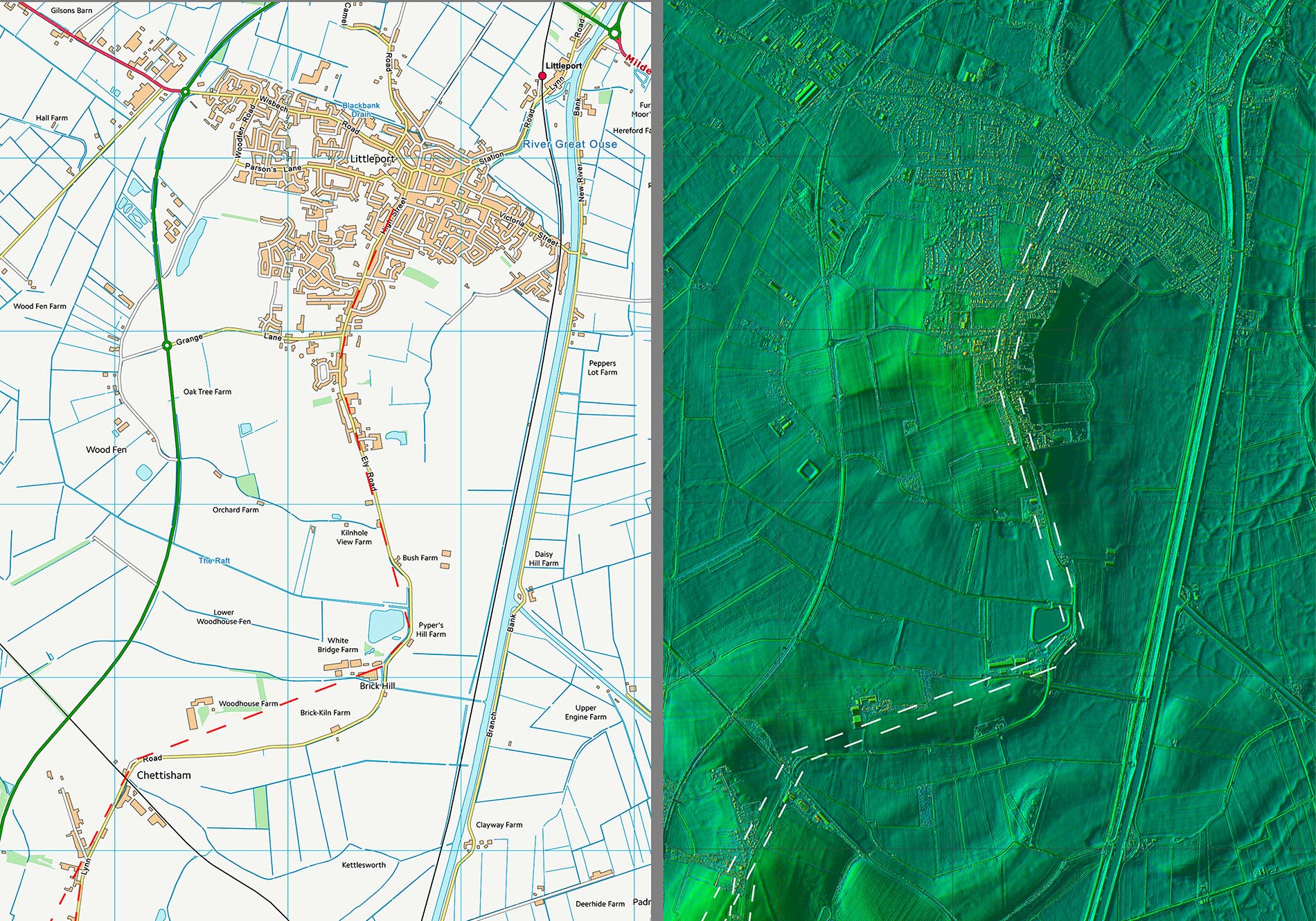
Lidar Image and Route Map 5 - Littleport Littleport was the last dry ground heading north - well at least until the Fends were drained. The Roman settlement at Littleport was located alongside the old course of the River Cam and included high status Roman buildings (Roberts, 1997). Further excavations there found a channel 25-30 metres wide and 2.4 metres deep, “possibly artificial or enhanced”, again with Roman material found throughout the fills (Kenney, 2001). In reality there can be little doubt that Littleport was the ultimate destination of Akeman Street. |
Click for larger view |
 |
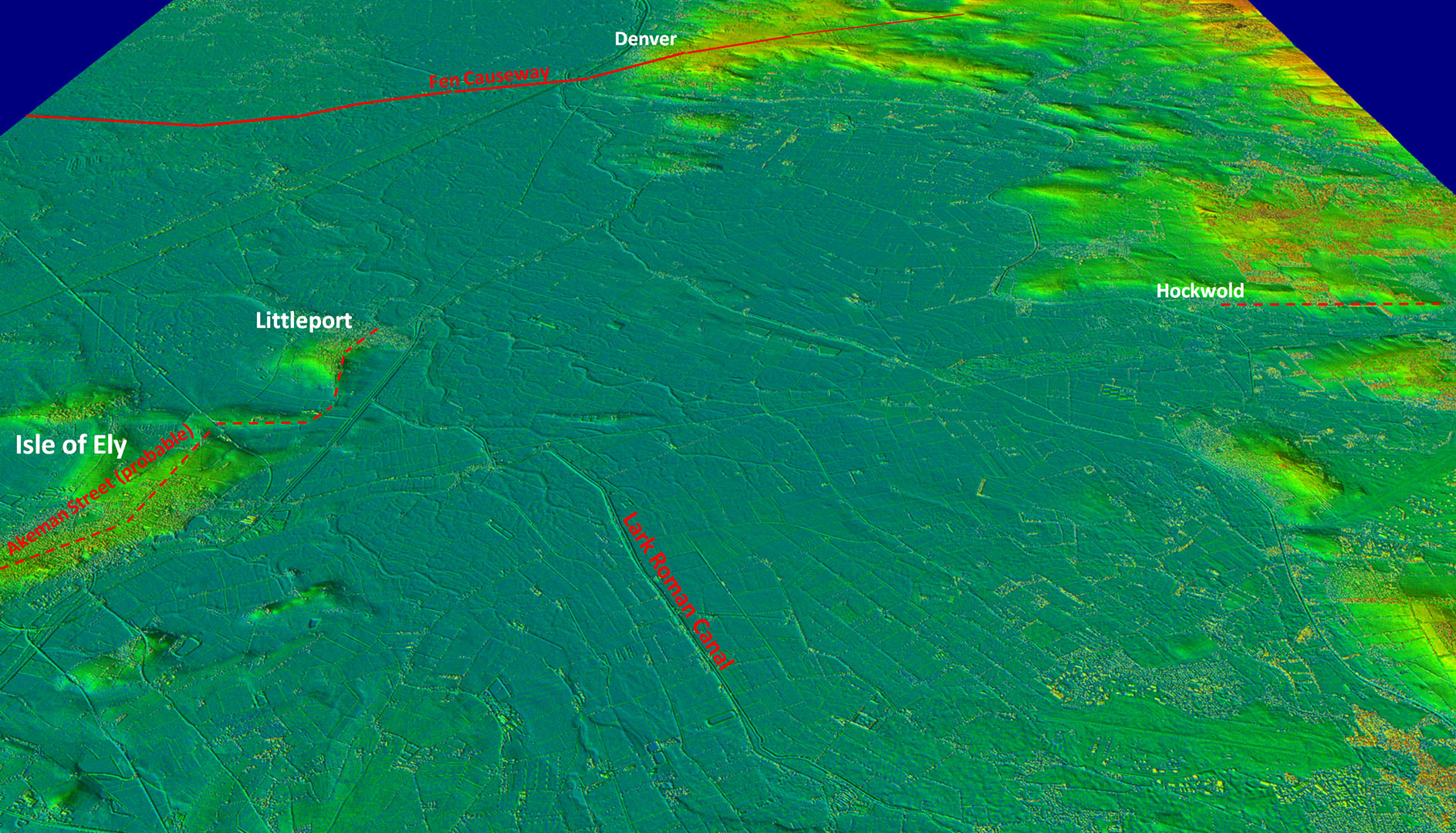
Oblique 3D Lidar Image - Littleport to Denver Denver looks tantalisingly close but probably well out of reach being impractical for Roman road building. From Littleport onwards it would have been boat traffic only. |
Click for larger view |
 |
|
|
|
Last update: April 2025 |
© David Ratledge |