|
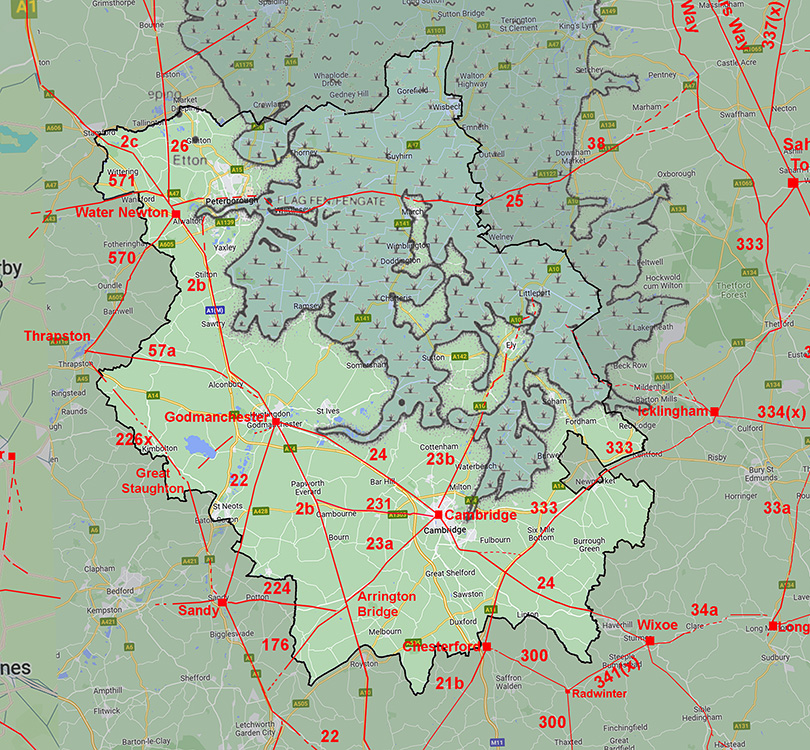
The Roman Road from Cambridge to Arrington Bridge, WimpoleMargary Number: 23aDistance: 10 miles Shares the name Akeman Street with the road to Ely. It is now understood that Arrington Bridge was a Roman roadside settlement on Ermine Street but the road was probably there first and the settlement would have grown around what would become an important road hub with 5 routes joining.
|
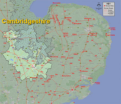
Historic Counties: Cambridgeshire Current Counties:Cambridgeshire HER: Cambridgeshire
|
|
|
|
|
|
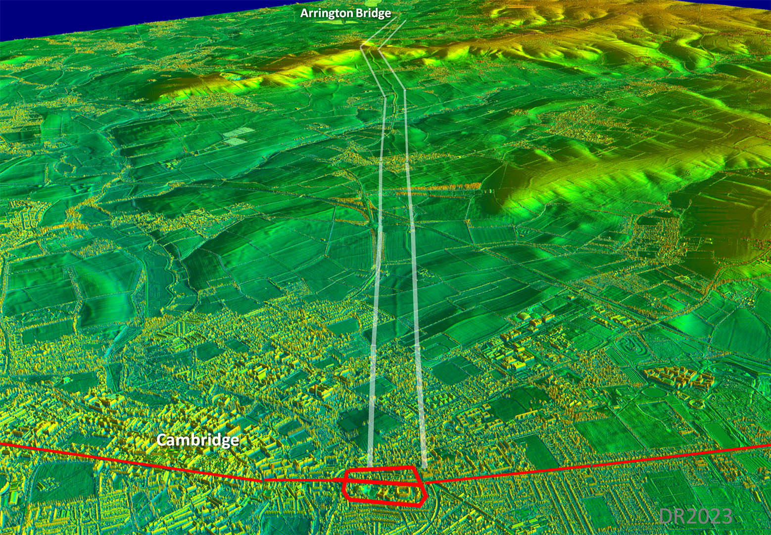
Lidar Image - Full Route Very sensible and direct route to connect Cambridge to Ermine Street for southern destinations or westwards to Sandy or Stotford. |
Click for larger view
|
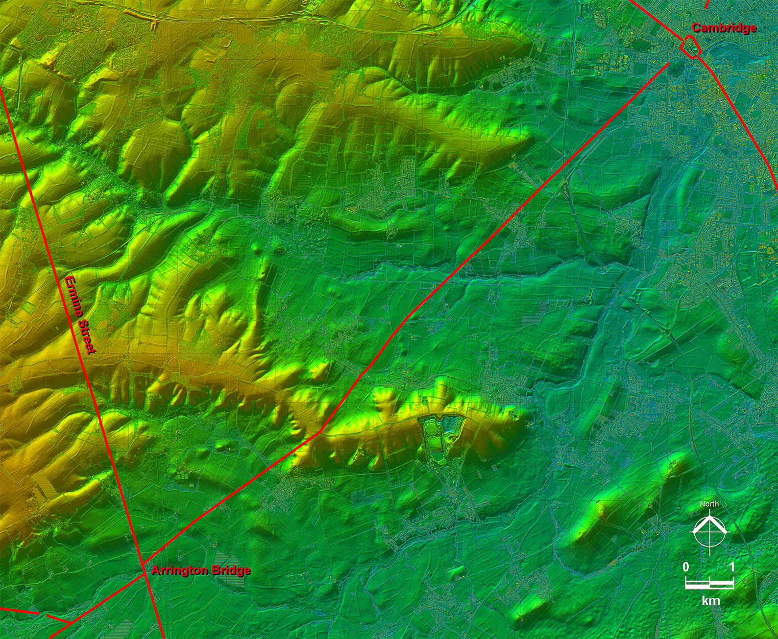 |
Oblique 3D Lidar Image The alignment couldn't really be much simpler with just a little dog-leg to negotiate the ridge of higher ground |
Click for larger view |
 |
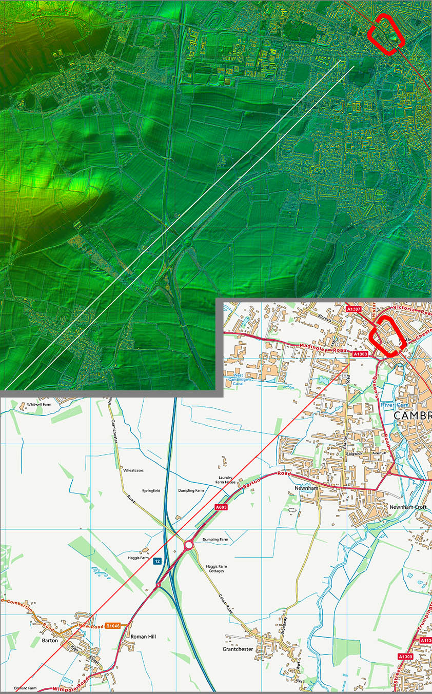
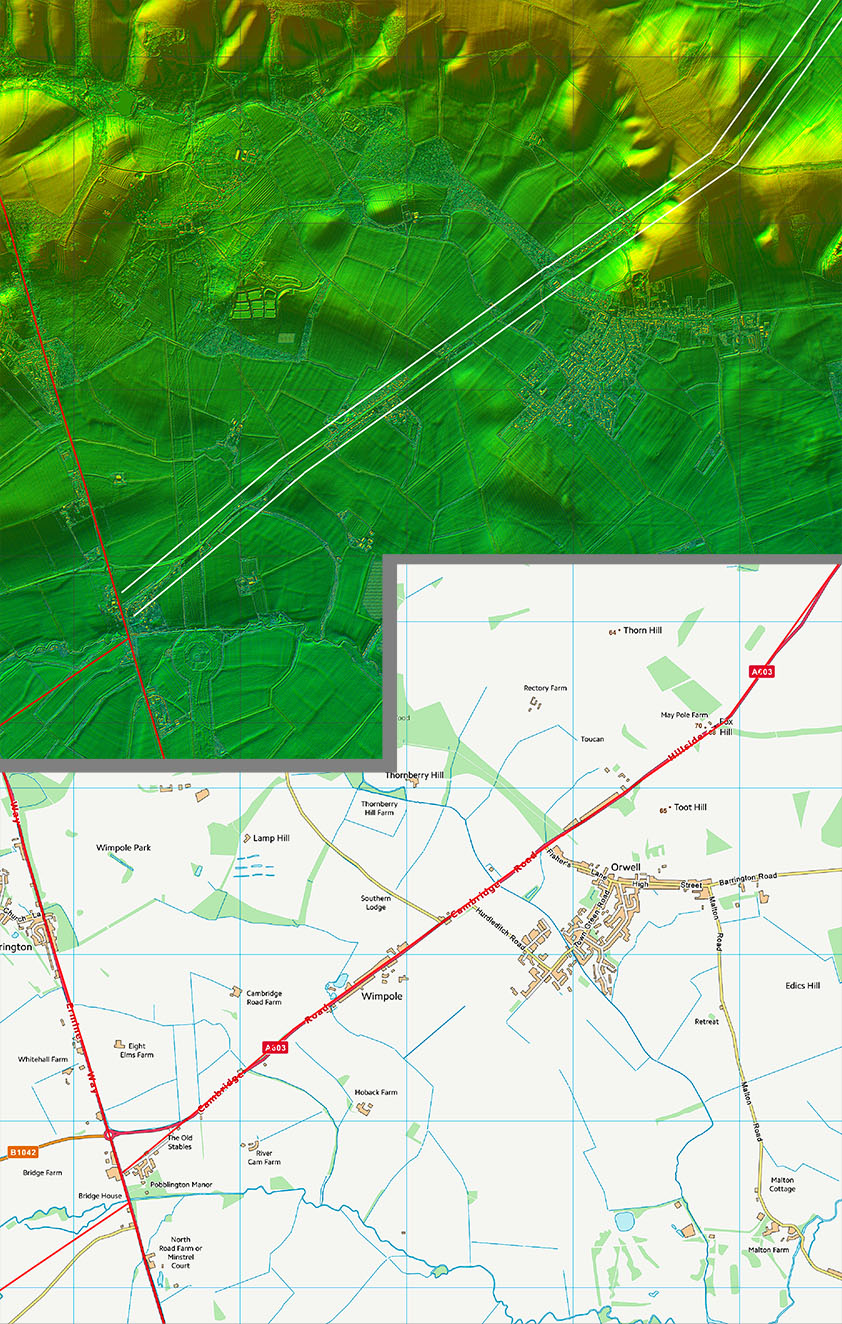
Lidar Image and Route Map 1 Leaving Cambridge the Roman line is much more direct than the modern A603, which takes a huge detour. |
Click for larger view |
 |
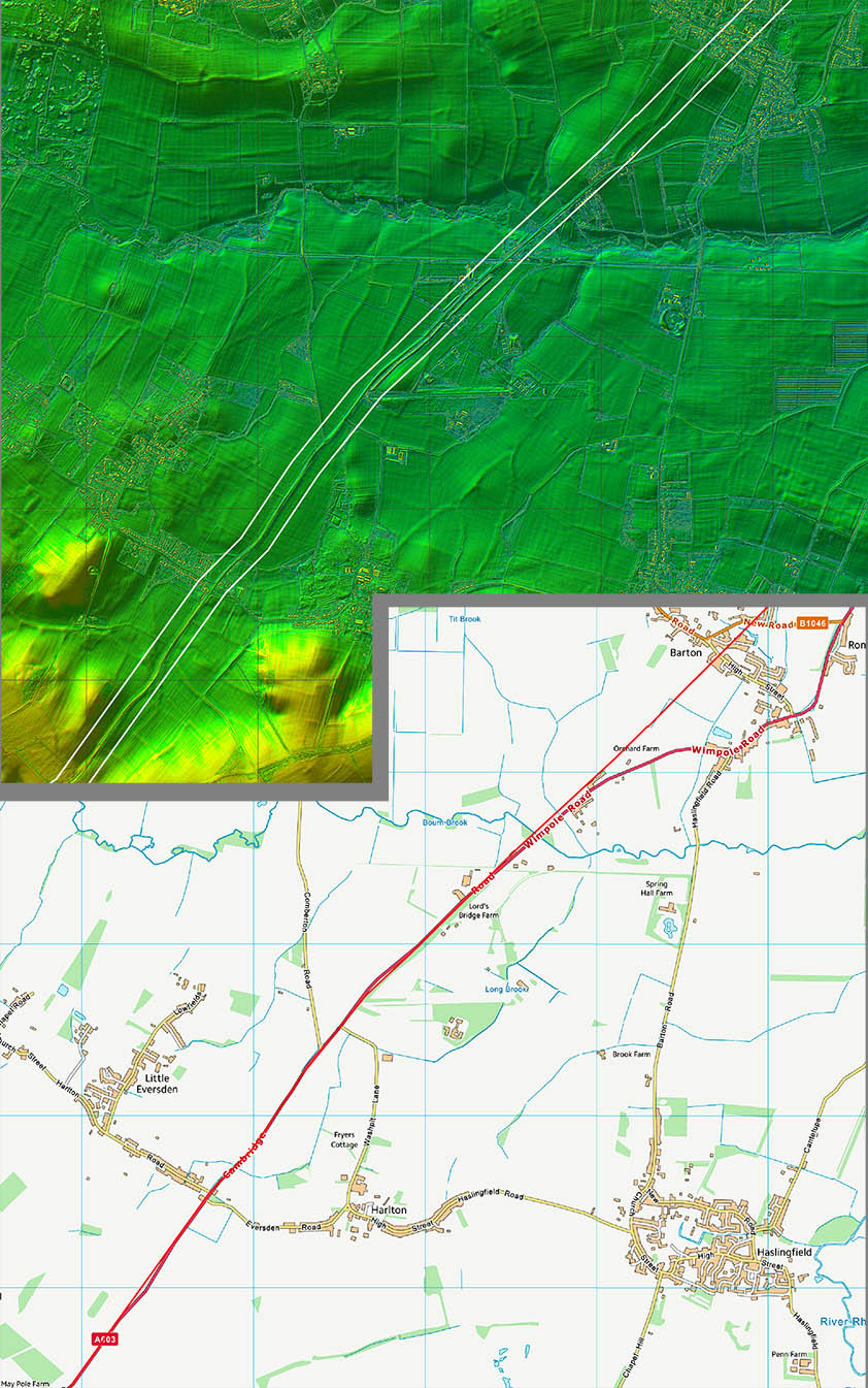
Lidar Image and Route Map 2 The Roman line and the A603 merge at Lord's Bridge Farm and from there on there is little Roman evidence to see. |
Click for larger view |
 |
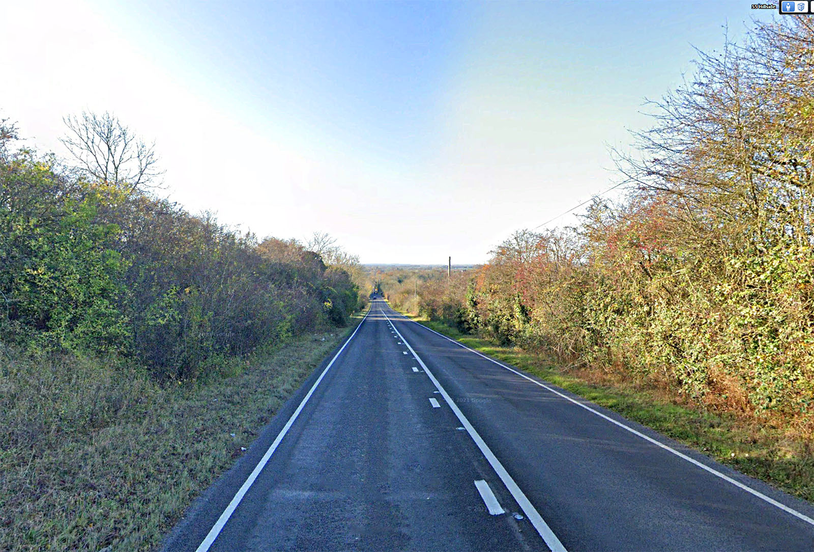
Descent from Orwell Hill, Hillside Very typically Roman - wide and straight. |
Click for larger view |
 |
Lidar Image and Route Map 3 The A603 now leaves the original Roman alignment just before it reaches Ermine Street. The old road is now a cul-de-sac. |
Click for larger view |
 |
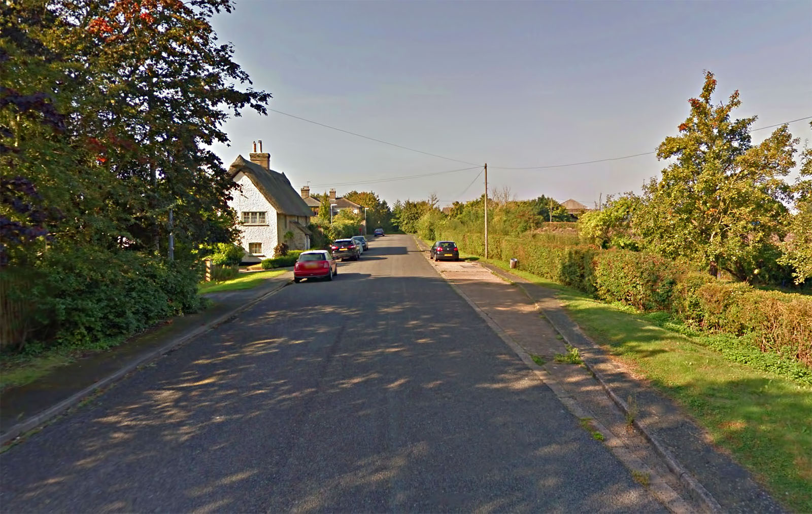
Cambridge (Old) Road, Wimpole Now nice and quiet with the A603 diverted off line. |
Click for larger view |
 |
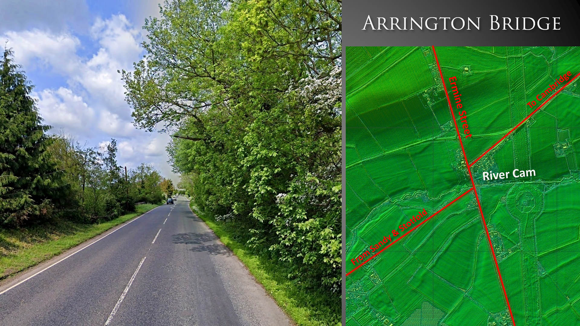
Arrington Bridge Arrington Bridge was an important road junction with roads from Cambridge, Sandy and Stotford all met Ermine Street and shared a common bridge over the River Cam. |
Click for larger view |
 |
|
|
|
Last update: Jan 2024 |
© David Ratledge |