
|
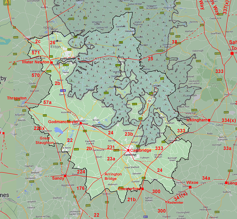
The Roman Road from Arrington Bridge to StotfoldMargary Number: 176Distance: 10 miles An argument could be made for this road really being a continuation of Margary 23 (Akeman Street) from Cambridge. It certainly continues that road's general alignment. Evidence is strong for all but the last mile to Stotfold and Ermine Street. Viatores suggested a similar road RR176 but it wandered all over the place and very little of their route is actually correct. I have however adopted their road number.
|
Historic Counties: Cambridgeshire & Hertfordshire Current Counties:Cambridgeshire & Hertfordshire HER: Cambridgeshire & Hertfordshire
|
|
|
|
|
|
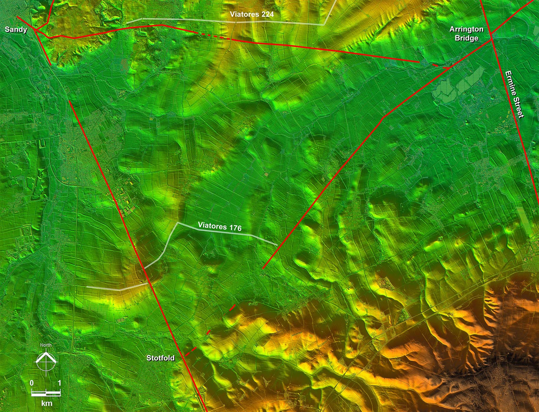
Lidar Image - Full Route Clearly the road to Stotfold was the earlier and the route to Sandy a later branch off it at the village of Wendy. The last section heading to Margary 22 at Stotford is a bit vague but little doubt that this was the road's destination. Viatores right-angled turn off the alignment was clearly wrong. |
Click for larger view
|
 |
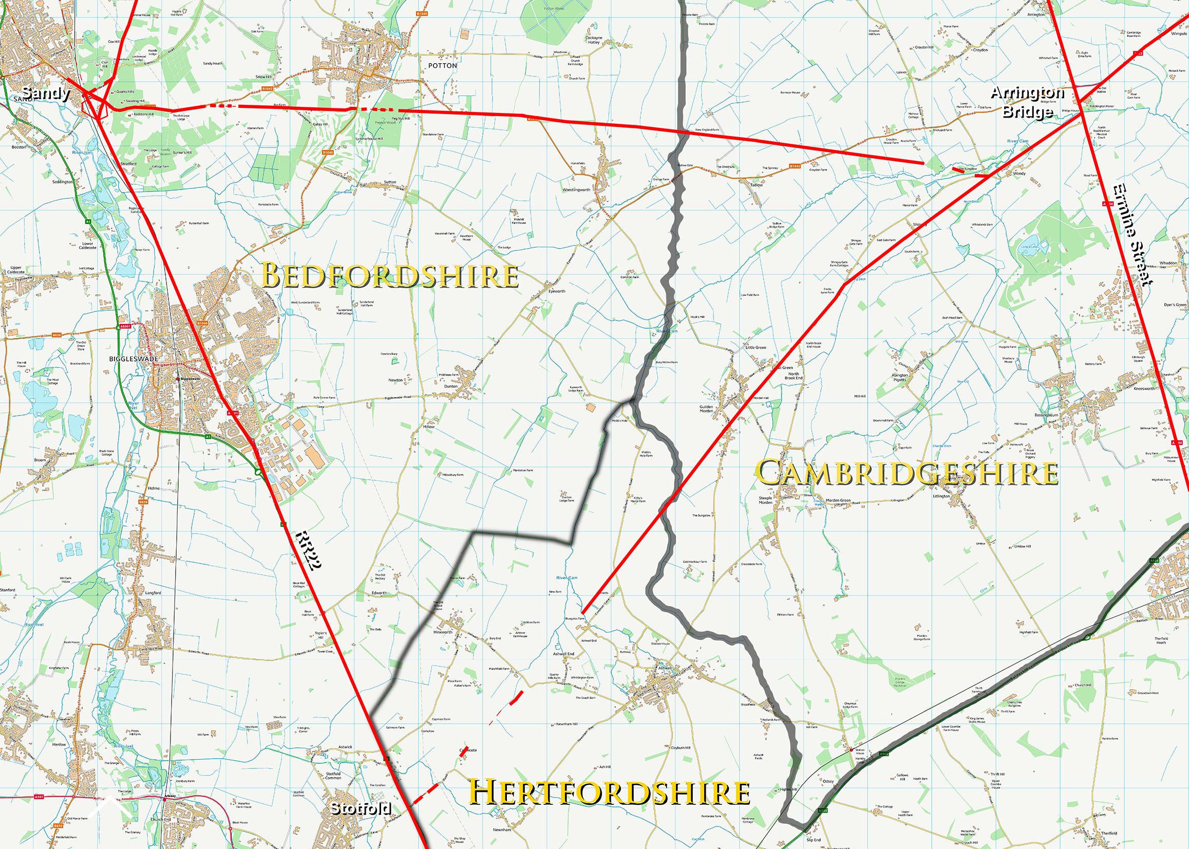
Arrington Bridge Roads - Routes Map equivalent to the above with county boundaries. |
Click for larger view
|
 |
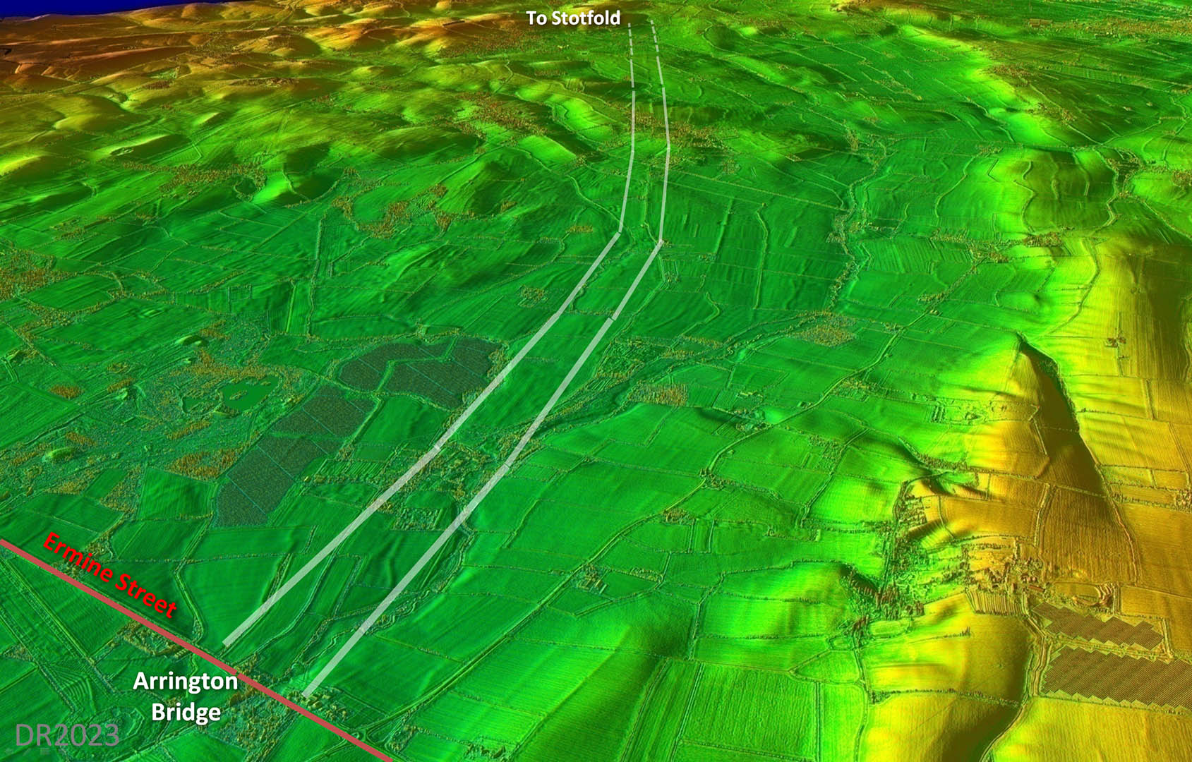
Oblique 3D Lidar Image, Arrington Bridge Just a slight dog-leg from a perfectly straight alignment. Only nearer Stotfold does the evidence become more intermittent.
|
Click for larger view |
 |
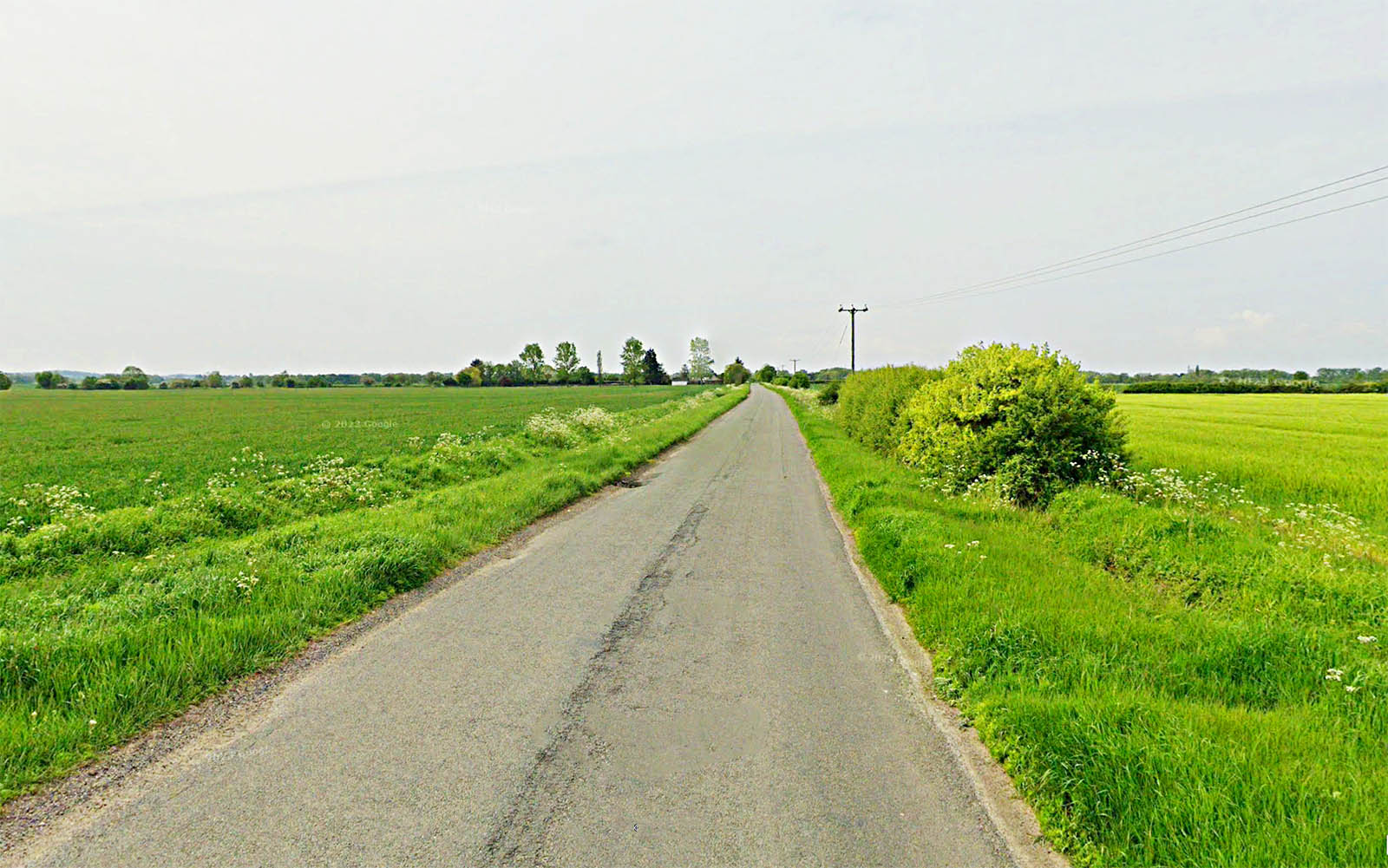
Flecks Lane This the first stretch where the modern road actually shares the Roman agger. We are near Flecks Lane Farm here looking towards Great Green. The width over the ditches is huge and gives the game away as to being the Roman road. |
Click for larger view |
 |
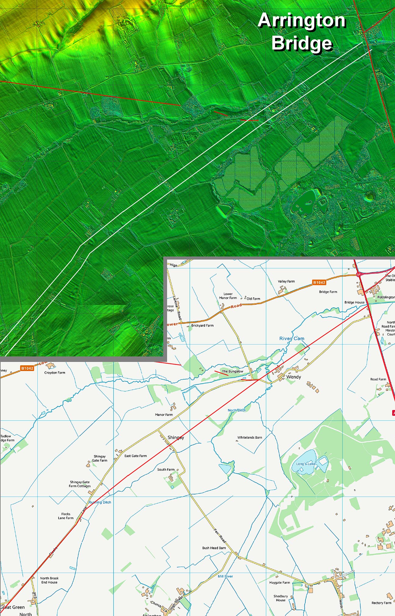
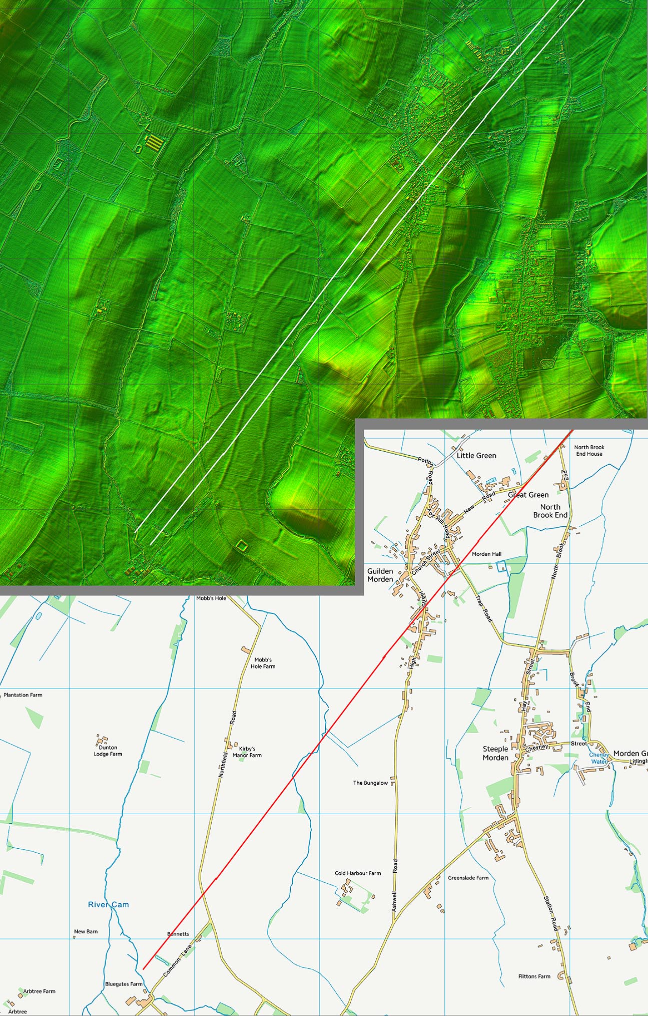
Lidar Image and Route Map 1 The Viatores in suggesting a route here following the modern road but in reality the Roman line is in the fields until Flecks Lane Farm (see above). |
Click for larger view |
 |
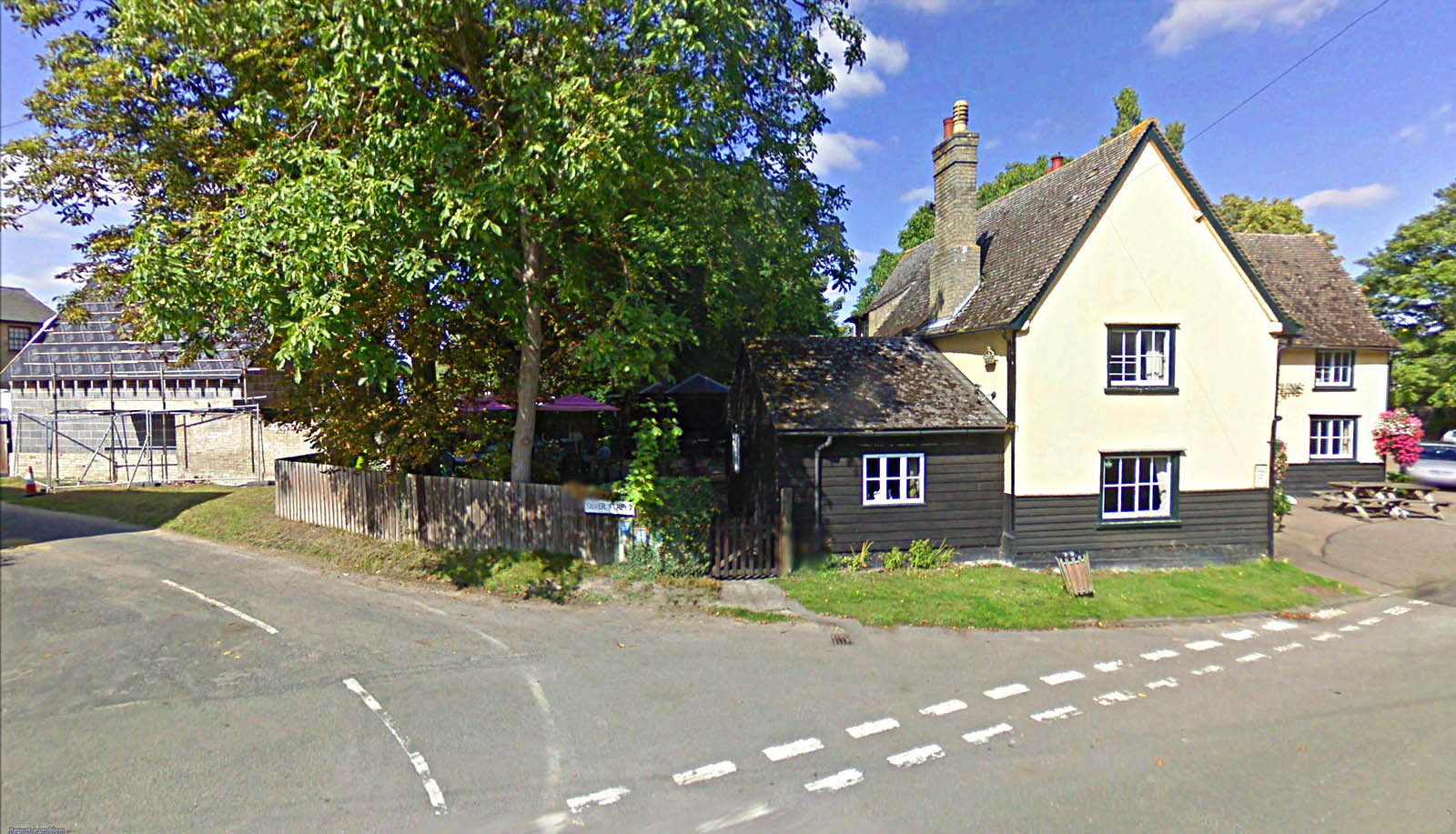
Silver Street, Guilden Morden The short Silver Street (heading off left) marks the Roman line in Guilden Morden, by the the Three Tuns Pub. The footpath of Church Lane also follows the Roman course (off picture to the right). |
Click for larger view |
 |
Lidar Image and Route Map 2 Beyond Great Green the road is generally running through the fields apart from Silver Street (above). The agger can be seen continuing past where Viatores thought it did a right angled turn northwards. |
Click for larger view |
 |
Lidar Image and Route Map 3 Enough clues I think to get the approximate course to Stotfold where it would have formed a junction with RR22. |
Click for larger view |
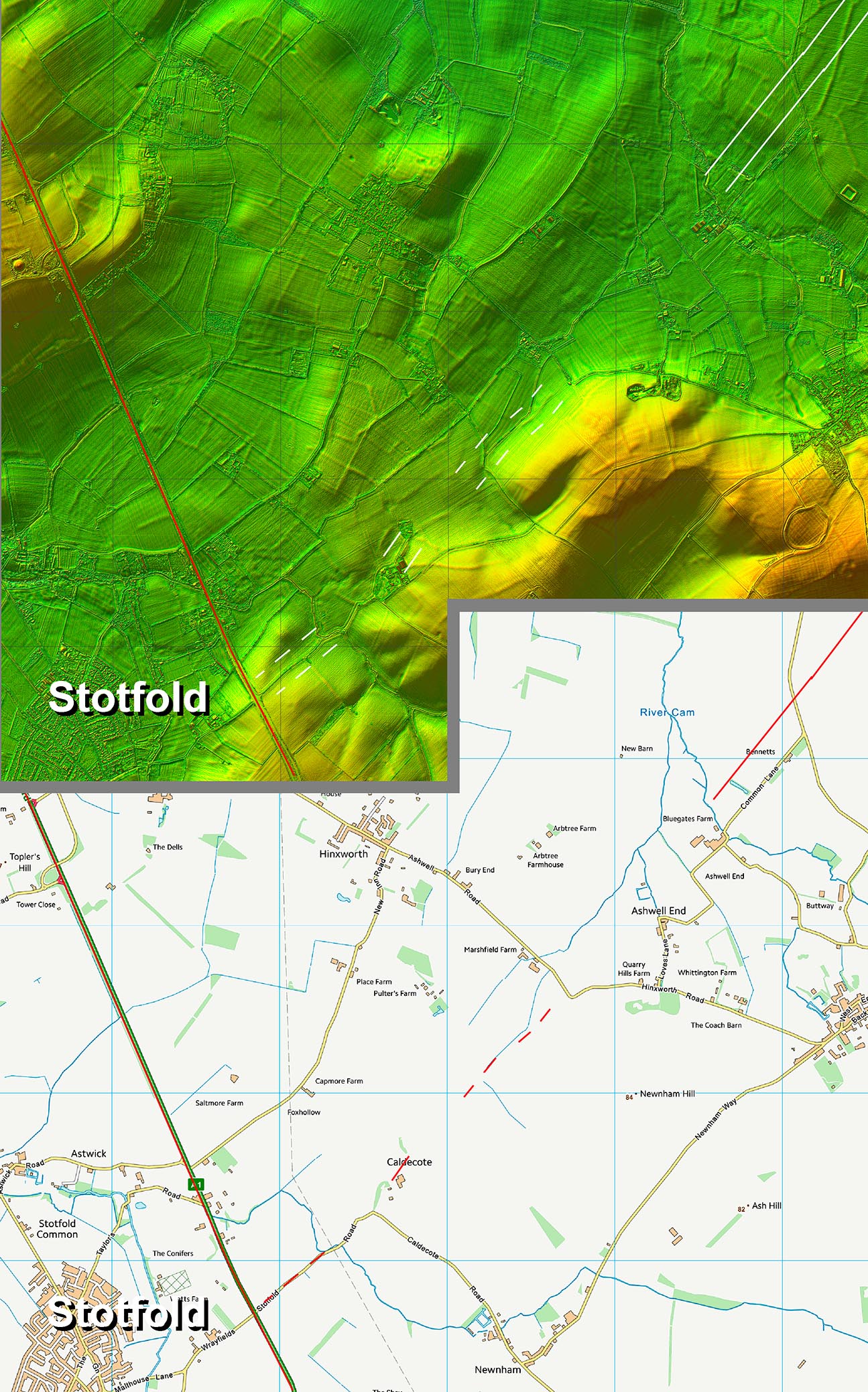 |
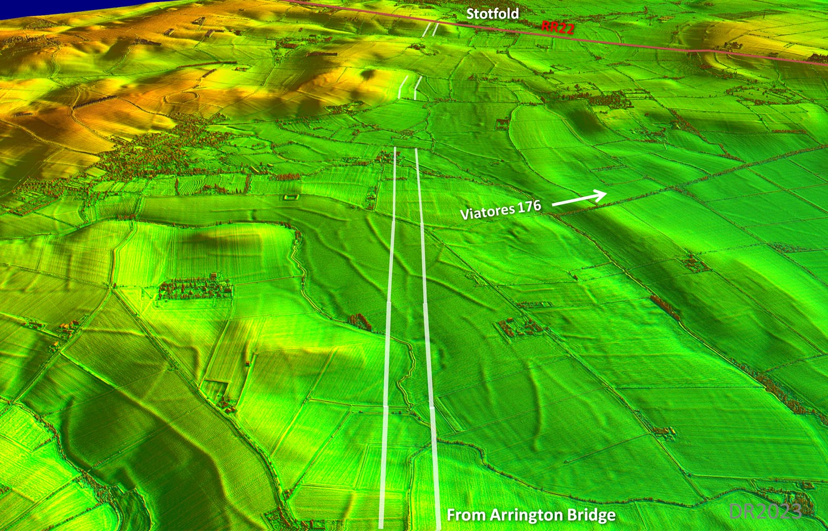
Oblique 3D Lidar Image - approaching Stotfold Intermittent clues but little doubt the road would have continued straight on to Stotfold.and Roman road 22 This is felt the more likely but....see below. |
Click for larger view |
 |
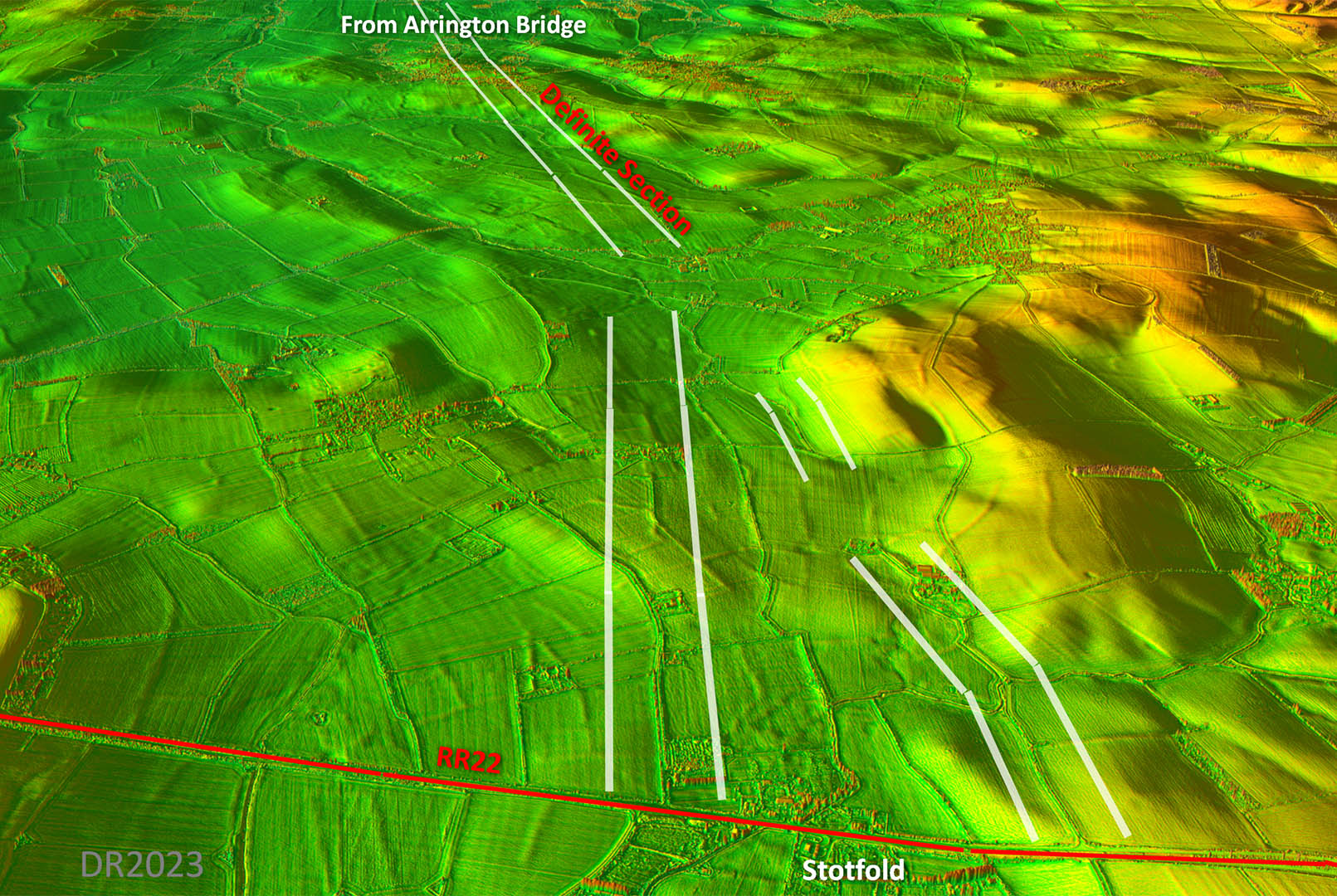
Oblique 3D Lidar Image - Stotfold Options Approaching Stotfold.and Roman road 22.then there are two options. The one I have depicted above is felt the more likely as it maintains the general direction of the road. However, there is another option (left0 which does have some evidence supporting it. |
Click for larger view |
 |
|
Last update: Jan 2024 |
© David Ratledge |