|
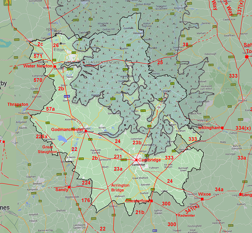
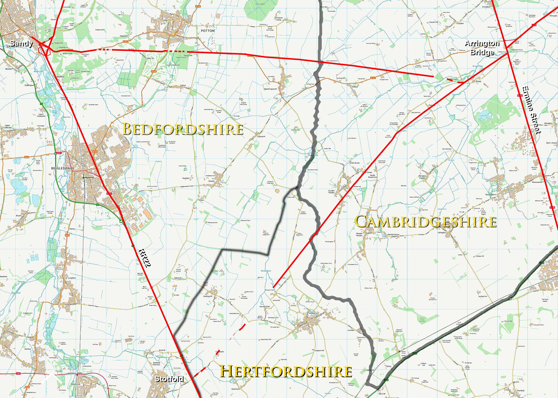
The Roman Road from Arrington Bridge to SandyMargary Number: 224Distance: 10.5 miles Sandy was a settlement of sufficient importance to have had a town wall so no surprise it was connected with a road to Ermine Street and onwards to Cambridge. Viatores recorded the Sandy end as RR 224 but wandered off course at Potton whereas the real route headed directly to Arrington Bridge.
|
Historic Counties: Cambridgeshire, Bedfordshire Current Counties:Cambridgeshire, Bedfordshire HER: Cambridgeshire, Bedfordshire
|
|
|
|
|
|
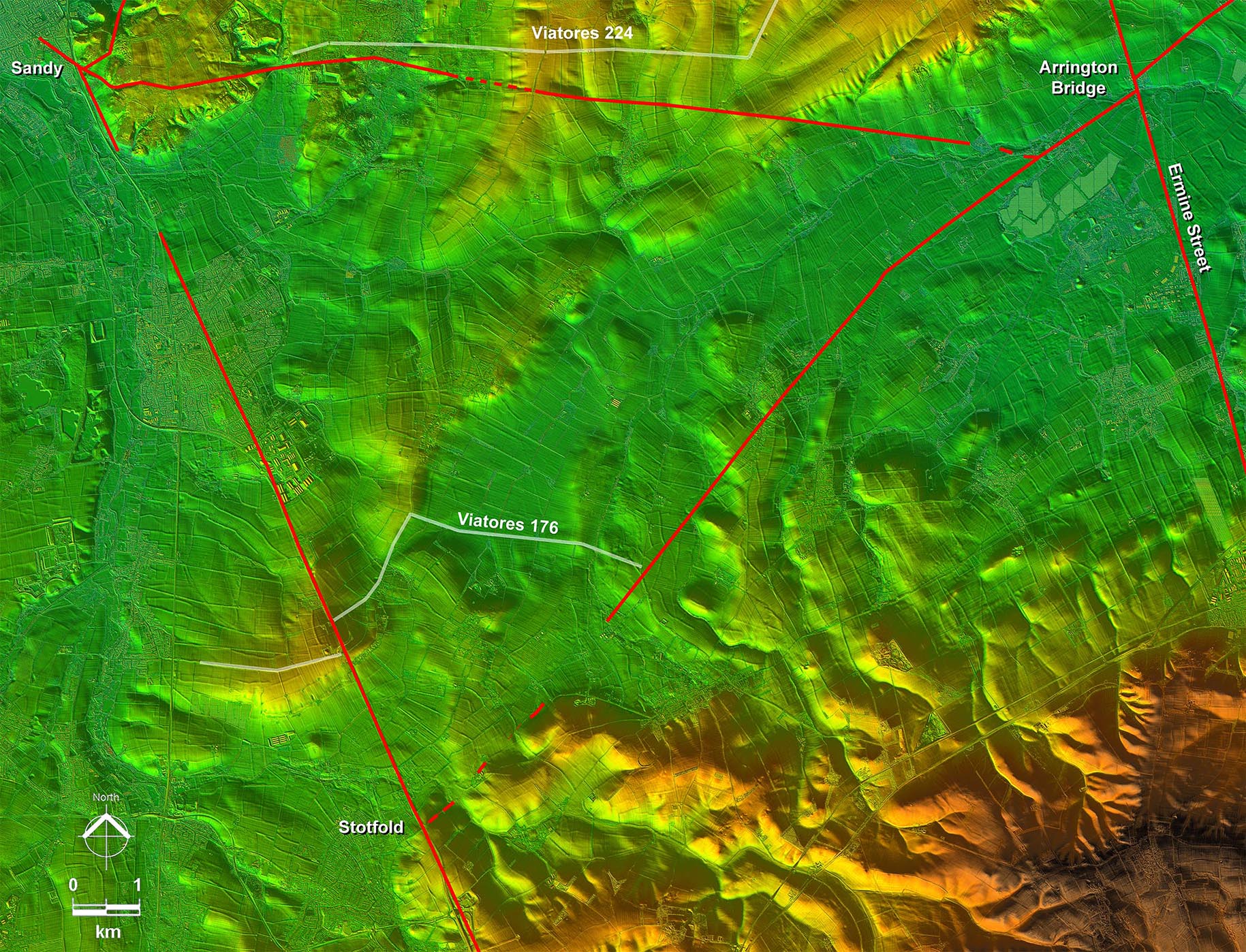
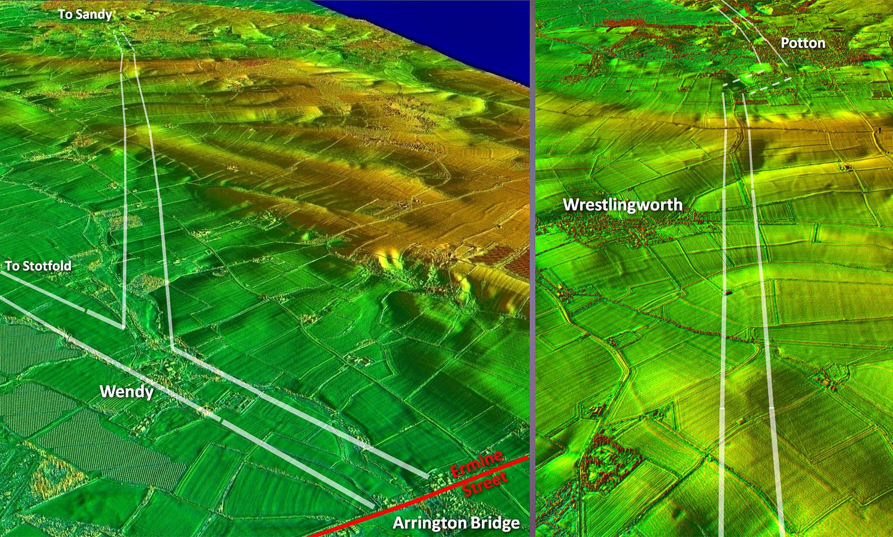
Lidar Image - Full Route The route to Sandy looks to be a branch off the road to Stotfold at the village of Wendy. A fairly direct route to the hills east of Sandy where a more contour based route was chosen to minimise the gradients. |
Click for larger view
|
 |
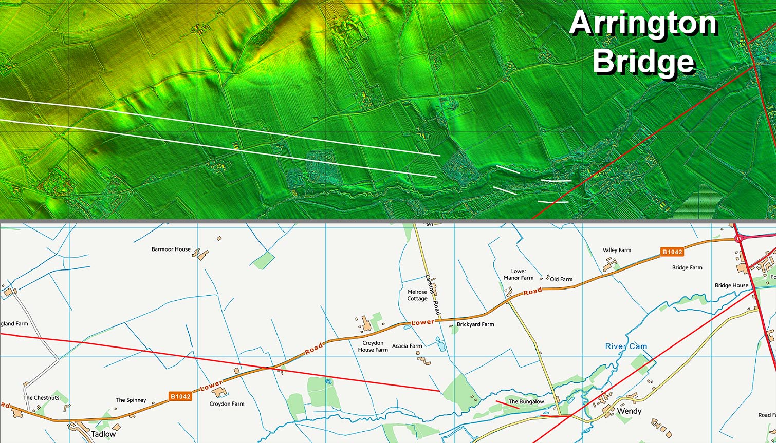
Arrington Bridge Roads - Routes Map equivalent to the above with county boundaries. |
Click for larger view
|
 |
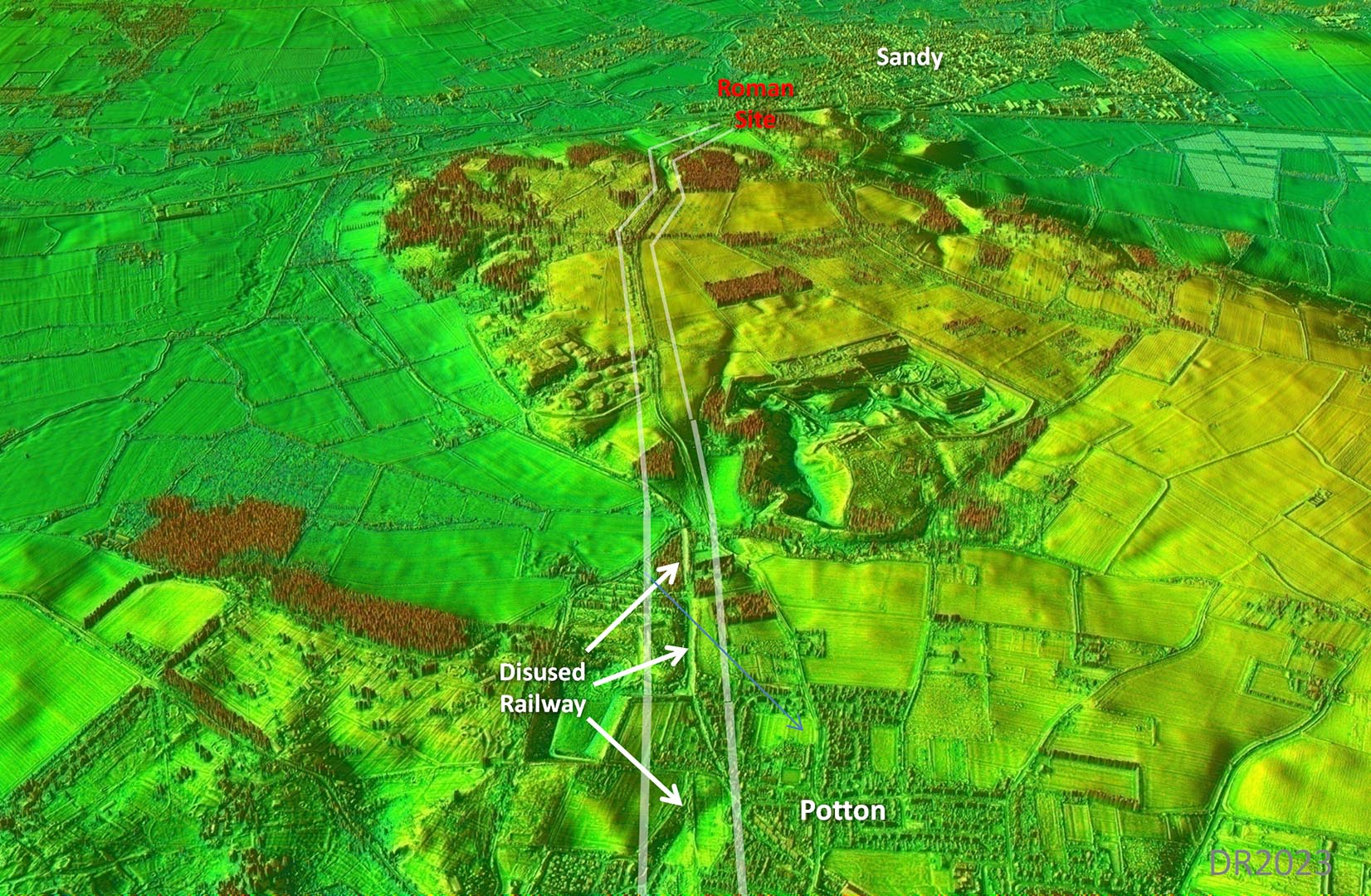
Oblique 3D Lidar Image - looking West After the branch off the Stotfold road then the River Cam would have needed a bridge but at that spot not a large one.. The road then takes a very direct route towards Sandy (Bedfordshire). |
Click for larger view |
 |
Lidar Image and Route Map 1 Perhaps surprisingly no modern roads or tracks made use of the Roman agger. The agger is faint and widened by ploughing but sufficient remains to indicate the Road's course. |
Click for larger view |
 |
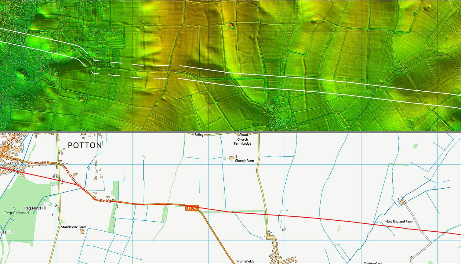
Lidar Image - Route across Potton Pretty direct as you would expect although it did then involve some climbing and ascending. |
Click for larger view |
 |
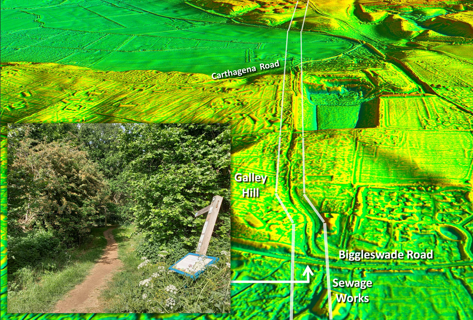
Oblique 3D Lidar Image - Galley Hill Classic Roman agger and zig-zag to minimise the gradient for its ascent up Galley Hill. Looks like quarry encroachment has destroyed part of the road. This section is marked by a parish boundary. Inset: ascent from Biggleswade Road.- image DR |
Click for larger view |
 |
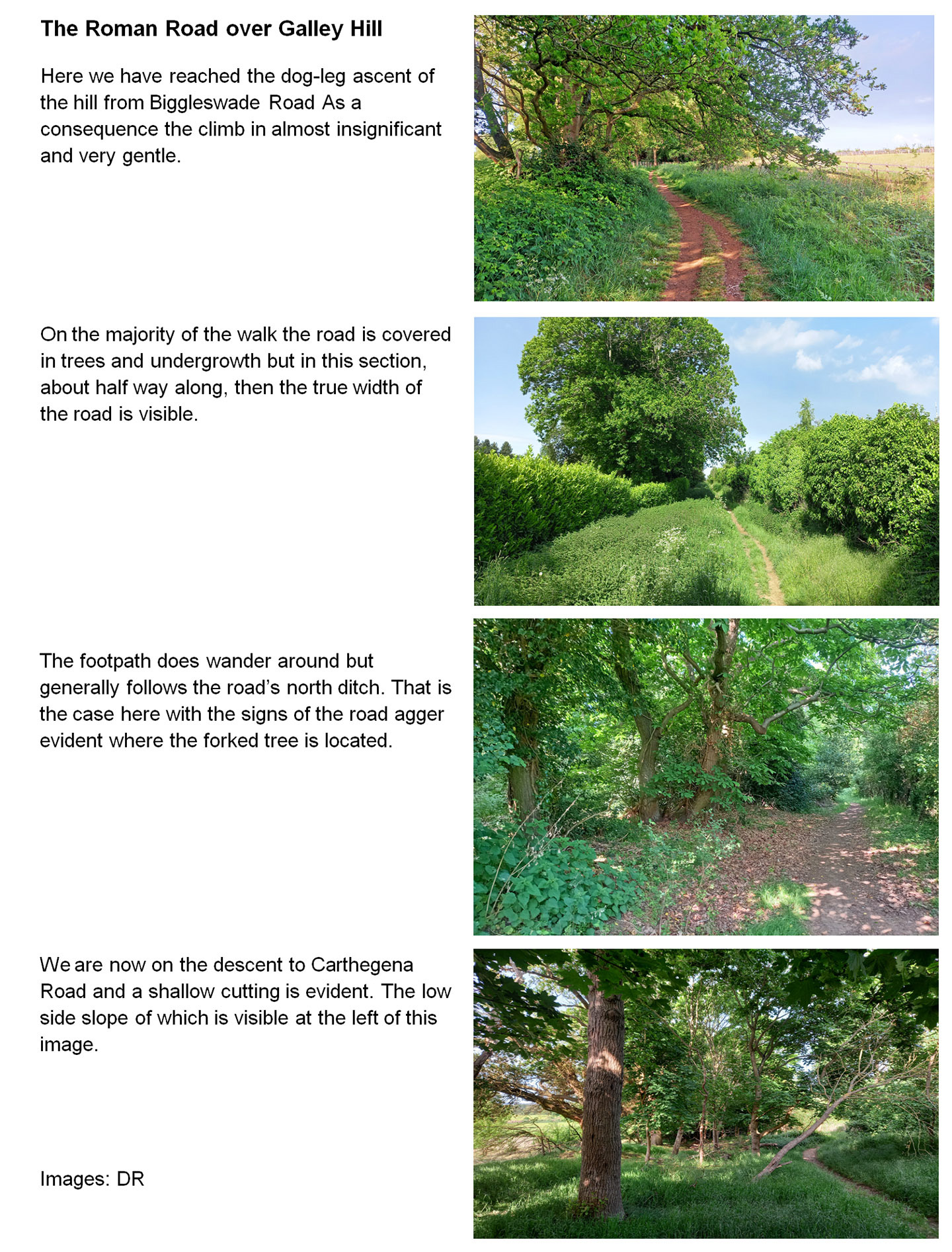
The Roman Road over Galley Hill A fabulous little walk and highly recommended. This sequence traces the road from Biggleswade Road to Carthagena Road. Images: DR |
Click for larger view |
 |
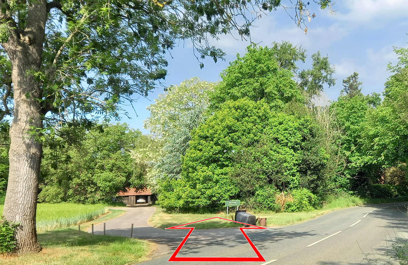
Fen Farm, Carthagena Road Across Carthagena Road then the track to Fen Farm is just to the left of the Roman road. Image: DR |
Click for larger view |
 |
Fen Farm - Aerial Photograph Its reassuring when the lidar and aerial photographs agree on the route. The twin ditches of the road are visible in this historic aerial photograph by Google. Google dates the image to December 2006 but there are leaves on the trees so I would guess summer 2006 when it was taken. |
Click for larger view |
 |
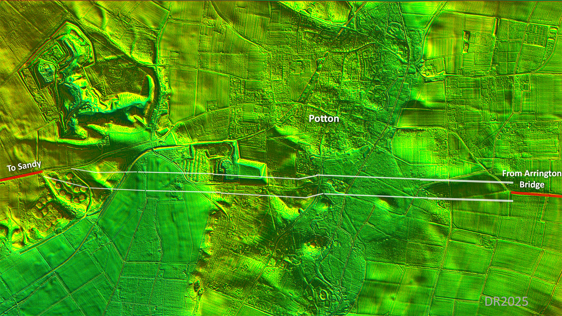
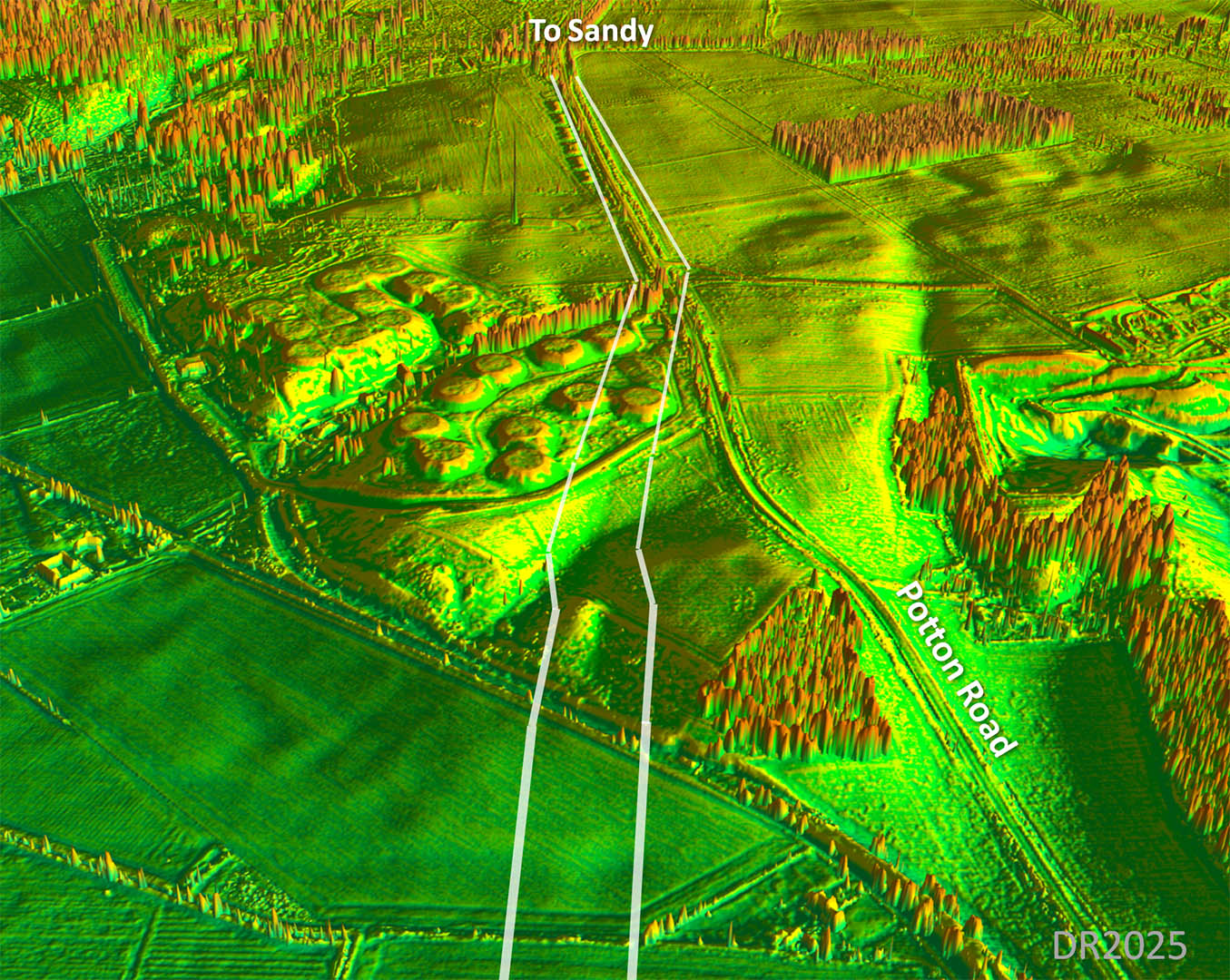
Oblique 3D Lidar Image - Ascent to Potton Road Clever engineering to climb up to Potton Road. First it uses a little natural valley and then, as is typical, angles up the slope. |
Click for larger view |
 |
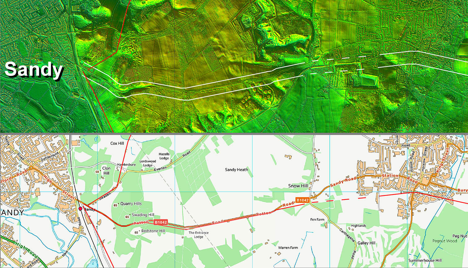
Oblique 3D Lidar Image - Approaching Sandy The modern road (Potton Road) mostly overlies the route into Sandy. |
Click for larger view |
 |
Lidar Image and Route Map 2 Towards Potton part of the B1042 does overly the Roman line but then wanders off-line as the Roman route takes a direct course, |
Click for larger view |
 |
Lidar Image and Route Map 3 Modern road and the Roman road (mostly) share a common route down the hill to Sandy It has recently become clear Sandy was an important Roman settlement. It was located near the railway rather than where the modern town is today.
|
Click for larger view |
 |
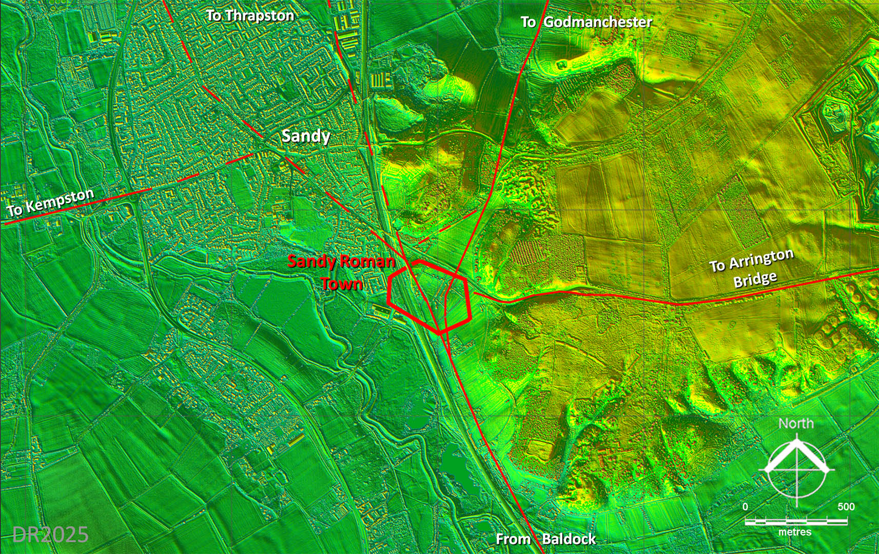
Lidar Image - Roman Roads around Sandy Thanks to several recent archaeological excavations we now know theta Sandy (Bedfordshire) was an important Roman road junction with at least 5 roads meeting there. There were not two north road to Great Staughton - I am just not sure which is the correct one. Sandy was important enough to have town walls. The lines of the walls are from Mike Luke. For Mike Luke's publication on Roman Sandy - follow link |
Click for larger view |
 |
|
|
|
Last update: May 2025 |
© David Ratledge |